West Cliff

Settlement in Yorkshire Scarborough

England

West Cliff

The car park at Whitby Abbey The car park never became overcroded today, despite it being a warm and bright day.
The car park at Whitby Abbey Credit: Malcolm Neal

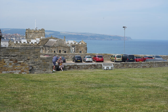
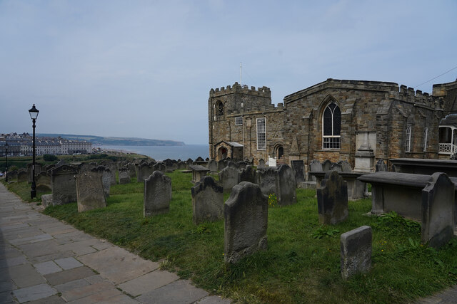
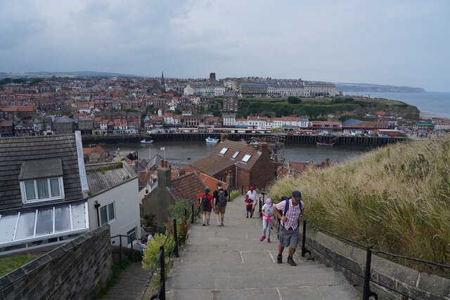
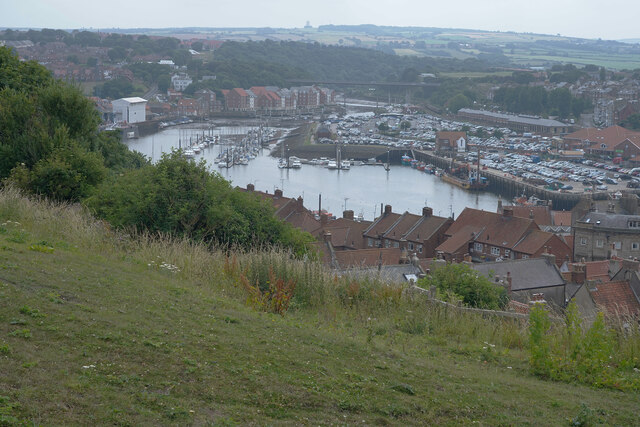
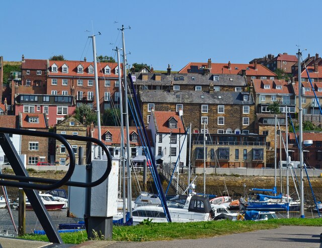
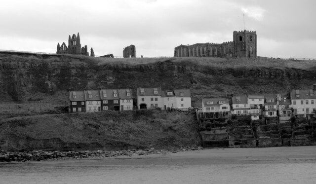
West Cliff is a picturesque coastal area located in the town of Whitby, in the county of Yorkshire, England. Situated on the North Sea coast, it offers breathtaking views of the rugged cliffs and the vast expanse of the ocean. West Cliff is a popular tourist destination, attracting visitors from all over due to its natural beauty and historical significance.

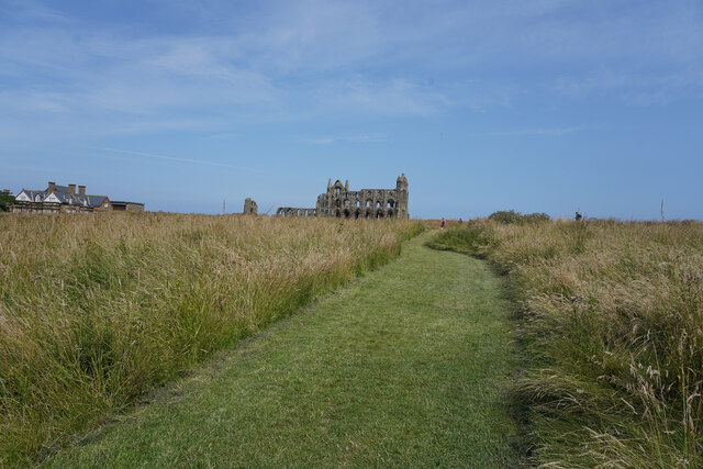
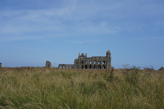
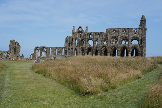
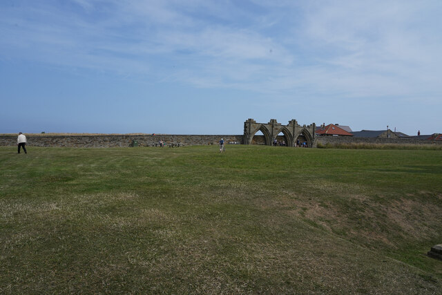
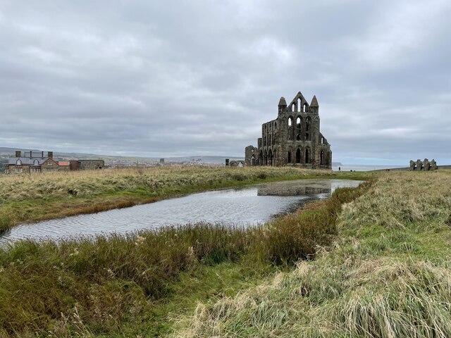
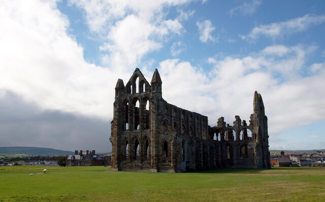
The main attraction of West Cliff is the iconic Whitby Abbey, a ruined Benedictine abbey that stands majestically on top of the cliffs. This historical site, dating back to the 7th century, is said to have inspired Bram Stoker's famous novel "Dracula." Tourists can explore the ruins and learn about the abbey's rich history at the onsite visitor center.

The area is also known for its pristine sandy beach, which stretches for miles and offers a perfect spot for sunbathing, picnicking, or a leisurely stroll along the shoreline. The beach is well-maintained and offers facilities such as beach huts, cafes, and public toilets, ensuring a comfortable experience for visitors.

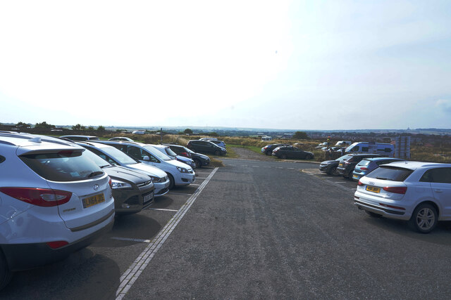
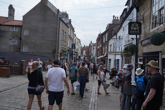
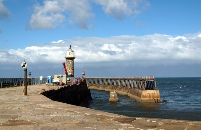
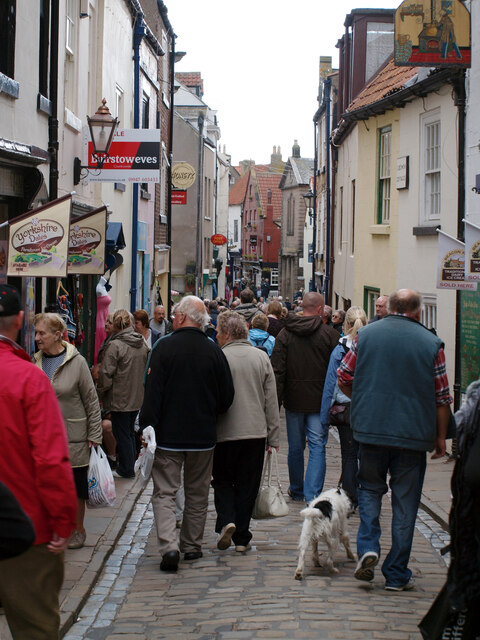
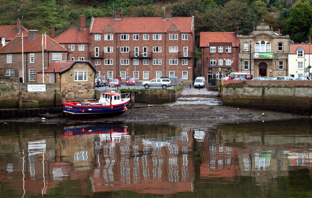
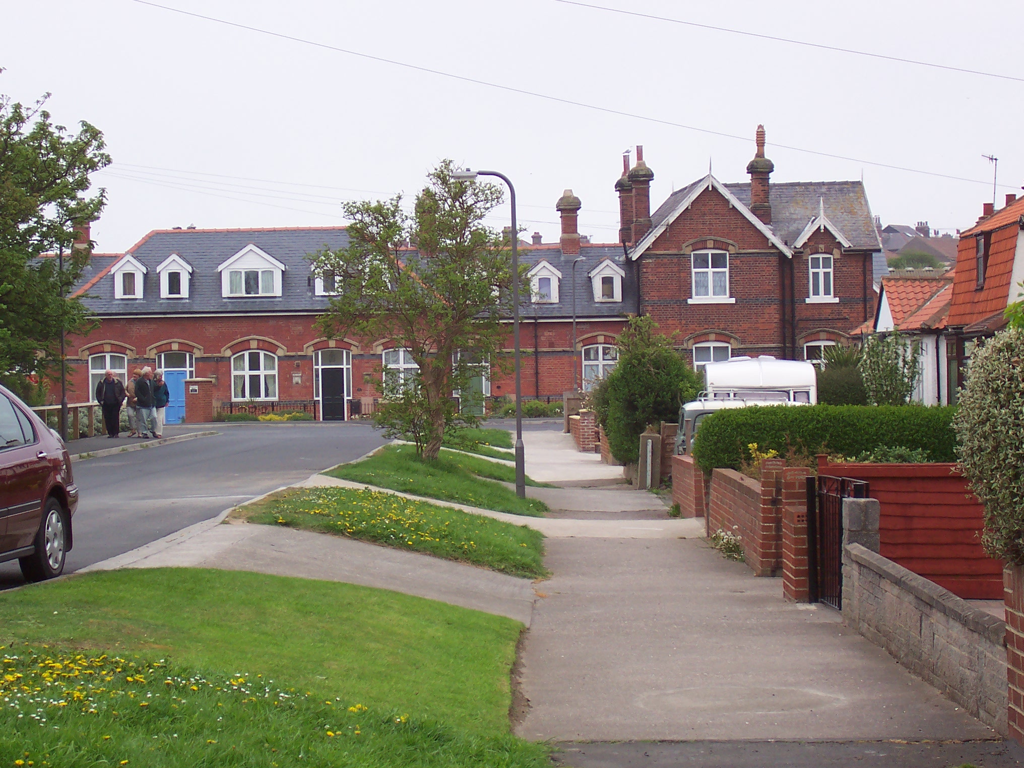
In addition to its natural beauty, West Cliff boasts a range of amenities and attractions. The town of Whitby, just a short walk away, offers a variety of shops, restaurants, and pubs, where visitors can sample the local cuisine and enjoy a vibrant nightlife. The area is well-connected by road and rail, making it easily accessible for both local and international travelers.

Overall, West Cliff, Yorkshire, is a captivating destination that combines stunning natural scenery, rich history, and modern amenities, making it a must-visit place for anyone exploring the Yorkshire coast.

If you have any feedback on the listing, please let us know in the comments section below.

West Cliff Images

Images are sourced within 2km of 54.489293/-0.623398 or Grid Reference NZ8911. Thanks to Geograph Open Source API. All images are credited.

The car park at Whitby Abbey The car park never became overcroded today, despite it being a warm and bright day.
The car park at Whitby Abbey
The car park never became overcroded today, despite it being a warm and bright day.
The path to the abbey There are several well mown paths leading towards the entrance and the pay kiosk for Whitby Abbey.
The path to the abbey
There are several well mown paths leading towards the entrance and the pay kiosk for Whitby Abbey.
The long grass in front of the entrance The depth of the grass at this point is around 60cm or 2 feet in old measurements. I think the abbey looks more natural with the foreground as long grass.
The long grass in front of the entrance
The depth of the grass at this point is around 60cm or 2 feet in old measurements. I think the abbey looks more natural with the foreground as long grass.
Whitby Abbey The abbey is still impressive despite being partly destroyed by Henry VIII some time after 1527.
Whitby Abbey
The abbey is still impressive despite being partly destroyed by Henry VIII some time after 1527.
The wall around the abbey The barrier  wall is in the foreground with distant views towards the cliffs beyond Sandsend.
The wall around the abbey
The barrier wall is in the foreground with distant views towards the cliffs beyond Sandsend.
The distant remains of the abbey Just in front of the perimeter wall is a small part of the abbey remains.
The distant remains of the abbey
Just in front of the perimeter wall is a small part of the abbey remains.
St. Mary's Church and graveyard The church is close to the abbey and at the head of the 199 steps which lead down to the town.
St. Mary's Church and graveyard
The church is close to the abbey and at the head of the 199 steps which lead down to the town.
The steps to the town The steps are quite shallow and not quite continuous as there are a few level parts about a third of the way down.
The steps to the town
The steps are quite shallow and not quite continuous as there are a few level parts about a third of the way down.
A  crowded Whitby The narrow street is open to two way traffic and as most pedestrians walk in the road it makes for very slow progress for any cars attempting to pass.
A crowded Whitby
The narrow street is open to two way traffic and as most pedestrians walk in the road it makes for very slow progress for any cars attempting to pass.
Looking down on the inner harbour The inner harbour is better protected so there are more smaller boats here.
Looking down on the inner harbour
The inner harbour is better protected so there are more smaller boats here.
Whitby-Abbey Farm Perched high above the town.
Whitby-Abbey Farm
Perched high above the town.
Whitby-Church Street A view across the River Esk.
Whitby-Church Street
A view across the River Esk.
Whitby Abbey from the pond
Whitby Abbey Whitby Abbey was a 7th century monastery that later became a Benedictine abbey. The abbey and its possessions were confiscated by the crown during the Dissolution of the Monasteries under Henry VIII. The abbey church was situated overlooking the North Sea on the East Cliff above Whitby in North Yorkshire, England. The substantial ruins of the church are designated as a Grade I Listed building (List entry Number: 1316347 <span class="nowrap"><a title="https://historicengland.org.uk/listing/the-list/list-entry/1316347" rel="nofollow ugc noopener" href="https://historicengland.org.uk/listing/the-list/list-entry/1316347">Link</a><img style="margin-left:2px;" alt="External link" title="External link - shift click to open in new window" src="https://s1.geograph.org.uk/img/external.png" width="10" height="10"/></span>  Historic England) and are in the care of English Heritage <span class="nowrap"><a title="http://www.english-heritage.org.uk/visit/places/whitby-abbey/" rel="nofollow ugc noopener" href="http://www.english-heritage.org.uk/visit/places/whitby-abbey/">Link</a><img style="margin-left:2px;" alt="External link" title="External link - shift click to open in new window" src="https://s1.geograph.org.uk/img/external.png" width="10" height="10"/></span>  .
Whitby Abbey
Whitby Abbey was a 7th century monastery that later became a Benedictine abbey. The abbey and its possessions were confiscated by the crown during the Dissolution of the Monasteries under Henry VIII. The abbey church was situated overlooking the North Sea on the East Cliff above Whitby in North Yorkshire, England. The substantial ruins of the church are designated as a Grade I Listed building (List entry Number: 1316347 LinkExternal link Historic England) and are in the care of English Heritage LinkExternal link .
The east pier, Whitby harbour
Church Street, Whitby
Old Town, Whitby, seen from the west pier of the harbour The ruins of Whitby Abbey, St. Mary's Church and houses on Henrietta Street can be seen.
Old Town, Whitby, seen from the west pier of the harbour
The ruins of Whitby Abbey, St. Mary's Church and houses on Henrietta Street can be seen.
A slipway on the River Esk seen from New Quay Road, Whitby River Esk rises on Westerdale Moor (North Yorkshire Moors) and flows east 28 miles to Whitby. A good Salmon river.
A slipway on the River Esk seen from New Quay Road, Whitby
River Esk rises on Westerdale Moor (North Yorkshire Moors) and flows east 28 miles to Whitby. A good Salmon river.
Show me another place!

West Cliff is located at Grid Ref: NZ8911 (Lat: 54.489293, Lng: -0.623398)

Division: North Riding

Administrative County: North Yorkshire

District: Scarborough

Police Authority: North Yorkshire

What 3 Words

///decanter.motivator.splits. Near Whitby, North Yorkshire

Related Wikis

Whitby Town F.C.

Whitby Town Football Club is an English football club based in Whitby, North Yorkshire. The club participates in the Northern Premier League, the seventh...

Whitby West Cliff railway station

Whitby West Cliff railway station was a railway station on the Whitby Redcar and Middlesbrough Union Railway. It was opened on 3 December 1883, to serve...

Whitby

Whitby is a seaside town, port and civil parish in North Yorkshire, England. The town is on the Yorkshire Coast at the mouth of the River Esk. It has a...

Whitby Museum

Whitby Museum is an independent museum in Whitby, North Yorkshire, England, run by Whitby Literary and Philosophical Society, a learned society and registered...

Magpie Café

The Magpie Café is a seafood restaurant in Whitby, North Yorkshire, England. It was established in 1937, but its building dates back to the 18th century...
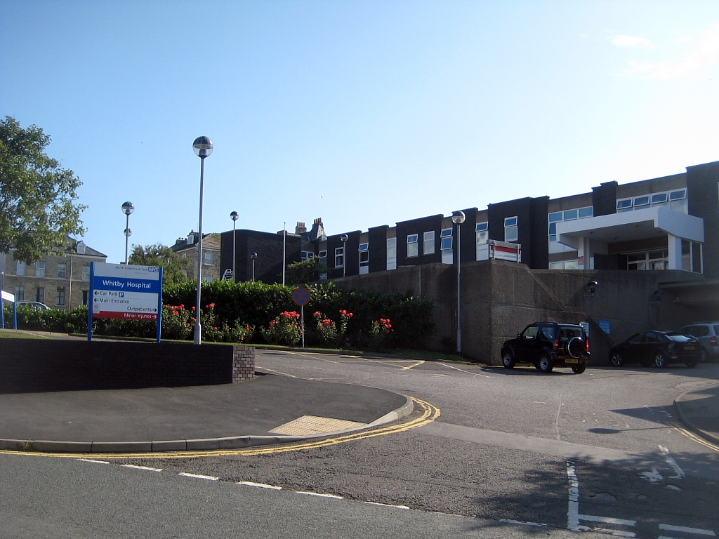
Whitby Hospital

The Whitby Hospital is a community hospital in Springhill, Whitby, North Yorkshire, England. It is managed by Humber NHS Foundation Trust. == History... ==

St Ninian's Church, Whitby

The Church of St Ninian is a former place of worship in Whitby, North Yorkshire, England. The building was a proprietor church, the only one in the whole...

Whitby Lifeboat Station

Whitby Lifeboat Station is a Royal National Lifeboat Institution (RNLI) lifeboat station located in Whitby, North Yorkshire, England. It is one of nine...

Nearby Amenities

Located within 500m of 54.489293,-0.623398
Source: PGS
Lat/Long: 54.4911129/-0.6166062
Source: PGS
Lat/Long: 54.4909988/-0.6178922
Source: PGS
Lat/Long: 54.4912595/-0.6218989
Source: PGS
Lat/Long: 54.4913717/-0.6227755
Source: PGS
Lat/Long: 54.491639/-0.6245735
Source: PGS
Lat/Long: 54.4917627/-0.6254867
Source: PGS
Lat/Long: 54.4920624/-0.6272187
Source: PGS
Lat/Long: 54.4922043/-0.6277268
Whale Bone Arch
Tourism: attraction
Lat/Long: 54.4902822/-0.6162622
Place Of Worship
Westcliff Congregational Church
Denomination: congregational
Religion: christian
Source: NPE
Lat/Long: 54.4880402/-0.6174513
Noexit: yes
Lat/Long: 54.4899254/-0.6172952
Noexit: yes
Lat/Long: 54.4857746/-0.6187957
Crossing
Lat/Long: 54.4862533/-0.6213895
Turning Circle
Lat/Long: 54.4884756/-0.628095
Turning Circle
Source Geometry: Bing
Lat/Long: 54.4873419/-0.6300408
Place Of Worship
Kingdom Hall Of Jehovahs Witnesses
Denomination: jehovahs_witness
Religion: christian
Lat/Long: 54.4892549/-0.6278583
Turning Circle
Lat/Long: 54.4890783/-0.6294277
Fuel
Esso
Addr City: Whitby
Addr Postcode: YO21 3DT
Addr Street: Upgang Lane
Brand: Esso
Brand Wikidata: Q867662
Contact Website: https://www.esso.co.uk/en-gb/find-station/esso-yorkshire-essowhitby-100200868
Operator: Geo. Harrison (Whitby) Ltd.
Source: survey
Lat/Long: 54.4866583/-0.6224926
Post Box
Ele: 46.749512
Post Box Type: pillar
Ref: YO21 77
Royal Cypher: GVIR
Royal Cypher Wikidata: Q33102169
Source: GPS
Lat/Long: 54.4907137/-0.6245689
Elevator
Lift to West Cliff Beach
Ele: 44.346313
Layer: 1
Opening Hours Covid19: 1000-1700
Seasonal: summer
Source: GPS
Lat/Long: 54.4906414/-0.623354
Post Box
Whitby Sorting Office
Ele: 42.423584
Post Box Type: wall
Ref: YO21 1
Royal Cypher: EIIR
Royal Cypher Wikidata: Q33102113
Source: GPS
Lat/Long: 54.4874093/-0.6215216
Recycling
Fixme: location approximate
Source: survey
Lat/Long: 54.4888208/-0.6226053
Pub
The Granby
Addr City: Whitby
Addr Housenumber: 34
Addr Postcode: YO21 3AJ
Addr Street: Skinner Street
Source Name: survey
Lat/Long: 54.4878249/-0.6178576
Captain Cook Statue
Alt Name: Captain Cook Monument
Historic: memorial
Memorial: statue
Lat/Long: 54.4904707/-0.616272
Royal Hotel
Addr City: Whitby
Addr Postcode: YO21 3HA
Tourism: hotel
Lat/Long: 54.490118/-0.6167203
Bar
The Met Lounge and Ballroom
Addr City: Whitby
Addr Postcode: YO21 3HU
Addr Street: Argyle Street
Old Name: Metropole
Lat/Long: 54.4903532/-0.6250817
Pub
Whitby Conservative Club
Addr City: Whitby
Addr Postcode: YO21 3DT
Addr Street: Upgang Lane
Lat/Long: 54.4865523/-0.6227717
Cafe
Botham's Cafe & Bakery
Lat/Long: 54.487766/-0.6175549
Holman's
Addr City: Whitby
Addr Housenumber: 19-21
Addr Postcode: YO21 3AH
Addr Street: Skinner Street
Designation: Bookshop, Newsagents, Greeting Cards & Stationers
Operator: Holman's
Shop: books
Website: https://www.holmansbookshop.co.uk/
Lat/Long: 54.4873237/-0.6173958
Toilets
West Cliff Superloo
Access: yes
Charge: 0.40 GBP
Fee: yes
Payment Coins: yes
Lat/Long: 54.4902663/-0.6225407
Parking
Pavilion Drive Car Park
Access: yes
Capacity: 68
Designation: Long Stay
Fee: yes
Operator: Scarborough Borough Council
Parking: surface
Source: http://www.scarborough.gov.uk/default.aspx?page=15765
Lat/Long: 54.4907336/-0.6167096
Whitby Leisure Centre
Sport: swimming
Lat/Long: 54.4880275/-0.6227499
Crossing
Crossing: zebra
Lat/Long: 54.4878988/-0.6251893
Crossing
Crossing: uncontrolled
Crossing Markings: zebra
Lat/Long: 54.4902916/-0.6200845
Crossing
Source: Bing
Lat/Long: 54.4888355/-0.615897
Parking
St. Hilda's Terrace Car Park
Capacity: 20
Designation: Short Stay
Operator: Scarborough Borough Council
Source: http://www.scarborough.gov.uk/default.aspx?page=15761
Lat/Long: 54.4868249/-0.6180778
Cafe
Clara's Cafe
Cuisine: ice_cream
Designation: Ice cream & Drinks in the Former Spa Booking Office
Lat/Long: 54.4905091/-0.6177022
Ashe Computers
Designation: Computer Sales & Repair
Source: http://www.ashe-computers.co.uk/
Lat/Long: 54.4882596/-0.6181217
Bicycle Rental
Dr Crank's Bike Shack
Designation: Bicycle Sales, Rental, Spares, Accessories, etc
Source: http://www.facebook.com/pages/Dr-Cranks-Bike-Shack/101720113223613
Lat/Long: 54.4874058/-0.6176121
House of Flowers
Shop: florist
Lat/Long: 54.4882439/-0.6179983
Bench
Backrest: yes
Material: wood
Lat/Long: 54.4855379/-0.619346
World Distance Direction Sign
Designation: Sign-post
Historic: memorial
Source: http://allthesocialnet.com/m/photos/view/DSCF2814_tweaked1
Lat/Long: 54.4904433/-0.6190799
Geo. Harrison (Whitby) Ltd
Designation: Car Sales Showroom
Shop: car
Source: local Knowledge
Website: https://www.harrisonsofwhitby.co.uk/
Lat/Long: 54.4874772/-0.6220135
Entrance: yes
Lat/Long: 54.4872321/-0.6219721
Musicport
Shop: music
Lat/Long: 54.4873001/-0.6175976
Post Box
Post Box Type: pillar
Ref: YO21 16
Royal Cypher: EIIR
Royal Cypher Wikidata: Q33102113
Lat/Long: 54.487565/-0.617533
Asquith & Co
Addr City: Whitby
Addr Housenumber: 14
Addr Postcode: YO21 3AJ
Addr Street: Skinner Street
Office: accountant
Website: https://www.asquithand.co.uk/
Lat/Long: 54.4872066/-0.6175628
Post Box
Post Box Type: pillar
Ref: YO21 2
Royal Cypher: VR
Royal Cypher Wikidata: Q33102356
Lat/Long: 54.4854349/-0.6227046
Bus Stop
Bus: yes
Public Transport: platform
Lat/Long: 54.4854769/-0.6234234
Bus Stop
Bus: yes
Naptan AtcoCode: 3200YNA90551
Naptan NaptanCode: 32090551
Public Transport: platform
Lat/Long: 54.4867951/-0.6222862
Bus Stop
Bus: yes
Public Transport: platform
Lat/Long: 54.4867047/-0.6223854
Post Box
Post Box Type: pillar
Ref: YO21 13
Royal Cypher: EIIR
Royal Cypher Wikidata: Q33102113
Lat/Long: 54.4889779/-0.6201161
Post Box
Post Box Type: lamp
Ref: YO21 12
Royal Cypher: EIIR
Royal Cypher Wikidata: Q33102113
Lat/Long: 54.4888392/-0.6271758
Bus Stop
Bus: yes
Public Transport: platform
Lat/Long: 54.4901978/-0.618084
Post Box
Post Box Type: pillar
Ref: YO21 14
Royal Cypher: EIIR
Royal Cypher Wikidata: Q33102113
Lat/Long: 54.4903505/-0.6177889
Bus Stop
Bus: yes
Naptan AtcoCode: 3200YNA90648
Naptan NaptanCode: 32090648
Public Transport: platform
Lat/Long: 54.4903005/-0.6182315
Bench
Backrest: yes
Source: survey
Lat/Long: 54.4907584/-0.6246594
Bench
Source: survey
Lat/Long: 54.4909982/-0.6264752
Bench
Source: survey
Lat/Long: 54.4906228/-0.622924
Bench
Source: survey
Lat/Long: 54.4908815/-0.6254855
Bench
Source: survey
Lat/Long: 54.4906587/-0.6243402
Bench
Source: survey
Lat/Long: 54.4906228/-0.6228381
Bench
Source: survey
Lat/Long: 54.4909187/-0.6262097
Bench
Source: survey
Lat/Long: 54.4907818/-0.6247371
Bench
Source: survey
Lat/Long: 54.4908395/-0.6249759
Bench
Backrest: yes
Source: survey
Lat/Long: 54.4908005/-0.6248149
Bench
Source: survey
Lat/Long: 54.4906135/-0.6227604
Blencathra Guest House
Addr City: Whitby
Addr Housenumber: 13
Addr Postcode: YO21 3ED
Addr Street: Crescent Avenue
Internet Access: wlan
Internet Access Fee: no
Phone: +44 1947 603706
Smoking: no
Tourism: guest_house
Website: www.blencathra-guesthouse.co.uk
Wheelchair: no
Lat/Long: 54.4878202/-0.6199175
Bench
Lat/Long: 54.4897022/-0.61942
Bench
Lat/Long: 54.4898152/-0.6192175
Addr City: Whitby
Addr Country: GB
Addr Housenumber: 8
Lat/Long: 54.4896516/-0.618901
Addr City: Whitby
Addr Country: GB
Addr Housenumber: 7
Lat/Long: 54.489724/-0.6188299
Addr City: Whitby
Addr Country: GB
Addr Housenumber: 6
Lat/Long: 54.4897856/-0.6187695
Addr City: Whitby
Addr Country: GB
Addr Housenumber: 4
Lat/Long: 54.4899297/-0.6187186
Addr City: Whitby
Addr Country: GB
Addr Housenumber: 5
Lat/Long: 54.4898611/-0.6187414
Bench
Lat/Long: 54.4899936/-0.6191236
Cresent Garden House
Addr City: Whitby
Addr Country: GB
Addr Housenumber: 3
Addr Street: Royal Crescent
Lat/Long: 54.489999/-0.6187239
Addr City: Whitby
Addr Country: GB
Addr Housenumber: 2
Addr Street: Royal Crescent
Lat/Long: 54.4900707/-0.6187105
Vending Machine
Vending: parking_tickets
Lat/Long: 54.4903348/-0.6187186
Bench
Lat/Long: 54.4903519/-0.6186233
Bench
Lat/Long: 54.490348/-0.6184209
Sunnyvale House
Addr City: Whitby
Addr Housenumber: 12
Addr Postcode: YO21 3ES
Addr Street: Normanby Terrace
Tourism: guest_house
Lat/Long: 54.4884436/-0.6194327
Chiltern
Addr City: Whitby
Addr Housenumber: 13
Addr Postcode: YO21 3ES
Addr Street: Normanby Terrace
Tourism: guest_house
Lat/Long: 54.4884388/-0.6195159
Pannett House
Addr City: Whitby
Addr Housenumber: 14
Addr Postcode: YO21 3ES
Addr Street: Normanby Terrace
Tourism: guest_house
Lat/Long: 54.4884353/-0.6196062
Glynceramics
Addr City: Whitby
Addr Housenumber: 5
Addr Postcode: YO21 3BU
Addr Street: Silver Street
Phone: +44 1947 820929
Shop: gift
Website: http://www.glynceramics.com/
Lat/Long: 54.486953/-0.6168683
Place Of Worship
Whitby Evangelical Church
Denomination: evangelical
Religion: christian
Lat/Long: 54.4871178/-0.6174607
Bar
Arch and Abbey
Addr City: Whitby
Addr Housenumber: 2-4
Addr Street: Skinner Street
Lat/Long: 54.4868474/-0.6174077
Fast Food
Silver Street Fisheries
Addr City: Whitby
Addr Housenumber: 22
Addr Postcode: YO21 3BX
Addr Street: Silver Street
Cuisine: fish_and_chips
Lat/Long: 54.4874518/-0.6167749
Bench
Backrest: yes
Lat/Long: 54.488013/-0.6252741
Bench
Backrest: yes
Lat/Long: 54.4879319/-0.6251212
Entrance: yes
Lat/Long: 54.4902846/-0.6251427
Defibrillator
Defibrillator Location: outside Metropole, Argyle Road, Whitby, YO21 3HU - to right of entrance labelled Ballroom
Emergency: defibrillator
Indoor: no
Lat/Long: 54.4903039/-0.6251256
Cafe
Stokers
Addr City: Whitby
Addr Housenumber: 1
Addr Postcode: YO21 3EU
Addr Street: Mulgrave Place
Opening Hours: Mo-Sa 10:00-16:00
Shop: gift
Lat/Long: 54.4880343/-0.617982
Dentist
Havelock Dental Practice
Addr City: Whitby
Addr Housenumber: 2
Addr Postcode: YO21 3ER
Addr Street: Havelock Place
Healthcare: dentist
Lat/Long: 54.488483/-0.6181644
Number 5 B&B
Addr City: Whitby
Addr Housenumber: 5
Addr Postcode: YO21 3ER
Addr Street: Havelock Place
Tourism: guest_house
Lat/Long: 54.4886714/-0.6181161
Bramblewick B&B
Addr City: Whitby
Addr Housenumber: 3
Addr Postcode: YO21 3ER
Addr Street: Havelock Place
Tourism: guest_house
Lat/Long: 54.4885327/-0.6181161
Entrance: yes
Lat/Long: 54.4870199/-0.6217316
St John Ambulance Whitby
Ambulance Station
Addr City: Whitby
Addr Postcode: YO21 3AA
Addr Street: St Hilda's Gardens
Emergency: ambulance_station
Operator: St John Ambulance
Operator Wikidata: Q7593637
Lat/Long: 54.4866704/-0.6213687
Generator Method: photovoltaic
Generator Output Electricity: yes
Generator Source: solar
Generator Type: solar_photovoltaic_panel
Power: generator
Lat/Long: 54.4863411/-0.6254199
Generator Method: photovoltaic
Generator Output Electricity: yes
Generator Source: solar
Generator Type: solar_photovoltaic_panel
Power: generator
Lat/Long: 54.4858544/-0.6233085
Railway: crossing
Lat/Long: 54.485986/-0.6238025
Bench
Source: survey;gps
Lat/Long: 54.4903468/-0.6180071
Bench
Source: survey;gps
Lat/Long: 54.4903503/-0.6182157
Bench
Source: survey;gps
Lat/Long: 54.4903562/-0.6188178
Bench
Source: survey;gps
Lat/Long: 54.490357/-0.6189989
Bench
Source: survey;gps
Lat/Long: 54.490408/-0.6191122
Bench
Source: survey;gps
Lat/Long: 54.4903784/-0.6208724
Bench
Source: survey;gps
Lat/Long: 54.4903795/-0.6209153
Bench
Source: survey;gps
Lat/Long: 54.4903811/-0.6209602
Bench
Source: survey;gps
Lat/Long: 54.4903823/-0.6210005
Bench
Source: survey;gps
Lat/Long: 54.4903807/-0.6210407
Bench
Source: survey;gps
Lat/Long: 54.4903815/-0.6210876
Bench
Source: survey;gps
Lat/Long: 54.4903838/-0.6211245
Bench
Source: survey;gps
Lat/Long: 54.4903842/-0.6211681
Bench
Source: survey;gps
Lat/Long: 54.4903858/-0.6212191
Bench
Source: survey;gps
Lat/Long: 54.4903877/-0.62126
Bench
Source: survey;gps
Lat/Long: 54.4903897/-0.6213056
Bench
Source: survey;gps
Lat/Long: 54.4904843/-0.6219251
Bench
Source: survey;gps
Lat/Long: 54.4904929/-0.6219573
Bench
Source: survey;gps
Lat/Long: 54.4905011/-0.6219942
Bench
Source: survey;gps
Lat/Long: 54.4905116/-0.6220371
Bench
Source: survey;gps
Lat/Long: 54.4905268/-0.6220867
Addr City: Whitby
Addr Country: GB
Addr Housenumber: 16
Lat/Long: 54.4893837/-0.6197941
Crow's Nest
Artist Name: Emma Stothard
Artwork Type: sculpture
Material: metal
Tourism: artwork
Lat/Long: 54.4905457/-0.6220138
Skipper Dora
Artist Name: Emma Stothard
Artwork Type: sculpture
Material: metal
Tourism: artwork
Lat/Long: 54.4906506/-0.6181772
Frank Meadow Sutcliffe
Artist Name: Emma Stothard
Artwork Type: sculpture
Material: metal
Tourism: artwork
Lat/Long: 54.4882801/-0.6178597
Bench
Backrest: yes
Lat/Long: 54.4906543/-0.6163862
Bench
Backrest: yes
Lat/Long: 54.490649/-0.616306
Bench
Backrest: yes
Lat/Long: 54.4906392/-0.6162317
Bench
Backrest: yes
Lat/Long: 54.4906161/-0.6161616
Bench
Backrest: yes
Lat/Long: 54.4905776/-0.6161023
Bench
Backrest: yes
Lat/Long: 54.4905364/-0.6160681
Bench
Backrest: yes
Lat/Long: 54.49049/-0.6160639
Bench
Backrest: yes
Lat/Long: 54.490442/-0.6160776
Bench
Backrest: yes
Lat/Long: 54.4904011/-0.6161092
Bench
Backrest: yes
Lat/Long: 54.490364/-0.6161691
Bench
Backrest: yes
Lat/Long: 54.490247/-0.6162015
Bench
Backrest: yes
Lat/Long: 54.4902381/-0.6161426
Bench
Backrest: yes
Lat/Long: 54.4901934/-0.6161945
Bench
Backrest: yes
Lat/Long: 54.4901575/-0.6161711
Bench
Backrest: yes
Lat/Long: 54.4901303/-0.6162237
Bench
Backrest: yes
Lat/Long: 54.4900903/-0.6162237
Bench
Backrest: yes
Lat/Long: 54.4900863/-0.6161595
Bench
Backrest: yes
Lat/Long: 54.4900361/-0.6162062
Bench
Backrest: yes
Lat/Long: 54.4900442/-0.616156
Bus Stop
Bus: yes
Naptan AtcoCode: 3200YNA90647
Naptan NaptanCode: 32090647
Public Transport: platform
Lat/Long: 54.4905007/-0.6237728
Whitby West Cliff
Historic Railway: station
Railway: site
Wikidata: Q7994186
Wikipedia: en:Whitby West Cliff railway station
Lat/Long: 54.4876409/-0.6281773
Storrbeck Guest House
Addr City: Whitby
Addr Housenumber: 9
Addr Postcode: YO21 3ED
Addr Street: Crescent Avenue
Guest House: bed_and_breakfast
Tourism: guest_house
Lat/Long: 54.4880306/-0.6198956
The data included in this document is from www.openstreetmap.org. The data is made available under ODbL.

Have you been to West Cliff?

Leave your review of West Cliff below (or comments, questions and feedback).