Bradley

Settlement in Derbyshire Derbyshire Dales

England

Bradley

A517 at Atlow Cottage
A517 at Atlow Cottage Credit: Colin Pyle

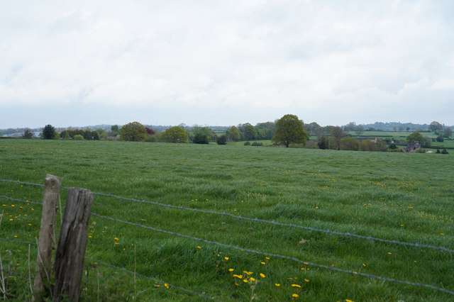
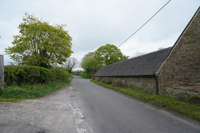
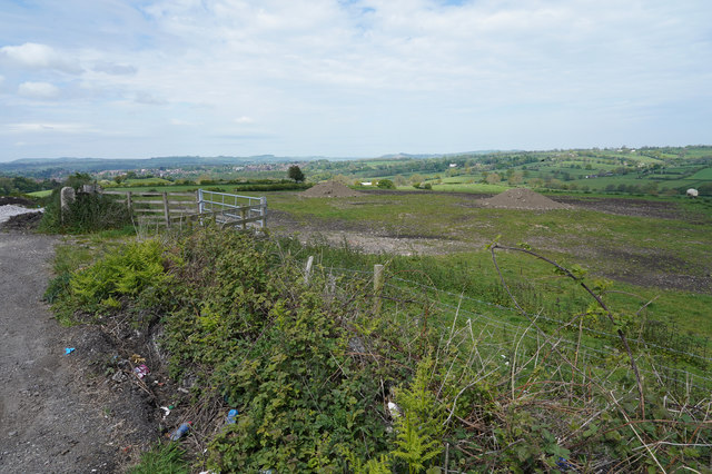
Bradley is a small village located in the county of Derbyshire, England. Situated in the southern part of the county, it lies approximately 11 miles southwest of the city of Derby. The village is nestled in the picturesque countryside, with rolling hills and green fields surrounding it.

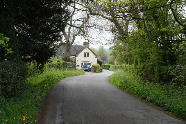
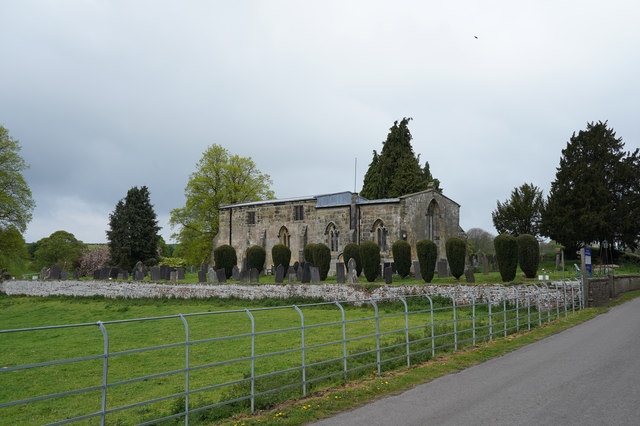
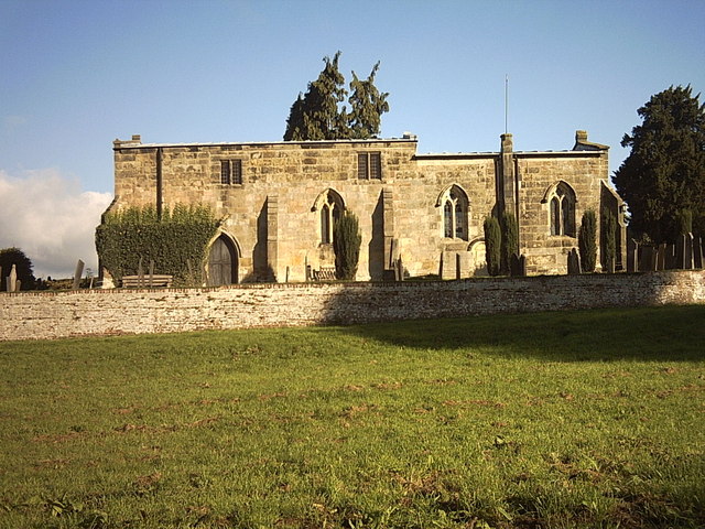
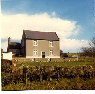
With a population of around 600 residents, Bradley is a tight-knit community known for its peaceful and idyllic atmosphere. The village is primarily residential, with a mix of traditional stone cottages and newer houses. It maintains a charming, rural character, with several historic buildings that add to its appeal.

Despite its small size, Bradley offers a range of amenities to its residents. These include a village hall, a primary school, and a local pub, which serves as a hub for social gatherings and community events. The village also benefits from its proximity to nearby towns, providing easy access to a wider range of services and facilities.

For those who enjoy outdoor activities, Bradley offers ample opportunities for exploring the surrounding countryside. The village is located near the Peak District National Park, renowned for its stunning landscapes and popular hiking trails. The nearby River Trent also provides opportunities for fishing and boating enthusiasts.

Overall, Bradley, Derbyshire offers a peaceful and picturesque village lifestyle, with a strong sense of community and access to the beautiful Derbyshire countryside.

If you have any feedback on the listing, please let us know in the comments section below.
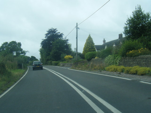
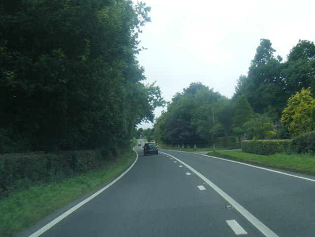
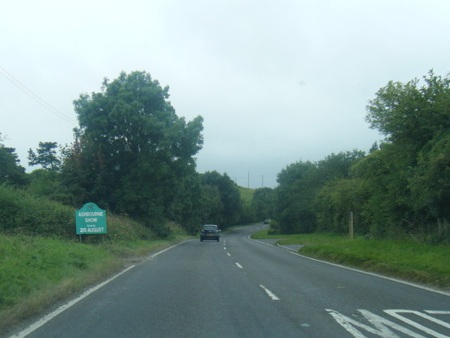
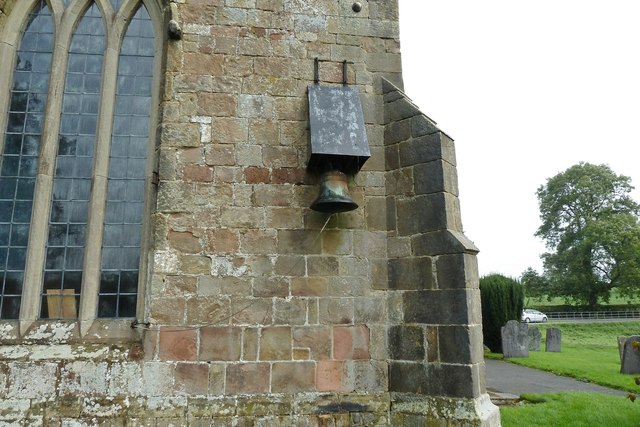
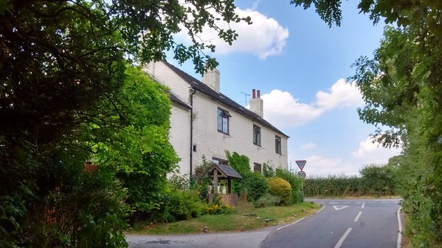
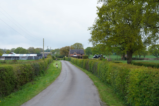
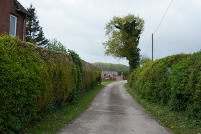
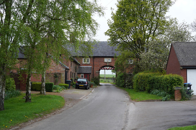
Bradley Images

Images are sourced within 2km of 53.007298/-1.6661036 or Grid Reference SK2245. Thanks to Geograph Open Source API. All images are credited.

A517 at Atlow Cottage
A517 near Yew Tree Lane, Bradley
A517 near New House Farm
Bradley Church This church in Bradley doesn't have a bell tower, so a bell is attached to the rear wall, with a steel canopy over it.
Bradley Church
This church in Bradley doesn't have a bell tower, so a bell is attached to the rear wall, with a steel canopy over it.
The Former Jinglers/Fox & Hounds About 4 miles east of Ashbourne on the A517, near Bradley, was a pub with two names. The side of the sign facing towards Ashbourne said The Fox & Hounds whilst the other side said The Jinglers. A former coaching inn, it closed in 2000 and is now a private residence.

Local historian Wendy Whitbread suggests that the Jinglers name came about as the pub used to stand at the end of a track coming from a lead mine. Ponies were employed to transport the lead and the leading pony wore a bell so that its jingling sound would alert workers in the bar to the fact that it was time to deal with the laden beasts. She also suggests that when the inn became tied to Offiler's Brewery the new owners wanted to change the name to the Fox & Hounds and that the double sign was a compromise to keep the locals happy.
The Former Jinglers/Fox & Hounds
About 4 miles east of Ashbourne on the A517, near Bradley, was a pub with two names. The side of the sign facing towards Ashbourne said The Fox & Hounds whilst the other side said The Jinglers. A former coaching inn, it closed in 2000 and is now a private residence. Local historian Wendy Whitbread suggests that the Jinglers name came about as the pub used to stand at the end of a track coming from a lead mine. Ponies were employed to transport the lead and the leading pony wore a bell so that its jingling sound would alert workers in the bar to the fact that it was time to deal with the laden beasts. She also suggests that when the inn became tied to Offiler's Brewery the new owners wanted to change the name to the Fox & Hounds and that the double sign was a compromise to keep the locals happy.
Towards Lower Hough Park Lower Hough Park is, I think, a very different name for one of the local farms.
Towards Lower Hough Park
Lower Hough Park is, I think, a very different name for one of the local farms.
Farm buildings The corrugated roof of some farm buildings is visible in the middle distance of this image.
Farm buildings
The corrugated roof of some farm buildings is visible in the middle distance of this image.
The Knob This distant group of houses around the Y junction is called the Knob on the OS map.
The Knob
This distant group of houses around the Y junction is called the Knob on the OS map.
Across the fields Looking across the fields several Pheasant scurried for safety as soon as they saw me.
Across the fields
Looking across the fields several Pheasant scurried for safety as soon as they saw me.
Near Homestead Farm Well tended hedges line the road on either side as we approach Hoemstead Farm.
Near Homestead Farm
Well tended hedges line the road on either side as we approach Hoemstead Farm.
Looking at War Farm The track is closely lined with hedges as it goes towards the farm.
Looking at War Farm
The track is closely lined with hedges as it goes towards the farm.
Hole in the Wall The minor road goes through a building at the quaintly named "Hole in the Wall". There are many warning signs about a low arch as you approach the gap.
Hole in the Wall
The minor road goes through a building at the quaintly named "Hole in the Wall". There are many warning signs about a low arch as you approach the gap.
A lush crop of grass I may be wrong but it looks as though this field is grass and will probably be used for silage.
A lush crop of grass
I may be wrong but it looks as though this field is grass and will probably be used for silage.
The road to Bradley The sign says Bradley and is obviously on the edge of the village.
The road to Bradley
The sign says Bradley and is obviously on the edge of the village.
All Saints Church Bradley In Derbyshire this church is quite unusual in that it has no spire or tower. The grounds around the church look as though they are extremely well tended, especially the clipped bushes.
All Saints Church Bradley
In Derbyshire this church is quite unusual in that it has no spire or tower. The grounds around the church look as though they are extremely well tended, especially the clipped bushes.
Gorse Lane The Farm is Bradley Nook and it sits very close to Gorse Lane, which is a very minor road.
Gorse Lane
The Farm is Bradley Nook and it sits very close to Gorse Lane, which is a very minor road.
Corley Lane The lane has the same name as the farm which was near where I took the photo.
Corley Lane
The lane has the same name as the farm which was near where I took the photo.
Piles of spoil in the field There are a couple of piles of spoil in the field at the top of this hill. They do give the area a somewhat unkempt look.
Piles of spoil in the field
There are a couple of piles of spoil in the field at the top of this hill. They do give the area a somewhat unkempt look.
Show me another place!

Bradley is located at Grid Ref: SK2245 (Lat: 53.007298, Lng: -1.6661036)

Administrative County: Derbyshire

District: Derbyshire Dales

Police Authority: Derbyshire

What 3 Words

///valid.motels.tabs. Near Ashbourne, Derbyshire

Related Wikis

Nearby Amenities

Located within 500m of 53.007298,-1.6661036
Passing Place
Lat/Long: 53.0049126/-1.6690574
Bradley
Created By: Potlatch 0.8b
Place: village
Wikidata: Q2519206
Lat/Long: 53.0084495/-1.66557
Post Box
Operator: Royal Mail
Post Box Type: lamp
Ref: DE6 872
Lat/Long: 53.0074194/-1.6660275
Parking
Ele: 170.0000000
Lat/Long: 53.0090838/-1.6663242
Ele: 170.0000000
Information: board
Tourism: information
Lat/Long: 53.0091412/-1.6661955
Ele: 170.0000000
Lat/Long: 53.0090294/-1.6662608
Barrier: stile
Ele: 171.0000000
Material: wood
Stile: stepover
Lat/Long: 53.0091443/-1.6662491
Ele: 169.0000000
Lat/Long: 53.0090709/-1.6661352
Ele: 170.0000000
Removed Amenity: telephone
Lat/Long: 53.0091258/-1.6663564
Ele: 149.0000000
Lat/Long: 53.0062143/-1.6675983
Barrier: stile
Steps: 1
Stile: stepover
Lat/Long: 53.0060707/-1.6660681
Passing Place
Lat/Long: 53.0041645/-1.6692584
Ele: 150.0000000
Lat/Long: 53.0040935/-1.6689474
Barrier: stile
Ele: 169.0000000
Material: wood
Steps: 2
Stile: stepover
Lat/Long: 53.0034222/-1.6656765
Ele: 179.0000000
Lat/Long: 53.005837/-1.6595804
Ele: 154.0000000
Lat/Long: 53.0036945/-1.6671208
Barrier: stile
Ele: 165.0000000
Steps: 1
Stile: stepover
Lat/Long: 53.003698/-1.6664939
Ele: 154.0000000
Lat/Long: 53.0045082/-1.6675146
Ele: 151.0000000
Lat/Long: 53.003293/-1.6678813
Ele: 150.0000000
Lat/Long: 53.003293/-1.6679617
Ele: 151.0000000
Lat/Long: 53.0036045/-1.6694692
Ele: 151.0000000
Lat/Long: 53.0035077/-1.6693511
Ele: 150.0000000
Lat/Long: 53.0034585/-1.6692666
Barrier: stile
Material: wood
Source: survey;gps
Stile: stepover
Lat/Long: 53.0117463/-1.6663653
Barrier: stile
Material: wood
Source: survey;gps
Stile: stepover
Lat/Long: 53.0106943/-1.6676387
Barrier: kissing_gate
Source: survey;gps
Lat/Long: 53.007921/-1.659844
Barrier: stile
Material: wood
Source: survey;gps
Stile: stepover
Lat/Long: 53.0083831/-1.6604644
Barrier: cattle_grid
Lat/Long: 53.008843/-1.6627094
Barrier: stile
Material: wood
Source: survey;gps
Stile: stepover
Lat/Long: 53.0031909/-1.665861
Barrier: stile
Material: wood
Source: survey;gps
Stile: stepover
Lat/Long: 53.0040382/-1.6633591
Barrier: stile
Material: wood
Source: survey;gps
Stile: stepover
Lat/Long: 53.0058468/-1.661597
Barrier: stile
Material: wood
Source: survey;gps
Stile: stepover
Lat/Long: 53.0061869/-1.660395
Barrier: stile
Material: wood
Source: survey;gps
Stile: stepover
Lat/Long: 53.0054812/-1.6631091
The FIrst Manor House
Information: board
Tourism: information
Lat/Long: 53.009098/-1.6661413
Barrier: cattle_grid
Lat/Long: 53.0092935/-1.6650413
Barrier: stile
Material: wood
Source: survey;gps
Stile: stepover
Lat/Long: 53.0087203/-1.6696671
Barrier: stile
Material: wood
Source: survey;gps
Stile: stepover
Lat/Long: 53.0064861/-1.6693763
Barrier: stile
Material: wood
Source: survey;gps
Stile: stepover
Lat/Long: 53.0107473/-1.6703671
Barrier: stile
Material: wood
Source: survey;gps
Stile: stepover
Lat/Long: 53.010553/-1.6680409
Barrier: stile
Material: wood
Source: survey;gps
Stile: stepover
Lat/Long: 53.0101884/-1.6690975
Direction: SSE
Generator Method: photovoltaic
Generator Output Electricity: yes
Generator Solar Modules: 6
Generator Source: solar
Generator Type: solar_photovoltaic_panel
Location: roof
Power: generator
Lat/Long: 53.0086154/-1.6667624
Direction: WSW
Generator Method: photovoltaic
Generator Output Electricity: yes
Generator Solar Modules: 10
Generator Source: solar
Generator Type: solar_photovoltaic_panel
Location: roof
Power: generator
Lat/Long: 53.0085884/-1.6667007
Direction: 185
Generator Method: photovoltaic
Generator Output Electricity: yes
Generator Solar Modules: 12
Generator Source: solar
Generator Type: solar_photovoltaic_panel
Location: roof
Power: generator
Lat/Long: 53.0073469/-1.6665718
Direction: SW
Generator Method: photovoltaic
Generator Output Electricity: yes
Generator Solar Modules: 5
Generator Source: solar
Generator Type: solar_photovoltaic_panel
Location: roof
Power: generator
Lat/Long: 53.0064787/-1.6599467
Direction: SW
Generator Method: photovoltaic
Generator Output Electricity: yes
Generator Solar Modules: 8
Generator Source: solar
Generator Type: solar_photovoltaic_panel
Location: roof
Power: generator
Lat/Long: 53.0064113/-1.6598247
The data included in this document is from www.openstreetmap.org. The data is made available under ODbL.

Have you been to Bradley?

Leave your review of Bradley below (or comments, questions and feedback).