Caister, West

Settlement in Norfolk Great Yarmouth

England

Caister, West

Caister Castle Interior <span class="nowrap"><a title="https://historicengland.org.uk/listing/the-list/list-entry/1002882?section=official-listing" rel="nofollow ugc noopener" href="https://historicengland.org.uk/listing/the-list/list-entry/1002882?section=official-listing">Link</a><img style="margin-left:2px;" alt="External link" title="External link - shift click to open in new window" src="https://s1.geograph.org.uk/img/external.png" width="10" height="10"/></span>
Caister Castle Interior Credit: Sandy Gerrard

Caister, located in the West of Norfolk, England, is a small village with a rich history and a population of around 8,000 residents. Situated on the east coast of England, Caister is known for its beautiful sandy beach, which attracts tourists during the summer months.

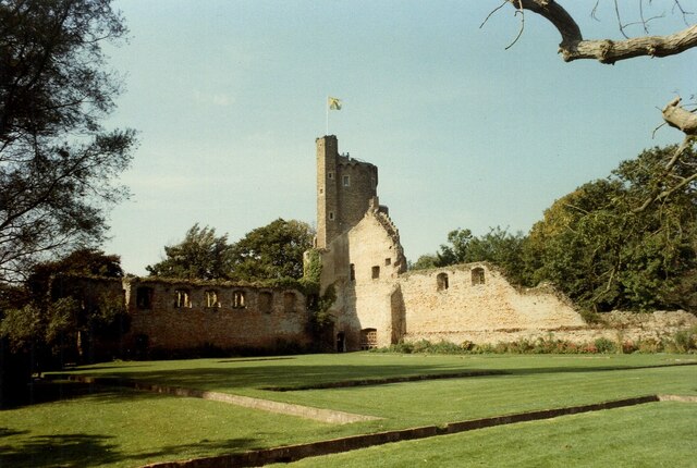
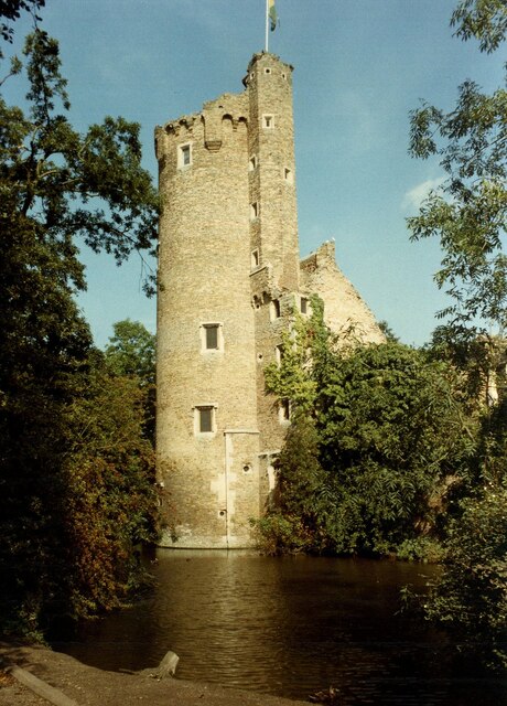
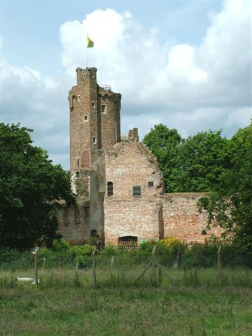
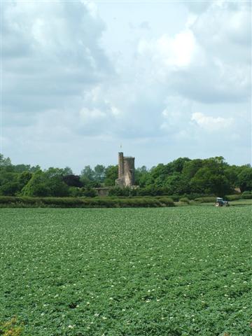
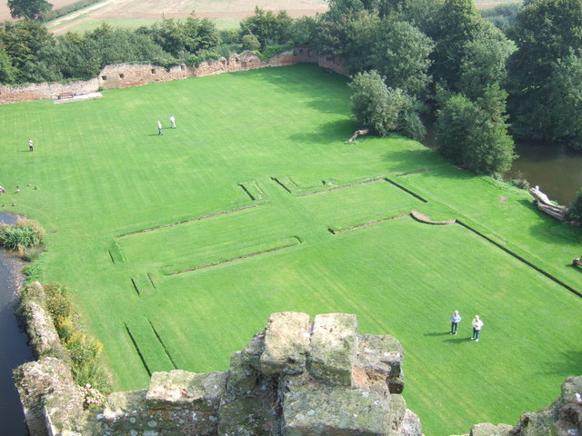
One of the village's most prominent landmarks is Caister Castle, a medieval fortress that dates back to the 15th century. The castle is now privately owned but is open to the public, offering visitors a glimpse into its storied past. Additionally, Caister-on-Sea Roman Fort, built in the 3rd century, is another historical site of interest in the area.

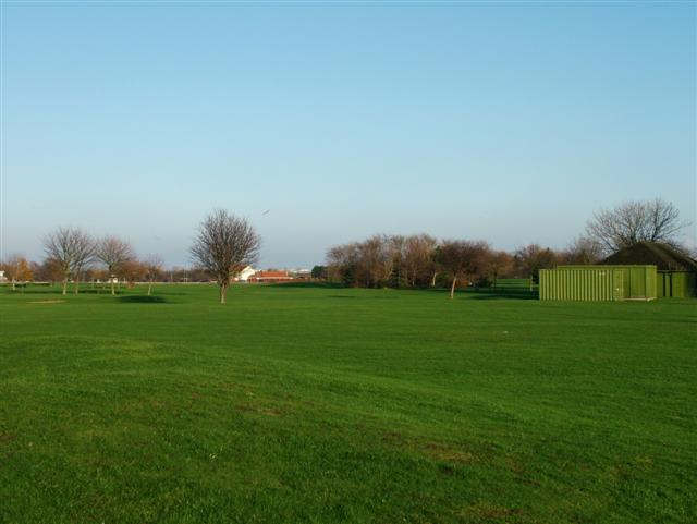
Caister is a thriving community with a range of amenities and facilities for locals and visitors alike. It boasts a variety of shops, cafes, and restaurants, providing residents with easy access to everyday necessities. The village also has a primary school, a medical center, and several recreational areas, including sports fields and parks.

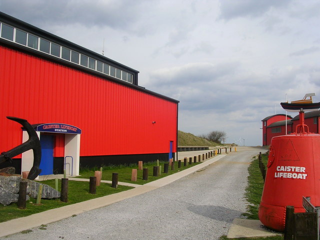
The village hosts various events throughout the year, such as the Caister Lifeboat Day, which celebrates the local lifeboat station and raises funds for this vital service. Caister is also known for its annual Christmas lights switch-on, which brings the community together in a festive spirit.

Overall, Caister offers a charming coastal village experience with a mix of history, natural beauty, and a close-knit community. Its picturesque surroundings and range of amenities make it an attractive destination for both residents and visitors seeking a peaceful retreat by the sea.

If you have any feedback on the listing, please let us know in the comments section below.

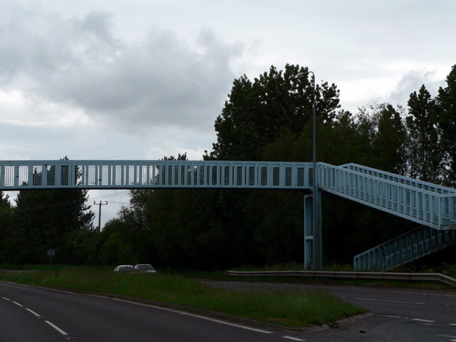
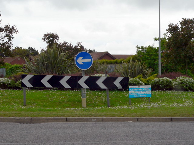
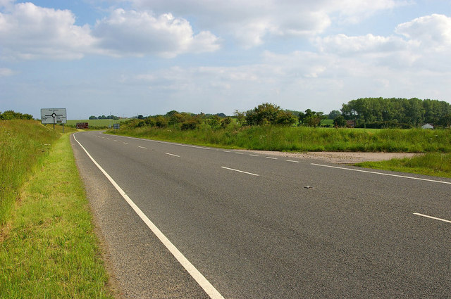
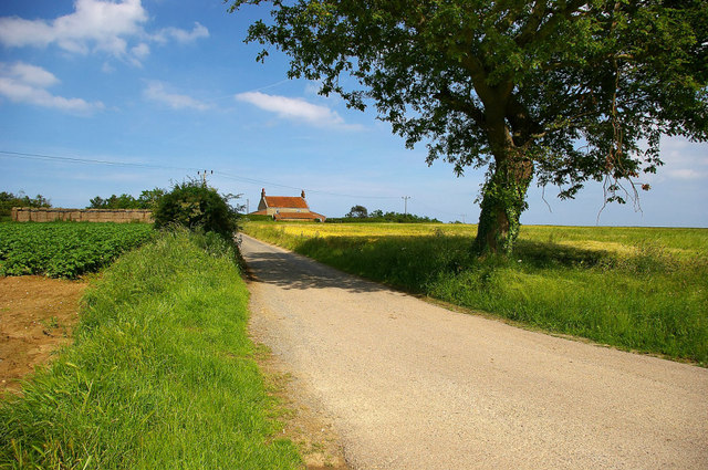
Caister, West Images

Images are sourced within 2km of 52.64465/1.7038758 or Grid Reference TG5011. Thanks to Geograph Open Source API. All images are credited.

Caister Castle Interior <span class="nowrap"><a title="https://historicengland.org.uk/listing/the-list/list-entry/1002882?section=official-listing" rel="nofollow ugc noopener" href="https://historicengland.org.uk/listing/the-list/list-entry/1002882?section=official-listing">Link</a><img style="margin-left:2px;" alt="External link" title="External link - shift click to open in new window" src="https://s1.geograph.org.uk/img/external.png" width="10" height="10"/></span>
Caister Castle Interior
Caister Castle Tower <span class="nowrap"><a title="https://historicengland.org.uk/listing/the-list/list-entry/1002882?section=official-listing" rel="nofollow ugc noopener" href="https://historicengland.org.uk/listing/the-list/list-entry/1002882?section=official-listing">Link</a><img style="margin-left:2px;" alt="External link" title="External link - shift click to open in new window" src="https://s1.geograph.org.uk/img/external.png" width="10" height="10"/></span>
Caister Castle Tower
River Bure Near Great Yarmouth. The Wind Farm which is visible is the Scorby Sands farm, 3km off the coast.
River Bure
Near Great Yarmouth. The Wind Farm which is visible is the Scorby Sands farm, 3km off the coast.
River Bure Near Great Yarmouth, where the river is very tidal. The protective matting, to avoid erosion by tide and boat wash, is clearly visible.
River Bure
Near Great Yarmouth, where the river is very tidal. The protective matting, to avoid erosion by tide and boat wash, is clearly visible.
Caister Lifeboat Station
Caister Castle
Caister Castle
Caister Castle
Caister Castle
The River Bure, Norfolk
Pitch and Putt, Caister, Great Yarmouth
Heliport, Caister, Great Yarmouth Bristow helicopters serve the oil rigs in the North Sea from here.
Heliport, Caister, Great Yarmouth
Bristow helicopters serve the oil rigs in the North Sea from here.
The Greyhound Stadium, Caister, Great Yarmouth Taken from the bank of the River Bure.
The Greyhound Stadium, Caister, Great Yarmouth
Taken from the bank of the River Bure.
Caister Castle View from the top of Caister Castle
Caister Castle
View from the top of Caister Castle
Footbridge over A149 Caister Bypass West Caister, Norfolk
Footbridge over A149 Caister Bypass
West Caister, Norfolk
Roundabout A149 - B1159 Caister-on-Sea
The Tower Caravan Park - Caister Water Tower The Tower Caravan Park off Covent Garden Road, and Caister’s unmistakable Water Tower in the background.
The Tower Caravan Park - Caister Water Tower
The Tower Caravan Park off Covent Garden Road, and Caister’s unmistakable Water Tower in the background.
A149 Bypass looking in the direction of West Caister A149 Bypass completed in the mid 1990’s. A half kilometre stretch cuts the southwest corner of this grid square. The southern section of the bypass replaced the old Nova Scotia Road.
A149 Bypass looking in the direction of West Caister
A149 Bypass completed in the mid 1990’s. A half kilometre stretch cuts the southwest corner of this grid square. The southern section of the bypass replaced the old Nova Scotia Road.
Rural Scene off the A149 Bypass A rural scene photographed from the A149 bypass. The lane flanked on either side by farmland leads to Nova Scotia Cottages and continues on to Nova Scotia Farm.
Rural Scene off the A149 Bypass
A rural scene photographed from the A149 bypass. The lane flanked on either side by farmland leads to Nova Scotia Cottages and continues on to Nova Scotia Farm.
Caister Water Tower Caister Water Tower photographed from Covent Garden Road is nowadays a feature to this much built up housing estate. This particular spot between the bungalows creates a nice short vista to the water tower.
Caister Water Tower
Caister Water Tower photographed from Covent Garden Road is nowadays a feature to this much built up housing estate. This particular spot between the bungalows creates a nice short vista to the water tower.
Show me another place!

Caister, West is located at Grid Ref: TG5011 (Lat: 52.64465, Lng: 1.7038758)

Administrative County: Norfolk

District: Great Yarmouth

Police Authority: Norfolk

What 3 Words

///exists.sentences.glitz. Near Caister-on-Sea, Norfolk

Nearby Locations

West Caister Caister, West

Related Wikis

West Caister

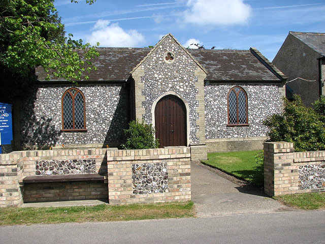
West Caister is a village and civil parish in the English county of Norfolk. It is situated just inland from the coast, some 2 km (1.2 mi) from the seaside...

Caister Roman Site

Caister Roman Site is a Roman Saxon Shore fort, located in Caister-on-Sea, Norfolk, England. It was constructed around AD 200 for use by units of the Roman...

Great Yarmouth – North Denes Airport

North Denes Airport (ICAO: EGSD) is a heliport that is located in the northern suburbs of Great Yarmouth, just off the A149 next to Yarmouth Stadium, formerly...
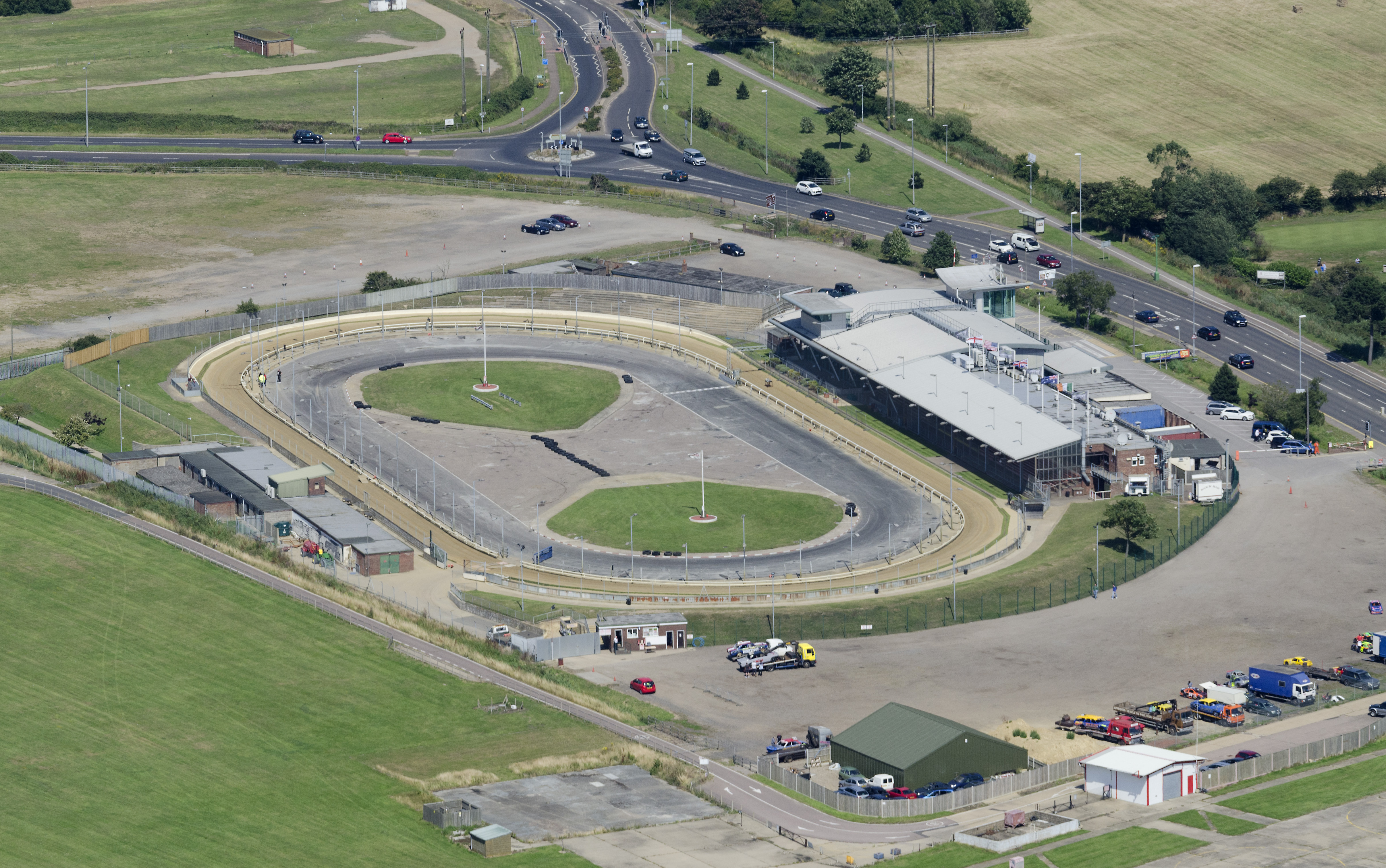
Yarmouth Stadium

Yarmouth Stadium is a greyhound racing track located at Caister-on-Sea in the Borough of Great Yarmouth and English county of Norfolk. It is licensed by...

Caister Academy

Caister Academy, formerly known as Caister High School, is a coeducational secondary school located in the seaside village of Caister-on-Sea in Norfolk...

Caister-on-Sea railway station

Caister-on-Sea railway station is a former railway station in Caister-on-Sea, Norfolk, England. It was opened in 1877. It later became part of the Midland...

Never Turn Back

The Never Turn Back is a grade II listed public house in Caister-on-Sea, Norfolk, England. It was designed by A. W. Ecclestone in the Art Deco and Streamline...

Caister-on-Sea

Caister-on-Sea, also known colloquially as Caister, is a large village and seaside resort in Norfolk, England. It is close to the town of Great Yarmouth...

Nearby Amenities

Located within 500m of 52.64465,1.7038758
West Caister
Is In: Norfolk
Place: hamlet
Lat/Long: 52.644868/1.7033288
Bench
Backrest: yes
Colour: brown
Material: wood
Seats: 3
Lat/Long: 52.645145/1.7071026
Entrance: main
Lat/Long: 52.6451982/1.7071435
Post Box
Lat/Long: 52.645025/1.705817
Saint Edmund
Abandoned Amenity: place_of_worship
Denomination: anglican
Historic: ruins
Listed Status: Grade II
Material: stone
Religion: christian
Ruins: church
Website: http://www.heritage.norfolk.gov.uk/record-details?MNF8694
Lat/Long: 52.6456421/1.7070463
The data included in this document is from www.openstreetmap.org. The data is made available under ODbL.

Have you been to Caister, West?

Leave your review of Caister, West below (or comments, questions and feedback).