Buckland, West

Settlement in Devon North Devon

England

Buckland, West

Huxtable Lane
Huxtable Lane Credit: Roger Cornfoot

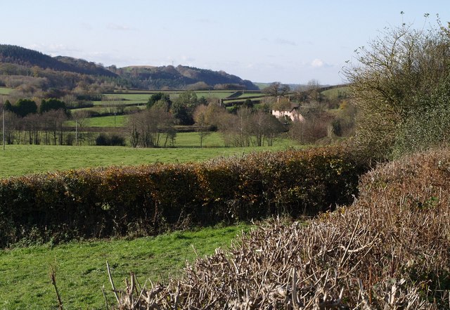
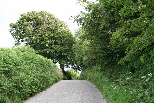
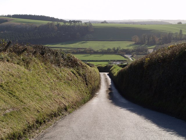
Buckland, West is a small village located in the county of Devon, England. Situated in the West Devon district, it lies within the Dartmoor National Park, offering stunning natural landscapes and a tranquil environment. The village is nestled on the western slopes of Dartmoor, providing residents and visitors with picturesque views of rolling hills, lush green fields, and scattered woodlands.

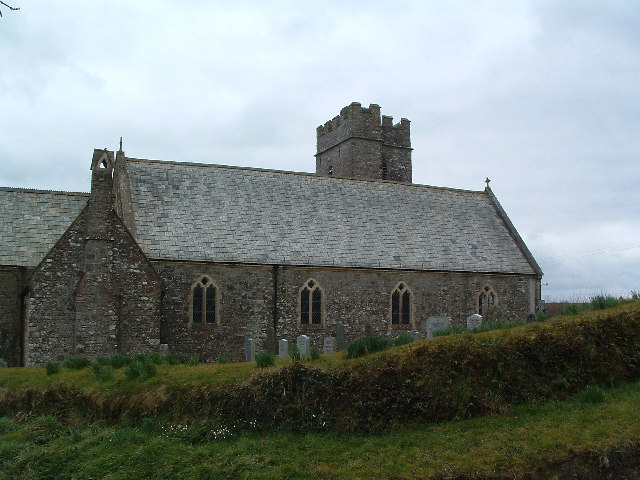
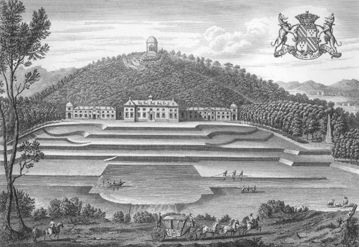
Buckland, West is known for its rich history, with evidence of human settlement dating back to prehistoric times. The village features several historic buildings, including St. Peter's Church, a medieval structure that showcases architectural elements from different periods. Additionally, the Buckland Abbey, a National Trust property, is a popular attraction in the area. This former Cistercian monastery was transformed into a grand residence and was once owned by the famous seafarer Sir Francis Drake.

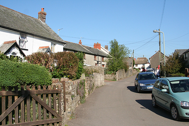
The village offers a peaceful and close-knit community atmosphere. It has a small population, with a mix of permanent residents and holiday homes. The locals take pride in maintaining the village's charm and preserving its natural beauty.

Despite its small size, Buckland, West has a few amenities to cater to its residents' needs, including a village hall and a pub. However, for more extensive facilities and services, the nearby town of Tavistock is easily accessible.

Buckland, West is an ideal destination for nature lovers, history enthusiasts, and those seeking a tranquil retreat away from the hustle and bustle of city life. Its idyllic location within Dartmoor National Park provides ample opportunities for outdoor activities such as hiking, cycling, and wildlife spotting.

If you have any feedback on the listing, please let us know in the comments section below.

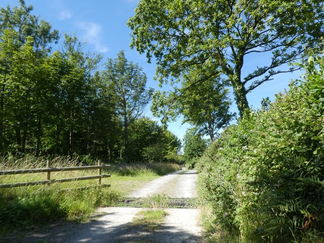
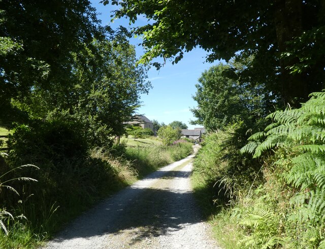
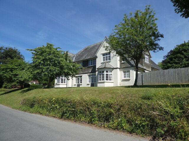
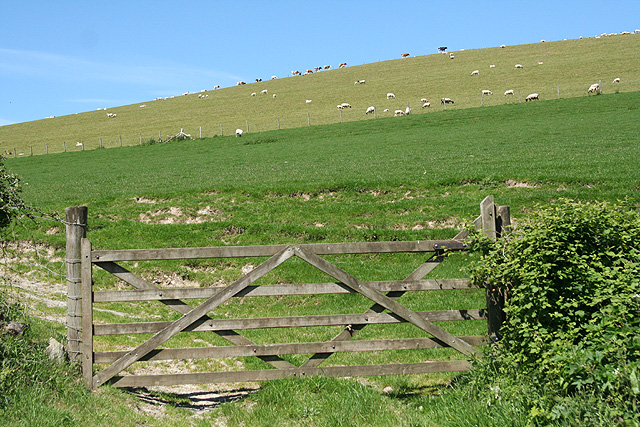
Buckland, West Images

Images are sourced within 2km of 51.06513/-3.9177858 or Grid Reference SS6531. Thanks to Geograph Open Source API. All images are credited.

Huxtable Lane
Huxtable Lane
Huxtable Farm
Huxtable Farm
Huxtable Lane
Huxtable Lane
West Buckland School
A view towards West Buckland and surrounding hills Codden Hill lies just in view to the right of this image with Codden Farm in the valley next to it.
A view towards West Buckland and surrounding hills
Codden Hill lies just in view to the right of this image with Codden Farm in the valley next to it.
West Buckland: Buckingham’s Leary A farm with 250 Friesians in December 2003. In 1890 there was water-power here; one pier of an aqueduct is all that remains of this installation, by the lane beyond the farmhouse. The cottage to the right of the original farm carries an 1858 datestone
West Buckland: Buckingham’s Leary
A farm with 250 Friesians in December 2003. In 1890 there was water-power here; one pier of an aqueduct is all that remains of this installation, by the lane beyond the farmhouse. The cottage to the right of the original farm carries an 1858 datestone
West Buckland: by Leary Barton Looking north-north-west opposite the entrance to Leary Barton
West Buckland: by Leary Barton
Looking north-north-west opposite the entrance to Leary Barton
Gould's Leary Scattered along the lane between Filleigh Bridge and Riverton are numerous farmhouses bearing the name "Leary" and preceded by the surname of a person who once lived there. Gould's Leary is just across the lane from May's Leary. Close by to the left, but hidden, is the A371 link road to Barnstaple. The hills on the left, High Down and Great Hill are in adjoining squares.
Gould's Leary
Scattered along the lane between Filleigh Bridge and Riverton are numerous farmhouses bearing the name "Leary" and preceded by the surname of a person who once lived there. Gould's Leary is just across the lane from May's Leary. Close by to the left, but hidden, is the A371 link road to Barnstaple. The hills on the left, High Down and Great Hill are in adjoining squares.
St Michael's Church, East Buckland Taken for the North side
St Michael's Church, East Buckland
Taken for the North side
St Peter's Church, West Buckland Taken from the West end.
St Peter's Church, West Buckland
Taken from the West end.
West Buckland: South Stoodleigh The entrance gateposts seem slightly elaborate for the location but once served West Buckland School. Looking south-south-east
West Buckland: South Stoodleigh
The entrance gateposts seem slightly elaborate for the location but once served West Buckland School. Looking south-south-east
West Buckland: Stoodleigh Barton Plantation Looking south
West Buckland: Stoodleigh Barton Plantation
Looking south
West Buckland: village street Near the church, looking east
West Buckland: village street
Near the church, looking east
West Buckland: St Peter’s church Looking east to the west tower, the only part of the church to escape the 19th century rebuilding. Note the raised churchyard, just possibly an indication of a pre-Christian site
West Buckland: St Peter’s church
Looking east to the west tower, the only part of the church to escape the 19th century rebuilding. Note the raised churchyard, just possibly an indication of a pre-Christian site
West Buckland: near Upcott Farm
West Buckland: towards Catriage Hill Near the summit and the parish boundary with East Buckland
West Buckland: towards Catriage Hill
Near the summit and the parish boundary with East Buckland
West Buckland School The main School buildings, on left and in centre date from 4 October 1860 when Earl Fortsecue (from nearby Castle Hill House <a title="https://www.geograph.org.uk/photo/3364399" href="https://www.geograph.org.uk/photo/3364399">Link</a> <a href="https://www.geograph.org.uk/gridref/SS6728">SS6728</a>) laid the foundation stone.
West Buckland School
The main School buildings, on left and in centre date from 4 October 1860 when Earl Fortsecue (from nearby Castle Hill House Link SS6728) laid the foundation stone.
Lane above Leary Cross A feature of this area is these high-banked lanes, particularly on lanes dropping down from the foothills of Exmoor. This lane is descending to Buckingham's Leary - see <a href="https://www.geograph.org.uk/photo/72115">SS6529 : West Buckland: Buckingham’s Leary</a>. The A361 and the steep rise of Oxford Down in the background are also in <a href="https://www.geograph.org.uk/gridref/SS6529">SS6529</a>.
Lane above Leary Cross
A feature of this area is these high-banked lanes, particularly on lanes dropping down from the foothills of Exmoor. This lane is descending to Buckingham's Leary - see SS6529 : West Buckland: Buckingham’s Leary. The A361 and the steep rise of Oxford Down in the background are also in SS6529.
Show me another place!

Buckland, West is located at Grid Ref: SS6531 (Lat: 51.06513, Lng: -3.9177858)

Administrative County: Devon

District: North Devon

Police Authority: Devon and Cornwall

What 3 Words

///spins.wrist.poetic. Near South Molton, Devon

Related Wikis

West Buckland, Devon

West Buckland is a small village and former manor, now in the parish of East and West Buckland, in the North Devon district, in the county of Devon, England...

East and West Buckland

East and West Buckland is a civil parish in the English county of Devon. Forming part of the district of North Devon its main settlements are West Buckland...

Accott

Accott is an historic estate, now a small settlement, in the parish of Bishop's Tawton in the county of Devon, England == History == The place-name Accott...

East Buckland

East Buckland is a small village and former civil parish, now in the parish of East and West Buckland, in the North Devon district of Devon, England, next...

Castle Hill, Filleigh

Castle Hill in the parish of Filleigh in North Devon, is an early Neo-Palladian country house situated 3 miles (5 kilometres) north-west of South Molton...

Filleigh

Filleigh is a small village, civil parish and former manor in North Devon, on the southern edge of Exmoor, 3.5 miles (5.6 km) west of South Molton. The...

Brayford

Brayford is a village and civil parish in Devon, England, situated about 5 miles (8.0 km) from South Molton and 6 miles (9.7 km) from Barnstaple. It lies...

Swimbridge

Swimbridge (historical spelling: Swymbridge) is a village, parish and former manor in Devon, England. It is situated 4 miles (6.4 km) south-east of Barnstaple...

Nearby Amenities

Located within 500m of 51.06513,-3.9177858
Post Office
Source: OS OpenData StreetView
Lat/Long: 51.065316/-3.919092
Parsonage Lane Cross
Junction: yes
Source: OS_OpenData_StreetView
Lat/Long: 51.0627559/-3.9185485
West Buckland
Place: village
Source: OS_OpenData_StreetView
Wikidata: Q7984609
Lat/Long: 51.0660702/-3.9180108
Generator Method: photovoltaic
Generator Output Electricity: yes
Generator Source: solar
Generator Type: solar_photovoltaic_panel
Location: roof
Power: generator
Lat/Long: 51.0643899/-3.9173891
Generator Method: photovoltaic
Generator Output Electricity: yes
Generator Source: solar
Generator Type: solar_photovoltaic_panel
Location: roof
Power: generator
Lat/Long: 51.0643629/-3.9174306
Generator Method: photovoltaic
Generator Output Electricity: yes
Generator Source: solar
Generator Type: solar_photovoltaic_panel
Location: roof
Power: generator
Lat/Long: 51.0643224/-3.917487
Generator Method: photovoltaic
Generator Output Electricity: yes
Generator Source: solar
Generator Type: solar_photovoltaic_panel
Location: roof
Power: generator
Lat/Long: 51.0643755/-3.917558
Generator Method: photovoltaic
Generator Output Electricity: yes
Generator Source: solar
Generator Type: solar_photovoltaic_panel
Location: roof
Power: generator
Lat/Long: 51.0658058/-3.9196046
Generator Method: photovoltaic
Generator Output Electricity: yes
Generator Source: solar
Generator Type: solar_photovoltaic_panel
Location: roof
Power: generator
Lat/Long: 51.0656077/-3.9182621
Generator Method: photovoltaic
Generator Output Electricity: yes
Generator Source: solar
Generator Type: solar_photovoltaic_panel
Location: roof
Power: generator
Lat/Long: 51.0653372/-3.9189756
Power: pole
Source: bing
Lat/Long: 51.0615731/-3.9143944
The data included in this document is from www.openstreetmap.org. The data is made available under ODbL.

Have you been to Buckland, West?

Leave your review of Buckland, West below (or comments, questions and feedback).