Bexington, West

Settlement in Dorset

England

Bexington, West

Barn above Labour in Vain Farm
Barn above Labour in Vain Farm Credit: Vieve Forward

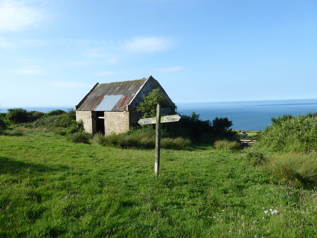
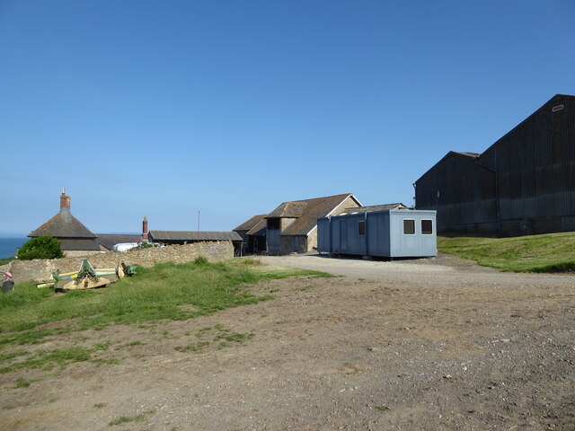
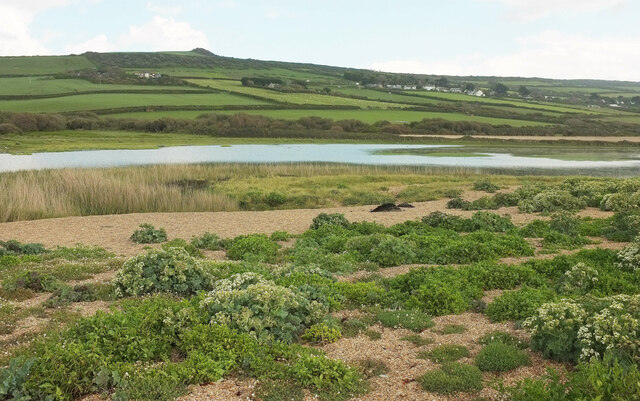
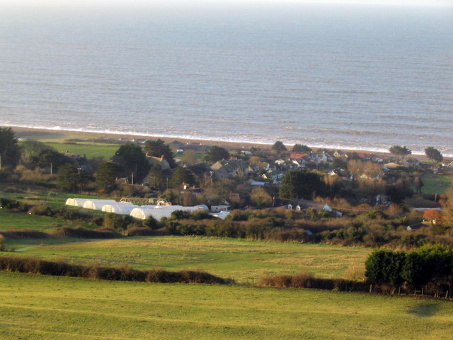
Bexington is a small coastal village located in West Dorset, England. Situated on the Jurassic Coast, a UNESCO World Heritage Site, it offers stunning views of the English Channel and the surrounding countryside. With a population of around 200 residents, Bexington is known for its quiet and peaceful atmosphere, making it a popular destination for those seeking a tranquil getaway.

The village is characterized by its picturesque thatched cottages, charming gardens, and narrow lanes, all contributing to its quintessential English countryside charm. Bexington is primarily a residential area, with a small number of local shops and amenities available to cater to the community's needs.

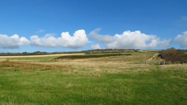
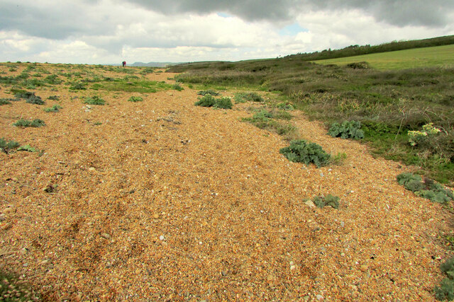
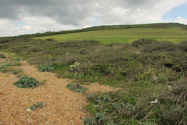
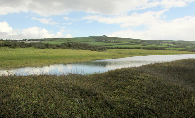
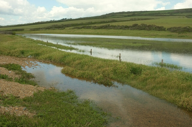
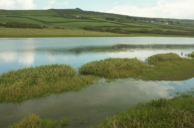
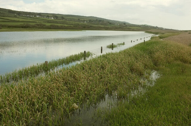
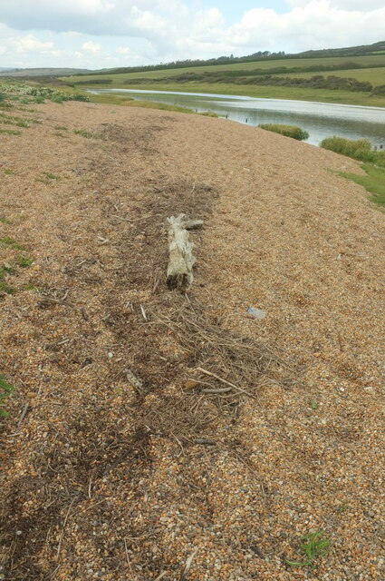
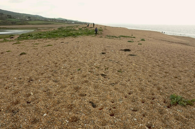
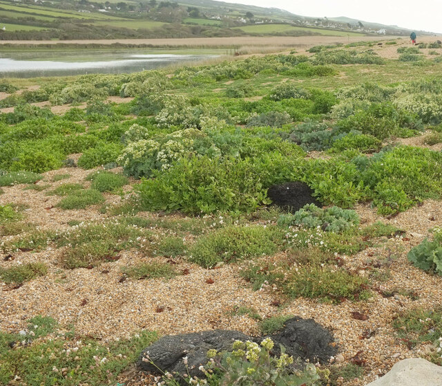
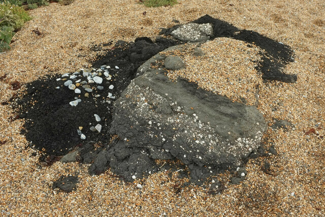
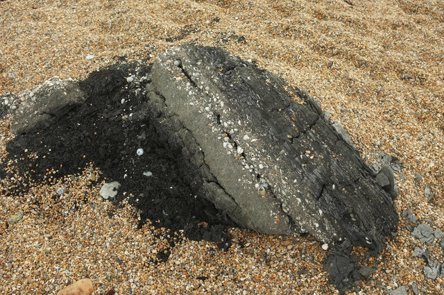
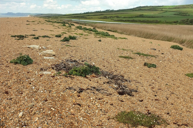
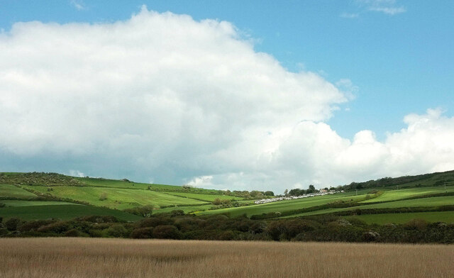
Nature enthusiasts will find Bexington to be an ideal base for exploring the Jurassic Coastline, which is renowned for its rich fossil heritage and scenic beauty. The steep cliffs and rocky beaches provide opportunities for hiking, fossil hunting, and enjoying the fresh sea air. The nearby Chesil Beach, a shingle tombolo stretching 18 miles, is a popular spot for birdwatching and beachcombing.

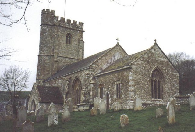
For history buffs, Bexington offers glimpses into the past with its historic buildings and landmarks. The 14th-century St. Mary's Church, perched on the hillside, is a notable architectural gem worth visiting. Additionally, the village is surrounded by ancient earthworks and burial mounds, showcasing its long-standing human habitation.

Overall, Bexington is a hidden gem on the West Dorset coast, offering a unique blend of natural beauty, history, and tranquility. Whether one seeks a peaceful retreat or an outdoor adventure, this small coastal village has something to offer for everyone.

If you have any feedback on the listing, please let us know in the comments section below.

Bexington, West Images

Images are sourced within 2km of 50.679547/-2.6612869 or Grid Reference SY5386. Thanks to Geograph Open Source API. All images are credited.

Barn above Labour in Vain Farm
East Bexington Farm
East Bexington Farm
Path leading up to New Lane & Swyre from the coast
Chesil Beach At the back edge of the shingle ridge between Burton Mere and West Bexington Nature Reserve.
Chesil Beach
At the back edge of the shingle ridge between Burton Mere and West Bexington Nature Reserve.
Scrub and grass by Chesil Beach Looking right from <a href="https://www.geograph.org.uk/photo/7058979">SY5187 : Chesil Beach</a> with overlap. The coast path and Hardy Way run along this side of the field.
Scrub and grass by Chesil Beach
Looking right from SY5187 : Chesil Beach with overlap. The coast path and Hardy Way run along this side of the field.
Pond and field west of West Bexington The pond is unmapped but appears on satellite images, though not reaching as far west as shown here.
Pond and field west of West Bexington
The pond is unmapped but appears on satellite images, though not reaching as far west as shown here.
Pond behind Chesil Beach A little further east along the side of the pond from <a href="https://www.geograph.org.uk/photo/7059012">SY5287 : Pond and field west of West Bexington</a>, looking back.
Pond behind Chesil Beach
A little further east along the side of the pond from SY5287 : Pond and field west of West Bexington, looking back.
Pond behind Chesil Beach Looking right from <a href="https://www.geograph.org.uk/photo/7059090">SY5287 : Pond behind Chesil Beach</a>, in the same direction as <a href="https://www.geograph.org.uk/photo/7059012">SY5287 : Pond and field west of West Bexington</a>, with The Knoll on the hilltop.
Pond behind Chesil Beach
Looking right from SY5287 : Pond behind Chesil Beach, in the same direction as SY5287 : Pond and field west of West Bexington, with The Knoll on the hilltop.
Pond behind Chesil Beach Looking right from <a href="https://www.geograph.org.uk/photo/7059095">SY5287 : Pond behind Chesil Beach</a>, towards West Bexington.
Pond behind Chesil Beach
Looking right from SY5287 : Pond behind Chesil Beach, towards West Bexington.
Log on the coast path In the background is the pond seen in <a href="https://www.geograph.org.uk/photo/7059159">SY5287 : Pond behind Chesil Beach</a>
Log on the coast path
In the background is the pond seen in SY5287 : Pond behind Chesil Beach
Chesil Beach west of West Bexington Very faint in the distance is the Isle of Portland.
Chesil Beach west of West Bexington
Very faint in the distance is the Isle of Portland.
Chesil Beach west of West Bexington The vegetated area seen from a distance at <a href="https://www.geograph.org.uk/photo/7059174">SY5286 : Chesil Beach west of West Bexington</a>. Many lumps of black shelly shale are scattered around this area among the sea kale and sea campion - could they be Kimmeridge Blackstone, and if so, from Portland or outcrops to the east, or from the sea bed? "Pieces of the oil shale can be seen washed up on the southeastern end of the Chesil Beach" <span class="nowrap"><a title="https://wessexcoastgeology.soton.ac.uk/Kimmeridge-Oil-Shale.htm" rel="nofollow ugc noopener" href="https://wessexcoastgeology.soton.ac.uk/Kimmeridge-Oil-Shale.htm">Link</a><img style="margin-left:2px;" alt="External link" title="External link - shift click to open in new window" src="https://s1.geograph.org.uk/img/external.png" width="10" height="10"/></span> - but this is not the southeastern end. There is "an outcrop under the sea off Chiswell" <span class="nowrap"><a title="http://www.chesilbeach.org/chesil/pebbles.html" rel="nofollow ugc noopener" href="http://www.chesilbeach.org/chesil/pebbles.html">Link</a><img style="margin-left:2px;" alt="External link" title="External link - shift click to open in new window" src="https://s1.geograph.org.uk/img/external.png" width="10" height="10"/></span> .
Chesil Beach west of West Bexington
The vegetated area seen from a distance at SY5286 : Chesil Beach west of West Bexington. Many lumps of black shelly shale are scattered around this area among the sea kale and sea campion - could they be Kimmeridge Blackstone, and if so, from Portland or outcrops to the east, or from the sea bed? "Pieces of the oil shale can be seen washed up on the southeastern end of the Chesil Beach" LinkExternal link - but this is not the southeastern end. There is "an outcrop under the sea off Chiswell" LinkExternal link .
Chesil Beach west of West Bexington From <a href="https://www.geograph.org.uk/photo/7059205">SY5286 : Chesil Beach west of West Bexington</a>, looking across a pond at West Bexington nature reserve. Further clods of what could be black oil shale can be seen a little way away.
Chesil Beach west of West Bexington
From SY5286 : Chesil Beach west of West Bexington, looking across a pond at West Bexington nature reserve. Further clods of what could be black oil shale can be seen a little way away.
Oil shale on Chesil Beach See also <a href="https://www.geograph.org.uk/photo/7059205">SY5286 : Chesil Beach west of West Bexington</a>. The paler rock has clearly stratified layers of shells; the darker stuff has probably been disturbed and decorated with pebbles.
Oil shale on Chesil Beach
See also SY5286 : Chesil Beach west of West Bexington. The paler rock has clearly stratified layers of shells; the darker stuff has probably been disturbed and decorated with pebbles.
Shells on Chesil Beach A closer look at the shells contained in the ?oil shals lumps such as those seen in <a href="https://www.geograph.org.uk/photo/7059205">SY5286 : Chesil Beach west of West Bexington</a> and <a href="https://www.geograph.org.uk/photo/7059225">SY5286 : Oil shale on Chesil Beach</a>.
Shells on Chesil Beach
A closer look at the shells contained in the ?oil shals lumps such as those seen in SY5286 : Chesil Beach west of West Bexington and SY5286 : Oil shale on Chesil Beach.
Oil shale on Chesil Beach A further example to add to <a href="https://www.geograph.org.uk/photo/7059225">SY5286 : Oil shale on Chesil Beach</a> and <a href="https://www.geograph.org.uk/photo/7059240">SY5286 : Shells on Chesil Beach</a>. Perhaps increasingly violent storms are responsible for bringing more submarine rocks ashore.
Oil shale on Chesil Beach
A further example to add to SY5286 : Oil shale on Chesil Beach and SY5286 : Shells on Chesil Beach. Perhaps increasingly violent storms are responsible for bringing more submarine rocks ashore.
Chesil Beach near West Bexington Nature Reserve The top of the beach, looking towards Cogden Beach.
Chesil Beach near West Bexington Nature Reserve
The top of the beach, looking towards Cogden Beach.
Towards Swyre Looking right from <a href="https://www.geograph.org.uk/photo/7059268">SY5286 : Chesil Beach near West Bexington Nature Reserve</a> across the reed beds of West Bexington Nature Reserve. To the right is Gorselands Caravan Park.
Towards Swyre
Looking right from SY5286 : Chesil Beach near West Bexington Nature Reserve across the reed beds of West Bexington Nature Reserve. To the right is Gorselands Caravan Park.
Show me another place!

Bexington, West is located at Grid Ref: SY5386 (Lat: 50.679547, Lng: -2.6612869)

Unitary Authority: Dorset

Police Authority: Dorset

What 3 Words

///crunched.tiger.shunts. Near Bridport, Dorset

Related Wikis

West Bexington

West Bexington is a village in south-west Dorset, England, sited just behind the Chesil Beach about 6 miles (10 km) southeast of Bridport. It forms part...

Holy Trinity Church, Swyre

Holy Trinity Church is a Church of England church in Swyre, Dorset, England. The oldest part of the church has been dated to the early 15th century, with...

Swyre

Swyre ( ) is a small village and civil parish in southwest Dorset, England, situated in a valley beside Chesil Beach 6 miles (9.7 km) southeast of Bridport...

Puncknowle

Puncknowle ( PUN-əl) is a village and civil parish in the county of Dorset in southwest England, situated on the southern slopes of the Bride Valley approximately...

Abbotsbury Castle

Abbotsbury Castle is an Iron Age hillfort in south west Dorset, England, situated on Wears Hill above the village of Abbotsbury, seven miles west of Dorchester...

Abbotsbury Subtropical Gardens

The Abbotsbury Subtropical Gardens is a visitor attraction near the village of Abbotsbury, Dorset, southern England. They are Grade I listed in the National...

Litton Cheney

Litton Cheney is a village and civil parish in the county of Dorset in south-west England. It lies 9 miles (14 km) west of the county town Dorchester....

Chilcombe

Chilcombe is a hamlet and civil parish in Dorset, England, situated in the Dorset unitary authority administrative area about 4 miles (6.4 km) east of...

Related Videos

A Dorset walk, Lulworth Cove To Weymouth

3rd leg of our walk along the South West Coastal path in Dorset. Our aim is to walk the full length of the Dorset coast. The Jarrasic ...

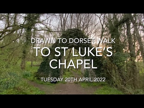
Walk to St Luke’s Chapel

Walk with “Drawn to Dorset” to St Luke's Chapel, 19th April 2022 (actually!) Volume up for birdsong and distant bells Many thanks ...

Wild Camping Jurassic Coast

Wild camping along the Jurassic Coast on a cold, frosty, snow covered weekend, early March.

Nearby Amenities

Located within 500m of 50.679547,-2.6612869
Toilets
Lat/Long: 50.6765979/-2.6654475
Post Box
Post Box Type: lamp
Ref: DT2 119
Ref GB Uprn: 10015404696
Royal Cypher: EIIR
Royal Cypher Wikidata: Q33102113
Lat/Long: 50.6798483/-2.6614465
West Bexington
Place: village
Wikidata: Q7984475
Lat/Long: 50.6802203/-2.6614154
Upper Tamarisk
Place: locality
Source: OD Streetview
Lat/Long: 50.6834213/-2.6618455
Restaurant
Club House Restaurant
Addr Housename: Beach Road, West Bexington
Cuisine: regional;fish
Internet Access: yes
Outdoor Seating: yes
Lat/Long: 50.6763366/-2.6648319
Corporal Neil Martin Blain
Historic: memorial
Openplaques Id: 39841
Lat/Long: 50.6759181/-2.6650442
Pub
The Manor House
Addr Postcode: DT2 9DF
Tourism: hotel
Website: https://www.manorhoteldorset.com/
Wikidata: Q26510610
Lat/Long: 50.6790009/-2.6614527
Tamarisk Farm Shop
Addr Housename: Tamarisk Farm, Beach Road, West Bexington
Operator: Tamarisk Farm
Payment Cash: yes
Shop: Farm_produce_direct_from_the_farm
Lat/Long: 50.6795132/-2.6615644
Information: board
Tourism: information
Lat/Long: 50.679618/-2.661446
Motorhome: yes
Lat/Long: 50.6757783/-2.6649456
Motorhome: yes
Lat/Long: 50.6757898/-2.6649805
Sea, Storms and Shingle
Information: board
Tourism: information
Lat/Long: 50.6758973/-2.6650821
Explore the Dorset Coast
Information: board
Tourism: information
Lat/Long: 50.6758909/-2.665058
Barrier: stile
Source: observation
Lat/Long: 50.6795365/-2.668165
The data included in this document is from www.openstreetmap.org. The data is made available under ODbL.

Have you been to Bexington, West?

Leave your review of Bexington, West below (or comments, questions and feedback).