Bradford Peverell

Settlement in Dorset

England

Bradford Peverell

St Mary the Virgin, Charminster, Dorset Over a period of 800 years since the 11th-century, this church has been built, demolished, rebuilt, extended and restored many times, the last restoration being between 1895 and 1897. Due to extensive flooding in 2016, the Victorian wooden block flooring was replaced with Somerset blue flag stones.
St Mary the Virgin, Charminster, Dorset Credit: Ray Jennings

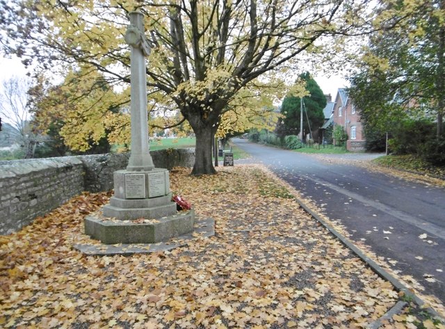
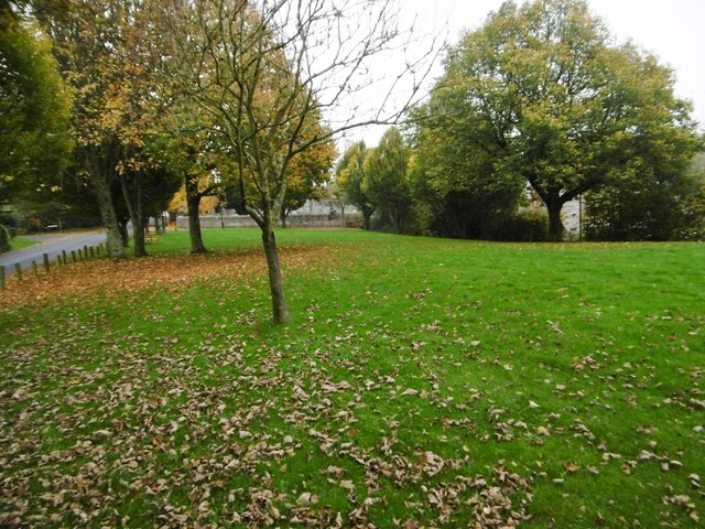
Bradford Peverell is a picturesque village located in the county of Dorset, England. Situated approximately 4 miles northwest of the county town of Dorchester, it lies in the Piddle Valley and is surrounded by beautiful countryside, making it an ideal destination for nature lovers and outdoor enthusiasts.

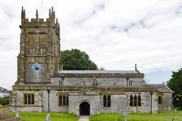
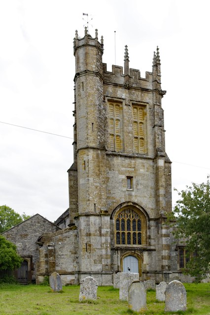
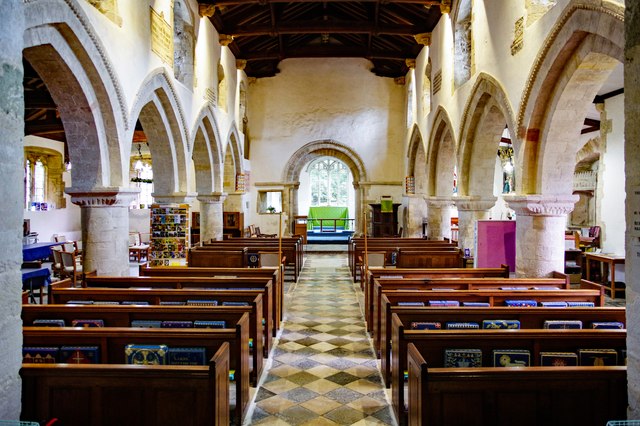
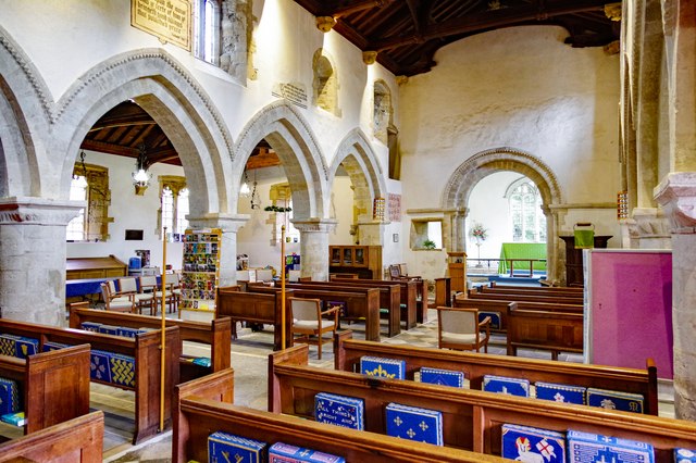
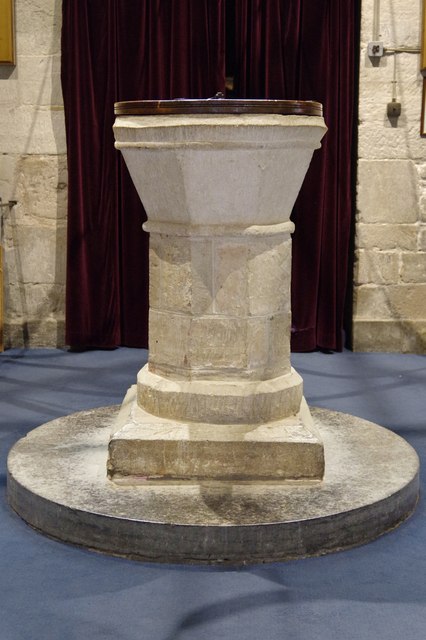
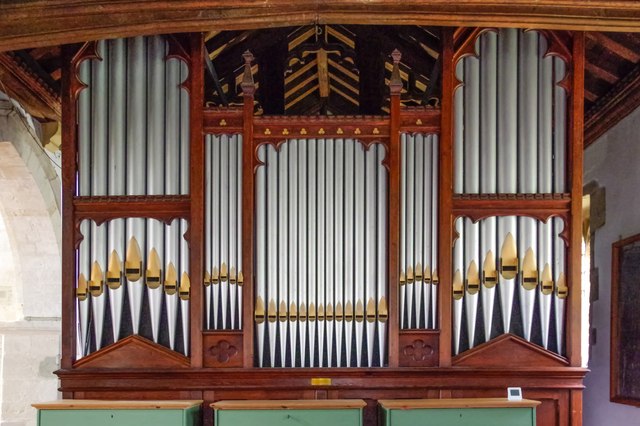
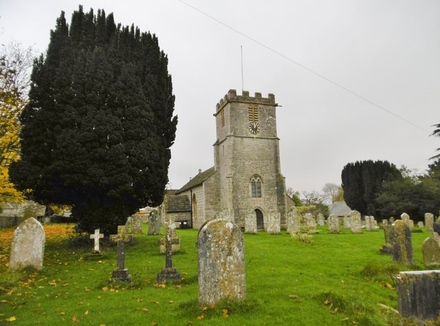
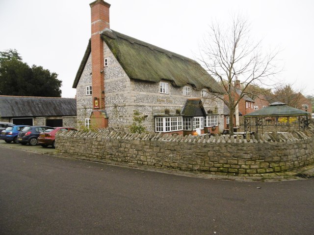
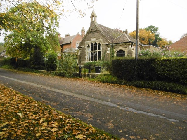
The village is renowned for its charming thatched cottages, many of which date back to the 17th and 18th centuries, giving it a distinctive historic character. The focal point of Bradford Peverell is the All Saints Church, a Grade I listed building that dates back to the 13th century, showcasing the architectural heritage of the area.

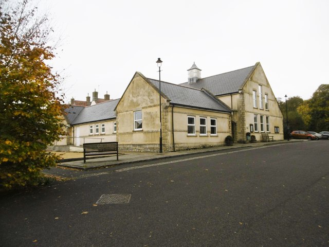
The village is well-served by amenities, including a local pub, The New Inn, which offers a warm and friendly atmosphere, as well as delicious food and drinks. There is also a village hall that hosts various community events and activities throughout the year, bringing residents together and fostering a strong sense of community spirit.

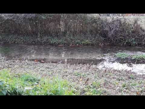
Bradford Peverell benefits from its proximity to the River Piddle, providing opportunities for fishing and leisurely walks along its banks. The surrounding countryside offers numerous walking and cycling routes, allowing visitors to explore the idyllic Dorset landscape.

With its tranquil setting, historical charm, and welcoming community, Bradford Peverell is a delightful village that offers a peaceful escape from the bustling city life, making it an attractive destination for both locals and tourists alike.

If you have any feedback on the listing, please let us know in the comments section below.

Bradford Peverell Images

Images are sourced within 2km of 50.735545/-2.4838671 or Grid Reference SY6592. Thanks to Geograph Open Source API. All images are credited.

St Mary the Virgin, Charminster, Dorset Over a period of 800 years since the 11th-century, this church has been built, demolished, rebuilt, extended and restored many times, the last restoration being between 1895 and 1897. Due to extensive flooding in 2016, the Victorian wooden block flooring was replaced with Somerset blue flag stones.
St Mary the Virgin, Charminster, Dorset
Over a period of 800 years since the 11th-century, this church has been built, demolished, rebuilt, extended and restored many times, the last restoration being between 1895 and 1897. Due to extensive flooding in 2016, the Victorian wooden block flooring was replaced with Somerset blue flag stones.
St Mary the Virgin, Charminster, Dorset Thought to date from the late 16th-century, the tower was built by Sir Thomas Trenchard.
St Mary the Virgin, Charminster, Dorset
Thought to date from the late 16th-century, the tower was built by Sir Thomas Trenchard.
St Mary the Virgin, Charminster, Dorset The Nave. Looking at the chancel arch, one can see original 11th-century, to either side and extending to form a link with each first arch leading into the nave. The arch itself is 12th-century and is bigger than the original.
St Mary the Virgin, Charminster, Dorset
The Nave. Looking at the chancel arch, one can see original 11th-century, to either side and extending to form a link with each first arch leading into the nave. The arch itself is 12th-century and is bigger than the original.
St Mary the Virgin, Charminster, Dorset A general view across the church towards the North aisle, showing some painted wall texts adjacent to the clerestory windows.
St Mary the Virgin, Charminster, Dorset
A general view across the church towards the North aisle, showing some painted wall texts adjacent to the clerestory windows.
St Mary the Virgin, Charminster, Dorset Standing beneath the tower, the font is surrounded by bell ringers at the appropriate times. Of 12th-century origin, the font was altered in shape sometime during the 15th-century.
St Mary the Virgin, Charminster, Dorset
Standing beneath the tower, the font is surrounded by bell ringers at the appropriate times. Of 12th-century origin, the font was altered in shape sometime during the 15th-century.
St Mary the Virgin, Charminster, Dorset Built in 1906, the organ has moved twice before settling in its 'forever' home in 1957. It was rebuilt in 1985 and brought up to modern (for the time) standards but was damaged by floods in 2000, which necessitated a full restoration. It now sits 50cm above floor level which proved successful in avoiding repeat flooding in 2014.
St Mary the Virgin, Charminster, Dorset
Built in 1906, the organ has moved twice before settling in its 'forever' home in 1957. It was rebuilt in 1985 and brought up to modern (for the time) standards but was damaged by floods in 2000, which necessitated a full restoration. It now sits 50cm above floor level which proved successful in avoiding repeat flooding in 2014.
Stratton, war memorial On Dorchester Road; recording the names of thirteen fallen in the world wars.
Stratton, war memorial
On Dorchester Road; recording the names of thirteen fallen in the world wars.
Stratton, St. Mary the Virgin Parish church on Dorchester Road, dating from C12; listed by Historic England (Grade I): <span class="nowrap"><a title="http://www.imagesofengland.org.uk/Details/Default.aspx?id=401939&mode=adv" rel="nofollow ugc noopener" href="http://www.imagesofengland.org.uk/Details/Default.aspx?id=401939&mode=adv">Link</a><img style="margin-left:2px;" alt="External link" title="External link - shift click to open in new window" src="https://s1.geograph.org.uk/img/external.png" width="10" height="10"/></span>
Stratton, St. Mary the Virgin
Parish church on Dorchester Road, dating from C12; listed by Historic England (Grade I): LinkExternal link
Stratton, Saxon Arms Welcoming village pub on the Square. A modern building, like the village hall opposite, and houses on this side of the main road, but with plenty of character. Back bar, open plan, with drinking area front and left, and dining right. Wooden panelled ceilings, wood burning stoves and festoons of hops. Cask ales on offer at my visit: Butcombe Bitter, Moorhouse's White Witch, St. Austell Proper Job, Taylor's Landlord. Listed in the 2016 Good Beer Guide.
Stratton, Saxon Arms
Welcoming village pub on the Square. A modern building, like the village hall opposite, and houses on this side of the main road, but with plenty of character. Back bar, open plan, with drinking area front and left, and dining right. Wooden panelled ceilings, wood burning stoves and festoons of hops. Cask ales on offer at my visit: Butcombe Bitter, Moorhouse's White Witch, St. Austell Proper Job, Taylor's Landlord. Listed in the 2016 Good Beer Guide.
Stratton Village Hall On the Square; dated 2000.
Stratton Village Hall
On the Square; dated 2000.
Stratton Village Green Overlooking Dorchester Road; with seats and a playground (out of sight).
Stratton Village Green
Overlooking Dorchester Road; with seats and a playground (out of sight).
Stratton, former school On Dorchester Road, dated 1898; now residential.
Stratton, former school
On Dorchester Road, dated 1898; now residential.
Bradford Peverell, Roman Road Lane from the crossroads at Muckleford to the village. Autumn colours on the beeches are showing well. Part of the Roman route from Ilchester to Dorchester.
Bradford Peverell, Roman Road
Lane from the crossroads at Muckleford to the village. Autumn colours on the beeches are showing well. Part of the Roman route from Ilchester to Dorchester.
Bradford Peverell, cottages In the village centre, on Roman Road.
Bradford Peverell, cottages
In the village centre, on Roman Road.
Bradford Peverell, St. Mary's Parish church, mid-C19 by Decimus Burton; listed by Historic England (Grade II*): <span class="nowrap"><a title="http://www.imagesofengland.org.uk/Details/Default.aspx?id=105117&mode=adv" rel="nofollow ugc noopener" href="http://www.imagesofengland.org.uk/Details/Default.aspx?id=105117&mode=adv">Link</a><img style="margin-left:2px;" alt="External link" title="External link - shift click to open in new window" src="https://s1.geograph.org.uk/img/external.png" width="10" height="10"/></span>
Bradford Peverell, St. Mary's
Parish church, mid-C19 by Decimus Burton; listed by Historic England (Grade II*): LinkExternal link
Bradford Peverell, River Frome Looking downstream from the road to Stratton.
Bradford Peverell, River Frome
Looking downstream from the road to Stratton.
Stratton, railway bridge Carrying the Dorchester to Yeovil line over the Bradford Peverell to Stratton road.
Stratton, railway bridge
Carrying the Dorchester to Yeovil line over the Bradford Peverell to Stratton road.
Show me another place!

Bradford Peverell is located at Grid Ref: SY6592 (Lat: 50.735545, Lng: -2.4838671)

Unitary Authority: Dorset

Police Authority: Dorset

What 3 Words

///painter.conspire.moving. Near Charminster, Dorset

Related Wikis

Bradford Peverell

Bradford Peverell is a village and civil parish in the English county of Dorset, 2 miles (3.2 km) north-west of the county town Dorchester. It is sited...

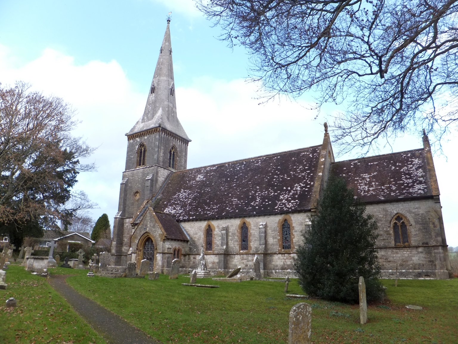
St Mary's Church, Bradford Peverell

St Mary's Church is a Church of England parish church in Bradford Peverell, Dorset, England. It was designed by Decimus Burton and built in 1849–50. The...

Bradford Peverell & Stratton Halt

Bradford Peverell and Stratton Halt was a station on the Great Western Railway on what had originally been part of the Wiltshire, Somerset & Weymouth Railway...

St George's Hundred, Dorset

St George's Hundred, later often George Hundred, was a hundred (administrative division) in the county of Dorset, England, containing the following parishes...

Stratton, Dorset

Stratton is a village and civil parish in Dorset, England, situated in the Frome valley about 3 miles (4.8 km) north-west of Dorchester. The parish includes...

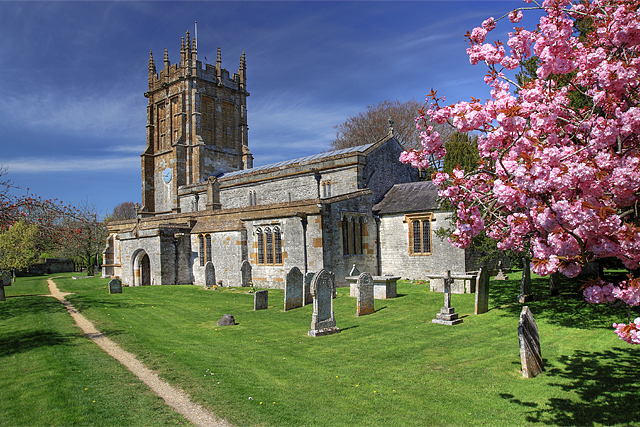
St Mary's Church, Charminster

St Mary's Church is an Anglican church in the village of Charminster, Dorset, in the Diocese of Salisbury. It is a Grade I listed building. The oldest...
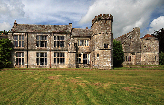
Wolfeton House

Wolfeton House (sometimes Wolveton House) is an early Tudor and Elizabethan manor house in Dorset, England. It is situated amongst water-meadows north...

Charminster

Charminster is a village and civil parish in west Dorset, England, situated on the River Cerne and A352 road 1 mile (1.6 km) north of the county town Dorchester...

Related Videos

Three Compasses Charminster Dorset another with our stickers

our stickers travel around the UK letting dog owners connect with local businesses helping local businesses meet new people ...

Nearby Amenities

Located within 500m of 50.735545,-2.4838671
Bradford Peverell
Is In: Dorset, England, UK
Place: village
Lat/Long: 50.7354843/-2.4846111
Turning Circle
Lat/Long: 50.7360465/-2.4867788
Turning Circle
Lat/Long: 50.7366032/-2.4877993
Material: wood
Power: pole
Source: bing
Lat/Long: 50.7310895/-2.4837192
Material: wood
Power: pole
Source: bing
Lat/Long: 50.7345637/-2.4786768
Material: wood
Power: pole
Source: bing
Lat/Long: 50.7351948/-2.4799904
Material: wood
Power: pole
Source: bing
Lat/Long: 50.7361953/-2.4834569
Material: wood
Power: pole
Source: bing
Lat/Long: 50.7366725/-2.4806494
Material: wood
Power: pole
Source: bing
Lat/Long: 50.7368312/-2.483434
Material: wood
Power: pole
Source: bing
Lat/Long: 50.7373846/-2.4879161
Material: wood
Power: pole
Source: bing
Lat/Long: 50.7375548/-2.4834098
Material: wood
Power: pole
Source: bing
Lat/Long: 50.7375642/-2.4838692
Material: wood
Power: pole
Source: bing
Lat/Long: 50.7376605/-2.4826739
Material: wood
Power: pole
Source: bing
Lat/Long: 50.7377916/-2.4877175
Material: wood
Power: pole
Source: bing
Lat/Long: 50.7380238/-2.4840082
Material: wood
Power: pole
Source: bing
Lat/Long: 50.738347/-2.4862576
Material: wood
Power: pole
Source: bing
Lat/Long: 50.7385745/-2.4846539
Material: wood
Power: pole
Source: bing
Lat/Long: 50.7388182/-2.4872502
Material: wood
Power: pole
Source: bing
Lat/Long: 50.7391228/-2.4853513
Material: wood
Power: pole
Source: bing
Lat/Long: 50.7395169/-2.4869226
Material: wood
Power: pole
Source: bing
Lat/Long: 50.733187/-2.4786481
Post Box
Collection Times: Mo-Fr 09:00; Sa 07:00
Operator: Royal Mail
Operator Wikidata: Q638098
Post Box Type: lamp
Ref: DT2 144D
Ref GB Uprn: 10015477928
Royal Cypher: EIIR
Royal Cypher Wikidata: Q33102113
Source: survey
Survey Date: 2022-12-26
Lat/Long: 50.7399312/-2.4847053
Direction: ESE
Generator Method: photovoltaic
Generator Output Electricity: yes
Generator Solar Modules: 10
Generator Source: solar
Generator Type: solar_photovoltaic_panel
Location: roof
Power: generator
Lat/Long: 50.7357335/-2.4824549
Direction: SE
Generator Method: photovoltaic
Generator Output Electricity: yes
Generator Solar Modules: 16
Generator Source: solar
Generator Type: solar_photovoltaic_panel
Location: roof
Power: generator
Lat/Long: 50.7322102/-2.4800952
Direction: SW
Generator Method: photovoltaic
Generator Output Electricity: yes
Generator Solar Modules: 6
Generator Source: solar
Generator Type: solar_photovoltaic_panel
Location: roof
Power: generator
Lat/Long: 50.7326516/-2.4802967
Direction: SE
Generator Method: photovoltaic
Generator Output Electricity: yes
Generator Solar Modules: 5
Generator Source: solar
Generator Type: solar_photovoltaic_panel
Location: roof
Power: generator
Lat/Long: 50.7326508/-2.4803788
Direction: SW
Generator Method: photovoltaic
Generator Output Electricity: yes
Generator Solar Modules: 10
Generator Source: solar
Generator Type: solar_photovoltaic_panel
Location: roof
Power: generator
Lat/Long: 50.7327302/-2.4805478
Direction: SW
Generator Method: photovoltaic
Generator Output Electricity: yes
Generator Solar Modules: 6
Generator Source: solar
Generator Type: solar_photovoltaic_panel
Location: roof
Power: generator
Lat/Long: 50.7333876/-2.4814326
Direction: 235
Generator Method: photovoltaic
Generator Output Electricity: yes
Generator Solar Modules: 7
Generator Source: solar
Generator Type: solar_photovoltaic_panel
Location: roof
Power: generator
Lat/Long: 50.7335228/-2.4815828
Direction: SW
Generator Method: photovoltaic
Generator Output Electricity: yes
Generator Solar Modules: 6
Generator Source: solar
Generator Type: solar_photovoltaic_panel
Location: roof
Power: generator
Lat/Long: 50.7336344/-2.4817286
Direction: 195
Generator Method: photovoltaic
Generator Output Electricity: yes
Generator Solar Modules: 6
Generator Source: solar
Generator Type: solar_photovoltaic_panel
Location: roof
Power: generator
Lat/Long: 50.7350258/-2.4831086
Direction: 125
Generator Method: photovoltaic
Generator Output Electricity: yes
Generator Solar Modules: 12
Generator Source: solar
Generator Type: solar_photovoltaic_panel
Location: roof
Power: generator
Lat/Long: 50.7359204/-2.4849929
Direction: SW
Generator Method: photovoltaic
Generator Output Electricity: yes
Generator Solar Modules: 6
Generator Source: solar
Generator Type: solar_photovoltaic_panel
Location: roof
Power: generator
Lat/Long: 50.7362665/-2.4877251
Direction: SW
Generator Method: photovoltaic
Generator Output Electricity: yes
Generator Solar Modules: 4
Generator Source: solar
Generator Type: solar_photovoltaic_panel
Location: roof
Power: generator
Lat/Long: 50.7363113/-2.4877965
Direction: SW
Generator Method: photovoltaic
Generator Output Electricity: yes
Generator Solar Modules: 6
Generator Source: solar
Generator Type: solar_photovoltaic_panel
Location: roof
Power: generator
Lat/Long: 50.7363355/-2.4878669
Power: pole
Source: bing
Lat/Long: 50.7351624/-2.4814913
Power: pole
Source: bing
Lat/Long: 50.7347796/-2.4804264
Power: pole
Source: bing
Lat/Long: 50.7337526/-2.4791752
Post Box
Collection Times: Mo-Fr 17:15; Sa 10:30
Operator: Royal Mail
Operator Wikidata: Q638098
Post Box Type: lamp
Ref: DT2 140
Ref GB Uprn: 10015318169
Royal Cypher: EIIR
Royal Cypher Wikidata: Q33102113
Source: survey
Survey Date: 2022-12-26
Lat/Long: 50.7360774/-2.4847274
Defibrillator
Defibrillator Location: outside Bradford Peverell Village Hall - down left hand side
Emergency: defibrillator
Indoor: no
Lat/Long: 50.7359695/-2.4846538
Shelter
Shelter Type: public_transport
Lat/Long: 50.7360672/-2.4847769
Bench
Lat/Long: 50.7360344/-2.4846937
Public Bookcase
Booth: K6
Disused Amenity: telephone
Man Made: telephone_box
Public Bookcase Type: phone_box
Lat/Long: 50.7362992/-2.4845819
Entrance: main
Lat/Long: 50.73581/-2.4860308
The data included in this document is from www.openstreetmap.org. The data is made available under ODbL.

Have you been to Bradford Peverell?

Leave your review of Bradford Peverell below (or comments, questions and feedback).