Bradford Abbas

Settlement in Dorset

England

Bradford Abbas

Signpost, Park House
Signpost, Park House Credit: Richard Webb

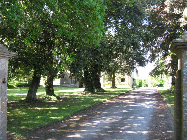
Bradford Abbas is a small village located in the county of Dorset, England. Situated approximately 3 miles southeast of the historic town of Sherborne, this rural settlement is nestled in a picturesque countryside setting. The village is primarily residential, with a population of around 650 people.

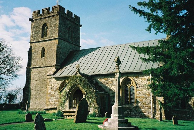
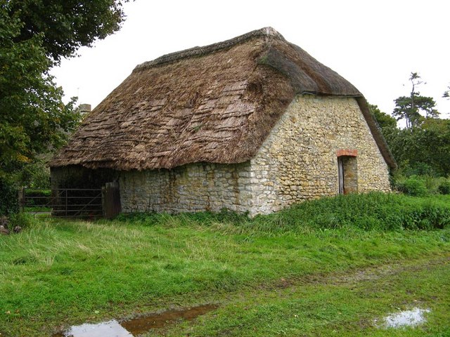
One of the notable features of Bradford Abbas is its charming architecture, showcasing a mix of traditional thatched cottages and well-preserved historical buildings. The village is centered around the Church of St. Mary, a beautiful 15th-century parish church that stands as a prominent landmark. The church's tower is particularly notable, offering panoramic views of the surrounding countryside.

The village is well-served by amenities, including a community hall, a primary school, and a local pub, which serves as a social hub for residents. The surrounding countryside provides ample opportunities for outdoor activities such as walking, cycling, and exploring nature.

Bradford Abbas enjoys a peaceful and close-knit community atmosphere, with various community events and gatherings bringing residents together. The village also has a strong sense of history, with evidence of human settlement in the area dating back to the Roman era.

Overall, Bradford Abbas offers a tranquil and idyllic way of life, where residents can enjoy the beauty of the Dorset countryside while still having access to essential amenities in nearby Sherborne.

If you have any feedback on the listing, please let us know in the comments section below.

Bradford Abbas Images

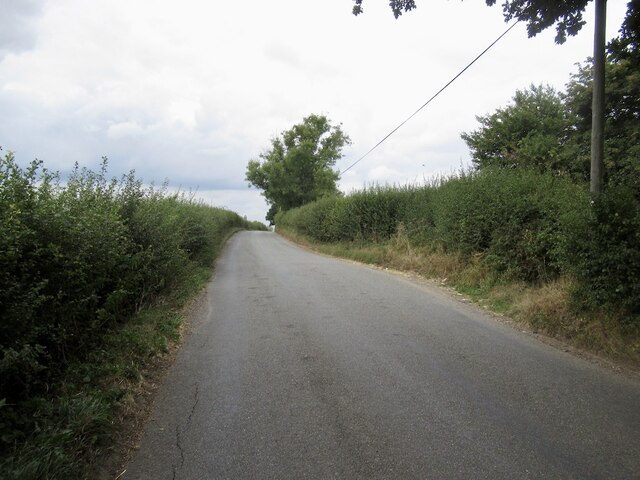
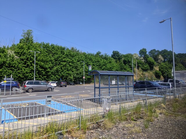
Images are sourced within 2km of 50.928432/-2.5882301 or Grid Reference ST5814. Thanks to Geograph Open Source API. All images are credited.

Signpost, Park House
Stubble near Bradford Abbas
Flood indicator near Smith's Bridge Not much danger of floods today, towards the end of a long dry spell.  I was only here because it was so dry - the railway through Sherborne being closed due to shrinkage of clay in embankments. I was off to catch a train via Westbury from Yeovil Junction.
Flood indicator near Smith's Bridge
Not much danger of floods today, towards the end of a long dry spell. I was only here because it was so dry - the railway through Sherborne being closed due to shrinkage of clay in embankments. I was off to catch a train via Westbury from Yeovil Junction.
Signpost, end of Clifton Road
Clifton Road Taking a breather on a small hill. Was racing to catch a train at Yeovil Junction having got just over half an hour to get here from the closed line at Sherborne. (I made it)
Clifton Road
Taking a breather on a small hill. Was racing to catch a train at Yeovil Junction having got just over half an hour to get here from the closed line at Sherborne. (I made it)
Car park at Yeovil Junction station
Thornford: lane to the church
Thornford: parish church of St. Mary Magdalene
Barn, Wyke Farm.
Barn, Wyke Farm.
Tithe barn at Wyke Farm near Bradford Abbas
Footpath to Bradford Abbas Starts by running alongside the churchyard in Thornford.
Footpath to Bradford Abbas
Starts by running alongside the churchyard in Thornford.
Footpath from Bradford Abbas Alongside the churchyard at Thornford.
Footpath from Bradford Abbas
Alongside the churchyard at Thornford.
Church of St. Mary Magdalene, Thornford Retains a medieval chancel and west tower but most of the rest dates from 1866 by Slater and Carpenter.
Church of St. Mary Magdalene, Thornford
Retains a medieval chancel and west tower but most of the rest dates from 1866 by Slater and Carpenter.
House by the churchyard, Thornford
Bembury Farm, Thornford Seen from the churchyard.
Bembury Farm, Thornford
Seen from the churchyard.
Church of St. Mary Magdalene, Thornford
Wyke Farm
Wyke Farm
Lane to Park House Cross
Show me another place!

Bradford Abbas is located at Grid Ref: ST5814 (Lat: 50.928432, Lng: -2.5882301)

Unitary Authority: Dorset

Police Authority: Dorset

What 3 Words

///each.grand.called. Near Yeovil, Somerset

Nearby Locations

Bradford Abbas

Related Wikis

Bradford Abbas

Bradford Abbas is a village and civil parish in north-west Dorset, England, on the border with Somerset. The village is 3 miles (5 km) south-east of Yeovil...

Bradford Abbas Railway Cutting

Bradford Abbas Railway Cutting (grid reference ST592145) is a 1.4 hectare geological Site of Special Scientific Interest in Dorset, notified in 1990....

Clifton Maybank

Clifton Maybank is a hamlet and civil parish in the English county of Dorset. It is located about a mile southwest of the village of Bradford Abbas. It...

Battle of Babylon Hill

The battle of Babylon Hill was an indecisive skirmish that took place between Royalist and Parliamentarian forces near Yeovil, in South West England, on...

Babylon Hill

Babylon Hill (grid reference ST583162) in Dorset is a 2.2 hectare geological Site of Special Scientific Interest designated in 1977.It was also the site...

Yeovil Junction railway station

Yeovil Junction railway station is the busier, but less central, of two railway stations serving the town of Yeovil in England. The station is 2 miles...

Thornford railway station

Thornford railway station serves the village of Thornford, in Dorset, England. It is approximately 3 miles (4.8 kilometres) to the south of Yeovil, and...

Newton Surmaville

Newton Surmaville is a 15,129-square-foot (1,405.5 m2) stately home with gardens and a park south of Yeovil, Somerset in the district of South Somerset...

Nearby Amenities

Located within 500m of 50.928432,-2.5882301
Bradford Abbas
Is In: Dorset, England, UK
Place: village
Lat/Long: 50.9272687/-2.5868996
Post Office
Bradford Abbas Post Office
Addr City: Sherborne
Addr Country: GB
Addr Housename: Bradford Abbas Village Hall
Addr Postcode: DT9 6RF
Addr Street: Church Road
Addr Village: Bradford Abbas
Opening Hours: Tu 13:30-16:00; Th 13:00-16:00
Ref Pol Id: 122804
Lat/Long: 50.9264826/-2.5866274
Pub
Rose and Crown
Lat/Long: 50.9265227/-2.5875408
Public Bookcase
Booth: K6
Disused Amenity: telephone
Man Made: telephone_box
Public Bookcase Type: phone_box
Lat/Long: 50.9266852/-2.5873101
Historic: memorial
Lat/Long: 50.9265355/-2.5870911
Post Box
Post Box Type: lamp
Ref GB Uprn: 10015455740
Lat/Long: 50.9300693/-2.5885567
Bradford Abbas Sports and Social Club
Leisure: sports_centre
Lat/Long: 50.9296881/-2.5938404
Barrier: bollard
Lat/Long: 50.9279027/-2.5861397
Leisure: playground
Lat/Long: 50.9274184/-2.5879793
Entrance: yes
Lat/Long: 50.9264206/-2.5883124
Entrance: main
Lat/Long: 50.9264127/-2.5884503
The data included in this document is from www.openstreetmap.org. The data is made available under ODbL.

Have you been to Bradford Abbas?

Leave your review of Bradford Abbas below (or comments, questions and feedback).