West Ardsley

Settlement in Yorkshire

England

West Ardsley

Crop field off Thorpe Lane Probably a cereal crop, but the shoots are too small at this time in the year to tell which.
Crop field off Thorpe Lane Credit: Stephen Craven

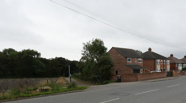
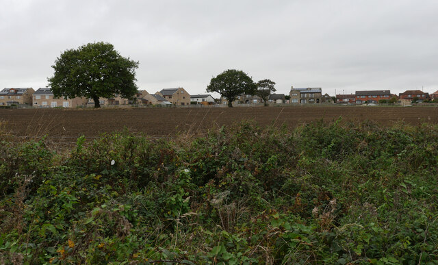
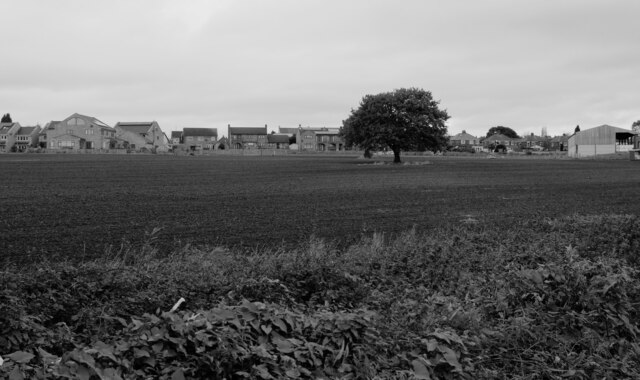
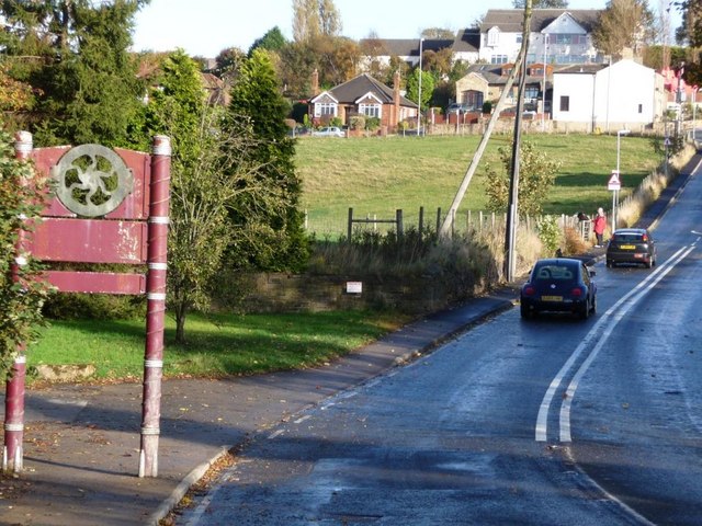
West Ardsley is a small village located in the metropolitan borough of Leeds, in the county of Yorkshire, England. Situated approximately seven miles south of Leeds city center, it lies between the towns of Morley and Tingley. The village is predominantly residential, with a population of around 3,500 people.

West Ardsley boasts a rich history, dating back to the Roman era. The remains of a Roman road, known as the Old Great North Road, can still be seen in the area. In the 19th century, the village experienced significant growth with the establishment of coal mines and mills, which contributed to its economic prosperity.

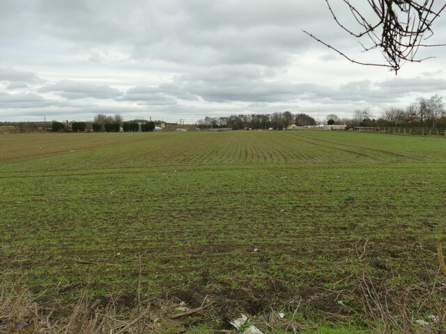
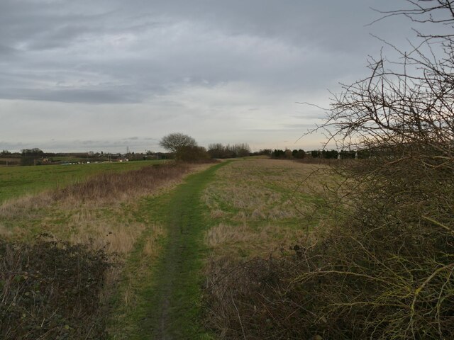
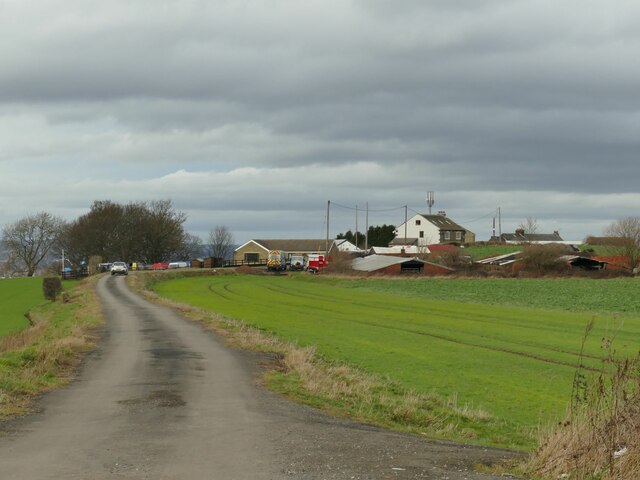
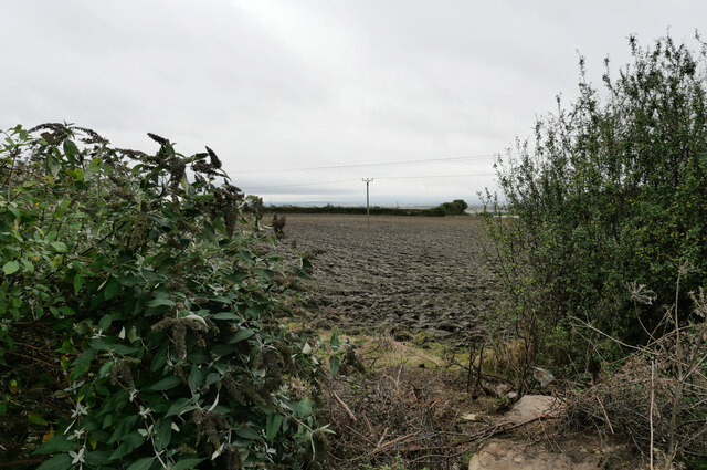
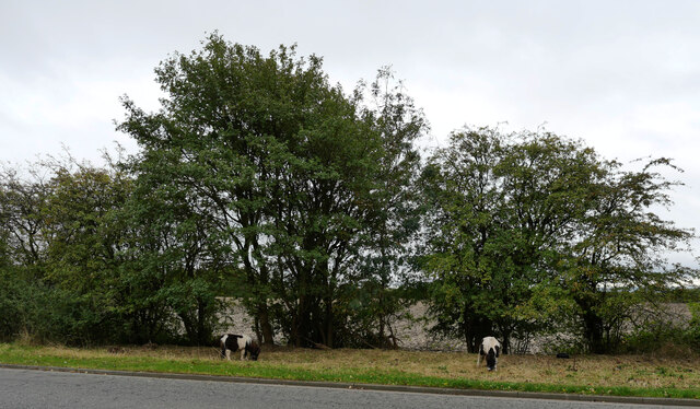
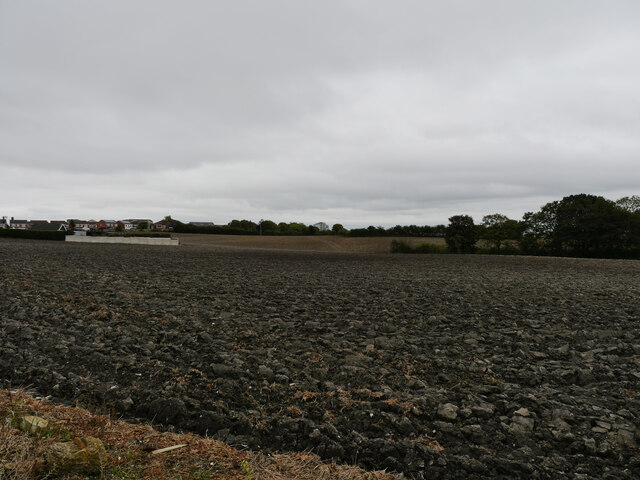
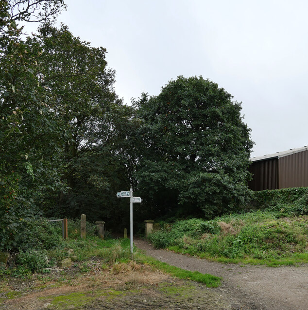
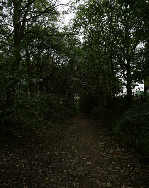
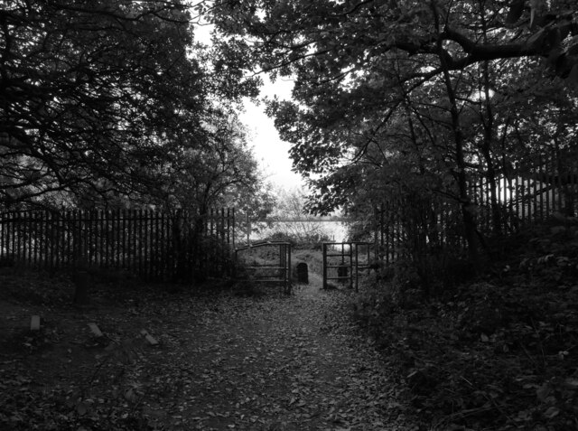
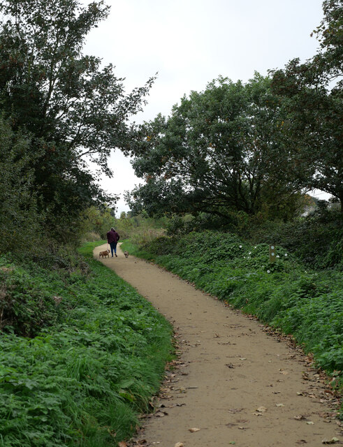
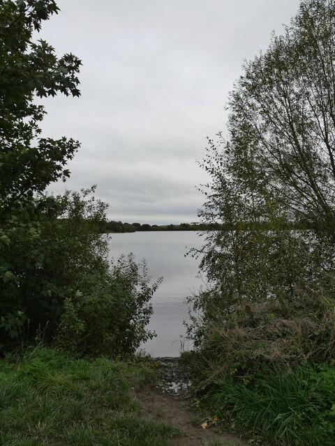
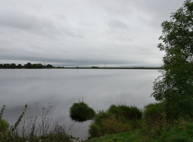
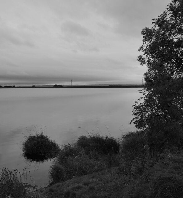
Today, West Ardsley is known for its picturesque countryside and green spaces. The village is surrounded by beautiful landscapes, including Ardsley Reservoir and Ardsley Woods, which provide opportunities for leisurely walks and outdoor activities.

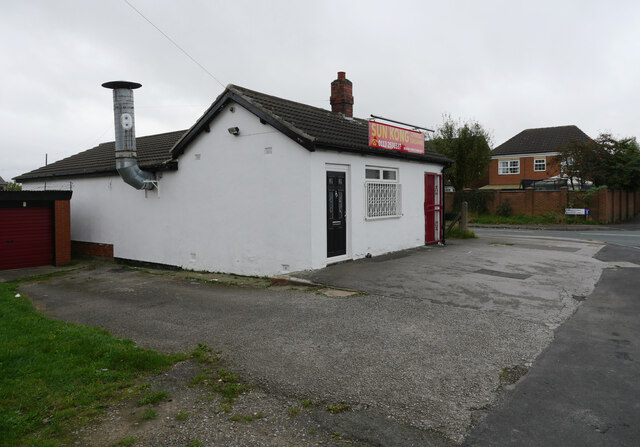
In terms of amenities, West Ardsley offers several local shops, a primary school, a community center, and a public house. The village also benefits from good transport links, with regular bus services connecting it to nearby towns and Leeds city center.

Overall, West Ardsley is a charming village that combines its historical roots with modern amenities, making it an attractive place to live for those seeking a tranquil residential area within close proximity to larger urban centers.

If you have any feedback on the listing, please let us know in the comments section below.

West Ardsley Images

Images are sourced within 2km of 53.725178/-1.58462 or Grid Reference SE2725. Thanks to Geograph Open Source API. All images are credited.

Crop field off Thorpe Lane Probably a cereal crop, but the shoots are too small at this time in the year to tell which.
Crop field off Thorpe Lane
Probably a cereal crop, but the shoots are too small at this time in the year to tell which.
Course of former railway east of Dunningley Lane Old maps show a four-track line in a shallow cutting here, which was the Great Northern's line branching off the Leeds main line and serving Bradford and Shipley via Laisterdayke. It would probably have been used mainly by goods trains; Tingley station was a short way west of here, but closed in 1954. The cutting has been filled in to ground level, but surprisingly the surface has not been turned to agricultural use and there is an unofficial footpath along the route.
Course of former railway east of Dunningley Lane
Old maps show a four-track line in a shallow cutting here, which was the Great Northern's line branching off the Leeds main line and serving Bradford and Shipley via Laisterdayke. It would probably have been used mainly by goods trains; Tingley station was a short way west of here, but closed in 1954. The cutting has been filled in to ground level, but surprisingly the surface has not been turned to agricultural use and there is an unofficial footpath along the route.
Dunningley Lane The single-track road is shown as a public footpath along its full length, so probably a private one as far as motor traffic is concerned. A locked gate across it beyond the group of houses in the distance prevents through traffic to the A653 anyway.
Dunningley Lane
The single-track road is shown as a public footpath along its full length, so probably a private one as far as motor traffic is concerned. A locked gate across it beyond the group of houses in the distance prevents through traffic to the A653 anyway.
Saxton Cottage, Dunningley Lane The name is explained by a plaque on the wall of the house claiming that Christopher Saxton, cartographer to Elizabeth I, was born in 1542 on or near this site. His Wikipedia entry, however, says that Saxton was probably born in Sowood near Ossett but later moved to Dunningley. The present house is modern.
Saxton Cottage, Dunningley Lane
The name is explained by a plaque on the wall of the house claiming that Christopher Saxton, cartographer to Elizabeth I, was born in 1542 on or near this site. His Wikipedia entry, however, says that Saxton was probably born in Sowood near Ossett but later moved to Dunningley. The present house is modern.
Sun Kong Chinese Takeaway, Westerton Road, East Ardsley
A field seen from Westerton Road, East Ardsley
Ponies, Westerton Road, East Ardsley
A path towards Westerton Wood leaving Westerton Road, East Ardsley
A field between Westerton Wood and Westerton Road, East Ardsley
A path junction at Westerton Wood, East Ardsley
A path through Westerton Wood, East Ardsley
A path entering Ardsley Reservoir from Westerton Wood, East Ardsley Ardsley Reservoir (also known as East Ardsley, or Haigh Moor) is situated west of Wakefield.

This reservoir is unusual in that it is not an impounding reservoir (primarily fed by natural streams or rivers) but, in modern terminology, an "En-route Storage Reservoir" (ESR) meaning it holds water delivered from other sources, prior to treatment. 

Constructed in 1880 for the Wakefield and District Water Board, it is fed mainly from the Board's upland reservoirs in the Ryburn Valley (Booth Wood, Baitings and Green Withens). Following the 1995/6 drought in Yorkshire, an emergency main was laid to feed the reservoir with water from underground aquifers in the east of the region in the event of a future water shortage.

The surface area is about 22.5 hectares; I have not managed to find a figure for its total capacity.   The spillway is steep and non-stepped, and was lined with sprayed concrete in 2016 to prevent erosion.

Although it still supplies Wakefield with water, there is also a large private client: Coca-Cola, whose large bottling plant in Wakefield is supplied direct from this reservoir.

There is public access to a surfaced track around the perimeter of the reservoir.
A path entering Ardsley Reservoir from Westerton Wood, East Ardsley
Ardsley Reservoir (also known as East Ardsley, or Haigh Moor) is situated west of Wakefield. This reservoir is unusual in that it is not an impounding reservoir (primarily fed by natural streams or rivers) but, in modern terminology, an "En-route Storage Reservoir" (ESR) meaning it holds water delivered from other sources, prior to treatment. Constructed in 1880 for the Wakefield and District Water Board, it is fed mainly from the Board's upland reservoirs in the Ryburn Valley (Booth Wood, Baitings and Green Withens). Following the 1995/6 drought in Yorkshire, an emergency main was laid to feed the reservoir with water from underground aquifers in the east of the region in the event of a future water shortage. The surface area is about 22.5 hectares; I have not managed to find a figure for its total capacity. The spillway is steep and non-stepped, and was lined with sprayed concrete in 2016 to prevent erosion. Although it still supplies Wakefield with water, there is also a large private client: Coca-Cola, whose large bottling plant in Wakefield is supplied direct from this reservoir. There is public access to a surfaced track around the perimeter of the reservoir.
A path at Ardsley Reservoir, East Ardsley Ardsley Reservoir (also known as East Ardsley, or Haigh Moor) is situated west of Wakefield.

This reservoir is unusual in that it is not an impounding reservoir (primarily fed by natural streams or rivers) but, in modern terminology, an "En-route Storage Reservoir" (ESR) meaning it holds water delivered from other sources, prior to treatment. 

Constructed in 1880 for the Wakefield and District Water Board, it is fed mainly from the Board's upland reservoirs in the Ryburn Valley (Booth Wood, Baitings and Green Withens). Following the 1995/6 drought in Yorkshire, an emergency main was laid to feed the reservoir with water from underground aquifers in the east of the region in the event of a future water shortage.

The surface area is about 22.5 hectares; I have not managed to find a figure for its total capacity.   The spillway is steep and non-stepped, and was lined with sprayed concrete in 2016 to prevent erosion.

Although it still supplies Wakefield with water, there is also a large private client: Coca-Cola, whose large bottling plant in Wakefield is supplied direct from this reservoir.

There is public access to a surfaced track around the perimeter of the reservoir.
A path at Ardsley Reservoir, East Ardsley
Ardsley Reservoir (also known as East Ardsley, or Haigh Moor) is situated west of Wakefield. This reservoir is unusual in that it is not an impounding reservoir (primarily fed by natural streams or rivers) but, in modern terminology, an "En-route Storage Reservoir" (ESR) meaning it holds water delivered from other sources, prior to treatment. Constructed in 1880 for the Wakefield and District Water Board, it is fed mainly from the Board's upland reservoirs in the Ryburn Valley (Booth Wood, Baitings and Green Withens). Following the 1995/6 drought in Yorkshire, an emergency main was laid to feed the reservoir with water from underground aquifers in the east of the region in the event of a future water shortage. The surface area is about 22.5 hectares; I have not managed to find a figure for its total capacity. The spillway is steep and non-stepped, and was lined with sprayed concrete in 2016 to prevent erosion. Although it still supplies Wakefield with water, there is also a large private client: Coca-Cola, whose large bottling plant in Wakefield is supplied direct from this reservoir. There is public access to a surfaced track around the perimeter of the reservoir.
Ardsley Reservoir, East Ardsley Ardsley Reservoir (also known as East Ardsley, or Haigh Moor) is situated west of Wakefield.

This reservoir is unusual in that it is not an impounding reservoir (primarily fed by natural streams or rivers) but, in modern terminology, an "En-route Storage Reservoir" (ESR) meaning it holds water delivered from other sources, prior to treatment. 

Constructed in 1880 for the Wakefield and District Water Board, it is fed mainly from the Board's upland reservoirs in the Ryburn Valley (Booth Wood, Baitings and Green Withens). Following the 1995/6 drought in Yorkshire, an emergency main was laid to feed the reservoir with water from underground aquifers in the east of the region in the event of a future water shortage.

The surface area is about 22.5 hectares; I have not managed to find a figure for its total capacity.   The spillway is steep and non-stepped, and was lined with sprayed concrete in 2016 to prevent erosion.

Although it still supplies Wakefield with water, there is also a large private client: Coca-Cola, whose large bottling plant in Wakefield is supplied direct from this reservoir.

There is public access to a surfaced track around the perimeter of the reservoir.
Ardsley Reservoir, East Ardsley
Ardsley Reservoir (also known as East Ardsley, or Haigh Moor) is situated west of Wakefield. This reservoir is unusual in that it is not an impounding reservoir (primarily fed by natural streams or rivers) but, in modern terminology, an "En-route Storage Reservoir" (ESR) meaning it holds water delivered from other sources, prior to treatment. Constructed in 1880 for the Wakefield and District Water Board, it is fed mainly from the Board's upland reservoirs in the Ryburn Valley (Booth Wood, Baitings and Green Withens). Following the 1995/6 drought in Yorkshire, an emergency main was laid to feed the reservoir with water from underground aquifers in the east of the region in the event of a future water shortage. The surface area is about 22.5 hectares; I have not managed to find a figure for its total capacity. The spillway is steep and non-stepped, and was lined with sprayed concrete in 2016 to prevent erosion. Although it still supplies Wakefield with water, there is also a large private client: Coca-Cola, whose large bottling plant in Wakefield is supplied direct from this reservoir. There is public access to a surfaced track around the perimeter of the reservoir.
A field seen from the path around Ardsley Reservoir, East Ardsley
Ardsley Reservoir, East Ardsley Ardsley Reservoir (also known as East Ardsley, or Haigh Moor) is situated west of Wakefield.

This reservoir is unusual in that it is not an impounding reservoir (primarily fed by natural streams or rivers) but, in modern terminology, an "En-route Storage Reservoir" (ESR) meaning it holds water delivered from other sources, prior to treatment. 

Constructed in 1880 for the Wakefield and District Water Board, it is fed mainly from the Board's upland reservoirs in the Ryburn Valley (Booth Wood, Baitings and Green Withens). Following the 1995/6 drought in Yorkshire, an emergency main was laid to feed the reservoir with water from underground aquifers in the east of the region in the event of a future water shortage.

The surface area is about 22.5 hectares; I have not managed to find a figure for its total capacity.   The spillway is steep and non-stepped, and was lined with sprayed concrete in 2016 to prevent erosion.

Although it still supplies Wakefield with water, there is also a large private client: Coca-Cola, whose large bottling plant in Wakefield is supplied direct from this reservoir.

There is public access to a surfaced track around the perimeter of the reservoir.
Ardsley Reservoir, East Ardsley
Ardsley Reservoir (also known as East Ardsley, or Haigh Moor) is situated west of Wakefield. This reservoir is unusual in that it is not an impounding reservoir (primarily fed by natural streams or rivers) but, in modern terminology, an "En-route Storage Reservoir" (ESR) meaning it holds water delivered from other sources, prior to treatment. Constructed in 1880 for the Wakefield and District Water Board, it is fed mainly from the Board's upland reservoirs in the Ryburn Valley (Booth Wood, Baitings and Green Withens). Following the 1995/6 drought in Yorkshire, an emergency main was laid to feed the reservoir with water from underground aquifers in the east of the region in the event of a future water shortage. The surface area is about 22.5 hectares; I have not managed to find a figure for its total capacity. The spillway is steep and non-stepped, and was lined with sprayed concrete in 2016 to prevent erosion. Although it still supplies Wakefield with water, there is also a large private client: Coca-Cola, whose large bottling plant in Wakefield is supplied direct from this reservoir. There is public access to a surfaced track around the perimeter of the reservoir.
A field seen from the path around Ardsley Reservoir, East Ardsley
Show me another place!

West Ardsley is located at Grid Ref: SE2725 (Lat: 53.725178, Lng: -1.58462)

Division: West Riding

Unitary Authority: Leeds

Police Authority: West Yorkshire

What 3 Words

///pirate.dose.depend. Near Morley, West Yorkshire

Related Wikis

Tingley

Tingley is a suburban village in the City of Leeds in West Yorkshire, Northern England, forming part of the parish of West Ardsley. Tingley forms part...

Woodkirk Priory

Woodkirk Priory was a cell of Augustinian Canons in West Yorkshire, England. William, second earl of Warenne (d. 1138), had granted the land for its foundation...

Woodkirk

Woodkirk is an ancient village between Leeds and Dewsbury, West Yorkshire, England. The parish church is a grade II listed building. It is traditionally...

Woodkirk Academy

Woodkirk Academy (formerly Woodkirk High School) is an academy located in Tingley, West Yorkshire, England. Established in 1948, the school now has over...

Woodkirk railway station

Woodkirk railway station was a Great Northern Railway (GNR) station on the Batley to Beeston line, which connected Batley to Leeds Central, in West Yorkshire...

Beggarington Hill

Beggarington Hill is a hamlet in the county of West Yorkshire, England, in the City of Leeds and at the border of Kirklees. Historically, it was part of...

Tingley railway station

Tingley railway station served the settlement of Tingley, West Yorkshire, England, from 1857 to 1966 on the Leeds, Bradford and Halifax Junction Railway...

Howley Hall

Howley Hall is a ruined Elizabethan country house located between the towns of Batley and Morley in West Yorkshire, England. It has been designated a scheduled...

Nearby Amenities

Located within 500m of 53.725178,-1.58462
Traffic Signals
Lat/Long: 53.725274/-1.5847147
Crossing
Crossing: marked
Lat/Long: 53.7281856/-1.5804923
Traffic Calming: table
Lat/Long: 53.7240963/-1.5775783
Cycleway: asl
Lat/Long: 53.7280769/-1.5799519
Turning Circle
Lat/Long: 53.7249291/-1.5771994
Power: substation
Lat/Long: 53.7267925/-1.5800348
Turning Circle
Lat/Long: 53.7267959/-1.5782323
Traffic Signals
Lat/Long: 53.725175/-1.5846483
Bus Stop
Baghill Road Westerton Road
Local Ref: 45016302
Naptan AtcoCode: 450016302
Naptan Bearing: SE
Naptan CommonName: Baghill Road Westerton Road
Naptan Crossing: Westerton Road
Naptan Indicator: Stop 45016302
Naptan PlusbusZoneRef: LEEDS
Naptan ShortCommonName: Westerton Road
Naptan Street: Baghill Road
Naptan Verified: yes
Ref: 45016302
Source: naptan_import
Lat/Long: 53.7220917/-1.5817366
Bus Stop
Westerton Road Syke Road
Local Ref: 45016085
Naptan AtcoCode: 450016085
Naptan Bearing: NE
Naptan CommonName: Westerton Road Syke Road
Naptan Crossing: Syke Road
Naptan Indicator: Stop 45016085
Naptan PlusbusZoneRef: LEEDS
Naptan ShortCommonName: Syke Road
Naptan Street: Westerton Road
Naptan Verified: yes
Ref: 45016085
Source: naptan_import
Lat/Long: 53.722584/-1.5815258
Turning Circle
Lat/Long: 53.7226502/-1.5802874
Post Box
Operator: Royal Mail
Post Box Type: lamp
Ref: WF3 112
Lat/Long: 53.7230222/-1.5801557
Power: substation
Lat/Long: 53.7228386/-1.581228
Post Box
Operator: Royal Mail
Post Box Type: pillar
Ref: WF3 229
Lat/Long: 53.7242498/-1.5835081
Turning Circle
Lat/Long: 53.7242091/-1.5807811
Turning Circle
Lat/Long: 53.7245976/-1.5821073
Turning Circle
Lat/Long: 53.724989/-1.5813251
Turning Circle
Lat/Long: 53.7253475/-1.5806344
Turning Circle
Lat/Long: 53.7256966/-1.5799209
Power: substation
Lat/Long: 53.7247719/-1.5815175
Crossing
Lat/Long: 53.7248308/-1.5781669
Crossing
Crossing: uncontrolled
Crossing Ref: zebra
Lat/Long: 53.7236995/-1.578745
Traffic Calming: cushion
Lat/Long: 53.7285995/-1.5871694
Crossing
Lat/Long: 53.7285125/-1.5804639
Turning Circle
Lat/Long: 53.7293447/-1.5825453
Power: substation
Lat/Long: 53.7258862/-1.5848436
Traffic Signals
Crossing: traffic_signals
Crossing Ref: pelican
Kerb: flush
Tactile Paving: yes
Lat/Long: 53.7278225/-1.5814875
Crossing
Crossing: traffic_signals
Crossing Ref: pelican
Kerb: flush
Tactile Paving: yes
Lat/Long: 53.7277719/-1.5812479
Traffic Signals
Crossing: traffic_signals
Crossing Ref: pelican
Kerb: flush
Tactile Paving: yes
Lat/Long: 53.7277959/-1.5814144
Traffic Signals
Lat/Long: 53.7280424/-1.5813062
Traffic Signals
Lat/Long: 53.7277993/-1.5809057
Traffic Signals
Traffic Signals: signal
Traffic Signals Direction: forward
Lat/Long: 53.7280478/-1.5808818
Traffic Signals
Traffic Signals: signal
Traffic Signals Direction: forward
Lat/Long: 53.7280071/-1.5808195
Traffic Signals
Traffic Signals: signal
Traffic Signals Direction: forward
Lat/Long: 53.7281087/-1.579984
Traffic Signals
Traffic Signals: signal
Traffic Signals Direction: forward
Lat/Long: 53.7284049/-1.5799125
Traffic Signals
Traffic Signals: signal
Traffic Signals Direction: forward
Lat/Long: 53.7284541/-1.5799571
Traffic Signals
Traffic Signals: signal
Traffic Signals Direction: forward
Lat/Long: 53.7283087/-1.5806216
Traffic Signals
Traffic Signals: signal
Traffic Signals Direction: forward
Lat/Long: 53.728264/-1.5805606
Pub
Bulls Head
Addr City: Wakefield
Addr Postcode: WF3 1LY
Addr Street: Dewsbury Road
Fhrs Id: 322040
Source: survey
Lat/Long: 53.7251466/-1.5853464
Bus Stop
Dewsbury Road Hesketh Lane
Bus: yes
Local Ref: 45015091
Naptan AtcoCode: 450015091
Naptan Bearing: SW
Naptan CommonName: Dewsbury Road Hesketh Lane
Naptan Crossing: Hesketh Lane
Naptan Indicator: Stop 45015091
Naptan PlusbusZoneRef: LEEDS
Naptan ShortCommonName: Hesketh Lane
Naptan Street: Dewsbury Road
Public Transport: platform
Shelter: no
Source: naptan_import
Timetable: yes
Lat/Long: 53.7269722/-1.5821311
Bus Stop
Dewsbury Road Syke Road
Kerb: raised
Local Ref: 45015092
Naptan AtcoCode: 450015092
Naptan Bearing: SW
Naptan CommonName: Dewsbury Road Syke Road
Naptan Crossing: Syke Road
Naptan Indicator: Stop 45015092
Naptan PlusbusZoneRef: LEEDS
Naptan ShortCommonName: Syke Road
Naptan Street: Dewsbury Road
Naptan Verified: yes
Source: naptan_import
Timetable: yes
Lat/Long: 53.724897/-1.5850464
Bus Stop
Dewsbury Road Rein Road
Kerb: raised
Local Ref: 45015115
Naptan AtcoCode: 450015115
Naptan Bearing: NE
Naptan CommonName: Dewsbury Road Rein Road
Naptan Crossing: Rein Road
Naptan Indicator: Stop 45015115
Naptan PlusbusZoneRef: LEEDS
Naptan ShortCommonName: Rein Road
Naptan Street: Dewsbury Road
Naptan Verified: no
Shelter: yes
Source: naptan_import
Lat/Long: 53.7257948/-1.5840597
Bus Stop
Woodkirk School
Local Ref: 45016226
Naptan AtcoCode: 450016226
Naptan Bearing: NW
Naptan CommonName: Woodkirk School
Naptan Crossing: Rein Gardens
Naptan Indicator: Stop 45016226
Naptan Landmark: WoodKirk School
Naptan PlusbusZoneRef: LEEDS
Naptan ShortCommonName: Rein Gardens
Naptan Street: Rein Road
Naptan Verified: yes
Source: naptan_import
Lat/Long: 53.7284816/-1.5871332
Bus Stop
Syke Road Meadow Way
Local Ref: 45016303
Naptan AtcoCode: 450016303
Naptan Bearing: N
Naptan CommonName: Syke Road Meadow Way
Naptan Crossing: Meadow Way
Naptan Indicator: Stop 45016303
Naptan PlusbusZoneRef: LEEDS
Naptan ShortCommonName: Meadow Way
Naptan Street: Syke Road
Naptan Verified: yes
Source: naptan_import
Timetable: yes
Lat/Long: 53.7230105/-1.5827614
Bus Stop
Syke Road Syke Avenue
Bench: no
Bin: yes
Lit: yes
Local Ref: 45016304
Naptan AtcoCode: 450016304
Naptan Bearing: NW
Naptan CommonName: Syke Road Syke Avenue
Naptan Crossing: Syke Avenue
Naptan Indicator: Stop 45016304
Naptan Landmark: Fish Shop
Naptan PlusbusZoneRef: LEEDS
Naptan ShortCommonName: Syke Avenue
Naptan Street: Syke Road
Naptan Verified: yes
Ref: 45016304
Shelter: no
Source: naptan_import
Tactile Paving: no
Lat/Long: 53.7247991/-1.5842841
Bus Stop
Syke Road Syke Avenue
Bench: no
Bin: no
Lit: no
Local Ref: 45016305
Naptan AtcoCode: 450016305
Naptan Bearing: SE
Naptan CommonName: Syke Road Syke Avenue
Naptan Crossing: Syke Avenue
Naptan Indicator: Stop 45016305
Naptan PlusbusZoneRef: LEEDS
Naptan ShortCommonName: Syke Avenue
Naptan Street: Syke Road
Naptan Verified: yes
Ref: 45016305
Shelter: no
Source: naptan_import
Tactile Paving: no
Lat/Long: 53.7249572/-1.5842729
Bus Stop
Dewsbury Road Hesketh Lane
Bus: yes
Kerb: raised
Layby: yes
Local Ref: 45024156
Naptan AtcoCode: 450024156
Naptan Bearing: NE
Naptan CommonName: Dewsbury Road Hesketh Lane
Naptan Crossing: Hesketh Lane
Naptan Indicator: Stop 45024156
Naptan PlusbusZoneRef: LEEDS
Naptan ShortCommonName: Hesketh Lane
Naptan Street: Dewsbury Road
Naptan Verified: no
Public Transport: platform
Shelter: yes
Source: naptan_import
Lat/Long: 53.7276543/-1.5818363
Bus Stop
Syke Road Syke Gardens
Local Ref: 45025617
Naptan AtcoCode: 450025617
Naptan Bearing: S
Naptan CommonName: Syke Road Syke Gardens
Naptan Crossing: Syke Gardens
Naptan Indicator: Stop 45025617
Naptan PlusbusZoneRef: LEEDS
Naptan ShortCommonName: Syke Gardens
Naptan Street: Syke Road
Naptan Verified: yes
Ref: 45025617
Source: naptan_import
Lat/Long: 53.7229726/-1.5825277
Bedale
Local Ref: 45024630
Naptan AtcoCode: 450024630
Naptan Bearing: SW
Naptan BusStopType: CUS
Naptan CommonName: Bedale
Naptan Crossing: Ryedale Way
Naptan Indicator: Stop 45024630
Naptan PlusbusZoneRef: LEEDS
Naptan ShortCommonName: Ryedale Way
Naptan Street: Bedale
Naptan Verified: no
Source: naptan_import
Lat/Long: 53.7256626/-1.577779
Bus Stop
Woodkirk School
Naptan AtcoCode: 450028547
Naptan Bearing: W
Naptan CommonName: Woodkirk School
Naptan Landmark: Woodkirk High School
Naptan PlusbusZoneRef: LEEDS
Naptan ShortCommonName: Rein Rd woodkrk sch
Naptan Street: Rein Road
Naptan Verified: no
Source: naptan_import
Lat/Long: 53.7287062/-1.5871006
Addr Housenumber: 8
Lat/Long: 53.7255355/-1.5840173
Barrier: stile
Description: squeeze stile
Lat/Long: 53.7240155/-1.5913906
Historic: memorial
Memorial: war_memorial
Lat/Long: 53.7232702/-1.5799133
Leefair Stores
Addr City: Wakefield
Addr Housenumber: 2
Addr Postcode: WF3 1DE
Addr Street: Baghill Road
Addr Suburb: Tingley
Fhrs Id: 706382
Shop: convenience
Lat/Long: 53.7221374/-1.5821144
Traffic Calming: cushion
Lat/Long: 53.7277993/-1.5864859
Traffic Calming: cushion
Lat/Long: 53.7270149/-1.5858412
Traffic Calming: cushion
Lat/Long: 53.7261592/-1.5851523
Traffic Calming: cushion
Lat/Long: 53.7252319/-1.5783362
Traffic Calming: cushion
Lat/Long: 53.7270918/-1.5802358
Traffic Calming: cushion
Lat/Long: 53.7260338/-1.579184
Waste Basket
Ref UK Leedscc Bin: 906
Lat/Long: 53.72777/-1.581793
Waste Basket
Ref UK Leedscc Bin: 903
Lat/Long: 53.725926/-1.584001
Waste Basket
Ref UK Leedscc Bin: 902
Lat/Long: 53.725733/-1.584708
Waste Basket
Ref UK Leedscc Bin: 4629
Lat/Long: 53.7248006/-1.5843085
Traffic Signals
Traffic Signals: signal
Traffic Signals Direction: forward
Lat/Long: 53.7285323/-1.5804865
Cycleway: asl
Lat/Long: 53.7285742/-1.5805315
Crossing
Lat/Long: 53.728143/-1.5800185
Crossing
Crossing: marked
Lat/Long: 53.7284295/-1.5800323
Crossing
Crossing: marked
Lat/Long: 53.7283759/-1.579975
Crossing
Crossing: marked
Lat/Long: 53.7285352/-1.5800257
Crossing
Crossing: marked
Lat/Long: 53.7282786/-1.5805205
Crossing
Crossing: marked
Lat/Long: 53.7283273/-1.5805773
Cycleway: asl
Lat/Long: 53.7280409/-1.5807744
Cycleway: asl
Lat/Long: 53.7280644/-1.5808082
Cycleway: asl
Lat/Long: 53.7282454/-1.5806315
Cycleway: asl
Lat/Long: 53.7282747/-1.5806744
Cycleway: asl
Lat/Long: 53.7284229/-1.5798634
Cycleway: asl
Lat/Long: 53.7284705/-1.5799066
Hesketh Lane Community orchard
Garden Type: community
Leisure: garden
Lat/Long: 53.7271073/-1.5807182
Post Office
Leeds Road Post Office
Brand: Post Office
Brand Wikidata: Q1783168
Check Date: 2023-09-27
Operator: One Stop
Operator Wikidata: Q65954217
Ref Pol Id: 15241
Website: https://www.postoffice.co.uk/branch-finder/4543238/leeds-road
Lat/Long: 53.7243479/-1.5833849
The data included in this document is from www.openstreetmap.org. The data is made available under ODbL.

Have you been to West Ardsley?

Leave your review of West Ardsley below (or comments, questions and feedback).