West Anstey

Settlement in Devon North Devon

England

West Anstey

Partridge Arms Farm Formerly an inn, now an excellent B&B on the edge of Exmoor
Partridge Arms Farm Credit: John Phillips

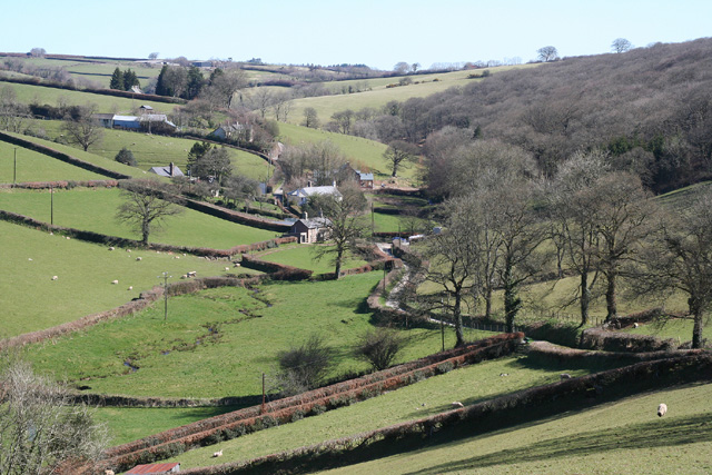
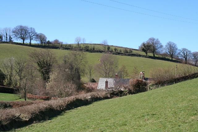
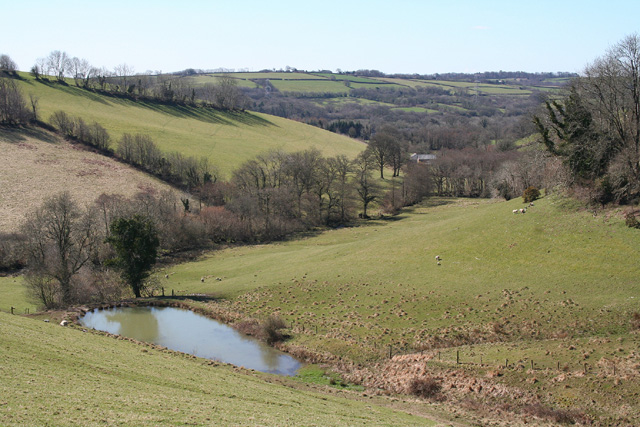
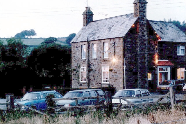
West Anstey is a small village located in the county of Devon, England. Situated in the heart of Exmoor National Park, it is surrounded by picturesque landscapes and offers a tranquil and idyllic setting for residents and visitors alike.

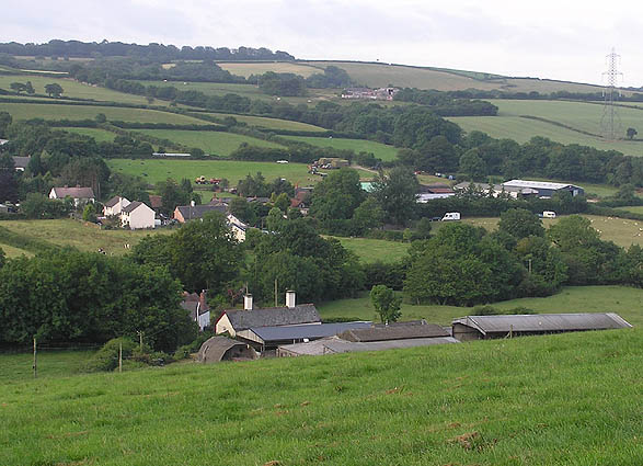
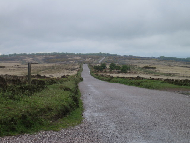
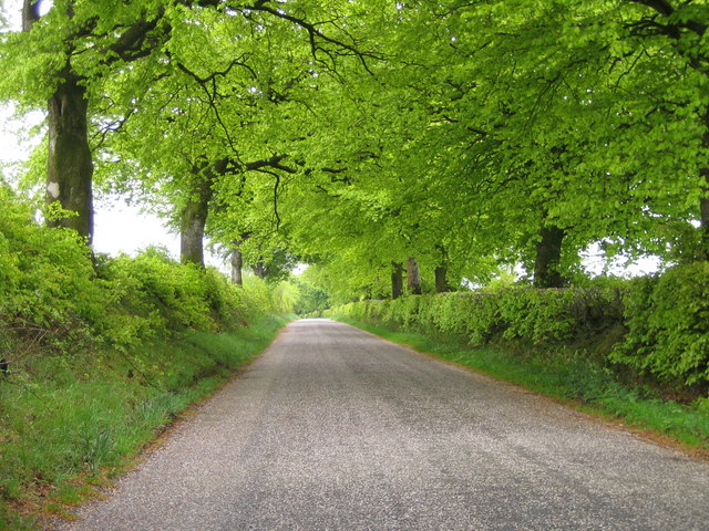
The village is situated on the southern slopes of the rolling hills of Exmoor, providing stunning views of the countryside. It is located approximately 10 miles northwest of the town of South Molton and is easily accessible by road.

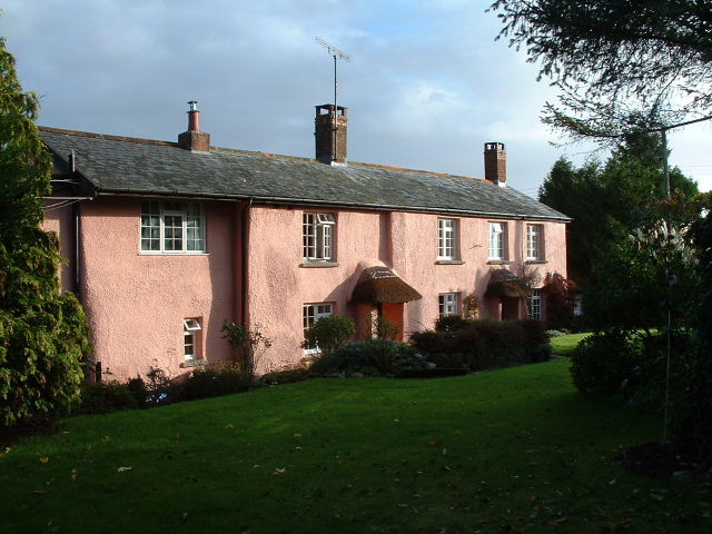
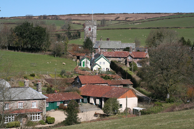
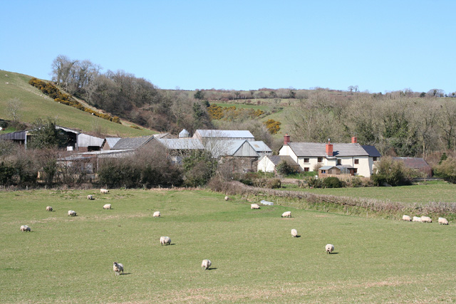
West Anstey is known for its traditional charm and rural character. The village is home to a small community, with a population of around 200 people. It features a mix of historic stone cottages and newer houses, blending old and new architectural styles.

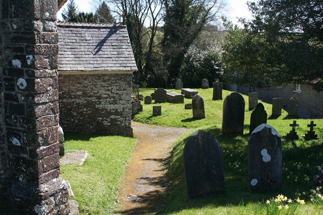
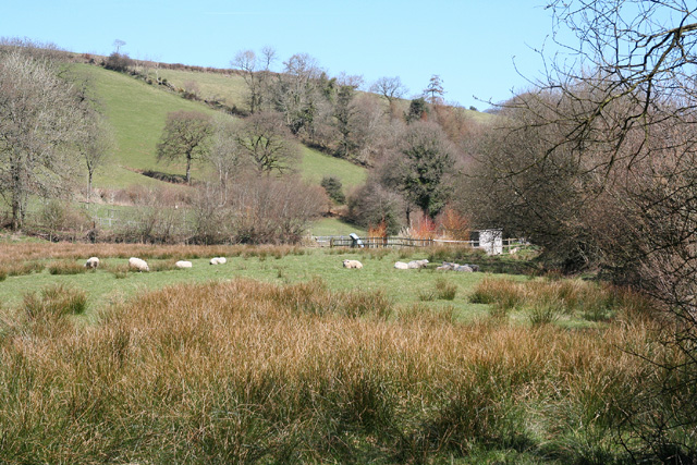
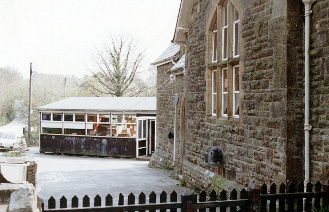
Although small in size, the village has a close-knit community spirit and offers amenities such as a village hall, a primary school, and a church. The surrounding area provides ample opportunities for outdoor activities, including hiking, cycling, and horse riding.

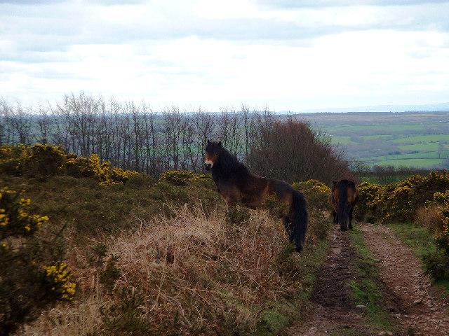
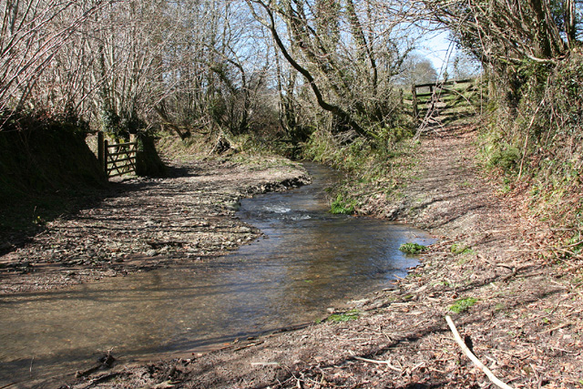
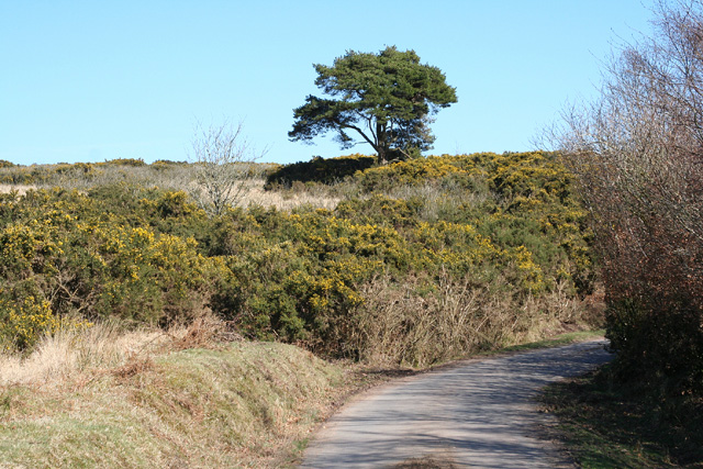
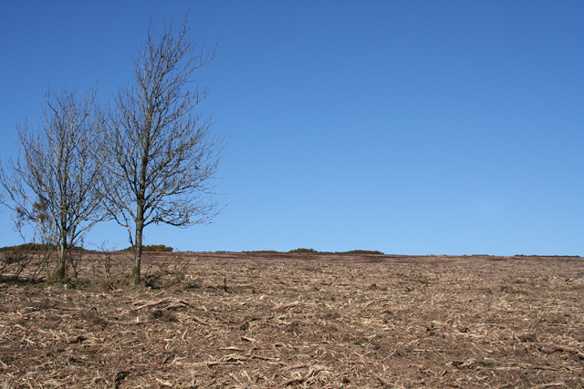
The nearby Exmoor National Park offers a wealth of natural beauty, with vast moorland, wooded valleys, and rivers. Visitors to West Anstey can enjoy exploring the park's extensive network of walking trails, taking in the breathtaking scenery and observing the local wildlife.

In summary, West Anstey is a charming village nestled within the stunning landscapes of Exmoor National Park. Its peaceful atmosphere, close community, and access to natural beauty make it an appealing destination for nature lovers and those seeking a tranquil countryside retreat.

If you have any feedback on the listing, please let us know in the comments section below.

West Anstey Images

Images are sourced within 2km of 51.035009/-3.6385427 or Grid Reference SS8527. Thanks to Geograph Open Source API. All images are credited.

Partridge Arms Farm Formerly an inn, now an excellent B&B on the edge of Exmoor
Partridge Arms Farm
Formerly an inn, now an excellent B&B on the edge of Exmoor
Exmoor ponies on Woodland Common Near Badlake Moor Cross
Exmoor ponies on Woodland Common
Near Badlake Moor Cross
IIMW sculpture by Peter Randall Page See also Granite Song in <a href="https://www.geograph.org.uk/gridref/SX7189">SX7189</a>
IIMW sculpture by Peter Randall Page
See also Granite Song in SX7189
Yeo Mills looking SW across the valley
East Anstey: Waddicombe Looking north east from the start of a bridleway to Badlake Farm. There is some evidence for a medieval watermill at Waddicombe
East Anstey: Waddicombe
Looking north east from the start of a bridleway to Badlake Farm. There is some evidence for a medieval watermill at Waddicombe
East Anstey: approaching Oak Farm Looking west-south-west on a bridleway from Waddicombe to Dunsley
East Anstey: approaching Oak Farm
Looking west-south-west on a bridleway from Waddicombe to Dunsley
West Anstey: village Looking north from the Two Moors Way
West Anstey: village
Looking north from the Two Moors Way
West Anstey: churchyard The present church was dedicated in November 1319 and was heavily restored in 1880. It is now St Petrock’s but may have been dedicated to the Holy Trinity in the 14th century. A Norman font survives from an earlier church
West Anstey: churchyard
The present church was dedicated in November 1319 and was heavily restored in 1880. It is now St Petrock’s but may have been dedicated to the Holy Trinity in the 14th century. A Norman font survives from an earlier church
West Anstey: towards Dunsley Mill Looking south west from the bridleway below Badlake Farm
West Anstey: towards Dunsley Mill
Looking south west from the bridleway below Badlake Farm
East Anstey: ford on bridleway Looking west-south-west on bridleway from Waddicombe to Dunsley
East Anstey: ford on bridleway
Looking west-south-west on bridleway from Waddicombe to Dunsley
West Anstey: near Dunsley Looking north towards Dunsley Mill. The Two Moors Way runs by the hedgeline on the skyline on the left, towards West Anstey village
West Anstey: near Dunsley
Looking north towards Dunsley Mill. The Two Moors Way runs by the hedgeline on the skyline on the left, towards West Anstey village
West Anstey: Slade Seen from Balls Corner, looking north east
West Anstey: Slade
Seen from Balls Corner, looking north east
West Anstey: near Woodland Common Looking east
West Anstey: near Woodland Common
Looking east
West Anstey: Woodland Common The common has recently stripped of gorse. Looking north east from a point above Woodland Farm
West Anstey: Woodland Common
The common has recently stripped of gorse. Looking north east from a point above Woodland Farm
West Anstey Common The Ridge Road over West Anstey Common.
West Anstey Common
The Ridge Road over West Anstey Common.
Spring Beeches Beech trees lining the road on Twitchen Common.
Spring Beeches
Beech trees lining the road on Twitchen Common.
East Anstey - The Froude Arms Now closed and a private residence.
East Anstey - The Froude Arms
Now closed and a private residence.
East Anstey School A cold morning!
East Anstey School
A cold morning!
Show me another place!

West Anstey is located at Grid Ref: SS8527 (Lat: 51.035009, Lng: -3.6385427)

Administrative County: Devon

District: North Devon

Police Authority: Devon and Cornwall

What 3 Words

///estimated.zoos.boater. Near Dulverton, Somerset

Nearby Locations

Anstey, West West Anstey

Related Wikis

West Anstey

West Anstey is a village and civil parish on the River Yeo, about 5 miles west of Dulverton, in the North Devon district, in the county of Devon, England...

Oldways End

Oldways End is a hamlet in the civil parish of East Anstey in the North Devon district of Devon, England. Its nearest town is Tiverton, which lies approximately...

East Anstey

East Anstey is a village and civil parish in the North Devon district of Devon, England. The parish is located in an area which has been designated as...

Church of St Giles, Hawkridge

The Anglican Church of St Giles in Hawkridge, Somerset, England was built in the 14th century. It is a Grade II* listed building. == History == The oldest...

Nearby Amenities

Located within 500m of 51.035009,-3.6385427
West Anstey
Place: village
Source: OS_OpenData_StreetView
Lat/Long: 51.0350117/-3.6381491
Post Box
Collection Times: Mo-Fr 09:00; Sa 07:00
Operator: Royal Mail
Operator Wikidata: Q638098
Post Box Type: wall
Ref: EX36 211
Royal Cypher: GR
Royal Cypher Wikidata: Q33102273
Lat/Long: 51.0342293/-3.6382757
The data included in this document is from www.openstreetmap.org. The data is made available under ODbL.

Have you been to West Anstey?

Leave your review of West Anstey below (or comments, questions and feedback).