Bradford

Settlement in Derbyshire Derbyshire Dales

England

Bradford

Broadmeadow Shaft Adjacent to the cottages here, which were once the offices of the Alport Mining Company, can be seen a large mound which marks the site of the Broadmeadow Shaft on the Alport mines. This company was an amalgamation of various separate mining concerns and operated the very rich lead mines of this area. They were classed as the most heavily watered mines in the country and suffered from inflows of more than 6000 gallons a minute. Consequently, heavy pumping was necessary, chiefly by water pressure engines which used a column of water to power them. The well known Cornish engineer, Richard Trevithick was consulted and he was responsible for the first of many such underground machines within this region. Water to power the engine in this shaft was taken from the River Lathkill and over Alport village in wooden launders and then by a tunnel to the shaft. All the pumped water, along with that used by the engines (of which there were upwards of seven scattered throughout the workings) was drained away by the deep Hillcarr Sough, a tunnel driven from the River Derwent near Darley Dale.
Broadmeadow Shaft Credit: Richard Bird

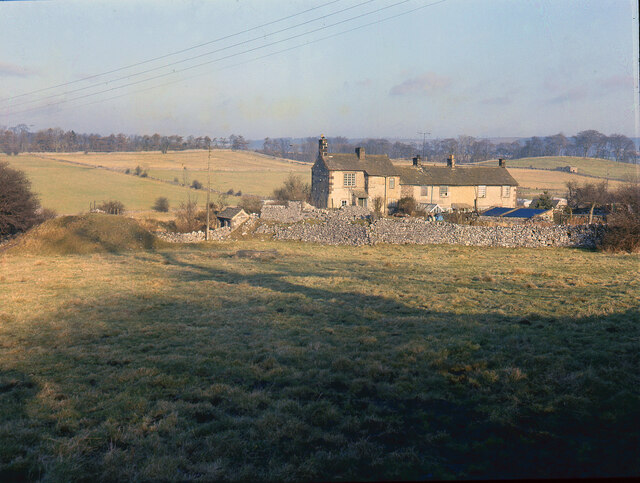
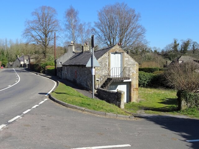
Bradford is a small village located in the county of Derbyshire, England. Situated in the heart of the Peak District National Park, it is surrounded by stunning natural beauty and offers a peaceful retreat for residents and visitors alike. The village is located approximately 7 miles west of the town of Bakewell and 23 miles northwest of the city of Derby.

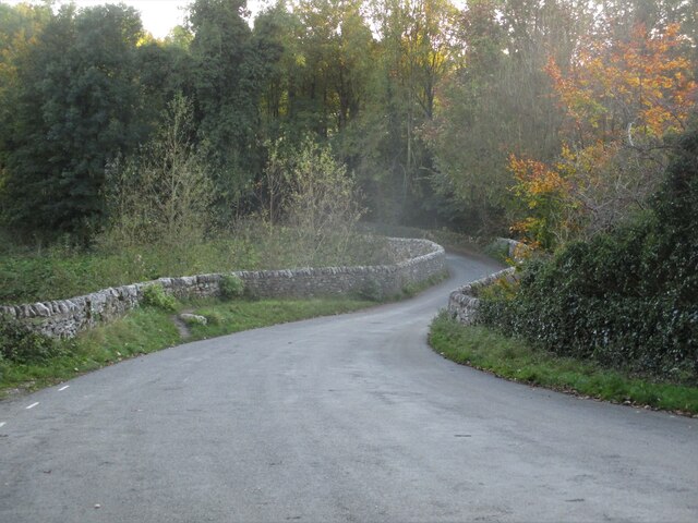
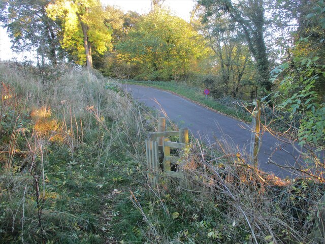
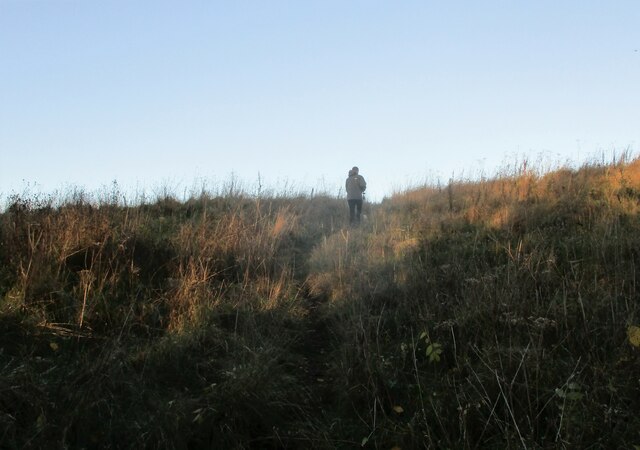
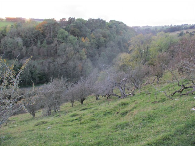
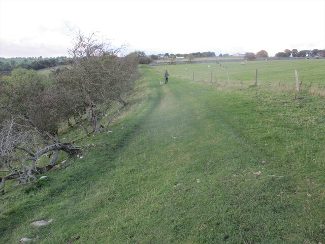
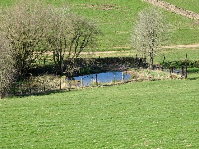
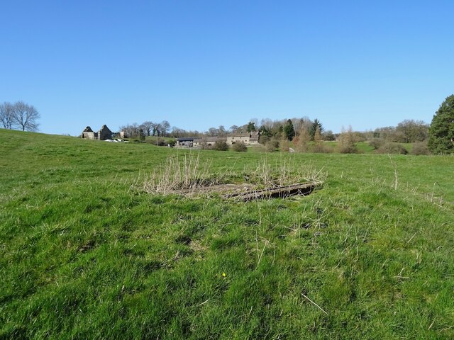
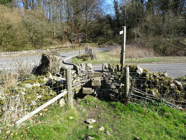
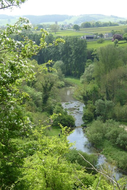
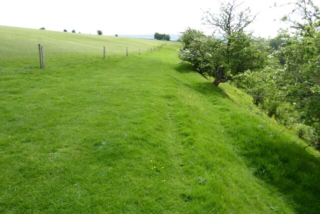
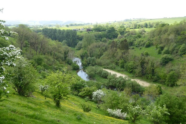
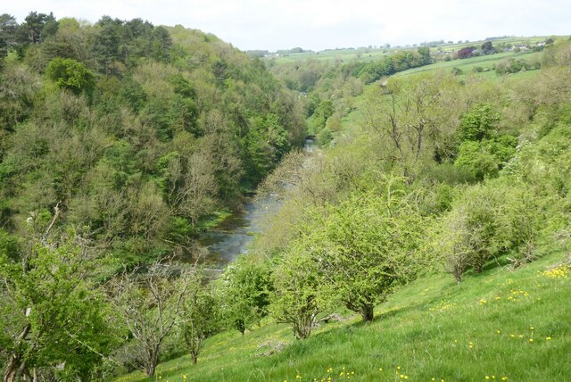
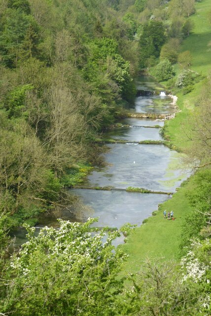
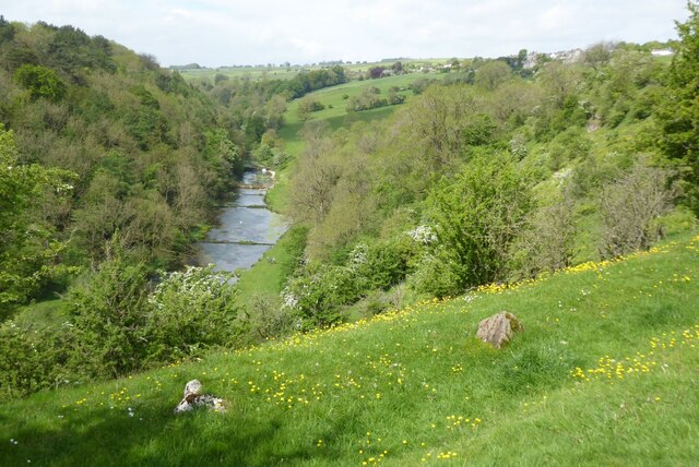
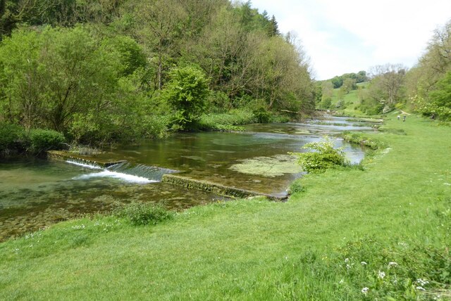
Known for its picturesque setting, Bradford is characterized by its charming stone cottages, lush green fields, and rolling hills. The village is particularly popular with outdoor enthusiasts, as it provides easy access to a plethora of hiking trails, cycling routes, and scenic walks. The nearby River Bradford also offers opportunities for fishing and canoeing.

Despite its small size, Bradford is home to a friendly and close-knit community. The village boasts a number of amenities, including a pub, a primary school, a post office, and a village hall. The pub, in particular, serves as a social hub for locals and visitors, offering a warm and welcoming atmosphere.

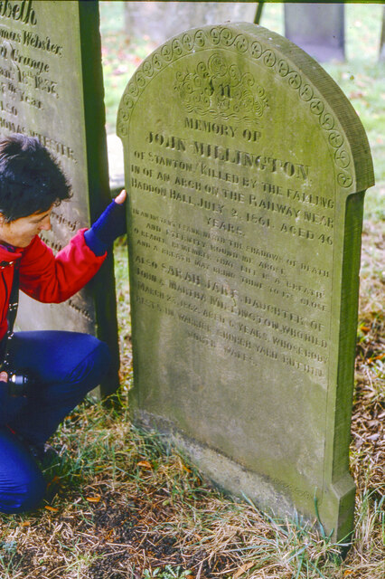
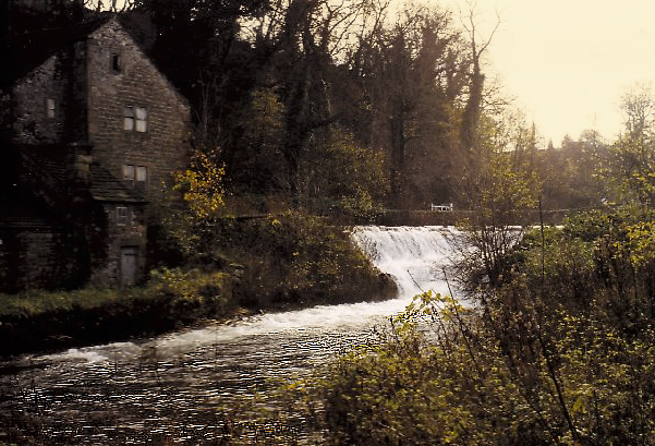
In terms of history, Bradford has a rich heritage dating back centuries. The village is known for its connection to the Industrial Revolution, with several mills once operating in the area. Today, remnants of this industrial past can still be seen in the form of historic buildings and landmarks.

Overall, Bradford, Derbyshire offers a tranquil and idyllic setting for those looking to escape the hustle and bustle of city life and immerse themselves in the natural beauty of the Peak District.

If you have any feedback on the listing, please let us know in the comments section below.

Bradford Images

Images are sourced within 2km of 53.173576/-1.684295 or Grid Reference SK2164. Thanks to Geograph Open Source API. All images are credited.

Broadmeadow Shaft Adjacent to the cottages here, which were once the offices of the Alport Mining Company, can be seen a large mound which marks the site of the Broadmeadow Shaft on the Alport mines. This company was an amalgamation of various separate mining concerns and operated the very rich lead mines of this area. They were classed as the most heavily watered mines in the country and suffered from inflows of more than 6000 gallons a minute. Consequently, heavy pumping was necessary, chiefly by water pressure engines which used a column of water to power them. The well known Cornish engineer, Richard Trevithick was consulted and he was responsible for the first of many such underground machines within this region. Water to power the engine in this shaft was taken from the River Lathkill and over Alport village in wooden launders and then by a tunnel to the shaft. All the pumped water, along with that used by the engines (of which there were upwards of seven scattered throughout the workings) was drained away by the deep Hillcarr Sough, a tunnel driven from the River Derwent near Darley Dale.
Broadmeadow Shaft
Adjacent to the cottages here, which were once the offices of the Alport Mining Company, can be seen a large mound which marks the site of the Broadmeadow Shaft on the Alport mines. This company was an amalgamation of various separate mining concerns and operated the very rich lead mines of this area. They were classed as the most heavily watered mines in the country and suffered from inflows of more than 6000 gallons a minute. Consequently, heavy pumping was necessary, chiefly by water pressure engines which used a column of water to power them. The well known Cornish engineer, Richard Trevithick was consulted and he was responsible for the first of many such underground machines within this region. Water to power the engine in this shaft was taken from the River Lathkill and over Alport village in wooden launders and then by a tunnel to the shaft. All the pumped water, along with that used by the engines (of which there were upwards of seven scattered throughout the workings) was drained away by the deep Hillcarr Sough, a tunnel driven from the River Derwent near Darley Dale.
Grave of John Millington, railway navvy, Youlgreave Churchyard During the construction of the Midland Railway near Haddon Hall in 1861 a tunnel was insisted upon by the Duke of Rutland so that the line could not be seen from the hall. A part of this tunnel collapsed during construction on 2nd July 1861 killing five workers. The grave of one of these can be found in the churchyard. The inscription reads: "In memory of John Millington of Stanton, killed by the falling of an arch on the railway near Haddon Hall, July 2nd 1861 aged 46 years". Reference to his 6 year old daughter is also on the stone whose body rests in Warrick churchyard, Ruthin, North Wales.
Grave of John Millington, railway navvy, Youlgreave Churchyard
During the construction of the Midland Railway near Haddon Hall in 1861 a tunnel was insisted upon by the Duke of Rutland so that the line could not be seen from the hall. A part of this tunnel collapsed during construction on 2nd July 1861 killing five workers. The grave of one of these can be found in the churchyard. The inscription reads: "In memory of John Millington of Stanton, killed by the falling of an arch on the railway near Haddon Hall, July 2nd 1861 aged 46 years". Reference to his 6 year old daughter is also on the stone whose body rests in Warrick churchyard, Ruthin, North Wales.
Conksbury  Bridge  over  River  Lathkill In Lathkill Dale
Conksbury Bridge over River Lathkill
In Lathkill Dale
Footpath  coming  off  minor  road Takes you over fields to Over Haddon
Footpath coming off minor road
Takes you over fields to Over Haddon
Footpath  through  rough  pasture  out  of  Lathkill  Dale
Footpath through rough pasture out of Lathkill Dale
Into  steep  sided  Lathkill  Dale From the field footpath to Over Haddon
Into steep sided Lathkill Dale
From the field footpath to Over Haddon
Footpath  over  fields  to  Over  Haddon
Footpath over fields to Over Haddon
Old reservoir Now just a pond but marked on old maps as a reservoir, possibly for the hydraulic ram sited a short distance downstream.
Old reservoir
Now just a pond but marked on old maps as a reservoir, possibly for the hydraulic ram sited a short distance downstream.
Old barn on the edge of Alport Not yet converted into a luxury residence.
Old barn on the edge of Alport
Not yet converted into a luxury residence.
Old lead shaft capped with concrete Harthill Hall is in the background
Old lead shaft capped with concrete
Harthill Hall is in the background
Step stile and fingerpost Off the B5056 at the junction with Birchover Road.
Step stile and fingerpost
Off the B5056 at the junction with Birchover Road.
Lathkill Dale View down to the River Lathkill in Lathkill Dale.  The tower of Youlgreave church can be seen in the distance.
Lathkill Dale
View down to the River Lathkill in Lathkill Dale. The tower of Youlgreave church can be seen in the distance.
Footpath above Lathkill Dale This footpath follows the shelf of land above the Lathkill Dale near Over Haddon.
Footpath above Lathkill Dale
This footpath follows the shelf of land above the Lathkill Dale near Over Haddon.
Footpath above Lathkill Dale View down to the River Lathkill in Lathkill Dale.  The tower of Youlgreave church can be seen in the distance.
Footpath above Lathkill Dale
View down to the River Lathkill in Lathkill Dale. The tower of Youlgreave church can be seen in the distance.
Lathkill Dale View of the River Lathkill in Lathkill Dale below Over Haddon.
Lathkill Dale
View of the River Lathkill in Lathkill Dale below Over Haddon.
Weirs in the River Lathkill Weirs in the River Lathkill in Lathkill Dale near Over Haddon.
Weirs in the River Lathkill
Weirs in the River Lathkill in Lathkill Dale near Over Haddon.
Lathkill Dale View of the River Lathkill in Lathkill Dale below Over Haddon.
Lathkill Dale
View of the River Lathkill in Lathkill Dale below Over Haddon.
Weirs on the River Lathkill Weirs on the River Lathkill below Over Haddon.
Weirs on the River Lathkill
Weirs on the River Lathkill below Over Haddon.
Show me another place!

Bradford is located at Grid Ref: SK2164 (Lat: 53.173576, Lng: -1.684295)

Administrative County: Derbyshire

District: Derbyshire Dales

Police Authority: Derbyshire

What 3 Words

///dolls.owns.riches. Near Youlgreave, Derbyshire

Related Wikis

Youlgreave

Youlgreave or Youlgrave is a village and civil parish in the Peak District of Derbyshire, England, on the River Bradford 2+1⁄2 miles (4.0 km) south of...

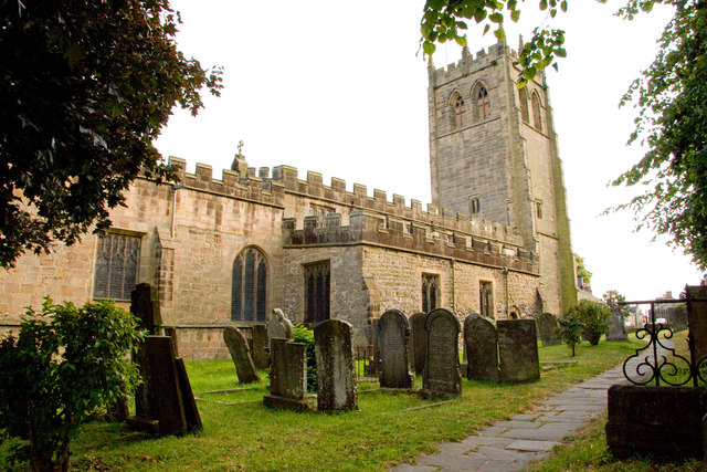
All Saints' Church, Youlgreave

All Saints’ Church, Youlgreave is a Grade I listed parish church in the Church of England in Youlgreave, Derbyshire. == History == The church dates from...

River Bradford

The River Bradford is a river in the Peak District National Park in Derbyshire. Its source is on Gratton Moor and after passing below Youlgreave it joins...

Alport

Alport is a hamlet in the White Peak area of Derbyshire, England. It lies east of Youlgreave, at the confluence of the River Bradford and the River Lathkill...

Harthill Moor

Harthill Moor is a small upland area in the Derbyshire Peak District of central and northern England, lying between Matlock and Bakewell near the villages...

Conksbury

Conksbury is the site of a deserted medieval settlement between Over Haddon and Youlgreave in Derbyshire, England. == History == The village was recorded...

Harthill, Derbyshire

Harthill is a civil parish within the Derbyshire Dales district, in the county of Derbyshire, England. Largely rural, along with parts of the neighbouring...

Harthill Hall

Harthill Hall was formerly the Manor House of a great 13th century Estate, and the hall is now a Grade II listed building within the civil parish of Harthill...

Related Videos

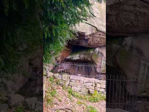
Hidden Gem - Hermit's Cave - Peak District | Solo Hiking

Things to do in Peak District - Roadtrip to Robin Hood's Stride & Nine Stones Close Stone Circle - Hermit's Cave - Cratcliffe Rocks ...

Off The Beaten Path: Robin Hood's Stride | Peak District | Solo Hiking

Short Edit - Part 3 | Cinematic Solo Hiking Film: "Off the Beaten Path" | Robin Hood's Stride | Solo Traveller | Aerial Drone Video ...

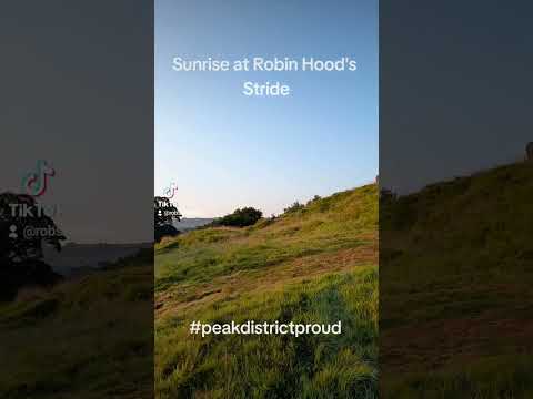
Sunrise At Robin Hood's Stride

I set an early alarm this morning and headed out to catch the sunrise at Robin Hood's Stride in the Peak District #sunrise ...

Walking in Peak District, the Square.

Short walk in Sunday October on the dog level in Derbyshire, Middleton by Youlgrave.

Nearby Amenities

Located within 500m of 53.173576,-1.684295
Youlgrave
Alt Name: Youlgreave
Is In: Derbyshire, England, UK
Place: village
Source Name: Local Knowledge
Wikidata: Q1822924
Lat/Long: 53.1754751/-1.6859938
Pub
George Hotel
Accommodation: yes
Addr City: Bakewell
Addr Postcode: DE45 1WN
Addr Street: Alport Lane
Addr Village: Youlgrave
Fhrs Id: 1669443
Floor Material: stone
Food: yes
Outdoor Seating: yes
Real Ale: Caledonian Flying Scotsman (may vary)
Lat/Long: 53.1762937/-1.6846687
Post Box
Brand: Royal Mail
Brand Wikidata: Q638098
Brand Wikipedia: en:Royal Mail
Operator: Royal Mail
Operator Wikidata: Q638098
Ref: DE45 1379
Lat/Long: 53.1739555/-1.690366
Bus Stop
Bus: yes
Public Transport: platform
Lat/Long: 53.1739945/-1.6904057
Pub
Farmyard Inn
Accommodation: yes
Addr City: Bakewell
Addr Postcode: DE45 1UW
Addr Street: Main Street
Addr Village: Youlgrave
Fhrs Id: 1626468
Food: yes
Parking: yes
Website: https://www.farmyardinnyoulgreave.co.uk/
Lat/Long: 53.1740655/-1.6898941
Bus Stop
Bus: yes
Naptan AtcoCode: 1000DYMS3131
Naptan NaptanCode: dbsdmwjt
Public Transport: platform
Lat/Long: 53.174617/-1.688075
Bus Stop
Bus: yes
Public Transport: platform
Lat/Long: 53.1746724/-1.6877384
Place Of Worship
Wesleyan Reform Church
Religion: christian
Lat/Long: 53.1745851/-1.6871687
Post Box
Brand: Royal Mail
Brand Wikidata: Q638098
Brand Wikipedia: en:Royal Mail
Collection Times: Mo-Fr 16:00; Sa 08:00
Operator: Royal Mail
Operator Wikidata: Q638098
Post Box Design: type_a
Post Box Type: pillar
Ref: DE45 1278
Royal Cypher: EIIR
Royal Cypher Wikidata: Q33102113
Lat/Long: 53.1751931/-1.6866937
Youlgreave Youth Hostel
Addr City: Bakewell
Addr Postcode: DE45 1UR
Addr Street: Fountain Square
Addr Village: Youlgreave
Brand: YHA
Brand Wikidata: Q8059214
Contact Website: https://www.yha.org.uk/hostel/yha-youlgreave
Fhrs Id: 1626837
Old Fhrs Id: 258656
Operator: YHA
Tourism: hostel
Wikidata: Q26619624
Lat/Long: 53.1750134/-1.6865046
Pub
Bulls Head
Addr City: Bakewell
Addr Postcode: DE45 1UR
Addr Street: Fountain Square
Addr Village: Youlgrave
Brand: Marston's
Brand Wikidata: Q6773982
Fhrs Id: 1626436
Food: yes
Note: More of a pub than a hotel
Outdoor Seating: yes
Real Ale: 3 from Marston's
Website: https://www.thebullsheadyoulgrave.co.uk/
Lat/Long: 53.1751867/-1.6862137
Post Box
Brand: Royal Mail
Brand Wikidata: Q638098
Brand Wikipedia: en:Royal Mail
Collection Times: Mo-Fr 09:00; Sa 07:00
Operator: Royal Mail
Operator Wikidata: Q638098
Post Box Type: lamp
Ref: DE45 1262D
Royal Cypher: EIIR
Royal Cypher Wikidata: Q33102113
Lat/Long: 53.1762633/-1.6844185
Bench
Lat/Long: 53.1726822/-1.6819921
Bench
Backrest: yes
Lat/Long: 53.1733062/-1.6855869
Bench
Backrest: yes
Lat/Long: 53.1728889/-1.6884929
Bench
Lat/Long: 53.1730644/-1.6798172
Bus Stop
Bus: yes
Public Transport: platform
Lat/Long: 53.1759229/-1.6849572
Bus Stop
Bus: yes
Naptan AtcoCode: 1000DYCS3129
Naptan NaptanCode: dbsdgawm
Public Transport: platform
Lat/Long: 53.1758375/-1.6848497
Barrier: stile
Foot: yes
Stile: squeezer
Lat/Long: 53.1726869/-1.6889165
Barrier: stile
Foot: yes
Lat/Long: 53.1738165/-1.6815335
Bench
Lat/Long: 53.1752305/-1.6865741
Conduit Head
Alt Name: Cistern
Man Made: water_tower
Wikidata: Q26597995
Lat/Long: 53.1752276/-1.6866155
Bench
Backrest: yes
Lat/Long: 53.1763612/-1.6838982
Bench
Lat/Long: 53.1758702/-1.6840081
Bus Stop
Bus: yes
Public Transport: platform
Lat/Long: 53.1768476/-1.6828236
The Mouth
Description: This gap in the cliffs was called The Mouth in the 20th Century including by leadminers on their way to Mawstone Mine (Originally Mosstone Mine)
Lat/Long: 53.1722531/-1.6886037
Barrier: stile
Foot: yes
Material: stone
Stile: squeezer
Lat/Long: 53.1721654/-1.6884556
Barrier: stile
Foot: yes
Lat/Long: 53.1703685/-1.6866041
Barrier: stile
Foot: yes
Steps: 1
Stile: wall
Lat/Long: 53.1701545/-1.6867271
Barrier: stile
Foot: yes
Material: stone
Stile: squeezer
Lat/Long: 53.1720291/-1.6883461
Post Box
Brand: Royal Mail
Brand Wikidata: Q638098
Brand Wikipedia: en:Royal Mail
Operator: Royal Mail
Operator Wikidata: Q638098
Ref: DE45 1291
Lat/Long: 53.1725156/-1.6822188
Barrier: cattle_grid
Lat/Long: 53.172446/-1.6820316
Bench
Lat/Long: 53.1730553/-1.6902646
Place Of Worship
Youlgreave Methodist Church
Denomination: methodist
Religion: christian
Lat/Long: 53.1736492/-1.691629
Barrier: stile
Material: stone
Source: survey;bing;gps
Stile: squeezer
Lat/Long: 53.1709847/-1.6898394
Barrier: stile
Material: stone
Source: survey;bing;gps
Stile: squeezer
Lat/Long: 53.1731674/-1.6888092
Barrier: stile
Material: stone
Source: survey;bing;gps
Stile: squeezer
Lat/Long: 53.1699293/-1.6812774
Barrier: stile
Material: stone
Source: survey;bing;gps
Stile: squeezer
Lat/Long: 53.1712392/-1.6825084
Barrier: stile
Source: survey
Stile: squeezer
Lat/Long: 53.1722921/-1.6823666
Barrier: stile
Stile: squeezer
Lat/Long: 53.173929/-1.6862816
Bench
Lat/Long: 53.1745688/-1.6876299
Bench
Backrest: yes
Lat/Long: 53.1737048/-1.6859985
Natural: cave_entrance
Source: View from path
Lat/Long: 53.1734161/-1.6783583
Post Office
Youlgrave Post Office
Addr City: Bakewell
Addr Housename: Parkers Butchers
Addr Postcode: DE45 1UR
Addr Street: Church Street
Not Addr Postcode: DE45 1WL
Old Fhrs Id: 1138595
Ref Pol Id: 15094
Lat/Long: 53.175418/-1.6857768
Shop: greengrocer
Source: survey
Lat/Long: 53.1754037/-1.6858256
Cafe
Youlgrave Village Shop and Tea Room
Addr City: Bakewell
Addr Housenumber: 26
Addr Postcode: DE45 1WL
Addr Street: Church Street
Addr Village: Youlgrave
Fhrs Id: 1626824
Old Name: Holland Butcher
Shop: convenience
Source: survey
Website: https://www.youlgrave.shop/
Lat/Long: 53.1756672/-1.6855451
Fuel
Youlgrave Garage
Source: survey
Lat/Long: 53.1767305/-1.6831338
Barrier: stile
Material: stone
Source: survey;gps
Stile: squeezer
Lat/Long: 53.1719025/-1.6827126
Barrier: stile
Material: stone
Source: survey;gps
Stile: squeezer
Lat/Long: 53.1745306/-1.6774948
Barrier: stile
Stile: squeezer
Lat/Long: 53.1716257/-1.6834348
Barrier: stile
Stile: squeezer
Lat/Long: 53.172668/-1.6825122
Barrier: stile
Stile: squeezer
Lat/Long: 53.1726353/-1.6867013
Parking
Access: private
Lat/Long: 53.1750683/-1.690927
Barrier: stile
Stile: squeezer
Lat/Long: 53.1757035/-1.6897427
Waste Basket
Lat/Long: 53.1757652/-1.6897152
Waste Basket
Lat/Long: 53.1763444/-1.6839528
Barrier: kissing_gate
Source: survey;gps
Lat/Long: 53.1752337/-1.6788593
Barrier: stile
Source: survey;gps
Stile: squeezer
Lat/Long: 53.1756423/-1.6802625
Barrier: stile
Material: stone
Source: survey;gps
Stile: squeezer
Lat/Long: 53.1728635/-1.6783556
Community Centre
Youlgrave Village Hall
Addr City: Bakewell
Addr Postcode: DE45 1UT
Addr Street: Holywell Lane
Addr Village: Youlgreave
Community Centre: village_hall
Website: https://www.yvh.org.uk/
Lat/Long: 53.1740177/-1.687581
Bench
Backrest: yes
Lat/Long: 53.1727079/-1.6889541
The Old Bakery B&B
Addr City: Bakewell
Addr Housename: The Old Bakery
Addr Postcode: DE45 1UR
Addr Street: Church Street
Addr Village: Youlgrave
Guest House: bed_and_breakfast
Note: Approx location
Old Fhrs Id: 1627104
Tourism: guest_house
Website: https://www.theoldbakeryyoulgrave.co.uk
Lat/Long: 53.1753807/-1.6861006
Generator Method: photovoltaic
Generator Output Electricity: yes
Generator Source: solar
Generator Type: solar_photovoltaic_panel
Location: roof
Power: generator
Lat/Long: 53.1750471/-1.6891404
Generator Method: photovoltaic
Generator Output Electricity: yes
Generator Source: solar
Generator Type: solar_photovoltaic_panel
Location: roof
Power: generator
Lat/Long: 53.1740139/-1.6891259
Generator Method: photovoltaic
Generator Output Electricity: yes
Generator Source: solar
Generator Type: solar_photovoltaic_panel
Location: roof
Power: generator
Lat/Long: 53.1769169/-1.6865663
Generator Method: photovoltaic
Generator Output Electricity: yes
Generator Source: solar
Generator Type: solar_photovoltaic_panel
Location: roof
Power: generator
Lat/Long: 53.1769293/-1.6863313
Generator Method: photovoltaic
Generator Output Electricity: yes
Generator Source: solar
Generator Type: solar_photovoltaic_panel
Location: roof
Power: generator
Lat/Long: 53.1773562/-1.68797
Generator Method: photovoltaic
Generator Output Electricity: yes
Generator Source: solar
Generator Type: solar_photovoltaic_panel
Location: roof
Power: generator
Lat/Long: 53.174928/-1.6893791
Generator Method: photovoltaic
Generator Output Electricity: yes
Generator Source: solar
Generator Type: solar_photovoltaic_panel
Location: roof
Power: generator
Lat/Long: 53.1769/-1.6867003
Generator Method: photovoltaic
Generator Output Electricity: yes
Generator Source: solar
Generator Type: solar_photovoltaic_panel
Location: roof
Power: generator
Lat/Long: 53.1751352/-1.6879827
Generator Method: photovoltaic
Generator Output Electricity: yes
Generator Source: solar
Generator Type: solar_photovoltaic_panel
Location: roof
Power: generator
Lat/Long: 53.1743897/-1.6900192
Generator Method: photovoltaic
Generator Output Electricity: yes
Generator Source: solar
Generator Type: solar_photovoltaic_panel
Location: roof
Power: generator
Lat/Long: 53.1723016/-1.6833052
Generator Method: photovoltaic
Generator Output Electricity: yes
Generator Source: solar
Generator Type: solar_photovoltaic_panel
Location: roof
Power: generator
Lat/Long: 53.1768928/-1.6869591
Generator Method: photovoltaic
Generator Output Electricity: yes
Generator Source: solar
Generator Type: solar_photovoltaic_panel
Location: roof
Power: generator
Lat/Long: 53.1739976/-1.6890329
Generator Method: photovoltaic
Generator Output Electricity: yes
Generator Source: solar
Generator Type: solar_photovoltaic_panel
Location: roof
Power: generator
Lat/Long: 53.1769777/-1.6861941
Generator Method: photovoltaic
Generator Output Electricity: yes
Generator Source: solar
Generator Type: solar_photovoltaic_panel
Location: roof
Power: generator
Lat/Long: 53.175429/-1.6891798
Generator Method: photovoltaic
Generator Output Electricity: yes
Generator Source: solar
Generator Type: solar_photovoltaic_panel
Location: roof
Power: generator
Lat/Long: 53.1756668/-1.6808128
Generator Method: photovoltaic
Generator Output Electricity: yes
Generator Source: solar
Generator Type: solar_photovoltaic_panel
Location: roof
Power: generator
Lat/Long: 53.1749413/-1.6892747
Generator Method: photovoltaic
Generator Output Electricity: yes
Generator Source: solar
Generator Type: solar_photovoltaic_panel
Location: roof
Power: generator
Lat/Long: 53.1770718/-1.6872021
Generator Method: photovoltaic
Generator Output Electricity: yes
Generator Source: solar
Generator Type: solar_photovoltaic_panel
Location: roof
Power: generator
Lat/Long: 53.1770064/-1.6817764
Generator Method: photovoltaic
Generator Output Electricity: yes
Generator Source: solar
Generator Type: solar_photovoltaic_panel
Location: roof
Power: generator
Lat/Long: 53.1768936/-1.6868394
Generator Method: photovoltaic
Generator Output Electricity: yes
Generator Source: solar
Generator Type: solar_photovoltaic_panel
Location: roof
Power: generator
Lat/Long: 53.1755982/-1.680597
Generator Method: photovoltaic
Generator Output Electricity: yes
Generator Source: solar
Generator Type: solar_photovoltaic_panel
Location: roof
Power: generator
Lat/Long: 53.1723516/-1.683414
Generator Method: photovoltaic
Generator Output Electricity: yes
Generator Source: solar
Generator Type: solar_photovoltaic_panel
Location: roof
Power: generator
Lat/Long: 53.176924/-1.6864535
Generator Method: photovoltaic
Generator Output Electricity: yes
Generator Source: solar
Generator Type: solar_photovoltaic_panel
Location: roof
Power: generator
Lat/Long: 53.1756868/-1.6807889
Generator Method: photovoltaic
Generator Output Electricity: yes
Generator Source: solar
Generator Type: solar_photovoltaic_panel
Location: roof
Power: generator
Lat/Long: 53.1740537/-1.6891819
Generator Method: photovoltaic
Generator Output Electricity: yes
Generator Source: solar
Generator Type: solar_photovoltaic_panel
Location: roof
Power: generator
Lat/Long: 53.171862/-1.6832538
Bench
Lat/Long: 53.1726421/-1.6824071
Barrier: stile
Stile: squeezer
Lat/Long: 53.1728195/-1.6824972
Parking
Capacity: 4
Lat/Long: 53.1702761/-1.6865911
Bench
Lat/Long: 53.174407/-1.6779484
Telephone
Booth: K6
Covered: booth
Listed Status: Grade II
Operator: BT
Operator Wikidata: Q593786
Phone: +44 1629 636369
Lat/Long: 53.1746336/-1.6876805
Midtech Cycle Services
Image: https://www.midtechcycles.co.uk/photo-gallery?lightbox=dataItem-kufz01c7
Lat/Long: 53.1768499/-1.6834441
Youlgrave Harriers
Addr City: Youlgrave
Addr Housename: Alport Lane Playing Fields
Club: sport
Opening Hours: Th 19:00
Operator: Youlgrave Harriers
Sport: running
Website: https://www.youlgraveharriers.com/home
Lat/Long: 53.1771646/-1.6808405
Bradford Dale
Board Type: nature
Information: board
Tourism: information
Lat/Long: 53.1727483/-1.6889125
Bench
Lat/Long: 53.1760627/-1.6844599
The data included in this document is from www.openstreetmap.org. The data is made available under ODbL.

Have you been to Bradford?

Leave your review of Bradford below (or comments, questions and feedback).