Rheinstor Plantation

Wood, Forest in Derbyshire Derbyshire Dales

England

Rheinstor Plantation

Broadmeadow Shaft Adjacent to the cottages here, which were once the offices of the Alport Mining Company, can be seen a large mound which marks the site of the Broadmeadow Shaft on the Alport mines. This company was an amalgamation of various separate mining concerns and operated the very rich lead mines of this area. They were classed as the most heavily watered mines in the country and suffered from inflows of more than 6000 gallons a minute. Consequently, heavy pumping was necessary, chiefly by water pressure engines which used a column of water to power them. The well known Cornish engineer, Richard Trevithick was consulted and he was responsible for the first of many such underground machines within this region. Water to power the engine in this shaft was taken from the River Lathkill and over Alport village in wooden launders and then by a tunnel to the shaft. All the pumped water, along with that used by the engines (of which there were upwards of seven scattered throughout the workings) was drained away by the deep Hillcarr Sough, a tunnel driven from the River Derwent near Darley Dale.
Broadmeadow Shaft Credit: Richard Bird

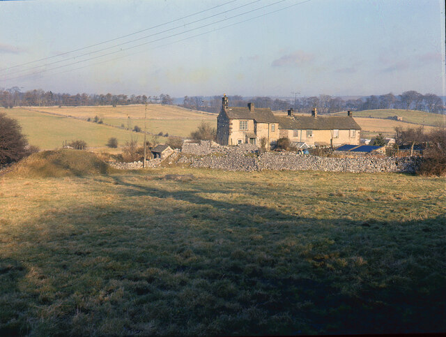
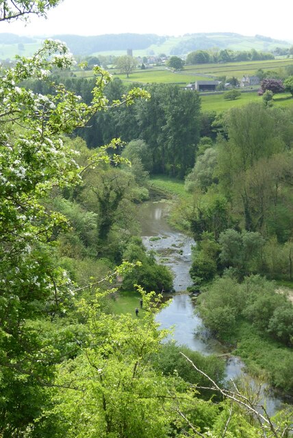
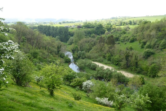
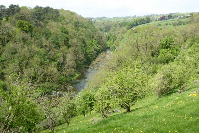
Rheinstor Plantation is a picturesque woodland located in Derbyshire, England. Covering an area of approximately 100 acres, it is nestled within the stunning landscape of the Derbyshire Dales. The plantation is known for its dense population of various tree species, offering visitors a diverse and enchanting forest experience.

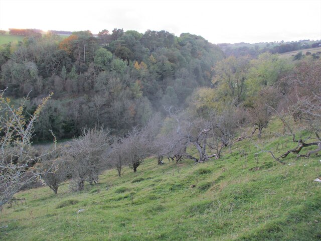
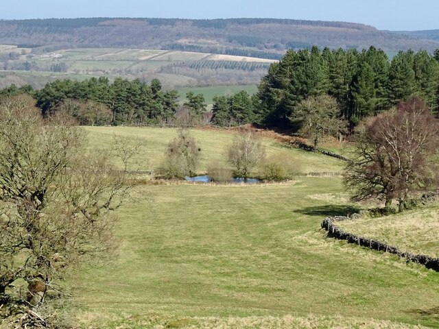
The woodland is primarily composed of deciduous trees, with a notable abundance of oak, beech, and birch. These towering trees create a dense canopy, providing a cool and shady environment even on the hottest of summer days. The forest floor is adorned with a vibrant carpet of ferns, wildflowers, and mosses, adding to its enchanting atmosphere.

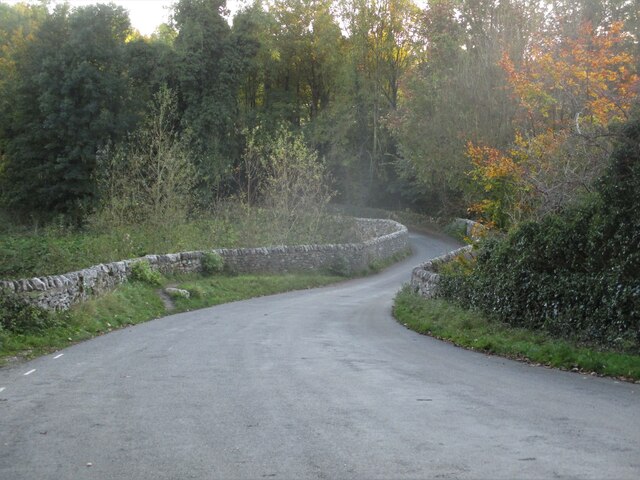
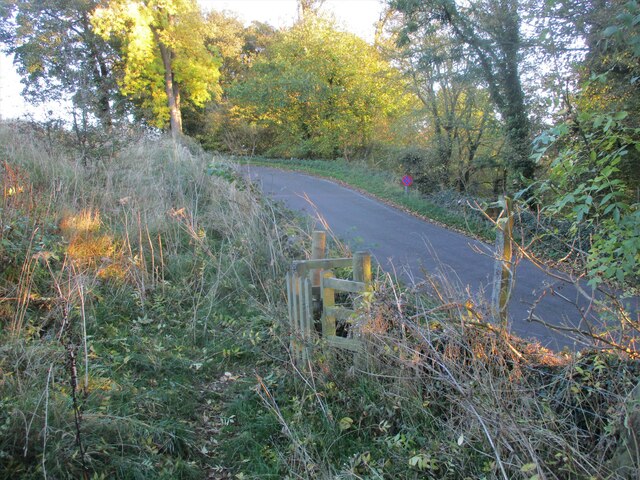
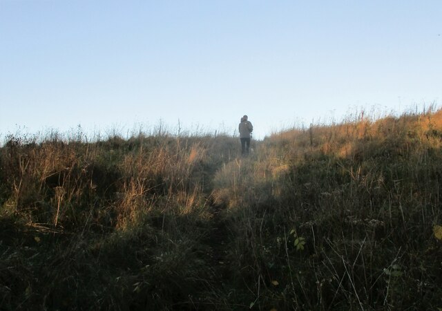
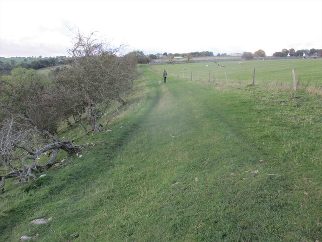
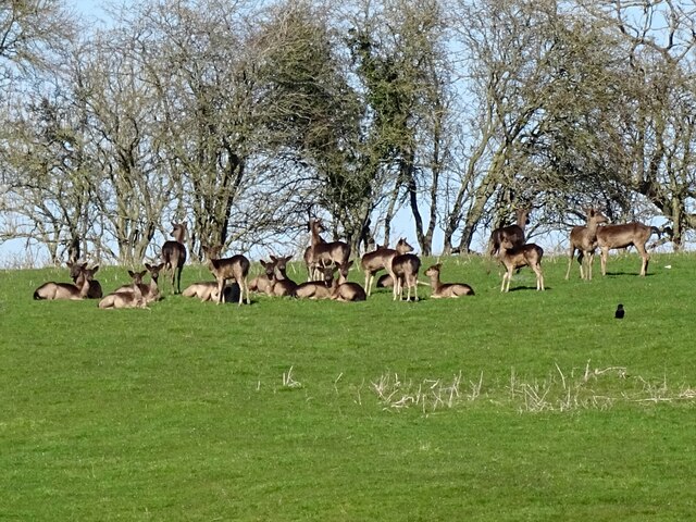
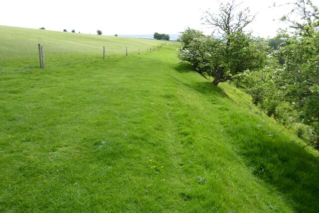
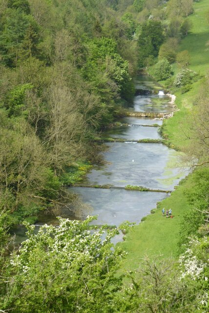
Visitors to Rheinstor Plantation can enjoy a range of recreational activities. There are numerous walking trails that wind through the woodland, allowing visitors to immerse themselves in the natural beauty of the area. The plantation is also a popular spot for birdwatching, with a variety of bird species residing within its borders. Wildlife enthusiasts may even catch a glimpse of deer, foxes, or rabbits during their visit.

The plantation is well-maintained, with clear signposts and designated picnic areas available for visitors to enjoy. It is accessible year-round, though the autumn months are especially popular due to the stunning display of colors as the leaves change. Rheinstor Plantation offers a peaceful and serene escape from the hustle and bustle of everyday life, making it a cherished destination for nature lovers and outdoor enthusiasts alike.

If you have any feedback on the listing, please let us know in the comments section below.

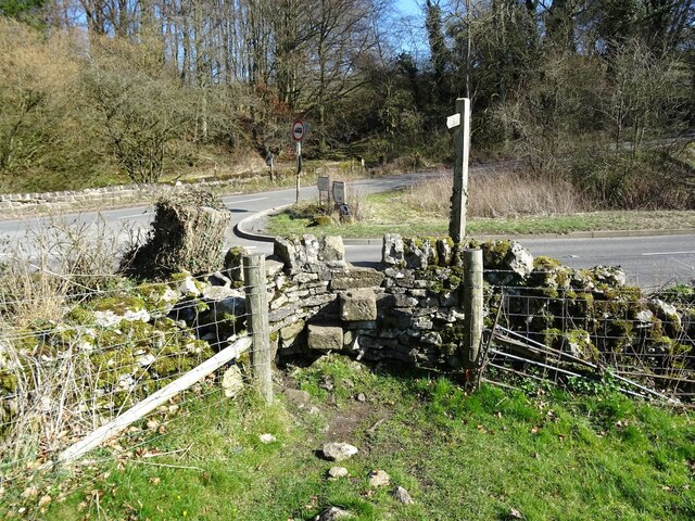
Rheinstor Plantation Images

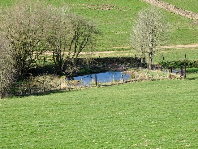
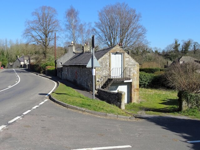
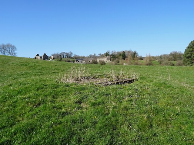
Images are sourced within 2km of 53.17556/-1.6742552 or Grid Reference SK2164. Thanks to Geograph Open Source API. All images are credited.

Broadmeadow Shaft Adjacent to the cottages here, which were once the offices of the Alport Mining Company, can be seen a large mound which marks the site of the Broadmeadow Shaft on the Alport mines. This company was an amalgamation of various separate mining concerns and operated the very rich lead mines of this area. They were classed as the most heavily watered mines in the country and suffered from inflows of more than 6000 gallons a minute. Consequently, heavy pumping was necessary, chiefly by water pressure engines which used a column of water to power them. The well known Cornish engineer, Richard Trevithick was consulted and he was responsible for the first of many such underground machines within this region. Water to power the engine in this shaft was taken from the River Lathkill and over Alport village in wooden launders and then by a tunnel to the shaft. All the pumped water, along with that used by the engines (of which there were upwards of seven scattered throughout the workings) was drained away by the deep Hillcarr Sough, a tunnel driven from the River Derwent near Darley Dale.
Broadmeadow Shaft
Adjacent to the cottages here, which were once the offices of the Alport Mining Company, can be seen a large mound which marks the site of the Broadmeadow Shaft on the Alport mines. This company was an amalgamation of various separate mining concerns and operated the very rich lead mines of this area. They were classed as the most heavily watered mines in the country and suffered from inflows of more than 6000 gallons a minute. Consequently, heavy pumping was necessary, chiefly by water pressure engines which used a column of water to power them. The well known Cornish engineer, Richard Trevithick was consulted and he was responsible for the first of many such underground machines within this region. Water to power the engine in this shaft was taken from the River Lathkill and over Alport village in wooden launders and then by a tunnel to the shaft. All the pumped water, along with that used by the engines (of which there were upwards of seven scattered throughout the workings) was drained away by the deep Hillcarr Sough, a tunnel driven from the River Derwent near Darley Dale.
Grave of John Millington, railway navvy, Youlgreave Churchyard During the construction of the Midland Railway near Haddon Hall in 1861 a tunnel was insisted upon by the Duke of Rutland so that the line could not be seen from the hall. A part of this tunnel collapsed during construction on 2nd July 1861 killing five workers. The grave of one of these can be found in the churchyard. The inscription reads: "In memory of John Millington of Stanton, killed by the falling of an arch on the railway near Haddon Hall, July 2nd 1861 aged 46 years". Reference to his 6 year old daughter is also on the stone whose body rests in Warrick churchyard, Ruthin, North Wales.
Grave of John Millington, railway navvy, Youlgreave Churchyard
During the construction of the Midland Railway near Haddon Hall in 1861 a tunnel was insisted upon by the Duke of Rutland so that the line could not be seen from the hall. A part of this tunnel collapsed during construction on 2nd July 1861 killing five workers. The grave of one of these can be found in the churchyard. The inscription reads: "In memory of John Millington of Stanton, killed by the falling of an arch on the railway near Haddon Hall, July 2nd 1861 aged 46 years". Reference to his 6 year old daughter is also on the stone whose body rests in Warrick churchyard, Ruthin, North Wales.
Conksbury  Bridge  over  River  Lathkill In Lathkill Dale
Conksbury Bridge over River Lathkill
In Lathkill Dale
Footpath  coming  off  minor  road Takes you over fields to Over Haddon
Footpath coming off minor road
Takes you over fields to Over Haddon
Footpath  through  rough  pasture  out  of  Lathkill  Dale
Footpath through rough pasture out of Lathkill Dale
Into  steep  sided  Lathkill  Dale From the field footpath to Over Haddon
Into steep sided Lathkill Dale
From the field footpath to Over Haddon
Footpath  over  fields  to  Over  Haddon
Footpath over fields to Over Haddon
Pond on Harthill Moor
Old reservoir Now just a pond but marked on old maps as a reservoir, possibly for the hydraulic ram sited a short distance downstream.
Old reservoir
Now just a pond but marked on old maps as a reservoir, possibly for the hydraulic ram sited a short distance downstream.
Old barn on the edge of Alport Not yet converted into a luxury residence.
Old barn on the edge of Alport
Not yet converted into a luxury residence.
A herd of deer
A herd of deer
Old lead shaft capped with concrete Harthill Hall is in the background
Old lead shaft capped with concrete
Harthill Hall is in the background
Step stile and fingerpost Off the B5056 at the junction with Birchover Road.
Step stile and fingerpost
Off the B5056 at the junction with Birchover Road.
Lathkill Dale View down to the River Lathkill in Lathkill Dale.  The tower of Youlgreave church can be seen in the distance.
Lathkill Dale
View down to the River Lathkill in Lathkill Dale. The tower of Youlgreave church can be seen in the distance.
Footpath above Lathkill Dale This footpath follows the shelf of land above the Lathkill Dale near Over Haddon.
Footpath above Lathkill Dale
This footpath follows the shelf of land above the Lathkill Dale near Over Haddon.
Footpath above Lathkill Dale View down to the River Lathkill in Lathkill Dale.  The tower of Youlgreave church can be seen in the distance.
Footpath above Lathkill Dale
View down to the River Lathkill in Lathkill Dale. The tower of Youlgreave church can be seen in the distance.
Lathkill Dale View of the River Lathkill in Lathkill Dale below Over Haddon.
Lathkill Dale
View of the River Lathkill in Lathkill Dale below Over Haddon.
Weirs in the River Lathkill Weirs in the River Lathkill in Lathkill Dale near Over Haddon.
Weirs in the River Lathkill
Weirs in the River Lathkill in Lathkill Dale near Over Haddon.
Show me another place!

Rheinstor Plantation is located at Grid Ref: SK2164 (Lat: 53.17556, Lng: -1.6742552)

Administrative County: Derbyshire

District: Derbyshire Dales

Police Authority: Derbyshire

What 3 Words

///warrior.pile.perfumed. Near Youlgreave, Derbyshire

Related Wikis

Nearby Amenities

Located within 500m of 53.17556,-1.6742552
Alport
Created By: POI Editor
Place: village
Source: npe
Wikidata: Q4735631
Lat/Long: 53.1780949/-1.6711396
Post Box
Brand: Royal Mail
Brand Wikidata: Q638098
Brand Wikipedia: en:Royal Mail
Collection Times: Mo-Fr 09:00, Sa 07:00
Operator: Royal Mail
Operator Wikidata: Q638098
Post Box Type: wall
Ref: DE45 1261D
Royal Cypher: GVIR
Royal Cypher Wikidata: Q33102169
Lat/Long: 53.1776254/-1.6713936
Bench
Lat/Long: 53.1730644/-1.6798172
Bench
Lat/Long: 53.1776498/-1.6741746
Source: bing
Lat/Long: 53.1716044/-1.6749399
Fixme: gate or stile?
Lat/Long: 53.1723769/-1.6770169
Barrier: stile
Lat/Long: 53.1781356/-1.672315
Ele: 122
Lat/Long: 53.1770854/-1.6705529
Barrier: stile
Ele: 121
Stile: squeezer
Lat/Long: 53.1771304/-1.6705924
Barrier: stile
Stile: squeezer
Lat/Long: 53.1775574/-1.6743478
Natural: cave_entrance
Source: View from path
Lat/Long: 53.1734161/-1.6783583
Bus Stop
Bus: yes
Naptan AtcoCode: 1000DAAL3126
Naptan NaptanCode: dbsgwtdt
Public Transport: platform
Lat/Long: 53.1779395/-1.6710099
Barrier: stile
Material: stone
Source: survey;gps
Stile: squeezer
Lat/Long: 53.1769432/-1.6675436
Barrier: stile
Material: stone
Source: survey;gps
Stile: squeezer
Lat/Long: 53.1745306/-1.6774948
Barrier: stile
Material: stone
Source: survey;gps
Stile: squeezer
Lat/Long: 53.1768732/-1.6730753
Barrier: stile
Material: stone
Source: survey;gps
Stile: squeezer
Lat/Long: 53.1772327/-1.6706746
Barrier: kissing_gate
Source: survey;gps
Lat/Long: 53.1752337/-1.6788593
Barrier: stile
Source: survey;gps
Stile: squeezer
Lat/Long: 53.1756423/-1.6802625
Barrier: stile
Material: stone
Source: survey;gps
Stile: squeezer
Lat/Long: 53.1714203/-1.6744948
Barrier: stile
Material: stone
Source: survey;gps
Stile: squeezer
Lat/Long: 53.1728635/-1.6783556
Parking
Access: private
Lat/Long: 53.1775182/-1.6734054
Defibrillator
Access: yes
Booth: K6
Check Date: 2023-03-09
Covered: booth
Defibrillator Location: in repurposed red phone box, Alport
Disused Amenity: telephone
Emergency: defibrillator
Indoor: no
Man Made: telephone_box
Ref: CHT-13-721
Source: survey
Lat/Long: 53.1775259/-1.6718822
Waterway: weir
Lat/Long: 53.1777833/-1.6715802
Bench
Backrest: yes
Lat/Long: 53.1775326/-1.671856
Generator Method: photovoltaic
Generator Output Electricity: yes
Generator Source: solar
Generator Type: solar_photovoltaic_panel
Location: roof
Power: generator
Lat/Long: 53.1756668/-1.6808128
Generator Method: photovoltaic
Generator Output Electricity: yes
Generator Source: solar
Generator Type: solar_photovoltaic_panel
Location: roof
Power: generator
Lat/Long: 53.1755982/-1.680597
Generator Method: photovoltaic
Generator Output Electricity: yes
Generator Source: solar
Generator Type: solar_photovoltaic_panel
Location: roof
Power: generator
Lat/Long: 53.1756868/-1.6807889
Barrier: stile
Lat/Long: 53.1776418/-1.6719486
Bench
Lat/Long: 53.174407/-1.6779484
Youlgrave Harriers
Addr City: Youlgrave
Addr Housename: Alport Lane Playing Fields
Club: sport
Opening Hours: Th 19:00
Operator: Youlgrave Harriers
Sport: running
Website: https://www.youlgraveharriers.com/home
Lat/Long: 53.1771646/-1.6808405
Waterway: weir
Lat/Long: 53.1787092/-1.6727277
Waterway: weir
Lat/Long: 53.178497/-1.6723672
Board Type: history
Information: board
Tourism: information
Lat/Long: 53.1773808/-1.6720616
The data included in this document is from www.openstreetmap.org. The data is made available under ODbL.

Have you been to Rheinstor Plantation?

Leave your review of Rheinstor Plantation below (or comments, questions and feedback).