Bradfield St Clare

Settlement in Suffolk West Suffolk

England

Bradfield St Clare

A134 looking north, Bradfield Combust A route from Colchester to King's Lynn, next major place, Bury St Edmunds. Parts of its route are on a Roman alignment, as here, although the A134 pulls off the Roman line just ahead.
A134 looking north, Bradfield Combust Credit: Robin Webster

Bradfield St Clare is a small village situated in the county of Suffolk, in eastern England. It is located approximately 5 miles northeast of the market town of Bury St Edmunds. The village lies within the Mid Suffolk district and is part of the civil parish of Bradfield Combust with Stanningfield.

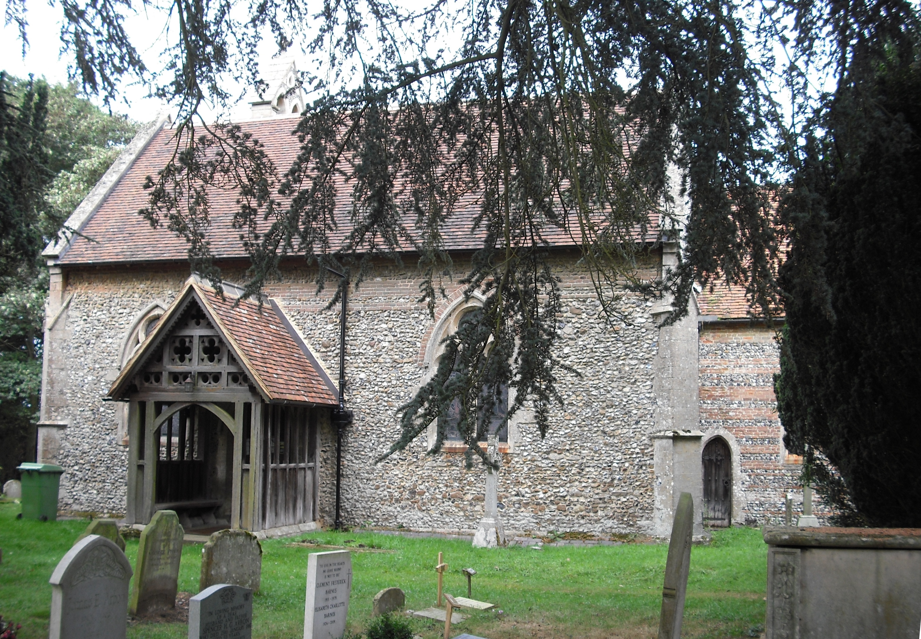
With a population of around 200 residents, Bradfield St Clare possesses a quintessential English countryside charm. The village is characterized by its picturesque landscapes, dotted with traditional thatched cottages and historic buildings. The heart of the village is centered around the All Saints Church, a Grade II* listed building that dates back to the 12th century and features a striking tower.

The community in Bradfield St Clare is tight-knit and boasts a friendly and welcoming atmosphere. The village has a vibrant social scene, with various events and activities organized throughout the year, including fetes, quizzes, and summer barbecues. The local pub, The Shoulder of Mutton, serves as a gathering place for residents and visitors alike, offering a range of traditional British food and beverages.

Surrounded by beautiful countryside, Bradfield St Clare offers ample opportunities for outdoor pursuits, such as walking, cycling, and horse riding. The village is also within close proximity to Nowton Park, a stunning country park with extensive woodlands, lakes, and gardens, perfect for leisurely strolls or picnics.

Overall, Bradfield St Clare is a peaceful and idyllic village, providing a tranquil escape from the hustle and bustle of city life, while still offering a strong sense of community and a range of amenities for its residents.

If you have any feedback on the listing, please let us know in the comments section below.

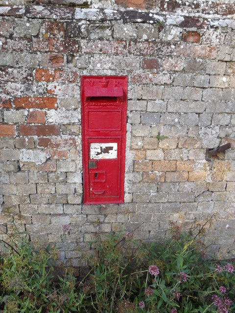
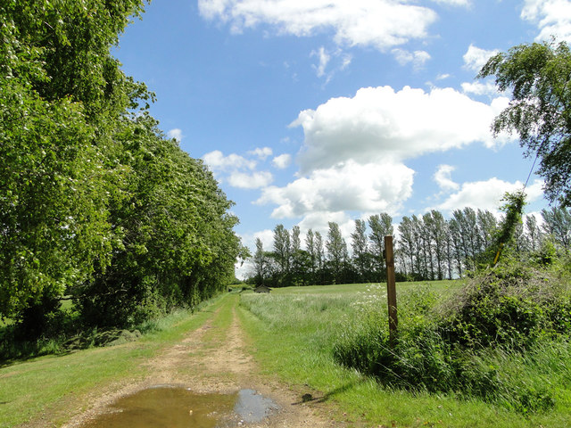
Bradfield St Clare Images

Images are sourced within 2km of 52.184332/0.79018736 or Grid Reference TL9057. Thanks to Geograph Open Source API. All images are credited.

A134 looking north, Bradfield Combust A route from Colchester to King's Lynn, next major place, Bury St Edmunds. Parts of its route are on a Roman alignment, as here, although the A134 pulls off the Roman line just ahead.
A134 looking north, Bradfield Combust
A route from Colchester to King's Lynn, next major place, Bury St Edmunds. Parts of its route are on a Roman alignment, as here, although the A134 pulls off the Roman line just ahead.
Lodge, Bradfield Combust Dated 1865. Surprisingly by William Eden Nesfield. Grade II listed.
On the other side of the entrance to Bradfield Hall stands a K6 phone box. Grade II listed.
Lodge, Bradfield Combust
Dated 1865. Surprisingly by William Eden Nesfield. Grade II listed. On the other side of the entrance to Bradfield Hall stands a K6 phone box. Grade II listed.
A134 The Street at Bradfield Combust At the junction with Ixer Lane
A134 The Street at Bradfield Combust
At the junction with Ixer Lane
Ixer Lane sign On Ixer Lane at the junction with the A134 The Street
Ixer Lane sign
On Ixer Lane at the junction with the A134 The Street
A134 The Street, Bradfield Combust At the junction with Ixer Lane
A134 The Street, Bradfield Combust
At the junction with Ixer Lane
Bradfield Combust Village sign Off the A134 The Street
Bradfield Combust Village sign
Off the A134 The Street
Bradfield Combust Village sign Off the A134 The Street 
(close up)
Bradfield Combust Village sign
Off the A134 The Street (close up)
Ixer Lane, Bradfield Combust
Ixer Lane Victorian Postbox On Ixer Lane 
Postbox No.IP30 2020
Ixer Lane Victorian Postbox
On Ixer Lane Postbox No.IP30 2020
Ixer Lane Victorian Postbox On Ixer Lane 
Postbox No.IP30 2020
(Close up)
Ixer Lane Victorian Postbox
On Ixer Lane Postbox No.IP30 2020 (Close up)
Bradfield Combust Village sign Off the A134 The Street
Bradfield Combust Village sign
Off the A134 The Street
Ixer Lane Victorian Postbox On Ixer Lane 
Postbox No.IP30 2020
Ixer Lane Victorian Postbox
On Ixer Lane Postbox No.IP30 2020
Ixer Lane, Bradfield Combust At the junction with the A134 The Street
Ixer Lane, Bradfield Combust
At the junction with the A134 The Street
Ixer Lane, Bradfield Combust Near the junction with the A134 The Street
Ixer Lane, Bradfield Combust
Near the junction with the A134 The Street
Bradfield Combust village sign (detail) Village signs are typically placed along the principal road or in a prominent location such as a village green or close by the church. The design often depicts a particularly feature of the village or a scene from its history, heritage, or culture. They are typically made of wood or metal or a combination of both, the designs are often made by the local community.
Although they do appear in villages and towns all over the country they are more prominent in East Anglia than elsewhere in the country.
Bradfield Combust village sign (detail)
Village signs are typically placed along the principal road or in a prominent location such as a village green or close by the church. The design often depicts a particularly feature of the village or a scene from its history, heritage, or culture. They are typically made of wood or metal or a combination of both, the designs are often made by the local community. Although they do appear in villages and towns all over the country they are more prominent in East Anglia than elsewhere in the country.
Bradfield Combust village sign and War Memorial The Memorial which is just independent of the village sign has the names of five men lost in WW1 and of four lost in WW2. Another Memorial can be seen in St. George's church.
Bradfield Combust village sign and War Memorial
The Memorial which is just independent of the village sign has the names of five men lost in WW1 and of four lost in WW2. Another Memorial can be seen in St. George's church.
A 134 Roman Road near Yew-tree Farm at Bradfield Combust
Sheepgate Lane, a bridleway
Show me another place!

Bradfield St Clare is located at Grid Ref: TL9057 (Lat: 52.184332, Lng: 0.79018736)

Administrative County: Suffolk

District: West Suffolk

Police Authority: Suffolk

What 3 Words

///outs.trickles.crumb. Near Thurston, Suffolk

Related Wikis

Bradfield St Clare

Bradfield St. Clare is a village and civil parish in the West Suffolk district of Suffolk, England, about six miles south of Bury St Edmunds. According...

Church of St Clare, Bradfield

The Church of St Clare, Bradfield is the Anglican parish church of Bradfield St Clare, in the district of West Suffolk, Suffolk. The original structure...

St Margaret's Church, Westhorpe

St Margaret's Church is the parish church of Westhorpe, Suffolk, England. It is part of the Badwell and Walsham Benefice. It is a Grade I listed building...

Bradfield Combust

Bradfield Combust (or Burnt Bradfield) is a village and former manor and civil parish, now in the parish of Bradfield Combust with Stanningfield, the West...

Welnetham railway station

Welnetham railway station was on the Long Melford-Bury St Edmunds branch line, serving Great Whelnetham, Little Whelnetham and Sicklesmere in Suffolk....

Bradfield Woods

Bradfield Woods is an 81.4-hectare (201-acre) biological Site of Special Scientific Interest between Bury St Edmunds and Stowmarket in Suffolk. The site...

Bradfield St George

Bradfield St. George is a village and civil parish in the West Suffolk district of Suffolk, England, about 6 miles (9.7 km) south of Bury St Edmunds. According...

Bradfield Combust with Stanningfield

Bradfield Combust with Stanningfield is a civil parish about 6 miles south of Bury St Edmunds, in the West Suffolk district of Suffolk, England. According...

Nearby Amenities

Located within 500m of 52.184332,0.79018736
Bradfield St Clare
Created By: Potlatch 0.10b
Place: village
Wikidata: Q1970691
Lat/Long: 52.1876009/0.7872639
Bus Stop
Bush Green
Naptan AtcoCode: 390050774
Naptan Bearing: S
Naptan CommonName: Bush Green
Naptan Indicator: adj
Naptan Landmark: Bush Green
Naptan NaptanCode: sufgjpwj
Naptan Street: Bury Road
Naptan Verified: no
Source: naptan_import
Lat/Long: 52.1807605/0.7939739
Bus Stop
Bush Green
Naptan AtcoCode: 390050775
Naptan Bearing: N
Naptan BusStopType: CUS
Naptan CommonName: Bush Green
Naptan Indicator: opp
Naptan Landmark: Bush Green
Naptan NaptanCode: sufgjpwm
Naptan Street: Bury Road
Naptan Verified: no
Source: naptan_import
Lat/Long: 52.1807471/0.7937124
Bus Stop
Church
Naptan AtcoCode: 390051065
Naptan Bearing: SE
Naptan BusStopType: CUS
Naptan CommonName: Church
Naptan Indicator: adj
Naptan Landmark: Church
Naptan NaptanCode: sufjgtjp
Naptan Street: Bury Road
Naptan Verified: no
Source: naptan_import
Lat/Long: 52.184385/0.7903228
Bus Stop
Church
Naptan AtcoCode: 390051066
Naptan Bearing: NW
Naptan BusStopType: CUS
Naptan CommonName: Church
Naptan Indicator: opp
Naptan Landmark: Church
Naptan NaptanCode: sufjgtjt
Naptan Street: Bury Road
Naptan Verified: no
Source: naptan_import
Lat/Long: 52.1842829/0.7902959
Post Box
Ref: IP30 2021
Lat/Long: 52.1860471/0.7857022
Man Made: water_tower
Lat/Long: 52.1849948/0.7971954
Bush Green
Place: hamlet
Lat/Long: 52.1805909/0.7935806
The data included in this document is from www.openstreetmap.org. The data is made available under ODbL.

Have you been to Bradfield St Clare?

Leave your review of Bradfield St Clare below (or comments, questions and feedback).