Welshwood Park

Settlement in Essex Colchester

England

Welshwood Park

Crockleford Heath, Essex A field of Borage near Crockleford Heath.
Crockleford Heath, Essex Credit: Rebecca A Wills

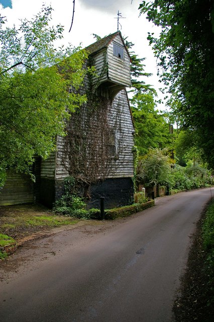
Welshwood Park is a picturesque residential area located in Essex, England. Situated in the heart of the county, this peaceful neighborhood offers a tranquil and idyllic setting for residents to enjoy.

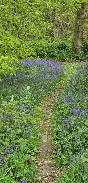
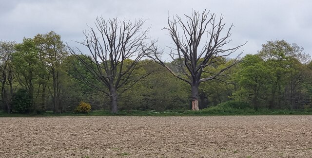
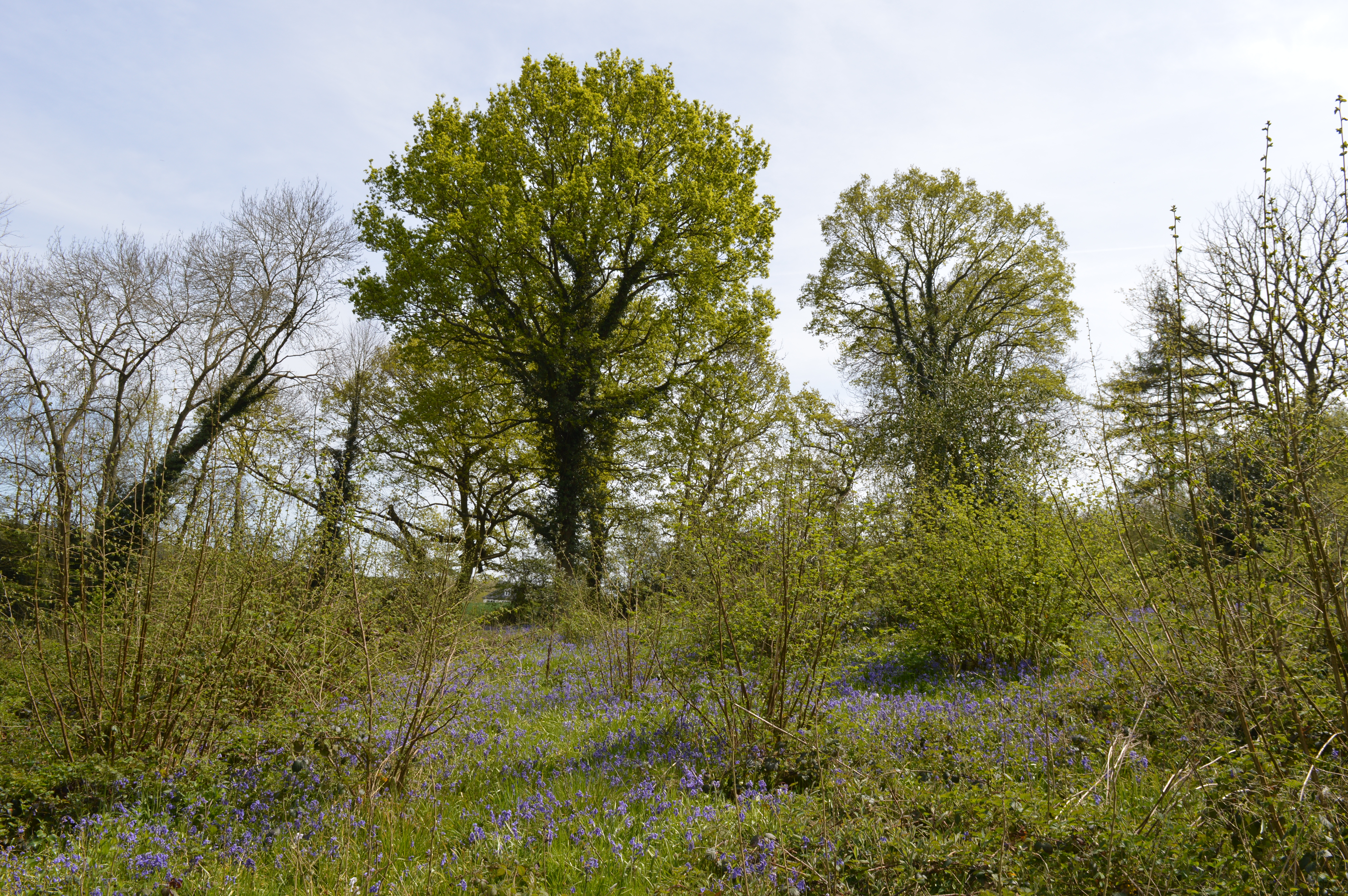
The park is known for its stunning natural beauty, with an abundance of lush greenery and well-maintained gardens. It boasts a variety of trees, including oak, beech, and birch, which contribute to the park's serene atmosphere. Additionally, there are several well-kept ponds scattered throughout the area, adding to the overall charm and providing habitats for various wildlife species.

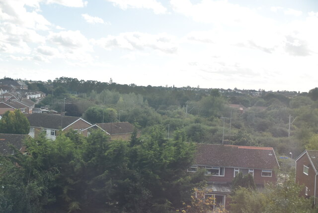
The residential properties in Welshwood Park are predominantly detached houses, reflecting a mix of architectural styles. These homes are renowned for their spaciousness and are set back from the road, providing ample privacy for residents. The area is popular with families and professionals alike, who appreciate the peaceful environment and proximity to local amenities.

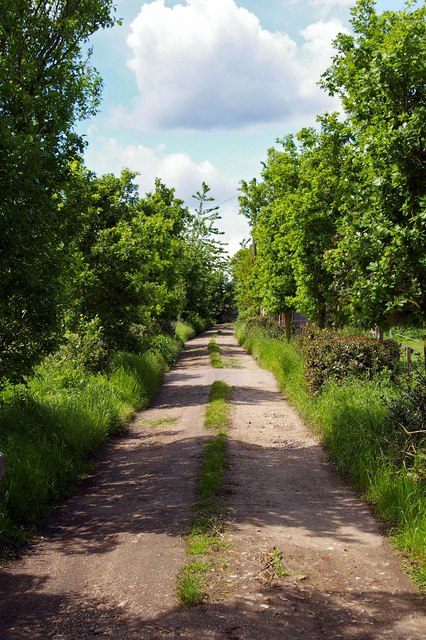
For recreational activities, Welshwood Park offers ample opportunities. The park features several well-maintained walking paths and cycling trails, perfect for outdoor enthusiasts and those looking to stay active. Additionally, there are several playgrounds for children to enjoy, ensuring that the whole family can make the most of the park's facilities.

Welshwood Park is conveniently located near a range of amenities. The nearby town center provides residents with easy access to shops, restaurants, and leisure facilities. Furthermore, the park benefits from excellent transport links, with convenient access to major roads and public transportation, making it an ideal location for commuters.

In conclusion, Welshwood Park in Essex is a stunning residential area that offers a peaceful and picturesque environment for its residents. With its beautiful natural surroundings, well-designed properties, and convenient amenities, it truly provides a high quality of life for those lucky enough to call it home.

If you have any feedback on the listing, please let us know in the comments section below.

Welshwood Park Images

Images are sourced within 2km of 51.901219/0.94430094 or Grid Reference TM0226. Thanks to Geograph Open Source API. All images are credited.

Crockleford Heath, Essex A field of Borage near Crockleford Heath.
Crockleford Heath, Essex
A field of Borage near Crockleford Heath.
Crockleford Heath, Essex Borage flowers in a field near Crockleford Heath, Essex.
Crockleford Heath, Essex
Borage flowers in a field near Crockleford Heath, Essex.
Crockleford Heath, Essex Farmland in the vicinity of Crockleford Heath.
Crockleford Heath, Essex
Farmland in the vicinity of Crockleford Heath.
Churn Wood, Essex A small track heading south through bluebells in Churn Wood.
Churn Wood, Essex
A small track heading south through bluebells in Churn Wood.
Crockleford Hill, Essex Looking across ploughed farmland towards a small copse near Crockleford Hill.
Crockleford Hill, Essex
Looking across ploughed farmland towards a small copse near Crockleford Hill.
Farmland near Colchester
Outskirts of Colchester
Ardleigh Reservoir This is a shot of Ardleigh Reservoir north of Colchester taken from the end of Lodge Lane. The picture looks west across the water. See also <a href="https://www.geograph.org.uk/gridref/TM0429">TM0429</a> & <a href="https://www.geograph.org.uk/gridref/TM0329">TM0329</a>
Ardleigh Reservoir
This is a shot of Ardleigh Reservoir north of Colchester taken from the end of Lodge Lane. The picture looks west across the water. See also TM0429 & TM0329
Sir Charles Lucas Arts College Comprehensive School named after the leader of the Royalist Army during the siege of Colchester in the English Civil War.
Sir Charles Lucas Arts College
Comprehensive School named after the leader of the Royalist Army during the siege of Colchester in the English Civil War.
Wycliffe Baptist Church In Parsons Heath
Wycliffe Baptist Church
In Parsons Heath
The Rovers Tye Public House and Restaurant on Ipswich Road.  The original building is 200 years old and has previously been a farmhouse and a butchers.
The Rovers Tye
Public House and Restaurant on Ipswich Road. The original building is 200 years old and has previously been a farmhouse and a butchers.
St Johns Ambulance Station This is the St Johns Ambulance Station and Garage in Greensted Rd Colchester
St Johns Ambulance Station
This is the St Johns Ambulance Station and Garage in Greensted Rd Colchester
Unofficial Path This path leads out of High Woods Country Park north of Colchester. However it is of little use to the average walker as you are confronted with the back garden gates of Friars Close (behind the photographer)  and no way to reach a public road or right of way.
Unofficial Path
This path leads out of High Woods Country Park north of Colchester. However it is of little use to the average walker as you are confronted with the back garden gates of Friars Close (behind the photographer) and no way to reach a public road or right of way.
Fen Farm footpath This footpath/private Road  near Fen Farm,  Fox Street runs from the A137 to A12/A120 Junction at TM019289
Fen Farm footpath
This footpath/private Road near Fen Farm, Fox Street runs from the A137 to A12/A120 Junction at TM019289
Henless Huts These abandoned chicken sheds are on Fen Farm, Fox Street north of Colchester.
Henless Huts
These abandoned chicken sheds are on Fen Farm, Fox Street north of Colchester.
Springvalley Lane Mill This mill near Ardleigh north of Colchester looks to be at the start of an extensive restoration it is a tad dilapidated at the moment.
Springvalley Lane Mill
This mill near Ardleigh north of Colchester looks to be at the start of an extensive restoration it is a tad dilapidated at the moment.
A120 This is the A120 looking coast bound from the flyover on Springvalley Lane near Ardleigh.
A120
This is the A120 looking coast bound from the flyover on Springvalley Lane near Ardleigh.
Springvalley Lane This is Springvalley Lane and the mill near Ardleigh north of Colchester.
Springvalley Lane
This is Springvalley Lane and the mill near Ardleigh north of Colchester.
Show me another place!

Welshwood Park is located at Grid Ref: TM0226 (Lat: 51.901219, Lng: 0.94430094)

Administrative County: Essex

District: Colchester

Police Authority: Essex

What 3 Words

///fades.hook.trails. Near Colchester, Essex

Related Wikis

Welsh Wood

Welsh Wood is a 3.2 hectare Local Nature Reserve in Colchester in Essex. It is owned and managed by Colchester Borough Council.Trees in this site are managed...

Colchester Academy

Colchester Academy, formerly Sir Charles Lucas Arts College, is a secondary school in Colchester, Essex specialising in English and Health Sciences. It...

Bullock Wood

Bullock Wood is a 23.3-hectare (58-acre) biological Site of Special Scientific Interest on the northern outskirts of Colchester in Essex.The site is mature...

Crockleford Heath

Crockleford Heath is part of the village and civil parish of Ardleigh in Essex. It is located 2+1⁄2 miles south-west of the village centre.Crockleford...

Nearby Amenities

Located within 500m of 51.901219,0.94430094
Mini Roundabout
Direction: clockwise
Lat/Long: 51.899622/0.9376966
Bus Stop
St. John's Road
Naptan AtcoCode: 150033020001
Naptan Bearing: S
Naptan CommonName: St. John's Road
Naptan Crossing: St. John's Road
Naptan Indicator: Opp
Naptan Landmark: St. John's Road
Naptan NaptanCode: esxamgat
Naptan PlusbusZoneRef: CLCHSTR
Naptan Street: Parson's Heath
Naptan Verified: no
Public Transport: platform
Source: naptan_import
Lat/Long: 51.8994837/0.937696
Bus Stop
St. John's Road
Naptan AtcoCode: 150033020002
Naptan Bearing: N
Naptan CommonName: St. John's Road
Naptan Crossing: St. John's Road
Naptan Indicator: Adj
Naptan Landmark: St. John's Road
Naptan NaptanCode: esxamgaw
Naptan PlusbusZoneRef: CLCHSTR
Naptan Street: Parson's Heath
Public Transport: platform
Source: naptan_import
Timetable Case: yes
Lat/Long: 51.8998814/0.937809
Bus Stop
Welshwood Park
Naptan AtcoCode: 150033020003
Naptan Bearing: SW
Naptan CommonName: Welshwood Park
Naptan Indicator: Adj
Naptan Landmark: Welshwood Park
Naptan NaptanCode: esxamgdg
Naptan PlusbusZoneRef: CLCHSTR
Naptan Street: Parson's Heath
Naptan Verified: no
Public Transport: platform
Source: naptan_import
Lat/Long: 51.901921/0.9394981
Bus Stop
Welshwood Park
Naptan AtcoCode: 150033020004
Naptan Bearing: NE
Naptan CommonName: Welshwood Park
Naptan Indicator: Opp
Naptan Landmark: Welshwood Park
Naptan NaptanCode: esxamgda
Naptan PlusbusZoneRef: CLCHSTR
Naptan Street: Parson's Heath
Naptan Verified: no
Public Transport: platform
Source: naptan_import
Lat/Long: 51.9022582/0.9396801
Bus Stop
Parson's Heath
Naptan AtcoCode: 1500IM67
Naptan Bearing: S
Naptan CommonName: Parson's Heath
Naptan Crossing: Parson's Heath
Naptan Indicator: Towards
Naptan Landmark: Parson's Heath
Naptan NaptanCode: esxamjdj
Naptan PlusbusZoneRef: CLCHSTR
Naptan Street: St. John's Road
Public Transport: platform
Source: naptan_import
Lat/Long: 51.8999766/0.9374581
Bus Stop
Parson's Heath
Naptan AtcoCode: 1500IM67B
Naptan Bearing: N
Naptan CommonName: Parson's Heath
Naptan Crossing: Parson's Heath
Naptan Indicator: From
Naptan Landmark: Parson's Heath
Naptan NaptanCode: esxamjdg
Naptan PlusbusZoneRef: CLCHSTR
Naptan Street: St. John's Road
Public Transport: platform
Source: naptan_import
Lat/Long: 51.9001055/0.9372845
Turning Circle
Lat/Long: 51.9005135/0.942135
Post Box
Postal Code: CO4 3JB
Ref: CO4 426
Lat/Long: 51.9020788/0.9401963
Power: pole
Lat/Long: 51.8986218/0.9494607
Bench
Lat/Long: 51.9035114/0.9406829
Waste Basket
Lat/Long: 51.9035011/0.9406547
Man Made: tower
Tower Type: communication
Lat/Long: 51.8989383/0.9382005
Man Made: tower
Tower Type: communication
Lat/Long: 51.8990637/0.938236
Power: pole
Lat/Long: 51.9009675/0.9485592
Power: pole
Lat/Long: 51.9017853/0.9492565
Power: pole
Lat/Long: 51.9026366/0.9500035
Power: pole
Lat/Long: 51.9039525/0.9500692
Power: pole
Transformer: distribution
Lat/Long: 51.9042934/0.9495388
Power: pole
Lat/Long: 51.8998808/0.9468149
Power: pole
Lat/Long: 51.9001869/0.9471393
Power: pole
Lat/Long: 51.8992468/0.9481438
Waste Basket
Waste: dog_excrement
Lat/Long: 51.9034551/0.9404917
The data included in this document is from www.openstreetmap.org. The data is made available under ODbL.

Have you been to Welshwood Park?

Leave your review of Welshwood Park below (or comments, questions and feedback).