Parson's Heath

Settlement in Essex Colchester

England

Parson's Heath

Churn Wood, Essex A small track heading south through bluebells in Churn Wood.
Churn Wood, Essex Credit: Rebecca A Wills

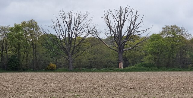
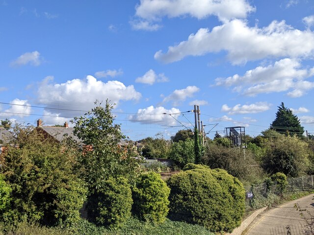
Parson's Heath is a small village located in the county of Essex, England. Situated approximately 4 miles to the west of the town of Colchester, it falls within the borough of Colchester and is part of the civil parish of West Bergholt. The village is surrounded by picturesque countryside, offering residents a peaceful and idyllic setting.

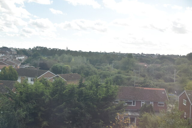
Parson's Heath is primarily a residential area, with a mix of housing options including detached houses, semi-detached houses, and bungalows. The village is known for its close-knit community atmosphere, with friendly and welcoming residents. The village also benefits from a range of local amenities, including a convenience store, post office, and a village hall.

The village is well-connected to the nearby town of Colchester, where residents can access a wider range of facilities including shops, supermarkets, restaurants, and leisure facilities. The area is also served by reliable public transport links, making it easy to travel to and from Parson's Heath.

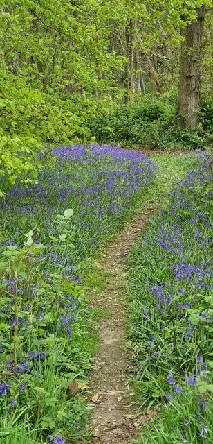
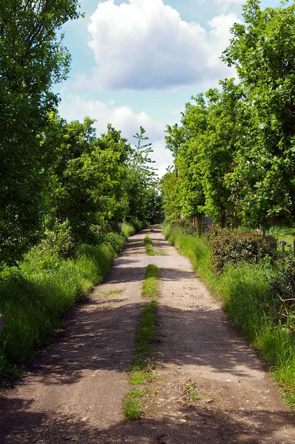
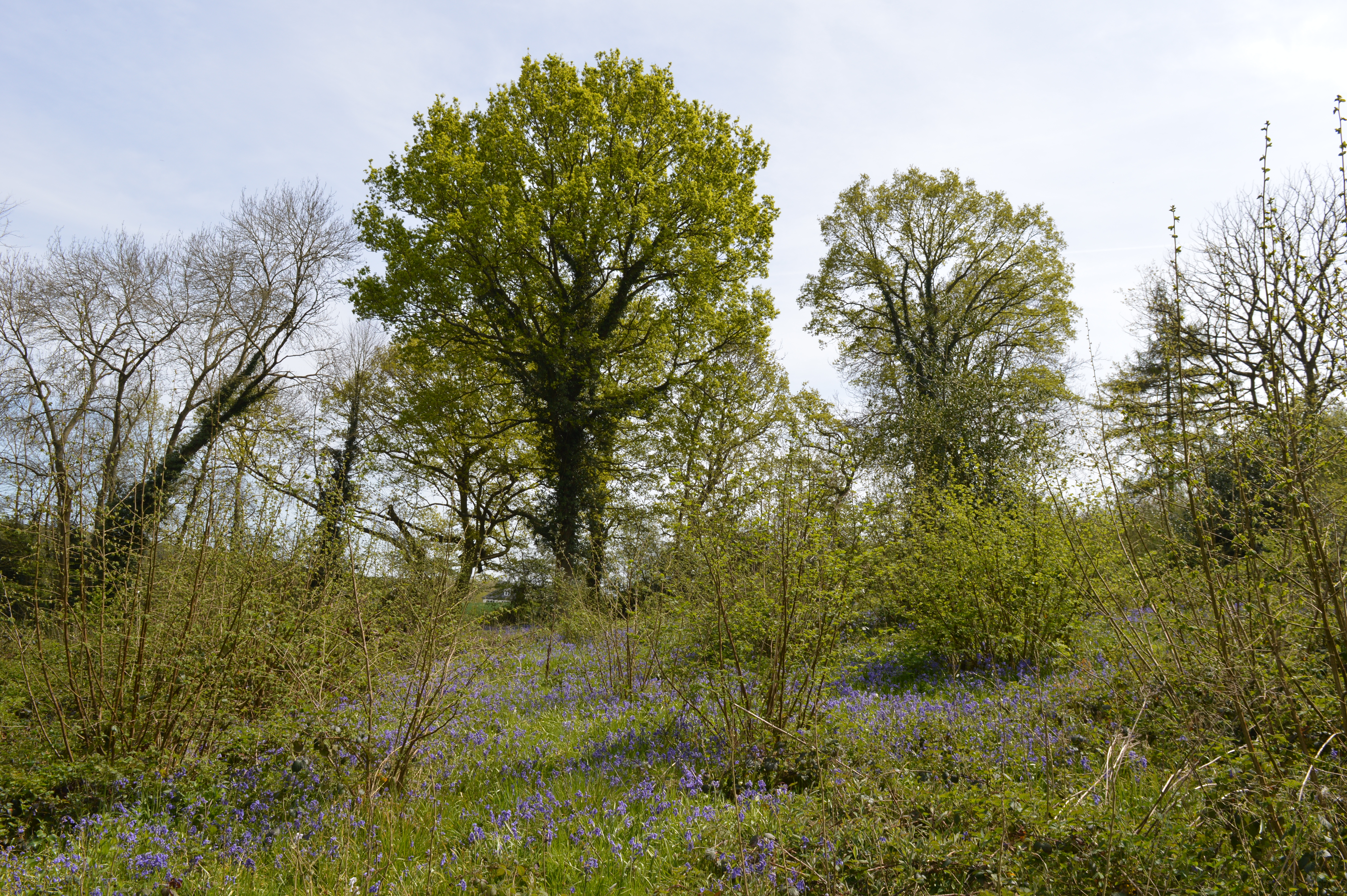
For those who enjoy outdoor activities, Parson's Heath offers plenty of opportunities for walking, cycling, and exploring the surrounding countryside. The nearby Dedham Vale Area of Outstanding Natural Beauty is a popular destination for nature enthusiasts, offering stunning landscapes and picturesque villages.

Overall, Parson's Heath is a charming and peaceful village, providing residents with a tranquil and rural lifestyle while still being within easy reach of larger towns and cities.

If you have any feedback on the listing, please let us know in the comments section below.

Parson's Heath Images

Images are sourced within 2km of 51.897355/0.940111 or Grid Reference TM0226. Thanks to Geograph Open Source API. All images are credited.

Churn Wood, Essex A small track heading south through bluebells in Churn Wood.
Churn Wood, Essex
A small track heading south through bluebells in Churn Wood.
Crockleford Hill, Essex Looking across ploughed farmland towards a small copse near Crockleford Hill.
Crockleford Hill, Essex
Looking across ploughed farmland towards a small copse near Crockleford Hill.
Farmland near Colchester
Outskirts of Colchester
Lots of vans, Colchester
Joining the main line from the Colchester Town chord
Train line entering Colchester
The Olde Siege House The Olde Siege House (East Bay Colchester). This 15th Century timber framed terrace of three houses (now one property) played a significant role in the siege of Colchester, which took place during the second phase of the English Civil War in the summer of 1648. The Parliamentarian town was taken by the Royalists and was promptly besieged for eleven weeks by Cromwell’s New Model Army. The civil war was finally brought to an end by the signing of a surrender document in the prophetically named “King’s Head Inn”. The red rings on the beams of the building are purported to surround bullet holes from the siege. However my father maintained to the end that he saw red rings being added to the building during his childhood in the early 1930’s..... around holes created with a brace and bit!
The Olde Siege House
The Olde Siege House (East Bay Colchester). This 15th Century timber framed terrace of three houses (now one property) played a significant role in the siege of Colchester, which took place during the second phase of the English Civil War in the summer of 1648. The Parliamentarian town was taken by the Royalists and was promptly besieged for eleven weeks by Cromwell’s New Model Army. The civil war was finally brought to an end by the signing of a surrender document in the prophetically named “King’s Head Inn”. The red rings on the beams of the building are purported to surround bullet holes from the siege. However my father maintained to the end that he saw red rings being added to the building during his childhood in the early 1930’s..... around holes created with a brace and bit!
Sir Charles Lucas Arts College Comprehensive School named after the leader of the Royalist Army during the siege of Colchester in the English Civil War.
Sir Charles Lucas Arts College
Comprehensive School named after the leader of the Royalist Army during the siege of Colchester in the English Civil War.
Wycliffe Baptist Church In Parsons Heath
Wycliffe Baptist Church
In Parsons Heath
The Rovers Tye Public House and Restaurant on Ipswich Road.  The original building is 200 years old and has previously been a farmhouse and a butchers.
The Rovers Tye
Public House and Restaurant on Ipswich Road. The original building is 200 years old and has previously been a farmhouse and a butchers.
St Johns Ambulance Station This is the St Johns Ambulance Station and Garage in Greensted Rd Colchester
St Johns Ambulance Station
This is the St Johns Ambulance Station and Garage in Greensted Rd Colchester
Unofficial Path This path leads out of High Woods Country Park north of Colchester. However it is of little use to the average walker as you are confronted with the back garden gates of Friars Close (behind the photographer)  and no way to reach a public road or right of way.
Unofficial Path
This path leads out of High Woods Country Park north of Colchester. However it is of little use to the average walker as you are confronted with the back garden gates of Friars Close (behind the photographer) and no way to reach a public road or right of way.
Further Meadow This meadow in High Woods Country Park has never been cultivated due to the soggy nature of the soil. It is now periodically grazed to maintain the habitat for wildlife.
Further Meadow
This meadow in High Woods Country Park has never been cultivated due to the soggy nature of the soil. It is now periodically grazed to maintain the habitat for wildlife.
Fen Farm footpath This footpath/private Road  near Fen Farm,  Fox Street runs from the A137 to A12/A120 Junction at TM019289
Fen Farm footpath
This footpath/private Road near Fen Farm, Fox Street runs from the A137 to A12/A120 Junction at TM019289
Henless Huts These abandoned chicken sheds are on Fen Farm, Fox Street north of Colchester.
Henless Huts
These abandoned chicken sheds are on Fen Farm, Fox Street north of Colchester.
St. Leonard's church, Hythe, Essex Hythe is no longer a village as Colchester has swallowed it up. It still has a few interesting old buildings, which includes this 14th century church.
St. Leonard's church, Hythe, Essex
Hythe is no longer a village as Colchester has swallowed it up. It still has a few interesting old buildings, which includes this 14th century church.
Tesco at High Wood, Colchester, Essex Looking at the grid reference for this picture on the 1940s O/S map, this Tesco stands on, what was once, the grounds of Maynard Hall.
Tesco at High Wood, Colchester, Essex
Looking at the grid reference for this picture on the 1940s O/S map, this Tesco stands on, what was once, the grounds of Maynard Hall.
Show me another place!

Parson's Heath is located at Grid Ref: TM0226 (Lat: 51.897355, Lng: 0.940111)

Administrative County: Essex

District: Colchester

Police Authority: Essex

What 3 Words

///heave.animal.warns. Near Colchester, Essex

Related Wikis

Welsh Wood

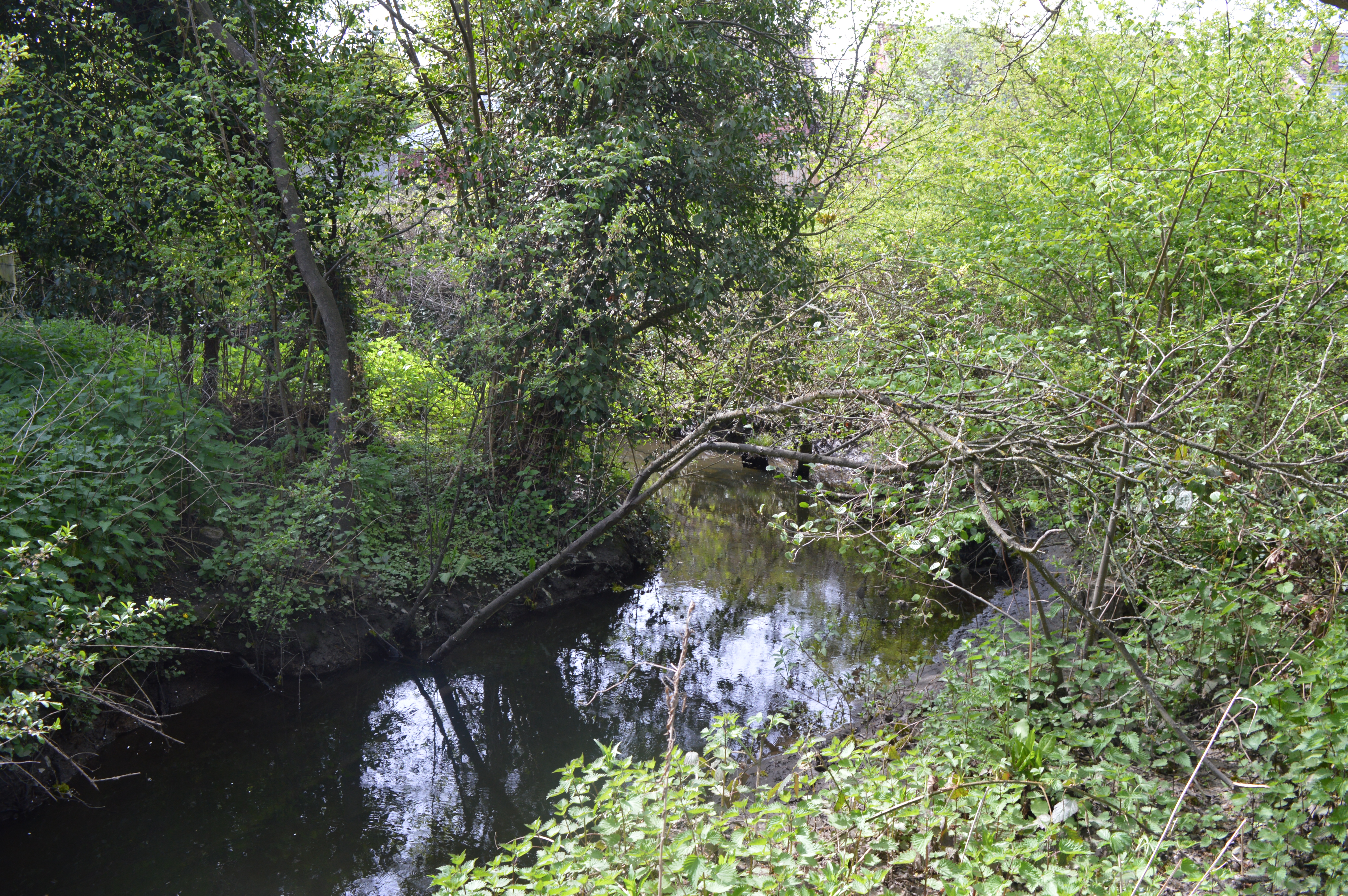
Welsh Wood is a 3.2 hectare Local Nature Reserve in Colchester in Essex. It is owned and managed by Colchester Borough Council.Trees in this site are managed...

Colchester Academy

Colchester Academy, formerly Sir Charles Lucas Arts College, is a secondary school in Colchester, Essex specialising in English and Health Sciences. It...

Salary Brook Local Nature Reserve

Salary Brook Local Nature Reserve is a 17.1 hectare Local Nature Reserve covering a stretch of Salary Brook and its banks on the south-east outskirts of...

Magic Roundabout (Colchester)

The Greenstead roundabout is a large roundabout junction in Colchester, Essex, England.It is a "magic roundabout", where traffic travels both directions...

Nearby Amenities

Located within 500m of 51.897355,0.940111
Mini Roundabout
Direction: clockwise
Lat/Long: 51.899622/0.9376966
Mini Roundabout
Direction: clockwise
Lat/Long: 51.8970973/0.9366667
Crossing
Crossing: zebra
Lat/Long: 51.8971047/0.9353877
Bus Stop
Bromley Road
Naptan AtcoCode: 150033019008
Naptan Bearing: E
Naptan CommonName: Bromley Road
Naptan Crossing: Bromley Road
Naptan Indicator: Adj
Naptan Landmark: Bromley Road
Naptan NaptanCode: esxamgam
Naptan PlusbusZoneRef: CLCHSTR
Naptan Street: Harwich Road
Public Transport: platform
Source: naptan_import
Lat/Long: 51.8971595/0.9358724
Bus Stop
Bromley Road
Bench: yes
Bus: yes
Naptan AtcoCode: 150033019009
Naptan Bearing: W
Naptan BusStopType: CUS
Naptan CommonName: Bromley Road
Naptan Crossing: Bromley Road
Naptan Indicator: Opp
Naptan Landmark: Bromley Road
Naptan NaptanCode: esxamgap
Naptan PlusbusZoneRef: CLCHSTR
Naptan Street: Harwich Road
Public Transport: platform
Shelter: yes
Source: naptan_import
Waste Basket: yes
Lat/Long: 51.8970448/0.9363157
Bus Stop
St. John's Road
Naptan AtcoCode: 150033020001
Naptan Bearing: S
Naptan CommonName: St. John's Road
Naptan Crossing: St. John's Road
Naptan Indicator: Opp
Naptan Landmark: St. John's Road
Naptan NaptanCode: esxamgat
Naptan PlusbusZoneRef: CLCHSTR
Naptan Street: Parson's Heath
Naptan Verified: no
Public Transport: platform
Source: naptan_import
Lat/Long: 51.8994837/0.937696
Bus Stop
St. John's Road
Naptan AtcoCode: 150033020002
Naptan Bearing: N
Naptan CommonName: St. John's Road
Naptan Crossing: St. John's Road
Naptan Indicator: Adj
Naptan Landmark: St. John's Road
Naptan NaptanCode: esxamgaw
Naptan PlusbusZoneRef: CLCHSTR
Naptan Street: Parson's Heath
Public Transport: platform
Source: naptan_import
Timetable Case: yes
Lat/Long: 51.8998814/0.937809
Bus Stop
Brinkley Crescent
Naptan AtcoCode: 150033021005
Naptan Bearing: W
Naptan CommonName: Brinkley Crescent
Naptan Crossing: Brinkley Crescent
Naptan Indicator: Opp
Naptan Landmark: Brinkley Crescent
Naptan NaptanCode: esxamagd
Naptan PlusbusZoneRef: CLCHSTR
Naptan Street: Hazelton Road
Public Transport: platform
Source: naptan_import
Lat/Long: 51.8995369/0.9340784
Bus Stop
Brinkley Crescent
Naptan AtcoCode: 150033021006
Naptan Bearing: E
Naptan CommonName: Brinkley Crescent
Naptan Crossing: Brinkley Crescent
Naptan Indicator: Adj
Naptan Landmark: Brinkley Crescent
Naptan NaptanCode: esxamaga
Naptan PlusbusZoneRef: CLCHSTR
Naptan Street: Hazelton Road
Public Transport: platform
Source: naptan_import
Lat/Long: 51.899636/0.9343106
Bus Stop
Broadmead Road
Naptan AtcoCode: 150033021007
Naptan Bearing: N
Naptan CommonName: Broadmead Road
Naptan Indicator: N-bound
Naptan Landmark: Broadmead Road
Naptan NaptanCode: esxamagj
Naptan PlusbusZoneRef: CLCHSTR
Naptan Street: Broadmead Road
Public Transport: platform
Source: naptan_import
Lat/Long: 51.8987831/0.9353562
Bus Stop
Salary Close
Bus: yes
Naptan AtcoCode: 150033022001
Naptan Bearing: W
Naptan CommonName: Salary Close
Naptan Crossing: Salary Close
Naptan Indicator: Adj
Naptan Landmark: Salary Close
Naptan NaptanCode: esxamgdj
Naptan PlusbusZoneRef: CLCHSTR
Naptan Street: Bromley Road
Naptan Verified: no
Public Transport: platform
Source: naptan_import
Lat/Long: 51.8956298/0.9423499
Bus Stop
Salary Close
Bus: yes
Naptan AtcoCode: 150033022002
Naptan Bearing: E
Naptan CommonName: Salary Close
Naptan Crossing: Salary Close
Naptan Indicator: Opp
Naptan Landmark: Salary Close
Naptan NaptanCode: esxamgdm
Naptan PlusbusZoneRef: CLCHSTR
Naptan Street: Bromley Road
Naptan Verified: no
Public Transport: platform
Source: naptan_import
Lat/Long: 51.8958359/0.943302
Bus Stop
Owls Retreat
Naptan AtcoCode: 150033023001
Naptan Bearing: SE
Naptan CommonName: Owls Retreat
Naptan Indicator: Adj
Naptan Landmark: Owls Retreat
Naptan NaptanCode: esxamgdp
Naptan PlusbusZoneRef: CLCHSTR
Naptan Street: Longridge
Naptan Verified: no
Public Transport: platform
Source: naptan_import
Lat/Long: 51.8957891/0.9458865
Bus Stop
Hazlemere School
Naptan AtcoCode: 150033025010
Naptan Bearing: S
Naptan CommonName: Hazlemere School
Naptan Indicator: o/s
Naptan Landmark: Hazlemere School
Naptan NaptanCode: esxamgpw
Naptan PlusbusZoneRef: CLCHSTR
Naptan Street: Hawthorn Avenue
Naptan Verified: no
Public Transport: platform
Source: naptan_import
Lat/Long: 51.8959183/0.938475
Bus Stop
Hazlemere School
Naptan AtcoCode: 150033025011
Naptan Bearing: NE
Naptan CommonName: Hazlemere School
Naptan Indicator: Opp
Naptan Landmark: Hazlemere School
Naptan NaptanCode: esxamgta
Naptan PlusbusZoneRef: CLCHSTR
Naptan Street: Hawthorn Avenue
Naptan Verified: no
Public Transport: platform
Source: naptan_import
Lat/Long: 51.8960746/0.938433
Bus Stop
Sir Charles Lucas School
Naptan AtcoCode: 1500IM1853
Naptan Bearing: NE
Naptan BusStopType: CUS
Naptan CommonName: Sir Charles Lucas School
Naptan Indicator: o/s
Naptan Landmark: Sir Charles Lucas School
Naptan NaptanCode: esxamgpm
Naptan PlusbusZoneRef: CLCHSTR
Naptan Street: Hawthorn Avenue
Naptan Verified: yes
Public Transport: platform
Source: naptan_import
Lat/Long: 51.8942256/0.9372074
Bus Stop
Sir Charles Lucas School
Layby: yes
Naptan AtcoCode: 1500IM1853A
Naptan Bearing: SW
Naptan CommonName: Sir Charles Lucas School
Naptan Indicator: Opp
Naptan Landmark: Sir Charles Lucas School
Naptan NaptanCode: esxamgpt
Naptan PlusbusZoneRef: CLCHSTR
Naptan Street: Hawthorn Avenue
Naptan Verified: yes
Public Transport: platform
Source: naptan_import
Lat/Long: 51.8943505/0.937608
Bus Stop
Parson's Heath
Naptan AtcoCode: 1500IM67
Naptan Bearing: S
Naptan CommonName: Parson's Heath
Naptan Crossing: Parson's Heath
Naptan Indicator: Towards
Naptan Landmark: Parson's Heath
Naptan NaptanCode: esxamjdj
Naptan PlusbusZoneRef: CLCHSTR
Naptan Street: St. John's Road
Public Transport: platform
Source: naptan_import
Lat/Long: 51.8999766/0.9374581
Bus Stop
Parson's Heath
Naptan AtcoCode: 1500IM67B
Naptan Bearing: N
Naptan CommonName: Parson's Heath
Naptan Crossing: Parson's Heath
Naptan Indicator: From
Naptan Landmark: Parson's Heath
Naptan NaptanCode: esxamjdg
Naptan PlusbusZoneRef: CLCHSTR
Naptan Street: St. John's Road
Public Transport: platform
Source: naptan_import
Lat/Long: 51.9001055/0.9372845
Turning Circle
Lat/Long: 51.8964707/0.9445454
Turning Circle
Lat/Long: 51.8951544/0.9451366
Turning Circle
Lat/Long: 51.9005135/0.942135
Bus Stop
Templewood Road
Naptan AtcoCode: 150033021008
Naptan NaptanCode: esxamagm
Public Transport: platform
Lat/Long: 51.8984881/0.9368058
Turning Circle
Lat/Long: 51.8989177/0.9345177
Traffic Calming: hump
Lat/Long: 51.8961554/0.9386251
Crossing
Crossing: zebra
Lat/Long: 51.896267/0.9390669
Entrance: main
Lat/Long: 51.9003627/0.9357533
Generator Location: roof
Generator Method: photovoltaic
Generator Output Electricity: yes
Generator Source: solar
Generator Type: solar_photovoltaic_panel
Power: generator
Lat/Long: 51.8930796/0.941431
Generator Location: roof
Generator Method: photovoltaic
Generator Output Electricity: yes
Generator Source: solar
Generator Type: solar_photovoltaic_panel
Power: generator
Lat/Long: 51.8930882/0.9408012
Generator Location: roof
Generator Method: photovoltaic
Generator Output Electricity: yes
Generator Source: solar
Generator Type: solar_photovoltaic_panel
Power: generator
Lat/Long: 51.8930925/0.9406859
Generator Method: photovoltaic
Generator Output Electricity: yes
Generator Source: solar
Generator Type: solar_photovoltaic_panel
Power: generator
Lat/Long: 51.8929359/0.9401853
Generator Method: photovoltaic
Generator Output Electricity: yes
Generator Source: solar
Generator Type: solar_photovoltaic_panel
Power: generator
Lat/Long: 51.8929415/0.9400768
Generator Method: photovoltaic
Generator Output Electricity: yes
Generator Source: solar
Generator Type: solar_photovoltaic_panel
Power: generator
Lat/Long: 51.8929401/0.9399753
Generator Location: roof
Generator Method: photovoltaic
Generator Output Electricity: yes
Generator Source: solar
Generator Type: solar_photovoltaic_panel
Power: generator
Lat/Long: 51.8933459/0.940176
Generator Location: roof
Generator Method: photovoltaic
Generator Output Electricity: yes
Generator Source: solar
Generator Type: solar_photovoltaic_panel
Power: generator
Lat/Long: 51.8933629/0.940469
Generator Location: roof
Generator Method: photovoltaic
Generator Output Electricity: yes
Generator Source: solar
Generator Type: solar_photovoltaic_panel
Power: generator
Lat/Long: 51.8933288/0.9402891
Generator Location: roof
Generator Method: photovoltaic
Generator Output Electricity: yes
Generator Source: solar
Generator Type: solar_photovoltaic_panel
Power: generator
Lat/Long: 51.8929928/0.9384344
Generator Location: roof
Generator Method: photovoltaic
Generator Output Electricity: yes
Generator Source: solar
Generator Type: solar_photovoltaic_panel
Power: generator
Lat/Long: 51.8930811/0.938349
Generator Location: roof
Generator Method: photovoltaic
Generator Output Electricity: yes
Generator Source: solar
Generator Type: solar_photovoltaic_panel
Power: generator
Lat/Long: 51.8931551/0.9383006
Generator Location: roof
Generator Method: photovoltaic
Generator Output Electricity: yes
Generator Source: solar
Generator Type: solar_photovoltaic_panel
Power: generator
Lat/Long: 51.893222/0.9381876
Generator Location: roof
Generator Method: photovoltaic
Generator Output Electricity: yes
Generator Source: solar
Generator Type: solar_photovoltaic_panel
Power: generator
Lat/Long: 51.8932291/0.9380745
Generator Location: roof
Generator Method: photovoltaic
Generator Output Electricity: yes
Generator Source: solar
Generator Type: solar_photovoltaic_panel
Power: generator
Lat/Long: 51.8932391/0.93795
Generator Location: roof
Generator Method: photovoltaic
Generator Output Electricity: yes
Generator Source: solar
Generator Type: solar_photovoltaic_panel
Power: generator
Lat/Long: 51.8934782/0.9386789
Generator Location: roof
Generator Method: photovoltaic
Generator Output Electricity: yes
Generator Source: solar
Generator Type: solar_photovoltaic_panel
Power: generator
Lat/Long: 51.8931693/0.9390526
Generator Location: roof
Generator Method: photovoltaic
Generator Output Electricity: yes
Generator Source: solar
Generator Type: solar_photovoltaic_panel
Power: generator
Lat/Long: 51.893085/0.9390648
Generator Location: roof
Generator Method: photovoltaic
Generator Output Electricity: yes
Generator Source: solar
Generator Type: solar_photovoltaic_panel
Power: generator
Lat/Long: 51.8932487/0.9390032
Generator Location: roof
Generator Method: photovoltaic
Generator Output Electricity: yes
Generator Source: solar
Generator Type: solar_photovoltaic_panel
Power: generator
Lat/Long: 51.8949405/0.9345552
Generator Location: roof
Generator Method: photovoltaic
Generator Output Electricity: yes
Generator Source: solar
Generator Type: solar_photovoltaic_panel
Power: generator
Lat/Long: 51.8949719/0.934684
Generator Location: roof
Generator Method: photovoltaic
Generator Output Electricity: yes
Generator Source: solar
Generator Type: solar_photovoltaic_panel
Power: generator
Lat/Long: 51.8951259/0.9338713
Generator Location: roof
Generator Method: photovoltaic
Generator Output Electricity: yes
Generator Source: solar
Generator Type: solar_photovoltaic_panel
Power: generator
Lat/Long: 51.8952351/0.9354135
Generator Location: roof
Generator Method: photovoltaic
Generator Output Electricity: yes
Generator Source: solar
Generator Type: solar_photovoltaic_panel
Power: generator
Lat/Long: 51.8958823/0.937165
Generator Location: roof
Generator Method: photovoltaic
Generator Output Electricity: yes
Generator Source: solar
Generator Type: solar_photovoltaic_panel
Power: generator
Lat/Long: 51.895874/0.9381548
Generator Location: roof
Generator Method: photovoltaic
Generator Output Electricity: yes
Generator Source: solar
Generator Type: solar_photovoltaic_panel
Power: generator
Lat/Long: 51.8963764/0.9375365
Generator Method: photovoltaic
Generator Output Electricity: yes
Generator Source: solar
Generator Type: solar_photovoltaic_panel
Location: roof
Power: generator
Lat/Long: 51.8937016/0.9374082
Generator Method: photovoltaic
Generator Output Electricity: yes
Generator Source: solar
Generator Type: solar_photovoltaic_panel
Location: roof
Power: generator
Lat/Long: 51.8936403/0.9375606
Generator Method: photovoltaic
Generator Output Electricity: yes
Generator Source: solar
Generator Type: solar_photovoltaic_panel
Location: roof
Power: generator
Lat/Long: 51.8946988/0.9349677
Generator Method: photovoltaic
Generator Output Electricity: yes
Generator Source: solar
Generator Type: solar_photovoltaic_panel
Location: roof
Power: generator
Lat/Long: 51.8946498/0.934514
Generator Method: photovoltaic
Generator Output Electricity: yes
Generator Source: solar
Generator Type: solar_photovoltaic_panel
Location: roof
Power: generator
Lat/Long: 51.8960957/0.9349671
Generator Method: photovoltaic
Generator Output Electricity: yes
Generator Source: solar
Generator Type: solar_photovoltaic_panel
Location: roof
Power: generator
Lat/Long: 51.8960957/0.9350234
Generator Method: photovoltaic
Generator Output Electricity: yes
Generator Source: solar
Generator Type: solar_photovoltaic_panel
Location: roof
Power: generator
Lat/Long: 51.8962695/0.9359944
Generator Method: photovoltaic
Generator Output Electricity: yes
Generator Source: solar
Generator Type: solar_photovoltaic_panel
Location: roof
Power: generator
Lat/Long: 51.8952565/0.9347767
Generator Method: photovoltaic
Generator Output Electricity: yes
Generator Source: solar
Generator Type: solar_photovoltaic_panel
Location: roof
Power: generator
Lat/Long: 51.8952532/0.9348276
Generator Method: photovoltaic
Generator Output Electricity: yes
Generator Source: solar
Generator Type: solar_photovoltaic_panel
Location: roof
Power: generator
Lat/Long: 51.8954386/0.9355035
Crossing
Crossing: zebra
Lat/Long: 51.8971823/0.9368366
Crossing
Crossing: zebra
Lat/Long: 51.8987513/0.9375273
Barrier: cycle_barrier
Lat/Long: 51.8990426/0.9374106
Barrier: cycle_barrier
Lat/Long: 51.8971351/0.934719
Barrier: cycle_barrier
Lat/Long: 51.8971682/0.9350677
Barrier: cycle_barrier
Lat/Long: 51.8994754/0.9337413
Man Made: tower
Tower Type: communication
Lat/Long: 51.8989383/0.9382005
Man Made: tower
Tower Type: communication
Lat/Long: 51.8990637/0.938236
Entrance: main
Lat/Long: 51.897222/0.935466
Addr City: Colchester
Addr Housenumber: 340a
Addr Postcode: CO4 3HP
Addr Street: Harwich Road
Lat/Long: 51.8972597/0.935411
Addr City: Colchester
Addr Housenumber: 338a
Addr Postcode: CO4 3HP
Addr Street: Harwich Road
Lat/Long: 51.897227/0.9352762
Entrance: main
Lat/Long: 51.8972286/0.9353319
Waste Basket
Lat/Long: 51.8971583/0.9350489
Bench
Lat/Long: 51.8971575/0.9350181
Waste Basket
Waste: dog_excrement
Lat/Long: 51.8971492/0.934837
Defibrillator
Access: customers
Defibrillator Location: Enter store, turn left, AED is on wall facing you, left of tills (wall of ATM cupboard)
Emergency: defibrillator
Indoor: yes
Ref GB The Circuit: CBC26C7F-F8F9-40D0-B626-B0350094E901
Lat/Long: 51.8964333/0.9390349
Atm
Lat/Long: 51.8964207/0.9389805
The data included in this document is from www.openstreetmap.org. The data is made available under ODbL.

Have you been to Parson's Heath?

Leave your review of Parson's Heath below (or comments, questions and feedback).