Wellington

Settlement in Caernarfonshire

Wales

Wellington

Former chapel, Llangian On the OS map it is shown as having a spire - presumably replaced by the house attachment when it was converted to a dwelling.
Former chapel, Llangian Credit: Trevor Harris

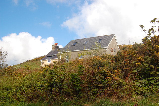
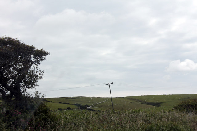
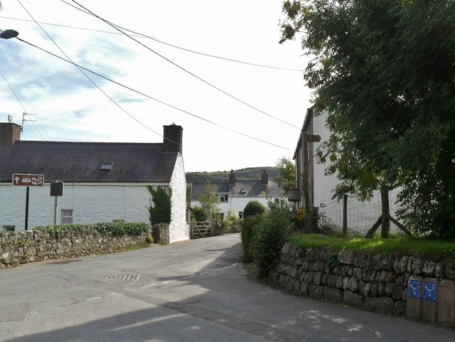
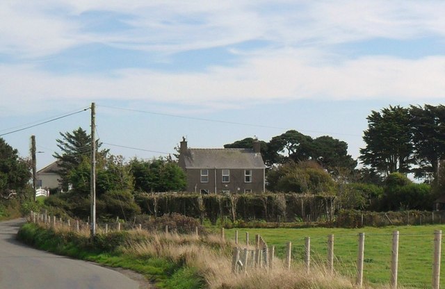
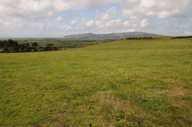
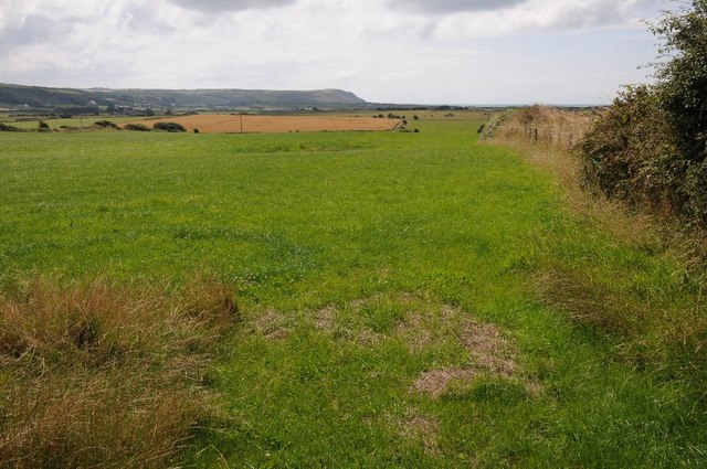
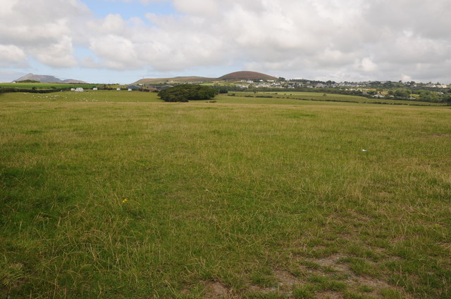
Wellington is a small village located in the county of Caernarfonshire, Wales. Situated in the northwestern part of the country, Wellington is surrounded by picturesque landscapes and offers a peaceful and scenic environment for its residents and visitors.

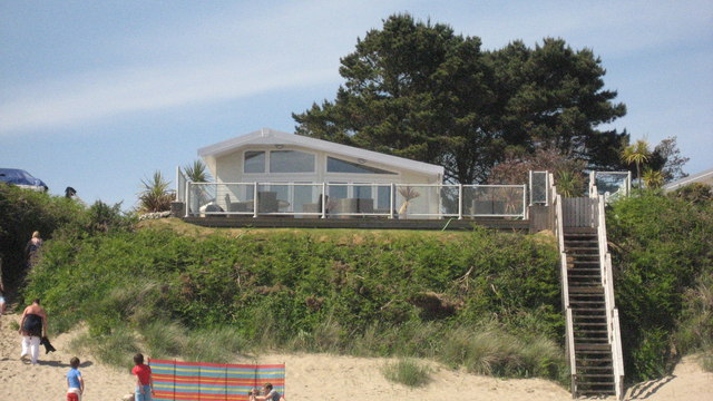
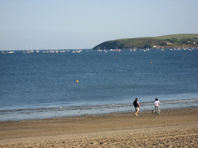
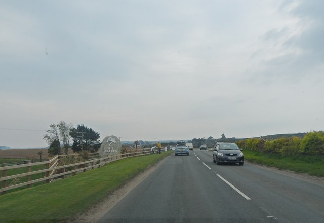
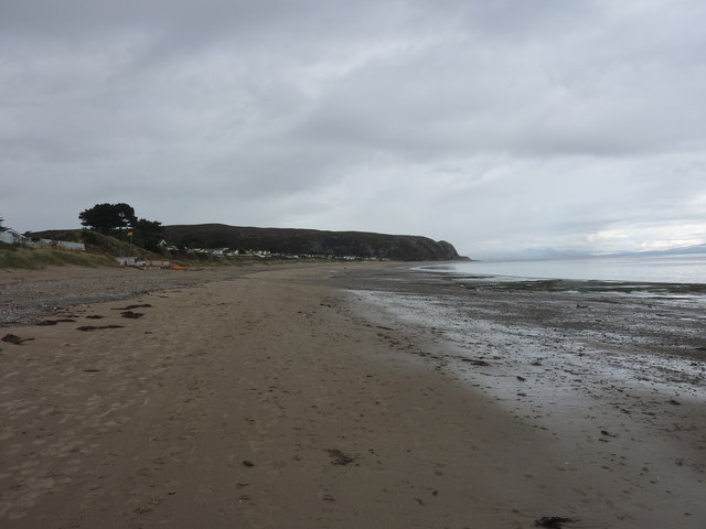
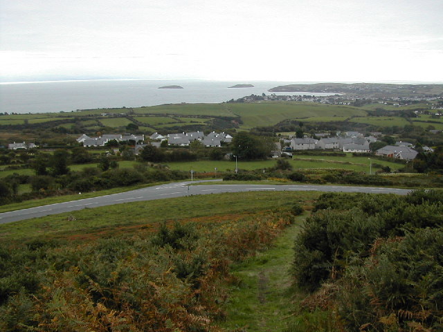
The village is characterized by its rural charm, with a population of around 500 people. It is situated near the coast, providing easy access to stunning beaches and the beautiful Irish Sea. The nearby Snowdonia National Park offers breathtaking views and an array of outdoor activities, attracting nature lovers and adventurers.

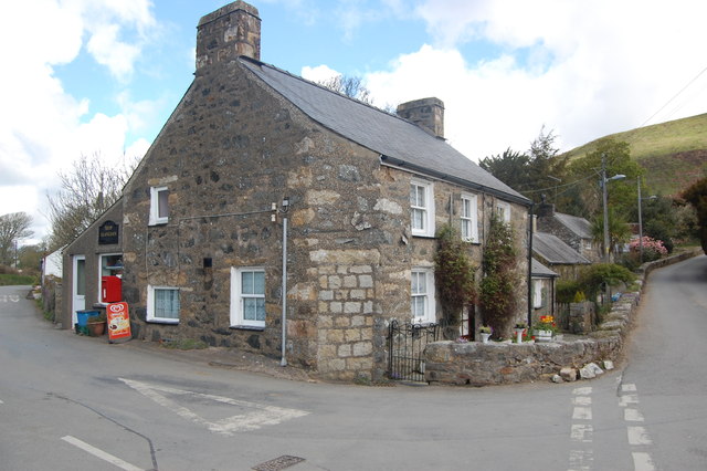
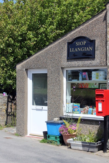
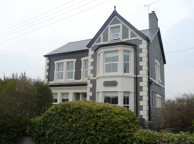
Wellington itself is a close-knit community with a strong sense of community spirit. It has a few local amenities, including a village pub, a small convenience store, and a primary school. Caernarfon, a larger town, is just a short drive away and provides additional services and facilities for residents.

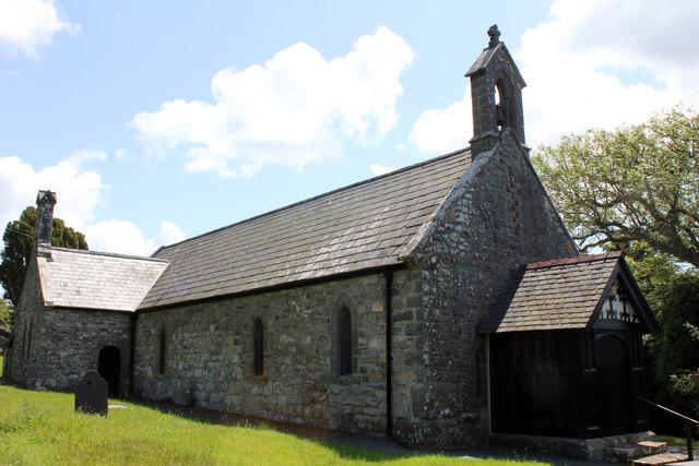
Historically, the village has ties to the slate mining industry, which was once a significant part of the local economy. Today, the village retains some of its mining heritage, with remnants of old quarry buildings and railway tracks still visible in the surrounding areas.

Overall, Wellington, Caernarfonshire offers a peaceful and idyllic setting for those seeking a quiet and scenic place to live or visit. Its proximity to the coast and the stunning landscapes of Snowdonia make it an attractive destination for outdoor enthusiasts and nature lovers alike.

If you have any feedback on the listing, please let us know in the comments section below.

Wellington Images

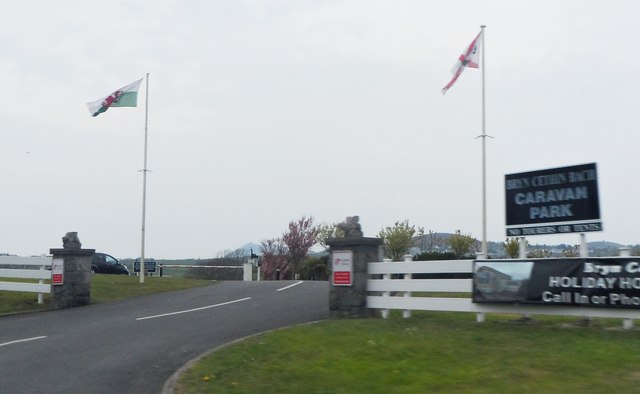
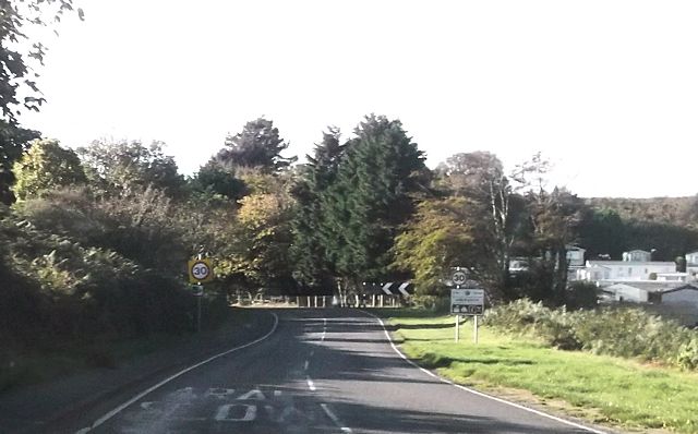
Images are sourced within 2km of 52.844636/-4.521433 or Grid Reference SH3030. Thanks to Geograph Open Source API. All images are credited.

Former chapel, Llangian On the OS map it is shown as having a spire - presumably replaced by the house attachment when it was converted to a dwelling.
Former chapel, Llangian
On the OS map it is shown as having a spire - presumably replaced by the house attachment when it was converted to a dwelling.
Village store, Llangian A very welcoming, friendly shop.
Village store, Llangian
A very welcoming, friendly shop.
Chalet living Could be anywhere in the world; in fact it is the Llyn Peninsula, Wales.
Chalet living
Could be anywhere in the world; in fact it is the Llyn Peninsula, Wales.
The Warren Beach Postcard perfect strolling along one of the most beautiful beaches in Wales
The Warren Beach
Postcard perfect strolling along one of the most beautiful beaches in Wales
Sheep on the hillside near Tyddyn Gwyn
Village store at Llangian Grade II listed building but this west wing is modern.
Village store at Llangian
Grade II listed building but this west wing is modern.
St Cian Church Llangian Grade II Listed Anglican parish church dating back to before 1254 but rebuilt in the 15th century. Restored in 1858 with new windows and vestry by Henry Kennedy. The timber porch was added about 1906. The late medieval roof although restored has been retained. Radiocarbon dated burnt structural debris found in 1994 suggests activity at the site as far back as 550 AD. In the graveyard a stone grave marker, that may not be in its original position, is 5th or 6th century in date. The graveyard was almost circular with an outer enclosure concentric with the graveyard. This is probably a 'corflan' or area of sanctuary enclosing the 'mynwent' or graveyard as detailed in 15th century abbot's text, the two terms having become confused over time, its origin corfflan meaning literally 'corpse enclosure'. The church has an octagonal font with the date 1638 inscribed on it. Recclesia carried out masonry repair work in 2017 and repointing works, internal decoration and the repair and reinstatement of the Victorian bell from the west end alongside the Taylor Bell Foundry in September 2018.
St Cian Church Llangian
Grade II Listed Anglican parish church dating back to before 1254 but rebuilt in the 15th century. Restored in 1858 with new windows and vestry by Henry Kennedy. The timber porch was added about 1906. The late medieval roof although restored has been retained. Radiocarbon dated burnt structural debris found in 1994 suggests activity at the site as far back as 550 AD. In the graveyard a stone grave marker, that may not be in its original position, is 5th or 6th century in date. The graveyard was almost circular with an outer enclosure concentric with the graveyard. This is probably a 'corflan' or area of sanctuary enclosing the 'mynwent' or graveyard as detailed in 15th century abbot's text, the two terms having become confused over time, its origin corfflan meaning literally 'corpse enclosure'. The church has an octagonal font with the date 1638 inscribed on it. Recclesia carried out masonry repair work in 2017 and repointing works, internal decoration and the repair and reinstatement of the Victorian bell from the west end alongside the Taylor Bell Foundry in September 2018.
Llangian village centre
Bryn Cethin
Bryn Cethin
Approaching the entrance to The Warren
House at Bryn Cethin
Entrance to Bryn Cethin Caravan Park
View west on the Lleyn peninsula View west over Hell's Mouth on the Lleyn peninsula, viewed from near Llangian.
View west on the Lleyn peninsula
View west over Hell's Mouth on the Lleyn peninsula, viewed from near Llangian.
View to Mynytho View across farmland to Mynytho from near Llangian.
View to Mynytho
View across farmland to Mynytho from near Llangian.
View to Mynytho View across farmland to Mynytho from near Llangian.
View to Mynytho
View across farmland to Mynytho from near Llangian.
The Warren
The Warren
A499 entering Abersoch
Show me another place!

Wellington is located at Grid Ref: SH3030 (Lat: 52.844636, Lng: -4.521433)

Unitary Authority: Gwynedd

Police Authority: North Wales

What 3 Words

///flamed.belief.juniors. Near Pwllheli, Gwynedd

Nearby Locations

Wellington

Related Wikis

Mynytho

Mynytho is a small village in the parish of Llanengan near the southern coast of the Llŷn Peninsula in northwestern Wales. It consists of a few houses...

Llangian

Llangian is a small village and former civil parish on the Llŷn Peninsula in the Welsh county of Gwynedd. It is located 1 mile (1.6 km) north west of...

Capel Newydd, Nanhoron

Capel Newydd in Nanhoron, near Llanengan, Gwynedd, is probably the oldest surviving Nonconformist chapel in North Wales. The chapel dates from 1770–1772...

Afon Soch

The Afon Soch is a short river on the Llŷn peninsula, Gwynedd, Wales. It arises to the north of the village of Sarn Meyllteyrn, through which it then flows...

Nearby Amenities

Located within 500m of 52.844636,-4.521433
Mynytho
Place: village
Wikidata: Q13651447
Lat/Long: 52.8476971/-4.5230986
Post Box
Ref: LL53 108
Lat/Long: 52.8455586/-4.5236539
Direction: 215
Generator Method: photovoltaic
Generator Output Electricity: yes
Generator Solar Modules: 16
Generator Source: solar
Generator Type: solar_photovoltaic_panel
Location: roof
Power: generator
Lat/Long: 52.8468373/-4.519444
Direction: 145
Generator Method: photovoltaic
Generator Output Electricity: yes
Generator Solar Modules: 13
Generator Source: solar
Generator Type: solar_photovoltaic_panel
Location: roof
Power: generator
Lat/Long: 52.8475416/-4.5195639
Direction: 215
Generator Method: photovoltaic
Generator Output Electricity: yes
Generator Solar Modules: 10
Generator Source: solar
Generator Type: solar_photovoltaic_panel
Location: roof
Power: generator
Lat/Long: 52.8470482/-4.5238447
Direction: 255
Generator Method: photovoltaic
Generator Output Electricity: yes
Generator Solar Modules: 8
Generator Source: solar
Generator Type: solar_photovoltaic_panel
Location: roof
Power: generator
Lat/Long: 52.8466137/-4.5224757
Direction: 75
Generator Method: photovoltaic
Generator Output Electricity: yes
Generator Solar Modules: 8
Generator Source: solar
Generator Type: solar_photovoltaic_panel
Location: roof
Power: generator
Lat/Long: 52.8466257/-4.5224075
Power: pole
Source: bing
Lat/Long: 52.8432572/-4.5147184
Power: pole
Source: bing
Lat/Long: 52.8435642/-4.5155297
Power: pole
Source: bing
Lat/Long: 52.8438493/-4.516325
Power: pole
Source: bing
Lat/Long: 52.8440222/-4.5176493
Power: pole
Lat/Long: 52.8420948/-4.5191413
Power: pole
Lat/Long: 52.8417035/-4.5198601
Power: pole
Lat/Long: 52.8428805/-4.5199326
Power: portal
Source: bing
Lat/Long: 52.842981/-4.5199379
Power: pole
Source: bing
Lat/Long: 52.8432167/-4.5193023
Power: pole
Source: bing
Lat/Long: 52.8434354/-4.5187148
Power: pole
Source: bing
Lat/Long: 52.8446852/-4.5225544
Power: pole
Source: bing
Lat/Long: 52.8444592/-4.5208566
Power: pole
Source: bing
Lat/Long: 52.8444017/-4.520418
Power: pole
Source: bing
Lat/Long: 52.8442948/-4.5196737
Power: pole
Source: bing
Lat/Long: 52.8441514/-4.5185848
Power: pole
Source: bing
Lat/Long: 52.8444835/-4.5185418
Power: pole
Source: bing
Lat/Long: 52.8450777/-4.5184165
Power: pole
Source: bing
Lat/Long: 52.8449201/-4.5242643
Power: pole
Source: bing
Lat/Long: 52.8451299/-4.5258053
Power: pole
Source: bing
Lat/Long: 52.8453859/-4.527723
Power: pole
Source: bing
Lat/Long: 52.8424407/-4.5186994
Power: pole
Source: bing
Lat/Long: 52.8427116/-4.5183299
Power: pole
Source: bing
Lat/Long: 52.8438218/-4.5178297
The data included in this document is from www.openstreetmap.org. The data is made available under ODbL.

Have you been to Wellington?

Leave your review of Wellington below (or comments, questions and feedback).