Bracon Ash

Settlement in Norfolk South Norfolk

England

Bracon Ash

Bracon Ash: Field with growing crop
Bracon Ash: Field with growing crop Credit: Michael Garlick

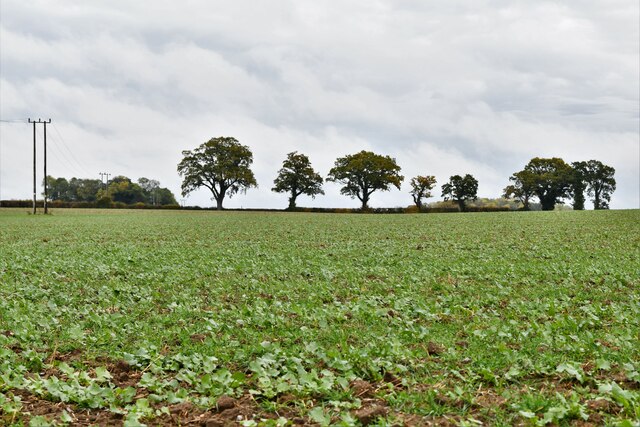
Bracon Ash is a small village located in the county of Norfolk, England. Situated approximately 7 miles south-west of the city of Norwich, Bracon Ash is part of the South Norfolk district. The village is nestled in a rural setting, surrounded by picturesque countryside and farmland.

Historically, Bracon Ash has been inhabited since at least the Saxon era, with evidence of Roman and Iron Age settlements in the area as well. The village's name is derived from the Old English words "braec" meaning "bracken" and "aesc" meaning "ash tree." This reflects the abundance of both bracken and ash trees in the local landscape.

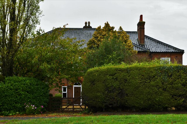
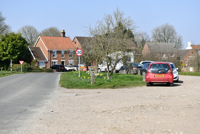
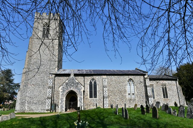
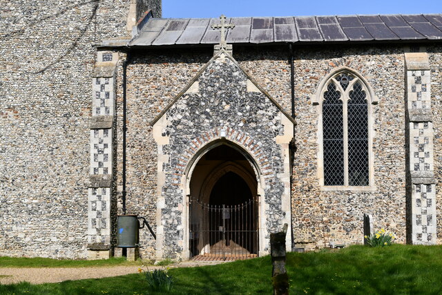
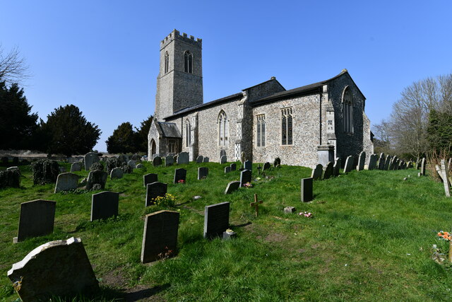
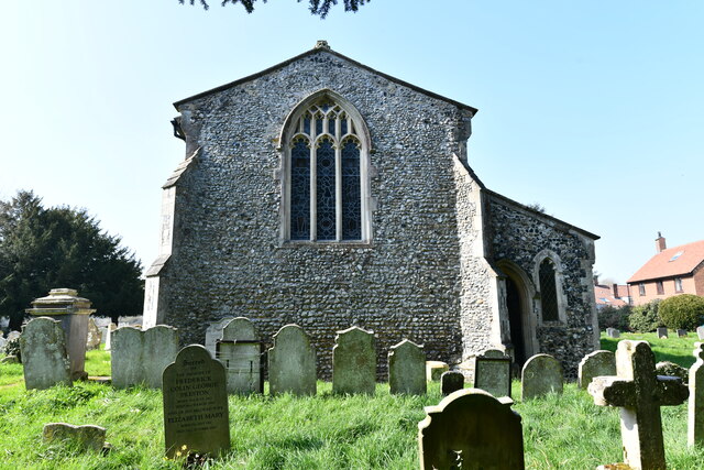
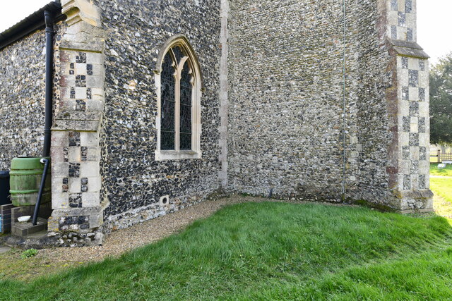
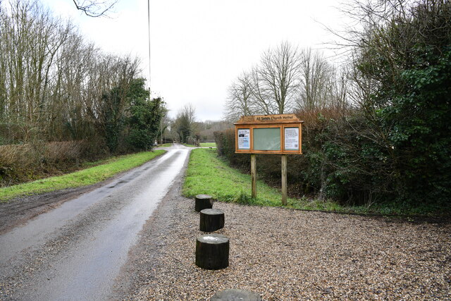
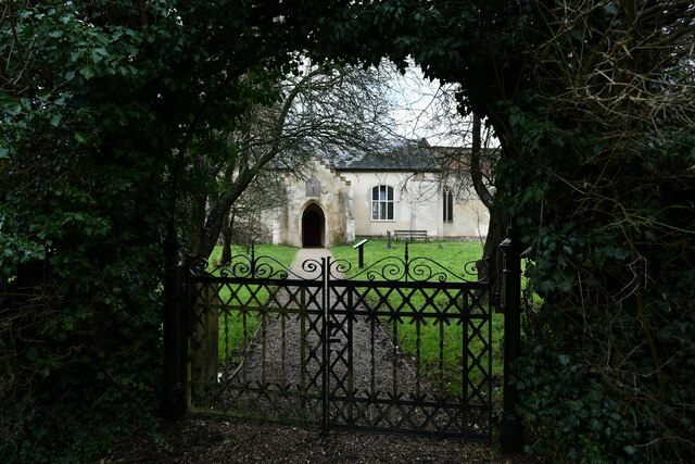
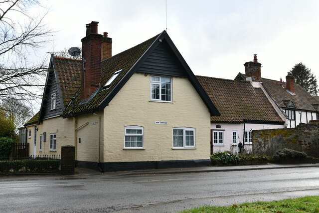
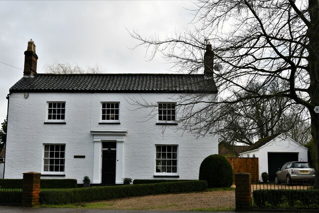
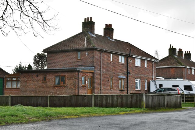
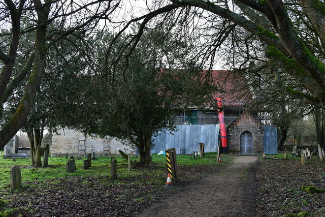
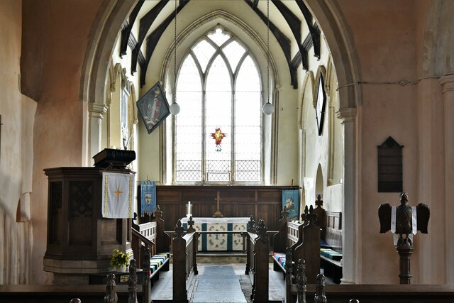
Today, Bracon Ash is a peaceful and close-knit community that offers a tranquil escape from the hustle and bustle of city life. The village is primarily residential, with a mix of charming period cottages and more modern homes. There is also a small church, St. Nicholas Church, which dates back to the 13th century and holds regular services.

Despite its small size, Bracon Ash benefits from being in close proximity to larger towns and cities, such as Norwich, which provides residents with access to a wider range of amenities, including shops, schools, and leisure facilities. The village is also well-connected by road, with the A11 and A47 arterial routes nearby, making it easily accessible for those commuting to other parts of Norfolk or even further afield.

Overall, Bracon Ash is a tranquil and picturesque village that offers a charming rural lifestyle within reach of urban conveniences.

If you have any feedback on the listing, please let us know in the comments section below.

Bracon Ash Images

Images are sourced within 2km of 52.553133/1.216906 or Grid Reference TM1899. Thanks to Geograph Open Source API. All images are credited.

Bracon Ash: Field with growing crop
Bracon Ash, Hill Farm: Farmhouse
Mulbarton: View from the church entrance
Mulbarton, St. Mary Magdalen's Church: Southern aspect
Mulbarton, St. Mary Magdalen's Church: South porch
Mulbarton, St. Mary Magdalen's Church: South eastern aspect
Mulbarton, St. Mary Magdalen's Church: Eastern aspect
Mulbarton, St. Mary Magdalen's Church: Profusion of primroses at the east end of the church
Mulbarton, St. Mary Magdalen's Church: Base of the tower
Hethel: Church Lane outside All Saints Church
Hethel: Entrance to All Saints Church
Mulbarton: New dwelling under construction in Catmere Herne
Bracon Ash: 'Ash Cottage'
Bracon Ash: 'Beech House'
Bracon Ash: 9, School Close
Bracon Ash, St. Nicholas' Church: Northern aspect
Bracon Ash, St. Nicholas' Church: The chancel
Hethel, All Saints Church: Natural history in the churchyard
Show me another place!

Bracon Ash is located at Grid Ref: TM1899 (Lat: 52.553133, Lng: 1.216906)

Administrative County: Norfolk

District: South Norfolk

Police Authority: Norfolk

What 3 Words

///strutting.stylists.copy. Near Hethel, Norfolk

Related Wikis

Bracon Ash

Bracon Ash is a village and civil parish in the South Norfolk district of Norfolk, England. == History == Bracon Ash's name is of Anglo-Saxon origin and...
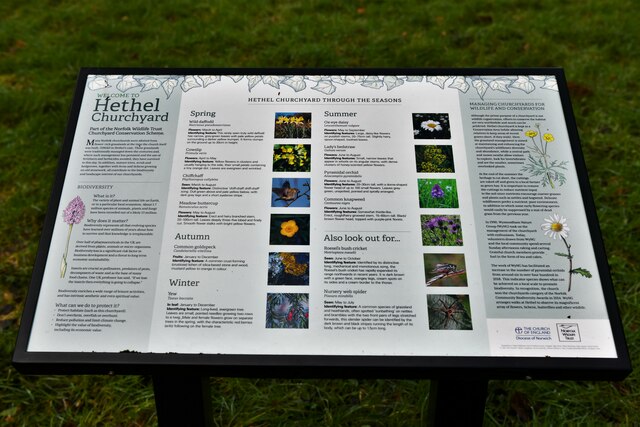
Hethel

Hethel is a small village in Norfolk, England, approximately five miles (8.0 km) southeast of the market town of Wymondham, and approximately ten miles...
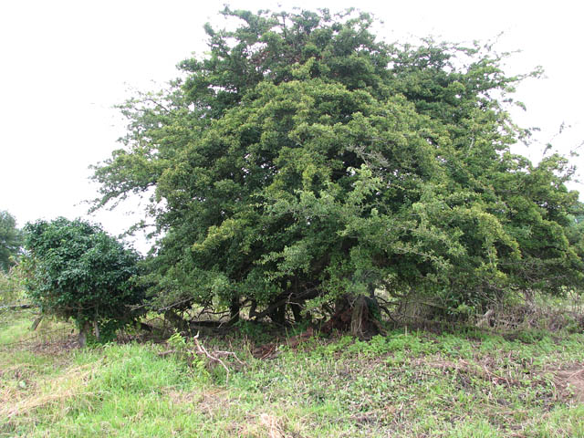
Hethel Old Thorn

Hethel Old Thorn is a 0.025-hectare (0.062-acre) nature reserve south-west of Norwich in Norfolk. It is managed by the Norfolk Wildlife Trust.This is...

Mulbarton Wanderers F.C.

Mulbarton Wanderers Football Club is a football club based in Mulbarton, Norfolk. The men's first team are currently members in the Eastern Counties League...

Wreningham

Wreningham is a village and civil parish in the English county of Norfolk. It is situated some 3 miles (4.8 km) south east of Wymondham and 9 miles (14...

East Carleton

East Carleton is a village and civil parish in the English county of Norfolk. The village is located 6.3 kilometres (3.9 mi) east of nearby Wymondham and...

Forehoe and Henstead Rural District

Forehoe and Henstead Rural Districts were adjacent rural districts in Norfolk, England from 1894 to 1935.They were formed under the Local Government Act...

Flordon Common

Flordon Common is a 9.9-hectare (24-acre) biological Site of Special Scientific Interest south-east of Wymondham in Norfolk. It is a registered common...

Nearby Amenities

Located within 500m of 52.553133,1.216906
Give Way
Lat/Long: 52.5537141/1.2179905
Bus Stop
School Road, adj
Naptan AtcoCode: 2900B391
Naptan Bearing: NE
Naptan CommonName: School Road
Naptan Indicator: adj
Naptan Landmark: bus shelter
Naptan Locality: Bracon Ash
Naptan NaptanCode: nfoagdga
Naptan Street: The Street
Shelter: yes
Source: naptan_import;survey
Lat/Long: 52.5545554/1.2190085
Bus Stop
School Road, opp
Naptan AtcoCode: 2900B394
Naptan Bearing: SW
Naptan BusStopType: CUS
Naptan CommonName: School Road
Naptan Indicator: opp
Naptan Landmark: opp School Road
Naptan Locality: Bracon Ash
Naptan NaptanCode: nfoagdgj
Naptan Street: The Street
Naptan Verified: no
Source: naptan_import
Lat/Long: 52.5545162/1.2191237
Bracon Ash
Place: village
Lat/Long: 52.5531016/1.2177992
Give Way
Lat/Long: 52.5543569/1.2187256
Note: Fence and stile removed.
Lat/Long: 52.5554187/1.2149632
Barrier: stile
Foot: yes
Note: Broken
Lat/Long: 52.5557371/1.2141425
Bench
Backrest: yes
Colour: brown
Material: wood
Seats: 6
Lat/Long: 52.5544492/1.2187917
Post Box
Collection Times: Mo-Fr 16:30; Sa 07:00
Operator: Royal Mail
Post Box Mounting: brick_pillar
Post Box Type: wall
Ref: NR14 1457
Royal Cypher: GVIR
Royal Cypher Wikidata: Q33102169
Lat/Long: 52.5545727/1.2188837
Milestone
Colour: white
Distance London: 103 mi
Distance New Buckenham: 9 mi
Distance Norwich: 6 mi
Material: stone
Lat/Long: 52.5545546/1.2189426
Entrance: main
Lat/Long: 52.5560082/1.2135937
Parking
Fee: no
Parking: surface
Lat/Long: 52.5554518/1.2112651
Give Way
Lat/Long: 52.5496043/1.2201484
Give Way
Lat/Long: 52.554501/1.2189111
Booth: K6
Colour: red
Description: Old Red phone box used to display information. Tribute to those of Braconash and Hethel who gave their lives in WW1.
Disused Amenity: telephone
Historic: memorial
Man Made: telephone_box
Lat/Long: 52.5538316/1.2179321
Bench
Backrest: no
Material: plastic
Seats: 2
Lat/Long: 52.5538259/1.2179643
Kett's Country
Board Type: map
Information: board
Tourism: information
Lat/Long: 52.5537786/1.2178811
Bracon Ash and Hethel
Alt Name: Hethel
Colour: silver
Inscription: Designed and constructed by Jonathan Stevens as a technology project at Wymondham College / 1994
Man Made: village_sign
Material: metal
Short Name: Bracon Ash
Lat/Long: 52.5536628/1.2181131
Bench
Backrest: yes
Colour: brown
Inscription: To the memory of Fred Rice / Clerk to the Parish Council from 1946 to 1987
Material: wood
Lat/Long: 52.5536334/1.2181239
Historic: memorial
Memorial: war_memorial
Lat/Long: 52.5535796/1.2178503
Give Way
Lat/Long: 52.5532735/1.2169179
Bench
Backrest: yes
Material: plastic
Seats: 3
Lat/Long: 52.5502216/1.2177658
Bench
Backrest: yes
Material: plastic
Seats: 3
Lat/Long: 52.5502917/1.2178181
Leisure: picnic_table
Lat/Long: 52.5556833/1.2120084
Leisure: picnic_table
Lat/Long: 52.5556254/1.2123142
Crossing
Crossing: unmarked
Tactile Paving: yes
Lat/Long: 52.5557774/1.2217202
Defibrillator
Access: yes
Defibrillator Location: On outside wall of Bracon Ash & Hethel Village Hall & Social Club, facing the war memorial on the green.
Emergency: defibrillator
Indoor: no
Ref GB The Circuit: BBF5843F-DC4C-4AAA-AD6B-ADD300CED6CF
Lat/Long: 52.5534861/1.2178115
The data included in this document is from www.openstreetmap.org. The data is made available under ODbL.

Have you been to Bracon Ash?

Leave your review of Bracon Ash below (or comments, questions and feedback).