Braceby

Settlement in Lincolnshire South Kesteven

England

Braceby

Haceby: aerial 2021 (1)
Haceby: aerial 2021 (1) Credit: Chris

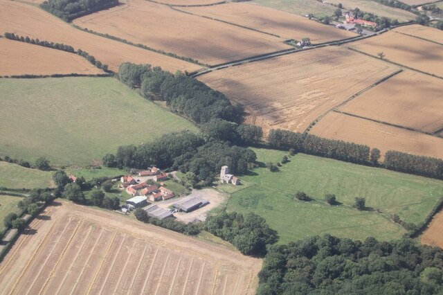
Braceby is a small village located in the district of North Kesteven, Lincolnshire, England. Situated about 10 miles south of the town of Sleaford, Braceby is known for its picturesque rural setting and historical significance.

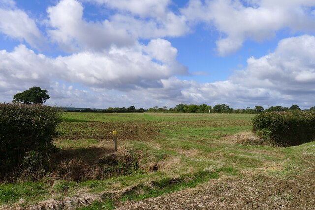
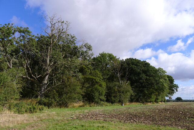
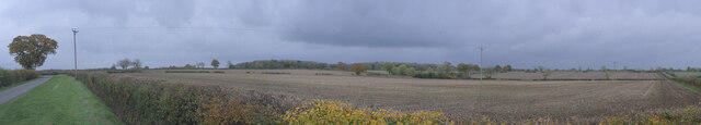
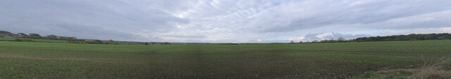
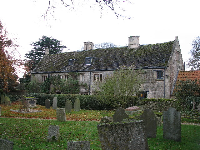
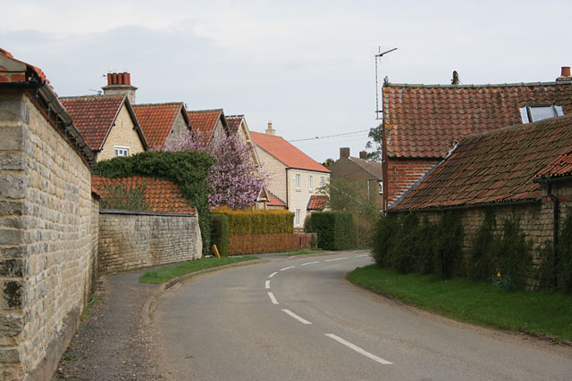
The village is home to a population of around 200 residents, living in a mix of traditional stone cottages and more modern houses. It is surrounded by beautiful countryside, with rolling hills, farmland, and meandering streams, making it an ideal location for nature enthusiasts and those seeking a peaceful retreat.

Braceby has a rich history that dates back to the Roman period, with evidence of ancient settlements and artifacts found in the area. The village also played a significant role during the medieval era, with its close proximity to the historic market town of Grantham.

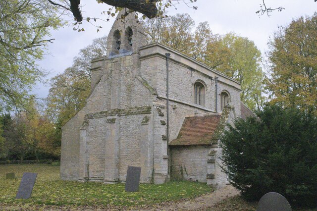
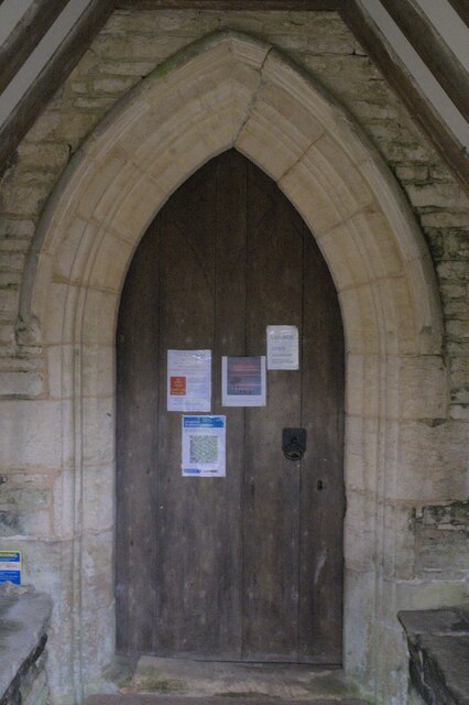
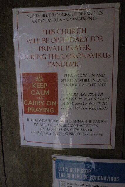
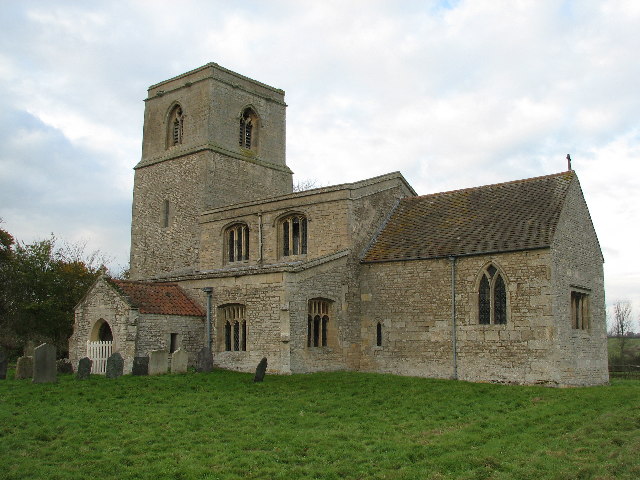
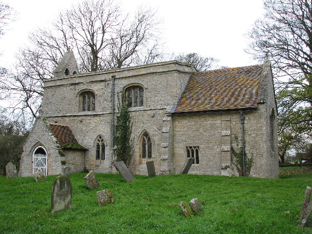
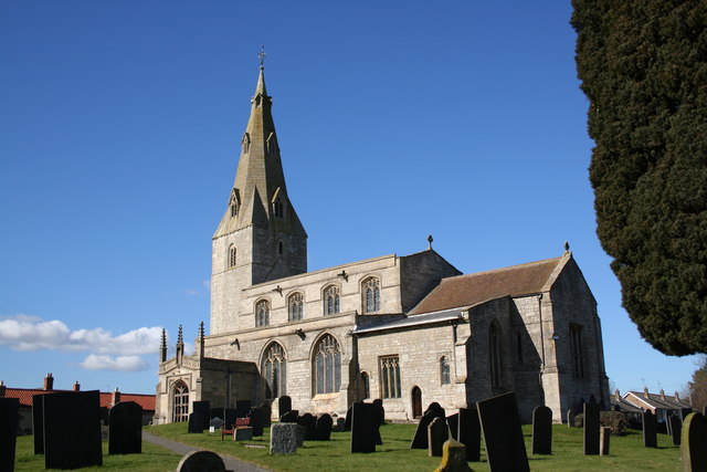
Although small in size, Braceby offers a range of amenities to its residents. These include a village hall, a local pub, and a church, which stands as a prominent feature in the village center. The church, St. Margaret's, is a Grade I listed building, known for its architectural beauty and historical significance.

The village is well-connected to surrounding areas through a network of roads, making it easily accessible for visitors. Its tranquil setting and historical charm make Braceby an attractive destination for those looking to explore the rural beauty of Lincolnshire.

If you have any feedback on the listing, please let us know in the comments section below.
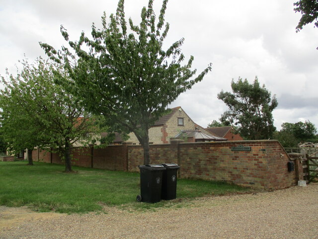
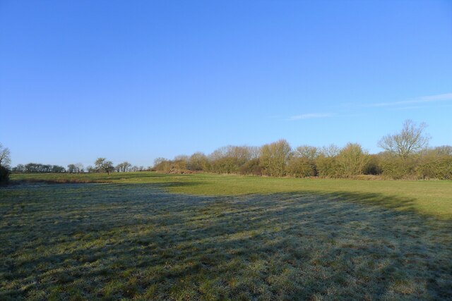
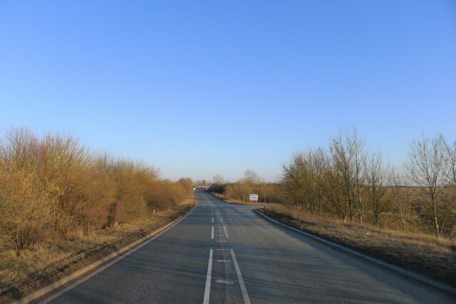
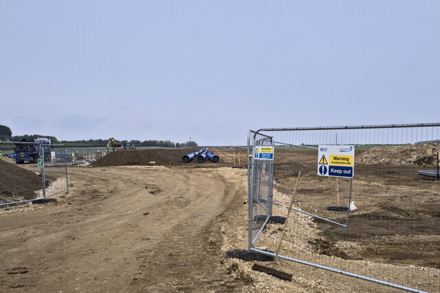
Braceby Images

Images are sourced within 2km of 52.906108/-0.491381 or Grid Reference TF0135. Thanks to Geograph Open Source API. All images are credited.

Haceby: aerial 2021 (1)
Haceby: aerial 2021 (2)
The Cross Britain Way crossing fields towards Sapperton The Cross Britain Way is a 279 mile, east-west trail across England and Wales, created to help raise money for Macmillan Cancer Support. Starting at Boston (where the original Macmillan Way starts), it crosses the Fens, the Vale of Belvoir, the Leicestershire/Nottinghamshire Wolds, the National Forest, Cannock Chase, East Shropshire along the Iron Bridge Gorge, the Shropshire Hills, the hills of mid Wales, the Berwyn Mountains, and Snowdonia National Park, to its end at Barmouth. <span class="nowrap"><a title="https://ldwa.org.uk/ldp/members/show_path.php?path_name=Macmillan+Way+-+Cross+Britain+Way" rel="nofollow ugc noopener" href="https://ldwa.org.uk/ldp/members/show_path.php?path_name=Macmillan+Way+-+Cross+Britain+Way">Link</a><img style="margin-left:2px;" alt="External link" title="External link - shift click to open in new window" src="https://s1.geograph.org.uk/img/external.png" width="10" height="10"/></span>
The Cross Britain Way crossing fields towards Sapperton
The Cross Britain Way is a 279 mile, east-west trail across England and Wales, created to help raise money for Macmillan Cancer Support. Starting at Boston (where the original Macmillan Way starts), it crosses the Fens, the Vale of Belvoir, the Leicestershire/Nottinghamshire Wolds, the National Forest, Cannock Chase, East Shropshire along the Iron Bridge Gorge, the Shropshire Hills, the hills of mid Wales, the Berwyn Mountains, and Snowdonia National Park, to its end at Barmouth. LinkExternal link
Sick ash at the edge of Sapperton South Wood Ash dieback?
Sick ash at the edge of Sapperton South Wood
Ash dieback?
Church of St Margaret, Braceby A grade II* listed church with origins in the 13th Century - see <span class="nowrap"><a title="https://historicengland.org.uk/listing/the-list/list-entry/1360324" rel="nofollow ugc noopener" href="https://historicengland.org.uk/listing/the-list/list-entry/1360324">Link</a><img style="margin-left:2px;" alt="External link" title="External link - shift click to open in new window" src="https://s1.geograph.org.uk/img/external.png" width="10" height="10"/></span> .
Church of St Margaret, Braceby
A grade II* listed church with origins in the 13th Century - see LinkExternal link .
Church of St Margaret: the door Wood door within the porch of the church.
Church of St Margaret: the door
Wood door within the porch of the church.
Church of St Margaret: Covid notice On the door seen in <a href="https://www.geograph.org.uk/photo/7018303">TF0135 : Church of St Margaret: the door</a> is the Test&trace checkin QR code and this welcoming notice, very different from so many other churches where precautions start with locking the door.
Church of St Margaret: Covid notice
On the door seen in TF0135 : Church of St Margaret: the door is the Test&trace checkin QR code and this welcoming notice, very different from so many other churches where precautions start with locking the door.
Field near Moor Lane A 90 degree panorama of the field south of Moor Lane
Field near Moor Lane
A 90 degree panorama of the field south of Moor Lane
Field between Braceby and Stibbington
Nightingale Farm
Nightingale Farm
Site of a Roman villa by the A52 near Haceby There is little to be seen now. But earlier excavation revealed a large villa, probably of a courtyard plan consisting of eight rooms including a bath house, and artefacts including coins dating from the period 76 to 364 AD. 
<span class="nowrap"><a title="https://heritage-explorer.lincolnshire.gov.uk/Monument/MLI60730" rel="nofollow ugc noopener" href="https://heritage-explorer.lincolnshire.gov.uk/Monument/MLI60730">Link</a><img style="margin-left:2px;" alt="External link" title="External link - shift click to open in new window" src="https://s1.geograph.org.uk/img/external.png" width="10" height="10"/></span>
The site, a scheduled Ancient Monument, lies next to the A52 (beyond the hedge on right), which follows the route of a Roman road (the Salt Way).
Site of a Roman villa by the A52 near Haceby
There is little to be seen now. But earlier excavation revealed a large villa, probably of a courtyard plan consisting of eight rooms including a bath house, and artefacts including coins dating from the period 76 to 364 AD. LinkExternal link The site, a scheduled Ancient Monument, lies next to the A52 (beyond the hedge on right), which follows the route of a Roman road (the Salt Way).
Roman crossroads? The A52 approaching the turnoff to Long Hollow The A52, believed to follow the Salt Way (Roman Road 58b) close to the crossing with King Street (Roman Road 26)
Roman crossroads? The A52 approaching the turnoff to Long Hollow
The A52, believed to follow the Salt Way (Roman Road 58b) close to the crossing with King Street (Roman Road 26)
Pipe laying site access The route for Project SPAR - the Strategic Pipeline Alliance.  Anglian Water is arranging to pipe surplus water from Elsham in North Lincolnshire to Colchester in Essex, where there is a shortage.
Pipe laying site access
The route for Project SPAR - the Strategic Pipeline Alliance. Anglian Water is arranging to pipe surplus water from Elsham in North Lincolnshire to Colchester in Essex, where there is a shortage.
Haceby Little Wood
Haceby Little Wood
Haceby Church, Dedicated To The Saints Margaret & Barbara First time I have come across a church dedicated to Saint Barbara. Albeit shared with Saint Margaret.
Haceby Church, Dedicated To The Saints Margaret & Barbara
First time I have come across a church dedicated to Saint Barbara. Albeit shared with Saint Margaret.
Braceby Woodland New woodland planted between Haceby & Braceby.
Braceby Woodland
New woodland planted between Haceby & Braceby.
Saint Margaret's Church, Braceby
Manor House, Sapperton.
Show me another place!

Braceby is located at Grid Ref: TF0135 (Lat: 52.906108, Lng: -0.491381)

Division: Parts of Kesteven

Administrative County: Lincolnshire

District: South Kesteven

Police Authority: Lincolnshire

What 3 Words

///earmarked.animals.buckling. Near Ancaster, Lincolnshire

Nearby Locations

Braceby

Related Wikis

Braceby

Braceby is a small English village in the South Kesteven district of Lincolnshire. Its population is included in the civil parish of Pickworth. The village...

Braceby and Sapperton

Braceby and Sapperton is a civil parish in the South Kesteven district of Lincolnshire, England. According to the 2001 census it had a population of 47...

Ropsley and Humby

Ropsley and Humby is a civil parish in the South Kesteven district of Lincolnshire, England. According to the 2001 Census it had a population of 808, increasing...

Sapperton, Lincolnshire

Sapperton is a village in the South Kesteven district of Lincolnshire, England. The nearest town is Grantham, 6 miles (9.7 km) to the west. Adjacent villages...

Haceby

Haceby is a hamlet in the civil parish of Newton and Haceby in the district of North Kesteven, Lincolnshire, England. It is 8 miles (13 km) east from...

St Barbara's Church, Haceby

St Barbara's Church is a redundant Anglican church in the village of Haceby, Lincolnshire, England. It is recorded in the National Heritage List for England...

St Peter's Church, Ropsley

St Peter's Church is a Grade I listed Anglican parish church dedicated to Saint Peter, in Ropsley, Lincolnshire, England. The church is 5 miles (8 km)...

Great Humby

Great Humby is a hamlet in the South Kesteven district of Lincolnshire, England. It lies in the civil parish of Ropsley and Humby, 6 miles (9.7 km) east...

Nearby Amenities

Located within 500m of 52.906108,-0.491381
Braceby
Is In: Lincolnshire, England, UK
Place: hamlet
Lat/Long: 52.9062543/-0.4905596
College Farm
Place: farm
Source: Bing
Lat/Long: 52.9062108/-0.489096
Manor Farm
Alt Name: Old Manor Farm
Place: farm
Source: Bing
Lat/Long: 52.9069231/-0.4911503
Telephone
Booth: K6
Covered: booth
Listed Status: Grade II
Man Made: telephone_box
Old Phone: +44 1529 497239
Lat/Long: 52.9061075/-0.489439
Post Box
Post Box Type: lamp
Royal Cypher: EIIR
Royal Cypher Wikidata: Q33102113
Lat/Long: 52.9061277/-0.4894524
Defibrillator
Defibrillator Location: behind the wooden door around the corner from the red phone box by College Farm in Braceby
Emergency: defibrillator
Indoor: no
Lat/Long: 52.9060913/-0.4893592
The data included in this document is from www.openstreetmap.org. The data is made available under ODbL.

Have you been to Braceby?

Leave your review of Braceby below (or comments, questions and feedback).