Warmwell
Settlement in Dorset
England
Warmwell
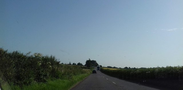
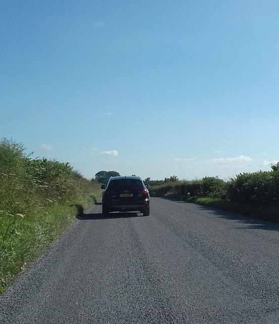
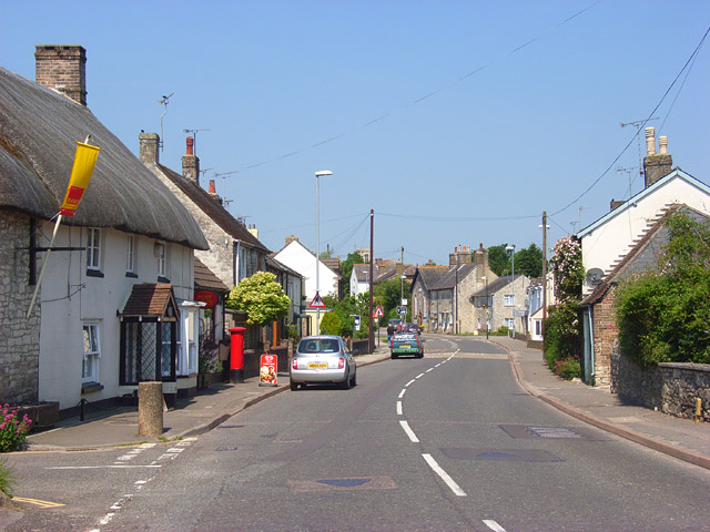
Warmwell is a small village located in the county of Dorset, England. Situated approximately 6 miles east of the town of Dorchester, Warmwell is nestled in the picturesque countryside of the South West region. The village is surrounded by rolling hills, lush green fields, and charming woodland, creating a tranquil and idyllic setting.
Historically, Warmwell has been inhabited for centuries, with evidence of prehistoric settlements in the area. The village itself has a rich history, with mentions in the Domesday Book of 1086. Over the years, Warmwell has experienced various developments, yet it has managed to retain its rural charm and character.
One of the most notable features of Warmwell is its proximity to the Warmwell Quarry Nature Reserve. This expansive reserve is a haven for wildlife enthusiasts, offering a diverse range of flora and fauna. The reserve is particularly renowned for its birdwatching opportunities, with many rare and migratory bird species being spotted throughout the year.
Warmwell also boasts a popular holiday park, which attracts visitors from all over the country. The park offers a range of accommodation options, including lodges and caravans, as well as a host of leisure facilities such as swimming pools, fishing lakes, and outdoor adventure activities.
In terms of amenities, Warmwell has a village hall, which serves as a hub for community events and activities. There is also a local pub, providing a gathering place for residents and visitors alike.
Overall, Warmwell is a charming and peaceful village, offering a perfect escape from the hustle and bustle of city life. Its beautiful surroundings, rich history, and natural attractions make it a delightful destination for nature lovers and those seeking a tranquil countryside retreat.
If you have any feedback on the listing, please let us know in the comments section below.
Warmwell Images
Images are sourced within 2km of 50.673009/-2.3508778 or Grid Reference SY7585. Thanks to Geograph Open Source API. All images are credited.
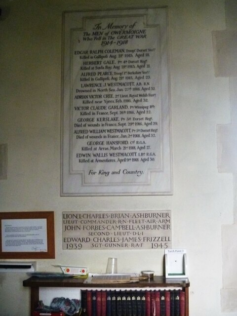
![Parish church [1] The Anglican parish church of St Michael was, except for the early 15th century tower, completely rebuilt in 1883 with some 13th and 16th century windows reset in the chancel. Constructed of rubble stone under tile roofs. Listed, grade II*, with details at: <span class="nowrap"><a title="https://historicengland.org.uk/listing/the-list/list-entry/1119232" rel="nofollow ugc noopener" href="https://historicengland.org.uk/listing/the-list/list-entry/1119232">Link</a><img style="margin-left:2px;" alt="External link" title="External link - shift click to open in new window" src="https://s1.geograph.org.uk/img/external.png" width="10" height="10"/></span>
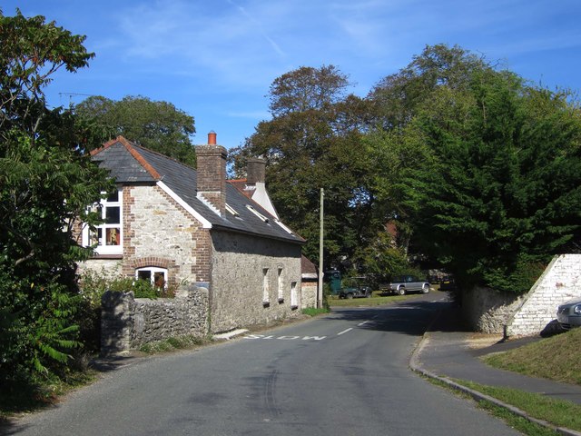
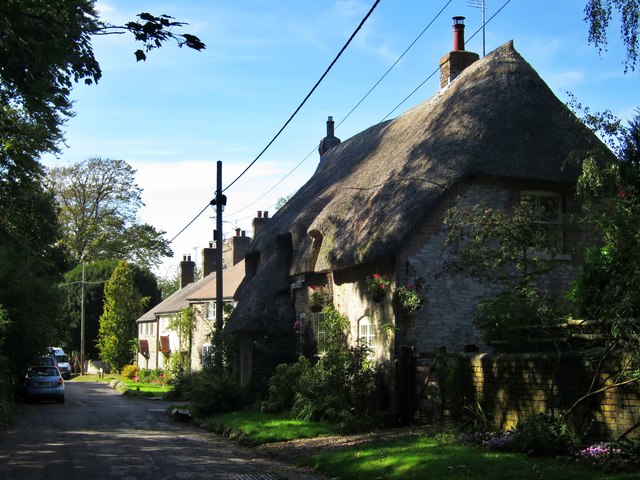
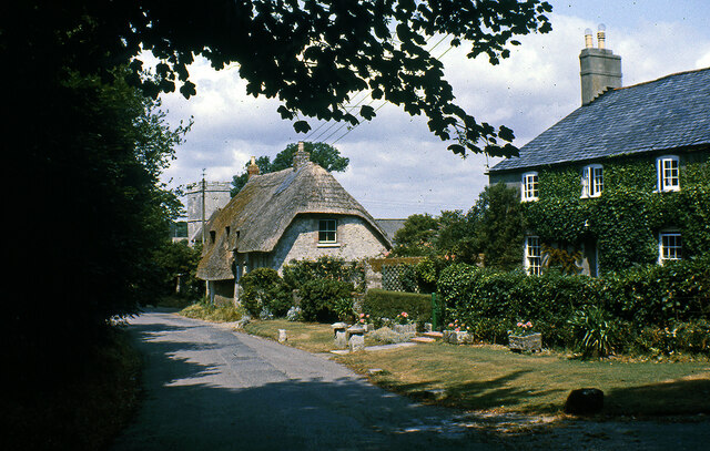
Owermoigne is a small Dorset village adjacent to the A352 road, some 6 miles southeast of Dorchester. Originally a Saxon settlement by the name of Ogre that later became Oweres, and the ancient landholding family of Le Moigne came together to give the village its name. The village surrounds the church of St Michael and most working residents commute into Dorchester.](https://s3.geograph.org.uk/geophotos/07/25/16/7251619_7464b2bf.jpg)
![Parish church [2] The nave and chancel.
The Anglican parish church of St Michael was, except for the early 15th century tower, completely rebuilt in 1883 with some 13th and 16th century windows reset in the chancel. Constructed of rubble stone under tile roofs. Listed, grade II*, with details at: <span class="nowrap"><a title="https://historicengland.org.uk/listing/the-list/list-entry/1119232" rel="nofollow ugc noopener" href="https://historicengland.org.uk/listing/the-list/list-entry/1119232">Link</a><img style="margin-left:2px;" alt="External link" title="External link - shift click to open in new window" src="https://s1.geograph.org.uk/img/external.png" width="10" height="10"/></span>
Owermoigne is a small Dorset village adjacent to the A352 road, some 6 miles southeast of Dorchester. Originally a Saxon settlement by the name of Ogre that later became Oweres, and the ancient landholding family of Le Moigne came together to give the village its name. The village surrounds the church of St Michael and most working residents commute into Dorchester.](https://s3.geograph.org.uk/geophotos/07/25/16/7251651_6528e0a5.jpg)
![Parish church [3] The chancel.
The Anglican parish church of St Michael was, except for the early 15th century tower, completely rebuilt in 1883 with some 13th and 16th century windows reset in the chancel. Constructed of rubble stone under tile roofs. Listed, grade II*, with details at: <span class="nowrap"><a title="https://historicengland.org.uk/listing/the-list/list-entry/1119232" rel="nofollow ugc noopener" href="https://historicengland.org.uk/listing/the-list/list-entry/1119232">Link</a><img style="margin-left:2px;" alt="External link" title="External link - shift click to open in new window" src="https://s1.geograph.org.uk/img/external.png" width="10" height="10"/></span>
Owermoigne is a small Dorset village adjacent to the A352 road, some 6 miles southeast of Dorchester. Originally a Saxon settlement by the name of Ogre that later became Oweres, and the ancient landholding family of Le Moigne came together to give the village its name. The village surrounds the church of St Michael and most working residents commute into Dorchester.](https://s2.geograph.org.uk/geophotos/07/25/16/7251654_3d199b4e.jpg)
![Parish church [4] The roof of the chancel.
The Anglican parish church of St Michael was, except for the early 15th century tower, completely rebuilt in 1883 with some 13th and 16th century windows reset in the chancel. Constructed of rubble stone under tile roofs. Listed, grade II*, with details at: <span class="nowrap"><a title="https://historicengland.org.uk/listing/the-list/list-entry/1119232" rel="nofollow ugc noopener" href="https://historicengland.org.uk/listing/the-list/list-entry/1119232">Link</a><img style="margin-left:2px;" alt="External link" title="External link - shift click to open in new window" src="https://s1.geograph.org.uk/img/external.png" width="10" height="10"/></span>
Owermoigne is a small Dorset village adjacent to the A352 road, some 6 miles southeast of Dorchester. Originally a Saxon settlement by the name of Ogre that later became Oweres, and the ancient landholding family of Le Moigne came together to give the village its name. The village surrounds the church of St Michael and most working residents commute into Dorchester.](https://s3.geograph.org.uk/geophotos/07/25/16/7251655_3e7a83ec.jpg)
![Parish church [5] The 18th century font.
The Anglican parish church of St Michael was, except for the early 15th century tower, completely rebuilt in 1883 with some 13th and 16th century windows reset in the chancel. Constructed of rubble stone under tile roofs. Listed, grade II*, with details at: <span class="nowrap"><a title="https://historicengland.org.uk/listing/the-list/list-entry/1119232" rel="nofollow ugc noopener" href="https://historicengland.org.uk/listing/the-list/list-entry/1119232">Link</a><img style="margin-left:2px;" alt="External link" title="External link - shift click to open in new window" src="https://s1.geograph.org.uk/img/external.png" width="10" height="10"/></span>
Owermoigne is a small Dorset village adjacent to the A352 road, some 6 miles southeast of Dorchester. Originally a Saxon settlement by the name of Ogre that later became Oweres, and the ancient landholding family of Le Moigne came together to give the village its name. The village surrounds the church of St Michael and most working residents commute into Dorchester.](https://s2.geograph.org.uk/geophotos/07/25/25/7252518_2cdf5fe8.jpg)
![Parish church [6] The small organ at the west end.
The Anglican parish church of St Michael was, except for the early 15th century tower, completely rebuilt in 1883 with some 13th and 16th century windows reset in the chancel. Constructed of rubble stone under tile roofs. Listed, grade II*, with details at: <span class="nowrap"><a title="https://historicengland.org.uk/listing/the-list/list-entry/1119232" rel="nofollow ugc noopener" href="https://historicengland.org.uk/listing/the-list/list-entry/1119232">Link</a><img style="margin-left:2px;" alt="External link" title="External link - shift click to open in new window" src="https://s1.geograph.org.uk/img/external.png" width="10" height="10"/></span>
Owermoigne is a small Dorset village adjacent to the A352 road, some 6 miles southeast of Dorchester. Originally a Saxon settlement by the name of Ogre that later became Oweres, and the ancient landholding family of Le Moigne came together to give the village its name. The village surrounds the church of St Michael and most working residents commute into Dorchester.](https://s3.geograph.org.uk/geophotos/07/25/25/7252519_887792dd.jpg)
![Parish church [7] Part of the churchyard.
The Anglican parish church of St Michael was, except for the early 15th century tower, completely rebuilt in 1883 with some 13th and 16th century windows reset in the chancel. Constructed of rubble stone under tile roofs. Listed, grade II*, with details at: <span class="nowrap"><a title="https://historicengland.org.uk/listing/the-list/list-entry/1119232" rel="nofollow ugc noopener" href="https://historicengland.org.uk/listing/the-list/list-entry/1119232">Link</a><img style="margin-left:2px;" alt="External link" title="External link - shift click to open in new window" src="https://s1.geograph.org.uk/img/external.png" width="10" height="10"/></span>
Owermoigne is a small Dorset village adjacent to the A352 road, some 6 miles southeast of Dorchester. Originally a Saxon settlement by the name of Ogre that later became Oweres, and the ancient landholding family of Le Moigne came together to give the village its name. The village surrounds the church of St Michael and most working residents commute into Dorchester.](https://s1.geograph.org.uk/geophotos/07/25/25/7252521_850874b2.jpg)
![Parish church [8] Part of the churchyard.
The Anglican parish church of St Michael was, except for the early 15th century tower, completely rebuilt in 1883 with some 13th and 16th century windows reset in the chancel. Constructed of rubble stone under tile roofs. Listed, grade II*, with details at: <span class="nowrap"><a title="https://historicengland.org.uk/listing/the-list/list-entry/1119232" rel="nofollow ugc noopener" href="https://historicengland.org.uk/listing/the-list/list-entry/1119232">Link</a><img style="margin-left:2px;" alt="External link" title="External link - shift click to open in new window" src="https://s1.geograph.org.uk/img/external.png" width="10" height="10"/></span>
Owermoigne is a small Dorset village adjacent to the A352 road, some 6 miles southeast of Dorchester. Originally a Saxon settlement by the name of Ogre that later became Oweres, and the ancient landholding family of Le Moigne came together to give the village its name. The village surrounds the church of St Michael and most working residents commute into Dorchester.](https://s2.geograph.org.uk/geophotos/07/25/25/7252522_623b52a8.jpg)
![Parish church [9] Part of the churchyard.
The Anglican parish church of St Michael was, except for the early 15th century tower, completely rebuilt in 1883 with some 13th and 16th century windows reset in the chancel. Constructed of rubble stone under tile roofs. Listed, grade II*, with details at: <span class="nowrap"><a title="https://historicengland.org.uk/listing/the-list/list-entry/1119232" rel="nofollow ugc noopener" href="https://historicengland.org.uk/listing/the-list/list-entry/1119232">Link</a><img style="margin-left:2px;" alt="External link" title="External link - shift click to open in new window" src="https://s1.geograph.org.uk/img/external.png" width="10" height="10"/></span>
Owermoigne is a small Dorset village adjacent to the A352 road, some 6 miles southeast of Dorchester. Originally a Saxon settlement by the name of Ogre that later became Oweres, and the ancient landholding family of Le Moigne came together to give the village its name. The village surrounds the church of St Michael and most working residents commute into Dorchester.](https://s3.geograph.org.uk/geophotos/07/25/25/7252523_e777e281.jpg)
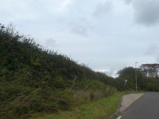
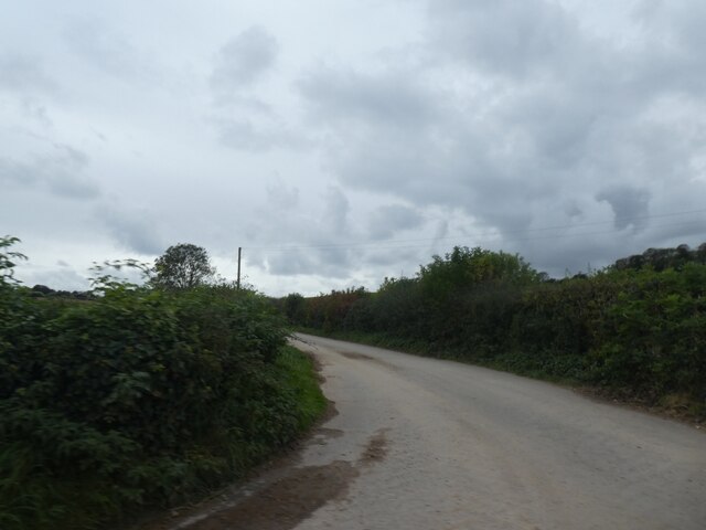
![Owermoigne village [1] Church Lane continues as a No Through Road and becomes a footpath leading to Wareham Road, A352.
Owermoigne is a small Dorset village adjacent to the A352 road, some 6 miles southeast of Dorchester. Originally a Saxon settlement by the name of Ogre that later became Oweres, and the ancient landholding family of Le Moigne came together to give the village its name. The village surrounds the church of St Michael and most working residents commute into Dorchester.](https://s0.geograph.org.uk/geophotos/07/25/25/7252524_6756c9b7.jpg)
Warmwell is located at Grid Ref: SY7585 (Lat: 50.673009, Lng: -2.3508778)
Unitary Authority: Dorset
Police Authority: Dorset
What 3 Words
///brotherly.swinging.wagers. Near Overcombe, Dorset
Nearby Locations
Related Wikis

Owermoigne
Owermoigne ( OH-ər-MOYN) is a village and civil parish in the county of Dorset in southern England, situated 6 miles (9.7 km) south-east of Dorchester...

Warmwell
Warmwell is a small village and civil parish in south west Dorset, England, situated on the B3390 road about 5 miles (8.0 km) southeast of Dorchester....

Poxwell
Poxwell (; sometimes written Pokeswell) is a hamlet and civil parish in the county of Dorset in southwest England. It is located 6 miles (9.7 km) east...

St John's Church, Poxwell
St John's Church was a Church of England church in Poxwell, Dorset, England. It was built in 1867–68 as a replacement to an earlier church and was demolished...
Broadmayne
Broadmayne is a village in the English county of Dorset. It lies two miles south-east of the county town Dorchester. The A352 main road between Dorchester...

Mayne Preceptory
Mayne Preceptory was a medieval house of Knights Hospitaller in Dorset, England, which caused the name of the settlement to change from Domesday-era Maine...

West Knighton, Dorset
West Knighton is a village and civil parish in Dorset, England, situated 3 miles (4.8 km) southeast of the county town Dorchester. It has an 11th-century...

RAF Warmwell
Royal Air Force Warmwell or more simply RAF Warmwell is a former Royal Air Force station near Warmwell in Dorset, England from 1937 to 1946, located about...
Nearby Amenities
Located within 500m of 50.673009,-2.3508778Have you been to Warmwell?
Leave your review of Warmwell below (or comments, questions and feedback).