Warleggan

Settlement in Cornwall

England

Warleggan

Old Boundary Markers on Warleggan Common Two boundary stones in the gorse and bracken scrub 120 metres west of the lane crossing Warleggan Common. Warleggan parish.

On the right is estate boundary marker CW_WARL19em. One of 5 roughly cut granite stones marked on their eastern face with the letters BC. The Tithe Apportionment shows that the land to the west of these stones is described as “allotment on Common” with the landowner being William Bickford Coham. Four of these stones have been located. Shown on the 6" map of 1907 and on the 1839 Tithe map and Apportionment of Warleggan Parish.

On the left is mine boundary marker CW_WARL20em. One of 3 surviving almost identical stones, marked T on their eastern faces, that are thought to mark the extent of the nearby Treveddoe mine sett.
Old Boundary Markers on Warleggan Common Credit: P G Moore

Warleggan is a small village situated in the southeastern part of Cornwall, England. Located about 8 miles southwest of Bodmin, it lies within the civil parish of Cardinham. With a population of approximately 200 residents, the village is known for its picturesque countryside, rich history, and close-knit community.

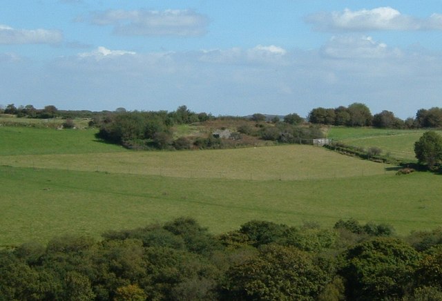
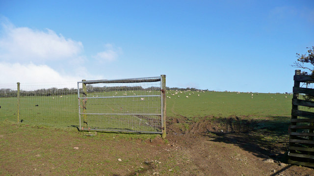
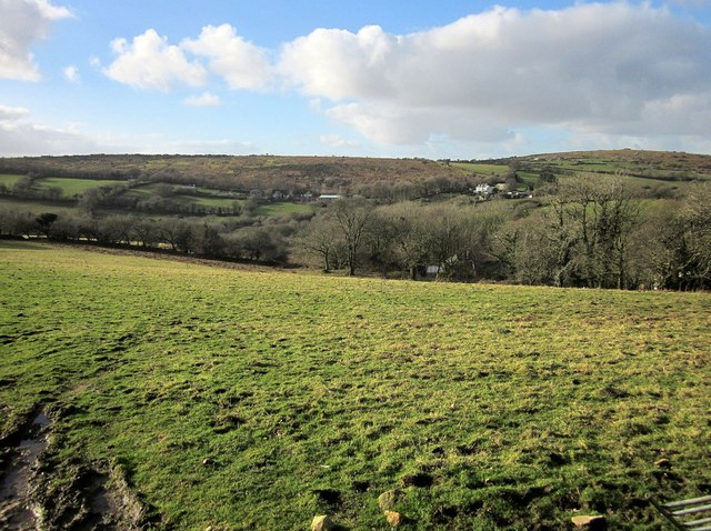
Surrounded by rolling hills and lush green fields, Warleggan offers breathtaking views of the Cornish landscape. The village is characterized by its traditional stone buildings, many of which date back several centuries. These structures, along with the local church, contribute to the village's charming and rustic atmosphere.

Despite its small size, Warleggan has a vibrant community spirit. The village hosts regular events and activities, including festivals, fairs, and social gatherings. The local pub, The Jubilee Inn, serves as a meeting place for residents and visitors alike.

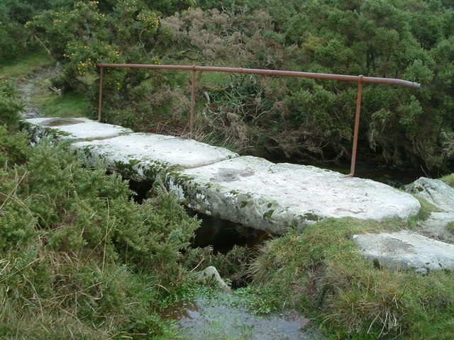
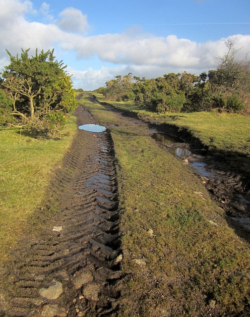
The area surrounding Warleggan is ideal for outdoor enthusiasts. The village is located near the edge of Bodmin Moor, a vast expanse of rugged moorland famous for its natural beauty and wildlife. Visitors can enjoy long walks, hiking trails, and cycling routes that showcase the area's stunning scenery.

For those interested in history, Warleggan offers glimpses into its past through landmarks such as the Holy Trinity Church, which dates back to the 15th century. The village also has connections to the mining industry, with remnants of former tin and copper mines scattered throughout the surrounding countryside.

In summary, Warleggan's idyllic setting, strong community spirit, and historical significance make it a delightful destination for nature lovers and history enthusiasts alike.

If you have any feedback on the listing, please let us know in the comments section below.

Warleggan Images

Images are sourced within 2km of 50.491419/-4.600903 or Grid Reference SX1568. Thanks to Geograph Open Source API. All images are credited.

Old Boundary Markers on Warleggan Common Two boundary stones in the gorse and bracken scrub 120 metres west of the lane crossing Warleggan Common. Warleggan parish.

On the right is estate boundary marker CW_WARL19em. One of 5 roughly cut granite stones marked on their eastern face with the letters BC. The Tithe Apportionment shows that the land to the west of these stones is described as “allotment on Common” with the landowner being William Bickford Coham. Four of these stones have been located. Shown on the 6" map of 1907 and on the 1839 Tithe map and Apportionment of Warleggan Parish.

On the left is mine boundary marker CW_WARL20em. One of 3 surviving almost identical stones, marked T on their eastern faces, that are thought to mark the extent of the nearby Treveddoe mine sett.
Old Boundary Markers on Warleggan Common
Two boundary stones in the gorse and bracken scrub 120 metres west of the lane crossing Warleggan Common. Warleggan parish. On the right is estate boundary marker CW_WARL19em. One of 5 roughly cut granite stones marked on their eastern face with the letters BC. The Tithe Apportionment shows that the land to the west of these stones is described as “allotment on Common” with the landowner being William Bickford Coham. Four of these stones have been located. Shown on the 6" map of 1907 and on the 1839 Tithe map and Apportionment of Warleggan Parish. On the left is mine boundary marker CW_WARL20em. One of 3 surviving almost identical stones, marked T on their eastern faces, that are thought to mark the extent of the nearby Treveddoe mine sett.
Warleggan Down Looking towards Tor House
Warleggan Down
Looking towards Tor House
Tremoreland, over fields I think I took a wrong lane.  I was supposed to end up a bit closer than this.
Tremoreland, over fields
I think I took a wrong lane. I was supposed to end up a bit closer than this.
Old Workhorse Abandoned Morris Minor van, one of several in nearby woodland
Old Workhorse
Abandoned Morris Minor van, one of several in nearby woodland
Old Bridge Little used footpath goes over bridge before its way is blocked by hedges and walls
Old Bridge
Little used footpath goes over bridge before its way is blocked by hedges and walls
Sheep pasture at Tremoreland View north-west uphill towards Great Care Hill on the southern edge of Bodmin Moor.
Sheep pasture at Tremoreland
View north-west uphill towards Great Care Hill on the southern edge of Bodmin Moor.
Boulders on Carburrow Tor Looking towards the old Glynn Valley china clay works in square SX1471.
Boulders on Carburrow Tor
Looking towards the old Glynn Valley china clay works in square SX1471.
Moorland on the south slope of Carburrow Tor Looking towards Tor House, currently undergoing extensive refurbishment.
Moorland on the south slope of Carburrow Tor
Looking towards Tor House, currently undergoing extensive refurbishment.
Drive leading to Mennabroom Farm Mennabroom is now operated as a holiday cottage complex <span class="nowrap"><a title="http://mennabroom.co.uk/index.html" rel="nofollow ugc noopener" href="http://mennabroom.co.uk/index.html">Link</a><img style="margin-left:2px;" alt="External link" title="External link - shift click to open in new window" src="https://s1.geograph.org.uk/img/external.png" width="10" height="10"/></span>
Drive leading to Mennabroom Farm
Mennabroom is now operated as a holiday cottage complex LinkExternal link
Track to Tor House
Track to Tor House
Sheep run, Mennabroom Farm (1) Grade II listed, probably dating from the C17 or earlier, comprising granite blocks of drystone walling, 2 metres high in places enclosing a passage entrance to a rectangular enclosure. Probably used as a lambing or shearing pen.
Sheep run, Mennabroom Farm (1)
Grade II listed, probably dating from the C17 or earlier, comprising granite blocks of drystone walling, 2 metres high in places enclosing a passage entrance to a rectangular enclosure. Probably used as a lambing or shearing pen.
Sheep run, Mennabroom Farm (2) Grade II listed, probably dating from the C17 or earlier, comprising granite blocks of drystone walling, 2 metres high in places enclosing a passage entrance to a rectangular enclosure. Probably used as a lambing or shearing pen.
Sheep run, Mennabroom Farm (2)
Grade II listed, probably dating from the C17 or earlier, comprising granite blocks of drystone walling, 2 metres high in places enclosing a passage entrance to a rectangular enclosure. Probably used as a lambing or shearing pen.
Pasture at Tamar Farm One of the buildings at Tamar Farm can be discerned through the trees across this pasture. Across the valley below Warleggan Down are Down House, and Castle Dewey (right).
Pasture at Tamar Farm
One of the buildings at Tamar Farm can be discerned through the trees across this pasture. Across the valley below Warleggan Down are Down House, and Castle Dewey (right).
Track on Letter Moor Heading away from the lane down the west edge of this area of access land.
Track on Letter Moor
Heading away from the lane down the west edge of this area of access land.
Letter Moor Looking across the track shown in <a href="https://www.geograph.org.uk/photo/4332604">SX1770 : Track on Letter Moor</a>.
Letter Moor
Looking across the track shown in SX1770 : Track on Letter Moor.
Letter Moor The moor just straddles this road to Colliford Lake. The narrow swathe of it on the left side of the road seems to have recently been cleared of gorse.
Letter Moor
The moor just straddles this road to Colliford Lake. The narrow swathe of it on the left side of the road seems to have recently been cleared of gorse.
Cairns, Carburrow Tor
Old Boundary Marker Estate Boundary Marker on Warleggan Down. WARLEGGAN parish. Inscribed B / C, perhaps for William Bickford Coham.

Milestone Society National ID: CW_WARL17em
Old Boundary Marker
Estate Boundary Marker on Warleggan Down. WARLEGGAN parish. Inscribed B / C, perhaps for William Bickford Coham. Milestone Society National ID: CW_WARL17em
Show me another place!

Warleggan is located at Grid Ref: SX1568 (Lat: 50.491419, Lng: -4.600903)

Unitary Authority: Cornwall

Police Authority: Devon and Cornwall

What 3 Words

///imperious.smothered.drill. Near Dobwalls, Cornwall

Related Wikis

Warleggan

Warleggan or Warleggon (Cornish: Gorlegan) is a civil parish on the southern edge of Bodmin Moor in Cornwall, England, United Kingdom. The parish is roughly...

Pantersbridge

Pantersbridge (Cornish: Pons Yesu, meaning Jesus Bridge)is a hamlet in the parish of St Neot, Cornwall, England, UK. It is about one mile south of Warleggan...

Mount, Cornwall

Mount is a village in the parish of Warleggan in east Cornwall, England. It lies south-west of Warleggan village. == References ==

Cornwall National Landscape

The Cornwall National Landscape (formerly the Cornwall Area of Outstanding Natural Beauty) covers 958 square kilometres (370 sq mi) in Cornwall, England...

Nearby Amenities

Located within 500m of 50.491419,-4.600903
Warleggan
Is In County: Cornwall
Name Kw: Worlegan
Place: hamlet
Source: NPE
Lat/Long: 50.4922695/-4.5999706
The data included in this document is from www.openstreetmap.org. The data is made available under ODbL.

Have you been to Warleggan?

Leave your review of Warleggan below (or comments, questions and feedback).