Wandle Park

Settlement in Surrey

England

Wandle Park

Saint Mary's Church Detail of the knapped flint on the exterior wall of the church.
Saint Mary's Church Credit: Peter Trimming

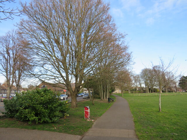
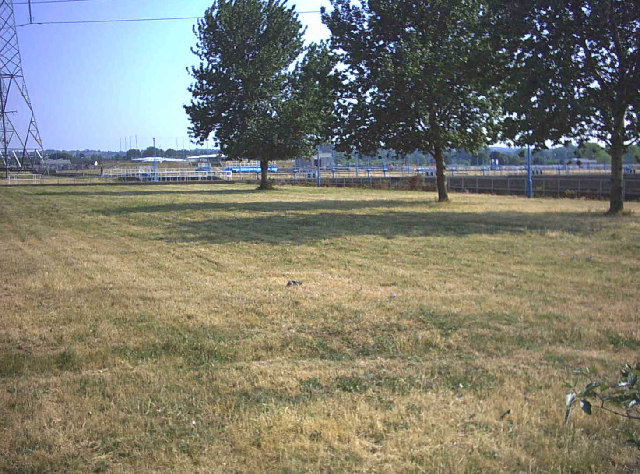
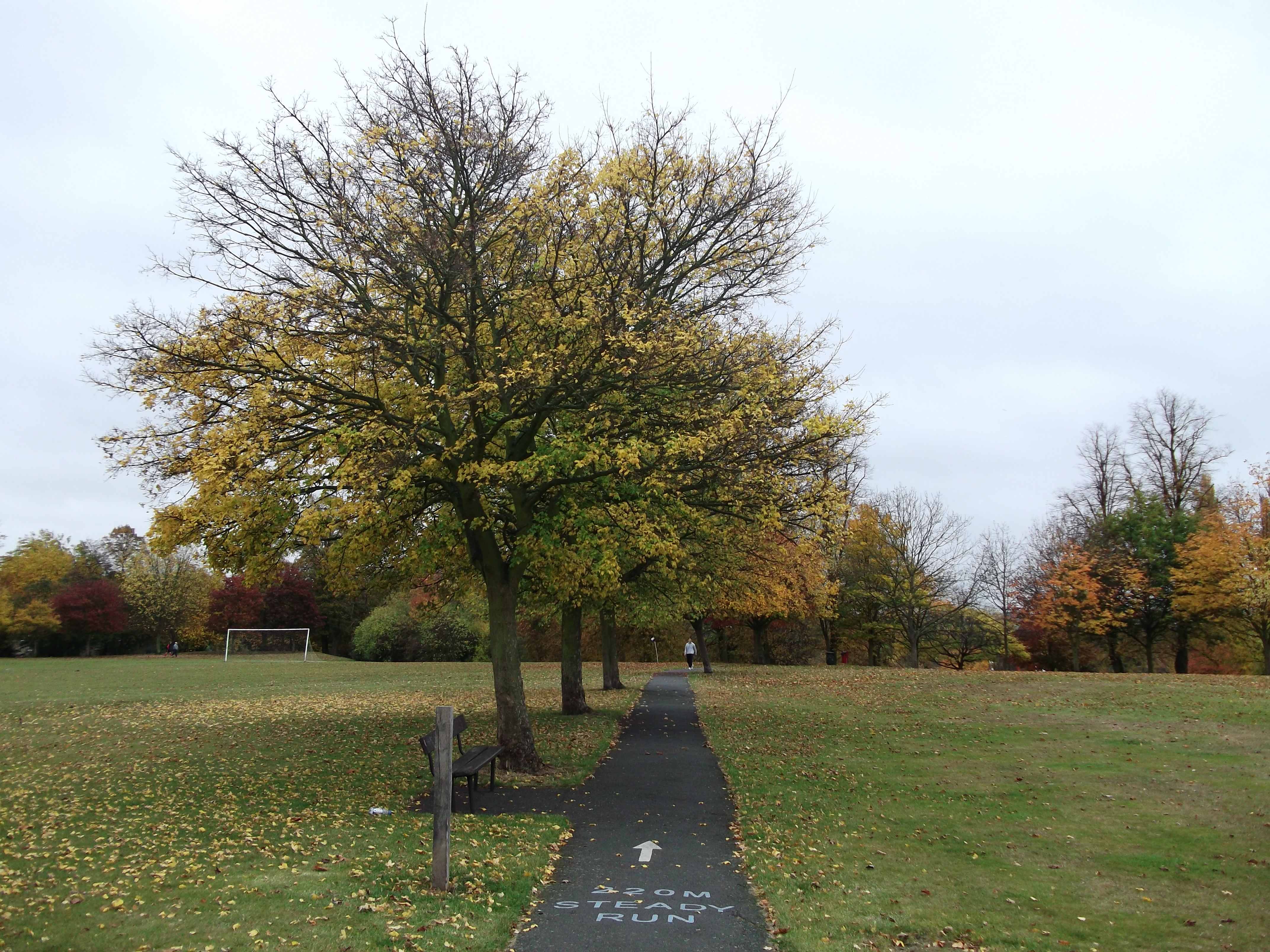
Wandle Park is a picturesque public park situated in Croydon, a borough in the county of Surrey, England. Spread over an expansive area of approximately 11 hectares, the park is a popular recreational spot for locals and visitors alike.

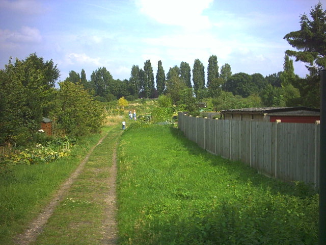
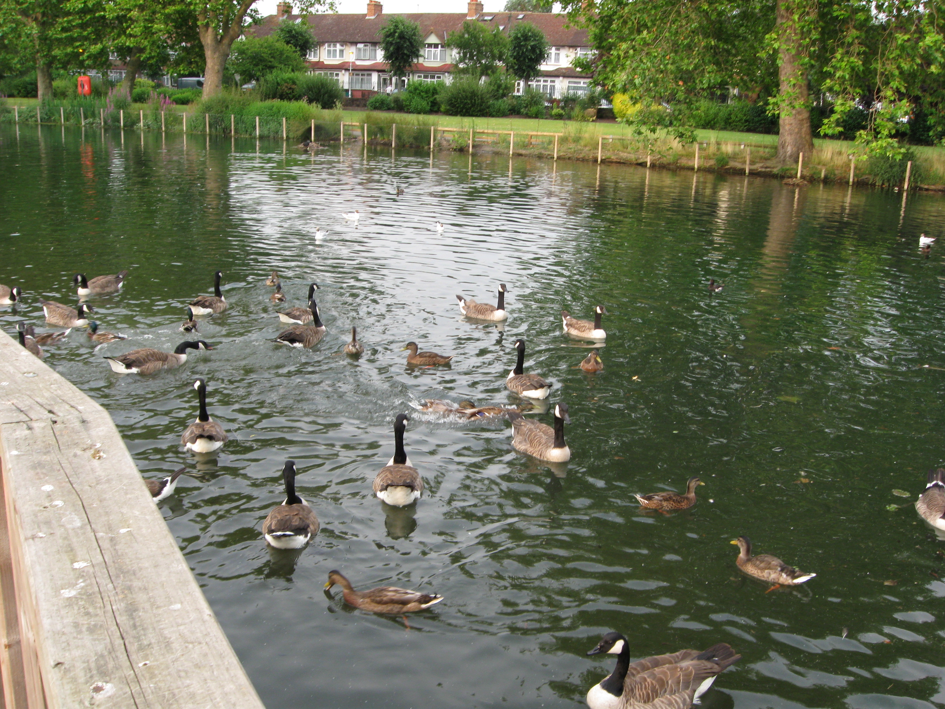
The park is named after the River Wandle, which runs through its southern boundary. The river adds to the park's charm, as it meanders through the lush green landscape, creating a serene and tranquil atmosphere. There are several footbridges strategically placed over the river, allowing visitors to enjoy leisurely walks and admire the scenic views.

Wandle Park offers a range of facilities and amenities to cater to the diverse needs of its visitors. For those seeking outdoor activities, there are well-maintained sports fields, including football pitches and cricket grounds. The park also features a children's play area, complete with swings, slides, and climbing frames, ensuring young ones can have an enjoyable time.

For those looking to relax and unwind, the park provides ample seating areas and picnic spots, allowing visitors to bask in the natural beauty and enjoy a leisurely day out. Additionally, there is a quaint café within the park, offering refreshments and light snacks.

Wandle Park is also known for hosting various community events and festivals throughout the year. These events attract a large number of people from the surrounding areas, fostering a sense of community and camaraderie.

Overall, Wandle Park in Surrey is a delightful green space, offering a range of activities, scenic beauty, and a sense of community for all who visit.

If you have any feedback on the listing, please let us know in the comments section below.
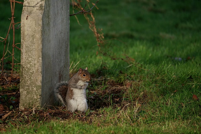
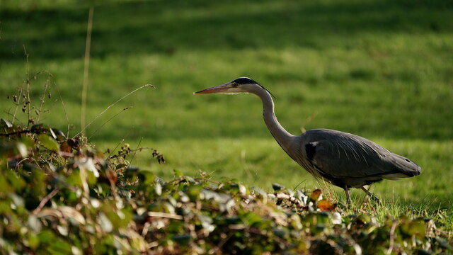
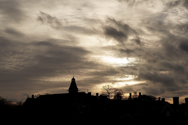
Wandle Park Images

Images are sourced within 2km of 51.36896/-0.1194986 or Grid Reference TQ3165. Thanks to Geograph Open Source API. All images are credited.

Saint Mary's Church Detail of the knapped flint on the exterior wall of the church.
Saint Mary's Church
Detail of the knapped flint on the exterior wall of the church.
Beddington Resident I went in search of an albino grey squirrel, reported on the previous day, but I only saw five of the usual colouration. Photographed in the churchyard of Saint Mary's church.
Beddington Resident
I went in search of an albino grey squirrel, reported on the previous day, but I only saw five of the usual colouration. Photographed in the churchyard of Saint Mary's church.
Little Egret Seen in Beddington Park. It had been fishing in the River Wandle, but noticed my approach.
Little Egret
Seen in Beddington Park. It had been fishing in the River Wandle, but noticed my approach.
Female Kestrel Its talons gripping the tip of a branch, close to Beddington Park.
Female Kestrel
Its talons gripping the tip of a branch, close to Beddington Park.
Female Kestrel Its talons gripping the tip of a branch, close to Beddington Park.
Female Kestrel
Its talons gripping the tip of a branch, close to Beddington Park.
Heron Seen in Beddington Park, with the heron watching a potential meal in the nearby brambles.
Heron
Seen in Beddington Park, with the heron watching a potential meal in the nearby brambles.
Carew Manor Late afternoon at Carew Manor, originally called Beddington Place, home to the Carew family from 1351-1859. It is now a school.
Carew Manor
Late afternoon at Carew Manor, originally called Beddington Place, home to the Carew family from 1351-1859. It is now a school.
Sandy Lane South Looking along Sandy Lane South towards its junction with Stafford Road.  The postbox here, sited outside Bandon Hill Primary School, is a regular recipient of knitted postbox toppers.  The one seen here, by Jan Gibson of the knitting group Yarn Bombers of Ewell, is commemorating Queen Elizabeth II's Platinum Jubilee.  For a closer view of the postbox, see <a href="https://www.geograph.org.uk/photo/7167107">TQ2963 : Postbox, Sandy Lane South</a>.
Sandy Lane South
Looking along Sandy Lane South towards its junction with Stafford Road. The postbox here, sited outside Bandon Hill Primary School, is a regular recipient of knitted postbox toppers. The one seen here, by Jan Gibson of the knitting group Yarn Bombers of Ewell, is commemorating Queen Elizabeth II's Platinum Jubilee. For a closer view of the postbox, see TQ2963 : Postbox, Sandy Lane South.
Postbox, Sandy Lane South Postbox in Sandy Lane South sited outside Bandon Hill Primary School,  a regular recipient of knitted postbox toppers.  This one, by Jan Gibson of the knitting group Yarn Bombers of Ewell, is commemorating Queen Elizabeth II's Platinum Jubilee.  For a close up of the topper, see <a href="https://www.geograph.org.uk/photo/7167111">TQ2963 : Postbox topper, Sandy Lane South</a> and for a wider view see <a href="https://www.geograph.org.uk/photo/7167103">TQ2963 : Sandy Lane South</a>.
Postbox, Sandy Lane South
Postbox in Sandy Lane South sited outside Bandon Hill Primary School, a regular recipient of knitted postbox toppers. This one, by Jan Gibson of the knitting group Yarn Bombers of Ewell, is commemorating Queen Elizabeth II's Platinum Jubilee. For a close up of the topper, see TQ2963 : Postbox topper, Sandy Lane South and for a wider view see TQ2963 : Sandy Lane South.
Postbox topper, Sandy Lane South A knitted postbox topper on a postbox in Sandy Lane South sited outside Bandon Hill Primary School, a regular recipient of such decorations.  This one, by Jan Gibson of the knitting group Yarn Bombers of Ewell, is commemorating Queen Elizabeth II's Platinum Jubilee.  For a photo of the whole postbox see <a href="https://www.geograph.org.uk/photo/7167107">TQ2963 : Postbox, Sandy Lane South</a>.
Postbox topper, Sandy Lane South
A knitted postbox topper on a postbox in Sandy Lane South sited outside Bandon Hill Primary School, a regular recipient of such decorations. This one, by Jan Gibson of the knitting group Yarn Bombers of Ewell, is commemorating Queen Elizabeth II's Platinum Jubilee. For a photo of the whole postbox see TQ2963 : Postbox, Sandy Lane South.
Beddington, St Mary
Beddington, St Mary
Beddington Cross, near Croydon Beddington Cross is an industrial estate near Croydon in the outer suburbs of south London.  Its occupants include a bus garage used by Abellio.
Beddington Cross, near Croydon
Beddington Cross is an industrial estate near Croydon in the outer suburbs of south London. Its occupants include a bus garage used by Abellio.
Bus depot at Beddington, near Croydon A yard at a bus depot in Beddington, in the suburbs of south London.  The depot is occupied by Go-Ahead London.  This part of Beddington is occupied by industrial premises.  Another bus garage operated by a different company, Abellio, is close by.

The road passing to the left is Beddington Lane, which forms part of the B272.
Bus depot at Beddington, near Croydon
A yard at a bus depot in Beddington, in the suburbs of south London. The depot is occupied by Go-Ahead London. This part of Beddington is occupied by industrial premises. Another bus garage operated by a different company, Abellio, is close by. The road passing to the left is Beddington Lane, which forms part of the B272.
Path in Mellows Park, near Wallington A path along the edge of Mellows Park, in the outer suburbs of south London.

This image was taken on a February afternoon.  Trees were bare for the winter season,
Path in Mellows Park, near Wallington
A path along the edge of Mellows Park, in the outer suburbs of south London. This image was taken on a February afternoon. Trees were bare for the winter season,
Car showroom near Wallington A car sales showroom near Wallington, on the corner of Sandy Lane North which leads away to the right of the building.  Sandy Lane North is a one-way street, as indicated by the small blue signs either side of the road.
Car showroom near Wallington
A car sales showroom near Wallington, on the corner of Sandy Lane North which leads away to the right of the building. Sandy Lane North is a one-way street, as indicated by the small blue signs either side of the road.
Waterer Rise, near Wallington Waterer Rise is a residential road in the outer suburbs of south London.

This image was taken on a February afternoon,  Trees were bare for the winter season.
Waterer Rise, near Wallington
Waterer Rise is a residential road in the outer suburbs of south London. This image was taken on a February afternoon, Trees were bare for the winter season.
Beddington Sewage Treatment Works. Beddington Lane (B272). Poor photograph; they're difficult to approach.
Beddington Sewage Treatment Works.
Beddington Lane (B272). Poor photograph; they're difficult to approach.
Entrance to Demesne Road Allotments, Wallington.
Show me another place!

Wandle Park is located at Grid Ref: TQ3165 (Lat: 51.36896, Lng: -0.1194986)

Unitary Authority: Croydon

Police Authority: Metropolitan

What 3 Words

///knots.icons.cattle. Near South Croydon, London

Nearby Locations

Wandle Park Waddon

Related Wikis

Waddon Ponds

Waddon Ponds is an ornamental 8.5 acres (3.4 ha) urban park / inland water in the western part of the London Borough of Croydon, by whom it is managed...

Waddon railway station

Waddon railway station is in the London Borough of Croydon in south London. The station and all trains serving it are operated by Southern. It is in Travelcard...

Wandle Park tram stop

Wandle Park tram stop is a stop adjacent to Wandle Park in the London Borough of Croydon in the southern suburbs of London. It serves the residential area...

St Andrew's Church of England High School

St Andrew's Church of England High School was a Church of England voluntary aided school in Central Croydon, Greater London. First opened in 1862, The...

Duppas Hill

Duppas Hill (or Duppa's Hill) is a park, road and surrounding residential area in Waddon, near Croydon in Greater London (and historically in Surrey)....

Waddon

Waddon () is a neighbourhood in the London Borough of Croydon, at the western end of the town of Croydon. The area borders the London Borough of Sutton...

Croydon

Croydon is a large town in South London, England, 9.3 miles (15.0 km) south of Charing Cross. Part of the London Borough of Croydon, a local government...

Wandle Park, Croydon

Wandle Park is an 8.5-hectare (21-acre) park located in the Broad Green Ward of Croydon, south London, England. It was opened in 1890 by the Mayor of...

Nearby Amenities

Located within 500m of 51.36896,-0.1194986
Traffic Signals
Traffic Signals: signal
Traffic Signals Direction: backward
Lat/Long: 51.366848/-0.1184328
Crossing
Crossing: traffic_signals
Crossing Island: no
Crossing Ref: pelican
Lat/Long: 51.3684032/-0.118646
Crossing
Crossing: traffic_signals
Lat/Long: 51.3666727/-0.1181483
Fuel
Esso
Brand: Esso
Brand Wikidata: Q867662
Brand Wikipedia: en:Esso
Contact Website: https://www.esso.co.uk/en-gb/find-station/esso-croydon-essomfgwaddoncourt-100354374
Operator: Motor Fuel Group
Operator Website: https://www.motorfuelgroup.com/locations/waddon-court-fs870/
Operator Wikidata: Q107271358
Lat/Long: 51.36989/-0.1171568
Barrier: hampshire_gate
Lat/Long: 51.3711638/-0.1209233
Waddon
Naptan AtcoCode: 9100WADDON
Network: National Rail
Network Website: https://www.nationalrail.co.uk/stations/wdo/
Network Wikidata: Q26334
Operator: Southern
Public Transport: station
Railway: station
Ref Crs: WDO
Source: NPE
Wheelchair: limited
Wheelchair Description: Step-free access via side gate to platform 2 (to Sutton). Steps to platform 1 (to London).
Wikidata: Q2120787
Wikipedia: en:Waddon railway station
Lat/Long: 51.3673338/-0.1174351
Post Box
Operator: Royal Mail
Operator Wikidata: Q638098
Post Box Type: pillar
Ref: CR0 395
Royal Cypher: GR
Royal Cypher Wikidata: Q33102273
Lat/Long: 51.3676741/-0.1263635
Post Box
Collection Times: Mo-Fr 09:00; Sa 07:00; Su off
Drive Through: no
Operator: Royal Mail
Operator Wikidata: Q638098
Post Box Design: type_b
Post Box Type: pillar
Ref: CR0 399D
Royal Cypher: GR
Royal Cypher Wikidata: Q33102273
Source: survey
Lat/Long: 51.3701385/-0.1238226
Turning Circle
Source: Bing
Lat/Long: 51.3704773/-0.1215449
Post Box
Operator: Royal Mail
Operator Wikidata: Q638098
Post Box Type: pillar
Ref: CR0 271
Royal Cypher: GR
Royal Cypher Wikidata: Q33102273
Lat/Long: 51.3675393/-0.1202327
Post Box
Collection Times: Mo-Fr 09:00; Sa 07:00; Su off
Drive Through: no
Operator: Royal Mail
Operator Wikidata: Q638098
Post Box Design: type_b
Post Box Type: pillar
Ref: CR0 86D
Source: survey
Lat/Long: 51.3710769/-0.1169474
Bus Stop
Waddon Station
Local Ref: NN
Naptan AtcoCode: 490001305A
Naptan Bearing: N
Naptan CommonName: Waddon
Naptan Indicator: Stop NN
Naptan Street: PURLEY WAY
Public Transport: platform
Lat/Long: 51.365773/-0.1183758
Bus Stop
Waddon Station
Local Ref: SD
Naptan AtcoCode: 490001305B
Naptan Bearing: S
Naptan CommonName: Waddon
Naptan Indicator: Stop SD
Naptan Street: PURLEY WAY
Naptan Verified: no
Public Transport: platform
Lat/Long: 51.3660167/-0.1181423
Bus Stop
Alton Road
Local Ref: NT
Naptan AtcoCode: 490003281N
Naptan Bearing: N
Naptan CommonName: Waddon Alton Road
Naptan Indicator: NT
Naptan Street: PURLEY WAY
Naptan Verified: no
Public Transport: platform
Lat/Long: 51.3688066/-0.1184057
Bus Stop
Alton Road
Local Ref: SU
Naptan AtcoCode: 490003281S
Naptan Bearing: S
Naptan CommonName: Waddon Alton Road
Naptan Indicator: SU
Naptan Street: PURLEY WAY
Naptan Verified: no
Public Transport: platform
Lat/Long: 51.3687685/-0.1182227
Bus Stop
Epsom Road
Local Ref: EW
Naptan AtcoCode: 490006611E
Naptan Bearing: E
Naptan CommonName: Epsom Road
Naptan Indicator: EW
Naptan Street: EPSOM ROAD
Naptan Verified: no
Public Transport: platform
Lat/Long: 51.3697285/-0.1134598
Bus Stop
Epsom Road
Naptan AtcoCode: 490006611W
Naptan Bearing: N
Naptan CommonName: Epsom Road
Naptan Street: EPSOM ROAD
Naptan Verified: no
Public Transport: platform
Lat/Long: 51.369396/-0.1135985
Bus Stop
Stafford Road
Bus: yes
Local Ref: WD
Naptan AtcoCode: 490006869W
Naptan Bearing: W
Naptan CommonName: Stafford Road Five Ways
Naptan Indicator: Stop WD
Naptan Verified: no
Public Transport: platform
Ref: 74191
Source Ref: naptan
Lat/Long: 51.3648203/-0.1171831
Bus Stop
Waddon Leisure Centre / Fiveways
Local Ref: WB
Naptan AtcoCode: 490006869W2
Naptan Bearing: W
Naptan CommonName: Stafford Road Five Ways
Naptan Indicator: Stop WB
Naptan Street: STAFFORD ROAD
Naptan Verified: no
Public Transport: platform
Lat/Long: 51.3654441/-0.1173536
Bus Stop
Lavington Road
Local Ref: F
Naptan AtcoCode: 490009010E
Naptan Bearing: E
Naptan CommonName: Lavington Road
Naptan Indicator: Stop F
Naptan Verified: no
Public Transport: platform
Lat/Long: 51.3677106/-0.1255945
Bus Stop
Lavington Road
Local Ref: K
Naptan AtcoCode: 490009010W
Naptan Bearing: W
Naptan CommonName: Lavington Road
Naptan Indicator: Stop K
Naptan Verified: no
Public Transport: platform
Lat/Long: 51.3675998/-0.1259829
Bus Stop
Purley Way / Waddon Station
Local Ref: WQ
Naptan AtcoCode: 490011275C
Naptan Bearing: N
Naptan CommonName: Purley Way Waddon Station
Naptan Indicator: WQ
Naptan Street: CROYDON ROAD
Naptan Verified: no
Public Transport: platform
Lat/Long: 51.3676156/-0.1199374
Bus Stop
Purley Way / Waddon Station
Local Ref: ES
Naptan AtcoCode: 490011275D
Naptan Bearing: N
Naptan CommonName: Purley Way Waddon Station
Naptan Indicator: ES
Naptan Street: CROYDON ROAD
Naptan Verified: no
Public Transport: platform
Lat/Long: 51.3677063/-0.120176
Bus Stop
Waddon Station
Bus: yes
Local Ref: EP
Naptan AtcoCode: 490013586E
Naptan Bearing: E
Naptan CommonName: Waddon Station Stafford Road
Naptan Indicator: Stop EP
Naptan Street: STAFFORD ROAD
Naptan Verified: no
Public Transport: platform
Ref: 75092
Source Ref: naptan
Lat/Long: 51.3671037/-0.1163773
Bus Stop
Waddon Station
Bus: yes
Local Ref: WA
Naptan AtcoCode: 490013586W
Naptan Bearing: W
Naptan CommonName: Waddon Station Stafford Road
Naptan Indicator: Stop WA
Naptan Street: STAFFORD ROAD
Naptan Verified: no
Public Transport: platform
Ref: 52965
Source Ref: naptan
Lat/Long: 51.3670857/-0.1161319
Bus Stop
Courtney Road
Bus: yes
Local Ref: EX
Naptan AtcoCode: 490014110B
Naptan Bearing: E
Naptan CommonName: Waddon Post Office Purley Way
Naptan Indicator: Stop EX
Naptan Street: WADDON ROAD
Naptan Verified: no
Public Transport: platform
Ref: 74226
Lat/Long: 51.3715093/-0.1155847
Bus Stop
Purley Way / Waddon Road
Bus: yes
Local Ref: NZ
Naptan AtcoCode: 490014110N
Naptan Bearing: N
Naptan CommonName: Waddon Post Office Purley Way
Naptan Indicator: Stop NZ
Naptan Street: PURLEY WAY
Naptan Verified: no
Public Transport: platform
Ref: 56574
Lat/Long: 51.3720969/-0.1174513
Bus Stop
Purley Way / Waddon Road
Bus: yes
Local Ref: SV
Naptan AtcoCode: 490014110S
Naptan Bearing: S
Naptan CommonName: Waddon Post Office Purley Way
Naptan Indicator: Stop SV
Naptan Verified: no
Public Transport: platform
Ref: 51351
Lat/Long: 51.3706076/-0.1170408
Post Box
Operator: Royal Mail
Operator Wikidata: Q638098
Ref: CR0 19
Lat/Long: 51.3668256/-0.116381
Ref GB Tflcid: RWG216436
Traffic Calming: hump
Lat/Long: 51.3726938/-0.1201699
Give Way
Lat/Long: 51.3664726/-0.1164878
Traffic Signals
Traffic Signals: signal
Lat/Long: 51.3675531/-0.1160793
Crossing
Crossing: marked
Lat/Long: 51.3675827/-0.1185317
Yes
Barrier: swing_gate
Bicycle: yes
Emergency: yes
Foot: yes
Material: metal
Motor Vehicle: no
Wheelchair: yes
Lat/Long: 51.3705122/-0.1142053
Fast Food
Fiveways Fish Bar
Addr City: Croydon
Addr Housenumber: 9
Addr Parentstreet: Denning Avenue
Addr Postcode: CR0 4DJ
Addr Street: Central Parade
Cuisine: fish_and_chips
Fhrs Authority: Croydon
Fhrs Id: 7714
Lat/Long: 51.3646958/-0.1177045
Mint & Curry Leaves
Addr City: Croydon
Addr Housenumber: 10
Addr Parentstreet: Denning Avenue
Addr Postcode: CR0 4DJ
Addr Street: Central Parade
Fhrs Authority: Croydon
Fhrs Id: 1042860
Shop: yes
Lat/Long: 51.3646615/-0.1178104
Mace Michael Store
Addr City: Croydon
Addr Housenumber: 8
Addr Parentstreet: Denning Avenue
Addr Postcode: CR0 4DJ
Addr Street: Central Parade
Shop: convenience
Lat/Long: 51.3647117/-0.1176095
Poundland
Brand: Poundland
Brand Wikidata: Q1434528
Brand Wikipedia: en:Poundland
Shop: variety_store
Lat/Long: 51.3677517/-0.1175102
Pets at Home
Brand: Pets at Home
Brand Wikidata: Q7179258
Brand Wikipedia: en:Pets at Home
Shop: pet
Website: https://community.petsathome.com/store/croydon/
Lat/Long: 51.3676399/-0.1179142
Fast Food
Pizza Centre
Addr City: Croydon
Addr Housenumber: 443
Addr Postcode: CR0 4RG
Addr Street: Purley Way
Cuisine: pizza
Fhrs Authority: Croydon
Fhrs Id: 1022159
Lat/Long: 51.3646251/-0.1178872
Cafe
Waddon Cafe Restaurant
Addr City: Croydon
Addr Housenumber: 445
Addr Postcode: CR0 4RG
Addr Street: Purley Way
Fhrs Authority: Croydon
Fhrs Id: 22201
Lat/Long: 51.3645703/-0.1179237
Crossing
Lat/Long: 51.372164/-0.1177003
Barrier: block
Lat/Long: 51.3732587/-0.1177227
Waddon
Place: suburb
Wikidata: Q1996918
Lat/Long: 51.3649811/-0.1181995
Toilets
Source: survey
Lat/Long: 51.3693889/-0.1193787
Barrier: bollard
Lat/Long: 51.3700553/-0.1254082
Barrier: bollard
Lat/Long: 51.3703248/-0.1241296
Barrier: hampshire_gate
Source: survey
Lat/Long: 51.3708117/-0.1210895
Speed Camera
Direction: 210
Maxspeed: 30 mph
Lat/Long: 51.3685615/-0.118394
Flip Out London
Addr City: Croydon
Addr Postcode: CR0 4AA
Addr Street: Mill Lane
Addr Unit: Unit 10
Leisure: amusement_arcade
Lat/Long: 51.3710622/-0.1230054
Bicycle Parking
Access: yes
Bicycle Parking: stands
Capacity: 6
Surface: asphalt
Lat/Long: 51.3713169/-0.1198679
Fast Food
La Pizzeria
Addr City: Croydon
Addr Housenumber: 352
Addr Postcode: CR0 4NY
Addr Street: Purley Way
Cuisine: pizza
Fhrs Authority: Croydon
Fhrs Id: 983432
Source: https://ratings.food.gov.uk/OpenDataFiles/FHRS507en-GB.xml;survey
Takeaway: yes
Lat/Long: 51.3711512/-0.117404
Telephone
Booth: KXPlus
Covered: booth
Operator: BT
Operator Wikidata: Q593786
Lat/Long: 51.3712163/-0.1173963
Vending Machine
Vending: parking_tickets
Lat/Long: 51.3715505/-0.1140839
Bench
Lat/Long: 51.3712966/-0.1198085
Bicycle Parking
Access: yes
Bicycle Parking: stands
Capacity: 2
Fee: no
Lat/Long: 51.370936/-0.1169135
Global Food & Wine
Addr City: Croydon
Addr Housenumber: 354-356
Addr Postcode: CR0 4NY
Addr Street: Purley Way
Fhrs Authority: Croydon
Fhrs Id: 7099
Shop: convenience
Source: survey;https://ratings.food.gov.uk/OpenDataFiles/FHRS507en-GB.xml
Lat/Long: 51.3710719/-0.1173809
Crossing
Crossing: unmarked
Crossing Island: yes
Lat/Long: 51.3676458/-0.1234162
Crossing
Crossing: unmarked
Lat/Long: 51.3676618/-0.125788
Crossing
Crossing: unmarked
Crossing Island: yes
Lat/Long: 51.3675822/-0.1237883
Addr City: Croydon
Addr Housenumber: 374
Addr Postcode: CR0 4NY
Addr Street: Purley Way
Lat/Long: 51.3704879/-0.1174808
Addr City: Croydon
Addr Housenumber: 360
Addr Postcode: CR0 4NY
Addr Street: Purley Way
Lat/Long: 51.3708044/-0.1174594
Green Double Glazing & Conservatories Ltd
Addr City: Croydon
Addr Housenumber: 358
Addr Postcode: CR0 4NY
Addr Street: Purley Way
Craft: glaziery
Source: survey
Lat/Long: 51.3709719/-0.1173628
Addr City: Croydon
Addr Housenumber: 334
Addr Postcode: CR0 4NS
Addr Street: Purley Way
Lat/Long: 51.3717831/-0.1176122
Addr City: Croydon
Addr Housenumber: 348
Addr Postcode: CR0 4NS
Addr Street: Purley Way
Lat/Long: 51.3714214/-0.1175532
Addr City: Croydon
Addr Housename: Windynook
Addr Housenumber: 50
Addr Postcode: CR0 4PP
Addr Street: Lavington Road
Source: survey;code-point open
Lat/Long: 51.3699452/-0.1251348
Addr City: Croydon
Addr Housenumber: 47
Addr Postcode: CR0 4PQ
Addr Street: Lavington Road
Source: survey;code-point open
Lat/Long: 51.3698182/-0.1255892
Addr City: Croydon
Addr Housenumber: 44
Addr Postcode: CR0 4PL
Addr Street: Aldwick Road
Source: survey;code-point open
Lat/Long: 51.3701546/-0.1241768
Addr City: Croydon
Addr Housenumber: 49
Addr Postcode: CR0 4PN
Addr Street: Aldwick Road
Source: survey;code-point open
Lat/Long: 51.370326/-0.1237529
A. G. Major
Addr City: Croydon
Addr Postcode: CR0 4AA
Addr Street: Mill Lane
Addr Unit: 1
Craft: engineering
Lat/Long: 51.371519/-0.1207739
Addr City: Croydon
Addr Housenumber: 93
Addr Postcode: CR0 4AH
Addr Street: The Ridgeway
Source: survey;code-point open
Lat/Long: 51.3706356/-0.1215485
Addr City: Croydon
Addr Housenumber: 99
Addr Postcode: CR0 4AH
Addr Street: The Ridgeway
Source: survey;code-point open
Lat/Long: 51.3707828/-0.1212311
Addr City: Croydon
Addr Housenumber: 68
Addr Postcode: CR0 4AF
Addr Street: The Ridgeway
Source: survey;code-point open
Lat/Long: 51.3702653/-0.121586
Addr City: Croydon
Addr Housenumber: 46
Addr Postcode: CR0 4JZ
Addr Street: Lodge Avenue
Source: survey;code-point open
Lat/Long: 51.3702199/-0.119668
Addr City: Croydon
Addr Housenumber: 62
Addr Postcode: CR0 4AJ
Addr Street: Waddon Court Road
Source: survey;code-point open
Lat/Long: 51.3687638/-0.1193087
Addr City: Croydon
Addr Housenumber: 35
Addr Postcode: CR0 4AP
Addr Street: Waddon Court Road
Source: survey;code-point open
Lat/Long: 51.3688601/-0.1188303
Addr City: Croydon
Addr Housenumber: 33
Addr Postcode: CR0 4AP
Addr Street: Waddon Court Road
Source: survey;code-point open
Lat/Long: 51.3690845/-0.1187862
Addr City: Croydon
Addr Housenumber: 57
Addr Postcode: CR0 4LZ
Addr Street: Alton Road
Source: survey;code-point open
Lat/Long: 51.3688822/-0.1186363
Addr City: Croydon
Addr Housenumber: 55
Addr Postcode: CR0 4LZ
Addr Street: Alton Road
Source: survey;code-point open
Lat/Long: 51.3688946/-0.1185239
Addr City: Croydon
Addr Housenumber: 53
Addr Postcode: CR0 4LZ
Addr Street: Alton Road
Source: survey;code-point open
Lat/Long: 51.3689221/-0.1178802
Addr City: Croydon
Addr Housenumber: 64
Addr Postcode: CR0 4LY
Addr Street: Alton Road
Source: survey;code-point open
Lat/Long: 51.3692882/-0.1174238
Addr City: Croydon
Addr Housenumber: 50
Addr Postcode: CR0 4LY
Addr Street: Alton Road
Source: survey;code-point open
Lat/Long: 51.369436/-0.116828
Addr City: Croydon
Addr Housenumber: 33
Addr Postcode: CR0 4LZ
Addr Street: Alton Road
Source: survey;code-point open
Lat/Long: 51.36918/-0.1167342
Addr City: Croydon
Addr Housenumber: 30
Addr Postcode: CR0 4LY
Addr Street: Alton Road
Source: survey;code-point open
Lat/Long: 51.36972/-0.1158345
Addr City: Croydon
Addr Housenumber: 3
Addr Postcode: CR0 4LZ
Addr Street: Alton Road
Source: survey;code-point open
Lat/Long: 51.3696593/-0.1151429
Addr City: Croydon
Addr Housenumber: 29
Addr Postcode: CR0 4LW
Addr Street: Waddon Park Avenue
Source: survey;code-point open
Lat/Long: 51.3696415/-0.1146722
Addr City: Croydon
Addr Housenumber: 2
Addr Postcode: CR0 4LY
Addr Street: Alton Road
Source: survey;code-point open
Lat/Long: 51.3700388/-0.1146322
Addr City: Croydon
Addr Housenumber: 1
Addr Postcode: CR0 4LW
Addr Street: Waddon Park Avenue
Source: survey;code-point open
Lat/Long: 51.3702006/-0.1139215
Addr City: Croydon
Addr Housenumber: 75
Addr Postcode: CR0 4ND
Addr Street: Epsom Road
Source: survey;code-point open
Lat/Long: 51.3695915/-0.1131975
Addr City: Croydon
Addr Housenumber: 71
Addr Postcode: CR0 4ND
Addr Street: Epsom Road
Source: survey;code-point open
Lat/Long: 51.3696784/-0.1130889
Addr City: Croydon
Addr Housename: Little Gables
Addr Housenumber: 65
Addr Postcode: CR0 4NB
Addr Street: Epsom Road
Source: survey;code-point open
Lat/Long: 51.3697878/-0.1127992
Addr City: Croydon
Addr Housenumber: 63
Addr Postcode: CR0 4NB
Addr Street: Epsom Road
Source: survey;code-point open
Lat/Long: 51.3698996/-0.112824
Addr City: Croydon
Addr Housenumber: 70
Addr Postcode: CR0 4NA
Addr Street: Epsom Road
Source: survey;code-point open
Lat/Long: 51.3702993/-0.1128716
Post Box
Brand: Royal Mail
Brand Wikidata: Q638098
Brand Wikipedia: en:Royal Mail
Collection Times: Mo-Fr 09:00; Sa 07:00; Su off
Drive Through: no
Operator: Royal Mail
Operator Wikidata: Q638098
Post Box Design: type_b
Post Box Type: pillar
Ref: CR0 217D
Royal Cypher: GR
Royal Cypher Wikidata: Q33102273
Source: survey
Lat/Long: 51.3697783/-0.1149123
Wolseley
Addr City: Croydon
Addr Housenumber: 315
Addr Postcode: CR0 4NU
Addr Street: Purley Way
Brand: Wolseley
Brand Wikidata: Q8030423
Craft: plumber
Shop: trade
Source: survey;code-point open
Trade: plumbing
Website: https://www.wolseley.co.uk/branch/croydon/
Lat/Long: 51.3721001/-0.1168002
National Tyres & Autocare
Addr City: Croydon
Addr Housenumber: 317
Addr Postcode: CR0 4NU
Addr Street: Purley Way
Brand: National Tyres and Autocare
Brand Wikidata: Q6979055
Shop: car_repair
Short Name: National Tyres
Source: survey;code-point open
Lat/Long: 51.3719279/-0.1167699
Pub
The Hare and Hounds
Addr City: Croydon
Addr Housenumber: 325
Addr Postcode: CR0 4NU
Addr Street: Purley Way
Fhrs Authority: Croydon
Fhrs Id: 7097
Source: survey;https://ratings.food.gov.uk/OpenDataFiles/FHRS507en-GB.xml
Lat/Long: 51.3715457/-0.1170962
Deckboard Hardwood Flooring Centre
Addr City: Croydon
Addr Housenumber: 271
Addr Postcode: CR0 4XF
Addr Street: Purley Way
Craft: floorer
Lat/Long: 51.3726701/-0.1161274
Fast Food
New Star
Addr City: Croydon
Addr Housenumber: 345
Addr Postcode: CR0 4NW
Addr Street: Purley Way
Cuisine: chinese
Drive Through: no
Fhrs Authority: Croydon
Fhrs Id: 1012373
Source: survey;https://ratings.food.gov.uk/OpenDataFiles/FHRS507en-GB.xml
Lat/Long: 51.3710068/-0.1168432
Sofas and Friends
Addr City: Croydon
Addr Housenumber: 351
Addr Postcode: CR0 4NW
Addr Street: Purley Way
Shop: furniture
Source: survey
Lat/Long: 51.3708605/-0.1168543
Crossing
Lat/Long: 51.3713824/-0.1172297
Waddon
Public Transport: stop_position
Railway: stop
Train: yes
Lat/Long: 51.3679315/-0.1163447
Waddon
Public Transport: stop_position
Railway: stop
Train: yes
Lat/Long: 51.3670118/-0.11812
Traffic Signals
Traffic Signals Direction: backward
Lat/Long: 51.3714723/-0.1172528
Traffic Signals
Traffic Signals Direction: forward
Lat/Long: 51.3712923/-0.1174687
Traffic Signals
Traffic Signals Direction: forward
Lat/Long: 51.3713007/-0.1169926
Traffic Signals
Traffic Signals Direction: forward
Lat/Long: 51.3711399/-0.1171616
Traffic Signals
Traffic Signals Direction: forward
Lat/Long: 51.3677784/-0.1193108
Traffic Signals
Traffic Signals Direction: backward
Lat/Long: 51.3677241/-0.1186301
Crossing
Crossing: traffic_signals
Lat/Long: 51.3678192/-0.1192339
Traffic Signals
Traffic Signals Direction: forward
Lat/Long: 51.3677187/-0.1192835
Traffic Signals
Traffic Signals Direction: forward
Lat/Long: 51.3675134/-0.1188865
Traffic Signals
Lat/Long: 51.3667768/-0.1181179
Traffic Signals
Traffic Signals Direction: forward
Lat/Long: 51.366578/-0.1182751
Description: Joint bay for National Grid's underground Beddington–Rowdown 400kV circuit.
Man Made: street_cabinet
Operator: National Grid
Street Cabinet: power
Lat/Long: 51.3647668/-0.116942
Barrier: height_restrictor
Lat/Long: 51.3652938/-0.1191435
Crossing
Crossing: marked
Lat/Long: 51.3675363/-0.1182653
Barrier: bollard
Lat/Long: 51.3700172/-0.1255658
Traffic Signals
Traffic Signals Direction: backward
Lat/Long: 51.3684474/-0.1186071
Traffic Signals
Traffic Signals Direction: forward
Lat/Long: 51.3683654/-0.1186803
Smyths
Brand: Smyths
Brand Wikidata: Q7546779
Brand Wikipedia: en:Smyths
Shop: toys
Lat/Long: 51.3725402/-0.1189469
ALDI
Addr City: Croydon
Addr Housenumber: 330
Addr Postcode: CR0 4XJ
Addr Street: Purley Way
Brand: ALDI
Brand Wikidata: Q41171672
Brand Wikipedia: en:Aldi
Contact Website: https://stores.aldi.co.uk/croydon/purley-way
Description: Aldi Croydon Purley Way
Fhrs Id: 1316032
Shop: supermarket
Source Addr: FHRS Open Data
Lat/Long: 51.3723618/-0.1188797
Traffic Calming: choker
Lat/Long: 51.3724889/-0.1154314
Crossing
Fixme: The pedestrian crossing of the side road here may be either via a speed table (traffic_calming=table) or a "Copenhagen Crossing" (crossing:continuous=yes) #tflcid #surveyme
Lat/Long: 51.3676606/-0.1219961
Stop
Direction: forward
Lat/Long: 51.3667744/-0.1165691
Bicycle Parking
Lat/Long: 51.3670288/-0.1175181
Crossing
Crossing: traffic_signals
Lat/Long: 51.3678721/-0.1159341
Give Way
Lat/Long: 51.3681394/-0.1153199
Traffic Signals
Traffic Signals: signal
Lat/Long: 51.3677789/-0.1158876
Crossing
Crossing: traffic_signals
Lat/Long: 51.3677633/-0.1159296
Crossing
Crossing: traffic_signals
Lat/Long: 51.3675961/-0.1160686
Traffic Signals
Traffic Signals: signal
Lat/Long: 51.367697/-0.1158659
Crossing
Crossing: traffic_signals
Lat/Long: 51.3676688/-0.1158881
Crossing
Crossing: traffic_signals
Lat/Long: 51.3667427/-0.1182234
Give Way
Lat/Long: 51.3665691/-0.1181724
Crossing
Crossing: traffic_signals
Lat/Long: 51.3666493/-0.118313
Give Way
Direction: backward
Lat/Long: 51.3658755/-0.1171299
Give Way
Direction: backward
Lat/Long: 51.3676013/-0.1201574
Crossing
Crossing: traffic_signals
Lat/Long: 51.367846/-0.1190344
Crossing
Crossing: traffic_signals
Lat/Long: 51.3677193/-0.1187561
Cycleway: asl
Direction: forward
Lat/Long: 51.3677946/-0.1192706
Cycleway: asl
Direction: forward
Lat/Long: 51.3675483/-0.1189073
Cycleway: asl
Direction: backward
Lat/Long: 51.3677217/-0.1186779
Cycleway: asl
Direction: backward
Lat/Long: 51.3678826/-0.119033
Traffic Signals
Traffic Signals: signal
Traffic Signals Direction: backward
Lat/Long: 51.3679164/-0.1190316
Crossing
Crossing: unmarked
Tactile Paving: yes
Lat/Long: 51.3681469/-0.1190091
Crossing
Crossing: unmarked
Tactile Paving: yes
Lat/Long: 51.3682318/-0.1189224
Crossing
Crossing: marked
Lat/Long: 51.3647628/-0.1193925
Crossing
Crossing: marked
Lat/Long: 51.3648039/-0.119172
Crossing
Crossing: marked
Lat/Long: 51.364844/-0.1189569
Ref GB Tflcid: RWG216435
Traffic Calming: hump
Lat/Long: 51.3725362/-0.1208695
Ref GB Tflcid: RWG215844
Traffic Calming: hump
Lat/Long: 51.3696778/-0.112781
Ref GB Tflcid: RWG216590
Traffic Calming: hump
Lat/Long: 51.3667454/-0.125733
Bicycle Parking
Bicycle Parking: stands
Capacity: 6
Ref GB Tflcid: RWG207501
Lat/Long: 51.3646714/-0.1180921
Bicycle Parking
Bicycle Parking: stands
Capacity: 16
Covered: yes
Ref GB Tflcid: RWG207606
Lat/Long: 51.3651634/-0.1200797
Ref GB Tflcid: RWG216631
Traffic Calming: hump
Lat/Long: 51.3656415/-0.1217421
Bicycle Parking
Bicycle Parking: stands
Capacity: 10
Covered: yes
Ref GB Tflcid: RWG207494
Lat/Long: 51.3727652/-0.1188594
Bicycle Parking
Bicycle Parking: stands
Capacity: 2
Ref GB Tflcid: RWG207485
Lat/Long: 51.3681647/-0.1186267
Bicycle Parking
Capacity: 24
Covered: yes
Ref GB Tflcid: RWG207495
Lat/Long: 51.3724917/-0.1187881
Operator: UK Power Networks
Operator Wikidata: Q7864927
Power: substation
Substation: minor_distribution
Lat/Long: 51.3689306/-0.12112
Operator: UK Power Networks
Operator Wikidata: Q7864927
Power: substation
Substation: minor_distribution
Lat/Long: 51.3701715/-0.1245207
Operator: UK Power Networks
Operator Wikidata: Q7864927
Power: substation
Substation: minor_distribution
Lat/Long: 51.3723967/-0.1176054
Operator: UK Power Networks
Operator Wikidata: Q7864927
Power: substation
Substation: minor_distribution
Lat/Long: 51.3712615/-0.1219294
Man Made: street_cabinet
Operator: National Grid
Lat/Long: 51.364681/-0.1186664
Barrier: bollard
Lat/Long: 51.3648225/-0.1173198
Barrier: bollard
Lat/Long: 51.3648219/-0.1173483
Barrier: bollard
Lat/Long: 51.3648222/-0.1173773
Barrier: bollard
Lat/Long: 51.3648216/-0.1174043
Barrier: bollard
Lat/Long: 51.3648209/-0.1174348
Barrier: bollard
Lat/Long: 51.3648182/-0.1174893
Barrier: bollard
Lat/Long: 51.364817/-0.1175193
Barrier: bollard
Lat/Long: 51.3648142/-0.1175469
Barrier: bollard
Lat/Long: 51.3648022/-0.1176353
Barrier: bollard
Lat/Long: 51.3647869/-0.1176344
Barrier: bollard
Lat/Long: 51.3648219/-0.1171069
Barrier: bollard
Lat/Long: 51.3648111/-0.1170878
Barrier: bollard
Lat/Long: 51.364797/-0.117071
Barrier: bollard
Lat/Long: 51.3647768/-0.1170651
Street Lamp
Lat/Long: 51.3646927/-0.1180749
Street Lamp
Lat/Long: 51.3645546/-0.1181062
Street Lamp
Lat/Long: 51.3645623/-0.1183989
Street Lamp
Lat/Long: 51.3645245/-0.1184413
Street Lamp
Lat/Long: 51.3646118/-0.1186684
Street Lamp
Lat/Long: 51.365018/-0.118118
Street Lamp
Lat/Long: 51.3651202/-0.1179697
Street Lamp
Lat/Long: 51.3649095/-0.1179527
Street Lamp
Lat/Long: 51.3649287/-0.117245
Street Lamp
Lat/Long: 51.365339/-0.1188395
Street Lamp
Lat/Long: 51.3652272/-0.1185123
Street Lamp
Lat/Long: 51.3648805/-0.1168123
Crossing
Crossing: uncontrolled
Lat/Long: 51.365299/-0.1197792
Crossing
Crossing: uncontrolled
Lat/Long: 51.365986/-0.1201022
Barrier: bollard
Lat/Long: 51.3652324/-0.1198208
Barrier: bollard
Lat/Long: 51.3652467/-0.1198069
Barrier: bollard
Lat/Long: 51.3652591/-0.1197938
Barrier: bollard
Lat/Long: 51.3652622/-0.1197776
Barrier: bollard
Lat/Long: 51.3649562/-0.1196241
Barrier: bollard
Lat/Long: 51.3649856/-0.1196379
Barrier: bollard
Lat/Long: 51.3650158/-0.1196521
Barrier: bollard
Lat/Long: 51.365047/-0.1196668
Barrier: bollard
Lat/Long: 51.3650758/-0.1196804
Barrier: bollard
Lat/Long: 51.3651658/-0.1197227
Barrier: bollard
Lat/Long: 51.3651365/-0.119709
Barrier: bollard
Lat/Long: 51.3651031/-0.1196932
Barrier: bollard
Lat/Long: 51.3651966/-0.1197372
Barrier: bollard
Lat/Long: 51.365227/-0.1197515
Barrier: bollard
Lat/Long: 51.3649306/-0.119596
Barrier: bollard
Lat/Long: 51.3649026/-0.119583
Barrier: bollard
Lat/Long: 51.3648748/-0.1195701
Barrier: bollard
Lat/Long: 51.3648471/-0.1195573
Barrier: bollard
Lat/Long: 51.3648201/-0.1195447
Barrier: bollard
Lat/Long: 51.3647887/-0.1195302
Barrier: bollard
Lat/Long: 51.3647664/-0.1195198
Barrier: bollard
Lat/Long: 51.3647138/-0.1194955
Barrier: bollard
Lat/Long: 51.3646873/-0.1194832
Barrier: bollard
Lat/Long: 51.3646596/-0.1194703
Barrier: bollard
Lat/Long: 51.3646317/-0.1194574
Barrier: bollard
Lat/Long: 51.3646116/-0.119448
Barrier: bollard
Lat/Long: 51.3645943/-0.11944
Street Lamp
Lat/Long: 51.3653466/-0.1209846
Barrier: bollard
Lat/Long: 51.3658496/-0.1203043
Barrier: bollard
Lat/Long: 51.3658064/-0.1202841
Barrier: bollard
Lat/Long: 51.3657634/-0.120264
Barrier: bollard
Lat/Long: 51.3657205/-0.1202439
Barrier: bollard
Lat/Long: 51.3656768/-0.1202235
Barrier: bollard
Lat/Long: 51.3656337/-0.1202034
Barrier: bollard
Lat/Long: 51.3655897/-0.1201828
Barrier: bollard
Lat/Long: 51.3655471/-0.1201629
Barrier: bollard
Lat/Long: 51.3655156/-0.1201482
Barrier: bollard
Lat/Long: 51.3653599/-0.1200753
Barrier: bollard
Lat/Long: 51.3653916/-0.1200902
Barrier: bollard
Lat/Long: 51.3654221/-0.1201044
Barrier: bollard
Lat/Long: 51.3653293/-0.1200611
Barrier: bollard
Lat/Long: 51.3652983/-0.1200466
Barrier: bollard
Lat/Long: 51.3652879/-0.1200417
Barrier: bollard
Lat/Long: 51.3653318/-0.1198059
Barrier: bollard
Lat/Long: 51.3653354/-0.1197849
Barrier: bollard
Lat/Long: 51.365363/-0.1197978
Barrier: bollard
Lat/Long: 51.3653592/-0.1198187
Barrier: bollard
Lat/Long: 51.3654146/-0.1198447
Barrier: bollard
Lat/Long: 51.3654735/-0.1198497
Barrier: bollard
Lat/Long: 51.3654696/-0.1198705
Barrier: bollard
Lat/Long: 51.3655294/-0.119876
Barrier: bollard
Lat/Long: 51.3655258/-0.1198969
Barrier: bollard
Lat/Long: 51.3655727/-0.1198963
Barrier: bollard
Lat/Long: 51.3655688/-0.1199171
Barrier: bollard
Lat/Long: 51.365475/-0.1201292
Barrier: bollard
Lat/Long: 51.3652686/-0.1205272
Barrier: bollard
Lat/Long: 51.3653125/-0.1205471
Barrier: bollard
Lat/Long: 51.3653556/-0.1205666
Barrier: bollard
Lat/Long: 51.3652258/-0.1205077
Barrier: bollard
Lat/Long: 51.3652031/-0.1204974
Barrier: bollard
Lat/Long: 51.3653141/-0.1207878
Barrier: bollard
Lat/Long: 51.3652712/-0.1207677
Barrier: bollard
Lat/Long: 51.3652273/-0.1207472
Barrier: bollard
Lat/Long: 51.3651846/-0.1207271
Barrier: bollard
Lat/Long: 51.365162/-0.1207165
Barrier: bollard
Lat/Long: 51.3658277/-0.1205488
Barrier: bollard
Lat/Long: 51.3657846/-0.1205286
Barrier: bollard
Lat/Long: 51.3657419/-0.1205086
Barrier: bollard
Lat/Long: 51.3656991/-0.1204885
Barrier: bollard
Lat/Long: 51.3656558/-0.1204681
Barrier: bollard
Lat/Long: 51.3656123/-0.1204477
Barrier: bollard
Lat/Long: 51.3653956/-0.120346
Barrier: bollard
Lat/Long: 51.3653532/-0.1203261
Barrier: bollard
Lat/Long: 51.36531/-0.1203059
Barrier: bollard
Lat/Long: 51.3652672/-0.1202858
Barrier: bollard
Lat/Long: 51.3652444/-0.1202751
Barrier: bollard
Lat/Long: 51.3654397/-0.1203668
Barrier: bollard
Lat/Long: 51.3654825/-0.1203868
Barrier: bollard
Lat/Long: 51.3655254/-0.120407
Street Lamp
Lat/Long: 51.3655476/-0.1204174
Barrier: bollard
Lat/Long: 51.3655688/-0.1204273
Street Lamp
Lat/Long: 51.3658495/-0.120559
Give Way
Direction: forward
Lat/Long: 51.3653921/-0.1205111
Give Way
Direction: backward
Lat/Long: 51.3653343/-0.1206771
Give Way
Direction: forward
Lat/Long: 51.3651819/-0.120606
Give Way
Direction: backward
Lat/Long: 51.3651405/-0.1208286
Give Way
Direction: forward
Lat/Long: 51.365222/-0.1203861
Barrier: yes
Lat/Long: 51.3658442/-0.1206765
Street Lamp
Lat/Long: 51.3654146/-0.1182407
Street Lamp
Lat/Long: 51.3656897/-0.1184461
Street Lamp
Lat/Long: 51.3652367/-0.1181862
Street Lamp
Lat/Long: 51.3656587/-0.1171113
Street Lamp
Lat/Long: 51.365485/-0.1175289
Barrier: bollard
Lat/Long: 51.3649181/-0.1170828
Man Made: utility_pole
Lat/Long: 51.364919/-0.1170903
Man Made: utility_pole
Lat/Long: 51.3649372/-0.1171312
Barrier: bollard
Lat/Long: 51.3649162/-0.1177312
Barrier: bollard
Lat/Long: 51.3649394/-0.1177934
Street Lamp
Lat/Long: 51.3649203/-0.1176945
Direction: 50
Traffic Sign: yes
Lat/Long: 51.3648164/-0.1174759
Direction: 75
Traffic Sign: yes
Lat/Long: 51.3648605/-0.1177812
Street Lamp
Lat/Long: 51.3649073/-0.1178866
Traffic Sign: yes
Lat/Long: 51.3648892/-0.1179782
Direction: -145
Traffic Sign: yes
Lat/Long: 51.3649109/-0.1180903
Traffic Sign: yes
Lat/Long: 51.3650896/-0.1178715
Street Lamp
Lat/Long: 51.3649735/-0.1181952
Traffic Sign: yes
Lat/Long: 51.3649555/-0.1181922
Direction: -110
Traffic Sign: yes
Lat/Long: 51.3648132/-0.1180393
Traffic Sign: yes
Lat/Long: 51.3649445/-0.1179149
Street Lamp
Lat/Long: 51.3651134/-0.1181142
Camera Type: panning
Man Made: surveillance
Surveillance Type: camera
Lat/Long: 51.3647996/-0.118474
Man Made: street_cabinet
Lat/Long: 51.3647779/-0.118476
Man Made: street_cabinet
Lat/Long: 51.3647526/-0.1184811
Street Lamp
Ref: 09319
Lat/Long: 51.3647617/-0.1184797
Barrier: bollard
Lat/Long: 51.3647718/-0.1185556
Man Made: street_cabinet
Lat/Long: 51.3645635/-0.1187274
Barrier: bollard
Lat/Long: 51.3644939/-0.1188071
Traffic Sign: yes
Lat/Long: 51.3644984/-0.1186381
Traffic Sign: yes
Lat/Long: 51.3645704/-0.1183974
Traffic Signals
Traffic Signals: signal
Traffic Signals Direction: forward
Lat/Long: 51.3652433/-0.1184574
Traffic Signals
Traffic Signals: signal
Traffic Signals Direction: forward
Lat/Long: 51.3655355/-0.118315
Traffic Signals
Traffic Signals: signal
Traffic Signals Direction: forward
Lat/Long: 51.3650303/-0.118291
Crossing
Crossing: traffic_signals
Lat/Long: 51.3645931/-0.1181792
Give Way
Direction: forward
Lat/Long: 51.3650571/-0.1180392
Crossing
Crossing: traffic_signals
Lat/Long: 51.3650627/-0.1181299
Traffic Signals
Traffic Signals: signal
Traffic Signals Direction: forward
Lat/Long: 51.3646225/-0.1185437
Crossing
Crossing: traffic_signals
Lat/Long: 51.3645665/-0.1184692
Crossing
Crossing: traffic_signals
Lat/Long: 51.3648681/-0.1179389
Give Way
Direction: forward
Lat/Long: 51.3649065/-0.1178115
Traffic Signals
Traffic Signals: signal
Traffic Signals Direction: forward
Lat/Long: 51.3649702/-0.1179483
Crossing
Crossing: traffic_signals
Lat/Long: 51.3649393/-0.117855
Crossing
Crossing: traffic_signals
Lat/Long: 51.364776/-0.1179855
Crossing
Crossing: traffic_signals
Lat/Long: 51.3649906/-0.1182829
Crossing
Crossing: traffic_signals
Lat/Long: 51.3649256/-0.1184163
Crossing
Crossing: traffic_signals
Lat/Long: 51.3645413/-0.1183177
Crossing
Crossing: traffic_signals
Lat/Long: 51.3649576/-0.118111
Crossing
Crossing: traffic_signals
Lat/Long: 51.3646525/-0.1185051
Crossing
Crossing: traffic_signals
Lat/Long: 51.3646466/-0.1184927
Traffic Signals
Traffic Signals: signal
Traffic Signals Direction: forward
Lat/Long: 51.3647874/-0.1179262
Barrier: bollard
Lat/Long: 51.3648395/-0.1166325
Barrier: jersey_barrier
Lat/Long: 51.3659755/-0.119961
Barrier: bollard
Lat/Long: 51.3659372/-0.1198257
Barrier: bollard
Lat/Long: 51.365894/-0.1198052
Barrier: bollard
Lat/Long: 51.3658507/-0.1197848
Barrier: bollard
Lat/Long: 51.3658082/-0.1197647
Barrier: bollard
Lat/Long: 51.3657651/-0.1197444
Barrier: bollard
Lat/Long: 51.3657218/-0.1197239
Barrier: bollard
Lat/Long: 51.3656785/-0.1197034
Barrier: bollard
Lat/Long: 51.3656347/-0.1196827
Barrier: bollard
Lat/Long: 51.3655912/-0.1196622
Barrier: bollard
Lat/Long: 51.3655474/-0.1196415
Barrier: bollard
Lat/Long: 51.3659143/-0.1200794
Barrier: bollard
Lat/Long: 51.3654186/-0.1198239
Barrier: bollard
Lat/Long: 51.365702/-0.119957
Barrier: bollard
Lat/Long: 51.3657456/-0.1199775
Barrier: bollard
Lat/Long: 51.3657417/-0.1199983
Barrier: bollard
Lat/Long: 51.3656983/-0.119978
Barrier: bollard
Lat/Long: 51.3656557/-0.1199579
Barrier: bollard
Lat/Long: 51.3656599/-0.1199373
Barrier: bollard
Lat/Long: 51.3657886/-0.1199977
Barrier: bollard
Lat/Long: 51.3658317/-0.1200179
Barrier: bollard
Lat/Long: 51.3658281/-0.1200389
Barrier: bollard
Lat/Long: 51.3657847/-0.1200185
Barrier: bollard
Lat/Long: 51.3659177/-0.1200583
Barrier: bollard
Lat/Long: 51.3658706/-0.1200589
Barrier: bollard
Lat/Long: 51.3658745/-0.120038
Barrier: jersey_barrier
Lat/Long: 51.3659302/-0.1202072
Barrier: jersey_barrier
Lat/Long: 51.3658845/-0.1204558
Barrier: jersey_barrier
Lat/Long: 51.3660156/-0.1197417
Barrier: bollard
Lat/Long: 51.3653098/-0.1195121
Barrier: bollard
Lat/Long: 51.3653384/-0.1193449
Barrier: bollard
Lat/Long: 51.3653435/-0.1193224
Barrier: bollard
Lat/Long: 51.3653481/-0.1192734
Barrier: bollard
Lat/Long: 51.3653567/-0.119224
Barrier: bollard
Lat/Long: 51.3653524/-0.1192492
Barrier: bollard
Lat/Long: 51.3653601/-0.1192002
Barrier: bollard
Lat/Long: 51.3658425/-0.1197816
Barrier: bollard
Lat/Long: 51.3654719/-0.1193092
Barrier: bollard
Lat/Long: 51.3658434/-0.1194859
Barrier: bollard
Lat/Long: 51.3654871/-0.1193165
Barrier: bollard
Lat/Long: 51.3655022/-0.1193236
Barrier: bollard
Lat/Long: 51.3655189/-0.1193316
Barrier: bollard
Lat/Long: 51.3655353/-0.1193394
Barrier: bollard
Lat/Long: 51.3655505/-0.1193466
Barrier: bollard
Lat/Long: 51.3656743/-0.1194055
Barrier: bollard
Lat/Long: 51.3656888/-0.1194124
Barrier: bollard
Lat/Long: 51.3657205/-0.1194275
Barrier: bollard
Lat/Long: 51.3657638/-0.1194481
Barrier: bollard
Lat/Long: 51.3657505/-0.1194417
Barrier: bollard
Lat/Long: 51.3658131/-0.1194715
Barrier: bollard
Lat/Long: 51.3658279/-0.1194786
Barrier: bollard
Lat/Long: 51.3657929/-0.1194619
Barrier: bollard
Lat/Long: 51.3657782/-0.119455
Barrier: bollard
Lat/Long: 51.3657361/-0.1194349
Barrier: bollard
Lat/Long: 51.3656597/-0.1193986
Barrier: bollard
Lat/Long: 51.3656443/-0.1193912
Barrier: bollard
Lat/Long: 51.3655983/-0.1193693
Barrier: bollard
Lat/Long: 51.3655814/-0.1193613
Barrier: bollard
Lat/Long: 51.3655652/-0.1193536
Barrier: bollard
Lat/Long: 51.3656124/-0.1193761
Barrier: bollard
Lat/Long: 51.3656292/-0.119384
Barrier: bollard
Lat/Long: 51.3657059/-0.1194205
Street Lamp
Lat/Long: 51.3658266/-0.1195391
Give Way
Lat/Long: 51.3653988/-0.1192348
Crossing
Crossing: uncontrolled
Lat/Long: 51.3652408/-0.1200967
Barrier: height_restrictor
Lat/Long: 51.3653496/-0.1195033
Give Way
Direction: forward
Lat/Long: 51.3676036/-0.1243349
Give Way
Direction: backward
Lat/Long: 51.3675842/-0.1243158
Give Way
Direction: backward
Lat/Long: 51.3676163/-0.1243567
Give Way
Direction: backward
Lat/Long: 51.3676474/-0.1219933
Give Way
Direction: backward
Lat/Long: 51.3675221/-0.1218162
Crossing
Crossing: unmarked
Crossing Island: yes
Lat/Long: 51.3676736/-0.1245673
Crossing
Crossing: unmarked
Crossing Island: no
Lat/Long: 51.3676155/-0.1245639
Cycleway: asl
Direction: forward
Lat/Long: 51.3677206/-0.119226
The data included in this document is from www.openstreetmap.org. The data is made available under ODbL.

Have you been to Wandle Park?

Leave your review of Wandle Park below (or comments, questions and feedback).