Boyndie

Settlement in Banffshire

Scotland

Boyndie

Boyndie The centre of the village of Boyndie
Boyndie Credit: Ralph Greig

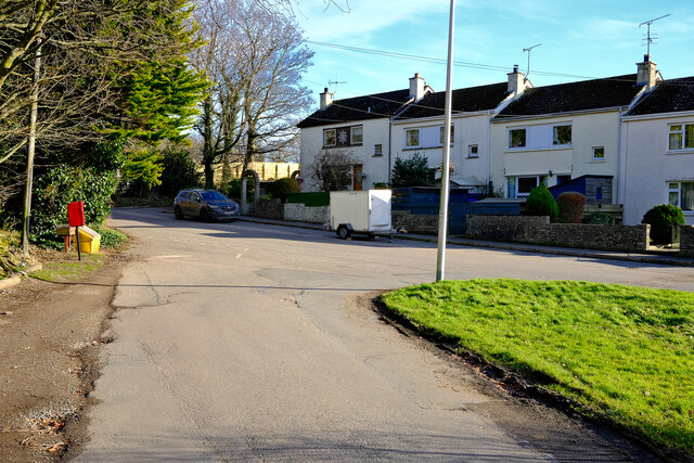
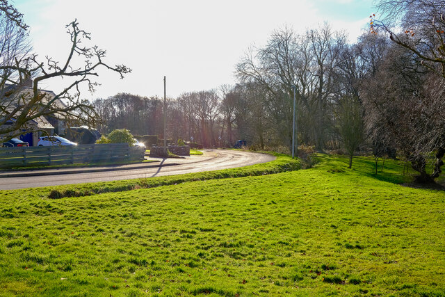
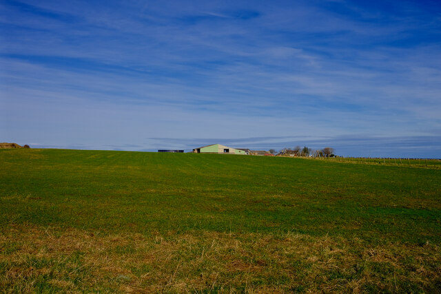
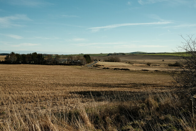
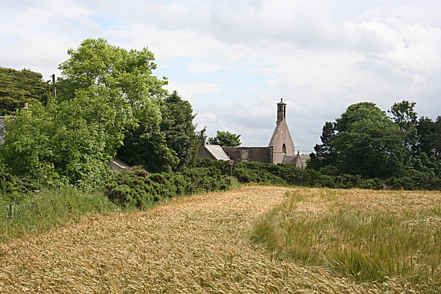
Boyndie is a small rural village located in the county of Banffshire, in the northeast region of Scotland. Situated near the coast, Boyndie offers stunning views of the North Sea and is surrounded by lush green countryside. The village is part of the larger Boyndie Estate, which covers a considerable area of land.

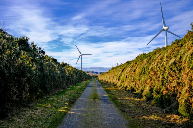
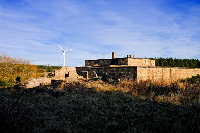
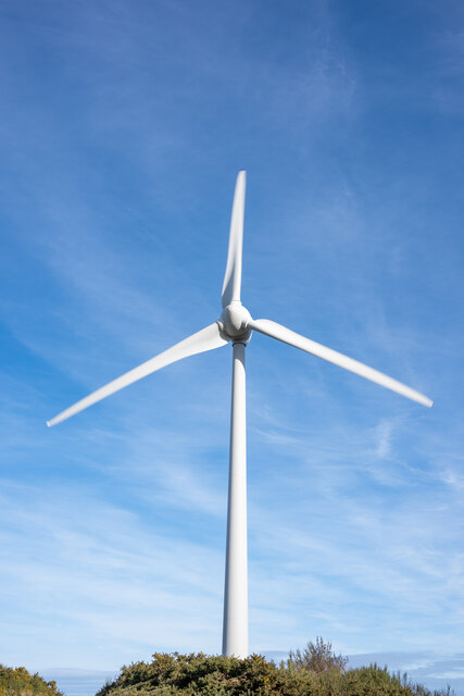
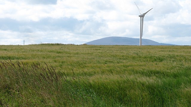
Historically, Boyndie was known for its agriculture, with farming being the main occupation of its residents. However, in recent years, the village has seen a diversification of industries, including tourism and renewable energy. The construction of wind farms in the surrounding area has brought employment opportunities and economic growth to the village.

One of the notable landmarks in Boyndie is the Boyndie Wind Farm Visitor Centre, which provides an insight into renewable energy and the process of wind power generation. The center offers interactive exhibits, educational displays, and guided tours, attracting visitors from both near and far.

In terms of amenities, Boyndie has a primary school, which serves the local community and nearby areas. The village also has a community hall, where various social and cultural events take place, fostering a sense of community spirit among residents.

For outdoor enthusiasts, Boyndie offers a range of activities such as hiking, cycling, and fishing. The nearby coastline provides opportunities for coastal walks and birdwatching, with a variety of seabirds frequenting the area.

Overall, Boyndie is a picturesque village that combines its rural charm with a growing focus on renewable energy, making it an attractive destination for both nature lovers and those interested in sustainable initiatives.

If you have any feedback on the listing, please let us know in the comments section below.

Boyndie Images

Images are sourced within 2km of 57.663557/-2.602719 or Grid Reference NJ6463. Thanks to Geograph Open Source API. All images are credited.

Boyndie The centre of the village of Boyndie
Boyndie
The centre of the village of Boyndie
Boyndie The road out or into Boyndie
Boyndie
The road out or into Boyndie
Thriepland farm Looking towards the farm at Thriepland
Thriepland farm
Looking towards the farm at Thriepland
Windfarm roads The old taxiways of Boyndie airfield now overgrown and used as access roads for the windfarm
Windfarm roads
The old taxiways of Boyndie airfield now overgrown and used as access roads for the windfarm
Old airfield building A ruined control room building for the Boyndie Airfield
Old airfield building
A ruined control room building for the Boyndie Airfield
A view of the A98 Looking over the fields towards the A98
A view of the A98
Looking over the fields towards the A98
Boyndie Windfarm One of the turbins at the Boyndie Windfarm
Boyndie Windfarm
One of the turbins at the Boyndie Windfarm
Water main markers, Nether Dallachy Farm Water main markers and also a very weathered Ordnance Survey benchmark on the corner of the barn (photograph <a href="https://www.geograph.org.uk/photo/6502997">NJ6464 : Ordnance Survey benchmark, Nether Dallachy Farm</a>).
Water main markers, Nether Dallachy Farm
Water main markers and also a very weathered Ordnance Survey benchmark on the corner of the barn (photograph NJ6464 : Ordnance Survey benchmark, Nether Dallachy Farm).
Ordnance Survey benchmark, Nether Dallachy Farm Heavily weathered Ordnance Survey benchmark on the corner of the barn marking a height of 52.9867m above sea level (Ordnance Datum Newlyn) last verified in 1975 (location photograph <a href="https://www.geograph.org.uk/photo/6502979">NJ6464 : Water main markers, Nether Dallachy Farm</a>).
Water main stop valve markers are adjacent.
Ordnance Survey benchmark, Nether Dallachy Farm
Heavily weathered Ordnance Survey benchmark on the corner of the barn marking a height of 52.9867m above sea level (Ordnance Datum Newlyn) last verified in 1975 (location photograph NJ6464 : Water main markers, Nether Dallachy Farm). Water main stop valve markers are adjacent.
Ordnance Survey benchmark, Boyndie The weathered Ordnance Survey benchmark cut into the base of the gatepost of the former St. Brandon's Church marks a height of 54.9449m above sea level (Ordnance Datum Newlyn) last verified in 1975 (photograph <a href="https://www.geograph.org.uk/photo/6503025">NJ6463 : Ordnance Survey Benchmark on gatepost, Boyndie</a>).
Ordnance Survey benchmark, Boyndie
The weathered Ordnance Survey benchmark cut into the base of the gatepost of the former St. Brandon's Church marks a height of 54.9449m above sea level (Ordnance Datum Newlyn) last verified in 1975 (photograph NJ6463 : Ordnance Survey Benchmark on gatepost, Boyndie).
Ordnance Survey Benchmark on gatepost, Boyndie Detail of the weathered Ordnance Survey benchmark on the gatepost of the former St. Brandon's Church, Boyndie.  The benchmark marks a height of 54.9449m above sea level (Ordnance Datum Newlyn) last verified in 1975 (location photograph <a href="https://www.geograph.org.uk/photo/6503017">NJ6463 : Ordnance Survey benchmark, Boyndie</a>).
Ordnance Survey Benchmark on gatepost, Boyndie
Detail of the weathered Ordnance Survey benchmark on the gatepost of the former St. Brandon's Church, Boyndie. The benchmark marks a height of 54.9449m above sea level (Ordnance Datum Newlyn) last verified in 1975 (location photograph NJ6463 : Ordnance Survey benchmark, Boyndie).
Whitehills, steps to the beach The rivet and cutmark are on top of Whitehills sea wall. It is located on the eastern side of the steps to the beach. The rivet is easy to see, although the benchmark is a little worn.
Whitehills, steps to the beach
The rivet and cutmark are on top of Whitehills sea wall. It is located on the eastern side of the steps to the beach. The rivet is easy to see, although the benchmark is a little worn.
Whitehills, steps to the beach A wider angle showing the location of the rivet and cutmark on top of Whitehills sea wall. It is located on the eastern side of the steps which lead to the beach. The rivet is easy to see, although the benchmark is a little worn.
Whitehills, steps to the beach
A wider angle showing the location of the rivet and cutmark on top of Whitehills sea wall. It is located on the eastern side of the steps which lead to the beach. The rivet is easy to see, although the benchmark is a little worn.
Stake Ness A rocky beach between Stake Ness and Whitehills.
Stake Ness
A rocky beach between Stake Ness and Whitehills.
Barley by Boyndie Ripening barley with a clover rich headland strip. Taken in a stiff wind which was making the barley look spectacular, but hindering westward progress.
Barley by Boyndie
Ripening barley with a clover rich headland strip. Taken in a stiff wind which was making the barley look spectacular, but hindering westward progress.
Pigs by Boyndie A field of pigs in a landscape dominated by nearby wind turbines. The turbines were doing a fair trade today with a very strong wind.
Pigs by Boyndie
A field of pigs in a landscape dominated by nearby wind turbines. The turbines were doing a fair trade today with a very strong wind.
Barley, Whyntie Spring barley which was still green unlike some neighbouring fields. A view beyond the wind turbines towards Knock Hill.
Barley, Whyntie
Spring barley which was still green unlike some neighbouring fields. A view beyond the wind turbines towards Knock Hill.
House fire Heading in to work early morning I came across this house fire. The large victorian hospital on this site is being demolished and this would appear to be part of the procedure.
House fire
Heading in to work early morning I came across this house fire. The large victorian hospital on this site is being demolished and this would appear to be part of the procedure.
Show me another place!

Boyndie is located at Grid Ref: NJ6463 (Lat: 57.663557, Lng: -2.602719)

Unitary Authority: Aberdeenshire

Police Authority: North East

What 3 Words

///vitals.success.structure. Near Whitehills, Aberdeenshire

Nearby Locations

Boyndie

Related Wikis

Boyndie

Boyndie is a village in Aberdeenshire, Scotland. == History == Boyndie was once home to RAF Banff Strike Wing, which played a pivotal role in protecting...

Ladysbridge Hospital

Ladysbridge Hospital was a mental health facility near Banff, Aberdeenshire, Scotland. The former hospital is a Category B listed building. == History... ==

Ladysbridge railway station

Ladysbridge railway station was a station in Aberdeenshire, Scotland. Opened as Lady's Bridge railway station in 1859 it was renamed Ladysbridge railway...
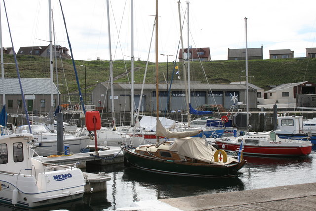
Whitehills

Whitehills is a small fishing village in Banffshire, Scotland, that lies three miles (five kilometres) west of Banff on the Moray Firth. It forms part...

Nearby Amenities

Located within 500m of 57.663557,-2.602719
Boyndie
Place: hamlet
Lat/Long: 57.6628754/-2.6044036
Cafe
Lat/Long: 57.6622829/-2.6055088
Post Box
Operator: Royal Mail
Post Box Mounting: pole
Post Box Type: lamp
Ref: AB45 610
Lat/Long: 57.6626734/-2.6043303
Power: pole
Lat/Long: 57.6679816/-2.604237
Power: pole
Lat/Long: 57.6673237/-2.6042597
Power: pole
Lat/Long: 57.6667059/-2.6042642
Power: pole
Lat/Long: 57.6660504/-2.6042619
Power: pole
Lat/Long: 57.6654071/-2.6042824
Power: pole
Lat/Long: 57.6647576/-2.6042302
Power: pole
Lat/Long: 57.664283/-2.6039578
Power: pole
Lat/Long: 57.6638023/-2.6036787
Power: pole
Lat/Long: 57.6632633/-2.6032656
Power: pole
Lat/Long: 57.664561/-2.6033292
Power: pole
Lat/Long: 57.6648802/-2.6025259
Power: pole
Lat/Long: 57.6649621/-2.6017811
Power: pole
Lat/Long: 57.6647865/-2.6010369
Bus Stop
Boyndie Centre
Bus: yes
Naptan AtcoCode: 630045411
Naptan Bearing: W
Naptan CommonName: Boyndie Centre
Naptan Indicator: at
Naptan Landmark: Boyndie Day Centre
Naptan NaptanCode: 23628745
Naptan Street: Unclassified road
Naptan Verified: no
Public Transport: platform
Ref: 23628745
Lat/Long: 57.662487/-2.60536
The data included in this document is from www.openstreetmap.org. The data is made available under ODbL.

Have you been to Boyndie?

Leave your review of Boyndie below (or comments, questions and feedback).