Wall Heath

Settlement in Staffordshire

England

Wall Heath

Ridge Road looking toward Dudley and the Black Country
Ridge Road looking toward Dudley and the Black Country Credit: charlie

Wall Heath is a quaint village located in the county of Staffordshire, England. Situated approximately five miles south-west of the town of Dudley, it is nestled amidst the picturesque countryside of the West Midlands. With a population of around 5,000 residents, Wall Heath maintains a close-knit community atmosphere.

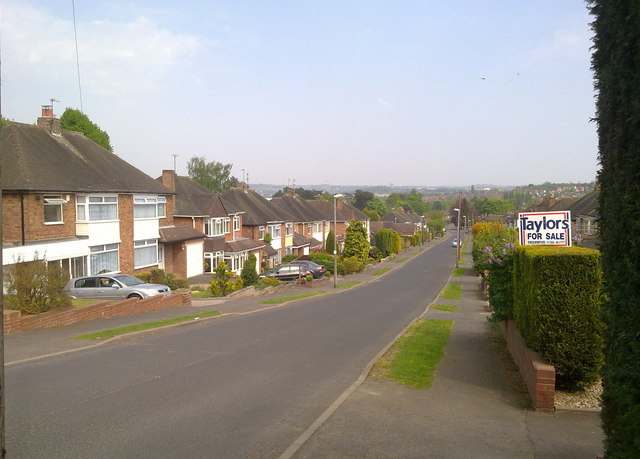
The village is known for its charming character, with a mix of traditional and modern architecture lining its streets. The center of Wall Heath is dominated by a range of local amenities, including a selection of shops, supermarkets, and cafes, providing convenience for its residents. Additionally, the village boasts a number of traditional pubs and restaurants, offering a variety of dining options.

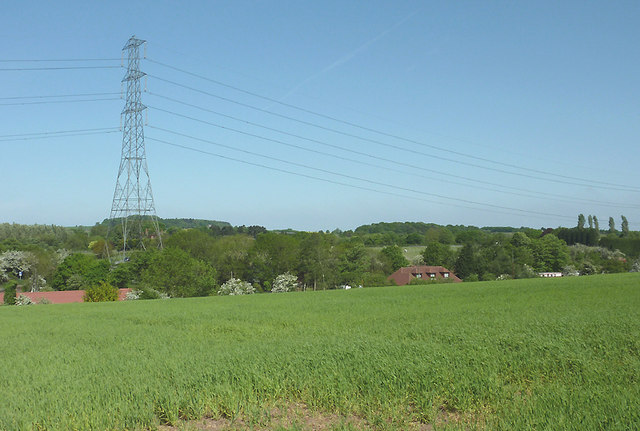
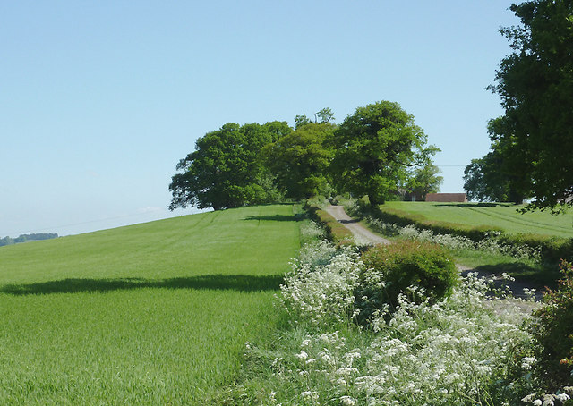
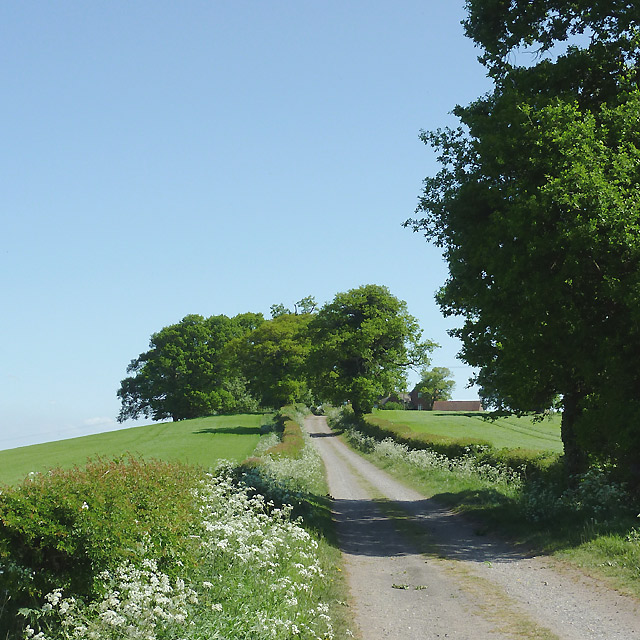
Nature enthusiasts are drawn to Wall Heath for its close proximity to several stunning green spaces. The nearby Himley Hall and Park is a popular destination, featuring beautiful gardens, woodlands, and a serene lake. The park hosts numerous events throughout the year, attracting locals and visitors alike.

Wall Heath is also well-connected, with good transport links to neighboring towns and cities. The village is served by several bus routes, providing easy access to Dudley and Wolverhampton. Furthermore, the M5 motorway is just a short drive away, connecting Wall Heath to major cities such as Birmingham and Worcester.

Overall, Wall Heath offers a peaceful and idyllic setting for its residents, combining the charm of a traditional village with modern amenities and convenient transport links.

If you have any feedback on the listing, please let us know in the comments section below.
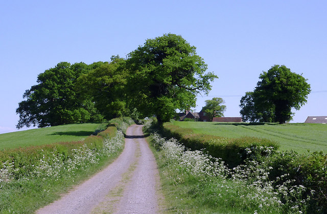
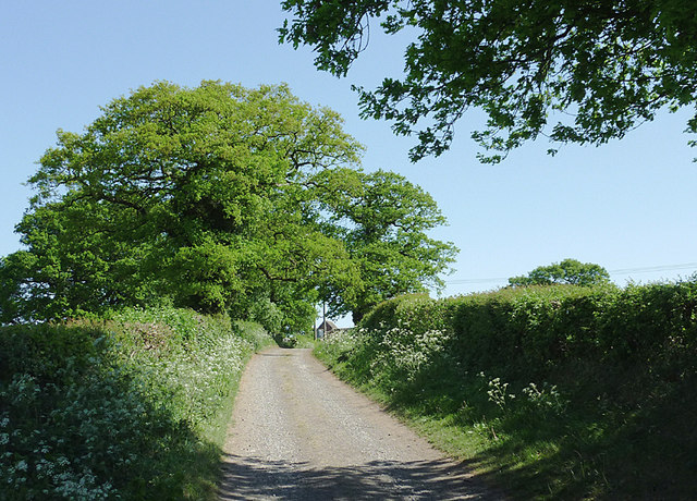
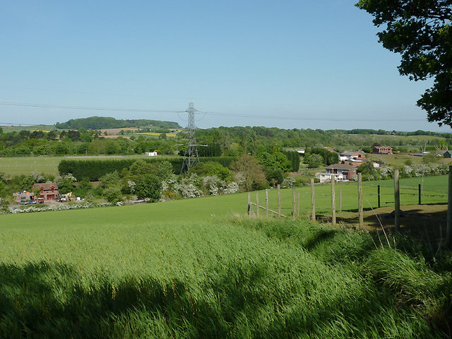
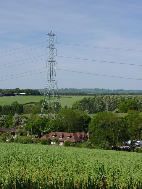
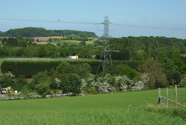
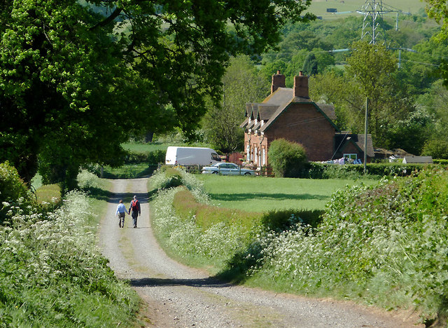
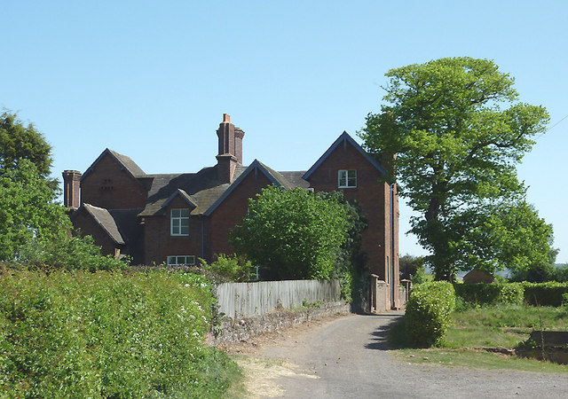
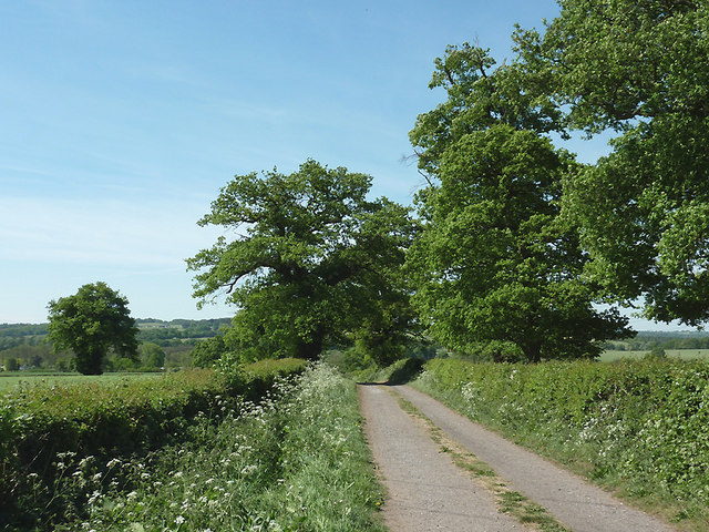
Wall Heath Images

Images are sourced within 2km of 52.505445/-2.1805781 or Grid Reference SO8789. Thanks to Geograph Open Source API. All images are credited.

Ridge Road looking toward Dudley and the Black Country
Arizona Crossing Pub at the crossroads in Kingswinford which has live music.
Arizona Crossing
Pub at the crossroads in Kingswinford which has live music.
Farmland near Ashwood, Staffordshire Looking across the Wom and Smestow valleys. The canal arm, formerly a coal wharf, crosses the scene hidden in the dip by the pylon beyond this crop field. The water is now used as a marina for narrowboats and other pleasure craft.
Farmland near Ashwood, Staffordshire
Looking across the Wom and Smestow valleys. The canal arm, formerly a coal wharf, crosses the scene hidden in the dip by the pylon beyond this crop field. The water is now used as a marina for narrowboats and other pleasure craft.
Farmland near Ashwood, Staffordshire The bridleway leads from Ashwood to the A449 Kidderminster Road, then continues as Lodge Lane to Kingswinford. The terrain slopes left to the Wom and Smestow valleys.
Farmland near Ashwood, Staffordshire
The bridleway leads from Ashwood to the A449 Kidderminster Road, then continues as Lodge Lane to Kingswinford. The terrain slopes left to the Wom and Smestow valleys.
Bridleway towards Kingswinford, Staffordshire The bridleway leads between fields from Ashwood to the A449 Kidderminster Road, then continues as the surfaced Lodge Lane to Kingswinford. The terrain slopes left to the Smestow Valley.
Bridleway towards Kingswinford, Staffordshire
The bridleway leads between fields from Ashwood to the A449 Kidderminster Road, then continues as the surfaced Lodge Lane to Kingswinford. The terrain slopes left to the Smestow Valley.
Bridleway towards Kingswinford, Staffordshire The bridleway leads between fields from Ashwood to the A449 Kidderminster Road, then continues as the surfaced Lodge Lane to Kingswinford. Buildings at Ashwood Lodge Farm can be seen on the right behind the trees. The terrain slopes left to the Wom and Smestow valleys.
Bridleway towards Kingswinford, Staffordshire
The bridleway leads between fields from Ashwood to the A449 Kidderminster Road, then continues as the surfaced Lodge Lane to Kingswinford. Buildings at Ashwood Lodge Farm can be seen on the right behind the trees. The terrain slopes left to the Wom and Smestow valleys.
Bridleway towards Kingswinford, Staffordshire The bridleway leads between fields from Ashwood to the A449 Kidderminster Road, then continues as the surfaced Lodge Lane to Kingswinford. Buildings at Ashwood Lodge Farm can be seen on the right behind the trees.
Bridleway towards Kingswinford, Staffordshire
The bridleway leads between fields from Ashwood to the A449 Kidderminster Road, then continues as the surfaced Lodge Lane to Kingswinford. Buildings at Ashwood Lodge Farm can be seen on the right behind the trees.
Farmland near Ashwood, Staffordshire Looking across the Wom and Smestow valleys. The former coal wharf/canal arm crosses the scene, hidden in the dip beyond this crop field, by the electricity pylon. It is now a marina for pleasure boats.
Farmland near Ashwood, Staffordshire
Looking across the Wom and Smestow valleys. The former coal wharf/canal arm crosses the scene, hidden in the dip beyond this crop field, by the electricity pylon. It is now a marina for pleasure boats.
Farmland near Ashwood, Staffordshire This is a telephoto assisted view across the farm land of the wide Smestow Valley. Ashwood Marina is hidden in the dip this side of the electricity pylon. Narrowboats are just visible on the left on the short (about 500 metres) canal arm, formerly used as a coal wharf. The actual Staffordshire and Worcestershire Canal crosses the view by the line of trees beyond the pylon.
Farmland near Ashwood, Staffordshire
This is a telephoto assisted view across the farm land of the wide Smestow Valley. Ashwood Marina is hidden in the dip this side of the electricity pylon. Narrowboats are just visible on the left on the short (about 500 metres) canal arm, formerly used as a coal wharf. The actual Staffordshire and Worcestershire Canal crosses the view by the line of trees beyond the pylon.
Farmland near Ashwood, Staffordshire Looking towards Greens forge, this is a telephoto assisted view across the wide Smestow valley. Between the blossom covered hawthorns and the electricity pylon, the Wom Brook drifts leftwards towards its confluence with the Smestow River. Also, a 500 metre arm of canal which was originally a busy coal wharf terminates near the pylon. The water is now used as a marina for narrowboats and other pleasure craft. A buzzard soars near the power wires.
Farmland near Ashwood, Staffordshire
Looking towards Greens forge, this is a telephoto assisted view across the wide Smestow valley. Between the blossom covered hawthorns and the electricity pylon, the Wom Brook drifts leftwards towards its confluence with the Smestow River. Also, a 500 metre arm of canal which was originally a busy coal wharf terminates near the pylon. The water is now used as a marina for narrowboats and other pleasure craft. A buzzard soars near the power wires.
Bridleway to Ashwood, Staffordshire The bridleway has led between fields from the A449 Kidderminster Road, and meeting Doctor's Lane by the cottages. This telephoto assisted image was taken from near Ashwood Lodge.
Bridleway to Ashwood, Staffordshire
The bridleway has led between fields from the A449 Kidderminster Road, and meeting Doctor's Lane by the cottages. This telephoto assisted image was taken from near Ashwood Lodge.
Bridleway and Ashwood Lodge, Staffordshire The bridleway leads from Ashwood to the A449 Kidderminster Road, then Lodge Lane continues the route to Kinswinford. Ashwood Lodge is an extensive Victorian building which is being renovated.
Bridleway and Ashwood Lodge, Staffordshire
The bridleway leads from Ashwood to the A449 Kidderminster Road, then Lodge Lane continues the route to Kinswinford. Ashwood Lodge is an extensive Victorian building which is being renovated.
Bridleway to Ashwood, Staffordshire The bridleway has led between fields from the A449 Kidderminster Road, and meets Doctor's Lane by the cottages at Ashwood in the Smestow Valley.
Bridleway to Ashwood, Staffordshire
The bridleway has led between fields from the A449 Kidderminster Road, and meets Doctor's Lane by the cottages at Ashwood in the Smestow Valley.
Chimney stacks on Ashwood Lodge near Kingswinford, Staffordshire Ashwood Lodge is a large Victorian brick building situated on the bridleway between Kingswinford and Ashwood. These chimneys no longer have pots on the top, though others on the building do.
<a href="https://www.geograph.org.uk/photo/2397741">SO8688 : Bridleway and Ashwood Lodge, Staffordshire</a>
<a href="https://www.geograph.org.uk/photo/2397354">SO8688 : Bridleway and Ashwood Lodge, Staffordshire</a>
Chimney stacks on Ashwood Lodge near Kingswinford, Staffordshire
Ashwood Lodge is a large Victorian brick building situated on the bridleway between Kingswinford and Ashwood. These chimneys no longer have pots on the top, though others on the building do. SO8688 : Bridleway and Ashwood Lodge, Staffordshire SO8688 : Bridleway and Ashwood Lodge, Staffordshire
Bridleway and Ashwood Lodge, Staffordshire The bridleway leads to Doctor's Lane at Ashwood, from the A449 Kidderminster Road. Ashwood Lodge is an extensive Victorian building which is being renovated.
Bridleway and Ashwood Lodge, Staffordshire
The bridleway leads to Doctor's Lane at Ashwood, from the A449 Kidderminster Road. Ashwood Lodge is an extensive Victorian building which is being renovated.
Bridleway towards Kingswinford, Staffordshire The bridleway leads between fields from Ashwood to the A449 Kidderminster Road, then continues as the surfaced Lodge Lane to Kingswinford. The distant buildings are those of Summerhill School in Lodge Lane, rebuilt in the early 2000s.
Bridleway towards Kingswinford, Staffordshire
The bridleway leads between fields from Ashwood to the A449 Kidderminster Road, then continues as the surfaced Lodge Lane to Kingswinford. The distant buildings are those of Summerhill School in Lodge Lane, rebuilt in the early 2000s.
Farmland north of Ashwood, Staffordshire The Wom Brook and Smestow River flow through the wide valley ahead.
Farmland north of Ashwood, Staffordshire
The Wom Brook and Smestow River flow through the wide valley ahead.
Farmland near Ashwood, Staffordshire Ashwood Lodge is on the left. Ahead the land dips down to the wide valley of the Smestow River.
Farmland near Ashwood, Staffordshire
Ashwood Lodge is on the left. Ahead the land dips down to the wide valley of the Smestow River.
Show me another place!

Wall Heath is located at Grid Ref: SO8789 (Lat: 52.505445, Lng: -2.1805781)

Unitary Authority: Dudley

Police Authority: West Midlands

What 3 Words

///closes.remain.dice. Near Kingswinford, West Midlands

Nearby Locations

Wall Heath

Related Wikis

Wall Heath

Wall Heath is a suburban village in the Dudley Metropolitan Borough in the West Midlands of England. It is located on the A449 road, approximately 1.5...

Holbeche House

Holbeche House (also, in some texts, Holbeach or Holbeache) is a mansion located approximately 1 mile (1.6 km) north of Kingswinford, now in the Metropolitan...

Kingswinford Academy

Kingswinford Academy is a coeducational secondary school with academy status, located in Kingswinford, West Midlands, England.The school is run by the...

Summerhill School, Kingswinford

Summerhill School is a mixed community secondary school located in Kingswinford, West Midlands, England. == History == The school was built by Brierley...

Nearby Amenities

Located within 500m of 52.505445,-2.1805781
Give Way
Direction: backward
Lat/Long: 52.5053012/-2.177677
Wall Heath
Created By: Potlatch 0.5d
Is In: West Midlands
Place: village
Wikidata: Q7962596
Lat/Long: 52.5046066/-2.1769868
Mini Roundabout
Direction: clockwise
Lat/Long: 52.5053621/-2.1776298
Mini Roundabout
Direction: clockwise
Lat/Long: 52.5054563/-2.177426
Bus Stop
Brookside Way / Lynwood Avenue
Bus: yes
Naptan AtcoCode: 43000844801
Naptan Bearing: SW
Naptan BusStopType: CUS
Naptan CommonName: Lynwood Avenue
Naptan Indicator: opp
Naptan NaptanCode: nwmtdjap
Naptan PlusbusZoneRef: BHAMNWS
Naptan Status: ACT
Naptan StopType: BCT
Naptan Street: BROOKSIDE WAY
Naptan Towards: Kingswinford
Naptan Verified: no
Public Transport: platform
Source: WMCA
Lat/Long: 52.5013894/-2.1774282
Bus Stop
Dudley Rd / New St
NaPTANAreaCode: 43000845401
Bus: yes
Naptan AtcoCode: 43000845401
Naptan Bearing: W
Naptan BusStopType: MKD
Naptan CommonName: New St
Naptan Indicator: adj
Naptan NaptanCode: nwmjwdpw
Naptan PlusbusZoneRef: BHAMNWS
Naptan Status: ACT
Naptan StopType: BCT
Naptan Street: DUDLEY RD
Naptan Towards: Wombourne
Naptan Verified: no
Public Transport: platform
Route Ref: 205;255;256;267
Shelter: yes
Shelter Ref: 405203
Source: WMCA
Lat/Long: 52.5051668/-2.1764121
Bus Stop
Dudley Rd / New St
NaPTANAreaCode: 43000845402
Bus: yes
Naptan AtcoCode: 43000845402
Naptan Bearing: E
Naptan BusStopType: MKD
Naptan CommonName: New St
Naptan Indicator: opp
Naptan NaptanCode: nwmjwdta
Naptan PlusbusZoneRef: BHAMNWS
Naptan Status: ACT
Naptan StopType: BCT
Naptan Street: DUDLEY RD
Naptan Towards: Kingswinford, Gornal Wood
Naptan Verified: no
Public Transport: platform
Route Ref: 205;255;256;257
Shelter: yes
Shelter Ref: 405204
Source: WMCA
Lat/Long: 52.505328/-2.17684
Bus Stop
Enville Rd / Blaze Park
NaPTANAreaCode: 43000845501
Bus: yes
Naptan AtcoCode: 43000845501
Naptan Bearing: E
Naptan BusStopType: MKD
Naptan CommonName: Blaze Park
Naptan Indicator: adj
Naptan Landmark: Community Centre
Naptan NaptanCode: nwmjwdtd
Naptan PlusbusZoneRef: BHAMNWS
Naptan Status: ACT
Naptan StopType: BCT
Naptan Street: ENVILLE RD
Naptan Towards: Kingswinford
Naptan Verified: no
Public Transport: platform
Route Ref: 205;255
Shelter: yes
Shelter Ref: 405202
Source: WMCA
Lat/Long: 52.5051931/-2.1828358
Bus Stop
Enville Rd / Blaze Park
NaPTANAreaCode: 43000845502
Bus: yes
Naptan AtcoCode: 43000845502
Naptan Bearing: W
Naptan BusStopType: MKD
Naptan CommonName: Blaze Park
Naptan Indicator: opp
Naptan Landmark: Community Centre
Naptan NaptanCode: nwmjwdtg
Naptan PlusbusZoneRef: BHAMNWS
Naptan Status: ACT
Naptan StopType: BCT
Naptan Street: ENVILLE RD
Naptan Towards: Wombourne
Naptan Verified: no
Public Transport: platform
Route Ref: 205;255
Shelter: yes
Shelter Ref: 405212
Source: WMCA
Lat/Long: 52.5051486/-2.1825409
Bus Stop
High St / Foundry St
Bus: yes
Naptan AtcoCode: 43000845801
Naptan Bearing: SW
Naptan BusStopType: CUS
Naptan CommonName: Foundry St
Naptan Indicator: opp
Naptan NaptanCode: nwmtdjdm
Naptan PlusbusZoneRef: BHAMNWS
Naptan Status: ACT
Naptan StopType: BCT
Naptan Street: HIGH ST
Naptan Towards: Kingswinford
Naptan Verified: no
Public Transport: platform
Route Ref: 267
Source: WMCA
Lat/Long: 52.5040399/-2.1792475
Fast Food
Roberto's
Cuisine: pizza
Lat/Long: 52.505521/-2.1788398
Post Office
Wall Heath Post Office
Addr City: Kingswinford
Addr Housenumber: 1-2
Addr Postcode: DY6 0NP
Addr Street: Albion Parade
Addr Suburb: Wall Heath
Brand: Post Office
Brand Wikidata: Q1783168
Opening Hours: Mo-Su 06:30-22:00
Ref Pol Id: 6398
Website: https://www.postoffice.co.uk/branch-finder/1942085/wall-heath
Lat/Long: 52.5057259/-2.1784122
Co-op Food
Addr Housenumber: 1-2
Addr Postcode: DY6 0NP
Addr Street: Albion Parade
Brand: Co-op Food
Brand Wikidata: Q3277439
Brand Wikipedia: en:Co-op Food
Fhrs Id: 500020
Operator: Midcounties Co-operative
Operator Wikidata: Q6841138
Shop: convenience
Source Addr: FHRS Open Data
Lat/Long: 52.5056752/-2.1784737
Man Made: pipeline_marker
Ref: S6
Utility: gas
Lat/Long: 52.5050044/-2.1746301
Parking
Parking: surface
Lat/Long: 52.5059808/-2.1789492
Recycling
Lat/Long: 52.5055094/-2.1790077
Fast Food
Four Seasons
Addr Housenumber: 5A
Addr Postcode: DY6 0JT
Addr Street: Enville Road
Cuisine: chinese
Fhrs Id: 500426
Source Addr: FHRS Open Data
Lat/Long: 52.5053347/-2.1791659
Restaurant
Emerald Restaurant
Addr Housenumber: 16
Addr Postcode: DY6 0JS
Addr Street: Albion Street
Fhrs Id: 1196296
Source Addr: FHRS Open Data
Lat/Long: 52.5054917/-2.1777675
Post Box
Ref: DY6 192
Lat/Long: 52.5090565/-2.1807391
Turning Circle
Source: bing
Lat/Long: 52.5064551/-2.1850061
Turning Circle
Source: bing
Lat/Long: 52.5056727/-2.1846631
Pub
The Albion Inn
Lat/Long: 52.5090135/-2.1804955
Give Way
Direction: forward
Lat/Long: 52.5055146/-2.1773865
Atm
Fee: no
Lat/Long: 52.5055275/-2.1788722
Vending Machine
Lat/Long: 52.5055091/-2.1788516
Crossing
Button Operated: yes
Crossing: traffic_signals
Crossing Island: no
Crossing Markings: dots
Tactile Paving: yes
Lat/Long: 52.5054281/-2.1786137
Library
Lat/Long: 52.5057207/-2.1795952
Place Of Worship
Religion: christian
Lat/Long: 52.5035868/-2.1794155
Crossing
Crossing: traffic_signals
Source: bing
Lat/Long: 52.5051996/-2.1761958
Bus Stop
Enville Rd / Blaze Park Terminus
Bus: yes
Naptan AtcoCode: 43000845601
Naptan Bearing: E
Naptan BusStopType: MKD
Naptan CommonName: Blaze Park Terminus
Naptan Indicator: adj
Naptan NaptanCode: nwmjwdtj
Naptan PlusbusZoneRef: BHAMNWS
Naptan Status: ACT
Naptan StopType: BCT
Naptan Street: ENVILLE RD
Naptan Towards: Both directions
Naptan Verified: no
Public Transport: platform
Route Ref: 205;255
Source: WMCA
Lat/Long: 52.5048706/-2.1870433
Dentist
Wall Heath Dental Practice
Addr Street: 7 High street, Wall Heath, DY6 0HA
Healthcare: dentist
Toilets Wheelchair: yes
Wheelchair: yes
Wheelchair Description: superb access from the rear , and the staff very helpful Tel 01384 292 666
Lat/Long: 52.5048371/-2.1780601
Pub
The Horse & Jockey
Addr City: Wall Heath
Addr Postcode: DY6 0HA
Addr Street: High Street
Fhrs Id: 547978
Smoking: outside
Wheelchair: limited
Lat/Long: 52.5049268/-2.1779846
Generator Method: photovoltaic
Generator Output Electricity: yes
Generator Source: solar
Generator Type: solar_photovoltaic_panel
Location: roof
Power: generator
Lat/Long: 52.5022321/-2.1773315
Generator Method: photovoltaic
Generator Output Electricity: yes
Generator Source: solar
Generator Type: solar_photovoltaic_panel
Location: roof
Power: generator
Lat/Long: 52.502446/-2.179327
Generator Method: photovoltaic
Generator Output Electricity: yes
Generator Source: solar
Generator Type: solar_photovoltaic_panel
Location: roof
Power: generator
Lat/Long: 52.5024117/-2.1792626
Generator Method: photovoltaic
Generator Output Electricity: yes
Generator Source: solar
Generator Type: solar_photovoltaic_panel
Location: roof
Power: generator
Lat/Long: 52.5030795/-2.1841496
Generator Method: photovoltaic
Generator Output Electricity: yes
Generator Source: solar
Generator Type: solar_photovoltaic_panel
Location: roof
Power: generator
Lat/Long: 52.5038583/-2.1834576
Generator Method: photovoltaic
Generator Output Electricity: yes
Generator Source: solar
Generator Type: solar_photovoltaic_panel
Location: roof
Power: generator
Lat/Long: 52.5037652/-2.1841228
Generator Method: photovoltaic
Generator Output Electricity: yes
Generator Source: solar
Generator Type: solar_photovoltaic_panel
Location: roof
Power: generator
Lat/Long: 52.5037538/-2.1869096
Generator Method: photovoltaic
Generator Output Electricity: yes
Generator Source: solar
Generator Type: solar_photovoltaic_panel
Location: roof
Power: generator
Lat/Long: 52.5055448/-2.186172
Generator Method: photovoltaic
Generator Output Electricity: yes
Generator Source: solar
Generator Type: solar_photovoltaic_panel
Location: roof
Power: generator
Lat/Long: 52.5054795/-2.1851125
Generator Method: photovoltaic
Generator Output Electricity: yes
Generator Source: solar
Generator Type: solar_photovoltaic_panel
Location: roof
Power: generator
Lat/Long: 52.5066893/-2.1869418
Generator Method: photovoltaic
Generator Output Electricity: yes
Generator Source: solar
Generator Type: solar_photovoltaic_panel
Location: roof
Power: generator
Lat/Long: 52.5065897/-2.1850053
Generator Method: photovoltaic
Generator Output Electricity: yes
Generator Source: solar
Generator Type: solar_photovoltaic_panel
Location: roof
Power: generator
Lat/Long: 52.5079382/-2.175478
Generator Method: photovoltaic
Generator Output Electricity: yes
Generator Source: solar
Generator Type: solar_photovoltaic_panel
Location: roof
Power: generator
Lat/Long: 52.5083202/-2.1784902
Generator Method: photovoltaic
Generator Output Electricity: yes
Generator Source: solar
Generator Type: solar_photovoltaic_panel
Location: roof
Power: generator
Lat/Long: 52.509587/-2.1810061
Barrier: bollard
Lat/Long: 52.5053351/-2.1800436
Hayes Cycles
Phone: +44 1384 279695
Shop: bicycle
Lat/Long: 52.5056239/-2.1804891
Generator Method: photovoltaic
Generator Output Electricity: yes
Generator Source: solar
Generator Type: solar_photovoltaic_panel
Location: roof
Power: generator
Lat/Long: 52.5034616/-2.1775246
Bicycle Parking
Bicycle Parking: stands
Capacity: 6
Covered: no
Fee: no
Lat/Long: 52.5054886/-2.1778955
Generator Method: photovoltaic
Generator Output Electricity: yes
Generator Source: solar
Generator Type: solar_photovoltaic_panel
Location: roof
Power: generator
Lat/Long: 52.5027072/-2.1859829
Traffic Signals
Traffic Signals: crossing
Traffic Signals Direction: forward
Lat/Long: 52.5054292/-2.1786734
Traffic Signals
Traffic Signals: crossing
Traffic Signals Direction: backward
Lat/Long: 52.5054273/-2.1785503
Traffic Signals
Traffic Signals: crossing
Traffic Signals Direction: forward
Lat/Long: 52.5052396/-2.1777395
Traffic Signals
Traffic Signals: crossing
Traffic Signals Direction: backward
Lat/Long: 52.5051787/-2.1778161
Crossing
Button Operated: yes
Crossing: traffic_signals
Crossing Island: no
Crossing Markings: dots
Tactile Paving: yes
Lat/Long: 52.5052083/-2.1777789
Traffic Calming: hump
Lat/Long: 52.5036026/-2.1786911
Bus Stop
Bus: yes
Public Transport: platform
Source: https://bustimes.org/stops/43000845802
Lat/Long: 52.5041198/-2.1792485
Shop: convenience
Lat/Long: 52.5037416/-2.1806078
Fuel
Texaco
Brand: Texaco
Brand Wikidata: Q775060
Website: https://locations.valero.com/en-gb/LocationDetails/Index/KIDDERMINSTER-ROAD/0000887134
Lat/Long: 52.5036934/-2.1805501
The data included in this document is from www.openstreetmap.org. The data is made available under ODbL.

Have you been to Wall Heath?

Leave your review of Wall Heath below (or comments, questions and feedback).