Walker Gate
Settlement in Northumberland
England
Walker Gate

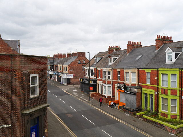
Walker Gate is a small village located in Northumberland, a county in the northeast of England. Situated approximately 6 miles east of the city of Newcastle upon Tyne, Walker Gate is part of the wider urban area of Walker. The village is known for its rich industrial heritage and close proximity to the River Tyne.
Historically, Walker Gate was a thriving coal mining community, with several pits operating in the area from the mid-19th century until the decline of the industry in the late 20th century. The village's economy was closely tied to coal mining, and many of its residents were employed in the mines.
Today, Walker Gate retains some of its industrial character, with remnants of former collieries and mining infrastructure visible in the landscape. However, the village has undergone significant changes in recent years, as the coal industry has dwindled. Many former mining sites have been transformed into residential areas or green spaces, contributing to a more diverse and modern community.
Walker Gate offers a range of amenities to its residents, including a primary school, local shops, and community facilities. The village is well-connected to nearby Newcastle upon Tyne, with regular bus services providing easy access to the city center. The surrounding countryside provides opportunities for outdoor activities, such as walking and cycling, with picturesque landscapes and scenic views of the River Tyne.
Overall, Walker Gate is a village with a proud industrial heritage, embracing its past while adapting to the changing times.
If you have any feedback on the listing, please let us know in the comments section below.
Walker Gate Images
Images are sourced within 2km of 54.984679/-1.561638 or Grid Reference NZ2865. Thanks to Geograph Open Source API. All images are credited.


Walker Gate is located at Grid Ref: NZ2865 (Lat: 54.984679, Lng: -1.561638)
Unitary Authority: Newcastle upon Tyne
Police Authority: Northumbria
What 3 Words
///jets.translated.gross. Near Wallsend, Tyne & Wear
Nearby Locations
Related Wikis
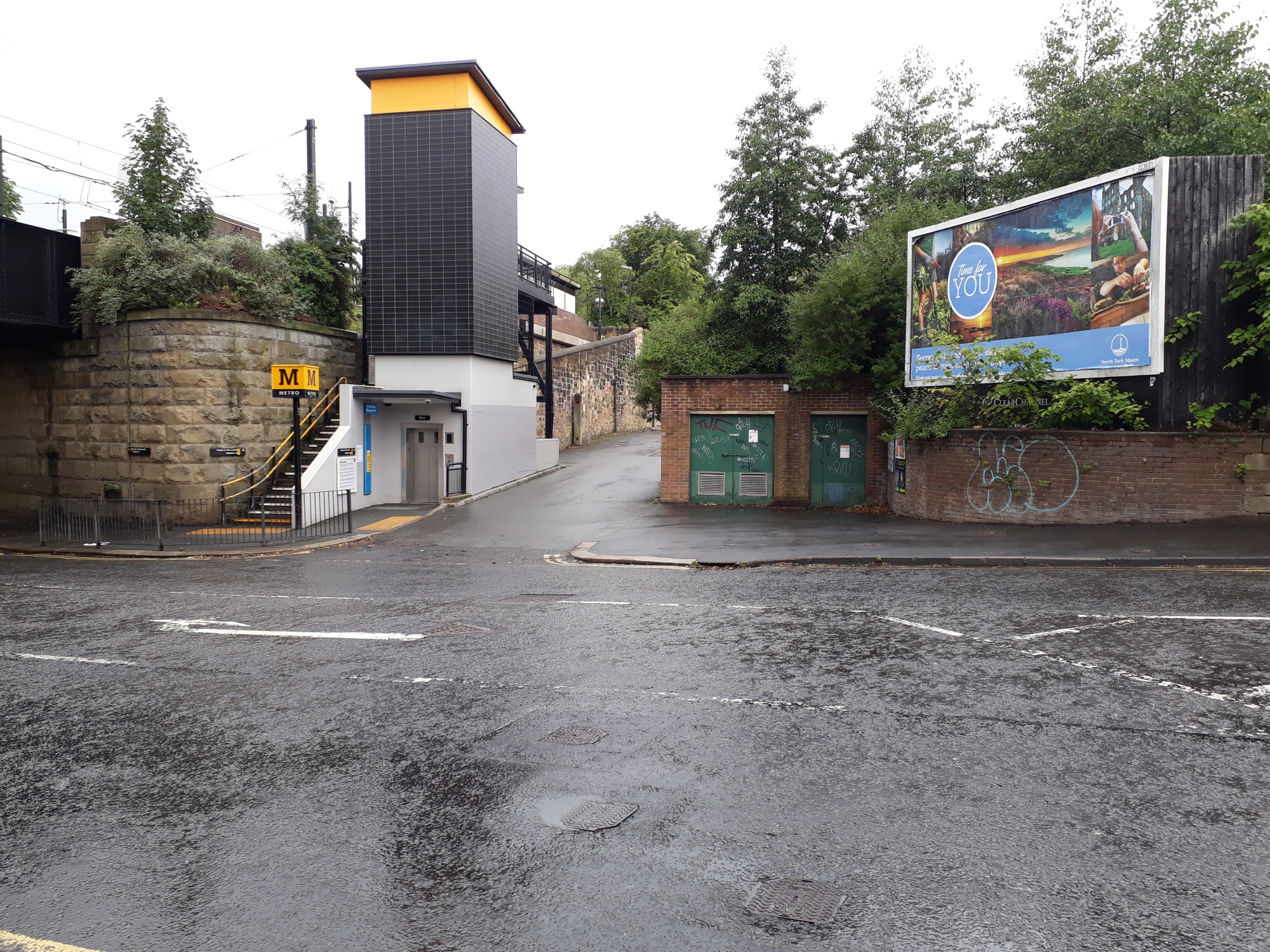
Walkergate Metro station
Walkergate is a Tyne and Wear Metro station, serving Walkergate, Newcastle upon Tyne in Tyne and Wear, England. It joined the network on 14 November 1982...
Walkergate
Walkergate is an area and electoral ward in the city of Newcastle upon Tyne, England. It is in the east of the city, north of Walker proper, east of the...
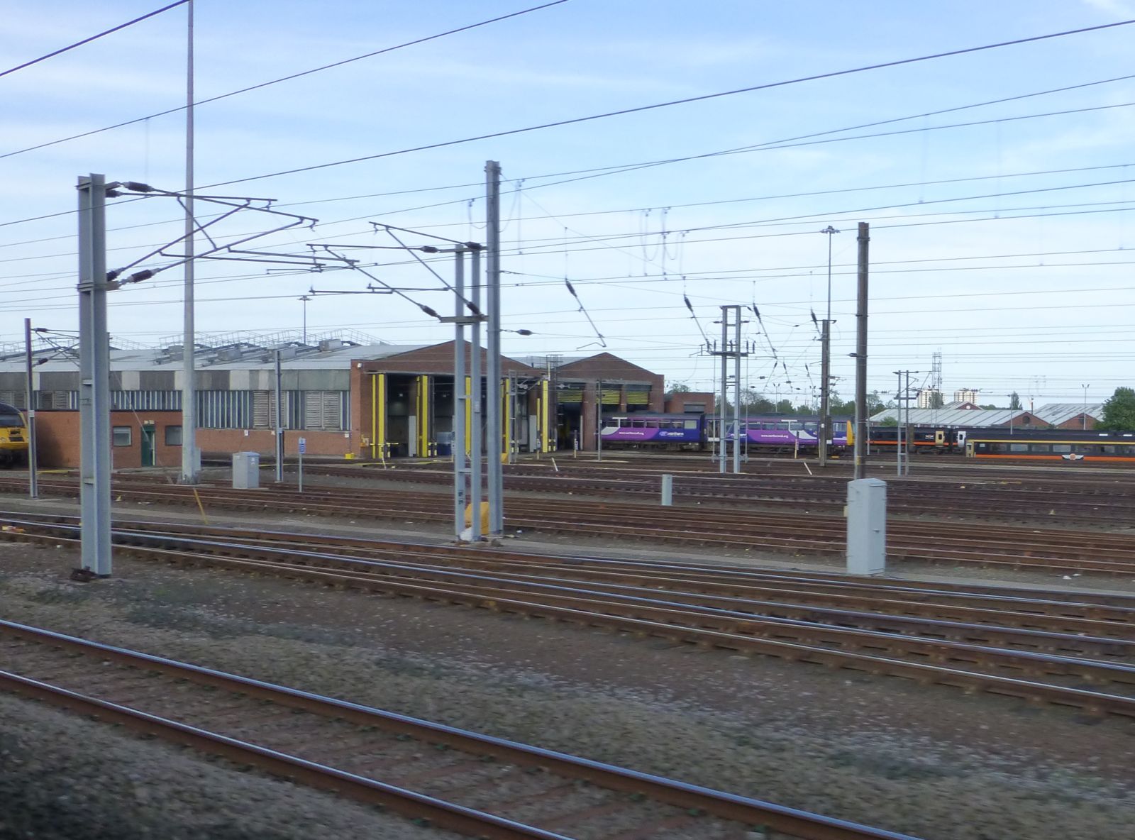
Heaton TMD
Heaton TMD is a railway traction maintenance depot situated in the Heaton area of Newcastle upon Tyne, England, it is located next to the East Coast Main...

Benfield School
Benfield School is a coeducational secondary school and sixth form located in Walkergate, Newcastle upon Tyne, England. There is an ongoing consultation...
Nearby Amenities
Located within 500m of 54.984679,-1.561638Have you been to Walker Gate?
Leave your review of Walker Gate below (or comments, questions and feedback).