Aiskew
Settlement in Yorkshire Hambleton
England
Aiskew

Aiskew is a small village located in North Yorkshire, England, approximately 2 miles southeast of the market town of Bedale. It is situated in the Hambleton district and falls within the civil parish of Bedale. Aiskew is surrounded by picturesque countryside, with rolling hills and green fields, making it an ideal place for nature lovers and those seeking a peaceful retreat.
The village itself is home to a tight-knit community, with a population of around 1,000 residents. It boasts a range of amenities, including a primary school, a church, a village hall, and a few local shops and pubs. The village also benefits from good transportation links, with the A1(M) motorway just a short drive away, providing easy access to nearby towns and cities.
Aiskew is steeped in history, with evidence of human settlement dating back to the Roman times. The village has a number of historical buildings, including the St. Mary's Church, which dates back to the 12th century and is a prominent landmark in the area. Additionally, Aiskew Hall, a Grade II listed building, can be found in the village. It was once a manor house and is now a private residence.
Despite its small size, Aiskew has a vibrant community spirit and hosts several events throughout the year, including a summer fete and a Christmas market. The village is also surrounded by beautiful countryside, offering opportunities for outdoor activities such as hiking, cycling, and horseback riding.
Overall, Aiskew is a charming and historic village that offers a peaceful and idyllic setting for residents and visitors alike.
If you have any feedback on the listing, please let us know in the comments section below.
Aiskew Images
Images are sourced within 2km of 54.290637/-1.5876073 or Grid Reference SE2688. Thanks to Geograph Open Source API. All images are credited.


Aiskew is located at Grid Ref: SE2688 (Lat: 54.290637, Lng: -1.5876073)
Division: North Riding
Administrative County: North Yorkshire
District: Hambleton
Police Authority: North Yorkshire
What 3 Words
///gears.zinc.newsstand. Near Bedale, North Yorkshire
Nearby Locations
Related Wikis
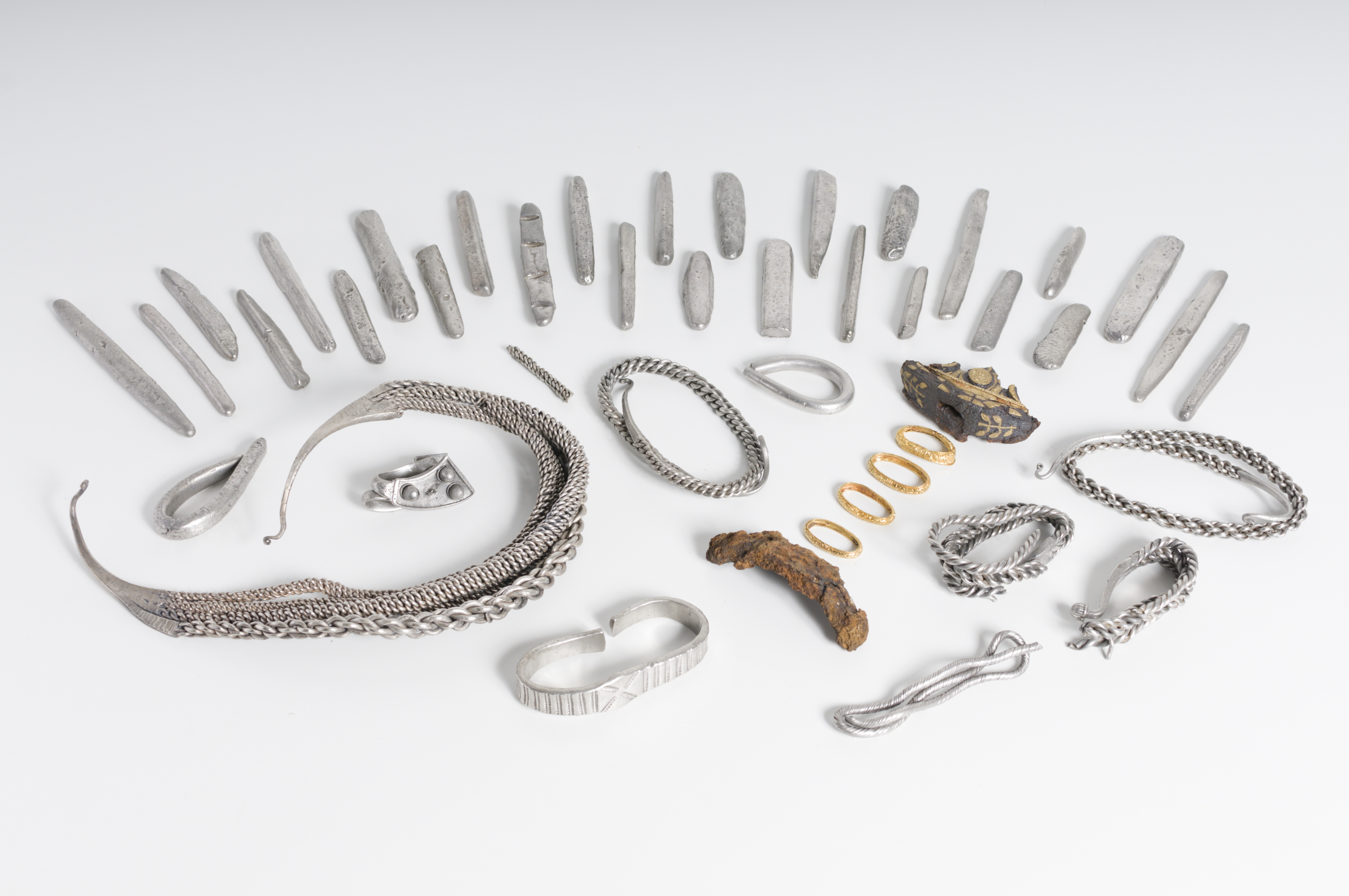
Bedale Hoard
The Bedale Hoard is a hoard of forty-eight silver and gold items dating from the late 9th to early 10th centuries AD and includes necklaces, arm-bands...
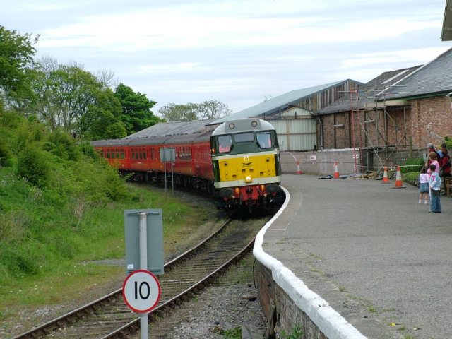
Bedale railway station
Bedale railway station is on the Wensleydale Railway and serves the town of Bedale in North Yorkshire, England. == History == First opened by the Bedale...

Bedale Leech House
This late Georgian Bedale Leech House in Bedale, North Yorkshire, England, is a unique example of a building constructed to keep live medicinal leeches...

Aiskew
Aiskew is a village in the civil parish of Aiskew and Leeming Bar, in North Yorkshire, England. The village is situated to the immediate north-east of...

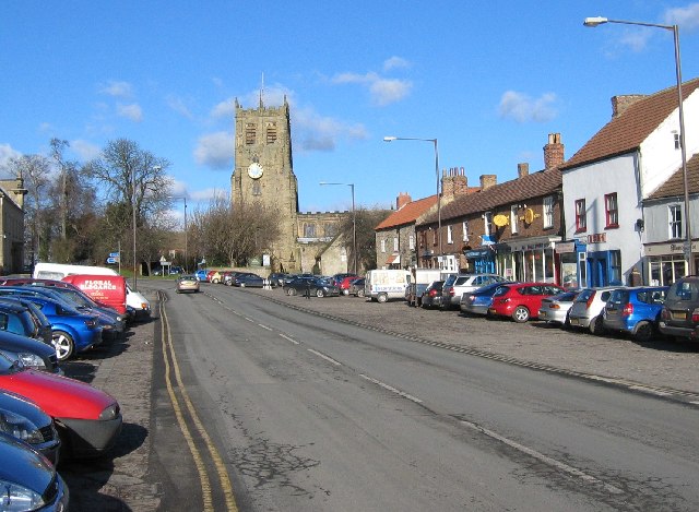
Bedale
Bedale ( BEE-dayl), is a market town and civil parish in North Yorkshire, England. Historically part of the North Riding of Yorkshire, it is 34 miles...

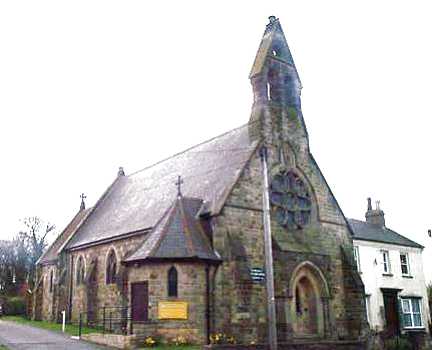
Church of St Gregory, Bedale
The Church of St Gregory, Bedale is the parish church for the town of Bedale in North Yorkshire, England. It is the main church of the benefice of Bedale...

Bedale Hall
Bedale Hall is a Grade I listed Palladian-style country house in the town of Bedale, North Yorkshire, England. It is a large two-storey house constructed...

Bedale High School
Bedale High School is a coeducational, community school situated on Fitzalan Road, Bedale, North Yorkshire, England. The School's 2004 Ofsted Inspection...
Nearby Amenities
Located within 500m of 54.290637,-1.5876073Have you been to Aiskew?
Leave your review of Aiskew below (or comments, questions and feedback).