Boxford

Settlement in Berkshire

England

Boxford

Village houses, Boxford, Berkshire
Village houses, Boxford, Berkshire Credit: Oswald Bertram

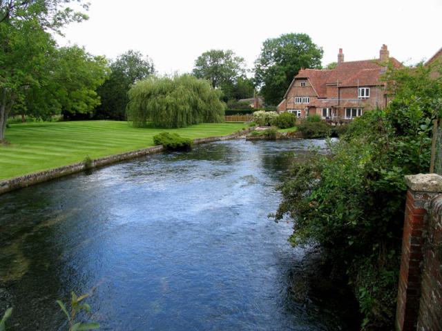
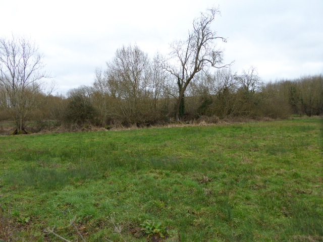
Boxford is a small village located in the county of Berkshire, England. Situated in the picturesque Lambourn Valley, it lies approximately 8 miles west of the town of Newbury. Boxford is surrounded by stunning countryside, with rolling hills, lush green fields, and charming woodland areas.

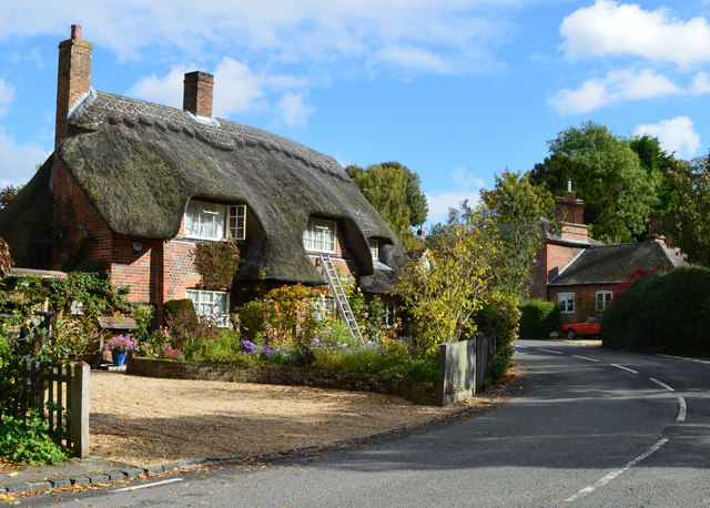
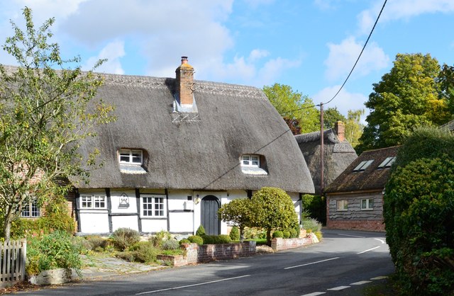
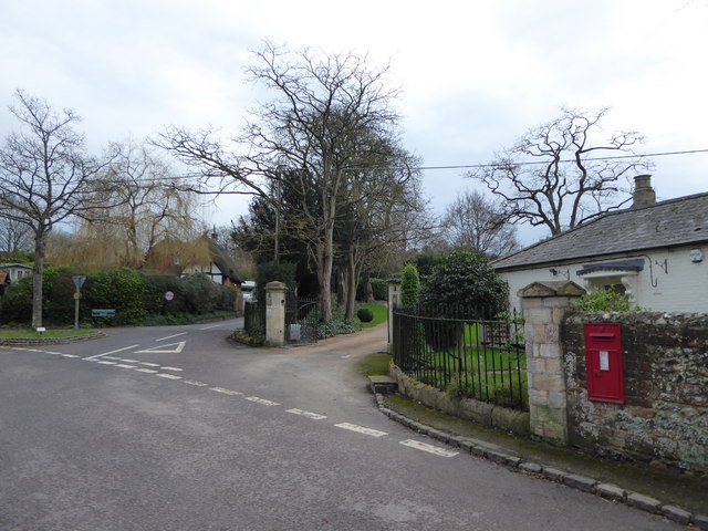
The village itself is known for its quaint and traditional English character. It features a mix of beautiful period cottages, historic buildings, and modern residences. Boxford is home to a close-knit community, with a population of around 1,000 residents.

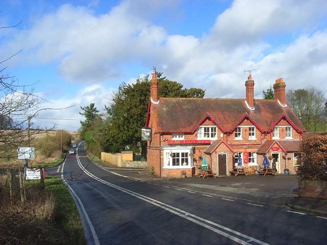
The heart of the village is centered around its local amenities, including a village shop, a post office, and a pub. Boxford also boasts a primary school, which serves the educational needs of the village and the surrounding area.

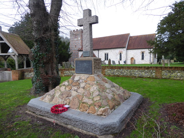
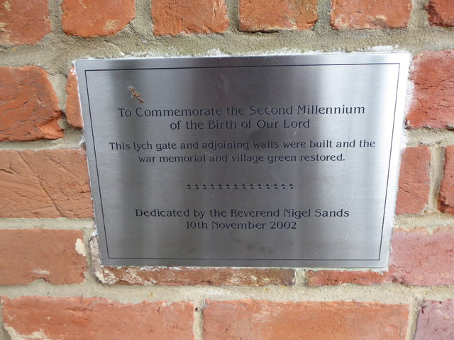
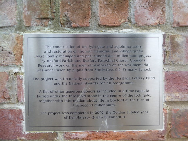
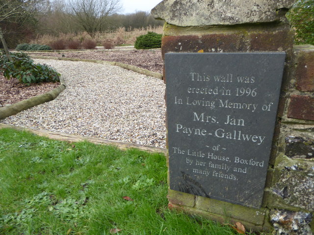
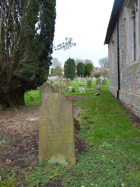
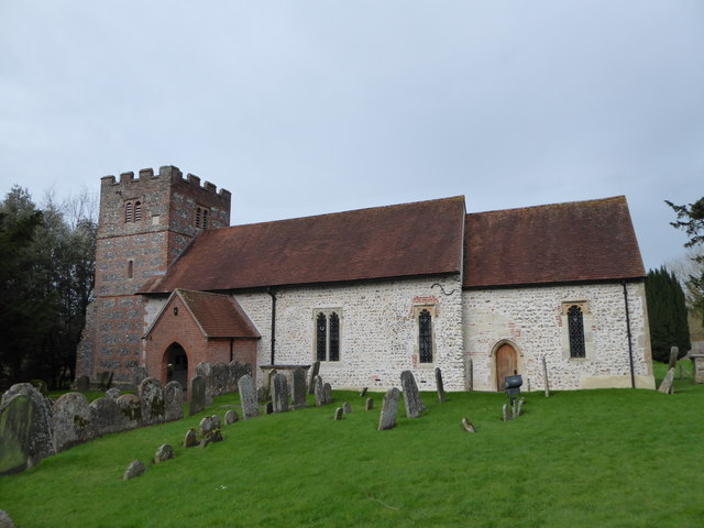
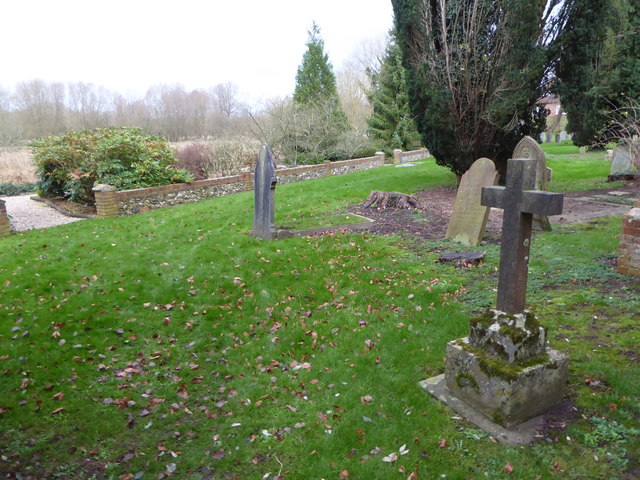
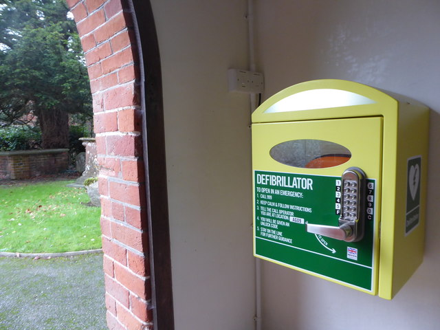
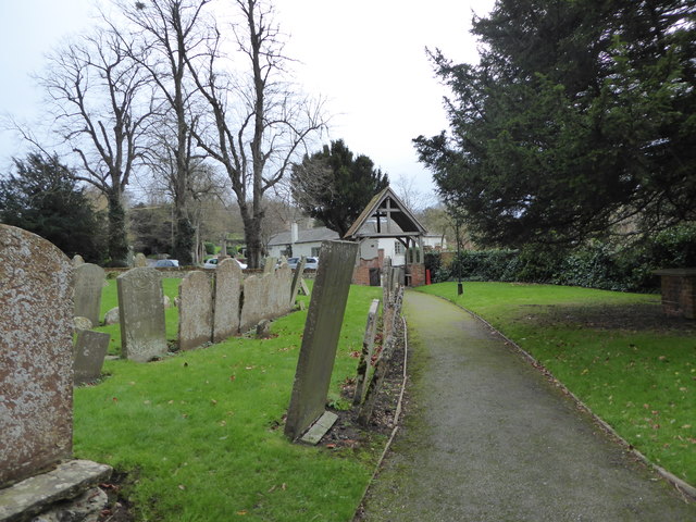
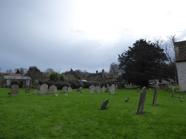
The village is rich in history and heritage, with several notable landmarks. St. Andrew's Church, a medieval structure dating back to the 12th century, stands as a prominent feature. Boxford also has a beautiful village green, where community events and fairs are held throughout the year.

The Lambourn Downs, an Area of Outstanding Natural Beauty, are easily accessible from Boxford. This offers residents and visitors the opportunity to explore and enjoy the stunning countryside through various walking, cycling, and equestrian routes.

In summary, Boxford is a charming and idyllic village in Berkshire, offering a peaceful and picturesque living environment with a strong sense of community and an abundance of natural beauty.

If you have any feedback on the listing, please let us know in the comments section below.

Boxford Images

Images are sourced within 2km of 51.439541/-1.389925 or Grid Reference SU4271. Thanks to Geograph Open Source API. All images are credited.

Village houses, Boxford, Berkshire
Thatched cottage, Boxford, Berkshire No. 81 (Formerly Listed 9.9.69 As Cornerways Stores)
C17. Timber framed with brick, and some flint, nogging. Thatched roof half-hipped to right. Central stack. One storey and attic. Lobby entrance type. 2 windows to left of door and one to right. Attic dormer to left. All casements.

(Source:Historic England)
Thatched cottage, Boxford, Berkshire
No. 81 (Formerly Listed 9.9.69 As Cornerways Stores) C17. Timber framed with brick, and some flint, nogging. Thatched roof half-hipped to right. Central stack. One storey and attic. Lobby entrance type. 2 windows to left of door and one to right. Attic dormer to left. All casements. (Source:Historic England)
Church of St Andrew, Boxford, Berkshire C13 and C15. West tower of c.1692. North aisle and vestry of 1841. Restored in 1908 by J.O.Scott and Sons. Nave and chancel cement rendered with stone dressings and tiled roofs. Tower and north aisles of banded flint and brick with stone dressings. Brick and tile porch. West tower, nave, north aisle, south porch, Vestry and chancel. Tower has 3 stages. First stage with diagonal buttresses to west. Embattled parapet. 6-light square headed windows on west face of first stage; one-light openings north and south on second stage and 2-light square headed openings on all faces of bell chamber. Sun-dial east of bell chamber opening on south face. South side of nave has one 1-light and two 2-light square headed windows with cinquefoils in heads, and hood moulds. Head on one-light window probably Cl9. Gabled south porch with arched opening. C13 south doorway with probably medieval door. North aisle has 2 square headed 2-light windows as those in nave. 2 to north and one at east end. Chancel has C19 arched south doorway and one 1-light square headed window with probably C19 cinquefoiled head and hood mould. C19 east window with panelled tracery, and hood mould with grotesque stops.

(Source:Historic England)
Church of St Andrew, Boxford, Berkshire
C13 and C15. West tower of c.1692. North aisle and vestry of 1841. Restored in 1908 by J.O.Scott and Sons. Nave and chancel cement rendered with stone dressings and tiled roofs. Tower and north aisles of banded flint and brick with stone dressings. Brick and tile porch. West tower, nave, north aisle, south porch, Vestry and chancel. Tower has 3 stages. First stage with diagonal buttresses to west. Embattled parapet. 6-light square headed windows on west face of first stage; one-light openings north and south on second stage and 2-light square headed openings on all faces of bell chamber. Sun-dial east of bell chamber opening on south face. South side of nave has one 1-light and two 2-light square headed windows with cinquefoils in heads, and hood moulds. Head on one-light window probably Cl9. Gabled south porch with arched opening. C13 south doorway with probably medieval door. North aisle has 2 square headed 2-light windows as those in nave. 2 to north and one at east end. Chancel has C19 arched south doorway and one 1-light square headed window with probably C19 cinquefoiled head and hood mould. C19 east window with panelled tracery, and hood mould with grotesque stops. (Source:Historic England)
War Memorial in front of St Andrew's Church
St Andrew, Boxford: noticeboard
St Andrew, Boxford: Millennium Plaque
St Andrew, Boxford: Golden Jubilee Plaque
Rush hour in Boxford
St Andrew, Boxford: memorial to a former incumbent Also see <span class="nowrap"><a title="https://en.wikipedia.org/wiki/Cecil_Boden" rel="nofollow ugc noopener" href="https://en.wikipedia.org/wiki/Cecil_Boden">Link</a><img style="margin-left:2px;" alt="External link" title="External link - shift click to open in new window" src="https://s1.geograph.org.uk/img/external.png" width="10" height="10"/></span>
St Andrew, Boxford: memorial to a former incumbent
Also see LinkExternal link
St Andrew, Boxford: memorial to a former parishioner
St Andrew, Boxford: churchyard (i)
St Andrew, Boxford: churchyard (ii)
St Andrew, Boxford: churchyard (iii)
St Andrew, Boxford: a first for me Never seen one of these before<span class="nowrap"><a title="https://en.wikipedia.org/wiki/Defibrillation" rel="nofollow ugc noopener" href="https://en.wikipedia.org/wiki/Defibrillation">Link</a><img style="margin-left:2px;" alt="External link" title="External link - shift click to open in new window" src="https://s1.geograph.org.uk/img/external.png" width="10" height="10"/></span>
St Andrew, Boxford: a first for me
Never seen one of these beforeLinkExternal link
St Andrew, Boxford: churchyard (iv)
St Andrew, Boxford: churchyard (v)
St Andrew, Boxford: churchyard (vi)
St Andrew, Boxford: churchyard (vii)
Show me another place!

Boxford is located at Grid Ref: SU4271 (Lat: 51.439541, Lng: -1.389925)

Unitary Authority: West Berkshire

Police Authority: Thames Valley

What 3 Words

///indulgent.edgy.menswear. Near Welford, Berkshire

Related Wikis

Boxford railway station

Boxford railway station was a railway station in Boxford, Berkshire, UK, on the Lambourn Valley Railway. The hut has been saved from being destroyed as...

Boxford Water Meadows

Boxford Water Meadows is a 13.9-hectare (34-acre) biological Site of Special Scientific Interest in Boxford in Berkshire. It is part of the Kennet & Lambourn...

Boxford Chalk Pit

Boxford Chalk Pit is a 0.4-hectare (0.99-acre) geological Site of Special Scientific Interest in Boxford in Berkshire. It is a Geological Conservation...

Boxford, Berkshire

Boxford is a village and civil parish in the unitary authority of West Berkshire, England. The village is on the east bank of the River Lambourn, about...

Easton Farm Meadow

Easton Farm Meadow is a 1.6-hectare (4.0-acre) biological Site of Special Scientific Interest in Easton, west of Boxford in Berkshire. It is in the North...

Ownham

Ownham is a hamlet in Berkshire, England, and part of the civil parish of Boxford (where according to the Grid Ref at the 2011 Census the majority of the...

Hungerford Newtown

Hungerford Newtown is a hamlet in the civil parish of Hungerford, Berkshire, England. It is south of the M4 motorway, near junction 14, on the A338, and...

Sole Common Pond

Sole Common Pond is a 3-hectare (7.4-acre) nature reserve south-west of Boxford in Berkshire in Berkshire. It is managed by the Berkshire, Buckinghamshire...

Nearby Amenities

Located within 500m of 51.439541,-1.389925
Boxford
Place: village
Lat/Long: 51.4405761/-1.3884596
Pub
The Bell at Boxford
Addr City: Newbury
Addr Housename: The Bell at Boxford
Addr Place: Boxford
Addr Postcode: RG20 8DD
Addr Street: Lambourn Road
Website: https://www.bellatboxford.com/
Lat/Long: 51.4394636/-1.3909083
Barrier: kissing_gate
Lat/Long: 51.4405246/-1.3855954
Bench
Lat/Long: 51.4431084/-1.3930771
Bench
Lat/Long: 51.4431485/-1.3931007
Post Box
Post Box Type: wall
Ref: RG20 98
Royal Cypher: EIIR
Royal Cypher Wikidata: Q33102113
Lat/Long: 51.4399164/-1.388534
Post Box
Post Box Type: wall
Ref: RG20 20D
Royal Cypher: VR
Royal Cypher Wikidata: Q33102356
Lat/Long: 51.4416301/-1.3841084
Historic: memorial
Memorial: war_memorial
Lat/Long: 51.4417221/-1.3843042
Turning Loop
Lat/Long: 51.440853/-1.3831874
Bus Stop
Bus: yes
Naptan AtcoCode: 030050730002
Naptan NaptanCode: brkgatj
Public Transport: platform
Source: Bing
Lat/Long: 51.4398412/-1.3916641
Bus Stop
Bus: yes
Naptan AtcoCode: 030050730001
Naptan NaptanCode: brkgatg
Public Transport: platform
Source: Bing
Lat/Long: 51.439791/-1.3914227
Entrance: yes
Lat/Long: 51.4434248/-1.3930961
Boxford
Abandoned Railway: station
Railway: site
Source: NPE
Wikidata: Q4951704
Lat/Long: 51.4431914/-1.3905839
Barrier: kissing_gate
Bicycle: yes
Foot: yes
Motor Vehicle: no
Lat/Long: 51.4391489/-1.3899885
Barrier: kissing_gate
Lat/Long: 51.4377918/-1.3902743
Power: pole
Lat/Long: 51.4354105/-1.3921818
Power: pole
Source: Bing
Lat/Long: 51.4359726/-1.3929076
Power: pole
Source: Bing
Lat/Long: 51.4366803/-1.3938625
Power: pole
Source: Bing
Lat/Long: 51.4374296/-1.394931
Power: pole
Source: Bing
Lat/Long: 51.4388533/-1.394724
Power: pole
Source: Bing
Lat/Long: 51.4390739/-1.3935954
Power: pole
Source: Bing
Lat/Long: 51.4392696/-1.3924802
Power: pole
Source: Bing
Lat/Long: 51.438627/-1.3958208
Power: pole
Lat/Long: 51.4400528/-1.3962993
The data included in this document is from www.openstreetmap.org. The data is made available under ODbL.

Have you been to Boxford?

Leave your review of Boxford below (or comments, questions and feedback).