Bowlish

Settlement in Somerset Mendip

England

Bowlish

Part of the town centre in Shepton Mallet The old pub here is sadly closed and the town has a slightly run down feel to it, which I hadn't expected. Other parts of the town centre were more vibrant, so quite why I took this shot I do not know.
Part of the town centre in Shepton Mallet Credit: Jeremy Bolwell

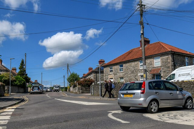
Bowlish is a small village located in the county of Somerset, England. It lies approximately 3 miles south of the town of Shepton Mallet and is nestled in the picturesque Mendip Hills. The village is surrounded by rolling countryside and offers stunning views of the nearby valleys.

Bowlish is known for its idyllic rural charm and historic character. It features a mix of traditional stone cottages and newer residential properties. The village is home to a close-knit community, with a population of around 300 residents.

One of the notable features of Bowlish is its proximity to the famous Babington House, a luxury country hotel and spa. Many visitors to the area are attracted to the tranquility and natural beauty of Bowlish, making it a popular destination for those seeking a peaceful retreat.

The village is well-connected to nearby towns and cities, with good transport links. It benefits from a range of local amenities, including a village hall and a pub, which serves as a social hub for residents and visitors alike. The surrounding area offers ample opportunities for outdoor activities such as hiking, cycling, and horse riding.

In conclusion, Bowlish is a charming village in Somerset that offers a rural escape with its stunning countryside, historic buildings, and strong sense of community. It is a popular destination for those seeking a peaceful and picturesque retreat in the heart of the Mendip Hills.

If you have any feedback on the listing, please let us know in the comments section below.

Bowlish Images

Images are sourced within 2km of 51.194928/-2.554526 or Grid Reference ST6144. Thanks to Geograph Open Source API. All images are credited.

Part of the town centre in Shepton Mallet The old pub here is sadly closed and the town has a slightly run down feel to it, which I hadn't expected. Other parts of the town centre were more vibrant, so quite why I took this shot I do not know.
Part of the town centre in Shepton Mallet
The old pub here is sadly closed and the town has a slightly run down feel to it, which I hadn't expected. Other parts of the town centre were more vibrant, so quite why I took this shot I do not know.
Shepton Mallet - Market Cross
Shepton Mallet - view N along High St
Sunrise clouds, Shepton Mallet If ever the maxim "red sky in the morning, shepherds' warning" proved apt it was on this day. A little later heavy snow set in.

The sun was actually rising off to the right.
Sunrise clouds, Shepton Mallet
If ever the maxim "red sky in the morning, shepherds' warning" proved apt it was on this day. A little later heavy snow set in. The sun was actually rising off to the right.
Commercial Road, Shepton Mallet Seen at sunrise across the crossroads with Old market Road and Rectory Road. On the left is the grade II* listed Anglo Trading Estate building <span class="nowrap"><a title="https://historicengland.org.uk/listing/the-list/list-entry/1296561?section=official-list-entry" rel="nofollow ugc noopener" href="https://historicengland.org.uk/listing/the-list/list-entry/1296561?section=official-list-entry">Link</a><img style="margin-left:2px;" alt="External link" title="External link - shift click to open in new window" src="https://s1.geograph.org.uk/img/external.png" width="10" height="10"/></span> (1864), also shown at most of the images at <a title="https://www.geograph.org.uk/search.php?i=173552446" href="https://www.geograph.org.uk/search.php?i=173552446">Link</a> .

On the right is No 24 Commercial Road (1840), described at <span class="nowrap"><a title="https://historicengland.org.uk/listing/the-list/list-entry/1058460?section=official-list-entry" rel="nofollow ugc noopener" href="https://historicengland.org.uk/listing/the-list/list-entry/1058460?section=official-list-entry">Link</a><img style="margin-left:2px;" alt="External link" title="External link - shift click to open in new window" src="https://s1.geograph.org.uk/img/external.png" width="10" height="10"/></span> .

Commercial Road is the A371.
Commercial Road, Shepton Mallet
Seen at sunrise across the crossroads with Old market Road and Rectory Road. On the left is the grade II* listed Anglo Trading Estate building LinkExternal link (1864), also shown at most of the images at Link . On the right is No 24 Commercial Road (1840), described at LinkExternal link . Commercial Road is the A371.
Town Street, Shepton Mallet Most of the buildings on the west side of the street, shown here in the light of sunrise, are listed. On the immediate right are numbers 13-15 <span class="nowrap"><a title="https://historicengland.org.uk/listing/the-list/list-entry/1058360?section=official-list-entry" rel="nofollow ugc noopener" href="https://historicengland.org.uk/listing/the-list/list-entry/1058360?section=official-list-entry">Link</a><img style="margin-left:2px;" alt="External link" title="External link - shift click to open in new window" src="https://s1.geograph.org.uk/img/external.png" width="10" height="10"/></span> , with next door but one by numbers 7 and 9 <span class="nowrap"><a title="https://historicengland.org.uk/listing/the-list/list-entry/1345272?section=official-list-entry" rel="nofollow ugc noopener" href="https://historicengland.org.uk/listing/the-list/list-entry/1345272?section=official-list-entry">Link</a><img style="margin-left:2px;" alt="External link" title="External link - shift click to open in new window" src="https://s1.geograph.org.uk/img/external.png" width="10" height="10"/></span> .
Town Street, Shepton Mallet
Most of the buildings on the west side of the street, shown here in the light of sunrise, are listed. On the immediate right are numbers 13-15 LinkExternal link , with next door but one by numbers 7 and 9 LinkExternal link .
Alleyway, Town Street, Shepton Mallet Rather blurred in the uncertain dawn light, this shows the eastern of two listed archways <span class="nowrap"><a title="https://historicengland.org.uk/listing/the-list/list-entry/1058361?section=official-list-entry" rel="nofollow ugc noopener" href="https://historicengland.org.uk/listing/the-list/list-entry/1058361?section=official-list-entry">Link</a><img style="margin-left:2px;" alt="External link" title="External link - shift click to open in new window" src="https://s1.geograph.org.uk/img/external.png" width="10" height="10"/></span> : "Archway to East c1600. Connecting wall and archway to West c1800. Both of dressed stone. Archway to East opening directly onto Town Street has 4-centred head, quirked-ogee mouldings, and spandrels".
Alleyway, Town Street, Shepton Mallet
Rather blurred in the uncertain dawn light, this shows the eastern of two listed archways LinkExternal link : "Archway to East c1600. Connecting wall and archway to West c1800. Both of dressed stone. Archway to East opening directly onto Town Street has 4-centred head, quirked-ogee mouldings, and spandrels".
Studfold Cottage, Bowlish A listed cottage of about 1650 on Ham Lane, described at <span class="nowrap"><a title="https://historicengland.org.uk/listing/the-list/list-entry/1058437?section=official-list-entry" rel="nofollow ugc noopener" href="https://historicengland.org.uk/listing/the-list/list-entry/1058437?section=official-list-entry">Link</a><img style="margin-left:2px;" alt="External link" title="External link - shift click to open in new window" src="https://s1.geograph.org.uk/img/external.png" width="10" height="10"/></span> .
Studfold Cottage, Bowlish
A listed cottage of about 1650 on Ham Lane, described at LinkExternal link .
Bowlish Grange "Mill, now house. Circa 1700" <span class="nowrap"><a title="https://historicengland.org.uk/listing/the-list/list-entry/1345229?section=official-list-entry" rel="nofollow ugc noopener" href="https://historicengland.org.uk/listing/the-list/list-entry/1345229?section=official-list-entry">Link</a><img style="margin-left:2px;" alt="External link" title="External link - shift click to open in new window" src="https://s1.geograph.org.uk/img/external.png" width="10" height="10"/></span> .
Bowlish Grange
"Mill, now house. Circa 1700" LinkExternal link .
Bowlish Villa " Circa 1700" <span class="nowrap"><a title="https://historicengland.org.uk/listing/the-list/list-entry/1172895?section=official-list-entry" rel="nofollow ugc noopener" href="https://historicengland.org.uk/listing/the-list/list-entry/1172895?section=official-list-entry">Link</a><img style="margin-left:2px;" alt="External link" title="External link - shift click to open in new window" src="https://s1.geograph.org.uk/img/external.png" width="10" height="10"/></span> . The description also includes the "flanking walls either side of the front, that to the left containing pointed arch garden door".
Bowlish Villa
" Circa 1700" LinkExternal link . The description also includes the "flanking walls either side of the front, that to the left containing pointed arch garden door".
Junction, Ham Lane Snow has fallen, and there's a lot more to come. Left of centre is one of three doorways in a listed wall <span class="nowrap"><a title="https://historicengland.org.uk/listing/the-list/list-entry/1058396?section=official-list-entry" rel="nofollow ugc noopener" href="https://historicengland.org.uk/listing/the-list/list-entry/1058396?section=official-list-entry">Link</a><img style="margin-left:2px;" alt="External link" title="External link - shift click to open in new window" src="https://s1.geograph.org.uk/img/external.png" width="10" height="10"/></span> , surrounding the Old Manor <span class="nowrap"><a title="https://historicengland.org.uk/listing/the-list/list-entry/1058395?section=official-list-entry" rel="nofollow ugc noopener" href="https://historicengland.org.uk/listing/the-list/list-entry/1058395?section=official-list-entry">Link</a><img style="margin-left:2px;" alt="External link" title="External link - shift click to open in new window" src="https://s1.geograph.org.uk/img/external.png" width="10" height="10"/></span> , only a little of which can be seen. On the right is Cleevers <span class="nowrap"><a title="https://historicengland.org.uk/listing/the-list/list-entry/1058397?section=official-list-entry" rel="nofollow ugc noopener" href="https://historicengland.org.uk/listing/the-list/list-entry/1058397?section=official-list-entry">Link</a><img style="margin-left:2px;" alt="External link" title="External link - shift click to open in new window" src="https://s1.geograph.org.uk/img/external.png" width="10" height="10"/></span> .
Junction, Ham Lane
Snow has fallen, and there's a lot more to come. Left of centre is one of three doorways in a listed wall LinkExternal link , surrounding the Old Manor LinkExternal link , only a little of which can be seen. On the right is Cleevers LinkExternal link .
Ham Lane Starting a descent into the Sheppey valley as the snow holds off for a short while. On the left is Darshill Wood.
Ham Lane
Starting a descent into the Sheppey valley as the snow holds off for a short while. On the left is Darshill Wood.
Old Milepost by A37, Bath Road, opposite former Downside Inn, North of Shepton Mallet The Milepost is located on the bank alongside the road on the East side.  Parish of Shepton Mallet (Mendip District). Cast iron post, plated iron casting design, erected by the Shepton Mallet turnpike trust in the 19th Century, hole in top below "Bath", missing rivet. An earlier photograph can be found here: <a title="https://www.geograph.org.uk/photo/6044224" href="https://www.geograph.org.uk/photo/6044224">Link</a> 

Inscription reads:-  
SHEPTON / MALLET / 1  : : BRISTOL / 19 : : BATH / 16 

Grade II listed. List Entry Number: 1167921 <span class="nowrap"><a title="https://historicengland.org.uk/listing/the-list/list-entry/1167921" rel="nofollow ugc noopener" href="https://historicengland.org.uk/listing/the-list/list-entry/1167921">Link</a><img style="margin-left:2px;" alt="External link" title="External link - shift click to open in new window" src="https://s1.geograph.org.uk/img/external.png" width="10" height="10"/></span> 

Milestone Society National ID: SO_SMBR01
Old Milepost by A37, Bath Road, opposite former Downside Inn, North of Shepton Mallet
The Milepost is located on the bank alongside the road on the East side.  Parish of Shepton Mallet (Mendip District). Cast iron post, plated iron casting design, erected by the Shepton Mallet turnpike trust in the 19th Century, hole in top below "Bath", missing rivet. An earlier photograph can be found here: Link  Inscription reads:- SHEPTON / MALLET / 1 : : BRISTOL / 19 : : BATH / 16 Grade II listed. List Entry Number: 1167921 LinkExternal link Milestone Society National ID: SO_SMBR01
Shepton Mallet : Westfield Looking along a road off West Shepton.
Shepton Mallet : Westfield
Looking along a road off West Shepton.
Shepton Mallet : High Street Off Cannard's Grave Road.
Shepton Mallet : High Street
Off Cannard's Grave Road.
Field A field with a solitary tree off Compton Lane.
Field
A field with a solitary tree off Compton Lane.
Compton Road Lane south of Shepton Mallet.
Compton Road
Lane south of Shepton Mallet.
Ridge Lane Lane south of Shepton Mallet, seen here by its junction with Compton Road (on the left) and Compton Lane (on the right).
Ridge Lane
Lane south of Shepton Mallet, seen here by its junction with Compton Road (on the left) and Compton Lane (on the right).
Show me another place!

Bowlish is located at Grid Ref: ST6144 (Lat: 51.194928, Lng: -2.554526)

Administrative County: Somerset

District: Mendip

Police Authority: Avon and Somerset

What 3 Words

///poppy.reflected.redeeming. Near Shepton Mallet, Somerset

Nearby Locations

Bowlish

Related Wikis

Brothers Cider

Brothers Cider is a brand of fruit cider originating in Somerset in South West England. Originally available at music festivals, it is now sold in pubs...

Anglo-Bavarian Brewery

The Anglo-Bavarian Brewery was originally established in Shepton Mallet in Somerset, England in 1864. It has been claimed as the first lager brewery in...

Shepton Mallet Rural District

Shepton Mallet was a rural district in Somerset, England, from 1894 to 1974. It was created in 1894, under the Local Government Act 1894. In 1974 it was...
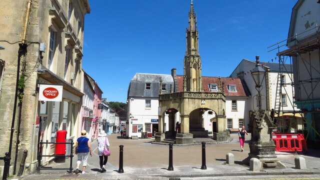
Shepton Mallet

Shepton Mallet is a market town and civil parish in Somerset, England, some 16 miles (26 kilometres) southwest of Bath, 18 miles (29 kilometres) south...

Nearby Amenities

Located within 500m of 51.194928,-2.554526
Barrier: stile
Material: wood
Stile: stepover
Lat/Long: 51.1982044/-2.5524818
Bowlish
Place: suburb
Source: OS7
Lat/Long: 51.195496/-2.5552219
Power: pole
Lat/Long: 51.199332/-2.5545976
Power: pole
Lat/Long: 51.1984525/-2.5542745
Power: pole
Lat/Long: 51.1973026/-2.5538402
Power: pole
Lat/Long: 51.1960959/-2.5534086
Power: pole
Lat/Long: 51.1953605/-2.5524083
Power: pole
Lat/Long: 51.1946553/-2.5510626
Location Transition: yes
Power: pole
Lat/Long: 51.194399/-2.5505765
Power: pole
Lat/Long: 51.1970766/-2.5591971
Power: pole
Lat/Long: 51.1968009/-2.5578461
Power: pole
Lat/Long: 51.1965517/-2.5566639
Power: pole
Lat/Long: 51.1961576/-2.5547929
Power: pole
Lat/Long: 51.1959696/-2.5538841
Power: pole
Lat/Long: 51.1953555/-2.5526953
Power: pole
Lat/Long: 51.1949169/-2.551822
Location Transition: yes
Power: pole
Lat/Long: 51.1942958/-2.5506043
Power: pole
Lat/Long: 51.1940716/-2.5523064
The data included in this document is from www.openstreetmap.org. The data is made available under ODbL.

Have you been to Bowlish?

Leave your review of Bowlish below (or comments, questions and feedback).