Strensham, Upper

Settlement in Worcestershire Wychavon

England

Strensham, Upper

Clouds & Floods Looking South along the M5 from Strensham under a stormy sky. The river Avon is in flood and to the left is the edge of the Cotswolds.
Clouds & Floods Credit: David Stowell

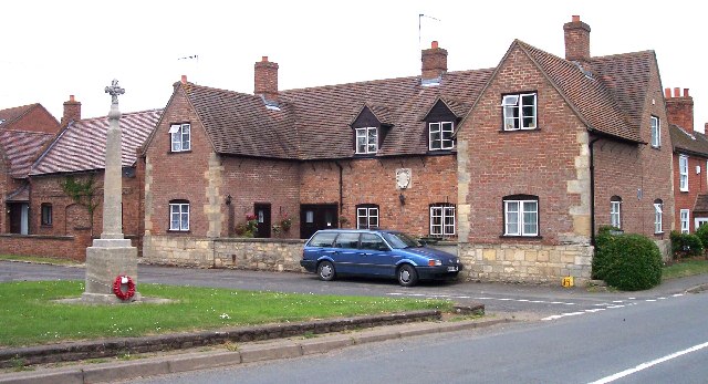
Strensham is a small village located in the Upper district of Worcestershire, England. Situated approximately 10 miles south of the city of Worcester, it is nestled amidst the picturesque countryside of the county. The village is part of the Wychavon district and falls under the administrative jurisdiction of Worcestershire County Council.

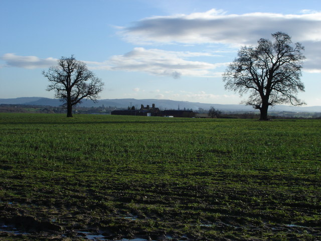
With a population of around 500 residents, Strensham has a close-knit community that thrives on its rural charm and tranquil surroundings. The village is known for its idyllic landscapes, characterized by rolling green hills, meandering streams, and scenic walking trails. This makes it a popular destination for outdoor enthusiasts and nature lovers.

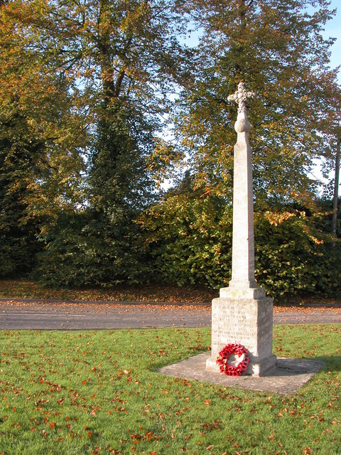
Strensham boasts a rich history, with evidence of human habitation dating back to Roman times. The village is home to St. John the Baptist Church, a medieval parish church that stands as a testament to its historical legacy. The church features stunning architectural elements and serves as a gathering place for the local community.

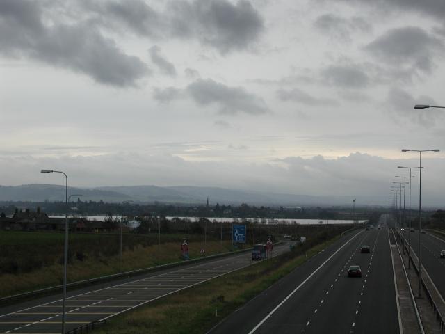
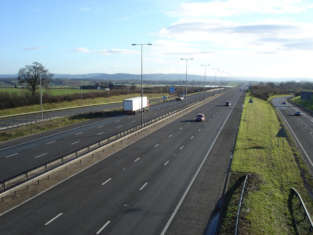
Despite its small size, Strensham offers a range of amenities to its residents. These include a village hall, a primary school, and a selection of local shops and services. Additionally, the village benefits from excellent transport links, with the M5 motorway passing nearby, providing easy access to Worcester, Cheltenham, and other major towns and cities in the region.

Overall, Strensham is a peaceful and charming village that offers a high quality of life for its residents, combining rural beauty with convenient access to nearby urban centers.

If you have any feedback on the listing, please let us know in the comments section below.

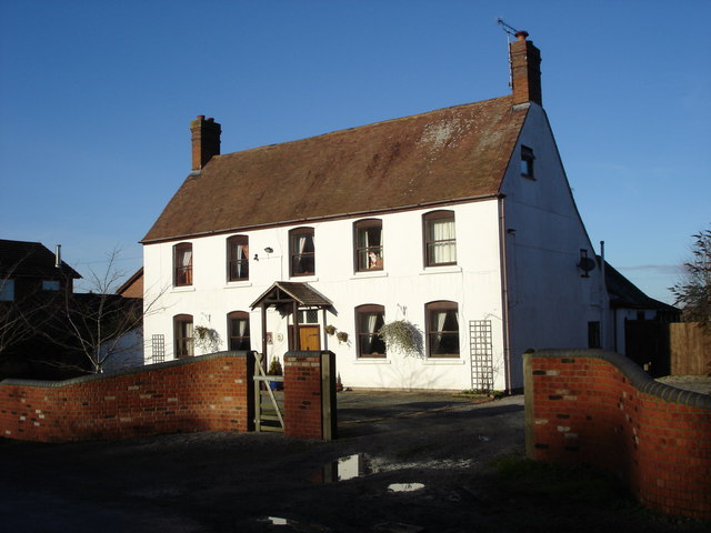
Strensham, Upper Images

Images are sourced within 2km of 52.053257/-2.1445195 or Grid Reference SO9039. Thanks to Geograph Open Source API. All images are credited.

Clouds & Floods Looking South along the M5 from Strensham under a stormy sky. The river Avon is in flood and to the left is the edge of the Cotswolds.
Clouds & Floods
Looking South along the M5 from Strensham under a stormy sky. The river Avon is in flood and to the left is the edge of the Cotswolds.
Hillend Common, near Twyning Open Common grassland for the most part. Surrounded on all three sides with houses.
Hillend Common, near Twyning
Open Common grassland for the most part. Surrounded on all three sides with houses.
M50 / M5 interchange The eastern end of the M50 where it meets the M5 at Junction 8 on a huge roundabout with flyover.
M50 / M5 interchange
The eastern end of the M50 where it meets the M5 at Junction 8 on a huge roundabout with flyover.
Near the end of the M50 Looking towards South Wales. Approaching traffic has to choose between the M5 North for Birmingham or M5 South for Bristol.
Near the end of the M50
Looking towards South Wales. Approaching traffic has to choose between the M5 North for Birmingham or M5 South for Bristol.
Strensham War Memorial and Almshouses. The almshouses bear a crest and date of 1697.
Strensham War Memorial and Almshouses.
The almshouses bear a crest and date of 1697.
Bredon Fields Farm Straw bales at Bredon Fields Farm, in the background are Bredon Fields Cottages.  In the distance is the Spire of Bredon church and on the horizon the escarpment of the Cotswolds
Bredon Fields Farm
Straw bales at Bredon Fields Farm, in the background are Bredon Fields Cottages. In the distance is the Spire of Bredon church and on the horizon the escarpment of the Cotswolds
Stubble field on Bredon Fields Farm Beyond this stubble field on Bredon Fields Farm is Strensham Water Treatment Works which takes water from its intake on the River Severn near Upton-upon-Severn and after treatment the water is then pumped to Coventry.
Stubble field on Bredon Fields Farm
Beyond this stubble field on Bredon Fields Farm is Strensham Water Treatment Works which takes water from its intake on the River Severn near Upton-upon-Severn and after treatment the water is then pumped to Coventry.
Strensham South Motorway Services Strensham South Motorway Services, on the M5.
Strensham South Motorway Services
Strensham South Motorway Services, on the M5.
Chestnut trees by Showborough House
Bredon Hill viewed from Twyning View of Bredon Hill from the footpath which crosses Hill End Bank. The River Avon flows between Twyning and Bredon and flood water can be seen on the meadow in the middle distance.
Bredon Hill viewed from Twyning
View of Bredon Hill from the footpath which crosses Hill End Bank. The River Avon flows between Twyning and Bredon and flood water can be seen on the meadow in the middle distance.
Hill End Common, Twyning Hill End Common is one of a number of commons in the parish of Twyning. In the background on the left is Windmill Farm, the cottage on the right is situated beside the lane at the top of Oaks Bank.
Hill End Common, Twyning
Hill End Common is one of a number of commons in the parish of Twyning. In the background on the left is Windmill Farm, the cottage on the right is situated beside the lane at the top of Oaks Bank.
Entrance to the Summer Leasow The Summer Leasow and Upham Meadow, known locally as Twyning Meadow, is a SSSI and is now Open Access land, though for only part of the year. This large area of meadow and common land is crossed by the M5 motorway. Bredon Hill can be seen in the background.
Entrance to the Summer Leasow
The Summer Leasow and Upham Meadow, known locally as Twyning Meadow, is a SSSI and is now Open Access land, though for only part of the year. This large area of meadow and common land is crossed by the M5 motorway. Bredon Hill can be seen in the background.
The Worcestershire/Gloucestershire boundary The ditch behind the fence is the county boundary between Worcestershire (far side) and Gloucestershire on this side of the fence. Bredon Hill can be seen in the background.
The Worcestershire/Gloucestershire boundary
The ditch behind the fence is the county boundary between Worcestershire (far side) and Gloucestershire on this side of the fence. Bredon Hill can be seen in the background.
Farm road to Bredon Fields Cottages Bredon Hill can be seen in the background on the other side of the River Avon.
Farm road to Bredon Fields Cottages
Bredon Hill can be seen in the background on the other side of the River Avon.
Bredon Field Farm Bredon Field Farm viewed from Mill Lane. The Cotswolds can be seen on the horizon.
Bredon Field Farm
Bredon Field Farm viewed from Mill Lane. The Cotswolds can be seen on the horizon.
The M5 junction 8 View to the south from the bridge carrying Mill Lane. Bredon Field Farm can be seen above the white lorry, one mile south of this junction the M5 crosses the River Avon which at the time of this picture was in flood. The Cotswolds can be seen on the horizon.
The M5 junction 8
View to the south from the bridge carrying Mill Lane. Bredon Field Farm can be seen above the white lorry, one mile south of this junction the M5 crosses the River Avon which at the time of this picture was in flood. The Cotswolds can be seen on the horizon.
Former public house, Strensham This used to be the Cavalier and previously the Pelican Inn, though it is many years since this was a pub.
Former public house, Strensham
This used to be the Cavalier and previously the Pelican Inn, though it is many years since this was a pub.
Show me another place!

Strensham, Upper is located at Grid Ref: SO9039 (Lat: 52.053257, Lng: -2.1445195)

Administrative County: Worcestershire

District: Wychavon

Police Authority: West Mercia

What 3 Words

///smuggled.chops.behind. Near Eckington, Worcestershire

Related Wikis

Strensham

Strensham is a village in the Wychavon district of Worcestershire. In the 2001 census, the civil parish of Strensham had a population of 314 across 127...
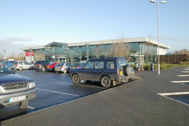
Strensham services

Strensham services is a motorway service station on the M5 in Worcestershire, England. It is operated by Roadchef. In August 2011, it was rated as 4 stars...

St John the Baptist's Church, Strensham

St John the Baptist's Church is a redundant Anglican church in the village of Strensham, Worcestershire, England. It is recorded in the National Heritage...

Hill Croome

Hill Croome is a village, and a civil parish which covers 1000 acres, in the Malvern Hills District in the county of Worcestershire, England. Historically...

Nearby Amenities

Located within 500m of 52.053257,-2.1445195
Motorway Junction
Strensham Interchange
Exit To: M50 South Wales, Ross-on-Wye
Level: 3
Ref: 8
Lat/Long: 52.0550886/-2.1399788
Bus Stop
War Memorial
Bus: yes
Fixme: Not sure this shelter is actually a bus stop any more. No indication of bus timetables; lots of other community leaflets though.
Naptan AtcoCode: 2000G065500
Naptan Bearing: N
Naptan CommonName: War Memorial
Naptan Indicator: Adj
Naptan Landmark: War Memorial
Naptan NaptanCode: wocdtdtp
Naptan Street: Hill View Road
Naptan Verified: no
Public Transport: platform
Source: naptan_import
Lat/Long: 52.0530672/-2.1447584
Bus Stop
War Memorial
Bus: yes
Naptan AtcoCode: 2000G500723
Naptan Bearing: SE
Naptan CommonName: War Memorial
Naptan Indicator: Opp
Naptan Landmark: War memorial
Naptan NaptanCode: wocgjgwp
Naptan Street: Twyning Road
Naptan Verified: no
Public Transport: platform
Source: naptan_import
Lat/Long: 52.0529868/-2.1443207
Upper Strensham
Place: village
Source: NPE
Lat/Long: 52.0528927/-2.1455338
Bench
Lat/Long: 52.0569333/-2.1453606
Historic: memorial
Memorial: war_memorial
Lat/Long: 52.0531756/-2.1446825
Old Phone: +44 1684 292161
Removed Amenity: telephone
Lat/Long: 52.0531096/-2.1447925
Post Box
Collection Plate: CP7
Collection Times: Mo-Fr 16:15; Sa 09:00
Historic Operator: Post Office
Post Box Type: lamp
Ref: WR8 291
Royal Cypher: EIIR
Royal Cypher Wikidata: Q33102113
Source: Walking Survey; Bing
Lat/Long: 52.0536016/-2.1444031
Shelter
Fixme: Just a shelter; no evidence that buses stop there. Done separately from putative NapTAn node next to it.
Lat/Long: 52.0530904/-2.1447736
Barrier: stile
Lat/Long: 52.0527927/-2.1376194
Power: pole
Lat/Long: 52.0540582/-2.1406239
Location Transition: yes
Power: pole
Lat/Long: 52.0541687/-2.140364
Location Transition: yes
Power: pole
Lat/Long: 52.054949/-2.1384742
Location Transition: yes
Power: pole
Lat/Long: 52.0561256/-2.1422294
Power: pole
Lat/Long: 52.055517/-2.1418606
Power: pole
Lat/Long: 52.055136/-2.1418076
Power: pole
Lat/Long: 52.0544458/-2.1417426
Power: pole
Lat/Long: 52.0556688/-2.1418646
Chlorination Plant
Power: pole
Transformer: distribution
Lat/Long: 52.0557141/-2.1446675
Power: pole
Lat/Long: 52.0556894/-2.1438856
Power: pole
Lat/Long: 52.0556696/-2.1427618
Strensham Court
Power: pole
Transformer: distribution
Lat/Long: 52.0514398/-2.1412316
Aerial Site Bredon Fields Farm
Power: pole
Transformer: distribution
Voltage Primary: 11000
Lat/Long: 52.0524286/-2.1409547
Power: pole
Lat/Long: 52.0532896/-2.1407904
Power: pole
Lat/Long: 52.0536376/-2.1416587
Location Transition: yes
Power: pole
Lat/Long: 52.0532847/-2.1433398
Power: pole
Lat/Long: 52.0534183/-2.142735
Strensham Farm
Location: indoor
Power: transformer
Transformer: distribution
Voltage Primary: 11000
Lat/Long: 52.0534034/-2.1458302
Strensham Court Mews
Place: neighbourhood
Lat/Long: 52.0512254/-2.1417801
Defibrillator
Defibrillator Location: outside Strensham Village Hall - to left of entrance
Emergency: defibrillator
Indoor: no
Lat/Long: 52.0533675/-2.1443051
The data included in this document is from www.openstreetmap.org. The data is made available under ODbL.

Have you been to Strensham, Upper?

Leave your review of Strensham, Upper below (or comments, questions and feedback).