Upper Lambourn

Settlement in Berkshire

England

Upper Lambourn

The driveway to Park Farm, Upper Lambourn A more imposing entrance and drive than that for your average farm!
The driveway to Park Farm, Upper Lambourn Credit: David Purchase

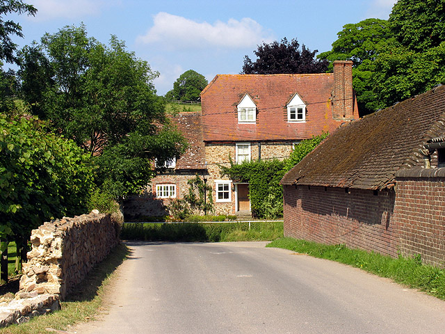
Upper Lambourn is a small village located in the county of Berkshire, England. It is situated in the Lambourn Valley, known for its picturesque landscapes and charming rural atmosphere. The village lies approximately 4 miles northwest of the market town of Hungerford and about 20 miles southeast of Swindon.

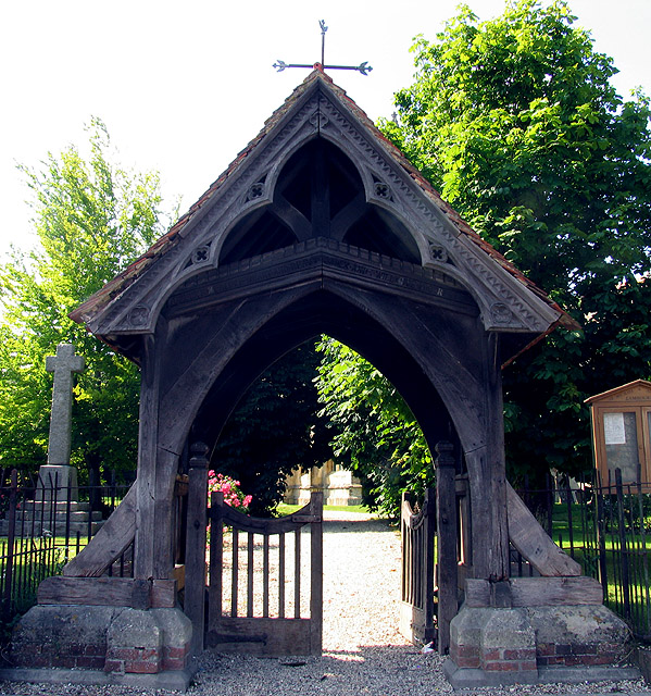
Despite its modest size, Upper Lambourn boasts a rich history that dates back to the medieval times. The village is home to several historic buildings, including St. Michael and All Angels Church, a Grade I listed structure that dates back to the 13th century. The church is renowned for its impressive architecture and stained glass windows.

The Lambourn Valley is also famous for its association with horse racing. Upper Lambourn is no exception, as it is nestled in the heart of one of the UK's most important horse racing regions. The village is surrounded by lush green fields that serve as training grounds for many renowned racehorses. It is common to see jockeys and horse trainers passing through the village, adding to its unique character.

In terms of amenities, Upper Lambourn offers a range of facilities to its residents and visitors. These include a primary school, a village hall, a local pub, and a post office. The village is well-connected to neighboring towns and cities through a network of roads, making it easily accessible for those looking to explore the surrounding areas.

Overall, Upper Lambourn is a delightful and historic village that combines its rural charm with its strong equestrian heritage, making it an attractive destination for both locals and visitors.

If you have any feedback on the listing, please let us know in the comments section below.

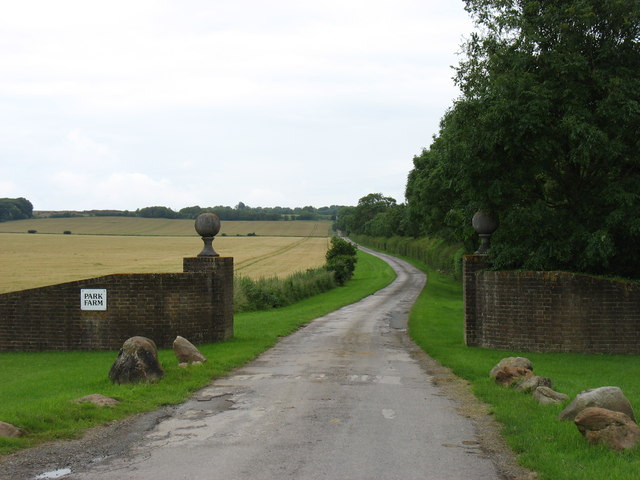
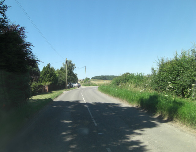
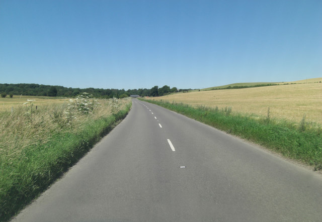
Upper Lambourn Images

Images are sourced within 2km of 51.520644/-1.5491367 or Grid Reference SU3180. Thanks to Geograph Open Source API. All images are credited.

The driveway to Park Farm, Upper Lambourn A more imposing entrance and drive than that for your average farm!
The driveway to Park Farm, Upper Lambourn
A more imposing entrance and drive than that for your average farm!
B4000 north of Fognam Farm Ahead is a crossroads but it doesn't appear so to the motorist on the 'B' road. Straight on is a byway open to all traffic and perpendicularly a private road to Park Farm.
B4000 north of Fognam Farm
Ahead is a crossroads but it doesn't appear so to the motorist on the 'B' road. Straight on is a byway open to all traffic and perpendicularly a private road to Park Farm.
B4000 climbs Fognam Down
Byway, Near Down, Lambourn A view towards the wooded area around Ashdown House.
Byway, Near Down, Lambourn
A view towards the wooded area around Ashdown House.
St Michael and All Angels: Lambourn This square is a mixture of the village of Lambourn and farmland. This church is in the northern section of the square.
St Michael and All Angels: Lambourn
This square is a mixture of the village of Lambourn and farmland. This church is in the northern section of the square.
Lych Gate at St Michael and All Angels: Lambourn The lych gate is south of the church on the village square.
Lych Gate at St Michael and All Angels: Lambourn
The lych gate is south of the church on the village square.
Lambourn: Estbury Almshouses This building, in the Market Place east of the church, is the entrance gateway to the almshouses founded in 1502 and rebuilt in 1582.
Lambourn: Estbury Almshouses
This building, in the Market Place east of the church, is the entrance gateway to the almshouses founded in 1502 and rebuilt in 1582.
Farmland: Lambourn This square contains the end of the village of Lambourn and farmland. This view taken from North Farm Close (the road between the B4001 and the minor road), looks north east across the field towards the top of the hill.
Farmland: Lambourn
This square contains the end of the village of Lambourn and farmland. This view taken from North Farm Close (the road between the B4001 and the minor road), looks north east across the field towards the top of the hill.
Valley Equine Hospital This square consists of residences, farms and the Equine hospital. This view of the paddocks for horses "on the mend", is to the north of the hospital driveway, in the south western section of the square.
Valley Equine Hospital
This square consists of residences, farms and the Equine hospital. This view of the paddocks for horses "on the mend", is to the north of the hospital driveway, in the south western section of the square.
Stud Farm in the Valley of the Race Horse: Lambourn This stud farm (Neardown Stables), is to the south west of the B road in the north eastern corner of the square. The square is mostly Farmland and stables.
Stud Farm in the Valley of the Race Horse: Lambourn
This stud farm (Neardown Stables), is to the south west of the B road in the north eastern corner of the square. The square is mostly Farmland and stables.
Sunflowers on Row Down A broad stripe of sunflowers and poppies running up the side of the bridleway over Row Down towards the gallops above Lambourn.
Sunflowers on Row Down
A broad stripe of sunflowers and poppies running up the side of the bridleway over Row Down towards the gallops above Lambourn.
Byway, Row Down Having crossed the gallops on Near Down, the byway descends to the valley of Farn Combe.
Byway, Row Down
Having crossed the gallops on Near Down, the byway descends to the valley of Farn Combe.
Stubble, above Farncombe Farm Beside the Lambourn to Baydon byway.
Stubble, above Farncombe Farm
Beside the Lambourn to Baydon byway.
Byway above Lambourn Looking along to The Folly, a copse.
Byway above Lambourn
Looking along to The Folly, a copse.
Downs above Lambourn Looking across the valley of Farn Combe.
Downs above Lambourn
Looking across the valley of Farn Combe.
St Michael & All Angels, Lambourn, Berks
St Michael & All Angels, Lambourn, Berks - East end
St Michael & All Angels, Lambourn, Berks - Tomb & Font
Show me another place!

Upper Lambourn is located at Grid Ref: SU3180 (Lat: 51.520644, Lng: -1.5491367)

Unitary Authority: West Berkshire

Police Authority: Thames Valley

What 3 Words

///drank.catch.scrapped. Near Lambourn, Berkshire

Related Wikis

Upper Lambourn

Upper Lambourn is a small village in the county of Berkshire, England. The village is situated in the civil parish of Lambourn , and is 1.2 miles (2 km...

Lambourn

Lambourn is a village and civil parish in Berkshire, England. It lies just north of the M4 Motorway between Swindon and Newbury, and borders Wiltshire...

Fognam Chalk Quarry

Fognam Chalk Quarry is a 3-hectare (7.4-acre) geological Site of Special Scientific Interest west of Upper Lambourn in Berkshire. It is a Geological Conservation...

Croker's Hole

Croker's Hole is a 4.4-hectare (11-acre) biological Site of Special Scientific Interest north of Upper Lambourn in Berkshire.The site is a narrow grassland...

Nearby Amenities

Located within 500m of 51.520644,-1.5491367
Upper Lambourn
Place: village
Wikidata: Q7898739
Lat/Long: 51.5223423/-1.5474568
cottage
Building: yes
Lat/Long: 51.5225399/-1.5473703
Barrier: bollard
Material: metal
Lat/Long: 51.5192227/-1.5441592
Turning Circle
Lat/Long: 51.5222709/-1.5467143
Barrier: bollard
Material: metal
Lat/Long: 51.5209896/-1.5459027
Barrier: bollard
Material: stone
Lat/Long: 51.5183093/-1.542958
Barrier: bollard
Material: stone
Lat/Long: 51.518343/-1.5430075
Barrier: bollard
Material: stone
Lat/Long: 51.5183584/-1.5430306
Post Box
Lat/Long: 51.5187524/-1.5436575
Waste Basket
Lat/Long: 51.519191/-1.5441511
Waste Basket
Waste: dog_excrement
Lat/Long: 51.5191806/-1.5441352
Give Way
Lat/Long: 51.5216771/-1.5554231
Bus Stop
St Lukes Church
Bus: yes
Public Transport: platform
Lat/Long: 51.5206088/-1.548921
Bus Stop
St Lukes Church
Bus: yes
Public Transport: platform
Lat/Long: 51.5206618/-1.5494021
The data included in this document is from www.openstreetmap.org. The data is made available under ODbL.

Have you been to Upper Lambourn?

Leave your review of Upper Lambourn below (or comments, questions and feedback).