Dean, Upper

Settlement in Bedfordshire

England

Dean, Upper

Farmland west of Swineshead
Farmland west of Swineshead Credit: JThomas

Dean, Upper, Bedfordshire is a small village located in the county of Bedfordshire, England. Situated on the outskirts of the town of Ampthill, it is a picturesque and idyllic rural area known for its tranquil surroundings and natural beauty.

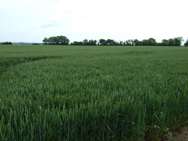
The village is home to a close-knit community of approximately 500 residents, who enjoy a peaceful and friendly atmosphere. Dean, Upper is characterized by its traditional English village architecture, with charming cottages and well-maintained gardens dotted throughout the area. The village is surrounded by rolling countryside, offering residents and visitors the opportunity to explore the beautiful landscape through walking trails and footpaths.

Despite its small size, Dean, Upper boasts a few amenities that cater to the needs of its residents. These include a local pub, which serves as a social hub for the community, as well as a small village hall that hosts various events and gatherings throughout the year. For more extensive amenities, residents can easily access the nearby town of Ampthill, where they can find a range of shops, restaurants, and other services.

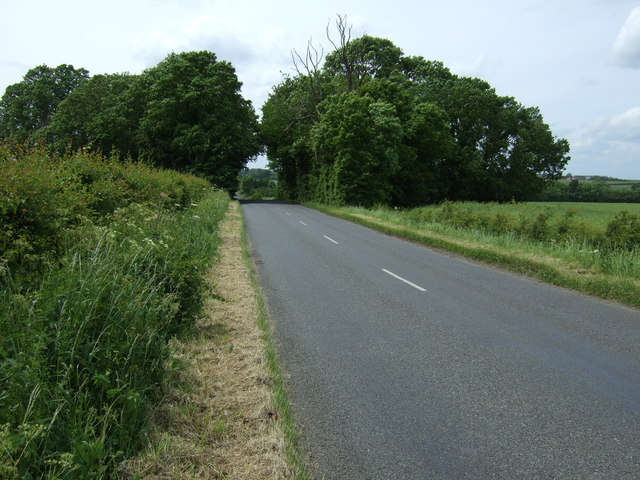
The village is also well-positioned for commuting, with excellent road links to nearby towns and cities. The A6 road runs just to the west of Dean, Upper, providing easy access to Bedford and Luton, while the M1 motorway is within a short drive away, connecting the village to London and other major cities in the UK.

Overall, Dean, Upper, Bedfordshire offers a peaceful and picturesque lifestyle, perfect for those seeking a rural retreat with easy access to amenities and transport links.

If you have any feedback on the listing, please let us know in the comments section below.

Dean, Upper Images

Images are sourced within 2km of 52.297928/-0.470473 or Grid Reference TL0467. Thanks to Geograph Open Source API. All images are credited.

Farmland west of Swineshead
Minor road towards Riseley
Farmland, Eastfields Farm
Track to Eastfields Farm (bridleway)
Farmland near Melchbourne
Minor road towards Yelden
Farmland near Melchbourne
Minor road towards Yelden
Upper Dean Ford This ford is found on Shay Lane in Upper Dean.
Upper Dean Ford
This ford is found on Shay Lane in Upper Dean.
Landscape in the valley of the River Til
Sweeping arable landscapes Open farmland above Upper Dean.
Sweeping arable landscapes
Open farmland above Upper Dean.
Arable landscape near Upper Dean
Non standard bridge on the Bridleway Crossing point over the River Til
Non standard bridge on the Bridleway
Crossing point over the River Til
Better than wet feet "Bridge" crossing over the River Til.
Better than wet feet
"Bridge" crossing over the River Til.
Windmill Tower at Upper Dean Recent history explained <span class="nowrap"><a title="http://www.windmillworld.com/millid/2260.htm" rel="nofollow ugc noopener" href="http://www.windmillworld.com/millid/2260.htm">Link</a><img style="margin-left:2px;" alt="External link" title="External link - shift click to open in new window" src="https://s1.geograph.org.uk/img/external.png" width="10" height="10"/></span>
Windmill Tower at Upper Dean
Recent history explained LinkExternal link
Cap details of Upper Dean Windmill Building description <span class="nowrap"><a title="http://www.windmillworld.com/millid/2260.htm" rel="nofollow ugc noopener" href="http://www.windmillworld.com/millid/2260.htm">Link</a><img style="margin-left:2px;" alt="External link" title="External link - shift click to open in new window" src="https://s1.geograph.org.uk/img/external.png" width="10" height="10"/></span>
Cap details of Upper Dean Windmill
Building description LinkExternal link
Windmill Tower at Upper Dean
The Three Compasses A pint of Thwaites "Good Elf" was taken here along with a fine pub lunch.
The Three Compasses
A pint of Thwaites "Good Elf" was taken here along with a fine pub lunch.
Show me another place!

Dean, Upper is located at Grid Ref: TL0467 (Lat: 52.297928, Lng: -0.470473)

Unitary Authority: Bedford

Police Authority: Bedfordshire

What 3 Words

///apprehend.frantic.truly. Near Swineshead, Bedfordshire

Nearby Locations

Dean, Upper Upper Dean

Related Wikis

Upper Dean

Upper Dean is a village located in the Borough of Bedford in Bedfordshire, England. == Description == The village forms part of the Dean and Shelton civil...

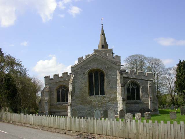
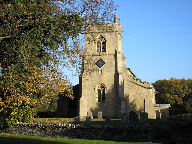
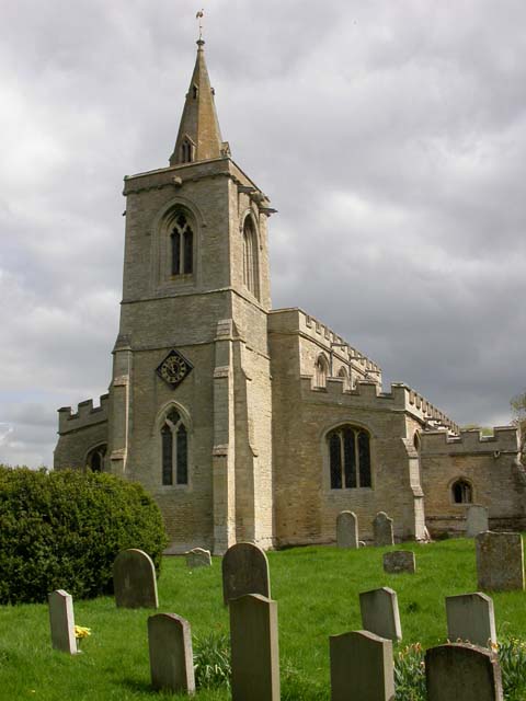
Church of All Saints, Upper Dean

The Church of All Saints is a Grade I listed church in Upper Dean, Bedfordshire, England. It became a listed building on 13 July 1964.The church escaped...

Dean and Shelton

Dean and Shelton is a civil parish in the Bedford district, in the ceremonial county of Bedfordshire, England. The two parishes of Dean and Shelton were...

Dean, Bedfordshire

Dean or Over Dene is a former civil parish, now in the parish of Dean and Shelton, in the Bedford district, in the ceremonial county of Bedfordshire, England...

Nearby Amenities

Located within 500m of 52.297928,-0.470473
Upper Dean
Place: village
Wikidata: Q1521029
Wikipedia: en:Upper Dean
Lat/Long: 52.2977267/-0.4672104
Pub
The Three Compasses
Addr City: Upper Dean
Addr Country: GB
Addr Postcode: PE28 0NE
Addr Street: High Street
Fhrs Authority: Bedford
Fhrs Id: 635877
Fhrs Local Authority Id: 114294
Source: survey
Wikidata: Q26607190
Lat/Long: 52.2971781/-0.4727717
Ford: yes
Lat/Long: 52.2993301/-0.4656141
Post Box
Post Box Type: pillar
Ref: PE28 147
Royal Cypher: GR
Royal Cypher Wikidata: Q33102273
Lat/Long: 52.2966792/-0.4662853
Barrier: kissing_gate
Lat/Long: 52.29567/-0.4671191
Barrier: stile
Lat/Long: 52.29697/-0.4683665
Barrier: kissing_gate
Lat/Long: 52.2971588/-0.4670305
Power: pole
Lat/Long: 52.297346/-0.4722788
Place Of Worship
Dean United Reformed Church
Addr City: Dean
Addr Country: GB
Addr Street: High Street
Denomination: united_reformed
Religion: christian
Lat/Long: 52.2996869/-0.4638116
The data included in this document is from www.openstreetmap.org. The data is made available under ODbL.

Have you been to Dean, Upper?

Leave your review of Dean, Upper below (or comments, questions and feedback).