Upper Dean

Settlement in Devon South Hams

England

Upper Dean

A38, Devon Expressway The A38 is a major A-class trunk route. When first designated in 1922, it ran from Derby to Plymouth but it was later extended at both ends so that it now runs for 292 miles from Mansfield in Nottinghamshire to Bodmin in Cornwall.

Prior to the opening of the M5 motorway in the 1960s and 1970s, the A38 formed the main "holiday route" from the Midlands to Somerset, Devon and Cornwall and the south-western section was notorious at holiday times for the congestion. Nowadays, for most of the southern section, the A38 is a fairly quiet road shadowing the M5 extremely closely; often running alongside the motorway as a single carriageway road. The section between Exeter and Plymouth is, however, a busy dual carriageway which serves as the southern extension of the M5 and is known as “the Devon Expressway”.

More information at <span class="nowrap"><a title="http://en.wikipedia.org/wiki/A38_road" rel="nofollow ugc noopener" href="http://en.wikipedia.org/wiki/A38_road">Link</a><img style="margin-left:2px;" alt="External link" title="External link - shift click to open in new window" src="https://s1.geograph.org.uk/img/external.png" width="10" height="10"/></span>  (Wikipedia) and <span class="nowrap"><a title="http://www.sabre-roads.org.uk/wiki/index.php?title=A38" rel="nofollow ugc noopener" href="http://www.sabre-roads.org.uk/wiki/index.php?title=A38">Link</a><img style="margin-left:2px;" alt="External link" title="External link - shift click to open in new window" src="https://s1.geograph.org.uk/img/external.png" width="10" height="10"/></span>  (SABRE).
A38, Devon Expressway Credit: David Dixon

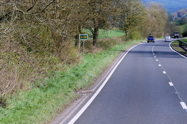
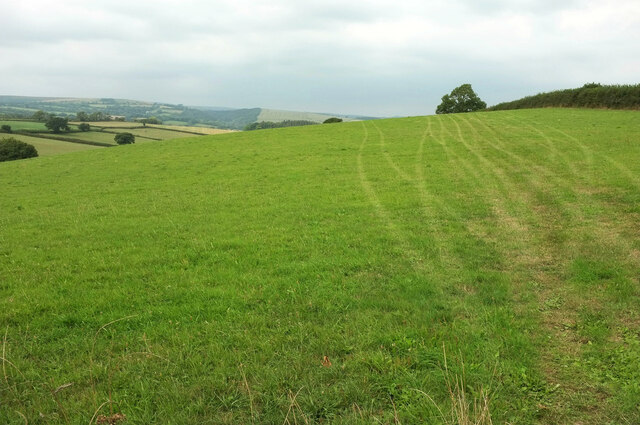
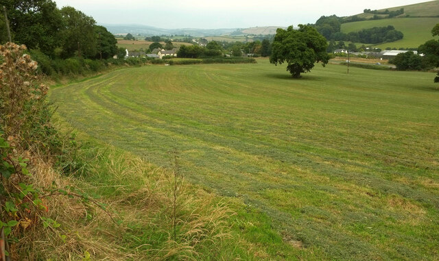
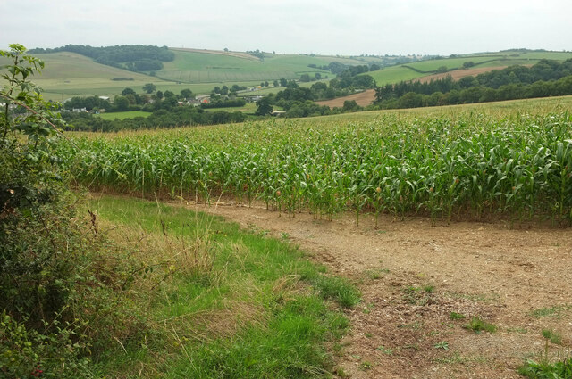
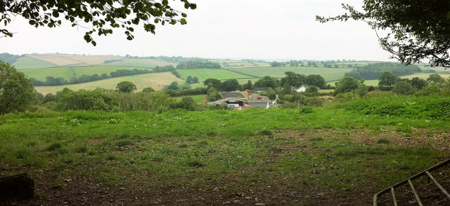
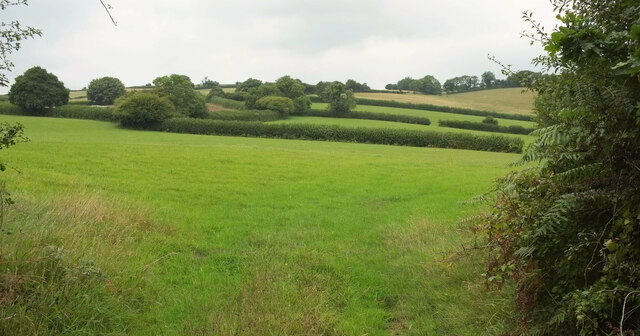
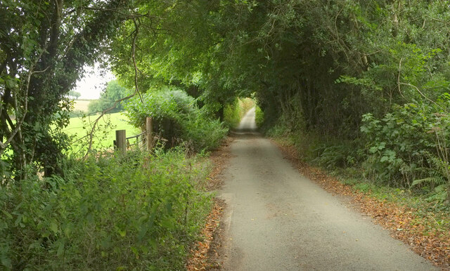
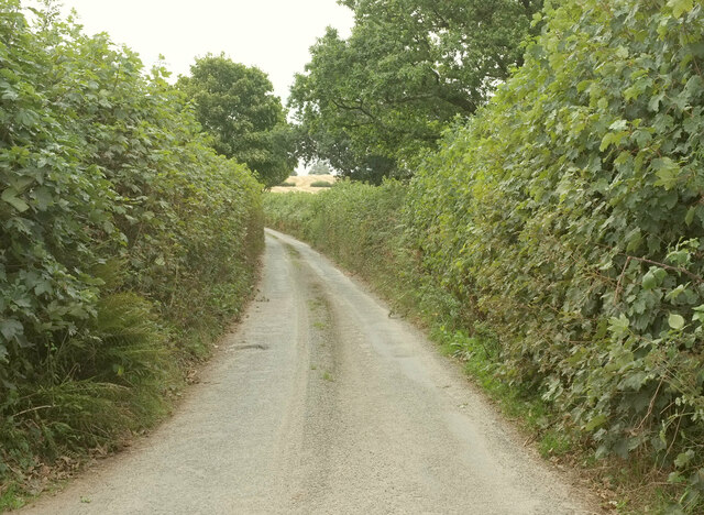
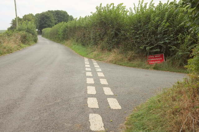
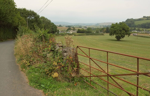
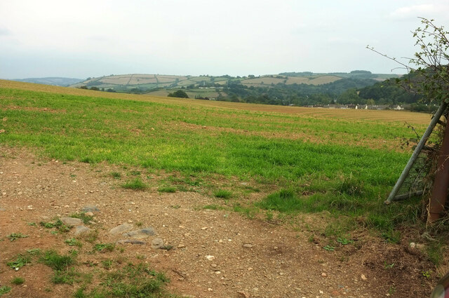
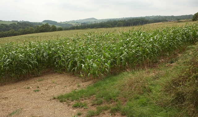
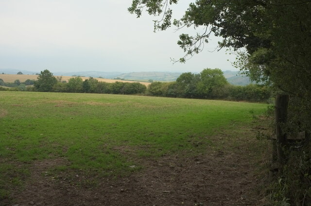
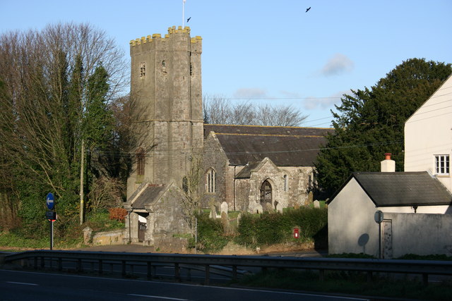
Upper Dean is a small village located in the county of Devon, situated in the southwestern part of England. It is a rural settlement that lies approximately 10 miles east of the city of Exeter. The village is nestled in a picturesque landscape surrounded by rolling hills and lush green fields, offering a tranquil and idyllic setting.

The population of Upper Dean is relatively small, with only a few hundred residents. The village is characterized by its quaint and traditional architecture, with charming cottages and historic buildings dotting its streets. The community has a close-knit feel, and residents often engage in various social activities and events.

Despite its small size, Upper Dean boasts a strong sense of community and offers basic amenities for its residents. It has a village hall that serves as a hub for social gatherings, meetings, and recreational activities. The village also has a primary school, providing education for the local children.

Surrounded by the beautiful Devon countryside, Upper Dean offers excellent opportunities for outdoor activities. There are several walking and cycling paths that meander through the village and its surroundings. The area is also known for its scenic beauty, attracting nature enthusiasts and photographers alike.

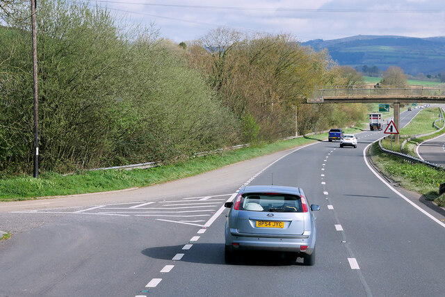
Upper Dean's close proximity to Exeter allows residents to access a wider range of services, including shops, supermarkets, healthcare facilities, and entertainment options. The village is well-connected to the surrounding areas through a network of roads, making it easily accessible for commuters and visitors.

Overall, Upper Dean is a charming and peaceful village in Devon, offering a close-knit community, stunning natural surroundings, and a relaxing rural lifestyle.

If you have any feedback on the listing, please let us know in the comments section below.

Upper Dean Images

Images are sourced within 2km of 50.461822/-3.8047294 or Grid Reference SX7264. Thanks to Geograph Open Source API. All images are credited.

A38, Devon Expressway The A38 is a major A-class trunk route. When first designated in 1922, it ran from Derby to Plymouth but it was later extended at both ends so that it now runs for 292 miles from Mansfield in Nottinghamshire to Bodmin in Cornwall.

Prior to the opening of the M5 motorway in the 1960s and 1970s, the A38 formed the main "holiday route" from the Midlands to Somerset, Devon and Cornwall and the south-western section was notorious at holiday times for the congestion. Nowadays, for most of the southern section, the A38 is a fairly quiet road shadowing the M5 extremely closely; often running alongside the motorway as a single carriageway road. The section between Exeter and Plymouth is, however, a busy dual carriageway which serves as the southern extension of the M5 and is known as “the Devon Expressway”.

More information at <span class="nowrap"><a title="http://en.wikipedia.org/wiki/A38_road" rel="nofollow ugc noopener" href="http://en.wikipedia.org/wiki/A38_road">Link</a><img style="margin-left:2px;" alt="External link" title="External link - shift click to open in new window" src="https://s1.geograph.org.uk/img/external.png" width="10" height="10"/></span>  (Wikipedia) and <span class="nowrap"><a title="http://www.sabre-roads.org.uk/wiki/index.php?title=A38" rel="nofollow ugc noopener" href="http://www.sabre-roads.org.uk/wiki/index.php?title=A38">Link</a><img style="margin-left:2px;" alt="External link" title="External link - shift click to open in new window" src="https://s1.geograph.org.uk/img/external.png" width="10" height="10"/></span>  (SABRE).
A38, Devon Expressway
The A38 is a major A-class trunk route. When first designated in 1922, it ran from Derby to Plymouth but it was later extended at both ends so that it now runs for 292 miles from Mansfield in Nottinghamshire to Bodmin in Cornwall. Prior to the opening of the M5 motorway in the 1960s and 1970s, the A38 formed the main "holiday route" from the Midlands to Somerset, Devon and Cornwall and the south-western section was notorious at holiday times for the congestion. Nowadays, for most of the southern section, the A38 is a fairly quiet road shadowing the M5 extremely closely; often running alongside the motorway as a single carriageway road. The section between Exeter and Plymouth is, however, a busy dual carriageway which serves as the southern extension of the M5 and is known as “the Devon Expressway”. More information at LinkExternal link (Wikipedia) and LinkExternal link (SABRE).
Footbridge across the Devon Expressway at Dean Prior The A38 is a major A-class trunk route. When first designated in 1922, it ran from Derby to Plymouth but it was later extended at both ends so that it now runs for 292 miles from Mansfield in Nottinghamshire to Bodmin in Cornwall.

Prior to the opening of the M5 motorway in the 1960s and 1970s, the A38 formed the main "holiday route" from the Midlands to Somerset, Devon and Cornwall and the south-western section was notorious at holiday times for the congestion. Nowadays, for most of the southern section, the A38 is a fairly quiet road shadowing the M5 extremely closely; often running alongside the motorway as a single carriageway road. The section between Exeter and Plymouth is, however, a busy dual carriageway which serves as the southern extension of the M5 and is known as “the Devon Expressway”.

More information at <span class="nowrap"><a title="http://en.wikipedia.org/wiki/A38_road" rel="nofollow ugc noopener" href="http://en.wikipedia.org/wiki/A38_road">Link</a><img style="margin-left:2px;" alt="External link" title="External link - shift click to open in new window" src="https://s1.geograph.org.uk/img/external.png" width="10" height="10"/></span>  (Wikipedia) and <span class="nowrap"><a title="http://www.sabre-roads.org.uk/wiki/index.php?title=A38" rel="nofollow ugc noopener" href="http://www.sabre-roads.org.uk/wiki/index.php?title=A38">Link</a><img style="margin-left:2px;" alt="External link" title="External link - shift click to open in new window" src="https://s1.geograph.org.uk/img/external.png" width="10" height="10"/></span>  (SABRE).
Footbridge across the Devon Expressway at Dean Prior
The A38 is a major A-class trunk route. When first designated in 1922, it ran from Derby to Plymouth but it was later extended at both ends so that it now runs for 292 miles from Mansfield in Nottinghamshire to Bodmin in Cornwall. Prior to the opening of the M5 motorway in the 1960s and 1970s, the A38 formed the main "holiday route" from the Midlands to Somerset, Devon and Cornwall and the south-western section was notorious at holiday times for the congestion. Nowadays, for most of the southern section, the A38 is a fairly quiet road shadowing the M5 extremely closely; often running alongside the motorway as a single carriageway road. The section between Exeter and Plymouth is, however, a busy dual carriageway which serves as the southern extension of the M5 and is known as “the Devon Expressway”. More information at LinkExternal link (Wikipedia) and LinkExternal link (SABRE).
A38 near Dean Prior The A38 is a major A-class trunk route. When first designated in 1922, it ran from Derby to Plymouth but it was later extended at both ends so that it now runs for 292 miles from Mansfield in Nottinghamshire to Bodmin in Cornwall.

Prior to the opening of the M5 motorway in the 1960s and 1970s, the A38 formed the main "holiday route" from the Midlands to Somerset, Devon and Cornwall and the south-western section was notorious at holiday times for the congestion. Nowadays, for most of the southern section, the A38 is a fairly quiet road shadowing the M5 extremely closely; often running alongside the motorway as a single carriageway road. The section between Exeter and Plymouth is, however, a busy dual carriageway which serves as the southern extension of the M5 and is known as “the Devon Expressway”.

More information at <span class="nowrap"><a title="http://en.wikipedia.org/wiki/A38_road" rel="nofollow ugc noopener" href="http://en.wikipedia.org/wiki/A38_road">Link</a><img style="margin-left:2px;" alt="External link" title="External link - shift click to open in new window" src="https://s1.geograph.org.uk/img/external.png" width="10" height="10"/></span>  (Wikipedia) and <span class="nowrap"><a title="http://www.sabre-roads.org.uk/wiki/index.php?title=A38" rel="nofollow ugc noopener" href="http://www.sabre-roads.org.uk/wiki/index.php?title=A38">Link</a><img style="margin-left:2px;" alt="External link" title="External link - shift click to open in new window" src="https://s1.geograph.org.uk/img/external.png" width="10" height="10"/></span>  (SABRE).
A38 near Dean Prior
The A38 is a major A-class trunk route. When first designated in 1922, it ran from Derby to Plymouth but it was later extended at both ends so that it now runs for 292 miles from Mansfield in Nottinghamshire to Bodmin in Cornwall. Prior to the opening of the M5 motorway in the 1960s and 1970s, the A38 formed the main "holiday route" from the Midlands to Somerset, Devon and Cornwall and the south-western section was notorious at holiday times for the congestion. Nowadays, for most of the southern section, the A38 is a fairly quiet road shadowing the M5 extremely closely; often running alongside the motorway as a single carriageway road. The section between Exeter and Plymouth is, however, a busy dual carriageway which serves as the southern extension of the M5 and is known as “the Devon Expressway”. More information at LinkExternal link (Wikipedia) and LinkExternal link (SABRE).
Devon Expressway at Lower Dean The A38 is a major A-class trunk route. When first designated in 1922, it ran from Derby to Plymouth but it was later extended at both ends so that it now runs for 292 miles from Mansfield in Nottinghamshire to Bodmin in Cornwall.

Prior to the opening of the M5 motorway in the 1960s and 1970s, the A38 formed the main "holiday route" from the Midlands to Somerset, Devon and Cornwall and the south-western section was notorious at holiday times for the congestion. Nowadays, for most of the southern section, the A38 is a fairly quiet road shadowing the M5 extremely closely; often running alongside the motorway as a single carriageway road. The section between Exeter and Plymouth is, however, a busy dual carriageway which serves as the southern extension of the M5 and is known as “the Devon Expressway”.

More information at <span class="nowrap"><a title="http://en.wikipedia.org/wiki/A38_road" rel="nofollow ugc noopener" href="http://en.wikipedia.org/wiki/A38_road">Link</a><img style="margin-left:2px;" alt="External link" title="External link - shift click to open in new window" src="https://s1.geograph.org.uk/img/external.png" width="10" height="10"/></span>  (Wikipedia) and <span class="nowrap"><a title="http://www.sabre-roads.org.uk/wiki/index.php?title=A38" rel="nofollow ugc noopener" href="http://www.sabre-roads.org.uk/wiki/index.php?title=A38">Link</a><img style="margin-left:2px;" alt="External link" title="External link - shift click to open in new window" src="https://s1.geograph.org.uk/img/external.png" width="10" height="10"/></span>  (SABRE).
Devon Expressway at Lower Dean
The A38 is a major A-class trunk route. When first designated in 1922, it ran from Derby to Plymouth but it was later extended at both ends so that it now runs for 292 miles from Mansfield in Nottinghamshire to Bodmin in Cornwall. Prior to the opening of the M5 motorway in the 1960s and 1970s, the A38 formed the main "holiday route" from the Midlands to Somerset, Devon and Cornwall and the south-western section was notorious at holiday times for the congestion. Nowadays, for most of the southern section, the A38 is a fairly quiet road shadowing the M5 extremely closely; often running alongside the motorway as a single carriageway road. The section between Exeter and Plymouth is, however, a busy dual carriageway which serves as the southern extension of the M5 and is known as “the Devon Expressway”. More information at LinkExternal link (Wikipedia) and LinkExternal link (SABRE).
Field above the A38 From a lane on the northwest side of Rattery.
Field above the A38
From a lane on the northwest side of Rattery.
Field, Upper Dean There are several trees in this field; this one is the largest. On the left, the lane from which this was taken runs past trees to the hamlet of Upper Dean. Lower Dean, across the A38 on the right, is dominated by Dean Court Farm and a business park.
Field, Upper Dean
There are several trees in this field; this one is the largest. On the left, the lane from which this was taken runs past trees to the hamlet of Upper Dean. Lower Dean, across the A38 on the right, is dominated by Dean Court Farm and a business park.
Maize near Upper Dean Looking left from <a href="https://www.geograph.org.uk/photo/3922444">SX7265 : Field near Coxhill Cross</a>, eight years on, looking across the Dean Burn valley.
Maize near Upper Dean
Looking left from SX7265 : Field near Coxhill Cross, eight years on, looking across the Dean Burn valley.
Addislade Seen from the lane between Deancombe and Reddacleave Kiln Cross. It can be seen much more clearly at <a title="https://www.geograph.org.uk/gridref/SX7164?centi=SX715640" href="https://www.geograph.org.uk/gridref/SX7164?centi=SX715640">Link</a> .
Addislade
Seen from the lane between Deancombe and Reddacleave Kiln Cross. It can be seen much more clearly at Link .
Fields near Zempson Bridge From the lane from Harbourneford Cross. The further fields move into <a href="https://www.geograph.org.uk/gridref/SX7062">SX7062</a>.
Fields near Zempson Bridge
From the lane from Harbourneford Cross. The further fields move into SX7062.
Lane at Moors Head Crossing the Moorshead Brook on this stretch, from which <a href="https://www.geograph.org.uk/photo/1270112">SX7163 : Private fishing pond</a> was taken, looking left.
Lane at Moors Head
Crossing the Moorshead Brook on this stretch, from which SX7163 : Private fishing pond was taken, looking left.
Lane to Cross Furzes From Buckfastleigh, where it started out as Wallaford Road. But it's probably not called that here, as Wallaford is about 700 metres back down the hill.
Lane to Cross Furzes
From Buckfastleigh, where it started out as Wallaford Road. But it's probably not called that here, as Wallaford is about 700 metres back down the hill.
Lane to Windy Corner Looking right from <a href="https://www.geograph.org.uk/photo/7274547">SX7362 : Field northwest of Rattery</a>.
Lane to Windy Corner
Whitehead's Cross A lane junction near Higher Dean, to which the road behind the camera and the right turn both lead. Ahead is for Harbourneford, and NCN2 follows the road.
Whitehead's Cross
A lane junction near Higher Dean, to which the road behind the camera and the right turn both lead. Ahead is for Harbourneford, and NCN2 follows the road.
Gate, Upper Dean The gate from which <a href="https://www.geograph.org.uk/photo/7270795">SX7264 : Field, Upper Dean</a> was taken. NCN2 follows the road.
Gate, Upper Dean
The gate from which SX7264 : Field, Upper Dean was taken. NCN2 follows the road.
Field near Higher Dean On the other side of the lane from <a href="https://www.geograph.org.uk/photo/7270800">SX7265 : Maize near Upper Dean</a>, with parts of Buckfastleigh visible. The presence of green grass in the field shows that this area was blessed with one of the very local heavy showers that has fallen in the last few weeks of the drought.
Field near Higher Dean
On the other side of the lane from SX7265 : Maize near Upper Dean, with parts of Buckfastleigh visible. The presence of green grass in the field shows that this area was blessed with one of the very local heavy showers that has fallen in the last few weeks of the drought.
Maize near Upper Dean Looking right from <a href="https://www.geograph.org.uk/photo/7270800">SX7265 : Maize near Upper Dean</a>. The distinctive shape of Brent Hill can be seen in the distance right of centre.
Maize near Upper Dean
Looking right from SX7265 : Maize near Upper Dean. The distinctive shape of Brent Hill can be seen in the distance right of centre.
Bridge over Dean Burn On the lane between Coxhill Cross and Deancombe, with the stream running for several kilometres in a wooded valley. This looks upstream.
Bridge over Dean Burn
On the lane between Coxhill Cross and Deancombe, with the stream running for several kilometres in a wooded valley. This looks upstream.
Field above Dean Wood On the other side of the lane from the field in the foreground of <a href="https://www.geograph.org.uk/photo/7270833">SX7164 : Addislade</a>.
Field above Dean Wood
On the other side of the lane from the field in the foreground of SX7164 : Addislade.
Show me another place!

Upper Dean is located at Grid Ref: SX7264 (Lat: 50.461822, Lng: -3.8047294)

Administrative County: Devon

District: South Hams

Police Authority: Devon and Cornwall

What 3 Words

///pest.park.crunching. Near Buckfastleigh, Devon

Related Wikis

Dean Prior

Dean Prior is a village and civil parish near the A38 road, in the South Hams district, in the county of Devon, England. It is located near the town of...

Pennywell Farm

Pennywell Farm is a farm tourist attraction just outside the town of Buckfastleigh in South Devon, England. It is a farm 600 feet (180 m) above sea level...

Buckfastleigh

Buckfastleigh is a market town and civil parish in Devon, England situated beside the Devon Expressway (A38) at the edge of the Dartmoor National Park...

Luscombe, Rattery

Luscombe is an historic estate situated in the parish of Rattery in Devon. == History == Loscume is an estate mentioned in the Domesday Book of 1086, not...

Brent Hill

Brent Hill is the site of an Iron Age hill fort situated close to South Brent in Devon, England. The fort occupies the top of Brent Hill at approx 311...
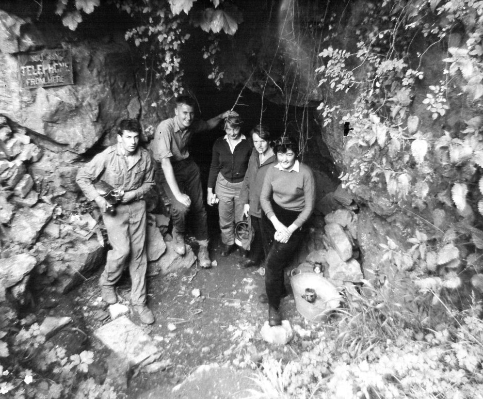
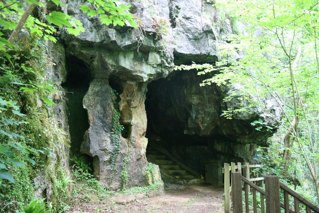
Bakers Pit

Bakers Pit is a phreatic maze cave system near Buckfastleigh, Devon, England. It was first opened in 1847 by quarrying activities.Bakers Pit is entered...

Joint Mitnor Cave

Joint Mitnor Cave, also known as Bone Cave, is a limestone cave situated in the now disused Higher Kiln Quarry near Buckfastleigh, in Devon, England. The...
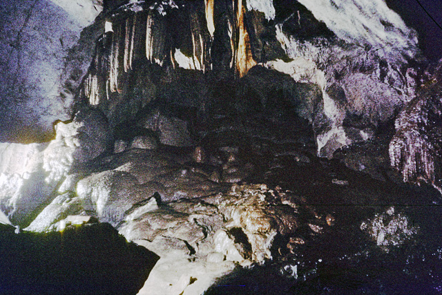
Reed's Cave

Reed's cave is a cave in Higher Kiln Quarry near Buckfastleigh, Dartmoor, Devon. It has many formations including the unique Little Man formation, which...

Nearby Amenities

Located within 500m of 50.461822,-3.8047294
Deancombe
Place: hamlet
Lat/Long: 50.4654756/-3.8012624
Butts Cross
Place: locality
Lat/Long: 50.4608952/-3.8093429
Addislade
Place: hamlet
Lat/Long: 50.4620693/-3.8103152
Ford: yes
Lat/Long: 50.4612979/-3.8034766
Generator Method: photovoltaic
Generator Output Electricity: yes
Generator Source: solar
Generator Type: solar_photovoltaic_panel
Location: roof
Power: generator
Lat/Long: 50.4649598/-3.8016705
The data included in this document is from www.openstreetmap.org. The data is made available under ODbL.

Have you been to Upper Dean?

Leave your review of Upper Dean below (or comments, questions and feedback).