Bowderdale

Settlement in Westmorland Eden

England

Bowderdale

Farmhouse at Cow Bank The building is at the minor road end in Weasdale on the north side of the Howgill Fells. The image was made in June 1992 when the building was clearly unoccupied however notes made at the time record that the roof had been renewed and guttering replaced, so it's possible that the house is now, in 2022, in use. Aerial views show that the trees close to the house are no longer there.
Farmhouse at Cow Bank Credit: Trevor Littlewood

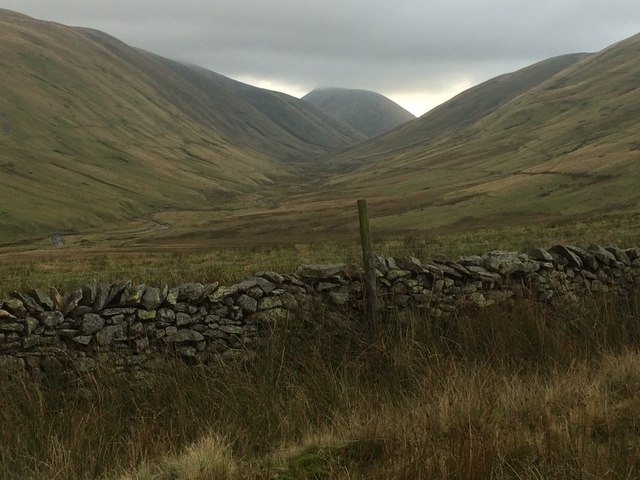
Bowderdale is a picturesque valley located in the Eden district of Westmorland, a historic county in the northwestern region of England. Nestled within the Yorkshire Dales National Park, Bowderdale is renowned for its stunning natural beauty and tranquil atmosphere.

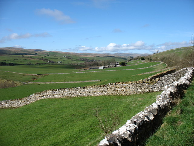
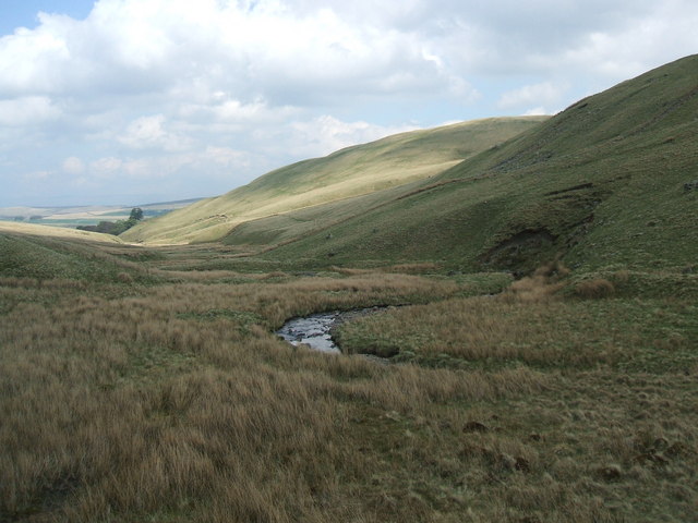
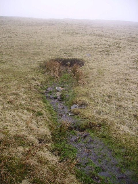
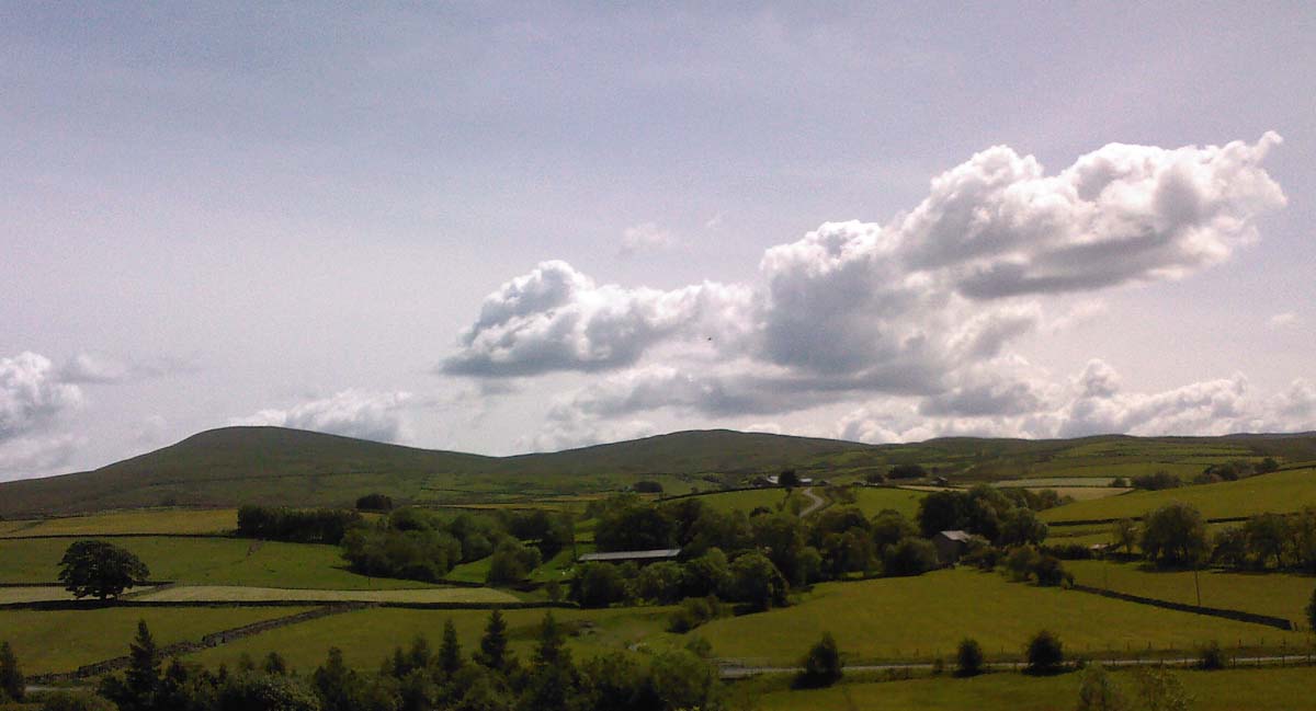
The valley is characterized by rolling hills, lush green meadows, and charming stone walls that dot the landscape. It is crisscrossed by the meandering River Lune, which adds to the allure of the area. Bowderdale is surrounded by the rugged slopes of the Howgill Fells, providing a dramatic backdrop to the valley.

The remote location of Bowderdale makes it a haven for outdoor enthusiasts and nature lovers. Hikers and walkers are drawn to the area's extensive network of trails, including the famous Dales High Way, which passes through the valley. The diverse wildlife of Bowderdale also attracts birdwatchers and wildlife photographers.

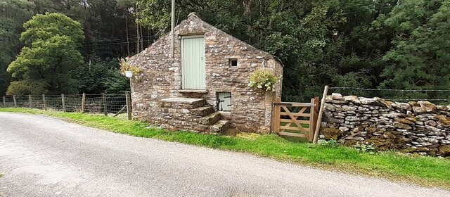
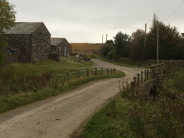
Although Bowderdale is primarily known for its natural offerings, there are a few scattered farms and hamlets in the vicinity. These traditional, stone-built dwellings add to the charm and authenticity of the area. However, amenities and facilities are limited, and visitors often have to venture to nearby towns for accommodation and services.

Overall, Bowderdale offers a peaceful retreat for those seeking to escape the hustle and bustle of modern life. Its unspoiled beauty and serene ambiance make it a must-visit destination for nature enthusiasts and those looking to reconnect with the great outdoors.

If you have any feedback on the listing, please let us know in the comments section below.

Bowderdale Images

Images are sourced within 2km of 54.436136/-2.497262 or Grid Reference NY6704. Thanks to Geograph Open Source API. All images are credited.

Farmhouse at Cow Bank The building is at the minor road end in Weasdale on the north side of the Howgill Fells. The image was made in June 1992 when the building was clearly unoccupied however notes made at the time record that the roof had been renewed and guttering replaced, so it's possible that the house is now, in 2022, in use. Aerial views show that the trees close to the house are no longer there.
Farmhouse at Cow Bank
The building is at the minor road end in Weasdale on the north side of the Howgill Fells. The image was made in June 1992 when the building was clearly unoccupied however notes made at the time record that the roof had been renewed and guttering replaced, so it's possible that the house is now, in 2022, in use. Aerial views show that the trees close to the house are no longer there.
Looking north along Weasdale Beck
Looking south along Weasdale Beck
Sheep in field near High Dubbs A farm and a field to the west of Newbiggin-on-Lune.
The northern slopes of the Howgill Fells rise in the distance.
Sheep in field near High Dubbs
A farm and a field to the west of Newbiggin-on-Lune. The northern slopes of the Howgill Fells rise in the distance.
Road junction above Wath The junction is of minor roads in the valley of the River Lune, west of Newbiggin-on-Lune.
The Howgill Fells are rising at the left side of the image.
Road junction above Wath
The junction is of minor roads in the valley of the River Lune, west of Newbiggin-on-Lune. The Howgill Fells are rising at the left side of the image.
Entrance to Lane Farm Ordnance Survey records indicate that a benchmark levelled at 272.897m above Newlyn Datum was verified in 1953 a gatepost at the entrance, now remodelled with loss of the gatepost
Entrance to Lane Farm
Ordnance Survey records indicate that a benchmark levelled at 272.897m above Newlyn Datum was verified in 1953 a gatepost at the entrance, now remodelled with loss of the gatepost
Gate to field from Church Gate east of Weasdale
Farm buildings at Weasdale
Fields on south side of Church Lane
Farm outbuilding with step access at Weasdale
Footpath and entrance track to Weasdale Nurseries (growers with altitude)
Weasdale Beck Ford This ford on the Weasdale Beck is found beside the footbridge just below Weasdale Nursery.
Weasdale Beck Ford
This ford on the Weasdale Beck is found beside the footbridge just below Weasdale Nursery.
Weasdale Beck Ford This irish bridge ford on the Weasdale Beck has been substantially washed away.
Weasdale Beck Ford
This irish bridge ford on the Weasdale Beck has been substantially washed away.
Ford at Scar Sikes This ford is found on the track above Scar Sikes.
Ford at Scar Sikes
This ford is found on the track above Scar Sikes.
Wall above Bowderdale Yarlside on the horizon.
Wall above Bowderdale
Yarlside on the horizon.
Bowderdale: farm and bridge
Stone walls approaching Kelleth Looking downstream, at the head of the Lune Valley.
Stone walls approaching Kelleth
Looking downstream, at the head of the Lune Valley.
Farm road and bridleway The bridleway is a continuation of the public road which has reached and ended at the farm, Cow Bank.
Farm road and bridleway
The bridleway is a continuation of the public road which has reached and ended at the farm, Cow Bank.
Show me another place!

Bowderdale is located at Grid Ref: NY6704 (Lat: 54.436136, Lng: -2.497262)

Administrative County: Cumbria

District: Eden

Police Authority: Cumbria

What 3 Words

///commended.blushed.thrillers. Near Kirkby Stephen, Cumbria

Nearby Locations

Bowderdale

Related Wikis

Bowderdale

Bowderdale is a hamlet in Cumbria, England, 6 miles (10 km) southwest of Kirkby Stephen. It is also the name of a dale in the Howgill Fells, the valley...

Weasdale Beck

Weasdale Beck is a stream in Cumbria, England. The Beck rises in Ravenstonedale and drains Leathgill Bridge on Randygill Top and Great Swindale, below...

Sandwath Beck

Sandwath Beck is a river running through Cumbria in England. The beck rises beneath Green Bell in Ravenstonedale as Dale Gill, changing its designation...
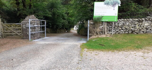
Weasdale

Weasdale is a small hamlet in Cumbria, England, 850 feet (260 m) above sea-level on the northern flanks of the Howgill Fells. It is located approximately...

Kelleth

Kelleth is a hamlet in Cumbria, England, containing around a dozen houses and formerly a toy factory. It is approximately 19 miles (31 km) from Penrith...

Ravenstonedale railway station

Ravenstonedale railway station was situated on the South Durham & Lancashire Union Railway (SD&LUR) between Tebay and Kirkby Stephen East. It served the...

Brownber

Brownber is a hamlet surrounding Brownber Hall near Newbiggin-on-Lune in Cumbria, England.

Newbiggin-on-Lune

Newbiggin-on-Lune is a village in the Eden district of Cumbria, England. Historically in Westmorland it is about 4 miles (6.4 km) south west of Kirkby...

Nearby Amenities

Located within 500m of 54.436136,-2.497262
Barrier: cattle_grid
Source: survey
Lat/Long: 54.4360947/-2.5005374
Bowderdale
Place: hamlet
Wikidata: Q4950747
Lat/Long: 54.4356676/-2.4965781
Potts
Place: locality
Lat/Long: 54.4334686/-2.4937216
Parking
Capacity: 3
Lat/Long: 54.4360682/-2.498749
Power: pole
Lat/Long: 54.4368155/-2.5041827
Power: pole
Lat/Long: 54.4368511/-2.5022283
Power: pole
Lat/Long: 54.4368916/-2.5006665
Power: pole
Lat/Long: 54.4369177/-2.4989492
Power: pole
Lat/Long: 54.436957/-2.4976081
Power: pole
Lat/Long: 54.4369748/-2.4966248
Power: pole
Lat/Long: 54.4370117/-2.4953021
Power: pole
Lat/Long: 54.4370556/-2.4936769
Power: pole
Lat/Long: 54.4370973/-2.4920394
Power: pole
Lat/Long: 54.4372637/-2.4907126
Power: pole
Lat/Long: 54.4363375/-2.497876
Power: pole
Lat/Long: 54.4358702/-2.498062
Power: pole
Lat/Long: 54.4353827/-2.4981192
Power: pole
Lat/Long: 54.4349618/-2.4981683
Power: pole
Lat/Long: 54.4364469/-2.4895678
The data included in this document is from www.openstreetmap.org. The data is made available under ODbL.

Have you been to Bowderdale?

Leave your review of Bowderdale below (or comments, questions and feedback).