Birchwood, Upper

Settlement in Derbyshire Amber Va

England

Birchwood, Upper

Roundabout on Birchwood Lane In South Normanton
Roundabout on Birchwood Lane Credit: Neil Theasby

Birchwood is a small village located in the Upper area of Derbyshire, England. Situated amidst picturesque countryside, it is known for its scenic beauty and tranquil ambiance. The village is well-connected to the nearby towns and cities, with good road links providing easy access to the surrounding areas.

Birchwood boasts a close-knit community, where residents enjoy a peaceful and friendly atmosphere. The village is home to a population of approximately 500 people, creating a tight-knit community where neighbors often know each other. The village is renowned for its strong community spirit, with various social events and activities taking place throughout the year to bring residents together.

The village offers a range of amenities to cater to the needs of its residents. These include a local convenience store, a post office, and a primary school, ensuring that essential services are easily accessible to the community. For recreational purposes, Birchwood has a community center that hosts various clubs and activities, providing opportunities for residents to engage in sports, arts, and other hobbies.

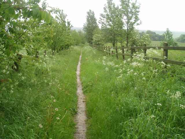
Surrounded by the stunning Derbyshire countryside, Birchwood offers numerous opportunities for outdoor activities and exploration. The village is located near several walking and cycling trails, allowing residents and visitors to immerse themselves in the beauty of the surrounding landscape. Additionally, the nearby Peak District National Park offers further recreational opportunities, including hiking, camping, and wildlife spotting.

Overall, Birchwood is a charming village in Upper Derbyshire that offers a peaceful lifestyle, strong community bonds, and access to beautiful natural surroundings.

If you have any feedback on the listing, please let us know in the comments section below.

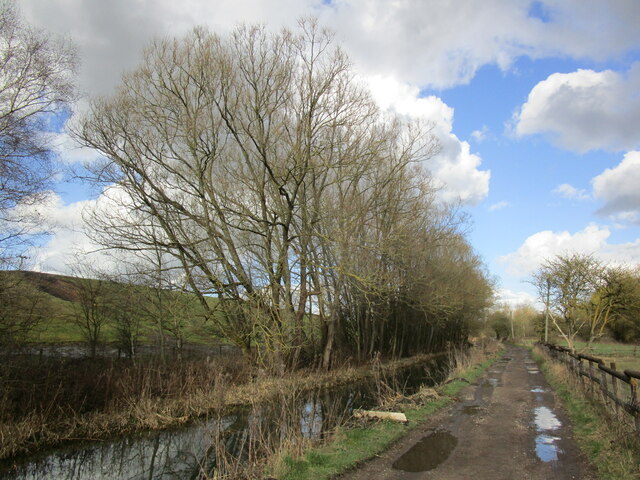
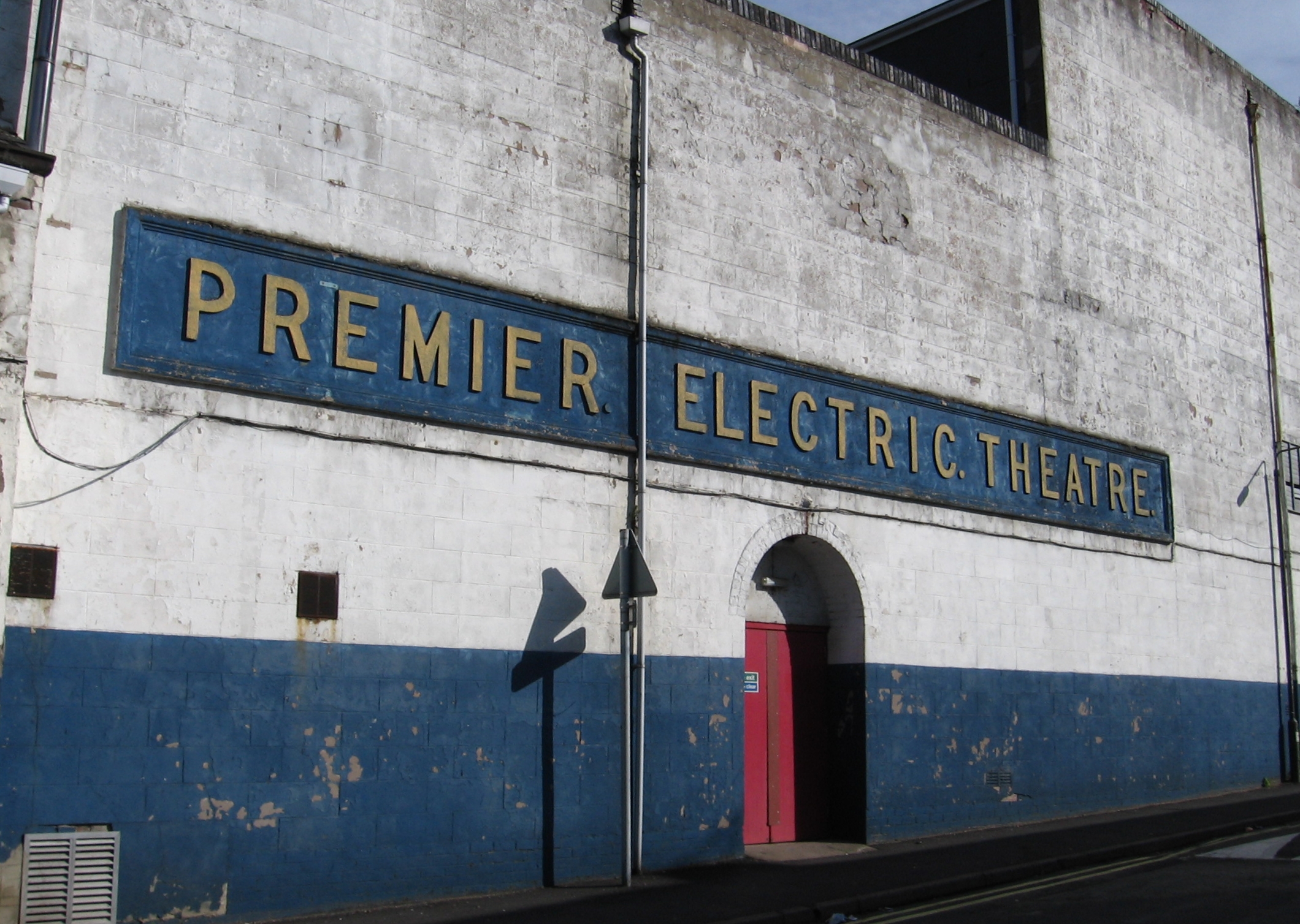
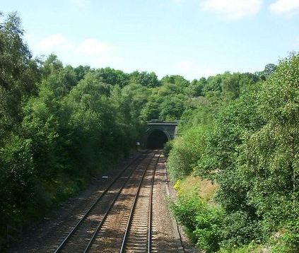
Birchwood, Upper Images

Images are sourced within 2km of 53.081499/-1.3595224 or Grid Reference SK4354. Thanks to Geograph Open Source API. All images are credited.

Roundabout on Birchwood Lane In South Normanton
Roundabout on Birchwood Lane
In South Normanton
Part of an industrial estate in Alfreton, Derbyshire The unit ahead is leased by Mountain Outfitters as a factory shop for Rab and Lowe Alpine outdoor gear and stocks sleeping bags and down jackets and the like at around 50% discounted prices compared to the high street retailers.
Part of an industrial estate in Alfreton, Derbyshire
The unit ahead is leased by Mountain Outfitters as a factory shop for Rab and Lowe Alpine outdoor gear and stocks sleeping bags and down jackets and the like at around 50% discounted prices compared to the high street retailers.
Industrial unit on an estate in Alfreton Mountain Outfitters retail Rab and Lowe Alpine products here and manufacture them next door I believe.
Industrial unit on an estate in Alfreton
Mountain Outfitters retail Rab and Lowe Alpine products here and manufacture them next door I believe.
Shafts of sunlight Leabrooks Railway Path, Alfreton
A38 near Alfreton
A38 near Alfreton
Go local extra - convenience store Terrace housing '2 up and 2 down' in older part of Riddings.
Go local extra - convenience store
Terrace housing '2 up and 2 down' in older part of Riddings.
Alongside the Pinxton Canal The Pinxton Canal was a branch of the Cromford canal. It is not open for navigation.
Alongside the Pinxton Canal
The Pinxton Canal was a branch of the Cromford canal. It is not open for navigation.
Footpath to Selston
Footpath to Selston
Alongside the Pinxton Canal The Pinxton Canal was a branch of the Cromford Canal.
Alongside the Pinxton Canal
The Pinxton Canal was a branch of the Cromford Canal.
Footpath by the River Erewash
The River Erewash near Pinxton The river forms the boundary between Nottinghamshire (left) and Derbyshire.
The River Erewash near Pinxton
The river forms the boundary between Nottinghamshire (left) and Derbyshire.
Footpath to Pinxton
Footpath to Pinxton
The Hanger, Somercotes Charity superstore raising funds for the Air Ambulance service.
The Hanger, Somercotes
Charity superstore raising funds for the Air Ambulance service.
Closed Poundstretcher store. Somercotes
St James church at Riddings St James church at Riddings
St James church at Riddings
Disused Factory near Alfreton This factory unit stands on a busy junction at the entrance to the Cotes Park industrial estate near Alfreton.  Once part of the thriving hosiery industry in this area the factory is now disused - a victim of overseas competition.
<a href="https://www.geograph.org.uk/photo/1607851">SK4154 : Cotes Park - Site of former factory</a>
Disused Factory near Alfreton
This factory unit stands on a busy junction at the entrance to the Cotes Park industrial estate near Alfreton. Once part of the thriving hosiery industry in this area the factory is now disused - a victim of overseas competition. SK4154 : Cotes Park - Site of former factory
Cotes Park Industrial Estate Crane hire specialist on the Cotes Park industrial estate near Alfreton.
Cotes Park Industrial Estate
Crane hire specialist on the Cotes Park industrial estate near Alfreton.
Tip and Industrial Area on Cotes Park Industrial Estate Tip and industrial area on Cotes Park industrial estate
Tip and Industrial Area on Cotes Park Industrial Estate
Tip and industrial area on Cotes Park industrial estate
Show me another place!

Birchwood, Upper is located at Grid Ref: SK4354 (Lat: 53.081499, Lng: -1.3595224)

Administrative County: Derbyshire

District: Amber Va

Police Authority: Derbyshire

What 3 Words

///below.unfit.microchip. Near Alfreton, Derbyshire

Related Wikis

Somercotes

Somercotes is a village and civil parish in the district of Amber Valley in the English county of Derbyshire, close to the border with Nottinghamshire...

Upper Birchwood

Upper Birchwood is a village in Derbyshire, England. It is in the civil parish of Pinxton. Upper Birchwood lies east of the town of Alfreton, and the Erewash...

Lower Birchwood

Lower Birchwood is a village in Derbyshire, England. Lower Birchwood lies east of the town of Alfreton but the population is included in the civil parish...

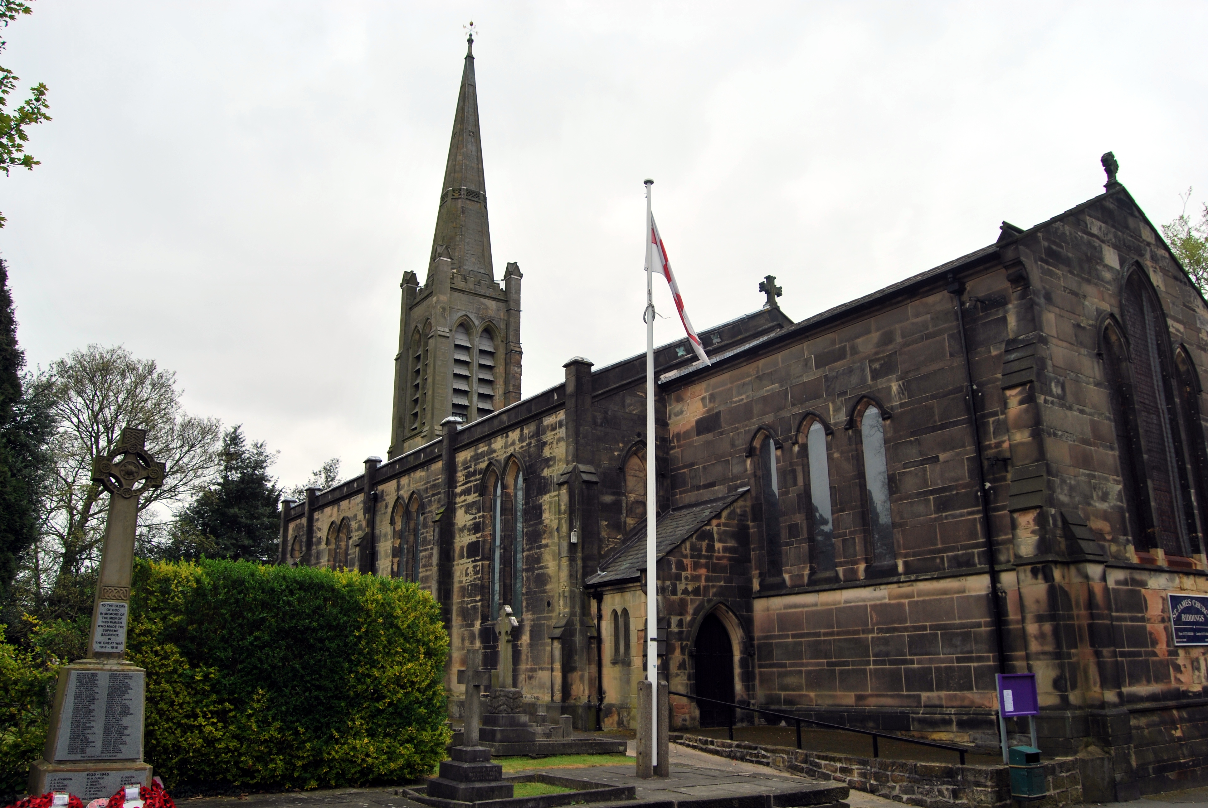
St James' Church, Riddings

St James’ Church, Riddings is a Grade II listed parish church in the Church of England: 309  in Riddings, Derbyshire. == History == The church was built...

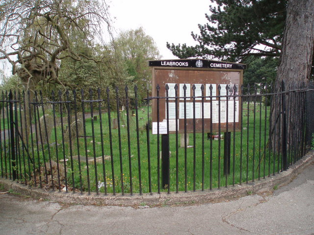
Leabrooks, Derbyshire

Leabrooks is a small urban locality in Derbyshire that merges with the village of Somercotes and the locality of Greenhill Lane. It is named after a stream...

Greenhill Lane

Greenhill Lane is a hamlet near the town of Alfreton, Derbyshire, England, located between the villages of Leabrooks and Riddings. The majority of UK census...

Riddings

Riddings is a large village in Derbyshire, England. The appropriate ward of the Amber Valley Council is called Ironville and Riddings. The population of...

Pye Bridge railway station

Pye Bridge railway station served the village of Pye Bridge, Derbyshire, England from 1849 to 1967 on the Erewash Valley Line. == History == The station...

Nearby Amenities

Located within 500m of 53.081499,-1.3595224
Barrier: motorcycle_barrier
Lat/Long: 53.0845635/-1.3563872
Bench
Lat/Long: 53.0847522/-1.3634235
Bench
Lat/Long: 53.0846234/-1.3627969
Bench
Lat/Long: 53.0841491/-1.3615695
Post Box
Brand: Royal Mail
Brand Wikidata: Q638098
Brand Wikipedia: en:Royal Mail
Operator: Royal Mail
Operator Wikidata: Q638098
Ref: DE55 758
Lat/Long: 53.0793311/-1.3613644
Post Box
Brand: Royal Mail
Brand Wikidata: Q638098
Brand Wikipedia: en:Royal Mail
Operator: Royal Mail
Operator Wikidata: Q638098
Ref: DE55 590
Lat/Long: 53.0814055/-1.3618174
Post Box
Brand: Royal Mail
Brand Wikidata: Q638098
Brand Wikipedia: en:Royal Mail
Operator: Royal Mail
Operator Wikidata: Q638098
Ref: DE55 375
Lat/Long: 53.0816154/-1.3561022
Pub
Olde English Gentleman
Addr City: Alfreton
Addr Housenumber: 365
Addr Postcode: DE55 4JX
Addr Street: Somercotes Hill
Addr Village: Somercotes
Car Park: yes
Ele: 133
Fhrs Id: 713
Note: For sale sign outside, but lights on , so still open I guess
Real Ale: Coppice Side Deception
Lat/Long: 53.0779015/-1.3639543
Bench
Ele: 112.0000000
Lat/Long: 53.085135/-1.3630033
Ele: 112.0000000
Lat/Long: 53.0851752/-1.3631025
Bench
Ele: 112.0000000
Lat/Long: 53.0850899/-1.3625581
Ele: 115.0000000
Lat/Long: 53.0853052/-1.3610677
Barrier: horse_stile
Ele: 114.0000000
Lat/Long: 53.0851438/-1.3613262
Ele: 112.0000000
Lat/Long: 53.0850706/-1.3616804
Barrier: cycle_barrier
Ele: 113.0000000
Lat/Long: 53.0851527/-1.361335
Ele: 119
Lat/Long: 53.0859244/-1.3605652
Ele: 115.0000000
Lat/Long: 53.0854656/-1.3606596
Ele: 108
Lat/Long: 53.0848672/-1.3559718
Ele: 107
Lat/Long: 53.0848764/-1.3559433
Bench
Lat/Long: 53.0778205/-1.3605362
Ele: 129.0000000
Lat/Long: 53.0794898/-1.3635832
Ele: 130.0000000
Lat/Long: 53.0796524/-1.3641438
Ele: 132
Lat/Long: 53.0803281/-1.3651837
Ele: 133.0000000
Lat/Long: 53.0791657/-1.3649002
Ele: 128.0000000
Lat/Long: 53.0798838/-1.3630285
Ele: 118.0000000
Lat/Long: 53.0787971/-1.3603653
Ele: 120
Lat/Long: 53.0793641/-1.360657
Ele: 114
Lat/Long: 53.0777967/-1.3603831
Ele: 115.0000000
Lat/Long: 53.0780038/-1.3602831
Ele: 117
Lat/Long: 53.0783706/-1.360201
Barrier: cycle_barrier
Ele: 134.0000000
Lat/Long: 53.079104/-1.3650209
Bench
Ele: 115.0000000
Lat/Long: 53.0846408/-1.3609387
Ele: 112.0000000
Lat/Long: 53.0849442/-1.3612809
Ele: 114.0000000
Lat/Long: 53.0849925/-1.3612318
Ele: 115.0000000
Lat/Long: 53.0849976/-1.361202
Barrier: cycle_barrier
Ele: 133.0000000
Lat/Long: 53.0810931/-1.3634643
Ele: 130.0000000
Lat/Long: 53.0806206/-1.3628135
Barrier: cycle_barrier
Ele: 129.0000000
Lat/Long: 53.0806121/-1.3624682
Barrier: cycle_barrier
Lat/Long: 53.0787138/-1.3641618
Barrier: cycle_barrier
Lat/Long: 53.0786371/-1.363954
Turning Circle
Lat/Long: 53.0818333/-1.3651215
Bus Stop
Bus: yes
Public Transport: platform
Lat/Long: 53.0813003/-1.3591515
Crossfire Cars
Shop: car
Lat/Long: 53.0814807/-1.3562184
Bus Stop
Bus: yes
Public Transport: platform
Lat/Long: 53.0813775/-1.3627764
Bailey's Stores
Addr City: Alfreton
Addr Housenumber: 35
Addr Postcode: DE55 4ND
Addr Street: Birchwood Lane
Fhrs Id: 667
Shop: convenience
Lat/Long: 53.0808624/-1.3657113
Direction: 145
Generator Method: photovoltaic
Generator Output Electricity: yes
Generator Solar Modules: 8
Generator Source: solar
Generator Type: solar_photovoltaic_panel
Location: roof
Power: generator
Lat/Long: 53.0808987/-1.3655766
Direction: SE
Generator Method: photovoltaic
Generator Output Electricity: yes
Generator Solar Modules: 17
Generator Source: solar
Generator Type: solar_photovoltaic_panel
Location: roof
Power: generator
Lat/Long: 53.0801221/-1.3651582
Direction: SW
Generator Method: photovoltaic
Generator Output Electricity: yes
Generator Solar Modules: 18
Generator Source: solar
Generator Type: solar_photovoltaic_panel
Location: roof
Power: generator
Lat/Long: 53.0796855/-1.365464
Direction: E
Generator Method: photovoltaic
Generator Output Electricity: yes
Generator Solar Modules: 8
Generator Source: solar
Generator Type: solar_photovoltaic_panel
Location: roof
Power: generator
Lat/Long: 53.0810779/-1.3615895
Direction: W
Generator Method: photovoltaic
Generator Output Electricity: yes
Generator Solar Modules: 8
Generator Source: solar
Generator Type: solar_photovoltaic_panel
Location: roof
Power: generator
Lat/Long: 53.0810811/-1.3616298
Direction: 165
Generator Method: photovoltaic
Generator Output Electricity: yes
Generator Solar Modules: 14
Generator Source: solar
Generator Type: solar_photovoltaic_panel
Location: roof
Power: generator
Lat/Long: 53.0781132/-1.362071
Direction: 165
Generator Method: photovoltaic
Generator Output Electricity: yes
Generator Solar Modules: 15
Generator Source: solar
Generator Type: solar_photovoltaic_panel
Location: roof
Power: generator
Lat/Long: 53.0776624/-1.3609297
Direction: NE
Generator Method: photovoltaic
Generator Output Electricity: yes
Generator Solar Modules: 6
Generator Source: solar
Generator Type: solar_photovoltaic_panel
Location: roof
Power: generator
Lat/Long: 53.0796308/-1.3660034
Direction: SW
Generator Method: photovoltaic
Generator Output Electricity: yes
Generator Solar Modules: 10
Generator Source: solar
Generator Type: solar_photovoltaic_panel
Location: roof
Power: generator
Lat/Long: 53.0795992/-1.3660446
Direction: SE
Generator Method: photovoltaic
Generator Output Electricity: yes
Generator Solar Modules: 18
Generator Source: solar
Generator Type: solar_photovoltaic_panel
Location: roof
Power: generator
Lat/Long: 53.0802905/-1.3648611
Direction: 55
Generator Method: photovoltaic
Generator Output Electricity: yes
Generator Solar Modules: 8
Generator Source: solar
Generator Type: solar_photovoltaic_panel
Location: roof
Power: generator
Lat/Long: 53.0808749/-1.3645144
Direction: 235
Generator Method: photovoltaic
Generator Output Electricity: yes
Generator Solar Modules: 8
Generator Source: solar
Generator Type: solar_photovoltaic_panel
Location: roof
Power: generator
Lat/Long: 53.0808558/-1.3645654
The data included in this document is from www.openstreetmap.org. The data is made available under ODbL.

Have you been to Birchwood, Upper?

Leave your review of Birchwood, Upper below (or comments, questions and feedback).