Battlefield, Upper
Settlement in Shropshire
England
Battlefield, Upper

Battlefield is a small village located in the county of Shropshire, England. Situated approximately 2 miles north of the town of Shrewsbury, it is known for its historical significance and tranquil surroundings. The village derives its name from the Battle of Shrewsbury, which took place nearby in 1403 during the reign of King Henry IV.
The area surrounding Battlefield is predominantly rural, characterized by rolling hills, farmland, and picturesque countryside. It offers a peaceful and idyllic setting, making it popular among nature lovers and those seeking a retreat from the hustle and bustle of city life.
The village itself is small, with a population of around 300 people. It features a handful of residential properties, some dating back to the 17th century, giving it a charming and traditional feel. Additionally, there are a few local amenities such as a village hall and a pub, providing residents with essential services and a sense of community.
Tourism plays a significant role in the village's economy, with visitors attracted to its historical significance and natural beauty. The nearby Battlefield Heritage Centre provides insights into the Battle of Shrewsbury, displaying artifacts and offering guided tours. The surrounding countryside also offers opportunities for outdoor activities such as hiking, cycling, and exploring the local flora and fauna.
In summary, Battlefield, Upper, Shropshire is a quaint village with a rich historical background and stunning natural surroundings. It offers a peaceful retreat for residents and visitors alike, appealing to those interested in history and those seeking a tranquil countryside experience.
If you have any feedback on the listing, please let us know in the comments section below.
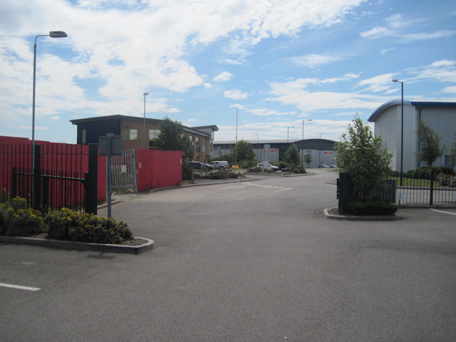
Battlefield, Upper Images
Images are sourced within 2km of 52.75724/-2.716409 or Grid Reference SJ5117. Thanks to Geograph Open Source API. All images are credited.


Battlefield, Upper is located at Grid Ref: SJ5117 (Lat: 52.75724, Lng: -2.716409)
Unitary Authority: Shropshire
Police Authority: West Mercia
What 3 Words
///trick.skater.jammy. Near Astley, Shropshire
Nearby Locations
Related Wikis

Upper Battlefield, Shropshire
Upper Battlefield is a small village in Shropshire, England. It lies on the A49 just north of Battlefield. The Welsh Marches railway line runs through...
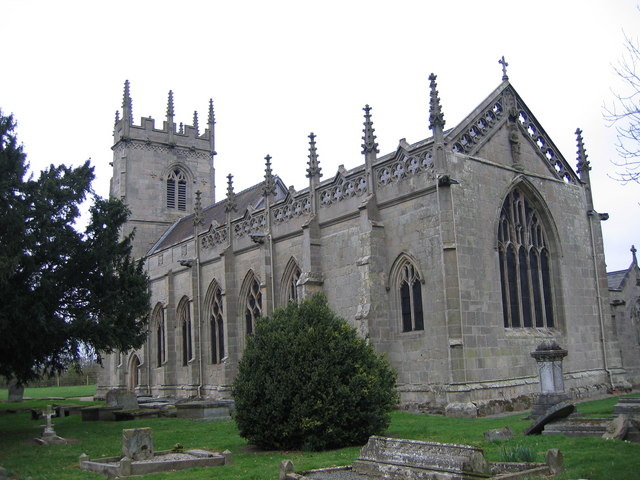
St Mary Magdalene's Church, Battlefield
St Mary Magdalene's Church is in the village of Battlefield, Shropshire, England, dedicated to Jesus' companion Mary Magdalene. It was built on the site...
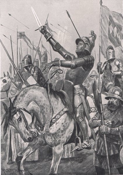
Battle of Shrewsbury
The Battle of Shrewsbury was a battle fought on 21 July 1403, waged between an army led by the Lancastrian King Henry IV and a rebel army led by Henry...

Battlefield, Shropshire
Battlefield is a village and suburb of the town of Shrewsbury in Shropshire, England. It is 3 miles (5 km) north of the town centre. The village is today...

Astley, Shropshire
Astley is a small village and civil parish in Shropshire, England. The official 2001 census recorded 454 people living in the parish and 116 in the village...

Battlefield Heritage Park
Battlefield Heritage Park is a country park situated north of Shrewsbury in Shropshire, in the area known as Battlefield. It marks the supposed site of...

A5124 road
The A5124 is a road in Shropshire, England, that forms part of the northern section of the Shrewsbury by-pass. It is known locally as the Battlefield Link...

Hadnall railway station
Hadnall railway station was a station in Hadnall, Shropshire, England. The station was opened in 1858 and closed in 1960. == References == == Further... ==
Nearby Amenities
Located within 500m of 52.75724,-2.716409Have you been to Battlefield, Upper?
Leave your review of Battlefield, Upper below (or comments, questions and feedback).