Ugley

Settlement in Essex Uttlesford

England

Ugley

Houses on Rickling Green The tree stump has been cut since a nice tree was there in 2009
Houses on Rickling Green Credit: David Howard

Ugley is a small village located in the district of Uttlesford, in the county of Essex, England. Situated approximately 46 miles northeast of London, Ugley is nestled amidst picturesque countryside and offers a serene and idyllic setting.

The history of Ugley dates back to the Anglo-Saxon era, and its name is believed to derive from the Old English word "ug," meaning "dreadful" or "dreadful clearing." Despite its somewhat unflattering name, Ugley is a charming village with a close-knit community.

The village is renowned for its traditional thatched cottages and historic buildings, which add to its timeless appeal. The tranquil atmosphere and stunning scenery make Ugley a popular destination for those seeking a peaceful retreat away from the hustle and bustle of city life.

Ugley is home to St. Peter's Church, a beautiful Grade II listed building that dates back to the 12th century. The church showcases stunning architectural features, including a Norman doorway and a medieval font. It serves as a focal point for the community and hosts regular services and community events.

The village is surrounded by verdant countryside, providing ample opportunities for outdoor activities such as hiking, cycling, and birdwatching. The nearby Flitch Way, a former railway line turned nature trail, offers a scenic route for leisurely walks.

Overall, Ugley is a hidden gem in Essex, offering a peaceful and picturesque escape for residents and visitors alike. Its rich history, charming architecture, and natural beauty make it a delightful place to explore and enjoy the tranquility of rural England.

If you have any feedback on the listing, please let us know in the comments section below.
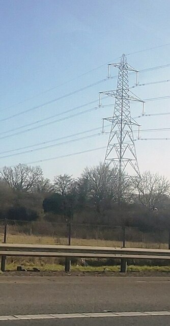
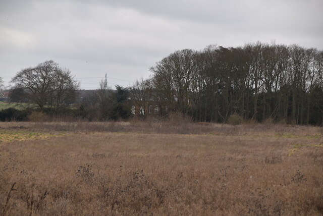
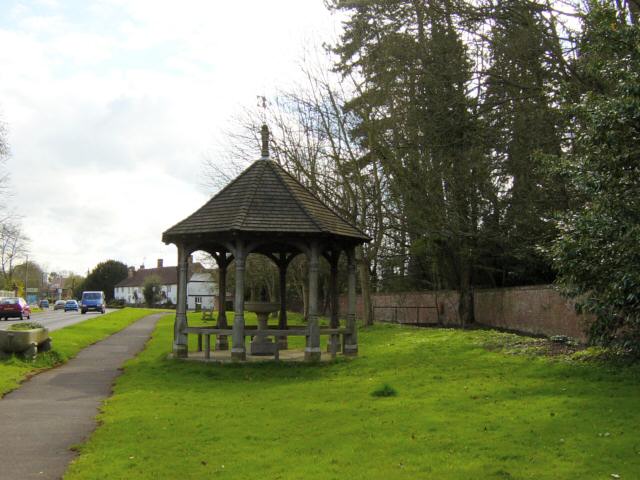
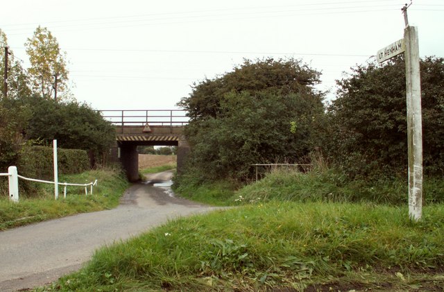
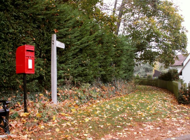
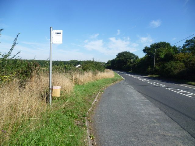
Ugley Images

Images are sourced within 2km of 51.93704/0.204463 or Grid Reference TL5128. Thanks to Geograph Open Source API. All images are credited.

Houses on Rickling Green The tree stump has been cut since a nice tree was there in 2009
Houses on Rickling Green
The tree stump has been cut since a nice tree was there in 2009
Brick Kiln Lane, Rickling Green
Electricity Pylon by the M11
Rough pasture
Rough pasture
Quendon parish church, Essex This church dates back to the 13th century but this view from the south, shows much of the restoration of 1881.
Quendon parish church, Essex
This church dates back to the 13th century but this view from the south, shows much of the restoration of 1881.
Fountain and Drinking Trough, Quendon The inscription on the inside of the roof reads: This fountain and drinking trough were donated to the people of Quendon in 1887 by Henry Tufnell Esq. in memory of Col. Cranmer-Byng of Quendon Hall. They were later restored in memory of G.B. Beeman who lived at Manor Farm 1922-54.
Fountain and Drinking Trough, Quendon
The inscription on the inside of the roof reads: This fountain and drinking trough were donated to the people of Quendon in 1887 by Henry Tufnell Esq. in memory of Col. Cranmer-Byng of Quendon Hall. They were later restored in memory of G.B. Beeman who lived at Manor Farm 1922-54.
Railway Bridge over the road to Little Henham, Essex This is the view from North Hall Road.
Railway Bridge over the road to Little Henham, Essex
This is the view from North Hall Road.
Public Bridleway at Quendon This is a view from the B.1383 road, which was once the busy A.11
Public Bridleway at Quendon
This is a view from the B.1383 road, which was once the busy A.11
M11 heading south
M11 heading south
St Simon and St Jude Parish Church, Quendon, Essex
Liverpool Street express The rural nature of the Cambridge to London Liverpool Street line as seen 30 years ago between Newport station and Elsenham. This was the days before electrification of the line from Bishop's Stortford to Kings Lynn and before Stansted airport was expanded. The trains were older but more comfortable to ride in back in those days.
Liverpool Street express
The rural nature of the Cambridge to London Liverpool Street line as seen 30 years ago between Newport station and Elsenham. This was the days before electrification of the line from Bishop's Stortford to Kings Lynn and before Stansted airport was expanded. The trains were older but more comfortable to ride in back in those days.
Sign on Cambridge Road The B1383 north of Stansted Mountfitchet is very busy. The sign points to the quiet backwater of Vicarage Lane, not far from Ugley.
Sign on Cambridge Road
The B1383 north of Stansted Mountfitchet is very busy. The sign points to the quiet backwater of Vicarage Lane, not far from Ugley.
Signpost to Vicarage Lane The B1383 north of Stansted Mountfitchet is very busy. The sign points to the quiet backwater of Vicarage Lane, not far from Ugley.
Signpost to Vicarage Lane
The B1383 north of Stansted Mountfitchet is very busy. The sign points to the quiet backwater of Vicarage Lane, not far from Ugley.
Bus stop on the B1383 This is the busy Cambridge Road between Stansted Mountfitchet and Newport. The bus stop for northbound buses is opposite Smiths Cottages.
Bus stop on the B1383
This is the busy Cambridge Road between Stansted Mountfitchet and Newport. The bus stop for northbound buses is opposite Smiths Cottages.
Fields next to the B1383 The B1383 north of Stansted Mountfitchet is very busy. This looks across the B1383 opposite Smiths Cottages.
Fields next to the B1383
The B1383 north of Stansted Mountfitchet is very busy. This looks across the B1383 opposite Smiths Cottages.
Rickling Green Rickling Green has a large green at its centre which is used as a cricket green in the summer. This view is from near The Cricketers public house.
Rickling Green
Rickling Green has a large green at its centre which is used as a cricket green in the summer. This view is from near The Cricketers public house.
The green at Rickling Green Rickling Green has a large green at its centre which is used as a cricket green in the summer. It is surrounded by houses.  This view is from near The Cricketers public house and looks past the houses on the west side of the green.
The green at Rickling Green
Rickling Green has a large green at its centre which is used as a cricket green in the summer. It is surrounded by houses. This view is from near The Cricketers public house and looks past the houses on the west side of the green.
The cricket pavilion at Rickling Green Rickling Green has a large green at its centre which is used as a cricket ground in the summer. The Cricketers public house is on the east side of the green while the cricket pavilion is on the west side.
The cricket pavilion at Rickling Green
Rickling Green has a large green at its centre which is used as a cricket ground in the summer. The Cricketers public house is on the east side of the green while the cricket pavilion is on the west side.
Show me another place!

Ugley is located at Grid Ref: TL5128 (Lat: 51.93704, Lng: 0.204463)

Administrative County: Essex

District: Uttlesford

Police Authority: Essex

What 3 Words

///banks.engrossed.ticket. Near Elsenham, Essex

Nearby Locations

Ugley

Related Wikis

Ugley

Ugley is a small village and civil parish in the non-metropolitan district of Uttlesford in Essex, England. It is about 2 miles (3 km) north from Stansted...

Quendon Wood

Quendon Wood is a 32.1-hectare (79-acre) biological Site of Special Scientific Interest in Quendon in Essex.The site is ancient coppiced woodland with...

Hall's Quarry

Hall's Quarry is a 0.8-hectare (2.0-acre) geological Site of Special Scientific Interest north-west of Ugley Green in Essex. It is a Geological Conservation...

Quendon and Rickling

Quendon and Rickling is a civil parish in the Uttlesford district of Essex, England with an area of 2,048 acres. The population of the civil parish at...

Nearby Amenities

Located within 500m of 51.93704,0.204463
Bus Stop
The Chequers
Bus: yes
Naptan AtcoCode: 1500IM1066
Naptan Bearing: S
Naptan CommonName: The Chequers
Naptan Indicator: o/s
Naptan Landmark: The Chequers
Naptan NaptanCode: esxdgamw
Naptan Street: London Road
Naptan Verified: no
Public Transport: platform
Source: naptan_import
Lat/Long: 51.9372865/0.1984801
Bus Stop
The Chequers
Bus: yes
Naptan AtcoCode: 1500IM1066AA
Naptan Bearing: N
Naptan BusStopType: CUS
Naptan CommonName: The Chequers
Naptan Indicator: Opp
Naptan Landmark: The Chequers
Naptan NaptanCode: esxgptmj
Naptan Street: London Road
Naptan Verified: no
Public Transport: platform
Source: naptan_import
Lat/Long: 51.9373007/0.1983046
Bench
Lat/Long: 51.9364355/0.2086277
Patmore End
Place: hamlet
Lat/Long: 51.9380203/0.2012915
Power: tower
Lat/Long: 51.9384971/0.2003091
Power: tower
Lat/Long: 51.9397604/0.2096378
Power: tower
Lat/Long: 51.9387617/0.2045202
Barrier: stile
Lat/Long: 51.9378696/0.1983657
Barrier: stile
Lat/Long: 51.9414079/0.2037609
Post Box
Brand: Royal Mail
Brand Wikidata: Q638098
Operator: Royal Mail
Operator Wikidata: Q638098
Post Box Type: wall
Ref: CM22 42D
Royal Cypher: EVIIR
Royal Cypher Wikidata: Q33102324
Source: survey
Lat/Long: 51.937801/0.1985702
Bench
Lat/Long: 51.9380601/0.1985823
The data included in this document is from www.openstreetmap.org. The data is made available under ODbL.

Have you been to Ugley?

Leave your review of Ugley below (or comments, questions and feedback).