Tyler Hill

Settlement in Kent Canterbury

England

Tyler Hill

Barton Down, NE of Canterbury: aerial 2022
Barton Down, NE of Canterbury: aerial 2022 Credit: Simon Tomson

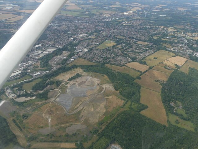
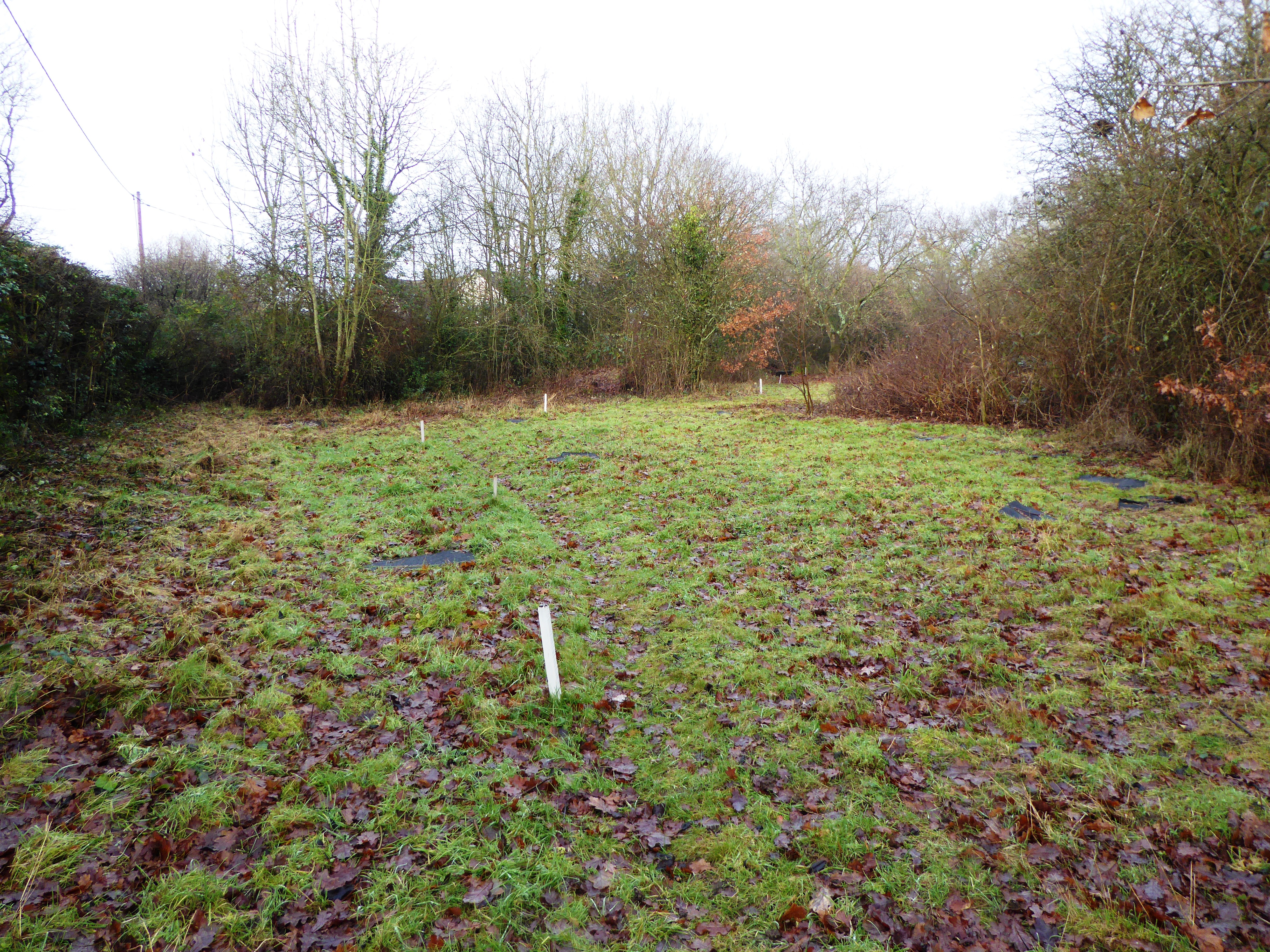
Tyler Hill is a small village located in the district of Canterbury in Kent, England. Situated about 5 miles north of the historic city of Canterbury, it is nestled in the picturesque countryside of the Kent Downs Area of Outstanding Natural Beauty. The village is surrounded by lush green fields, rolling hills, and scenic woodland, offering residents and visitors a tranquil and idyllic setting.

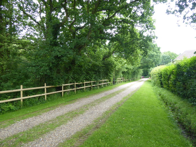
Tyler Hill is known for its charming rural character and its close-knit community. The village primarily consists of traditional Kentish houses, many of which date back several centuries, adding to its historic charm. While it has retained its rural atmosphere, it benefits from its proximity to Canterbury, providing easy access to a range of amenities and services.

The village is home to a village hall and a small church, which serves as a focal point for community gatherings and events. The nearby countryside offers an abundance of walking and cycling routes, allowing residents to explore the natural beauty of the area.

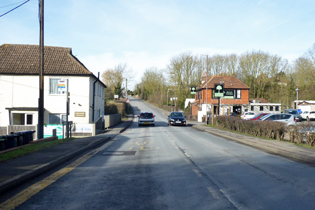
Tyler Hill is well-connected to surrounding areas by road, with the A2 and A28 nearby, providing easy access to Canterbury and other major towns in Kent. Public transportation options include bus services that connect the village to Canterbury and other nearby villages.

Overall, Tyler Hill offers a peaceful and scenic environment for residents seeking a rural lifestyle while still benefiting from the amenities of nearby Canterbury.

If you have any feedback on the listing, please let us know in the comments section below.
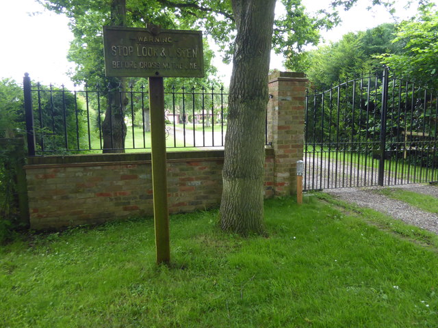
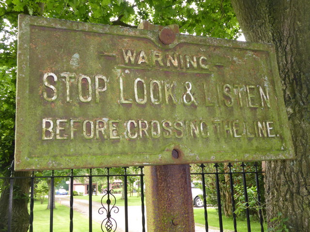
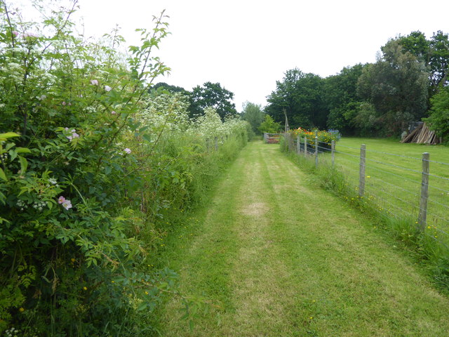
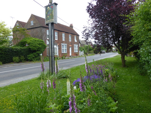
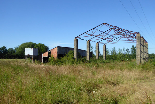
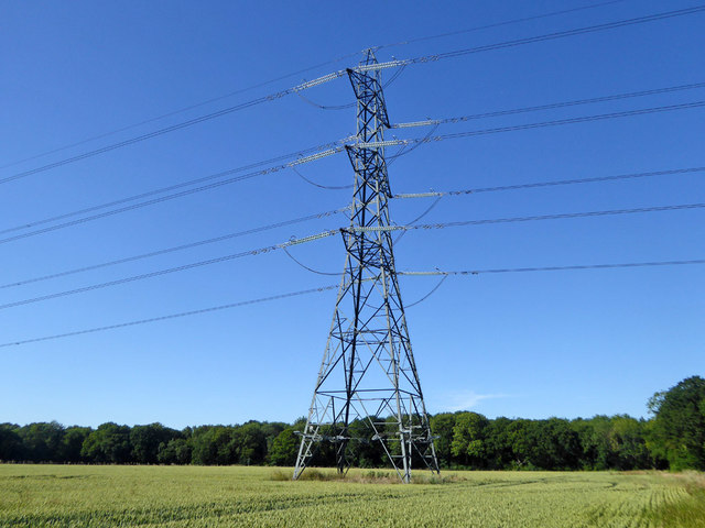
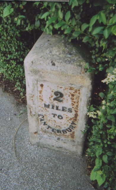
Tyler Hill Images

Images are sourced within 2km of 51.3041/1.073059 or Grid Reference TR1460. Thanks to Geograph Open Source API. All images are credited.

Barton Down, NE of Canterbury: aerial 2022
University of Kent at Canterbury A road on the northern side of the campus site.
University of Kent at Canterbury
A road on the northern side of the campus site.
A290 past the Blean Tavern Heading towards Whitstable.
A290 past the Blean Tavern
Heading towards Whitstable.
Route of the former Canterbury & Whitstable Railway The Canterbury & Whitstable Railway is often said to have been the first passenger railway in the world.  Construction of the 6 mile line took several years and work excavating the 828 yard Tyler Hill Tunnel proved difficult and lengthy. There were great celebrations for the opening on 3rd May 1830. In Canterbury, the cathedral bells were rung and guns were fired in salute.  

Sections of the line were so steeply graded that stationary engines were required to haul trains by cable up the steep ascents.  After the First World War, bus competition began to cause problems and the line to Whitstable finally closed to passengers on 1st January 1931. Goods traffic continued for a number of years but final closure came on 1st December 1952 after which time the track was removed.  A path now follows part of the old route and is known as the Crab & Winkle Way. Here though it is a private driveway to a house known appropriately as 'The Halt'. The Halt is now a private residence converted from an engineer's cottage.

This section of the old trackbed is particularly interesting as Blean & Tyler Hill Halt was located ahead between here and Tyler Hill Road. It was opened in 1908 and closed a mere 22 years later with the last passenger train. See <a title="https://www.geograph.org.uk/photo/1832585" href="https://www.geograph.org.uk/photo/1832585">Link</a>

See <span class="nowrap"><a title="http://www.bbc.co.uk/kent/content/articles/2008/05/27/history_lost_railway_feature.shtml" rel="nofollow ugc noopener" href="http://www.bbc.co.uk/kent/content/articles/2008/05/27/history_lost_railway_feature.shtml">Link</a><img style="margin-left:2px;" alt="External link" title="External link - shift click to open in new window" src="https://s1.geograph.org.uk/img/external.png" width="10" height="10"/></span>  and <span class="nowrap"><a title="https://en.wikipedia.org/wiki/Canterbury_and_Whitstable_Railway" rel="nofollow ugc noopener" href="https://en.wikipedia.org/wiki/Canterbury_and_Whitstable_Railway">Link</a><img style="margin-left:2px;" alt="External link" title="External link - shift click to open in new window" src="https://s1.geograph.org.uk/img/external.png" width="10" height="10"/></span>   and <span class="nowrap"><a title="http://crabandwinkle.org/?page_id=19" rel="nofollow ugc noopener" href="http://crabandwinkle.org/?page_id=19">Link</a><img style="margin-left:2px;" alt="External link" title="External link - shift click to open in new window" src="https://s1.geograph.org.uk/img/external.png" width="10" height="10"/></span>
Route of the former Canterbury & Whitstable Railway
The Canterbury & Whitstable Railway is often said to have been the first passenger railway in the world. Construction of the 6 mile line took several years and work excavating the 828 yard Tyler Hill Tunnel proved difficult and lengthy. There were great celebrations for the opening on 3rd May 1830. In Canterbury, the cathedral bells were rung and guns were fired in salute. Sections of the line were so steeply graded that stationary engines were required to haul trains by cable up the steep ascents. After the First World War, bus competition began to cause problems and the line to Whitstable finally closed to passengers on 1st January 1931. Goods traffic continued for a number of years but final closure came on 1st December 1952 after which time the track was removed. A path now follows part of the old route and is known as the Crab & Winkle Way. Here though it is a private driveway to a house known appropriately as 'The Halt'. The Halt is now a private residence converted from an engineer's cottage. This section of the old trackbed is particularly interesting as Blean & Tyler Hill Halt was located ahead between here and Tyler Hill Road. It was opened in 1908 and closed a mere 22 years later with the last passenger train. See Link See LinkExternal link and LinkExternal link and LinkExternal link
Old sign for the Canterbury & Whitstable Railway The Canterbury & Whitstable Railway is often said to have been the first passenger railway in the world.  Construction of the 6 mile line took several years and work excavating the 828 yard Tyler Hill Tunnel proved difficult and lengthy. There were great celebrations for the opening on 3rd May 1830. In Canterbury, the cathedral bells were rung and guns were fired in salute.  

Sections of the line were so steeply graded that stationary engines were required to haul trains by cable up the steep ascents.  After the First World War, bus competition began to cause problems and the line to Whitstable finally closed to passengers on 1st January 1931. Goods traffic continued for a number of years but final closure came on 1st December 1952 after which time the track was removed.  A path now follows part of the old route and is known as the Crab & Winkle Way. Here though it is alongside a private driveway to a house known appropriately as 'The Halt'. The old sign has survived - see <a title="https://www.geograph.org.uk/photo/5809263" href="https://www.geograph.org.uk/photo/5809263">Link</a>  for a close up. The Halt is now a private residence converted from an engineer's cottage. This section of the old trackbed is particularly interesting as Blean & Tyler Hill Halt was located between here and Tyler Hill Road just behind where I am standing. It was opened in 1908 and closed a mere 22 years later with the last passenger train. See <a title="https://www.geograph.org.uk/photo/1832585" href="https://www.geograph.org.uk/photo/1832585">Link</a>


See <span class="nowrap"><a title="http://www.bbc.co.uk/kent/content/articles/2008/05/27/history_lost_railway_feature.shtml" rel="nofollow ugc noopener" href="http://www.bbc.co.uk/kent/content/articles/2008/05/27/history_lost_railway_feature.shtml">Link</a><img style="margin-left:2px;" alt="External link" title="External link - shift click to open in new window" src="https://s1.geograph.org.uk/img/external.png" width="10" height="10"/></span>  and <span class="nowrap"><a title="https://en.wikipedia.org/wiki/Canterbury_and_Whitstable_Railway" rel="nofollow ugc noopener" href="https://en.wikipedia.org/wiki/Canterbury_and_Whitstable_Railway">Link</a><img style="margin-left:2px;" alt="External link" title="External link - shift click to open in new window" src="https://s1.geograph.org.uk/img/external.png" width="10" height="10"/></span>   and <span class="nowrap"><a title="http://crabandwinkle.org/?page_id=19" rel="nofollow ugc noopener" href="http://crabandwinkle.org/?page_id=19">Link</a><img style="margin-left:2px;" alt="External link" title="External link - shift click to open in new window" src="https://s1.geograph.org.uk/img/external.png" width="10" height="10"/></span>
Old sign for the Canterbury & Whitstable Railway
The Canterbury & Whitstable Railway is often said to have been the first passenger railway in the world. Construction of the 6 mile line took several years and work excavating the 828 yard Tyler Hill Tunnel proved difficult and lengthy. There were great celebrations for the opening on 3rd May 1830. In Canterbury, the cathedral bells were rung and guns were fired in salute. Sections of the line were so steeply graded that stationary engines were required to haul trains by cable up the steep ascents. After the First World War, bus competition began to cause problems and the line to Whitstable finally closed to passengers on 1st January 1931. Goods traffic continued for a number of years but final closure came on 1st December 1952 after which time the track was removed. A path now follows part of the old route and is known as the Crab & Winkle Way. Here though it is alongside a private driveway to a house known appropriately as 'The Halt'. The old sign has survived - see Link for a close up. The Halt is now a private residence converted from an engineer's cottage. This section of the old trackbed is particularly interesting as Blean & Tyler Hill Halt was located between here and Tyler Hill Road just behind where I am standing. It was opened in 1908 and closed a mere 22 years later with the last passenger train. See Link See LinkExternal link and LinkExternal link and LinkExternal link
Old railway sign The Canterbury & Whitstable Railway is often said to have been the first passenger railway in the world.  Construction of the 6 mile line took several years and work excavating the 828 yard Tyler Hill Tunnel proved difficult and lengthy. There were great celebrations for the opening on 3rd May 1830. In Canterbury, the cathedral bells were rung and guns were fired in salute.  

Sections of the line were so steeply graded that stationary engines were required to haul trains by cable up the steep ascents.  After the First World War, bus competition began to cause problems and the line to Whitstable finally closed to passengers on 1st January 1931. Goods traffic continued for a number of years but final closure came on 1st December 1952 after which time the track was removed.  

A path now follows part of the old route and is known as the Crab & Winkle Way. Here though it a private driveway to a house known appropriately as 'The Halt'. The Halt is now a private residence converted from an engineer's cottage. This section of the old trackbed is particularly interesting as Blean & Tyler Hill Halt was located between here and Tyler Hill Road just behind where I am standing. It was opened in 1908 and closed a mere 22 years later with the last passenger train. See <a title="https://www.geograph.org.uk/photo/1832585" href="https://www.geograph.org.uk/photo/1832585">Link</a>  The other reminder that this was once a railway is this old sign - see <a title="https://www.geograph.org.uk/photo/5809261" href="https://www.geograph.org.uk/photo/5809261">Link</a>  for its location.

See <span class="nowrap"><a title="http://www.bbc.co.uk/kent/content/articles/2008/05/27/history_lost_railway_feature.shtml" rel="nofollow ugc noopener" href="http://www.bbc.co.uk/kent/content/articles/2008/05/27/history_lost_railway_feature.shtml">Link</a><img style="margin-left:2px;" alt="External link" title="External link - shift click to open in new window" src="https://s1.geograph.org.uk/img/external.png" width="10" height="10"/></span>  and <span class="nowrap"><a title="https://en.wikipedia.org/wiki/Canterbury_and_Whitstable_Railway" rel="nofollow ugc noopener" href="https://en.wikipedia.org/wiki/Canterbury_and_Whitstable_Railway">Link</a><img style="margin-left:2px;" alt="External link" title="External link - shift click to open in new window" src="https://s1.geograph.org.uk/img/external.png" width="10" height="10"/></span>   and <span class="nowrap"><a title="http://crabandwinkle.org/?page_id=19" rel="nofollow ugc noopener" href="http://crabandwinkle.org/?page_id=19">Link</a><img style="margin-left:2px;" alt="External link" title="External link - shift click to open in new window" src="https://s1.geograph.org.uk/img/external.png" width="10" height="10"/></span>
Old railway sign
The Canterbury & Whitstable Railway is often said to have been the first passenger railway in the world. Construction of the 6 mile line took several years and work excavating the 828 yard Tyler Hill Tunnel proved difficult and lengthy. There were great celebrations for the opening on 3rd May 1830. In Canterbury, the cathedral bells were rung and guns were fired in salute. Sections of the line were so steeply graded that stationary engines were required to haul trains by cable up the steep ascents. After the First World War, bus competition began to cause problems and the line to Whitstable finally closed to passengers on 1st January 1931. Goods traffic continued for a number of years but final closure came on 1st December 1952 after which time the track was removed. A path now follows part of the old route and is known as the Crab & Winkle Way. Here though it a private driveway to a house known appropriately as 'The Halt'. The Halt is now a private residence converted from an engineer's cottage. This section of the old trackbed is particularly interesting as Blean & Tyler Hill Halt was located between here and Tyler Hill Road just behind where I am standing. It was opened in 1908 and closed a mere 22 years later with the last passenger train. See Link The other reminder that this was once a railway is this old sign - see Link for its location. See LinkExternal link and LinkExternal link and LinkExternal link
Footpath from Tyler Hill Road This footpath crosses the old route of the Canterbury & Whitstable Railway just ahead - see <a title="https://www.geograph.org.uk/photo/5809261" href="https://www.geograph.org.uk/photo/5809261">Link</a>  Beyond that it meets Fleets Lane.
Footpath from Tyler Hill Road
This footpath crosses the old route of the Canterbury & Whitstable Railway just ahead - see Link Beyond that it meets Fleets Lane.
Tyler Hill Tyler Hill is just to the north of the University of Kent campus. This is at the centre of the village with the village sign on Hackington Road.
Tyler Hill
Tyler Hill is just to the north of the University of Kent campus. This is at the centre of the village with the village sign on Hackington Road.
Hackington Road at Tyler Hill Tyler Hill is just to the north of the University of Kent campus. This is at the centre of the village with the village sign on Hackington Road.
Hackington Road at Tyler Hill
Tyler Hill is just to the north of the University of Kent campus. This is at the centre of the village with the village sign on Hackington Road.
Tyler Hill Tyler Hill is just to the north of the University of Kent campus. This is at the centre of the village with the village sign on Hackington Road. The village sign includes, of course, oast houses.
Tyler Hill
Tyler Hill is just to the north of the University of Kent campus. This is at the centre of the village with the village sign on Hackington Road. The village sign includes, of course, oast houses.
Calais Hill, Tyler Hill This is immediately west of the village centre of Tyler Hill - see <a title="https://www.geograph.org.uk/photo/5810136" href="https://www.geograph.org.uk/photo/5810136">Link</a>
Calais Hill, Tyler Hill
This is immediately west of the village centre of Tyler Hill - see Link
Calais Hill, Tyler Hill This is immediately west of the village centre of Tyler Hill - see <a title="https://www.geograph.org.uk/photo/5810136" href="https://www.geograph.org.uk/photo/5810136">Link</a>
Calais Hill, Tyler Hill
This is immediately west of the village centre of Tyler Hill - see Link
Derelict barn, Well Court The public bridleway passing through here is hardly used and unclear on the ground, with a lack of visible official signage. One OS map has it passing to the right of these barns, another to the left.
Derelict barn, Well Court
The public bridleway passing through here is hardly used and unclear on the ground, with a lack of visible official signage. One OS map has it passing to the right of these barns, another to the left.
Power line tower ZV194
Calais Hill is closed Blean was accessible via a diversion route further up the road at Tyler Hill.
Calais Hill is closed
Blean was accessible via a diversion route further up the road at Tyler Hill.
Hackington Road, Tyler Hill Towards Whitstable.
Hackington Road, Tyler Hill
Towards Whitstable.
Weather vane, Well Court Farm
Old Milestone by the A290, Tile Kiln Hill, Blean Metal plate attached to stone post by the A290, in parish of ST COSMUS AND ST DAMIAN IN THE BLEAN (CANTERBURY District), Tile Kiln Hill, opposite No. 32, by No. 27, in domestic hedge at back of tarmac footpath, on West side of road. Whitstable iron plate, erected by the Whitstable turnpike trust in the 19th century. 

Inscription reads:- : 4½ / MILES / TO / WHITSTABLE : : 2 / MILES / TO / CANTERBURY : 
Carved benchmark and rivet on top.

Milestone Society National ID: KE_CYWS02.
Old Milestone by the A290, Tile Kiln Hill, Blean
Metal plate attached to stone post by the A290, in parish of ST COSMUS AND ST DAMIAN IN THE BLEAN (CANTERBURY District), Tile Kiln Hill, opposite No. 32, by No. 27, in domestic hedge at back of tarmac footpath, on West side of road. Whitstable iron plate, erected by the Whitstable turnpike trust in the 19th century. Inscription reads:- : 4½ / MILES / TO / WHITSTABLE : : 2 / MILES / TO / CANTERBURY : Carved benchmark and rivet on top. Milestone Society National ID: KE_CYWS02.
Show me another place!

Tyler Hill is located at Grid Ref: TR1460 (Lat: 51.3041, Lng: 1.073059)

Administrative County: Kent

District: Canterbury

Police Authority: Kent

What 3 Words

///unpacked.downturn.angel. Near Blean, Kent

Nearby Locations

Tyler Hill

Related Wikis

Tyler Hill, Kent

Tyler Hill is a small village on the northern outskirts of Canterbury, Kent in England. The population is included in the civil parish of Hackington. Its...

Hackington

Hackington is an area of Canterbury in Kent, England, also known (especially historically) as St Stephen's, incorporating the northern part of the city...

Tyler Hill Meadow

Tyler Hill Meadow is a 0.8-hectare (2.0-acre) Local Nature Reserve in Hackington, north of Canterbury in Kent. It is owned by Hackington Parish Council...

British Cartoon Archive

The British Cartoon Archive (BCA) is a department of the University of Kent, at Canterbury in Kent, England, and holds the national collection of political...

University of Kent

The University of Kent (formerly the University of Kent at Canterbury, abbreviated as UKC) is a semi-collegiate public research university based in Kent...

CSR 97.4FM

Canterbury Student Radio (CSR FM) is a membership based student and community radio station based in Canterbury, England. It is currently funded by Kent...

Kent Business School

Kent Business School (KBS) is the business school of the University of Kent. Although there are two business schools known as KBS, generally people seem...

Fifteenth Lambeth Conference

The fifteenth Lambeth Conference was an assembly of bishops of the Anglican Communion convened by the archbishop of Canterbury, Justin Welby, between 27...

Nearby Amenities

Located within 500m of 51.3041,1.073059
Check Date: 2021-08-29
Traffic Calming: cushion
Lat/Long: 51.3001097/1.0724255
Mini Roundabout
Direction: clockwise
Lat/Long: 51.2997467/1.0713278
Crossing
Crossing Island: yes
Lat/Long: 51.3072457/1.0698408
Post Box
Collection Plate: CP1D
Collection Times: Mo-Fr 09:00; Sa 07:00
Old Ref: CT2 227
Operator: Royal Mail
Operator Wikidata: Q638098
Post Box Mounting: brick_pillar
Post Box Type: wall
Postal Code: CT2
Ref: CT2 227D
Royal Cypher: GR
Source: survey
Survey Date: 2023-07-11
Lat/Long: 51.3067863/1.0695829
Barrier: bollard
Lat/Long: 51.2999432/1.0705029
Barrier: bollard
Lat/Long: 51.3000039/1.0706305
Bus Stop
Link Road
Naptan AtcoCode: 240096705
Naptan Bearing: NE
Naptan CommonName: Link Road
Naptan Indicator: NE-bound
Naptan NaptanCode: kntgmagd
Naptan Street: Link Road
Naptan Verified: no
Source: naptan_import
Lat/Long: 51.3066435/1.0688292
Bus Stop
Alcroft Grange
Bench: no
Bin: no
Check Date Shelter: 2021-08-29
Lit: yes
Naptan AtcoCode: 2400A040340A
Naptan Bearing: N
Naptan CommonName: Alcroft Grange
Naptan Indicator: N-bound
Naptan Landmark: University
Naptan NaptanCode: kntdpwdg
Naptan PlusbusZoneRef: CNTBE
Naptan Street: St Stephens Hill
Naptan Verified: no
Shelter: no
Source: naptan_import
Tactile Paving: no
Lat/Long: 51.2998868/1.0736871
Bus Stop
Alcroft Grange
Bench: no
Bin: no
Check Date Shelter: 2021-08-29
Lit: yes
Naptan AtcoCode: 2400A040350A
Naptan Bearing: S
Naptan CommonName: Alcroft Grange
Naptan Indicator: S-bound
Naptan Landmark: University
Naptan NaptanCode: kntdpwdj
Naptan PlusbusZoneRef: CNTBE
Naptan Street: St Stephens Hill
Naptan Verified: no
Shelter: no
Source: naptan_import
Tactile Paving: no
Lat/Long: 51.3001273/1.073691
Bus Stop
Ivy House Inn
Naptan AtcoCode: 2400A050310A
Naptan Bearing: N
Naptan CommonName: Ivy House Inn
Naptan Indicator: o/s
Naptan Landmark: Ivy House
Naptan NaptanCode: kntgatjg
Naptan Street: Hackington Road
Naptan Verified: no
Source: naptan_import
Lat/Long: 51.3072006/1.0697737
Bus Stop
Ivy House Inn
Naptan AtcoCode: 2400A050320A
Naptan Bearing: S
Naptan CommonName: Ivy House Inn
Naptan Indicator: opp
Naptan Landmark: Ivy House
Naptan NaptanCode: kntgatjm
Naptan Street: Hackington Road
Naptan Verified: no
Source: naptan_import
Lat/Long: 51.3070894/1.0698835
Pub
The Tyler's Kiln
Addr City: Canterbury
Addr Housenumber: 27
Addr Postcode: CT2 9NE
Addr Street: Hackington Road
Addr Village: Tyler Hill
Fhrs Id: 1103102
Old Name: Ivy House
Phone: +44 1227 471912
Source Addr: http://www2.canterbury.gov.uk/committee/CeConvert2PDF.asp?MID=4248&F=Agenda+Enclosure+7.pdf&A=1&R=0
Wheelchair: yes
Wheelchair Description: Main door has ramp and ground floor is mostly accessible but many heavy doors to get through.
Lat/Long: 51.3071994/1.0696914
Bicycle Parking
Covered: yes
Lat/Long: 51.2999413/1.070316
Tyler Hill
Place: village
Source: OS7
Wikidata: Q3546024
Lat/Long: 51.3078088/1.0693089
Power: pole
Lat/Long: 51.301379/1.0682452
Power: pole
Lat/Long: 51.3032788/1.0671908
Power: pole
Lat/Long: 51.3053791/1.0672629
Power: pole
Lat/Long: 51.3023263/1.0677113
Power: pole
Lat/Long: 51.3042614/1.066654
Power: pole
Lat/Long: 51.3049405/1.0663445
Mini Roundabout
Direction: clockwise
Lat/Long: 51.3003231/1.0734572
Barrier: stile
Foot: yes
Source: survey
Lat/Long: 51.302902/1.0721322
Check Date: 2021-08-29
Traffic Calming: cushion
Lat/Long: 51.3000437/1.0737153
Generator Method: photovoltaic
Generator Output Electricity: yes
Generator Source: solar
Generator Type: solar_photovoltaic_panel
Location: roof
Power: generator
Lat/Long: 51.3081539/1.0707378
Generator Method: photovoltaic
Generator Output Electricity: yes
Generator Source: solar
Generator Type: solar_photovoltaic_panel
Location: roof
Power: generator
Lat/Long: 51.3080986/1.0701826
Generator Method: photovoltaic
Generator Output Electricity: yes
Generator Source: solar
Generator Type: solar_photovoltaic_panel
Location: roof
Power: generator
Lat/Long: 51.3080064/1.0702148
Generator Method: photovoltaic
Generator Output Electricity: yes
Generator Source: solar
Generator Type: solar_photovoltaic_panel
Location: roof
Power: generator
Lat/Long: 51.3064788/1.0689193
The data included in this document is from www.openstreetmap.org. The data is made available under ODbL.

Have you been to Tyler Hill?

Leave your review of Tyler Hill below (or comments, questions and feedback).