Tydd St Mary

Settlement in Lincolnshire South Holland

England

Tydd St Mary

Long Road, Tydd Gote Yes, it's long, straight and over a mile long. There are two roads off it to the west, which both rejoin the A1101 before the main road crosses the South Holland Main Drain.
Long Road, Tydd Gote Credit: David Howard

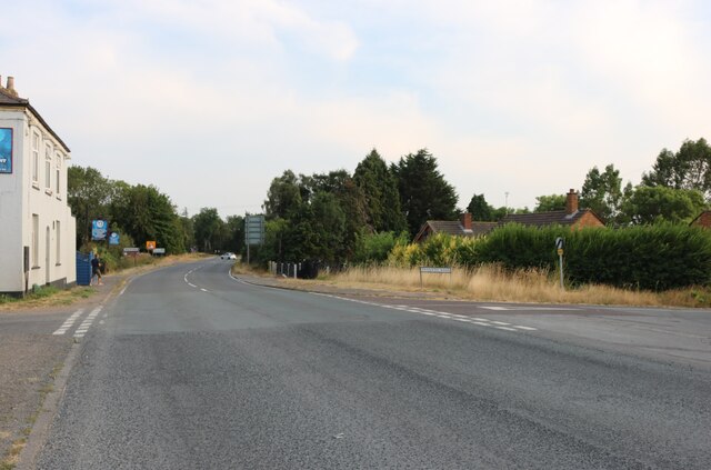
Tydd St Mary is a village located in the South Holland district of Lincolnshire, England. Situated near the River Nene, it lies roughly 8 miles to the east of Spalding and 16 miles to the west of Wisbech. The village is part of the civil parish of Tydd St Mary, which also includes the nearby hamlet of Tydd Gote.

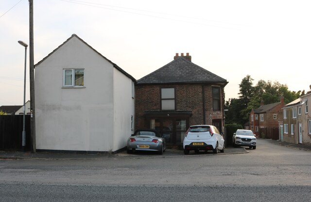
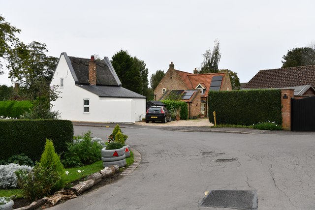
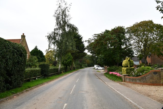
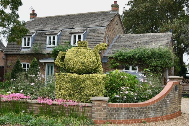
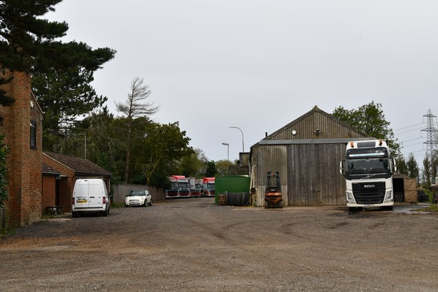
With a population of around 1,500 residents, Tydd St Mary is a quiet and close-knit community. The village is predominantly residential, consisting of a mix of historic and modern houses, as well as a few small businesses. The scenic countryside surroundings and the nearby river offer a peaceful and picturesque setting for residents and visitors alike.

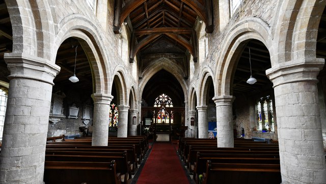
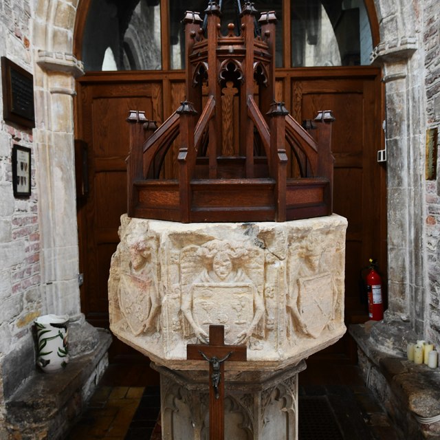
Tydd St Mary boasts several amenities, including a primary school, a village hall, and a local pub, providing a sense of community and social engagement. Additionally, the village is home to the St Mary's Church, a fine example of medieval architecture, dating back to the 12th century.

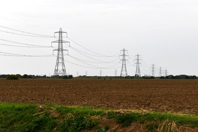
The area surrounding Tydd St Mary is mainly agricultural, with vast stretches of farmland and fields. Agriculture plays a significant role in the local economy, and the village benefits from its proximity to the rich agricultural lands of the Lincolnshire Fens.

Overall, Tydd St Mary is a charming and tranquil village, offering a peaceful lifestyle in the heart of the Lincolnshire countryside. Its historical landmarks, community spirit, and beautiful natural surroundings make it an appealing place to live or visit.

If you have any feedback on the listing, please let us know in the comments section below.

Tydd St Mary Images

Images are sourced within 2km of 52.747/0.12960241 or Grid Reference TF4318. Thanks to Geograph Open Source API. All images are credited.

Long Road, Tydd Gote Yes, it's long, straight and over a mile long. There are two roads off it to the west, which both rejoin the A1101 before the main road crosses the South Holland Main Drain.
Long Road, Tydd Gote
Yes, it's long, straight and over a mile long. There are two roads off it to the west, which both rejoin the A1101 before the main road crosses the South Holland Main Drain.
Fenlands Church, Tydd Gote
Odd house on Sutton Road, Tydd Gote Also in need of some tlc.
Odd house on Sutton Road, Tydd Gote
Also in need of some tlc.
Sutton Road, Tydd Gote
Sutton Road, Tydd Gote At the junction of Hannath Road
Sutton Road, Tydd Gote
At the junction of Hannath Road
Sutton Road, Tydd Gote
Semi-detached houses on Station Road, Tydd Gote The solar panels have arrived in the previous year.
Semi-detached houses on Station Road, Tydd Gote
The solar panels have arrived in the previous year.
Station Road, Tydd Gote
Tydd St Mary: Church Lane
Tydd St Mary: 'Bob's Bench'
Tydd St Mary: Common Way
Tydd St Mary, Common Way: 'Roman Cottage' with its teapot topiary
Tydd St Mary: Power line and a ploughed field in which a metal detectorist club are working
Tydd St Giles: Poplar Tree Farm
Tydd St Mary, St. Mary's Church: The nave
Tydd St Mary, St. Mary's Church: c15th octagonal bowl font with angels holding shields on each face 1
Show me another place!

Tydd St Mary is located at Grid Ref: TF4318 (Lat: 52.747, Lng: 0.12960241)

Division: Parts of Holland

Administrative County: Lincolnshire

District: South Holland

Police Authority: Lincolnshire

What 3 Words

///universe.fakes.eternally. Near Sutton Bridge, Lincolnshire

Nearby Locations

Tydd St Mary

Related Wikis

Tydd St Mary

Tydd St Mary is a village and civil parish in the South Holland district of Lincolnshire, England, about 9 miles (14 km) east of the town of Spalding and...

Tydd Gote

Tydd Gote is an English village, partly, at the north, in the civil parish of Tydd St Mary of the South Holland District of Lincolnshire, and partly, at...

Four Gotes

Four Gotes is a hamlet in the civil parish of Tydd St Giles in Cambridgeshire, England. The population is included in the civil parish of Leverington....

Tydd St Giles

Tydd St Giles is a village in Fenland, Cambridgeshire, England. It is the northernmost village in the Isle of Ely, Cambridgeshire (bordering Lincolnshire...

Tydd railway station

Tydd railway station was a station, opened by the Peterborough, Wisbech and Sutton Bridge Railway on 1 August 1866, in Lincolnshire serving the villages...

Low Fulney

Low Fulney is a hamlet in the South Holland district of Lincolnshire, England. It is in the Spalding St. Paul's ward of the South Holland District Council...

Little Sutton, Lincolnshire

Little Sutton is a small civil parish, containing a few farms and a few houses, lying between the much larger parishes of Long Sutton and Sutton Bridge...

Sutton St James

Sutton St James is a village and civil parish in the South Holland district of Lincolnshire, England, about four miles (6.4 km) south-west of Long Sutton...

Nearby Amenities

Located within 500m of 52.747,0.12960241
Bus Stop
Lowgate
Naptan AtcoCode: 270000009652
Naptan Bearing: W
Naptan CommonName: Lowgate
Naptan Indicator: W - bound
Naptan Landmark: Lowgate
Naptan NaptanCode: linjdmtd
Naptan Street: Hix's Lane
Naptan Verified: no
Public Transport: platform
Source: naptan_import
Lat/Long: 52.7436753/0.1267764
Bus Stop
Lowgate
Naptan AtcoCode: 2700LTSM1653
Naptan Bearing: E
Naptan CommonName: Lowgate
Naptan Indicator: opp
Naptan Landmark: Lowgate
Naptan NaptanCode: linamgjp
Naptan Street: Church Way
Naptan Verified: no
Source: naptan_import
Lat/Long: 52.7469755/0.1262556
Bus Stop
Rectory Road
Naptan AtcoCode: 2700LTSM1759
Naptan Bearing: W
Naptan CommonName: Rectory Road
Naptan Indicator: adj
Naptan Landmark: Rectory Road
Naptan NaptanCode: linampaj
Naptan Street: Common Way
Naptan Verified: no
Public Transport: platform
Source: naptan_import
Lat/Long: 52.7456194/0.1366441
Bus Stop
Lowgate
Naptan AtcoCode: 2700LTSM6215
Naptan Bearing: W
Naptan CommonName: Lowgate
Naptan Indicator: adj
Naptan Landmark: Lowgate
Naptan NaptanCode: lingatat
Naptan Street: Church Way
Naptan Verified: no
Source: naptan_import
Lat/Long: 52.7469148/0.1262402
Bus Stop
Rectory Road
Naptan AtcoCode: 2700LTSM6459
Naptan Bearing: E
Naptan CommonName: Rectory Road
Naptan Indicator: opp
Naptan Landmark: Rectory Road
Naptan NaptanCode: lingdjam
Naptan Street: Church Way
Naptan Verified: no
Public Transport: platform
Source: naptan_import
Lat/Long: 52.7457324/0.1366419
Bus Stop
Lowgate
Naptan AtcoCode: 2700LTSM6685
Naptan Bearing: E
Naptan CommonName: Lowgate
Naptan Indicator: E - bound
Naptan Landmark: Lowgate
Naptan NaptanCode: lingdtpw
Naptan Street: Hix's Lane
Naptan Verified: no
Public Transport: platform
Source: naptan_import
Lat/Long: 52.7438021/0.1267233
Tydd St Mary
Is In: Lincolnshire, England, UK
Place: village
Lat/Long: 52.7456824/0.131329
Tydd St Mary Village Stores
Addr City: Wisbech
Addr Country: GB
Addr Hamlet: Common Way
Addr Postcode: PE13 5QH
Addr Street: Common Way
Fhrs Authority: South Holland
Fhrs Id: 243654
Fhrs Local Authority Id: 4771
Shop: convenience
Lat/Long: 52.7458039/0.1363526
Post Box
Post Box Type: lamp
Royal Cypher: EIIR
Royal Cypher Wikidata: Q33102113
Lat/Long: 52.7457402/0.136416
Booth: K6
Removed Amenity: telephone
Lat/Long: 52.7456298/0.1364274
Leisure: playground
Lat/Long: 52.7454901/0.1341087
Post Box
Ref: PE13 19
Source: survey
Lat/Long: 52.7436427/0.127085
Bottom Field
Place: locality
Source: Bing
Lat/Long: 52.7451597/0.1332366
Brondel Farm
Place: farm
Source: Bing
Lat/Long: 52.7480093/0.1236461
Greendyke Farm
Place: farm
Source: Bing
Lat/Long: 52.7507529/0.1299949
Middle Field
Place: locality
Source: Bing
Lat/Long: 52.7500107/0.1331149
Rectory Farm
Place: farm
Source: Bing
Lat/Long: 52.7438607/0.1328751
Minerva Farm
Place: farm
Source: Bing
Lat/Long: 52.7450352/0.1266764
Power: pole
Lat/Long: 52.747187/0.1245737
Power: pole
Lat/Long: 52.7488072/0.1243235
Power: pole
Lat/Long: 52.7495608/0.1241785
Generator Method: photovoltaic
Generator Output Electricity: yes
Generator Source: solar
Generator Type: solar_photovoltaic_panel
Location: roof
Power: generator
Lat/Long: 52.7433223/0.1302562
Generator Method: photovoltaic
Generator Output Electricity: yes
Generator Source: solar
Generator Type: solar_photovoltaic_panel
Location: roof
Power: generator
Lat/Long: 52.7429732/0.1299289
Generator Method: photovoltaic
Generator Output Electricity: yes
Generator Source: solar
Generator Type: solar_photovoltaic_panel
Location: roof
Power: generator
Lat/Long: 52.7436008/0.1267318
Generator Method: photovoltaic
Generator Output Electricity: yes
Generator Source: solar
Generator Type: solar_photovoltaic_panel
Location: roof
Power: generator
Lat/Long: 52.7453621/0.1268726
Generator Method: photovoltaic
Generator Output Electricity: yes
Generator Source: solar
Generator Type: solar_photovoltaic_panel
Location: roof
Power: generator
Lat/Long: 52.7459321/0.1284363
Generator Method: photovoltaic
Generator Output Electricity: yes
Generator Source: solar
Generator Type: solar_photovoltaic_panel
Location: roof
Power: generator
Lat/Long: 52.7454742/0.1299544
Generator Method: photovoltaic
Generator Output Electricity: yes
Generator Source: solar
Generator Type: solar_photovoltaic_panel
Location: roof
Power: generator
Lat/Long: 52.7465215/0.1282754
Generator Method: photovoltaic
Generator Output Electricity: yes
Generator Source: solar
Generator Type: solar_photovoltaic_panel
Location: roof
Power: generator
Lat/Long: 52.7464841/0.1283827
Generator Method: photovoltaic
Generator Output Electricity: yes
Generator Source: solar
Generator Type: solar_photovoltaic_panel
Location: roof
Power: generator
Lat/Long: 52.7463461/0.1268109
Generator Method: photovoltaic
Generator Output Electricity: yes
Generator Source: solar
Generator Type: solar_photovoltaic_panel
Location: roof
Power: generator
Lat/Long: 52.7456999/0.1288842
Generator Method: photovoltaic
Generator Output Electricity: yes
Generator Source: solar
Generator Type: solar_photovoltaic_panel
Location: roof
Power: generator
Lat/Long: 52.7469023/0.1249977
Generator Method: photovoltaic
Generator Output Electricity: yes
Generator Source: solar
Generator Type: solar_photovoltaic_panel
Location: roof
Power: generator
Lat/Long: 52.7469072/0.1249414
Defibrillator
Defibrillator Location: outside Tydd St Mary Village Store
Emergency: defibrillator
Indoor: no
Lat/Long: 52.7457835/0.1363753
The data included in this document is from www.openstreetmap.org. The data is made available under ODbL.

Have you been to Tydd St Mary?

Leave your review of Tydd St Mary below (or comments, questions and feedback).