Bourton-on-the-Water
Settlement in Gloucestershire Cotswold
England
Bourton-on-the-Water

Bourton-on-the-Water is a picturesque village located in the Cotswolds, a region in Gloucestershire, England. Known as the "Venice of the Cotswolds," this charming village is renowned for its scenic beauty and idyllic setting.
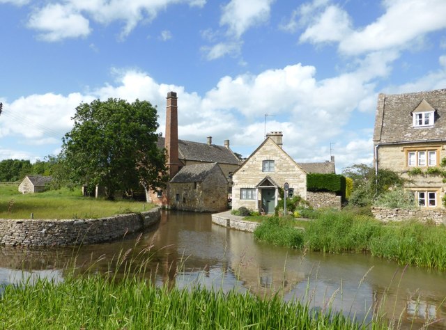
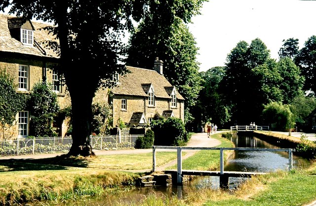
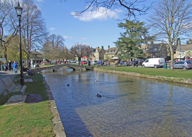
Situated on the River Windrush, Bourton-on-the-Water is famous for its series of low stone bridges that traverse the river, giving the village its distinctive character. These bridges, coupled with the well-preserved limestone buildings and traditional Cotswold architecture, make it a popular destination for tourists from around the world.
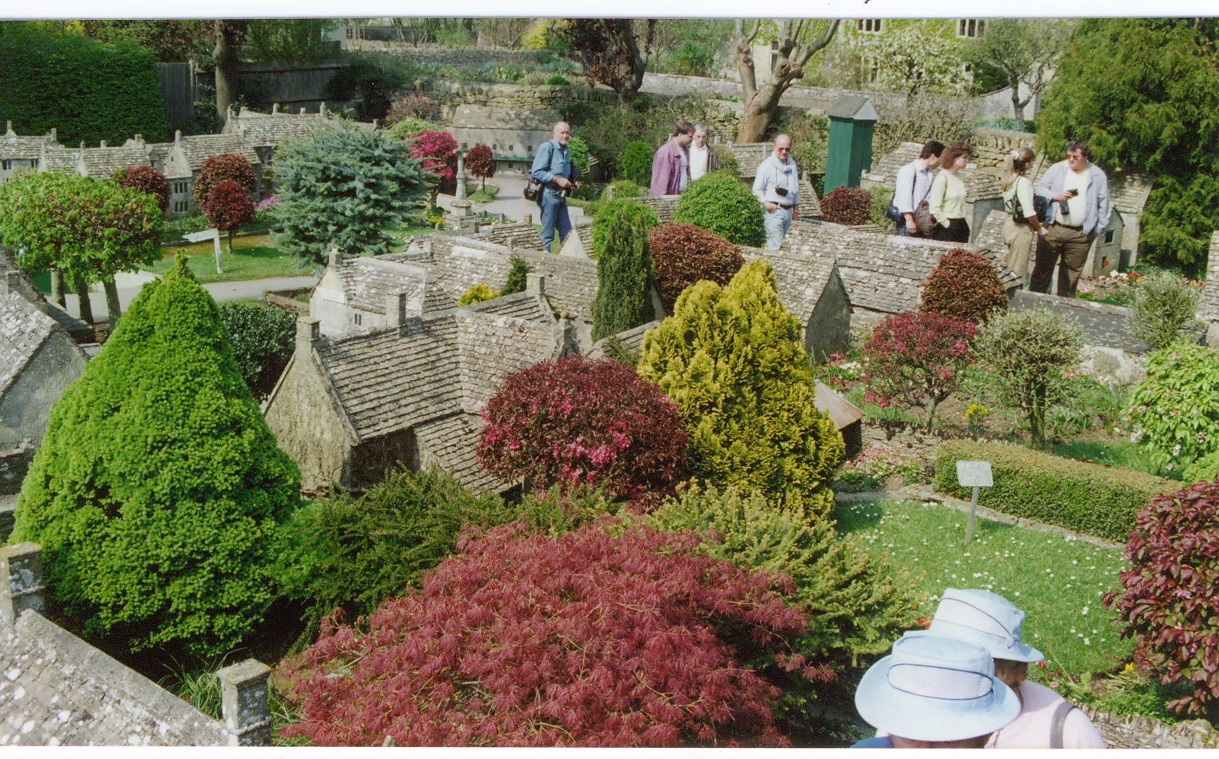
The village boasts a range of attractions and amenities for visitors to enjoy. The Cotswold Motor Museum, situated in a historic mill, showcases a stunning collection of vintage cars, motorcycles, and other memorabilia. The Model Village is another highlight, offering a miniature replica of Bourton-on-the-Water that captures every detail of the village on a 1/9 scale.
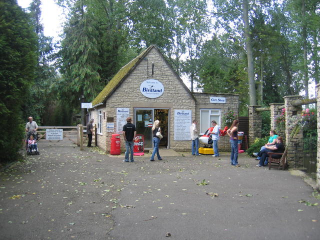
For nature enthusiasts, the Birdland Park and Gardens provide an opportunity to see a wide variety of exotic birds and other wildlife. The gardens also feature a flamingo pond and a nature reserve, making it a haven for birdwatchers and families alike.
Bourton-on-the-Water is also home to several traditional pubs, tearooms, and independent shops, offering visitors a chance to experience the local culture and sample traditional British cuisine. The village hosts various events throughout the year, including the Bourton-on-the-Water Football in the River, where teams compete in a unique game played in the shallow waters of the river.
With its stunning scenery, rich history, and welcoming atmosphere, Bourton-on-the-Water is a must-visit destination for anyone exploring the Cotswolds.
If you have any feedback on the listing, please let us know in the comments section below.
Bourton-on-the-Water Images
Images are sourced within 2km of 51.884812/-1.758029 or Grid Reference SP1620. Thanks to Geograph Open Source API. All images are credited.


Bourton-on-the-Water is located at Grid Ref: SP1620 (Lat: 51.884812, Lng: -1.758029)
Administrative County: Gloucestershire
District: Cotswold
Police Authority: Gloucestershire
What 3 Words
///awesome.handbook.plausible. Near Bourton on the Water, Gloucestershire
Nearby Locations
Related Wikis
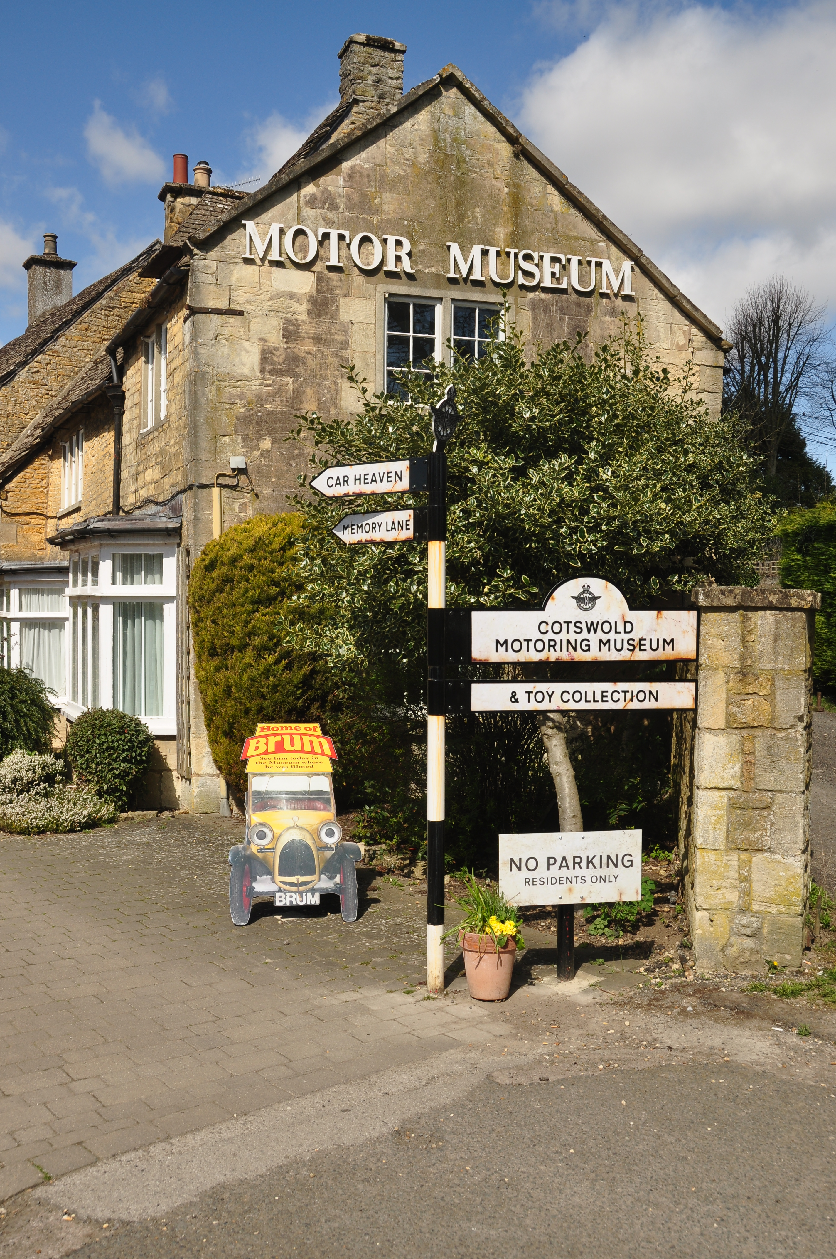
Cotswold Motoring Museum
The Cotswold Motoring Museum is a museum in the Cotswolds village of Bourton-on-the-Water, Gloucestershire, England. It features motoring history of the...
Bourton-on-the-Water
Bourton-on-the-Water is a village and civil parish in Gloucestershire, England, that lies on a wide flat vale within the Cotswolds Area of Outstanding...
Bourton-on-the-Water model village
Bourton-on-the-Water model village is a scale model village in the grounds of the Old New Inn in Bourton-on-the-Water, Gloucestershire, England. One of...

The Cotswold School
The Cotswold School is an 11 to 18 academy school located in Bourton-on-the-Water, Gloucestershire, Great Britain. The school achieved academy status in...
Birdland Park and Gardens
Birdland Park and Gardens, often called Birdland, is a wildlife park in Bourton-on-the-Water, Gloucestershire, England. First opened in 1957, the park...

Bourton Rovers F.C.
Bourton Rovers Football Club is a football club based in Bourton-on-the-Water, Gloucestershire, England. Affiliated to the Gloucestershire County Football...

Bourton-on-the-Water railway station
Bourton-on-the-Water railway station was a Gloucestershire railway station on the Great Western Railway's Banbury and Cheltenham Direct Railway which opened...
Salmonsbury Meadows SSSI
Salmonsbury Meadows (grid reference SP178213) is an 18-hectare (44-acre) biological and geological Site of Special Scientific Interest in Gloucestershire...
Nearby Amenities
Located within 500m of 51.884812,-1.758029Have you been to Bourton-on-the-Water?
Leave your review of Bourton-on-the-Water below (or comments, questions and feedback).