Bournville
Settlement in Worcestershire
England
Bournville

Bournville is a suburban village located in Worcestershire, England. It is situated approximately 4 miles south of Birmingham city center and falls under the jurisdiction of Birmingham City Council. The village is renowned for being the birthplace of the renowned Cadbury chocolate company.
Bournville is characterized by its picturesque surroundings and well-maintained green spaces. The area is known for its leafy streets, Victorian-style houses, and a strong sense of community. The Cadbury family, who established the chocolate company in the 19th century, created Bournville as a model village for their employees. As a result, the village boasts a unique architectural style, with many of the houses and public buildings designed in the Arts and Crafts movement.
One of the most notable landmarks in Bournville is the Cadbury World visitor attraction, which offers an interactive experience that showcases the history and production of chocolate. The village is also home to the Bournville Carillon, a 48-bell musical instrument housed in a stunning tower, which hosts regular concerts and events.
In addition to its chocolate heritage, Bournville offers a range of amenities and facilities for its residents. These include several schools, a variety of shops, sports clubs, parks, and community centers. The village benefits from excellent transport links, with regular bus and train services connecting it to Birmingham and the wider region.
Overall, Bournville is a charming village that combines its rich chocolate history with a close-knit community, beautiful surroundings, and convenient amenities.
If you have any feedback on the listing, please let us know in the comments section below.
Bournville Images
Images are sourced within 2km of 52.427295/-1.933934 or Grid Reference SP0481. Thanks to Geograph Open Source API. All images are credited.


Bournville is located at Grid Ref: SP0481 (Lat: 52.427295, Lng: -1.933934)
Unitary Authority: Birmingham
Police Authority: West Midlands
What 3 Words
///judges.code.logs. Near Bartley Green, West Midlands
Nearby Locations
Related Wikis

Bournville Cricket Ground
The Bournville Cricket Ground in Birmingham, England was used for first-class cricket by Worcestershire County Cricket Club on two occasions. In 1910 they...

Cadbury Athletic F.C.
Cadbury Athletic Football Club is an amateur football club based in Birmingham, England. Affiliated with the Cadbury confectionery company and playing...
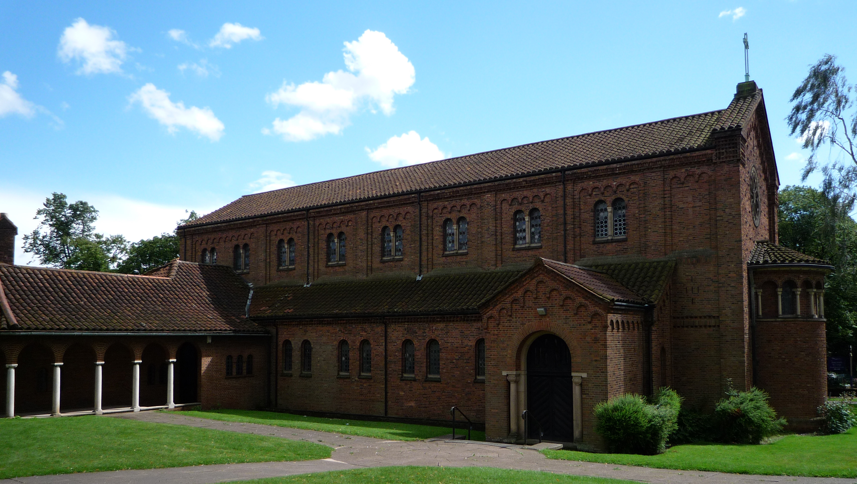
St Francis of Assisi's Church, Bournville
St Francis of Assisi's Church, Bournville is a parish church in the Church of England in Bournville, Birmingham. == History == Land had been set aside...
Cadbury World
Cadbury World is a visitor attraction in Bournville, Birmingham, England, featuring a self-guided exhibition tour, created and run by the Cadbury Company...

Bournville
Bournville () is a model village on the southwest side of Birmingham, England, founded by the Quaker Cadbury family for employees at its Cadbury's factory...

Minworth Greaves
Minworth Greaves is a timber cruck-framed, Grade II listed building in Bournville, an area of Birmingham, England. It is thought to date from the 14th...

Bournville Centre for Visual Arts
The School of Art, Bournville (formerly Bournville College of Art and Bournville Centre for Visual Arts but better known as Bournville School of Art) was...

Birmingham Selly Oak (UK Parliament constituency)
Birmingham Selly Oak is a constituency in the West Midlands, represented in the House of Commons of the UK Parliament since 2010 by Steve McCabe of the...
Nearby Amenities
Located within 500m of 52.427295,-1.933934Have you been to Bournville?
Leave your review of Bournville below (or comments, questions and feedback).