Camp Wood

Wood, Forest in Worcestershire

England

Camp Wood

Tennis Court, Kings Norton It's clearly not a tennis court but probably was.
Tennis Court, Kings Norton Credit: David Howard

Camp Wood is a picturesque woodland located in the county of Worcestershire, England. Situated within the larger expanse of the Wyre Forest, it offers visitors a tranquil and scenic setting to immerse themselves in nature. The wood covers an area of approximately 50 acres and is characterized by a diverse range of trees, including oak, beech, and ash.

The woodland is a popular destination for outdoor enthusiasts, attracting hikers, nature lovers, and birdwatchers alike. Its well-maintained trails provide opportunities for leisurely walks or more challenging hikes, with stunning views of the surrounding countryside. Wildlife is abundant in Camp Wood, with numerous species of birds, mammals, and insects calling it home. Birdwatchers can spot common species such as woodpeckers, nuthatches, and jays, while lucky visitors may even catch a glimpse of rarer creatures like deer or foxes.

Camp Wood offers visitors a chance to escape the hustle and bustle of everyday life, providing a peaceful retreat in the heart of nature. The wood is managed by the Forestry Commission, ensuring its preservation and conservation for future generations to enjoy. Facilities within Camp Wood include designated picnic areas and benches, allowing visitors to relax and soak in the serene atmosphere.

Whether it's a leisurely stroll, an adventurous hike, or a peaceful picnic, Camp Wood in Worcestershire offers a truly enchanting experience for those seeking solace and connection with the natural world.

If you have any feedback on the listing, please let us know in the comments section below.

Camp Wood Images

Images are sourced within 2km of 52.432405/-1.9347691 or Grid Reference SP0481. Thanks to Geograph Open Source API. All images are credited.
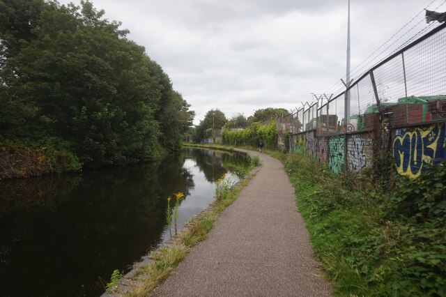
Tennis Court, Kings Norton It's clearly not a tennis court but probably was.
Tennis Court, Kings Norton
It's clearly not a tennis court but probably was.
Northfield Road at the junction of Selly Oak Road
St Mary's Hospice Shop, Cotteridge
Flats on Middleton Hall Road, Cotteridge
Worcester & Birmingham Canal towards bridge #74
Kings Norton Boys' School
Kings Norton Boys' School The school was built on a greenfield site sometime between 1903 and 1914. It has been much extended since then. There is an OS cut benchmark on the brick pillar at the end of wall.
Kings Norton Boys' School
The school was built on a greenfield site sometime between 1903 and 1914. It has been much extended since then. There is an OS cut benchmark on the brick pillar at the end of wall.
Semi-detached cottages, Northfield Road These semis pre-date most of the other buildings in the vicinity and are shown on the 1884 OS 1/2500 map. The look to have been sensitively renovated.
Semi-detached cottages, Northfield Road
These semis pre-date most of the other buildings in the vicinity and are shown on the 1884 OS 1/2500 map. The look to have been sensitively renovated.
Houses in Northfield Road These attractive houses were built just before the first world war.
Houses in Northfield Road
These attractive houses were built just before the first world war.
Kings Norton Boys' School Pictured just after a heavy downpour.
Kings Norton Boys' School
Pictured just after a heavy downpour.
Cotteridge The busy double roundabout junction where the outer ring road crosses the Redditch Road.
Cotteridge
The busy double roundabout junction where the outer ring road crosses the Redditch Road.
King's Norton Community Fire Station Built beside Pershore Road South in Cotteridge to service the southward growth of the city suburbs.
King's Norton Community Fire Station
Built beside Pershore Road South in Cotteridge to service the southward growth of the city suburbs.
Midland Bank Cotteridge. Sorting code 40-11-40 I worked for Midland Bank HSBC for 32 years and spent all but the last two in Birmingham Branches. I am photographing all the branches, or what's left of them, as they were when I joined Midland Bank in 1963. The branches all start with the sorting code 40-11.
This was the 55, Pershore Road South, Cotteridge branch. They had a sub-office at 1398 Pershore Road Stirchley. Both had a sorting code of 40-11-40.
Midland Bank Cotteridge. Sorting code 40-11-40
I worked for Midland Bank HSBC for 32 years and spent all but the last two in Birmingham Branches. I am photographing all the branches, or what's left of them, as they were when I joined Midland Bank in 1963. The branches all start with the sorting code 40-11. This was the 55, Pershore Road South, Cotteridge branch. They had a sub-office at 1398 Pershore Road Stirchley. Both had a sorting code of 40-11-40.
Grant Arms, Pershore Road, Lifford
Cotteridge Road, Lifford
La Banca Restaurant Until recently this was a branch of Barclays Bank.
La Banca Restaurant
Until recently this was a branch of Barclays Bank.
Pershore Rd, Cotteridge, 1993 Pershore Road at Cotteridge, Birmingham,  looking towards the city in 1993
Pershore Rd, Cotteridge, 1993
Pershore Road at Cotteridge, Birmingham, looking towards the city in 1993
Watford Road, Cotteridge, 1993 The outer ring road [Watford Rd] at Cotteridge, Birmingham in 1993
Watford Road, Cotteridge, 1993
The outer ring road [Watford Rd] at Cotteridge, Birmingham in 1993
Show me another place!

Camp Wood is located at Grid Ref: SP0481 (Lat: 52.432405, Lng: -1.9347691)

Unitary Authority: Birmingham

Police Authority: West Midlands

What 3 Words

///buyers.racing.civil. Near Bartley Green, West Midlands

Nearby Locations

Bournville Camp Wood

Related Wikis

Minworth Greaves

Minworth Greaves is a timber cruck-framed, Grade II listed building in Bournville, an area of Birmingham, England. It is thought to date from the 14th...

Bournville Centre for Visual Arts

The School of Art, Bournville (formerly Bournville College of Art and Bournville Centre for Visual Arts but better known as Bournville School of Art) was...

Bournville

Bournville () is a model village on the southwest side of Birmingham, England, founded by the Quaker Cadbury family for employees at its Cadbury's factory...

Cadbury World

Cadbury World is a visitor attraction in Bournville, Birmingham, England, featuring a self-guided exhibition tour, created and run by the Cadbury Company...

St Francis of Assisi's Church, Bournville

St Francis of Assisi's Church, Bournville is a parish church in the Church of England in Bournville, Birmingham. == History == Land had been set aside...

Birmingham Selly Oak (UK Parliament constituency)

Birmingham Selly Oak is a constituency in the West Midlands, represented in the House of Commons of the UK Parliament since 2010 by Steve McCabe of the...

Selly Oak Hospital

Selly Oak Hospital was situated in the Selly Oak area of Birmingham, England. Previously managed by the University Hospitals Birmingham NHS Foundation...

Cadbury Athletic F.C.

Cadbury Athletic Football Club is an amateur football club based in Birmingham, England. Affiliated with the Cadbury confectionery company and playing...

Nearby Amenities

Located within 500m of 52.432405,-1.9347691
Crossing: no
Lat/Long: 52.4287281/-1.9358757
Crossing
Crossing: marked
Crossing Island: no
Tactile Paving: yes
Lat/Long: 52.4355129/-1.9345706
Traffic Calming: bump
Lat/Long: 52.4312363/-1.9349504
Access: yes
Leisure: playground
Lat/Long: 52.4285258/-1.9363024
Crossing
Check Date Crossing: 2022-01-08
Crossing: uncontrolled
Crossing Ref: zebra
Tactile Paving: yes
Lat/Long: 52.4293784/-1.9339789
Traffic Calming: bump
Lat/Long: 52.4298441/-1.9338738
Traffic Calming: bump
Lat/Long: 52.4304145/-1.9329323
Crossing
Crossing: marked
Crossing Markings: yes
Lat/Long: 52.4304598/-1.9324127
Traffic Calming: bump
Lat/Long: 52.430422/-1.9319838
Crossing
Crossing: traffic_signals
Crossing Ref: pelican
Lat/Long: 52.4299696/-1.9361779
Traffic Calming: bump
Lat/Long: 52.4293245/-1.934038
Traffic Calming: bump
Lat/Long: 52.4290339/-1.9343802
Cadbury World
Addr Postcode: B30 1JR
Fee: yes
Fee Conditional: no @ (age < 3)
Opening Hours Url: https://www.cadburyworld.co.uk/plan-your-visit/before-you-visit/opening-times/
Tourism: attraction
Website: https://www.cadburyworld.co.uk/
Wheelchair: limited
Wikidata: Q5945554
Wikipedia: en:Cadbury World
Lat/Long: 52.4299863/-1.9322297
Post Box
Ref: B30 188
Lat/Long: 52.4331845/-1.9409798
Post Box
Collection Times: Mo-Fr 21:00, Sa 07:00
Ref: B29 200
Royal Cypher: EIIR
Royal Cypher Wikidata: Q33102113
Lat/Long: 52.4343177/-1.9396922
Post Box
Ref: B30 77
Lat/Long: 52.4315976/-1.9318002
Bus Stop
Linden Rd / Acacia Rd
Bus: yes
Naptan AtcoCode: 43000358201
Naptan Bearing: NW
Naptan BusStopType: MKD
Naptan CommonName: Acacia Rd
Naptan Indicator: opp
Naptan NaptanCode: nwmatwmd
Naptan PlusbusZoneRef: BHAMNWS
Naptan Status: ACT
Naptan StopType: BCT
Naptan Street: LINDEN RD
Naptan Towards: Selly Oak
Public Transport: platform
Route Ref: 11C;84
Shelter: no
Source: WMCA
Towards: Selly Oak
Lat/Long: 52.4334035/-1.9389152
Bus Stop
Linden Rd / Acacia Rd
Bench: no
Bin: no
Bus: yes
Electronic Information Board: yes
Mapillary: 322029486038551
Naptan AtcoCode: 43000358202
Naptan Bearing: SE
Naptan BusStopType: MKD
Naptan CommonName: Acacia Rd
Naptan Indicator: adj
Naptan NaptanCode: nwmatwmg
Naptan PlusbusZoneRef: BHAMNWS
Naptan Status: ACT
Naptan StopType: BCT
Naptan Street: LINDEN RD
Naptan Towards: Cotteridge
Public Transport: platform
Route Ref: 11A;84
Shelter: yes
Source: WMCA
Survey Date: 2019-10-17
Towards: Cotteridge
Lat/Long: 52.4335729/-1.9389377
Bus Stop
Linden Rd / Woodbrooke Rd
NaPTANAreaCode: 43000358303
Asset Ref: 610549
Bus: yes
Naptan AtcoCode: 43000358303
Naptan Bearing: S
Naptan BusStopType: MKD
Naptan CommonName: Woodbrooke Rd
Naptan Indicator: opp
Naptan NaptanCode: nwmatwmj
Naptan PlusbusZoneRef: BHAMNWS
Naptan Status: ACT
Naptan StopType: BCT
Naptan Street: LINDEN RD
Naptan Towards: Cotteridge
Public Transport: platform
Route Ref: 11A;27;84
Shelter: yes
Shelter Ref: 610549
Source: WMCA
Tactile Paving: yes
Towards: Cotteridge
Lat/Long: 52.4297682/-1.9360594
Bus Stop
Linden Rd / Woodbrooke Rd
NaPTANAreaCode: 43000358304
Asset Ref: 610421
Bus: yes
Electronic Information Board: yes
Naptan AtcoCode: 43000358304
Naptan Bearing: NW
Naptan BusStopType: MKD
Naptan CommonName: Woodbrooke Rd
Naptan Indicator: adj
Naptan NaptanCode: nwmatwmp
Naptan PlusbusZoneRef: BHAMNWS
Naptan Status: ACT
Naptan StopType: BCT
Naptan Street: LINDEN RD
Naptan Towards: Selly Oak
Public Transport: platform
Route Ref: 11C;84
Shelter: yes
Shelter Ref: 610421
Source: WMCA
Tactile Paving: yes
Towards: Selly Oak
Lat/Long: 52.4305652/-1.9366278
Bus Stop
Raddlebarn Rd / Hestia Drive
Bus: yes
Naptan AtcoCode: 43000358901
Naptan Bearing: SE
Naptan BusStopType: MKD
Naptan CommonName: Hestia Drive
Naptan Indicator: after
Naptan NaptanCode: nwmdpjdt
Naptan PlusbusZoneRef: BHAMNWS
Naptan Status: ACT
Naptan StopType: BCT
Naptan Street: RADDLEBARN RD
Naptan Towards: Cotteridge
Public Transport: platform
Route Ref: 38
Shelter: no
Source: WMCA
Towards: Cotteridge
Lat/Long: 52.436004/-1.9349935
Bus Stop
Woodbrooke Rd / Linden Rd
Bus: yes
Naptan AtcoCode: 43003580001
Naptan Bearing: NE
Naptan BusStopType: MKD
Naptan CommonName: Linden Rd
Naptan Indicator: before
Naptan NaptanCode: nwmpjwag
Naptan PlusbusZoneRef: BHAMNWS
Naptan Status: ACT
Naptan StopType: BCT
Naptan Street: WOODBROOKE RD
Naptan Towards: Kings Heath
Public Transport: platform
Route Ref: 27
Shelter: no
Source: WMCA
Towards: Kings Heath
Lat/Long: 52.4299653/-1.9371022
Bus Stop
Woodbrooke Rd / Linden Rd
NaPTANAreaCode: 43003580002
Asset Ref: 610422
Bus: yes
Naptan AtcoCode: 43003580002
Naptan Bearing: SW
Naptan BusStopType: MKD
Naptan CommonName: Linden Rd
Naptan Indicator: after
Naptan NaptanCode: nwmpjwaj
Naptan PlusbusZoneRef: BHAMNWS
Naptan Status: ACT
Naptan StopType: BCT
Naptan Street: WOODBROOKE RD
Naptan Towards: Northfield
Public Transport: platform
Route Ref: 27
Shelter: yes
Shelter Ref: 610422
Source: WMCA
Towards: Northfield; Druids Heath
Lat/Long: 52.4299913/-1.9367701
Blue Plaque: George Cadbury
Historic: memorial
Lat/Long: 52.4299538/-1.935464
Addr City: Birmingham
Addr Housenumber: 2
Addr Street: Thorn Road
Lat/Long: 52.4294215/-1.9382519
Addr City: Birmingham
Addr Housenumber: 1
Addr Street: Thorn Road
Lat/Long: 52.4294354/-1.9378991
Addr City: Birmingham
Addr Housenumber: 11
Addr Street: Woodbrooke Road
Lat/Long: 52.4294616/-1.9382987
Addr City: Birmingham
Addr Housenumber: 27
Addr Street: Woodbrooke Road
Lat/Long: 52.429308/-1.9396341
Crossing
Check Date Crossing: 2022-01-08
Crossing: uncontrolled
Crossing Ref: zebra
Tactile Paving: yes
Lat/Long: 52.4286206/-1.9354946
Addr City: Birmingham
Addr Housenumber: 60
Addr Street: Raddlebarn Road
Lat/Long: 52.4359008/-1.9308895
Crossing
Button Operated: yes
Crossing: traffic_signals
Crossing Island: no
Crossing Ref: pelican
Source: BING;BCC_CycleData
Tactile Paving: yes
Traffic Signals Sound: yes
Traffic Signals Vibration: yes
Lat/Long: 52.4289762/-1.9359103
Martin's
Addr City: Birmingham
Addr Housenumber: 47
Addr Street: Sycamore Road
Brand: Martin's
Brand Wikidata: Q116779207
Shop: newsagent
Website: https://my.morrisons.com/storefinder/66144/martins-bournville-sycamore-rd
Lat/Long: 52.4295038/-1.9353437
Pharmacy
The Bournville Pharmacy
Addr City: Birmingham
Addr Housenumber: 45
Addr Street: Sycamore Road
Healthcare: pharmacy
Phone: 0121 472 0282
Lat/Long: 52.4295205/-1.9352176
John the Barber
Addr City: Birmingham
Addr Street: Sycamore Road
Shop: hairdresser
Lat/Long: 52.4295394/-1.935123
Evans's of Bournville
Addr City: Birmingham
Addr Housenumber: 43
Addr Street: Sycamore Road
Phone: 0121 472 1926
Shop: stationery
Website: https://www.evanss.co.uk
Lat/Long: 52.4295979/-1.9351089
Bournville Bread Basket
Addr City: Birmingham
Addr Housenumber: 41
Addr Street: Sycamore Road
Phone: 0121 471 1420
Shop: bakery
Lat/Long: 52.4296672/-1.9350351
Doctors
Addr City: Birmingham
Addr Street: Sycamore Road
Healthcare: doctor
Lat/Long: 52.4296724/-1.9349576
Russel's
Addr City: Birmingham
Addr Housenumber: 39
Addr Street: Sycamore Road
Phone: 0121 472 8013
Shop: butcher
Lat/Long: 52.4297153/-1.934958
Christine's
Addr City: Birmingham
Addr Housenumber: 37
Addr Postcode: B30 2AA
Addr Street: Sycamore Road
Phone: +441216283977
Shop: sewing
Website: http://www.cityknits.co.uk/
Lat/Long: 52.4297589/-1.934915
Bournville Designs
Addr City: Birmingham
Addr Housenumber: 35
Addr Street: Sycamore Road
Shop: jewelry
Lat/Long: 52.429787/-1.9348743
Post Box
Collection Times: Mo-Fr 17:45; Sa 11:30
Post Box Type: wall
Ref: B30 56
Lat/Long: 52.4298497/-1.9348439
Cafe
Kafenion
Addr City: Birmingham
Addr Housenumber: 35
Addr Postcode: B30 2AA
Addr Street: Sycamore Road
Cuisine: coffee;greek;cake
Indoor Seating: yes
Note: Greek Cafe
Opening Hours: Mo-Fr 09:00-16:00; Sa-Su 09:00-16:30
Outdoor Seating: yes
Phone: +44 121 472 5855
Website: https://www.kafenion.business.site/
Lat/Long: 52.4298256/-1.9348252
Telephone
Booth: K6
Covered: booth
Heritage: 2
Heritage Operator: Historic England
Listed Status: Grade II
Operator: BT
Operator Wikidata: Q593786
Phone: +44 121 471 1480
Source: survey;English Heritage
Lat/Long: 52.4298768/-1.9347987
Telephone
Defibrillator
Booth: K6
Covered: booth
Defibrillator Location: inside right hand red phone box, by the shops, Sycamore Road, Bournville
Emergency: defibrillator
Heritage: 2
Heritage Operator: Historic England
Indoor: no
Listed Status: Grade II
Not Ref GB The Circuit: E9AD294A-A781-4BDE-9DF9-5C9FA9050455
Old Phone: +44 121 472 2772
Source: survey;English Heritage
Lat/Long: 52.4298707/-1.9347817
Bournville Area Office
Addr City: Birmingham
Addr Housenumber: 27
Addr Street: Sycamore Road
Note: Office for the Bournville estate
Lat/Long: 52.4301304/-1.9343809
Bench
Lat/Long: 52.4301819/-1.9344971
SAS & Co. Hair & Beauty Spa
Addr City: Birmingham
Addr Housenumber: 25
Addr Street: Sycamore Road
Note: Also a beauty shop
Shop: hairdresser
Lat/Long: 52.4301829/-1.9343401
Grit Bin
Lat/Long: 52.4341504/-1.9284263
Grit Bin
Lat/Long: 52.4293258/-1.9398489
Grit Bin
Lat/Long: 52.4338004/-1.9410626
Addr City: Birmingham
Addr Housenumber: 23
Addr Street: Thorn Road
Lat/Long: 52.4286758/-1.9376632
Addr City: Birmingham
Addr Housenumber: 9
Addr Street: Woodbrooke Road
Lat/Long: 52.4295334/-1.9380135
Addr City: Birmingham
Addr Housenumber: 1
Addr Street: Woodbrooke Road
Lat/Long: 52.4296692/-1.937499
Waste Basket
Lat/Long: 52.4300637/-1.9363302
Bournville Carillon
Tourism: attraction
Url: http://carillon.atspace.org/
Lat/Long: 52.4295339/-1.9363717
Addr City: Birmingham
Addr Housenumber: 20
Addr Street: Thorn Road
Lat/Long: 52.4286956/-1.93802
Addr City: Birmingham
Addr Housenumber: 22
Addr Street: Thorn Road
Lat/Long: 52.4286815/-1.9381362
Grit Bin
Lat/Long: 52.4284072/-1.9325101
Crossing
Crossing Island: yes
Lat/Long: 52.4303915/-1.9364173
Addr City: Birmingham
Addr Housenumber: 49
Addr Street: Linden Road
Lat/Long: 52.4312455/-1.9368926
Addr City: Birmingham
Addr Housenumber: 15
Addr Street: Sycamore Road
Lat/Long: 52.430668/-1.933747
Addr City: Birmingham
Addr Housenumber: 19
Addr Street: Linden Road
Lat/Long: 52.4325077/-1.9377713
Addr City: Birmingham
Addr Housenumber: 23
Addr Street: Acacia Road
Lat/Long: 52.4326258/-1.937321
Addr City: Birmingham
Addr Housenumber: 17
Addr Street: Acacia Road
Lat/Long: 52.4327893/-1.9367223
Grit Bin
Lat/Long: 52.4312933/-1.9331676
Addr City: Birmingham
Addr Housenumber: 51
Addr Street: Laburnum Road
Lat/Long: 52.4312612/-1.9328015
Addr City: Birmingham
Addr Housenumber: 1
Addr Street: Sycamore Road
Lat/Long: 52.4311684/-1.9331073
Addr City: Birmingham
Addr Housenumber: 37
Addr Street: Laburnum Road
Lat/Long: 52.4314946/-1.931773
Addr City: Birmingham
Addr Housenumber: 39
Addr Street: Laburnum Road
Lat/Long: 52.4314451/-1.932032
Addr City: Birmingham
Addr Housenumber: 30
Addr Street: Laburnum Road
Lat/Long: 52.4318628/-1.9313575
Addr City: Birmingham
Addr Housenumber: 32
Addr Street: Laburnum Road
Lat/Long: 52.4317303/-1.9317792
Addr City: Birmingham
Addr Housenumber: 13
Addr Street: Laburnum Road
Lat/Long: 52.4320302/-1.9296773
Addr City: Birmingham
Addr Housenumber: 12
Addr Street: Laburnum Road
Lat/Long: 52.4321339/-1.9301982
Addr City: Birmingham
Addr Housenumber: 15
Addr Street: Laburnum Road
Lat/Long: 52.4317885/-1.9304126
Addr City: Birmingham
Addr Housenumber: 3
Addr Street: Laburnum Road
Lat/Long: 52.4322255/-1.9289195
Addr City: Birmingham
Addr Housenumber: 77
Addr Street: Willow Road
Lat/Long: 52.4317919/-1.9318379
Addr City: Birmingham
Addr Housenumber: 56
Addr Street: Acacia Road
Lat/Long: 52.4328192/-1.9378486
Addr City: Birmingham
Addr Housenumber: 17
Addr Street: Linden Road
Lat/Long: 52.4327775/-1.93805
Addr City: Birmingham
Addr Housenumber: 1
Addr Street: Linden Road
Lat/Long: 52.433469/-1.9386281
Linden Road North
Power: substation
Ref: 6501
Lat/Long: 52.4335233/-1.93868
Addr City: Birmingham
Addr Housenumber: 34
Addr Street: Acacia Road
Lat/Long: 52.4332382/-1.9364015
Addr City: Birmingham
Addr Housenumber: 36
Addr Street: Acacia Road
Lat/Long: 52.4331496/-1.9366369
Waste Basket
Lat/Long: 52.4329125/-1.9360919
Bench
Lat/Long: 52.4329038/-1.936097
Addr City: Birmingham
Addr Housenumber: 62
Addr Street: Willow Road
Lat/Long: 52.4321184/-1.9328201
Addr City: Birmingham
Addr Housenumber: 30
Addr Street: Willow Road
Lat/Long: 52.4335838/-1.9334531
Addr City: Birmingham
Addr Housenumber: 24
Addr Street: Thorn Road
Lat/Long: 52.4286674/-1.9382524
Board Type: welcome_sign
Information: board
Note: Sign for Bournville Village Estate Trust
Tourism: information
Lat/Long: 52.4359959/-1.9308435
Addr City: Birmingham
Addr Country: GB
Addr Housenumber: 182
Addr Street: Oak Tree Lane
Lat/Long: 52.4300089/-1.939886
Addr City: Birmingham
Addr Country: GB
Addr Housenumber: 84
Addr Street: Woodbrooke Road
Lat/Long: 52.4295469/-1.9395765
Addr City: Birmingham
Addr Housenumber: St. George's Court
Lat/Long: 52.4297113/-1.9401848
Addr City: Birmingham
Addr Country: GB
Addr Housenumber: 147
Addr Street: Oak Tree Lane
Lat/Long: 52.4313039/-1.9391531
Addr City: Birmingham
Addr Country: GB
Addr Housenumber: 14
Addr Street: Woodbrooke Road
Lat/Long: 52.4298985/-1.9377373
Addr City: Birmingham
Addr Country: GB
Addr Housenumber: 2
Addr Street: Woodbrooke Road
Lat/Long: 52.4301132/-1.9371161
Addr City: Birmingham
Addr Country: GB
Addr Housenumber: 143
Addr Street: Oak Tree Lane
Lat/Long: 52.4315012/-1.9390144
Addr City: Birmingham
Addr Country: GB
Addr Housenumber: 145
Addr Street: Oak Tree Lane
Lat/Long: 52.431395/-1.9390464
Addr City: Birmingham
Addr Country: GB
Addr Housenumber: 1
Addr Street: Acorn Close
Lat/Long: 52.4320739/-1.9389112
Addr City: Birmingham
Addr Country: GB
Addr Housenumber: 2
Addr Street: Acorn Close
Lat/Long: 52.4319242/-1.9388365
Addr City: Birmingham
Addr Country: GB
Addr Housenumber: 3
Addr Street: Acorn Close
Lat/Long: 52.4317745/-1.9388507
Bench
Lat/Long: 52.4302361/-1.9358065
Bench
Lat/Long: 52.4302028/-1.9358047
Bench
Lat/Long: 52.4302716/-1.9353821
Bench
Lat/Long: 52.4302417/-1.9353785
Bench
Lat/Long: 52.4302983/-1.9349231
Bench
Lat/Long: 52.4302672/-1.9349213
Bournville Centre for Visual Art
Lat/Long: 52.4305487/-1.9346816
Addr City: Birmingham
Addr Housename: West Holme
Addr Housenumber: 160
Addr Street: Oak Tree Lane
Lat/Long: 52.4323775/-1.9395231
Addr City: Birmingham
Addr Country: GB
Addr Housenumber: 158
Addr Street: Oak Tree Lane
Lat/Long: 52.4325814/-1.9395231
Addr City: Birmingham
Addr Country: GB
Addr Housenumber: 156
Addr Street: Oak Tree Lane
Lat/Long: 52.4327007/-1.9395017
Addr City: Birmingham
Addr Country: GB
Addr Housenumber: 5
Addr Street: Linden Road
Lat/Long: 52.4332888/-1.9384821
Addr City: Birmingham
Addr Country: GB
Addr Housenumber: 3
Addr Street: Linden Road
Lat/Long: 52.4334229/-1.9385875
Addr City: Birmingham
Addr Country: GB
Addr Housenumber: 20
Addr Street: Acacia Road
Lat/Long: 52.4334608/-1.9354153
Historic: memorial
Note: Plaque on the wall comemorating the errection of the buildings
Lat/Long: 52.4335077/-1.9348736
Leisure: playground
Surface: asphalt
Lat/Long: 52.4284363/-1.9380378
Entrance: yes
Source: survey
Lat/Long: 52.4305052/-1.9346305
Bench
Heritage: 2
Heritage Operator: Historic England
Listed Status: Grade II
Source: survey
Lat/Long: 52.4302559/-1.9360585
Bournville Memorial Cross
Heritage: 2
Heritage Operator: Historic England
Historic: memorial
Listed Status: Grade II
Memorial: war_memorial
Source: BING;Wikidata
Unveiled: 1923-07-23
Wikidata: Q23809761
Lat/Long: 52.4316979/-1.9324184
George Cadbury
Artwork Type: bust
Source: survey
Tourism: artwork
Lat/Long: 52.4304613/-1.9359174
Access: private
Bicycle: no
Entrance: yes
Foot: yes
Operator: Selly Manor Museum
Source: survey; Bing
Wheelchair: limited
Lat/Long: 52.4308015/-1.9343005
Access: private
Bicycle: no
Entrance: yes
Foot: yes
Operator: Selly Manor Museum
Source: survey; Bing
Wheelchair: limited
Lat/Long: 52.4308967/-1.9344058
Man Made: street_cabinet
Source: survey
Street Cabinet: telecom
Lat/Long: 52.4359367/-1.935066
Man Made: street_cabinet
Source: survey
Street Cabinet: telecom
Lat/Long: 52.4359376/-1.935068
Communication Mobile Phone: yes
Man Made: mast
Tower Construction: tube
Tower Type: communication
Lat/Long: 52.435949/-1.9350727
Man Made: street_cabinet
Source: survey
Street Cabinet: telecom
Lat/Long: 52.4359592/-1.9350827
Man Made: street_cabinet
Source: survey
Street Cabinet: telecom
Lat/Long: 52.4359645/-1.9350861
Give Way
Lat/Long: 52.4347686/-1.9398379
Give Way
Lat/Long: 52.4342101/-1.9396153
Give Way
Lat/Long: 52.4325364/-1.9380744
Give Way
Lat/Long: 52.4293024/-1.9359131
Give Way
Lat/Long: 52.430144/-1.9362945
Post Box
Collection Times: Mo-Fr 09:00; Sa 07:00
Post Box Type: pillar
Ref: B29 864
Royal Cypher: EIIR
Royal Cypher Wikidata: Q33102113
Source: survey
Lat/Long: 52.4361001/-1.9350817
Waste Basket
Waste: trash
Lat/Long: 52.4295893/-1.9314843
Fire Hydrant
Emergency: fire_hydrant
Fire Hydrant Type: underground
Source: survey
Lat/Long: 52.4364095/-1.9366837
Crossing
Button Operated: yes
Crossing: traffic_signals
Crossing Island: no
Source: survey
Tactile Paving: yes
Traffic Signals Sound: yes
Traffic Signals Vibration: yes
Lat/Long: 52.4337814/-1.9392169
Generator Method: photovoltaic
Generator Output Electricity: yes
Generator Source: solar
Generator Type: solar_photovoltaic_panel
Location: roof
Power: generator
Lat/Long: 52.4363637/-1.9343863
Generator Method: photovoltaic
Generator Output Electricity: yes
Generator Source: solar
Generator Type: solar_photovoltaic_panel
Location: roof
Power: generator
Lat/Long: 52.4363539/-1.9343153
Generator Method: photovoltaic
Generator Output Electricity: yes
Generator Solar Modules: 10
Generator Source: solar
Generator Type: solar_photovoltaic_panel
Location: roof
Power: generator
Lat/Long: 52.4314399/-1.9414258
Addr City: Birmingham
Addr Postcode: B30 2BD
Addr Street: Laburnum Road
Lat/Long: 52.4308364/-1.9298869
Access: no
Barrier: block
Bicycle: yes
Foot: yes
Motor Vehicle: no
Lat/Long: 52.4293599/-1.9397613
Crossing
Crossing: marked
Lat/Long: 52.4302472/-1.9309175
Crossing
Crossing: marked
Lat/Long: 52.4301765/-1.9311417
Crossing
Crossing: marked
Lat/Long: 52.4302007/-1.9309052
Crossing
Crossing: marked
Lat/Long: 52.4302326/-1.9306638
Crossing
Crossing: marked
Lat/Long: 52.4302629/-1.9304318
Crossing
Crossing: marked
Lat/Long: 52.4302931/-1.9301938
Crossing
Crossing: marked
Lat/Long: 52.4303229/-1.9299556
Crossing
Crossing: marked
Lat/Long: 52.4303559/-1.9297158
Crossing
Crossing: marked
Lat/Long: 52.4305273/-1.9322594
Barrier: lift_gate
Lat/Long: 52.4288639/-1.9349713
Barrier: bollard
Foot: yes
Motor Vehicle: no
Lat/Long: 52.4342475/-1.937772
Barrier: bollard
Foot: yes
Motor Vehicle: no
Lat/Long: 52.4341675/-1.9378045
Crossing
Crossing: marked
Crossing Markings: yes
Tactile Paving: yes
Lat/Long: 52.4296107/-1.9336604
Cafe
Cadbury Cafe
Lat/Long: 52.429903/-1.93256
Entrance: main
Lat/Long: 52.4300409/-1.9326102
Itnet Laburnum Rd 11kV
Power: substation
Ref: 724266
Source: wpd_opendata
Lat/Long: 52.4306762/-1.9299915
Cadbury No 2 11kV
Power: substation
Ref: 724268
Source: wpd_opendata
Lat/Long: 52.429551/-1.9324109
The data included in this document is from www.openstreetmap.org. The data is made available under ODbL.

Have you been to Camp Wood?

Leave your review of Camp Wood below (or comments, questions and feedback).