Tunstead

Settlement in Yorkshire

England

Tunstead

View of St Chad Church, Saddleworth Link to Church Website <span class="nowrap"><a title="https://www.cofeinsaddleworth.org.uk/st-chad-saddleworth-parish-church" rel="nofollow ugc noopener" href="https://www.cofeinsaddleworth.org.uk/st-chad-saddleworth-parish-church">Link</a><img style="margin-left:2px;" alt="External link" title="External link - shift click to open in new window" src="https://s1.geograph.org.uk/img/external.png" width="10" height="10"/></span>
View of St Chad Church, Saddleworth Credit: Philip Cornwall

Tunstead is a small village located in the county of Yorkshire, in the northern part of England. Situated in the district of Hambleton, it is surrounded by picturesque countryside and offers a tranquil setting for its residents. The village is positioned about 5 miles south-west of the market town of Thirsk, making it conveniently accessible for amenities and services.

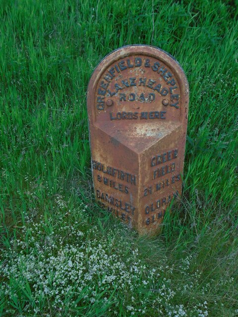
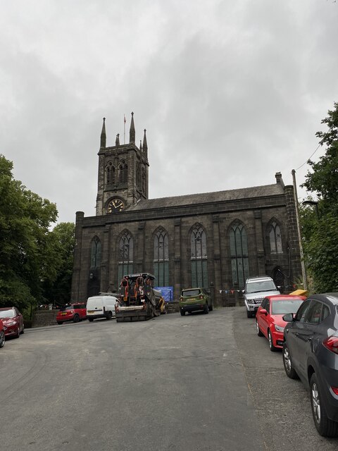
Tunstead boasts a rich history, with evidence of human occupation dating back to the Bronze Age. The village grew during the medieval period, and remnants of its historic past can still be seen today in its architecture and landmarks. One notable feature is the village church, which dates back to the 12th century and showcases stunning architectural details.

The village itself is relatively small, with a population of around 200 residents. It is primarily a residential area, with a close-knit community feel. The village offers a peaceful environment, away from the hustle and bustle of larger towns and cities.

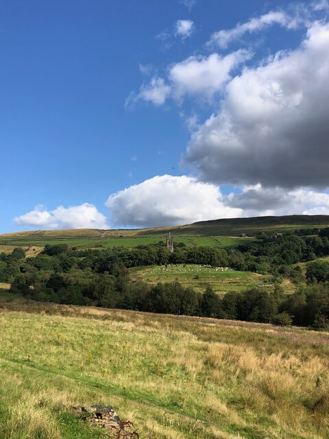
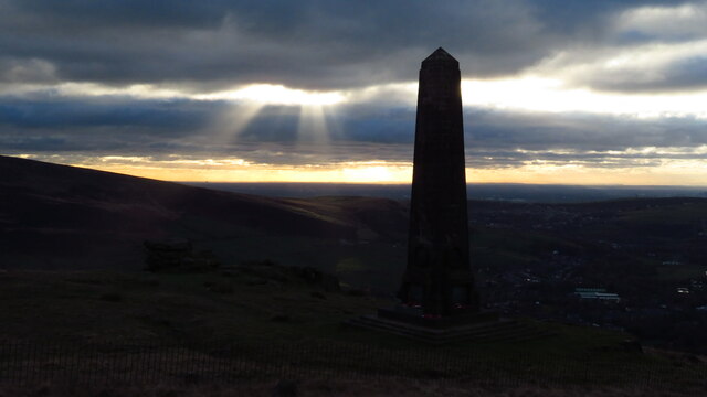
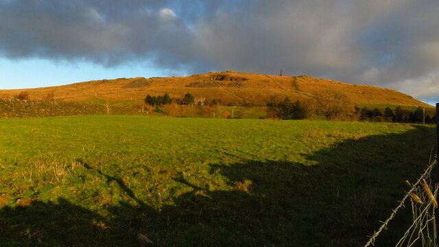
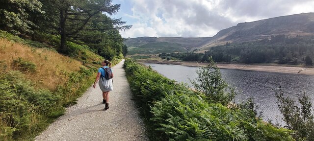
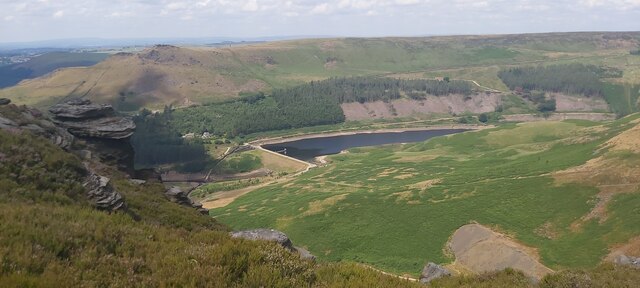
Surrounding Tunstead are rolling hills, lush fields, and charming countryside landscapes, making it an ideal location for nature lovers and outdoor enthusiasts. The village is also in close proximity to the North York Moors National Park, offering ample opportunities for hiking, cycling, and other recreational activities.

Overall, Tunstead presents itself as a quaint village with a rich heritage and a peaceful rural setting, providing a haven for those seeking a slower pace of life in the heart of Yorkshire.

If you have any feedback on the listing, please let us know in the comments section below.
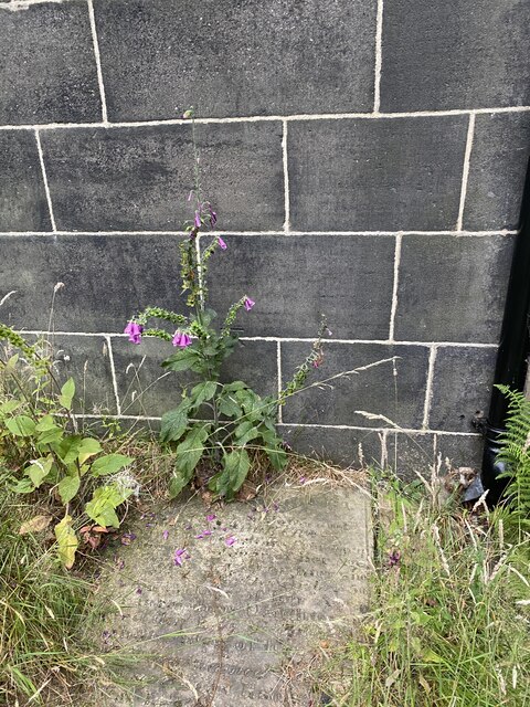
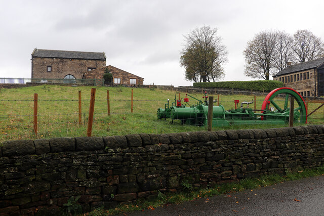
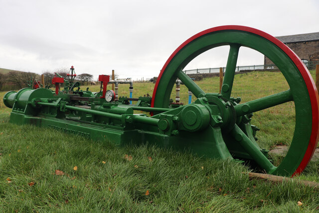
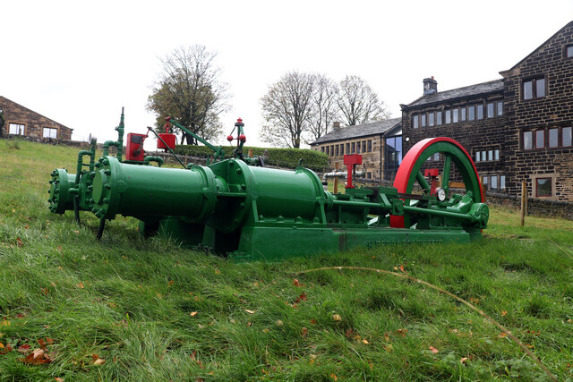
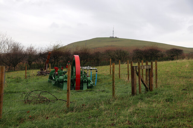
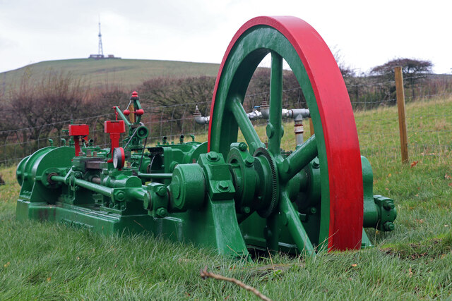
Tunstead Images

Images are sourced within 2km of 53.537509/-1.9941979 or Grid Reference SE0004. Thanks to Geograph Open Source API. All images are credited.

View of St Chad Church, Saddleworth Link to Church Website <span class="nowrap"><a title="https://www.cofeinsaddleworth.org.uk/st-chad-saddleworth-parish-church" rel="nofollow ugc noopener" href="https://www.cofeinsaddleworth.org.uk/st-chad-saddleworth-parish-church">Link</a><img style="margin-left:2px;" alt="External link" title="External link - shift click to open in new window" src="https://s1.geograph.org.uk/img/external.png" width="10" height="10"/></span>
View of St Chad Church, Saddleworth
Link to Church Website LinkExternal link
Pots & Pans Monument & Greenfield This war memorial was erected in 1923 to honour the 259 people from the villages of Saddleworth who died during the first world war and was located here specifically to be visible from the villages in the area. When plans were submitted for the war memorial there was much opposition from local people who wanted a memorial in the village rather than on top of a bleak hill.
Pots & Pans Monument & Greenfield
This war memorial was erected in 1923 to honour the 259 people from the villages of Saddleworth who died during the first world war and was located here specifically to be visible from the villages in the area. When plans were submitted for the war memorial there was much opposition from local people who wanted a memorial in the village rather than on top of a bleak hill.
Late afternoon sunlight on Pots & Pans Monument near Greenfield
Old milestone The 2 miles from Greenfield West Riding CC milestone, now in Greater Manchester, is on the west side of the A635.  The 3 mile stone minus its attachment was seen in 2002 but has since disappeared altogether.  Many of the milestones in this area known as Saddleworth were painted several years ago.   Now ready for a repaint although the legends can be read.  Neither the 2 or 3 mile stones were 'listed'.
Old milestone
The 2 miles from Greenfield West Riding CC milestone, now in Greater Manchester, is on the west side of the A635. The 3 mile stone minus its attachment was seen in 2002 but has since disappeared altogether. Many of the milestones in this area known as Saddleworth were painted several years ago. Now ready for a repaint although the legends can be read. Neither the 2 or 3 mile stones were 'listed'.
Old milestone The Greenfield and Shepley Lane Head tollroad existed from 1823 to the early 1880s.   About 2 metres to the right of the West Riding CC milestone can just be made out an old stone at the edge of the uncut longer grass.   It is thought that this is a milestone from the turnpike era although no inscription can be made out.
Old milestone
The Greenfield and Shepley Lane Head tollroad existed from 1823 to the early 1880s. About 2 metres to the right of the West Riding CC milestone can just be made out an old stone at the edge of the uncut longer grass. It is thought that this is a milestone from the turnpike era although no inscription can be made out.
Old milestone This milestone is not quite like any of the other late 19C West Riding CC milestones so may be an early replacement.  There is no raised edge to the top section and the lettering is a different style.   It is on the A669 Chew Valley Road near St Mary's CE school.   This area was once in the West Riding but now Greater Manchester.
Old milestone
This milestone is not quite like any of the other late 19C West Riding CC milestones so may be an early replacement. There is no raised edge to the top section and the lettering is a different style. It is on the A669 Chew Valley Road near St Mary's CE school. This area was once in the West Riding but now Greater Manchester.
Dove Stone Reservoir in drought The first six months of 2022 are the driest in the UK since 1976
Dove Stone Reservoir in drought
The first six months of 2022 are the driest in the UK since 1976
Redundant Reservoir Overflow Drain at Dove Stone Reservoir The first six months of 2022 are the driest since 1976
Redundant Reservoir Overflow Drain at Dove Stone Reservoir
The first six months of 2022 are the driest since 1976
Footpath by Dove Stone Reservoir
Yeoman Hey Reservoir from above Ashway Gap
St Chad's Saddleworth
OS Cut Mark - Saddleworth, Saint Chad's Church <span class="nowrap"><a title="https://www.bench-marks.org.uk/bm83022" rel="nofollow ugc noopener" href="https://www.bench-marks.org.uk/bm83022">Link</a><img style="margin-left:2px;" alt="External link" title="External link - shift click to open in new window" src="https://s1.geograph.org.uk/img/external.png" width="10" height="10"/></span>
OS Cut Mark - Saddleworth, Saint Chad's Church
Location of OS Cut Mark - Saddleworth, Saint Chad's Church
A surprising find, Kinders Lane, Greenfield The building on the left is Dolefield Barn while on the right is part of Fur Lane Farm with a building looking like a former weaver's cottage. The surprise was the green and red lump in the field. This is a steam powered hydraulic pumping engine by Henry Berry of Leeds. It is a horizontal twin tandem compound steam engine with four single acting hydraulic pumps straddling the Laird type crosshead guides on each side. It can apparently be run on compressed air. It was recovered from a scrapyard in the Doncaster area and has been named 'Proud Mary'. It bears an uncanny resemblance to the engine that was at Storey Brothers xylonite works at Cattawade in Suffolk and it is very tempting to think it is the same as it is such an unusual beast. This is the engine at Cattawade - <a href="https://www.geograph.org.uk/photo/1649917">TM1032 : Steam hydraulic pumping engine</a>.
A surprising find, Kinders Lane, Greenfield
The building on the left is Dolefield Barn while on the right is part of Fur Lane Farm with a building looking like a former weaver's cottage. The surprise was the green and red lump in the field. This is a steam powered hydraulic pumping engine by Henry Berry of Leeds. It is a horizontal twin tandem compound steam engine with four single acting hydraulic pumps straddling the Laird type crosshead guides on each side. It can apparently be run on compressed air. It was recovered from a scrapyard in the Doncaster area and has been named 'Proud Mary'. It bears an uncanny resemblance to the engine that was at Storey Brothers xylonite works at Cattawade in Suffolk and it is very tempting to think it is the same as it is such an unusual beast. This is the engine at Cattawade - TM1032 : Steam hydraulic pumping engine.
Proud Mary, Kinders Lane, Greenfield This is a steam powered hydraulic pumping engine by Henry Berry of Leeds. It is a horizontal twin tandem compound steam engine with four single acting hydraulic pumps straddling the Laird type crosshead guides on each side. It can apparently be run on compressed air. It was recovered from a scrapyard in the Doncaster area and has been named 'Proud Mary'. It bears an uncanny resemblance to the engine that was at Storey Brothers xylonite works at Cattawade in Suffolk and it is very tempting to think it is the same as it is such an unusual beast. This is the engine at Cattawade - <a href="https://www.geograph.org.uk/photo/1649917">TM1032 : Steam hydraulic pumping engine</a>.
Proud Mary, Kinders Lane, Greenfield
This is a steam powered hydraulic pumping engine by Henry Berry of Leeds. It is a horizontal twin tandem compound steam engine with four single acting hydraulic pumps straddling the Laird type crosshead guides on each side. It can apparently be run on compressed air. It was recovered from a scrapyard in the Doncaster area and has been named 'Proud Mary'. It bears an uncanny resemblance to the engine that was at Storey Brothers xylonite works at Cattawade in Suffolk and it is very tempting to think it is the same as it is such an unusual beast. This is the engine at Cattawade - TM1032 : Steam hydraulic pumping engine.
Proud Mary, Kinders Lane, Greenfield This is a steam powered hydraulic pumping engine by Henry Berry of Leeds. It is a horizontal twin tandem compound steam engine with four single acting hydraulic pumps straddling the Laird type crosshead guides on each side. It can apparently be run on compressed air. It was recovered from a scrapyard in the Doncaster area and has been named 'Proud Mary'. It bears an uncanny resemblance to the engine that was at Storey Brothers xylonite works at Cattawade in Suffolk and it is very tempting to think it is the same as it is such an unusual beast. This is the engine at Cattawade - <a href="https://www.geograph.org.uk/photo/1649917">TM1032 : Steam hydraulic pumping engine</a>. The engine does really slope with the flywheel end being lower.
Proud Mary, Kinders Lane, Greenfield
This is a steam powered hydraulic pumping engine by Henry Berry of Leeds. It is a horizontal twin tandem compound steam engine with four single acting hydraulic pumps straddling the Laird type crosshead guides on each side. It can apparently be run on compressed air. It was recovered from a scrapyard in the Doncaster area and has been named 'Proud Mary'. It bears an uncanny resemblance to the engine that was at Storey Brothers xylonite works at Cattawade in Suffolk and it is very tempting to think it is the same as it is such an unusual beast. This is the engine at Cattawade - TM1032 : Steam hydraulic pumping engine. The engine does really slope with the flywheel end being lower.
Proud Mary, Kinders Lane, Greenfield This is a steam powered hydraulic pumping engine by Henry Berry of Leeds. It is a horizontal twin tandem compound steam engine with four single acting hydraulic pumps straddling the Laird type crosshead guides on each side. It can apparently be run on compressed air. It was recovered from a scrapyard in the Doncaster area and has been named 'Proud Mary'. It bears an uncanny resemblance to the engine that was at Storey Brothers xylonite works at Cattawade in Suffolk and it is very tempting to think it is the same as it is such an unusual beast. This is the engine at Cattawade - <a href="https://www.geograph.org.uk/photo/1649917">TM1032 : Steam hydraulic pumping engine</a>.
Proud Mary, Kinders Lane, Greenfield
This is a steam powered hydraulic pumping engine by Henry Berry of Leeds. It is a horizontal twin tandem compound steam engine with four single acting hydraulic pumps straddling the Laird type crosshead guides on each side. It can apparently be run on compressed air. It was recovered from a scrapyard in the Doncaster area and has been named 'Proud Mary'. It bears an uncanny resemblance to the engine that was at Storey Brothers xylonite works at Cattawade in Suffolk and it is very tempting to think it is the same as it is such an unusual beast. This is the engine at Cattawade - TM1032 : Steam hydraulic pumping engine.
Proud Mary, Kinders Lane, Greenfield This is a steam powered hydraulic pumping engine by Henry Berry of Leeds. It is a horizontal twin tandem compound steam engine with four single acting hydraulic pumps straddling the Laird type crosshead guides on each side. It can apparently be run on compressed air. It was recovered from a scrapyard in the Doncaster area and has been named 'Proud Mary'. It bears an uncanny resemblance to the engine that was at Storey Brothers xylonite works at Cattawade in Suffolk and it is very tempting to think it is the same as it is such an unusual beast
Proud Mary, Kinders Lane, Greenfield
This is a steam powered hydraulic pumping engine by Henry Berry of Leeds. It is a horizontal twin tandem compound steam engine with four single acting hydraulic pumps straddling the Laird type crosshead guides on each side. It can apparently be run on compressed air. It was recovered from a scrapyard in the Doncaster area and has been named 'Proud Mary'. It bears an uncanny resemblance to the engine that was at Storey Brothers xylonite works at Cattawade in Suffolk and it is very tempting to think it is the same as it is such an unusual beast
Show me another place!

Tunstead is located at Grid Ref: SE0004 (Lat: 53.537509, Lng: -1.9941979)

Division: West Riding

Unitary Authority: Oldham

Police Authority: Greater Manchester

What 3 Words

///novelists.courts.compiled. Near Diggle, Manchester

Related Wikis

Huddersfield Narrow Canal

The Huddersfield Narrow Canal is an inland waterway in northern England. It runs just under 20 miles (32 km) from Lock 1E at the rear of the University...

Greenfield, Greater Manchester

Greenfield is a village in the civil parish of Saddleworth in the Metropolitan Borough of Oldham, in Greater Manchester, England. It is 4 miles (6.4 km...

Friezland railway station

Friezland Railway Station served the Hamlet of Friezland in Saddleworth until closure on 1 January 1917. It was built by the London and North Western Railway...

Uppermill railway station

Uppermill Railway Station served the village of Uppermill in Oldham. It was built by the London and North Western Railway on their Micklehurst Line from...

Nearby Amenities

Located within 500m of 53.537509,-1.9941979
Noexit: yes
Lat/Long: 53.5359491/-2.0008019
Barrier: stile
Material: wood
Source: survey;gps
Stile: stepover
Lat/Long: 53.5359902/-1.9890779
Barrier: stile
Material: wood
Source: survey;gps
Stile: stepover
Lat/Long: 53.5374607/-1.989402
Bench
Backrest: yes
Lat/Long: 53.5417683/-1.9931909
Barrier: stile
Stile: stepover
Lat/Long: 53.537091/-2.0004486
Material: wood
Power: pole
Lat/Long: 53.541085/-1.9906571
Material: wood
Power: pole
Lat/Long: 53.5402319/-1.9907134
Material: wood
Power: pole
Lat/Long: 53.5394226/-1.9907519
Material: wood
Power: pole
Lat/Long: 53.5387375/-1.9909902
Material: wood
Power: pole
Lat/Long: 53.5383053/-1.9911145
Material: wood
Power: pole
Lat/Long: 53.5378787/-1.9912459
Material: wood
Power: pole
Lat/Long: 53.5371803/-1.9914523
Material: wood
Power: pole
Lat/Long: 53.5361782/-1.9917617
Material: wood
Power: pole
Lat/Long: 53.5364002/-1.9904212
Material: wood
Power: pole
Lat/Long: 53.5358508/-1.988249
Grit Bin
Lat/Long: 53.5348645/-1.9929745
Barrier: stile
Material: wood
Step Count: 1
Stile: stepover
Lat/Long: 53.5373005/-1.9961578
Material: wood
Power: pole
Lat/Long: 53.5361075/-1.9892513
Grit Bin
Colour: yellow
Lat/Long: 53.5389941/-1.9981592
Barrier: stile
Material: wood
Step Count: 1
Stile: stepover
Lat/Long: 53.5369245/-1.9952483
Material: wood
Power: pole
Lat/Long: 53.5388835/-1.9948827
Material: wood
Power: pole
Lat/Long: 53.5388505/-1.993622
Material: wood
Power: pole
Lat/Long: 53.538788/-1.992333
Material: wood
Power: pole
Lat/Long: 53.5387688/-1.9916732
Barrier: cattle_grid
Lat/Long: 53.5405638/-1.9913848
Barrier: stile
Material: wood
Stile: stepover
Lat/Long: 53.5354368/-1.9882815
Ford: stepping_stones
Lat/Long: 53.5379168/-1.9901273
Barrier: kissing_gate
Locked: no
Material: wood
Lat/Long: 53.5364325/-1.9976294
The data included in this document is from www.openstreetmap.org. The data is made available under ODbL.

Have you been to Tunstead?

Leave your review of Tunstead below (or comments, questions and feedback).