Boarshurst

Settlement in Yorkshire

England

Boarshurst

Pots & Pans Monument & Greenfield This war memorial was erected in 1923 to honour the 259 people from the villages of Saddleworth who died during the first world war and was located here specifically to be visible from the villages in the area. When plans were submitted for the war memorial there was much opposition from local people who wanted a memorial in the village rather than on top of a bleak hill.
Pots & Pans Monument & Greenfield Credit: Colin Park

Boarshurst is a small village located in the metropolitan borough of Oldham, within the county of Yorkshire, England. Nestled in the picturesque hills of the Pennines, this rural settlement offers a tranquil escape from the hustle and bustle of city life.

The village is primarily known for its rich agricultural heritage, with vast expanses of farmland surrounding the area. The fertile soil and favorable climate make it an ideal location for various crops, including wheat, barley, and potatoes. Boarshurst is also renowned for its sheep farming, with many locals engaged in rearing sheep for both meat and wool production.

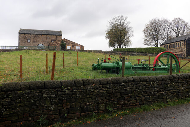
Despite its small size, Boarshurst boasts a close-knit community that takes pride in preserving its historical charm. The village is adorned with traditional stone-built houses and a quaint parish church, reflecting its rural character. Residents often gather at the local pub, the Boar's Head Inn, which has been serving the community for generations.

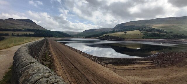
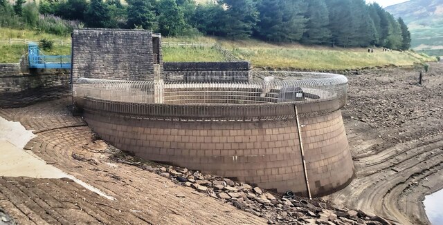
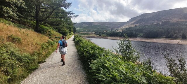
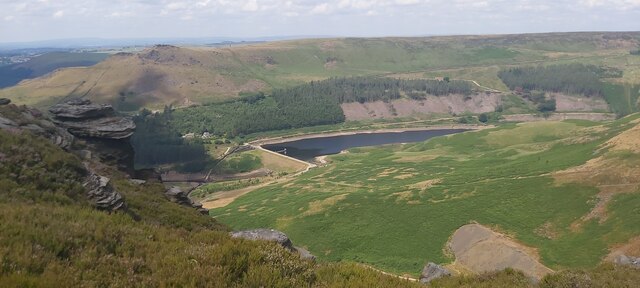
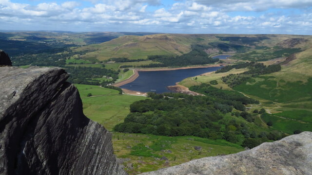
Nature enthusiasts will find solace in the surrounding landscape, as Boarshurst is located near several nature reserves and walking trails. The nearby Dovestone Reservoir, nestled in the scenic Peak District National Park, offers breathtaking views and is a popular spot for hiking, birdwatching, and fishing.

Boarshurst may be small in size, but its tranquil ambiance, strong sense of community, and natural beauty make it a hidden gem in the heart of Yorkshire.

If you have any feedback on the listing, please let us know in the comments section below.
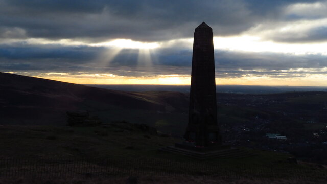
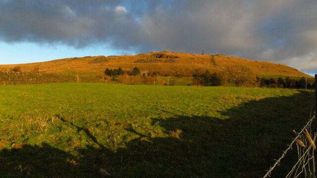
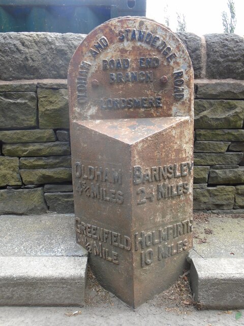
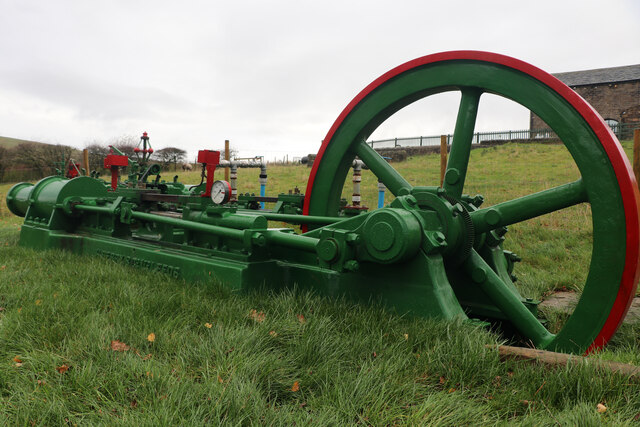
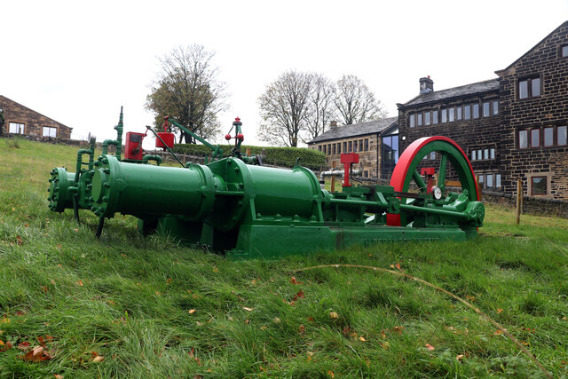
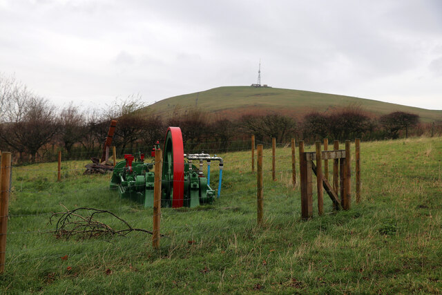
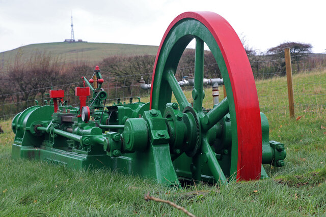
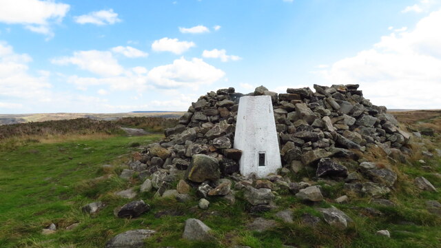
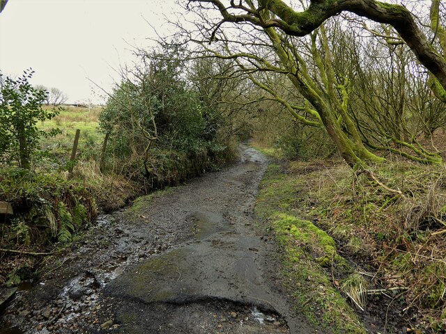
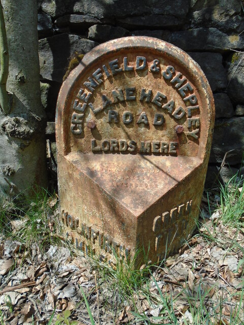
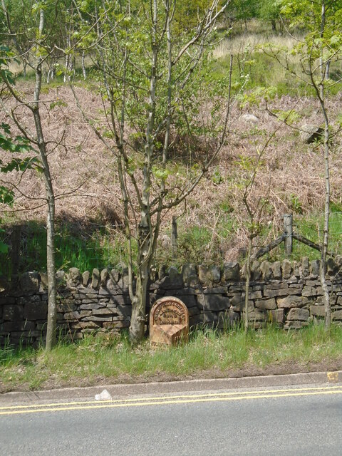
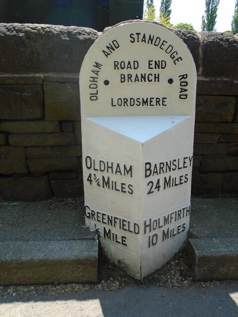
Boarshurst Images

Images are sourced within 2km of 53.535794/-1.998458 or Grid Reference SE0004. Thanks to Geograph Open Source API. All images are credited.

Pots & Pans Monument & Greenfield This war memorial was erected in 1923 to honour the 259 people from the villages of Saddleworth who died during the first world war and was located here specifically to be visible from the villages in the area. When plans were submitted for the war memorial there was much opposition from local people who wanted a memorial in the village rather than on top of a bleak hill.
Pots & Pans Monument & Greenfield
This war memorial was erected in 1923 to honour the 259 people from the villages of Saddleworth who died during the first world war and was located here specifically to be visible from the villages in the area. When plans were submitted for the war memorial there was much opposition from local people who wanted a memorial in the village rather than on top of a bleak hill.
Late afternoon sunlight on Pots & Pans Monument near Greenfield
Old milestone This milestone is not quite like any of the other late 19C West Riding CC milestones so may be an early replacement.  There is no raised edge to the top section and the lettering is a different style.   It is on the A669 Chew Valley Road near St Mary's CE school.   This area was once in the West Riding but now Greater Manchester.
Old milestone
This milestone is not quite like any of the other late 19C West Riding CC milestones so may be an early replacement. There is no raised edge to the top section and the lettering is a different style. It is on the A669 Chew Valley Road near St Mary's CE school. This area was once in the West Riding but now Greater Manchester.
Dove Stone Reservoir in drought The first six months of 2022 are the driest in the UK since 1976
Dove Stone Reservoir in drought
The first six months of 2022 are the driest in the UK since 1976
Redundant Reservoir Overflow Drain at Dove Stone Reservoir The first six months of 2022 are the driest since 1976
Redundant Reservoir Overflow Drain at Dove Stone Reservoir
The first six months of 2022 are the driest since 1976
Footpath by Dove Stone Reservoir
Yeoman Hey Reservoir from above Ashway Gap
A surprising find, Kinders Lane, Greenfield The building on the left is Dolefield Barn while on the right is part of Fur Lane Farm with a building looking like a former weaver's cottage. The surprise was the green and red lump in the field. This is a steam powered hydraulic pumping engine by Henry Berry of Leeds. It is a horizontal twin tandem compound steam engine with four single acting hydraulic pumps straddling the Laird type crosshead guides on each side. It can apparently be run on compressed air. It was recovered from a scrapyard in the Doncaster area and has been named 'Proud Mary'. It bears an uncanny resemblance to the engine that was at Storey Brothers xylonite works at Cattawade in Suffolk and it is very tempting to think it is the same as it is such an unusual beast. This is the engine at Cattawade - <a href="https://www.geograph.org.uk/photo/1649917">TM1032 : Steam hydraulic pumping engine</a>.
A surprising find, Kinders Lane, Greenfield
The building on the left is Dolefield Barn while on the right is part of Fur Lane Farm with a building looking like a former weaver's cottage. The surprise was the green and red lump in the field. This is a steam powered hydraulic pumping engine by Henry Berry of Leeds. It is a horizontal twin tandem compound steam engine with four single acting hydraulic pumps straddling the Laird type crosshead guides on each side. It can apparently be run on compressed air. It was recovered from a scrapyard in the Doncaster area and has been named 'Proud Mary'. It bears an uncanny resemblance to the engine that was at Storey Brothers xylonite works at Cattawade in Suffolk and it is very tempting to think it is the same as it is such an unusual beast. This is the engine at Cattawade - TM1032 : Steam hydraulic pumping engine.
Proud Mary, Kinders Lane, Greenfield This is a steam powered hydraulic pumping engine by Henry Berry of Leeds. It is a horizontal twin tandem compound steam engine with four single acting hydraulic pumps straddling the Laird type crosshead guides on each side. It can apparently be run on compressed air. It was recovered from a scrapyard in the Doncaster area and has been named 'Proud Mary'. It bears an uncanny resemblance to the engine that was at Storey Brothers xylonite works at Cattawade in Suffolk and it is very tempting to think it is the same as it is such an unusual beast. This is the engine at Cattawade - <a href="https://www.geograph.org.uk/photo/1649917">TM1032 : Steam hydraulic pumping engine</a>.
Proud Mary, Kinders Lane, Greenfield
This is a steam powered hydraulic pumping engine by Henry Berry of Leeds. It is a horizontal twin tandem compound steam engine with four single acting hydraulic pumps straddling the Laird type crosshead guides on each side. It can apparently be run on compressed air. It was recovered from a scrapyard in the Doncaster area and has been named 'Proud Mary'. It bears an uncanny resemblance to the engine that was at Storey Brothers xylonite works at Cattawade in Suffolk and it is very tempting to think it is the same as it is such an unusual beast. This is the engine at Cattawade - TM1032 : Steam hydraulic pumping engine.
Proud Mary, Kinders Lane, Greenfield This is a steam powered hydraulic pumping engine by Henry Berry of Leeds. It is a horizontal twin tandem compound steam engine with four single acting hydraulic pumps straddling the Laird type crosshead guides on each side. It can apparently be run on compressed air. It was recovered from a scrapyard in the Doncaster area and has been named 'Proud Mary'. It bears an uncanny resemblance to the engine that was at Storey Brothers xylonite works at Cattawade in Suffolk and it is very tempting to think it is the same as it is such an unusual beast. This is the engine at Cattawade - <a href="https://www.geograph.org.uk/photo/1649917">TM1032 : Steam hydraulic pumping engine</a>. The engine does really slope with the flywheel end being lower.
Proud Mary, Kinders Lane, Greenfield
This is a steam powered hydraulic pumping engine by Henry Berry of Leeds. It is a horizontal twin tandem compound steam engine with four single acting hydraulic pumps straddling the Laird type crosshead guides on each side. It can apparently be run on compressed air. It was recovered from a scrapyard in the Doncaster area and has been named 'Proud Mary'. It bears an uncanny resemblance to the engine that was at Storey Brothers xylonite works at Cattawade in Suffolk and it is very tempting to think it is the same as it is such an unusual beast. This is the engine at Cattawade - TM1032 : Steam hydraulic pumping engine. The engine does really slope with the flywheel end being lower.
Proud Mary, Kinders Lane, Greenfield This is a steam powered hydraulic pumping engine by Henry Berry of Leeds. It is a horizontal twin tandem compound steam engine with four single acting hydraulic pumps straddling the Laird type crosshead guides on each side. It can apparently be run on compressed air. It was recovered from a scrapyard in the Doncaster area and has been named 'Proud Mary'. It bears an uncanny resemblance to the engine that was at Storey Brothers xylonite works at Cattawade in Suffolk and it is very tempting to think it is the same as it is such an unusual beast. This is the engine at Cattawade - <a href="https://www.geograph.org.uk/photo/1649917">TM1032 : Steam hydraulic pumping engine</a>.
Proud Mary, Kinders Lane, Greenfield
This is a steam powered hydraulic pumping engine by Henry Berry of Leeds. It is a horizontal twin tandem compound steam engine with four single acting hydraulic pumps straddling the Laird type crosshead guides on each side. It can apparently be run on compressed air. It was recovered from a scrapyard in the Doncaster area and has been named 'Proud Mary'. It bears an uncanny resemblance to the engine that was at Storey Brothers xylonite works at Cattawade in Suffolk and it is very tempting to think it is the same as it is such an unusual beast. This is the engine at Cattawade - TM1032 : Steam hydraulic pumping engine.
Proud Mary, Kinders Lane, Greenfield This is a steam powered hydraulic pumping engine by Henry Berry of Leeds. It is a horizontal twin tandem compound steam engine with four single acting hydraulic pumps straddling the Laird type crosshead guides on each side. It can apparently be run on compressed air. It was recovered from a scrapyard in the Doncaster area and has been named 'Proud Mary'. It bears an uncanny resemblance to the engine that was at Storey Brothers xylonite works at Cattawade in Suffolk and it is very tempting to think it is the same as it is such an unusual beast
Proud Mary, Kinders Lane, Greenfield
This is a steam powered hydraulic pumping engine by Henry Berry of Leeds. It is a horizontal twin tandem compound steam engine with four single acting hydraulic pumps straddling the Laird type crosshead guides on each side. It can apparently be run on compressed air. It was recovered from a scrapyard in the Doncaster area and has been named 'Proud Mary'. It bears an uncanny resemblance to the engine that was at Storey Brothers xylonite works at Cattawade in Suffolk and it is very tempting to think it is the same as it is such an unusual beast
Trig Point on Alphin
Dove Stone Reservoir from Wimberry Stones
Shaws Lane The lane changes from a well surfaced route to a rough track at this point
Shaws Lane
The lane changes from a well surfaced route to a rough track at this point
Old milestone This West Riding CC milestone dated 1893/94 was painted in 2010 but not dug out.   Now virtually all traces of paint except on the legends have been weathered away.   Under ground level on the left face is BARNSLEY/23 MILES and on the right OLDHAM 5¾ MILES.   This area was in the West Riding until 1974 when it was 'given away'.  The milestone is Grade II listed.
Old milestone
This West Riding CC milestone dated 1893/94 was painted in 2010 but not dug out. Now virtually all traces of paint except on the legends have been weathered away. Under ground level on the left face is BARNSLEY/23 MILES and on the right OLDHAM 5¾ MILES. This area was in the West Riding until 1974 when it was 'given away'. The milestone is Grade II listed.
Old milestone The milestone below the hillside up to Alderman's Hill.  And the tree has grown too.
Old milestone
The milestone below the hillside up to Alderman's Hill. And the tree has grown too.
Old milestone This milestone on Chew Valley Road near a pedestrian crossing at St Mary's CE school has been painted since 2022.   Although very similar to the West Riding CC milestones this forging may be an early replacement.   The style of lettering is slightly different and it doesn't have the maker's name on the bevel.
Old milestone
This milestone on Chew Valley Road near a pedestrian crossing at St Mary's CE school has been painted since 2022. Although very similar to the West Riding CC milestones this forging may be an early replacement. The style of lettering is slightly different and it doesn't have the maker's name on the bevel.
Show me another place!

Boarshurst is located at Grid Ref: SE0004 (Lat: 53.535794, Lng: -1.998458)

Division: West Riding

Unitary Authority: Oldham

Police Authority: Greater Manchester

What 3 Words

///enclosing.enter.soonest. Near Mossley, Manchester

Related Wikis

Huddersfield Narrow Canal

The Huddersfield Narrow Canal is an inland waterway in northern England. It runs just under 20 miles (32 km) from Lock 1E at the rear of the University...

Greenfield, Greater Manchester

Greenfield is a village in the civil parish of Saddleworth in the Metropolitan Borough of Oldham, in Greater Manchester, England. It is 4 miles (6.4 km...

Friezland railway station

Friezland Railway Station served the Hamlet of Friezland in Saddleworth until closure on 1 January 1917. It was built by the London and North Western Railway...

Greenfield railway station

Greenfield railway station in the village of Greenfield, Greater Manchester, England, is on the Huddersfield Line 12 miles (20 km) northeast of Manchester...

Nearby Amenities

Located within 500m of 53.535794,-1.998458
Greenfield
Is In: Saddleworth, Oldham, Greater Manchester, England, UK
Name Ur: گرینزفیلڈ
Place: village
Source: npe
Wikidata: Q5603930
Lat/Long: 53.5354092/-2.0055825
Mini Roundabout
Direction: clockwise
Lat/Long: 53.5335135/-2.0020032
Bus Stop
Greenfield, Chew Valley Road / opposite Clarence Hotel
Bus: yes
Naptan AtcoCode: 1800ED13551
Naptan Bearing: SE
Naptan CommonName: Chew Valley Road/Clarence Hotel
Naptan Indicator: Grass Verge
Naptan Landmark: CLARENCE HOTEL
Naptan NaptanCode: manapata
Naptan PlusbusZoneRef: MNCRPIC
Naptan ShortCommonName: Clarence Hotel
Naptan Street: Chew Valley Road
Naptan Verified: no
Network: TfGM
Operator: TfGM
Public Transport: platform
Shelter: yes
Source: naptan_import
Lat/Long: 53.5327409/-1.999487
Bus Stop
Greenfield, Chew Valley Road / outside Clarence Hotel
Bench: yes
Bin: no
Bus: yes
Naptan AtcoCode: 1800ED13561
Naptan Bearing: NW
Naptan CommonName: Chew Valley Road/Clarence Hotel
Naptan Indicator: Clarence Hotel
Naptan Landmark: CLARENCE HOTEL
Naptan NaptanCode: manapatd
Naptan PlusbusZoneRef: MNCRPIC
Naptan ShortCommonName: Clarence Hotel
Naptan Street: Chew Valley Road
Naptan Verified: no
Network: TfGM
Operator: TfGM
Public Transport: platform
Shelter: yes
Source: naptan_import
Lat/Long: 53.5327679/-1.9999095
Bus Stop
Greenfield, Chew Valley Road / opposite Central Avenue
Bench: no
Bin: no
Bus: yes
Naptan AtcoCode: 1800ED13571
Naptan Bearing: NW
Naptan CommonName: Chew Valley Road/Central Avenue
Naptan Indicator: Gemini
Naptan Landmark: GEMINI
Naptan NaptanCode: manapatg
Naptan PlusbusZoneRef: MNCRPIC
Naptan ShortCommonName: Central Avenue
Naptan Street: Chew Valley Road
Naptan Verified: no
Network: TfGM
Operator: TfGM
Public Transport: platform
Shelter: no
Source: naptan_import
Lat/Long: 53.534194/-2.0027993
Bus Stop
Greenfield, Chew Valley Road / near Central Avenue
Bench: no
Bus: yes
Naptan AtcoCode: 1800ED13581
Naptan Bearing: SE
Naptan CommonName: Chew Valley Road/Central Avenue
Naptan Indicator: Opp House 154
Naptan Landmark: PARK
Naptan NaptanCode: manapatj
Naptan PlusbusZoneRef: MNCRPIC
Naptan ShortCommonName: Central Avenue
Naptan Street: Chew Valley Road
Naptan Verified: no
Network: TfGM
Operator: TfGM
Public Transport: platform
Shelter: no
Source: naptan_import
Tactile Paving: no
Lat/Long: 53.5340262/-2.0023989
Bus Stop
Greenfield, Chew Valley Road / outside King William IV
Bench: no
Bin: no
Bus: yes
Lit: no
Naptan AtcoCode: 1800ED13591
Naptan Bearing: NW
Naptan CommonName: Chew Valley Road/King William IV
Naptan Indicator: Lampost Ltd
Naptan Landmark: HOUSE 136/138
Naptan NaptanCode: manapatm
Naptan PlusbusZoneRef: MNCRPIC
Naptan ShortCommonName: King William IV
Naptan Street: Chew Valley Road
Naptan Verified: no
Network: TfGM
Operator: TfGM
Public Transport: platform
Shelter: no
Source: naptan_import
Tactile Paving: no
Lat/Long: 53.5351138/-2.0043303
Bus Stop
Greenfield, Chew Valley Road / opposite King William IV
Bench: no
Bin: no
Bus: yes
Lit: yes
Naptan AtcoCode: 1800ED13601
Naptan Bearing: SE
Naptan CommonName: Chew Valley Road/King William IV
Naptan Indicator: O/s House 115
Naptan Landmark: HOUSE 115
Naptan NaptanCode: manapatp
Naptan PlusbusZoneRef: MNCRPIC
Naptan ShortCommonName: King William IV
Naptan Street: Chew Valley Road
Naptan Verified: no
Network: TfGM
Operator: TfGM
Public Transport: platform
Shelter: no
Source: naptan_import
Tactile Paving: no
Lat/Long: 53.5357609/-2.0054921
Bus Stop
Greenfield, Manchester Road / opposite Clarence Hotel
Bus: yes
Naptan AtcoCode: 1800ED45011
Naptan Bearing: W
Naptan CommonName: Manchester Road/Clarence Hotel
Naptan Indicator: Wooden Shelter
Naptan Landmark: HOUSE 3
Naptan NaptanCode: manatpjt
Naptan PlusbusZoneRef: MNCRPIC
Naptan ShortCommonName: Clarence Hotel
Naptan Street: MANCHESTER ROAD
Naptan Verified: no
Network: TfGM
Operator: TfGM
Public Transport: platform
Source: naptan_import
Lat/Long: 53.5322735/-1.9993513
Noexit: yes
Lat/Long: 53.5359491/-2.0008019
Noexit: yes
Lat/Long: 53.5344609/-2.0036666
Noexit: yes
Lat/Long: 53.5347236/-2.0041706
Telephone
Booth: K6
Covered: booth
Lat/Long: 53.532461/-1.999124
Noexit: yes
Lat/Long: 53.5334817/-2.0038408
Post Box
Collection Times: Mo-Fr 09:00; Sa 07:00
Post Box Type: pillar
Ref: OL3 39D
Royal Cypher: GVIR
Royal Cypher Wikidata: Q33102169
Source: survey
Lat/Long: 53.5353915/-2.0049928
Addr Housenumber: 115
Addr Street: Chew Valley Road
Source: Naptan
Lat/Long: 53.5357948/-2.0054528
Generator Method: photovoltaic
Generator Output Electricity: yes
Generator Source: solar
Generator Type: solar_photovoltaic_panel
Location: roof
Power: generator
Lat/Long: 53.5347027/-2.0045228
Generator Method: photovoltaic
Generator Output Electricity: yes
Generator Source: solar
Generator Type: solar_photovoltaic_panel
Location: roof
Power: generator
Lat/Long: 53.5349172/-2.0015756
Crossing
Crossing: zebra
Crossing Island: no
Crossing Markings: zebra
Tactile Paving: yes
Lat/Long: 53.5329938/-2.0004506
Noexit: yes
Lat/Long: 53.5316822/-1.9962418
Playground: slide
Lat/Long: 53.5349799/-2.0055277
Playground: swing
Lat/Long: 53.5348165/-2.0054264
Playground: swing
Lat/Long: 53.5348392/-2.0053768
Playground: climbingframe
Lat/Long: 53.5349101/-2.0056075
Barrier: bollard
Lat/Long: 53.537267/-2.0045236
Barrier: bollard
Bollard: fixed
Lat/Long: 53.5373385/-2.0051575
Barrier: stile
Stile: stepover
Lat/Long: 53.537091/-2.0004486
Material: wood
Power: pole
Lat/Long: 53.5371803/-1.9914523
Material: wood
Power: pole
Lat/Long: 53.5361782/-1.9917617
Post Box
Brand: Royal Mail
Brand Wikidata: Q638098
Operator: Royal Mail
Operator Wikidata: Q638098
Post Box Type: wall
Ref: OL3 147D
Royal Cypher: EIIR
Royal Cypher Wikidata: Q33102113
Lat/Long: 53.5326278/-1.9989299
Grit Bin
Lat/Long: 53.5348645/-1.9929745
Barrier: stile
Material: wood
Step Count: 1
Stile: stepover
Lat/Long: 53.5373005/-1.9961578
Grit Bin
Colour: yellow
Lat/Long: 53.5389941/-1.9981592
Defibrillator
Access: yes
Booth: K6
Covered: booth
Defibrillator Location: Inside telephone box
Emergency: defibrillator
Indoor: no
Man Made: telephone_box
Lat/Long: 53.5353866/-2.0049741
Barrier: stile
Material: wood
Step Count: 1
Stile: stepover
Lat/Long: 53.5369245/-1.9952483
Material: wood
Power: pole
Lat/Long: 53.5388835/-1.9948827
Material: wood
Power: pole
Lat/Long: 53.5388505/-1.993622
Post Office
Greenfield News
Addr City: Greenfield
Addr Housenumber: 125
Addr Postcode: OL3 7JJ
Addr Street: Chew Valley Road
Shop: newsagent
Lat/Long: 53.5356876/-2.0051854
Pharmacy
Well Pharmacy
Brand: Well Pharmacy
Brand Wikidata: Q7726524
Dispensing: yes
Healthcare: pharmacy
Website: https://finder.well.co.uk/store/greenfield-chew-valley-road
Lat/Long: 53.535627/-2.0054898
Byroms
Office: estate_agent
Lat/Long: 53.5354162/-2.0045507
Harrops
Butcher: yes
Fhrs Id: 87769
Outdoor Seating: yes
Shop: farm
Takeaway: yes
Lat/Long: 53.5354876/-2.0046238
Door: hinged
Entrance: main
Lat/Long: 53.5325/-1.999145
Grit Bin
Colour: yellow
Lat/Long: 53.5373368/-2.0038513
Parcel Locker
Brand: InPost
Brand Wikidata: Q3182097
Parcel Mail In: yes
Parcel Pickup: yes
Lat/Long: 53.5342336/-2.0035873
Barrier: kissing_gate
Locked: no
Material: wood
Lat/Long: 53.5364325/-1.9976294
The data included in this document is from www.openstreetmap.org. The data is made available under ODbL.

Have you been to Boarshurst?

Leave your review of Boarshurst below (or comments, questions and feedback).