Tuckingmill

Settlement in Cornwall

England

Tuckingmill

Wheal Grenville Fortesque's shaft and whim The impressive engine house at Fortesque's shaft with the drawing whim beyond. See
<a title="https://www.geograph.org.uk/photo/4131867" href="https://www.geograph.org.uk/photo/4131867">Link</a> for more details.
Wheal Grenville Fortesque's shaft and whim Credit: Richard Bird

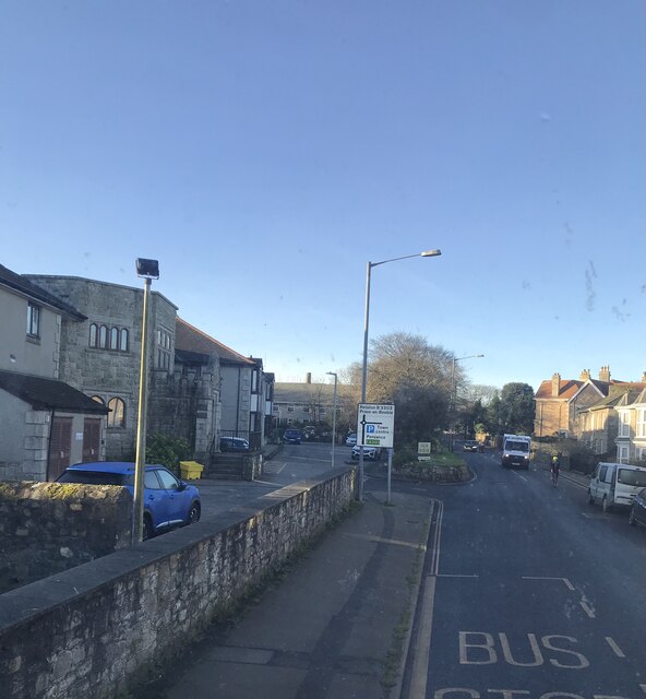
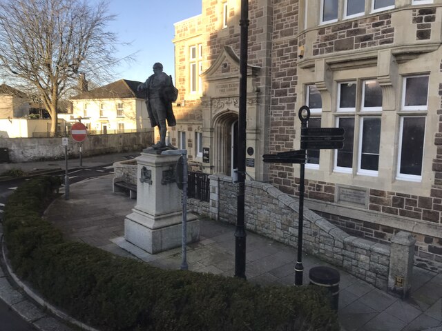
Tuckingmill is a small village situated in the county of Cornwall, in the southwestern region of England. It is located approximately one mile east of Camborne, a larger town in the area. The village is part of the Camborne, Pool, and Redruth conurbation, known for its rich mining history.

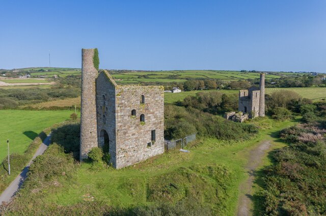
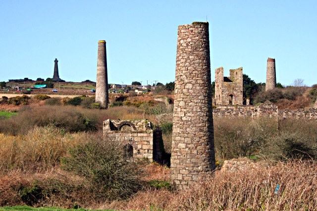
Historically, Tuckingmill was a significant industrial center, thriving during the 19th century due to its involvement in the mining industry. The village was home to various tin and copper mines, which played a crucial role in Cornwall's economy. However, as the mining industry declined, Tuckingmill transitioned into a residential area.

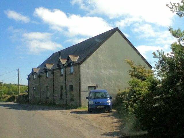
Today, Tuckingmill maintains its charm as a quiet and close-knit community. The village features a mix of period properties and modern houses, providing a range of housing options for its residents. The area is surrounded by picturesque countryside, offering opportunities for outdoor activities such as hiking and cycling.

Despite its small size, Tuckingmill boasts a number of amenities for its residents. These include a local convenience store, a post office, and a primary school, ensuring that the village caters to the needs of its inhabitants. Additionally, the nearby town of Camborne provides further options for shopping, dining, and entertainment.

Tuckingmill's location in Cornwall makes it an ideal base for exploring the region's stunning coastline and beautiful beaches, such as Portreath and Porthtowan. The village also benefits from good transportation links, with easy access to major roads and nearby railway stations.

In summary, Tuckingmill is a quaint village in Cornwall that combines a rich industrial heritage with a peaceful and picturesque setting. It offers a range of amenities and serves as a gateway to the natural beauty of the region.

If you have any feedback on the listing, please let us know in the comments section below.
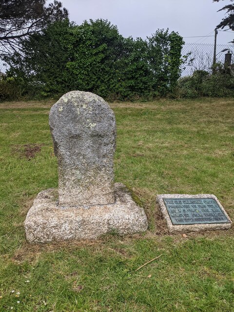
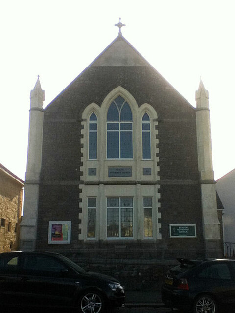
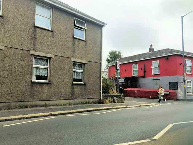
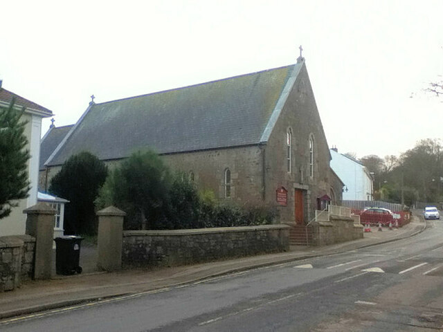
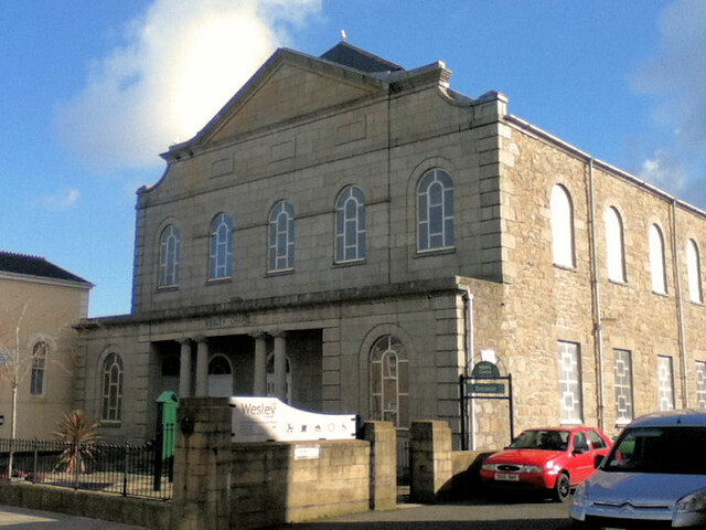
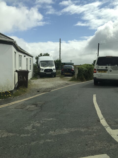
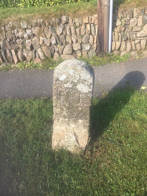
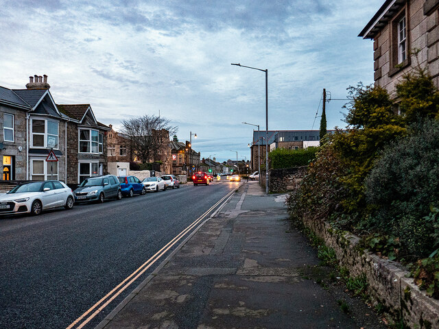
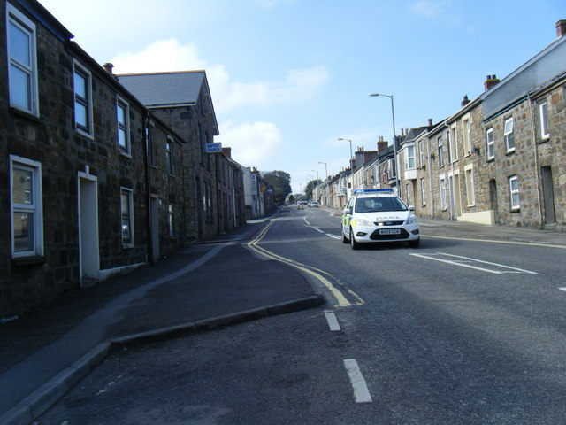
Tuckingmill Images

Images are sourced within 2km of 50.218859/-5.281539 or Grid Reference SW6640. Thanks to Geograph Open Source API. All images are credited.

Wheal Grenville Fortesque's shaft and whim The impressive engine house at Fortesque's shaft with the drawing whim beyond. See
<a title="https://www.geograph.org.uk/photo/4131867" href="https://www.geograph.org.uk/photo/4131867">Link</a> for more details.
Wheal Grenville Fortesque's shaft and whim
The impressive engine house at Fortesque's shaft with the drawing whim beyond. See Link for more details.
Old Wayside Cross in Camborne churchyard Camborne Cross, the head and neck of an old wayside cross moved to Camborne churchyard south of the church in Camborne parish. The cross was originally sited at Camborne Cross SW648398, was moved to Trevu House SW651394 in 1845, and then to its current location in 1935.

Milestone Society National ID: CWKE_CAM05
Old Wayside Cross in Camborne churchyard
Camborne Cross, the head and neck of an old wayside cross moved to Camborne churchyard south of the church in Camborne parish. The cross was originally sited at Camborne Cross SW648398, was moved to Trevu House SW651394 in 1845, and then to its current location in 1935. Milestone Society National ID: CWKE_CAM05
Old Wayside Cross off Chapel Street, Camborne Killivose Cross, also called Trevu Cross number 2, the head of a wayside cross moved inside the railings at the southwest corner of the site of Wesley Chapel on Chapel Street in Camborne parish. Grade II Listed <span class="nowrap"><a title="https://historicengland.org.uk/listing/the-list/list-entry/1142651" rel="nofollow ugc noopener" href="https://historicengland.org.uk/listing/the-list/list-entry/1142651">Link</a><img style="margin-left:2px;" alt="External link" title="External link - shift click to open in new window" src="https://s1.geograph.org.uk/img/external.png" width="10" height="10"/></span> and a Scheduled Monument <span class="nowrap"><a title="https://historicengland.org.uk/listing/the-list/list-entry/1006666" rel="nofollow ugc noopener" href="https://historicengland.org.uk/listing/the-list/list-entry/1006666">Link</a><img style="margin-left:2px;" alt="External link" title="External link - shift click to open in new window" src="https://s1.geograph.org.uk/img/external.png" width="10" height="10"/></span>.

Milestone Society National ID: CWKE_CAM07
Old Wayside Cross off Chapel Street, Camborne
Killivose Cross, also called Trevu Cross number 2, the head of a wayside cross moved inside the railings at the southwest corner of the site of Wesley Chapel on Chapel Street in Camborne parish. Grade II Listed LinkExternal link and a Scheduled Monument LinkExternal link. Milestone Society National ID: CWKE_CAM07
Beacon Methodist Church
Corner of Trevenson Street and  Stray Park Road
Corner of Trevenson Street and Stray Park Road
St John the Baptist RC Church
Camborne Wesley Methodist Church
Bus stop
Bus stop
Camborne Library
Camborne Library
Former chapel
Former chapel
Troon Cemetery
Troon Cemetery
Trevu Road
Trevu Road
Corner of Fore Street and Cadogan Road
Old Boundary Marker on Pendarves Street, Beacon Boundary Marker on the grass verge outside No.62 on the west side of Pendarves Street. Camborne parish. Inscribed N T and S T. The function of this stone is unclear as neither a boundary nor the stone are marked on any OS maps.

Milestone Society National ID: CW_CAMB03bm
Old Boundary Marker on Pendarves Street, Beacon
Boundary Marker on the grass verge outside No.62 on the west side of Pendarves Street. Camborne parish. Inscribed N T and S T. The function of this stone is unclear as neither a boundary nor the stone are marked on any OS maps. Milestone Society National ID: CW_CAMB03bm
Pendarves Road (B3303) Camborne
South Terrace, Camborne
Camborne Library And Richard Trevithick Statue Camborne Library and statue of Richard Trevithick who invented the steam locomotive ''The Puffing Devil''
Camborne Library And Richard Trevithick Statue
Camborne Library and statue of Richard Trevithick who invented the steam locomotive ''The Puffing Devil''
Show me another place!

Tuckingmill is located at Grid Ref: SW6640 (Lat: 50.218859, Lng: -5.281539)

Unitary Authority: Cornwall

Police Authority: Devon and Cornwall

What 3 Words

///renders.pulled.relishes. Near Camborne, Cornwall

Nearby Locations

Tuckingmill Brea

Related Wikis

Dolcoath mine

Dolcoath mine (Cornish: Bal Dorkoth) was a copper and tin mine in Camborne, Cornwall, England, United Kingdom. Its name derives from the Cornish for 'Old...

West Cornwall Bryophytes Site of Special Scientific Interest

The West Cornwall Bryophytes Site of Special Scientific Interest is a group of seven locations of former mining activity, that form a single SSSI and Important...

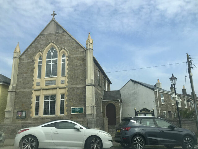
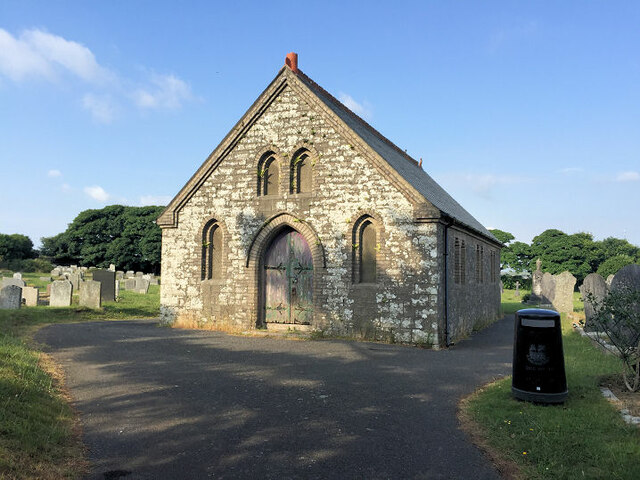
All Saints' Church, Tuckingmill

All Saints’ Church, Tuckingmill is a Grade II listed parish church in the Church of England in Pendarves Street, Tuckingmill, Camborne, Cornwall. ��2...

Tuckingmill, Camborne, Cornwall

Tuckingmill (Cornish: Talgarrek, meaning hill-brow of a rock) is a village in Cornwall, England, United Kingdom, which is in the civil parish of Camborne...

Nearby Amenities

Located within 500m of 50.218859,-5.281539
Traffic Calming: cushion
Lat/Long: 50.2169817/-5.2768855
Bus Stop
Roskear Road
Bench: no
Bus: yes
Description: Markings on the ground, signage on poll with timetable board next to lamp post, opposite number 24
Naptan AtcoCode: 0800COD40997
Naptan Bearing: NE
Naptan CommonName: Roskear Road
Naptan NaptanCode: corajpdm
Naptan PlusbusZoneRef: CBORNE
Naptan Street: Roskear
Public Transport: platform
Shelter: no
Source: naptan_import;survey
Survey Date: 2020-10-20
Tactile Paving: no
Lat/Long: 50.219346/-5.2876296
Bus Stop
South Roskear Terrace
Bench: no
Bus: yes
Description: Markings on the ground, signage on poll with timetable board
Naptan AtcoCode: 0800COD40998
Naptan Bearing: SW
Naptan CommonName: South Roskear Terrace
Naptan Crossing: South Roskear Terrace
Naptan NaptanCode: corajpmt
Naptan PlusbusZoneRef: CBORNE
Naptan Street: Roskear
Public Transport: platform
Shelter: no
Source: naptan_import;survey
Tactile Paving: no
Lat/Long: 50.2197412/-5.286478
Bus Stop
South Roskear Terrace
Bench: no
Bus: yes
Description: Opposite All Saints Church, markings on the ground with a live bus voice box and timetable board
Naptan AtcoCode: 0800COD40999
Naptan Bearing: NE
Naptan CommonName: South Roskear Terrace
Naptan Crossing: Church View Road
Naptan NaptanCode: corajptw
Naptan PlusbusZoneRef: CBORNE
Naptan Street: Pendarves Street
Public Transport: platform
Shelter: no
Source: naptan_import;survey
Survey Date: 2020-10-20
Tactile Paving: no
Lat/Long: 50.2202561/-5.2859433
Bus Stop
Lower Brea
Bench: no
Bin: no
Bus: yes
Description: Signage on lamp post with small time table baord
Naptan AtcoCode: 0800COD41111
Naptan Bearing: NW
Naptan CommonName: Lower Brea
Naptan Indicator: NW-bound
Naptan NaptanCode: corajwgt
Naptan NptgLocalityCode: E0003112
Naptan PlusbusZoneRef: CBORNE
Naptan Street: Tincroft Road
Passenger Information Display: no
Public Transport: platform
Shelter: no
Source: naptan_import;survey
Survey Date: 2020-10-28
Tactile Paving: no
Lat/Long: 50.2165399/-5.2758115
Bus Stop
Lower Brea
Bench: no
Bin: no
Bus: yes
Naptan AtcoCode: 0800COD41112
Naptan Bearing: SE
Naptan CommonName: Lower Brea
Naptan Indicator: SE-bound
Naptan NaptanCode: corajwgw
Naptan NptgLocalityCode: E0003112
Naptan PlusbusZoneRef: CBORNE
Naptan Street: Tincroft Road
Passenger Information Display: no
Public Transport: platform
Shelter: no
Source: naptan_import;survey
Survey Date: 2020-10-28
Tactile Paving: no
Lat/Long: 50.2165772/-5.2757355
Bus Stop
Pendarves Street
Bench: yes
Bus: yes
Description: Between Warrior Warehouse and Speedy hire, live bus times board
Naptan AtcoCode: 0800COD41000
Naptan Bearing: SW
Naptan CommonName: Pendarves Street
Naptan Indicator: SW-bound
Naptan LocalityName: Tuckingmill
Naptan NaptanCode: corajtmd
Naptan NptgLocalityCode: E0003471
Naptan PlusbusZoneRef: CBORNE
Naptan Street: Pendarves Street
Public Transport: platform
Shelter: yes
Source: naptan_import;survey
Survey Date: 2020-10-20
Tactile Paving: no
Lat/Long: 50.2230044/-5.2820427
Bus Stop
Dolcoath Rd
Bench: no
Bus: yes
Naptan AtcoCode: 0800FWX38449
Naptan Bearing: E
Naptan CommonName: Dolcoath Rd
Naptan NaptanCode: corajpgt
Naptan PlusbusZoneRef: CBORNE
Naptan Street: Dolcoath Road
Naptan Verified: no
Public Transport: platform
Shelter: no
Source: naptan_import
Tactile Paving: no
Lat/Long: 50.2168571/-5.2867384
Bus Stop
Dolcoath Rd
Bench: no
Bus: yes
Naptan AtcoCode: 0800FWX38463
Naptan Bearing: W
Naptan CommonName: Dolcoath Rd
Naptan NaptanCode: corajpmg
Naptan PlusbusZoneRef: CBORNE
Naptan Street: Dolcoath Road
Naptan Verified: no
Public Transport: platform
Shelter: no
Source: naptan_import
Tactile Paving: no
Lat/Long: 50.2168074/-5.2867213
Crossing
Bicycle: no
Button Operated: yes
Crossing: traffic_signals
Crossing Island: no
Crossing Ref: pelican
Supervised: no
Tactile Paving: yes
Traffic Signals Sound: yes
Traffic Signals Vibration: no
Lat/Long: 50.2224657/-5.2828677
Crossing
Bicycle: yes
Crossing: unmarked
Crossing Island: no
Crossing Markings: no
Kerb: no
Tactile Paving: no
Lat/Long: 50.2176887/-5.2785859
Crossing
Crossing: uncontrolled
Crossing Island: yes
Tactile Paving: yes
Lat/Long: 50.2163089/-5.2834601
Barrier: stile
Foot: yes
Lat/Long: 50.2219422/-5.2803154
Noexit: yes
Lat/Long: 50.22283/-5.2793002
Crossing
Crossing: uncontrolled
Crossing Island: yes
Tactile Paving: yes
Lat/Long: 50.2160963/-5.2835027
Crossing
Bicycle: yes
Crossing: uncontrolled
Crossing Island: yes
Tactile Paving: yes
Lat/Long: 50.2170113/-5.2830046
Barrier: height_restrictor
Maxheight: 2.2
Lat/Long: 50.217421/-5.2807018
Chimney
Historic: ruins
Lat/Long: 50.2193531/-5.2747875
Priority: backwards
Traffic Calming: choker
Lat/Long: 50.2166493/-5.276004
Barrier: block
Lat/Long: 50.2173096/-5.2779572
Material: wood
Power: pole
Source: GPS;survey;Bing
Lat/Long: 50.2152747/-5.2804514
Material: wood
Power: pole
Source: GPS;survey;Bing
Lat/Long: 50.2161078/-5.2809637
Material: wood
Power: pole
Source: GPS;survey;Bing
Lat/Long: 50.2161799/-5.2810375
Material: wood
Power: pole
Source: GPS;survey;Bing
Lat/Long: 50.2162682/-5.2819454
Material: wood
Power: pole
Source: GPS;survey;Bing
Lat/Long: 50.2169121/-5.2791888
Power: terminal
Source: GPS;survey;Bing
Lat/Long: 50.2171753/-5.2811381
Material: wood
Power: pole
Source: GPS;survey;Bing
Lat/Long: 50.2172096/-5.2810455
Material: wood
Power: pole
Source: GPS;survey;Bing
Lat/Long: 50.2173375/-5.2805239
Material: wood
Power: pole
Source: GPS;survey;Bing
Lat/Long: 50.2173377/-5.2801074
Material: wood
Power: pole
Source: GPS;survey;Bing
Lat/Long: 50.2173967/-5.2802496
Material: wood
Power: pole
Source: GPS;survey;Bing
Lat/Long: 50.2173888/-5.27974
Material: wood
Power: pole
Source: GPS;survey;Bing
Lat/Long: 50.2174903/-5.2815981
Material: wood
Power: pole
Source: GPS;survey;Bing
Lat/Long: 50.2175312/-5.2799532
Material: wood
Power: pole
Source: GPS;survey;Bing
Lat/Long: 50.2175332/-5.2805748
Material: wood
Power: pole
Source: GPS;survey;Bing
Lat/Long: 50.2176953/-5.2810429
Power: pole
Source: GPS;survey;Bing
Lat/Long: 50.2177099/-5.2806606
Material: wood
Power: pole
Source: GPS;survey;Bing
Lat/Long: 50.2182855/-5.2792102
Material: wood
Power: pole
Source: GPS;survey;Bing
Lat/Long: 50.2191668/-5.2756442
Material: wood
Power: pole
Source: GPS;survey;Bing
Lat/Long: 50.219359/-5.2764945
Power: pole
Source: GPS;survey;Bing
Lat/Long: 50.2202806/-5.2772402
Material: wood
Power: pole
Source: GPS;survey;Bing
Lat/Long: 50.2214055/-5.2781736
Material: wood
Power: pole
Source: GPS;survey;Bing
Lat/Long: 50.2216071/-5.2783379
Location Transition: yes
Power: pole
Source: GPS;survey;Bing
Lat/Long: 50.2226214/-5.279048
Historic: mine_shaft
Lat/Long: 50.2152652/-5.2843755
Historic: mine_shaft
Lat/Long: 50.2155877/-5.2840067
Historic: mine_shaft
Lat/Long: 50.2158126/-5.2837412
Historic: mine_shaft
Lat/Long: 50.2164845/-5.2830197
Historic: mine_shaft
Lat/Long: 50.2164828/-5.282899
Historic: mine_shaft
Lat/Long: 50.216614/-5.2824188
Historic: mine_shaft
Lat/Long: 50.2166707/-5.2821393
Historic: mine_shaft
Lat/Long: 50.2166793/-5.2820326
Historic: mine_shaft
Lat/Long: 50.216687/-5.2824336
Historic: mine_shaft
Lat/Long: 50.2177767/-5.2855
Historic: mine_shaft
Lat/Long: 50.2188431/-5.2829365
Historic: mine_shaft
Lat/Long: 50.2193502/-5.2824537
Material: wood
Power: pole
Lat/Long: 50.2152758/-5.2774423
Material: wood
Power: pole
Lat/Long: 50.2157659/-5.2771207
Material: wood
Power: pole
Lat/Long: 50.2163124/-5.2785742
Material: wood
Power: pole
Lat/Long: 50.2163816/-5.2767627
Power: pole
Lat/Long: 50.2165812/-5.27575
Power: pole
Lat/Long: 50.216722/-5.2763669
Crossing
Bicycle: yes
Crossing: uncontrolled
Crossing Island: yes
Tactile Paving: yes
Lat/Long: 50.2173365/-5.2831948
Source: planning application; survey
Lat/Long: 50.2145689/-5.2800469
Source: planning application; survey
Lat/Long: 50.2145383/-5.2799769
Source: planning application; survey
Lat/Long: 50.2146824/-5.2799245
Barrier: cycle_barrier
Lat/Long: 50.2209687/-5.278694
Barrier: cycle_barrier
Lat/Long: 50.2216628/-5.2785056
Turning Circle
Lat/Long: 50.2159032/-5.2845459
Barrier: stile
Stile: squeezer
Lat/Long: 50.2154852/-5.278396
Barrier: stile
Stile: squeezer
Lat/Long: 50.2158913/-5.2793964
Bickford Smith Lawn Bowling Club
Leisure: sports_centre
Lat/Long: 50.221176/-5.2821612
Bench
Backrest: no
Lat/Long: 50.215956/-5.2840562
Bench
Backrest: no
Lat/Long: 50.2159773/-5.2840176
Bench
Backrest: no
Lat/Long: 50.2159827/-5.2839772
Covered: no
Leisure: picnic_table
Lat/Long: 50.2148996/-5.2847504
Bench
Backrest: yes
Lat/Long: 50.2221069/-5.2780905
Bench
Backrest: yes
Lat/Long: 50.2219696/-5.2779315
Bench
Backrest: yes
Lat/Long: 50.2200194/-5.281017
Bench
Backrest: yes
Lat/Long: 50.2198803/-5.2808672
Bench
Backrest: no
Lat/Long: 50.2169785/-5.2832758
Bench
Backrest: no
Lat/Long: 50.2168137/-5.2821855
Bench
Backrest: yes
Lat/Long: 50.2210232/-5.2783594
Addr City: Camborne
Addr Country: GB
Building: service
Pipeline: substation
Substance: gas
Substation: distribution
Lat/Long: 50.217514/-5.2781227
Description: Surface water outlet
Lat/Long: 50.2215316/-5.2796482
Waste Basket
Bin: yes
Waste: trash;dog_excrement
Lat/Long: 50.2189569/-5.2857146
Waste Basket
Bin: yes
Waste: trash;dog_excrement
Lat/Long: 50.2214621/-5.2795744
Barrier: block
Lat/Long: 50.2177022/-5.2787348
Barrier: block
Lat/Long: 50.2176702/-5.278675
Barrier: block
Lat/Long: 50.2176862/-5.2787048
Barrier: block
Lat/Long: 50.2177162/-5.278761
Barrier: block
Lat/Long: 50.2177385/-5.2788026
Barrier: block
Lat/Long: 50.2177543/-5.2788322
Material: wood
Power: pole
Lat/Long: 50.2168811/-5.2804742
Entrance: yes
Lat/Long: 50.2165344/-5.2833751
Entrance: yes
Lat/Long: 50.2169804/-5.283524
Barrier: cycle_barrier
Cycle Barrier: double
Lat/Long: 50.2169139/-5.2836795
Barrier: cycle_barrier
Cycle Barrier: double
Lat/Long: 50.2164383/-5.2835279
Description: clock tower
Historic: ruins
Source: approximate
Lat/Long: 50.2161074/-5.2811113
Barrier: block
Lat/Long: 50.2165088/-5.2819837
Barrier: block
Lat/Long: 50.2164988/-5.2820072
Parking
Access: yes
Capacity: 3
Fee: no
Lit: no
Operator: Cornwall Council
Operator Type: government
Operator Wikidata: Q3774189
Parking: surface
Smoothness: bad
Surface: compacted
Lat/Long: 50.2164807/-5.2819441
Waste Basket
Waste: dog_excrement
Lat/Long: 50.2165052/-5.2820145
Crossing
Bicycle: yes
Crossing: uncontrolled
Crossing Island: yes
Tactile Paving: yes
Lat/Long: 50.2171132/-5.2833503
Crossing
Bicycle: yes
Crossing: uncontrolled
Crossing Island: yes
Tactile Paving: yes
Lat/Long: 50.217225/-5.282839
Entrance: yes
Lat/Long: 50.2170824/-5.282735
Barrier: block
Lat/Long: 50.2164391/-5.2815968
Barrier: block
Lat/Long: 50.2164099/-5.2815505
Bench
Backrest: no
Lat/Long: 50.2149781/-5.2841462
Bench
Backrest: no
Lat/Long: 50.2152673/-5.2846102
Waste Basket
Lat/Long: 50.2152613/-5.2850153
Crossing
Bicycle: yes
Button Operated: no
Crossing: uncontrolled
Crossing Island: no
Kerb: lowered
Tactile Paving: yes
Traffic Signals Sound: no
Lat/Long: 50.215267/-5.2852086
Post Box
Collection Times: Mo-Fr 17:00; Sa 09:15
Operator: Royal Mail
Operator Wikidata: Q638098
Post Box Type: lamp
Ref: TR14 86
Royal Cypher: EIIR
Royal Cypher Wikidata: Q33102113
Lat/Long: 50.2169199/-5.2857974
Fast Food
Golden House 128
Addr City: Camborne
Addr Housenumber: 38
Addr Postcode: TR14 8RF
Addr Street: Pendarves Street
Cuisine: chinese
Fhrs Id: 1107219
Operator: Europe Takeaway
Source Addr: FHRS Open Data
Takeaway: yes
Lat/Long: 50.2215024/-5.2839746
Post Box
Collection Times: Mo-Fr 09:00; Sa 07:00; Su off
Description: In the house wall
Operator: Royal Mail
Operator Wikidata: Q638098
Post Box Design: type_a
Post Box Mounting: building
Post Box Type: wall
Ref: TR14 97D
Royal Cypher: EVIIR
Royal Cypher Wikidata: Q33102324
Source: survey;aerial imagery
Survey Date: 2020-06-21
Lat/Long: 50.22162/-5.2838941
Post Box
Collection Times: Mo-Fr 09:00; Sa 07:00; Su off
Description: In the wall, on the side of Warrior Warehouse
Operator: Royal Mail
Operator Wikidata: Q638098
Post Box Design: type_b
Post Box Mounting: building
Post Box Type: wall
Ref: TR14 83D
Royal Cypher: VR
Royal Cypher Wikidata: Q33102356
Source: survey;aerial imagery
Survey Date: 2020-06-21
Lat/Long: 50.2233198/-5.2811676
Generator Method: photovoltaic
Generator Output Electricity: small_installation
Generator Source: solar
Generator Type: solar_photovoltaic_panel
Location: roof
Power: generator
Source: bing
Lat/Long: 50.2213282/-5.2866608
Generator Method: photovoltaic
Generator Output Electricity: small_installation
Generator Source: solar
Generator Type: solar_photovoltaic_panel
Location: roof
Power: generator
Source: bing
Lat/Long: 50.2229577/-5.2844265
Generator Method: photovoltaic
Generator Output Electricity: small_installation
Generator Source: solar
Generator Type: solar_photovoltaic_panel
Location: roof
Power: generator
Source: bing
Lat/Long: 50.2209704/-5.2835226
Generator Method: photovoltaic
Generator Output Electricity: small_installation
Generator Source: solar
Generator Type: solar_photovoltaic_panel
Location: roof
Power: generator
Source: bing
Lat/Long: 50.2156239/-5.2836286
Generator Method: photovoltaic
Generator Output Electricity: small_installation
Generator Source: solar
Generator Type: solar_photovoltaic_panel
Location: roof
Power: generator
Source: bing
Lat/Long: 50.2147232/-5.2827421
Generator Method: photovoltaic
Generator Output Electricity: small_installation
Generator Source: solar
Generator Type: solar_photovoltaic_panel
Location: roof
Power: generator
Source: bing
Lat/Long: 50.2169494/-5.2867577
Generator Method: photovoltaic
Generator Output Electricity: small_installation
Generator Source: solar
Generator Type: solar_photovoltaic_panel
Location: roof
Power: generator
Source: bing
Lat/Long: 50.2169184/-5.2868227
Generator Method: photovoltaic
Generator Output Electricity: small_installation
Generator Source: solar
Generator Type: solar_photovoltaic_panel
Location: roof
Power: generator
Source: bing
Lat/Long: 50.2160088/-5.2869491
Direction: SE
Generator Method: photovoltaic
Generator Output Electricity: small_installation
Generator Source: solar
Generator Type: solar_photovoltaic_panel
Location: roof
Power: generator
Source: bing
Lat/Long: 50.2144962/-5.2804884
Direction: SW
Generator Method: photovoltaic
Generator Output Electricity: small_installation
Generator Source: solar
Generator Type: solar_photovoltaic_panel
Location: roof
Power: generator
Source: bing
Lat/Long: 50.2145293/-5.2817255
Generator Method: photovoltaic
Generator Output Electricity: small_installation
Generator Source: solar
Generator Type: solar_photovoltaic_panel
Location: roof
Power: generator
Source: bing
Lat/Long: 50.2204822/-5.2865012
Generator Method: photovoltaic
Generator Output Electricity: small_installation
Generator Source: solar
Generator Type: solar_photovoltaic_panel
Location: roof
Power: generator
Source: bing
Lat/Long: 50.218176/-5.2815659
Generator Method: photovoltaic
Generator Output Electricity: small_installation
Generator Source: solar
Generator Type: solar_photovoltaic_panel
Location: roof
Power: generator
Source: bing
Lat/Long: 50.2228393/-5.2825731
Barrier: entrance
Lat/Long: 50.2204064/-5.2857401
Barrier: entrance
Lat/Long: 50.2203329/-5.2858508
Crossing
Crossing: unmarked
Crossing Island: yes
Crossing Markings: no
Kerb: lowered
Lat/Long: 50.2189159/-5.2883909
Barrier: lift_gate
Lat/Long: 50.2159054/-5.2859626
Turning Circle
Lat/Long: 50.2149614/-5.2822311
Bus Stop
Laity Fields
Bench: no
Bin: no
Bus: yes
Covered: no
Description: Signage on lamp post both directions on S bound lamp post, NO waiting area or sidewalk advised to wait on opp sidewalk
Lit: yes
Naptan AtcoCode: 0800COD40987
Naptan Bearing: N
Naptan Indicator: N-bound
Naptan NaptanCode: corajtdg
Passenger Information Display: no
Public Transport: platform
Shelter: no
Source: survey;naptan_data
Survey Date: 2021-04-27
Tactile Paving: no
Lat/Long: 50.2157311/-5.283416
Bus Stop
Laity Fields
Bench: no
Bin: no
Bus: yes
Covered: no
Description: Signage on lamp post both directions, near junction for Laity Fields
Lit: yes
Naptan AtcoCode: 0800COD40988
Naptan Bearing: S
Naptan Indicator: S-bound
Naptan NaptanCode: corajtdw
Passenger Information Display: no
Public Transport: platform
Shelter: no
Source: survey;naptan_data
Survey Date: 2021-04-27
Tactile Paving: no
Lat/Long: 50.215741/-5.2832966
Crossing
Bicycle: yes
Button Operated: no
Crossing: uncontrolled
Crossing Island: no
Horse: yes
Kerb: flush
Supervised: no
Tactile Paving: yes
Traffic Signals Sound: no
Lat/Long: 50.2224281/-5.277425
Crossing
Bicycle: yes
Crossing: uncontrolled
Crossing Island: yes
Kerb: lowered
Supervised: no
Tactile Paving: yes
Lat/Long: 50.2197944/-5.2815874
Barrier: bollard
Bollard: fixed
Lat/Long: 50.2162847/-5.283644
Crossing
Crossing: uncontrolled
Crossing Island: yes
Tactile Paving: yes
Lat/Long: 50.2170851/-5.2837307
Power: pole
Source: GPS;survey;Bing
Lat/Long: 50.2222326/-5.2788582
Location Transition: yes
Material: wood
Power: pole
Source: GPS;survey;Bing
Lat/Long: 50.2192123/-5.2770484
Bench
Backrest: no
Lat/Long: 50.2167682/-5.2821252
Crossing
Bicycle: yes
Crossing: uncontrolled
Crossing Island: yes
Kerb: lowered
Supervised: no
Tactile Paving: yes
Lat/Long: 50.219286/-5.2823094
Turning Circle
Lat/Long: 50.2160877/-5.2839518
Traffic Calming: hump
Lat/Long: 50.2159441/-5.2862846
Traffic Calming: hump
Lat/Long: 50.2160222/-5.2848133
Traffic Calming: hump
Lat/Long: 50.2159822/-5.2855543
Entrance: main
Lat/Long: 50.2154664/-5.2809994
Entrance: main
Lat/Long: 50.215689/-5.2822984
Entrance: main
Lat/Long: 50.2154989/-5.2814493
Barrier: cycle_barrier
Cycle Barrier: double
Lat/Long: 50.2157063/-5.2829084
Traffic Calming: cushion
Lat/Long: 50.2168183/-5.2765627
Source: survey;bing
Traffic Calming: cushion
Lat/Long: 50.2169662/-5.2840028
Source: survey;bing
Traffic Calming: cushion
Lat/Long: 50.2174237/-5.2838645
Source: survey;bing
Traffic Calming: cushion
Lat/Long: 50.218678/-5.2842093
Location: indoor
Power: transformer
Lat/Long: 50.2181739/-5.2845734
Location Transition: yes
Power: pole
Lat/Long: 50.222569/-5.2792418
The data included in this document is from www.openstreetmap.org. The data is made available under ODbL.

Have you been to Tuckingmill?

Leave your review of Tuckingmill below (or comments, questions and feedback).