Tucking Mill

Settlement in Somerset

England

Tucking Mill

Waiting for the cyclists! Work is gradually progressing on converting the old Somerset & Dorset Railway south of Midford into a cycle path. In May 2005 this was the next stretch awaiting the Sustrans treatment.
Waiting for the cyclists! Credit: Ron Strutt

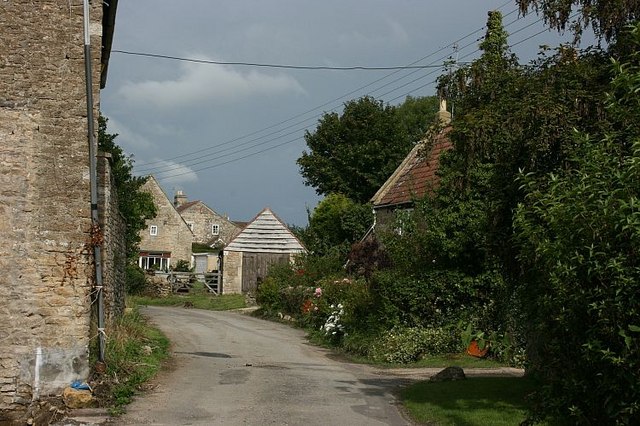
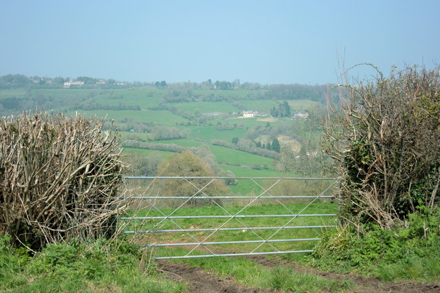
Tucking Mill is a small village located in the county of Somerset, England. Situated approximately 8 miles to the southwest of the city of Bath, it is nestled in a picturesque valley surrounded by rolling hills and scenic countryside.

The village is known for its historical significance, with evidence of human activity dating back to the Roman period. In fact, there are remnants of a Roman villa and a Roman road passing through the area, highlighting the village's rich heritage.

Tucking Mill is home to a close-knit community, with a population of around 400 residents. The village exudes a peaceful and tranquil atmosphere, making it an ideal destination for those seeking a retreat from the hustle and bustle of urban life.

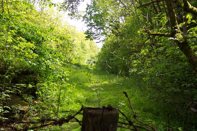
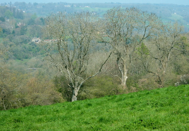
Nature enthusiasts will find plenty to explore in Tucking Mill, as the village is surrounded by an abundance of natural beauty. There are numerous walking and cycling trails that wind through the countryside, offering breathtaking views of the landscape.

Despite its small size, the village has a few amenities to cater to its residents and visitors. These include a local pub, a village hall, and a primary school. For more extensive shopping or entertainment options, the nearby city of Bath provides a range of facilities just a short drive away.

In conclusion, Tucking Mill is a charming and historic village in Somerset, offering a peaceful escape amidst stunning natural surroundings. Its rich heritage, friendly community, and convenient location make it an appealing destination for both residents and visitors alike.

If you have any feedback on the listing, please let us know in the comments section below.

Tucking Mill Images

Images are sourced within 2km of 51.352476/-2.3374075 or Grid Reference ST7661. Thanks to Geograph Open Source API. All images are credited.

Waiting for the cyclists! Work is gradually progressing on converting the old Somerset & Dorset Railway south of Midford into a cycle path. In May 2005 this was the next stretch awaiting the Sustrans treatment.
Waiting for the cyclists!
Work is gradually progressing on converting the old Somerset & Dorset Railway south of Midford into a cycle path. In May 2005 this was the next stretch awaiting the Sustrans treatment.
2007 : Pipehouse The hamlet of Pipehouse is off the A36 Bath to Warminster road, near Limpley Stoke.
There is a pleasant walk from here to Midford with good views to the south and west, though care must be taken as the surface of the bridle way is badly broken up in places due to rain.
OS Explorer 155 is useful.
2007 : Pipehouse
The hamlet of Pipehouse is off the A36 Bath to Warminster road, near Limpley Stoke. There is a pleasant walk from here to Midford with good views to the south and west, though care must be taken as the surface of the bridle way is badly broken up in places due to rain. OS Explorer 155 is useful.
2008 : Pasture near Twinhoe Taken from the lane between Midford and Twinhoe.
The Cam Brook runs through the valley behind the trees, Southstoke is on the other side of the valley and Midford is to the right.
2008 : Pasture near Twinhoe
Taken from the lane between Midford and Twinhoe. The Cam Brook runs through the valley behind the trees, Southstoke is on the other side of the valley and Midford is to the right.
2008 : Field gate on Twinhoe Lane The driveway to Lower Twinhoe Farm is behind us.
Upper Twinhoe with its farms is located on the eastern end of a ridge starting near Midford and running west to Peasedown St.John and beyond.
The two arms of the Somerset Coal Canal were built on either side of the ridge. The canal proper, which went as far as Radford Basin near Timsbury, went through the valley before us. The southern arm, which was part tramway and part canal, went along the valley behind as far as Radstock.
2008 : Field gate on Twinhoe Lane
The driveway to Lower Twinhoe Farm is behind us. Upper Twinhoe with its farms is located on the eastern end of a ridge starting near Midford and running west to Peasedown St.John and beyond. The two arms of the Somerset Coal Canal were built on either side of the ridge. The canal proper, which went as far as Radford Basin near Timsbury, went through the valley before us. The southern arm, which was part tramway and part canal, went along the valley behind as far as Radstock.
2009 : B3110 near the top of Midford Hill Looking toward Midford and Odd Down, then Bath.
2009 : B3110 near the top of Midford Hill
Looking toward Midford and Odd Down, then Bath.
Woodland field boundary
Field of Rape
Field of Rape
Roman road
Roman road
Footpath to Pipehouse
Byway, Pipehouse BOAT (byway open to all traffic) BA 12/34 leaves the hamlet along Pipehouse Lane towards Midford, passing an ash tree.
Byway, Pipehouse
BOAT (byway open to all traffic) BA 12/34 leaves the hamlet along Pipehouse Lane towards Midford, passing an ash tree.
Pipehouse Lane Houses in the hamlet of Pipehouse. I was going to write that this is a no through road for traffic, but the lane becomes a byway open to all traffic at the end of the houses - see <a href="https://www.geograph.org.uk/photo/4843518">ST7759 : Byway, Pipehouse</a> and, if you dare, <span class="nowrap"><a title="https://www.youtube.com/watch?v=xYirDEjkOmo" rel="nofollow ugc noopener" href="https://www.youtube.com/watch?v=xYirDEjkOmo">Link</a><img style="margin-left:2px;" alt="External link" title="External link - shift click to open in new window" src="https://s1.geograph.org.uk/img/external.png" width="10" height="10"/></span> (a You Tube video by a trail biker).
Pipehouse Lane
Houses in the hamlet of Pipehouse. I was going to write that this is a no through road for traffic, but the lane becomes a byway open to all traffic at the end of the houses - see ST7759 : Byway, Pipehouse and, if you dare, LinkExternal link (a You Tube video by a trail biker).
Old village room, Pipehouse As the inscription on the gable says, this house was constructed as a Village Room in 1903. It is now "Chapel House", having closed as a village room in 1975, but it was never a chapel; however, it was "affiliated to Limpley Stoke Baptists Chapel, ... so that the ... children of Pipehouse could attend Sunday School" <span class="nowrap"><a title="http://idox.bathnes.gov.uk/WAM/doc/BackGround%20Papers-557063.pdf?extension=.pdf&id=557063&location=VOLUME2&contentType=application/pdf&pageCount=1" rel="nofollow ugc noopener" href="http://idox.bathnes.gov.uk/WAM/doc/BackGround%20Papers-557063.pdf?extension=.pdf&id=557063&location=VOLUME2&contentType=application/pdf&pageCount=1">Link</a><img style="margin-left:2px;" alt="External link" title="External link - shift click to open in new window" src="https://s1.geograph.org.uk/img/external.png" width="10" height="10"/></span> .
Old village room, Pipehouse
As the inscription on the gable says, this house was constructed as a Village Room in 1903. It is now "Chapel House", having closed as a village room in 1975, but it was never a chapel; however, it was "affiliated to Limpley Stoke Baptists Chapel, ... so that the ... children of Pipehouse could attend Sunday School" LinkExternal link .
Pipehouse The western part of the hamlet.
Pipehouse
The western part of the hamlet.
Path at Pipehouse Placing <a href="https://www.geograph.org.uk/photo/4843929">ST7760 : Barns, Pipehouse</a> in more context, with footpath BA 13/14 crossing the field to reach the gate onto the byway shown in <a href="https://www.geograph.org.uk/photo/4843518">ST7759 : Byway, Pipehouse</a>.
Path at Pipehouse
Placing ST7760 : Barns, Pipehouse in more context, with footpath BA 13/14 crossing the field to reach the gate onto the byway shown in ST7759 : Byway, Pipehouse.
Field near Pipehouse The west side of the field shown in <a href="https://www.geograph.org.uk/photo/4843935">ST7759 : Path at Pipehouse</a>, from the western corner where footpath BA 13/14 enters it. The trees on the right are along Pipehouse Lane, the byway shown in <a href="https://www.geograph.org.uk/photo/4843518">ST7759 : Byway, Pipehouse</a>.
Field near Pipehouse
The west side of the field shown in ST7759 : Path at Pipehouse, from the western corner where footpath BA 13/14 enters it. The trees on the right are along Pipehouse Lane, the byway shown in ST7759 : Byway, Pipehouse.
Path by Hog Wood The kissing gate takes footpath BA 13/14 from the field shown in <a href="https://www.geograph.org.uk/photo/4843940">ST7759 : Field near Pipehouse</a> into an arable field of mud that will force me to abandon the line of the right of way and go round its edge.
Path by Hog Wood
The kissing gate takes footpath BA 13/14 from the field shown in ST7759 : Field near Pipehouse into an arable field of mud that will force me to abandon the line of the right of way and go round its edge.
Course of Roman road west of Pipehouse Not much to see at ground level, though smudges certainly show up in satellite images. This must have been an important trade route between Bath and Poole Harbour, according to <span class="nowrap"><a title="http://archaeologydataservice.ac.uk/archiveDS/archiveDownload?t=arch-886-1/dissemination/pdf/avonarch1-165074_1.pdf" rel="nofollow ugc noopener" href="http://archaeologydataservice.ac.uk/archiveDS/archiveDownload?t=arch-886-1/dissemination/pdf/avonarch1-165074_1.pdf">Link</a><img style="margin-left:2px;" alt="External link" title="External link - shift click to open in new window" src="https://s1.geograph.org.uk/img/external.png" width="10" height="10"/></span> .
Course of Roman road west of Pipehouse
Not much to see at ground level, though smudges certainly show up in satellite images. This must have been an important trade route between Bath and Poole Harbour, according to LinkExternal link .
B3110 near Hogwood Lodge Looking down Midford Hill from the bend by the lodge, where footpath BA 13/14 meets it. On the left is hang Wood; the small belt of trees on the right-hand slope is unnamed on maps.
B3110 near Hogwood Lodge
Looking down Midford Hill from the bend by the lodge, where footpath BA 13/14 meets it. On the left is hang Wood; the small belt of trees on the right-hand slope is unnamed on maps.
Show me another place!

Tucking Mill is located at Grid Ref: ST7661 (Lat: 51.352476, Lng: -2.3374075)

Unitary Authority: Bath and North East Somerset

Police Authority: Avon and Somerset

What 3 Words

///senses.solid.gifts. Near Limpley Stoke, Wiltshire

Related Wikis

Tucking Mill

Tucking Mill is a small hamlet within the parish of Monkton Combe, Somerset, England. It lies on Midford Brook and was a key point on the now disused Somerset...

Combe Down Tunnel

Combe Down Tunnel is on the now-closed Somerset and Dorset Joint Railway main line, between Midford and Bath Green Park railway station, below high ground...

Midford Valley Woods

Midford Valley Woods (grid reference ST769611) is a 60-acre (24.6-hectare) biological Site of Special Scientific Interest between Midford and Limpley Stoke...

Midford Castle

Midford Castle is a folly castle in the village of Midford, and the parish of Southstoke 3 miles (5 km) south of Bath, Somerset, England. The castle was...

Nearby Amenities

Located within 500m of 51.352476,-2.3374075
Barrier: kissing_gate
Lat/Long: 51.3526396/-2.3308461
Barrier: kissing_gate
Lat/Long: 51.3510424/-2.3354862
Barrier: kissing_gate
Lat/Long: 51.3508923/-2.3359411
Barrier: kissing_gate
Lat/Long: 51.350525/-2.3369936
Barrier: entrance
Lat/Long: 51.3499618/-2.3376907
Barrier: kissing_gate
Lat/Long: 51.3561628/-2.3414852
Barrier: stile
Lat/Long: 51.3541483/-2.3404803
Ford: yes
Lat/Long: 51.3544161/-2.3404356
Barrier: kissing_gate
Lat/Long: 51.3533181/-2.3440348
Barrier: kissing_gate
Lat/Long: 51.352558/-2.3405477
Natural: spring
Lat/Long: 51.3557234/-2.341915
Barrier: kissing_gate
Lat/Long: 51.3521926/-2.3388433
Barrier: bollard
Lat/Long: 51.3521462/-2.3387783
Barrier: stile
Lat/Long: 51.3519263/-2.3386357
Barrier: stile
Lat/Long: 51.3520802/-2.3386764
Material: wood
Power: pole
Lat/Long: 51.350616/-2.3407877
Material: wood
Power: pole
Lat/Long: 51.3485554/-2.3402682
Power: pole
Lat/Long: 51.3562776/-2.3404666
Material: wood
Power: pole
Lat/Long: 51.3517433/-2.3410693
Material: wood
Power: pole
Lat/Long: 51.349135/-2.3403988
Material: wood
Power: pole
Lat/Long: 51.3524894/-2.3415179
Material: wood
Power: pole
Lat/Long: 51.3543011/-2.3414931
Material: wood
Power: pole
Lat/Long: 51.3565783/-2.3398652
Material: wood
Power: pole
Lat/Long: 51.3521058/-2.3411719
Material: wood
Power: pole
Lat/Long: 51.3555558/-2.3418835
Material: wood
Power: pole
Lat/Long: 51.3548505/-2.3414905
Power: pole
Lat/Long: 51.3558874/-2.3412163
Material: wood
Power: pole
Lat/Long: 51.3497448/-2.3405597
Barrier: kissing_gate
Lat/Long: 51.354875/-2.3411151
Bench
Lat/Long: 51.3526318/-2.3405642
Bicycle Parking
Capacity: 4
Lat/Long: 51.3526971/-2.3405575
Barrier: kissing_gate
Lat/Long: 51.3539546/-2.3411661
Barrier: kissing_gate
Lat/Long: 51.3528809/-2.3403847
Location: pole
Power: transformer
Lat/Long: 51.348914/-2.3410803
Bench
Lat/Long: 51.3557909/-2.3413611
Information: board
Tourism: information
Lat/Long: 51.3558351/-2.3415098
Bench
Material: wood
Seats: 2
Lat/Long: 51.3526543/-2.3404567
Ford: yes
Lat/Long: 51.3541317/-2.3404735
William Smith stone plaque
Historic: memorial
Inscription: Here lived William Smith "Father of English geology" Born 23rd March 1769, died 28th August 1839.
Material: stone
Memorial: plaque
Openplaques Id: 12985
Lat/Long: 51.3522082/-2.3386503
The data included in this document is from www.openstreetmap.org. The data is made available under ODbL.

Have you been to Tucking Mill?

Leave your review of Tucking Mill below (or comments, questions and feedback).