Bourne End

Settlement in Bedfordshire

England

Bourne End

Blocked track to Bedford Aerodrome It's now a racetrack not an aerodrome and you can't reach it this way. <span class="nowrap"><a title="https://www.bedfordautodrome.co.uk/" rel="nofollow ugc noopener" href="https://www.bedfordautodrome.co.uk/">Link</a><img style="margin-left:2px;" alt="External link" title="External link - shift click to open in new window" src="https://s1.geograph.org.uk/img/external.png" width="10" height="10"/></span>
Blocked track to Bedford Aerodrome Credit: David Howard

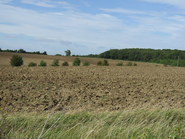
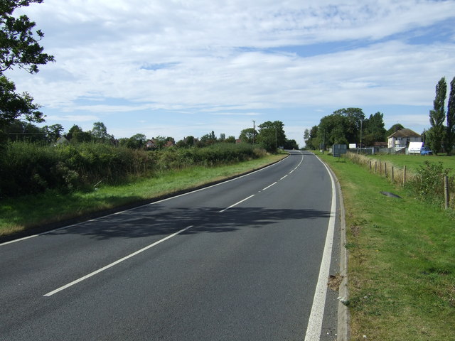
Bourne End is a small village located in the county of Bedfordshire, England. Situated on the eastern edge of the Chiltern Hills, it lies approximately 7 miles east of Leighton Buzzard and 11 miles south of Bedford. The village is characterized by its picturesque rural setting, with rolling hills and beautiful countryside surrounding it.

The settlement of Bourne End dates back to ancient times, with evidence of human habitation in the area dating back to the Iron Age. Over the centuries, the village has grown and developed, but it has managed to retain its quaint and charming character.

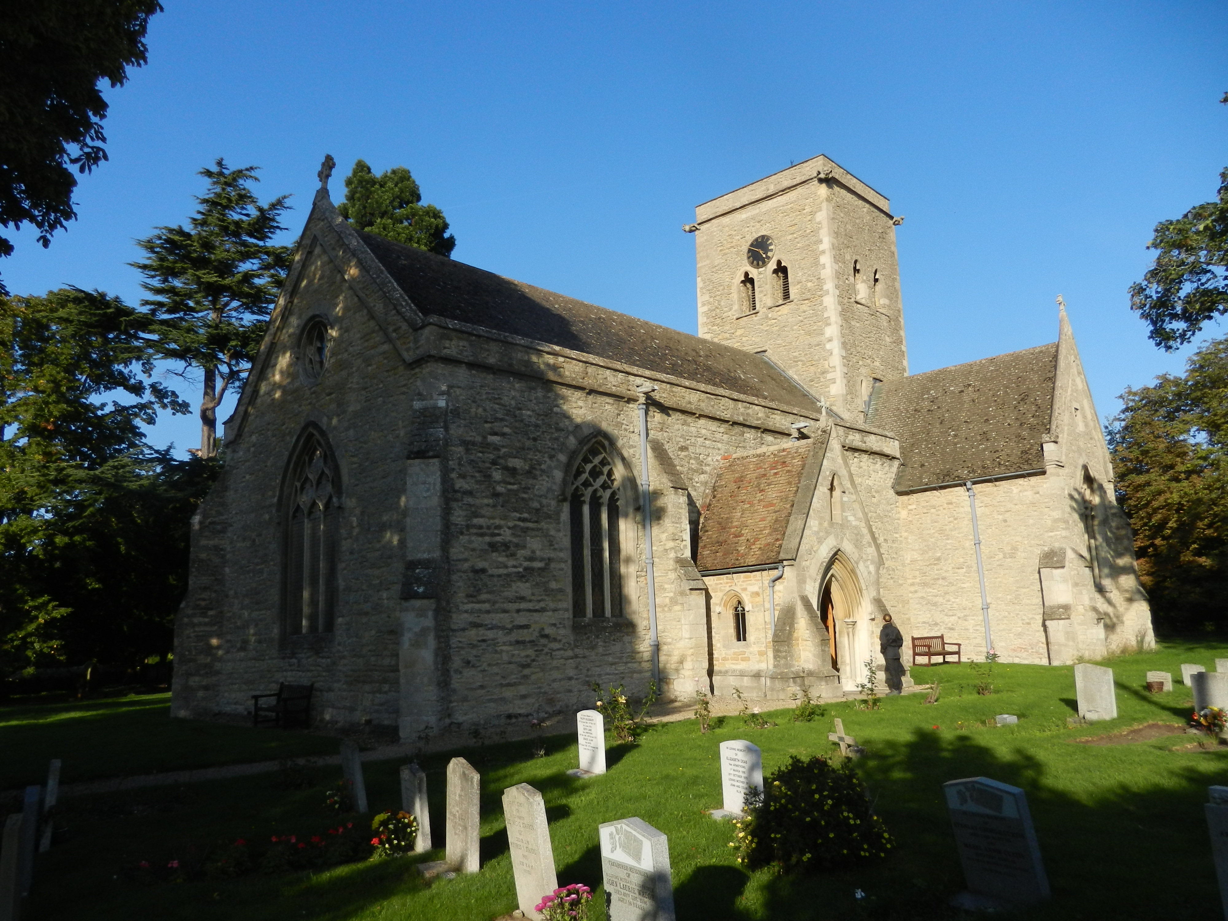
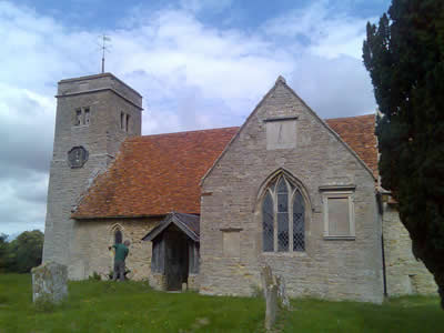
One of the notable landmarks in Bourne End is the St. Mary and All Saints Church, a stunning Grade II listed building that dates back to the 12th century. The church features a beautiful spire and impressive stained glass windows.

In terms of amenities, Bourne End offers a range of facilities to its residents. The village has a primary school, providing education for children in the community. There is also a village hall, which serves as a community hub for various events and activities.

For outdoor enthusiasts, Bourne End offers plenty of opportunities for recreational activities. The surrounding countryside provides a perfect setting for hiking, cycling, and nature walks. Additionally, the nearby Grand Union Canal offers opportunities for boating and fishing.

Overall, Bourne End in Bedfordshire is a tranquil and idyllic village, offering a peaceful and scenic environment for its residents.

If you have any feedback on the listing, please let us know in the comments section below.

Bourne End Images

Images are sourced within 2km of 52.234549/-0.506334 or Grid Reference TL0260. Thanks to Geograph Open Source API. All images are credited.

Blocked track to Bedford Aerodrome It's now a racetrack not an aerodrome and you can't reach it this way. <span class="nowrap"><a title="https://www.bedfordautodrome.co.uk/" rel="nofollow ugc noopener" href="https://www.bedfordautodrome.co.uk/">Link</a><img style="margin-left:2px;" alt="External link" title="External link - shift click to open in new window" src="https://s1.geograph.org.uk/img/external.png" width="10" height="10"/></span>
Blocked track to Bedford Aerodrome
It's now a racetrack not an aerodrome and you can't reach it this way. LinkExternal link
Road towards Bletsoe Heading south.
Road towards Bletsoe
Heading south.
Trees beside the Riseley to Bletsoe road
Farmland, High Barn Farm
Road towards Bourne End
Farmland near Bourne End
Road towards Bourne End
Farmland near Bourne End
Road towards Bourne End and the A6 The A6 is one of the main historic north south roads in England. At 299 miles long it is the fourth longest road in the country. It currently runs from Luton in Bedfordshire to Carlisle in Cumbria, although it formerly started at a junction with the A1 at Barnet.
Wikipedia: <span class="nowrap"><a title="http://en.wikipedia.org/wiki/A6_road_(England)" rel="nofollow ugc noopener" href="http://en.wikipedia.org/wiki/A6_road_(England)">Link</a><img style="margin-left:2px;" alt="External link" title="External link - shift click to open in new window" src="https://s1.geograph.org.uk/img/external.png" width="10" height="10"/></span> 
See also <span class="nowrap"><a title="http://www.sabre-roads.org.uk/wiki/index.php?title=A6" rel="nofollow ugc noopener" href="http://www.sabre-roads.org.uk/wiki/index.php?title=A6">Link</a><img style="margin-left:2px;" alt="External link" title="External link - shift click to open in new window" src="https://s1.geograph.org.uk/img/external.png" width="10" height="10"/></span> for more route detail.
Road towards Bourne End and the A6
The A6 is one of the main historic north south roads in England. At 299 miles long it is the fourth longest road in the country. It currently runs from Luton in Bedfordshire to Carlisle in Cumbria, although it formerly started at a junction with the A1 at Barnet. Wikipedia: LinkExternal link See also LinkExternal link for more route detail.
Farmland towards Temple Wood
Minor road towards the A6 The A6 is one of the main historic north south roads in England. At 299 miles long it is the fourth longest road in the country. It currently runs from Luton in Bedfordshire to Carlisle in Cumbria, although it formerly started at a junction with the A1 at Barnet.
Wikipedia: <span class="nowrap"><a title="http://en.wikipedia.org/wiki/A6_road_(England)" rel="nofollow ugc noopener" href="http://en.wikipedia.org/wiki/A6_road_(England)">Link</a><img style="margin-left:2px;" alt="External link" title="External link - shift click to open in new window" src="https://s1.geograph.org.uk/img/external.png" width="10" height="10"/></span> 
See also <span class="nowrap"><a title="http://www.sabre-roads.org.uk/wiki/index.php?title=A6" rel="nofollow ugc noopener" href="http://www.sabre-roads.org.uk/wiki/index.php?title=A6">Link</a><img style="margin-left:2px;" alt="External link" title="External link - shift click to open in new window" src="https://s1.geograph.org.uk/img/external.png" width="10" height="10"/></span> for more route detail.
Minor road towards the A6
The A6 is one of the main historic north south roads in England. At 299 miles long it is the fourth longest road in the country. It currently runs from Luton in Bedfordshire to Carlisle in Cumbria, although it formerly started at a junction with the A1 at Barnet. Wikipedia: LinkExternal link See also LinkExternal link for more route detail.
Farmland towards kennels
A6 towards Rushden The A6 is one of the main historic north south roads in England. At 299 miles long it is the fourth longest road in the country. It currently runs from Luton in Bedfordshire to Carlisle in Cumbria, although it formerly started at a junction with the A1 at Barnet.
Wikipedia: <span class="nowrap"><a title="http://en.wikipedia.org/wiki/A6_road_(England)" rel="nofollow ugc noopener" href="http://en.wikipedia.org/wiki/A6_road_(England)">Link</a><img style="margin-left:2px;" alt="External link" title="External link - shift click to open in new window" src="https://s1.geograph.org.uk/img/external.png" width="10" height="10"/></span> 
See also <span class="nowrap"><a title="http://www.sabre-roads.org.uk/wiki/index.php?title=A6" rel="nofollow ugc noopener" href="http://www.sabre-roads.org.uk/wiki/index.php?title=A6">Link</a><img style="margin-left:2px;" alt="External link" title="External link - shift click to open in new window" src="https://s1.geograph.org.uk/img/external.png" width="10" height="10"/></span> for more route detail.
A6 towards Rushden
The A6 is one of the main historic north south roads in England. At 299 miles long it is the fourth longest road in the country. It currently runs from Luton in Bedfordshire to Carlisle in Cumbria, although it formerly started at a junction with the A1 at Barnet. Wikipedia: LinkExternal link See also LinkExternal link for more route detail.
In Deadmans Spinney
In Deadmans Spinney
Farmland towards Greenacres
Farmland east of Bourne End
Road towards Riseley
Farmland, Park Farm
Farmland, Park Farm
Show me another place!

Bourne End is located at Grid Ref: TL0260 (Lat: 52.234549, Lng: -0.506334)

Unitary Authority: Bedford

Police Authority: Bedfordshire

What 3 Words

///guidebook.scripted.forces. Near Riseley, Bedfordshire

Nearby Locations

Bourne End

Related Wikis

Sharnbrook railway station

Sharnbrook railway station was opened in 1857 by the Midland Railway to serve the village of Sharnbrook in Bedfordshire, England. It was on the Midland...

RAF Thurleigh

Royal Air Force Thurleigh or more simply RAF Thurleigh is a former Royal Air Force station located 5 miles (8.0 km) north of Bedford, Bedfordshire, England...

RAE Bedford

RAE Bedford was a research site of the Royal Aircraft Establishment between 1946 and 1994. It was located near the village of Thurleigh, north of the town...

Bletsoe Castle

Bletsoe Castle was a late medieval fortified manor house in the village of Bletsoe, Bedfordshire, England. == Details == Bletsoe Castle was created by...

Bedford Autodrome

Bedford Autodrome is an autodrome based on the former site of RAE Bedford, in the village of Thurleigh, Bedfordshire. It is owned by former Formula One...

Bletsoe

Bletsoe is a village and civil parish in Bedfordshire, England. It is on the A6, and about eight miles north of Bedford. The village has a small park,...

Knotting, Bedfordshire

Knotting is a village and former civil parish, now in the parish of Knotting and Souldrop, in the Bedford district, in the ceremonial county of Bedfordshire...

Sharnbrook

Sharnbrook is a village and civil parish located in the Borough of Bedford in Bedfordshire, England, situated around 7 miles (11 km) north-west of Bedford...

Nearby Amenities

Located within 500m of 52.234549,-0.506334
Bourne End
Place: locality
Source: OS_OpenData_StreetView
Lat/Long: 52.2345979/-0.5085235
Power: pole
Lat/Long: 52.2306162/-0.5029746
Power: pole
Lat/Long: 52.2311804/-0.5038609
Power: pole
Lat/Long: 52.231769/-0.5047868
Power: pole
Lat/Long: 52.2322963/-0.5056227
Power: pole
Lat/Long: 52.2328235/-0.5064285
The data included in this document is from www.openstreetmap.org. The data is made available under ODbL.

Have you been to Bourne End?

Leave your review of Bourne End below (or comments, questions and feedback).