Trumpet

Settlement in Herefordshire

England

Trumpet

St Andrew's Church, Pixley Much of the church building is thought to date from the thirteenth century. It is built of local red sandstone on a mound which until fairly recently was surrounded by a moat. The church was extensively restored in 1865. Additional repairs were carried out in the 1980s and again in 2005 when the roof and Victorian turret were renovated.
St Andrew's Church, Pixley Credit: Eirian Evans

Trumpet is a small village located in Herefordshire, a county in the West Midlands region of England. Situated near the border with Wales, Trumpet is nestled in the beautiful countryside, offering stunning scenic views and a tranquil atmosphere.

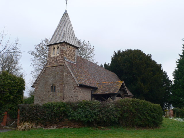
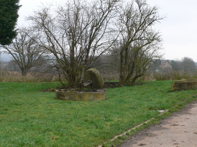
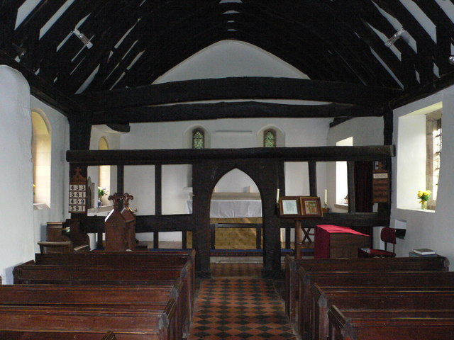
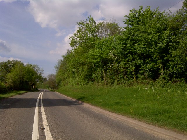
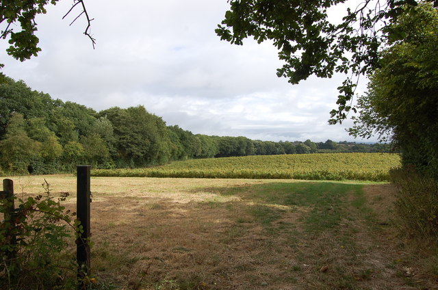
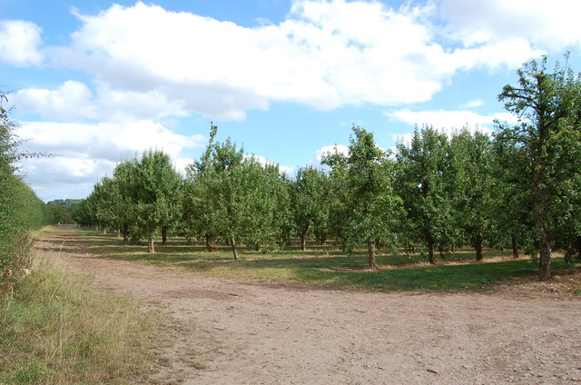
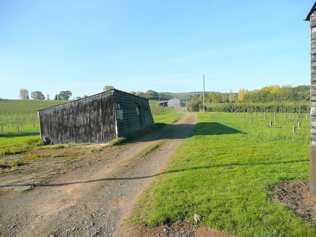
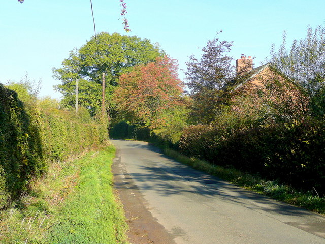
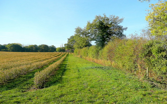
The village is known for its picturesque setting, surrounded by rolling hills and lush green fields. It is a popular destination for those seeking a peaceful retreat away from the hustle and bustle of city life. The area is also renowned for its rich history and heritage, with several historic buildings and landmarks scattered throughout the village.

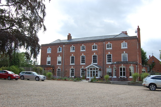
One of the notable attractions in Trumpet is the Trumpet Inn, a charming country pub that has been serving locals and visitors for many years. The inn offers a warm and welcoming atmosphere, with a traditional bar area and a cozy dining room serving delicious meals made from locally sourced ingredients.

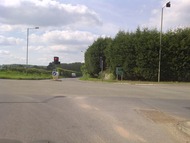
In addition to its natural beauty and historic charm, Trumpet is also a gateway to the Herefordshire countryside, offering easy access to a range of outdoor activities. Visitors can enjoy walking and hiking along the numerous trails and footpaths, exploring the nearby orchards and vineyards, or even trying their hand at fishing in the nearby rivers.

Overall, Trumpet, Herefordshire, is a hidden gem for those seeking a peaceful and idyllic retreat in the heart of the English countryside. Its natural beauty, historic charm, and proximity to outdoor activities make it a perfect destination for nature lovers and history enthusiasts alike.

If you have any feedback on the listing, please let us know in the comments section below.

Trumpet Images

Images are sourced within 2km of 52.053344/-2.5023406 or Grid Reference SO6539. Thanks to Geograph Open Source API. All images are credited.

St Andrew's Church, Pixley Much of the church building is thought to date from the thirteenth century. It is built of local red sandstone on a mound which until fairly recently was surrounded by a moat. The church was extensively restored in 1865. Additional repairs were carried out in the 1980s and again in 2005 when the roof and Victorian turret were renovated.
St Andrew's Church, Pixley
Much of the church building is thought to date from the thirteenth century. It is built of local red sandstone on a mound which until fairly recently was surrounded by a moat. The church was extensively restored in 1865. Additional repairs were carried out in the 1980s and again in 2005 when the roof and Victorian turret were renovated.
Relics of a cider mill An old millstone from the cider mill which used to be at Pixley Court Farm.
Relics of a cider mill
An old millstone from the cider mill which used to be at Pixley Court Farm.
Benchmark on Pixley Church Flush bracket S9688 on the western face of St Andrew's Church.
Benchmark on Pixley Church
Flush bracket S9688 on the western face of St Andrew's Church.
Inside St Andrew's Church, Pixley The little white-washed nave is divided from the white-washed chancel by a screen, its entrance arch (only six feet high) made of naturally curved timbers from some great tree. The screen has three bays and the cross-beam has a patch of neat carving; So have the roof beams which match these venerable timbers. There are no iron nails in the screen, which is fastened together with pegs.
Inside St Andrew's Church, Pixley
The little white-washed nave is divided from the white-washed chancel by a screen, its entrance arch (only six feet high) made of naturally curved timbers from some great tree. The screen has three bays and the cross-beam has a patch of neat carving; So have the roof beams which match these venerable timbers. There are no iron nails in the screen, which is fastened together with pegs.
A4172 at Pixley
A4172 at Pixley
Trumpet Crossroads
Trumpet Crossroads
Land near Birchall
Land near Birchall
Oast cowl at the White House A typical Herefordshire pointed cowl
Oast cowl at the White House
A typical Herefordshire pointed cowl
Verzon House Hotel Boutique Hotel and Restaurant
Verzon House Hotel
Boutique Hotel and Restaurant
Orchard, near The Verzons Apple Orchard
Orchard, near The Verzons
Apple Orchard
Fruit growing at Birchall The predominant crop here is cider apples.
Fruit growing at Birchall
The predominant crop here is cider apples.
Lane at Birchall Looking north towards Poolend.
Lane at Birchall
Looking north towards Poolend.
Fruit crop by Birchall Lane The rows are of blackcurrants, probably for processing.
Fruit crop by Birchall Lane
The rows are of blackcurrants, probably for processing.
Restored barn at Aylton This barn at Aylton Court has undergone a major restoration since I last visited in 2005. <a href="https://www.geograph.org.uk/photo/71425">SO6537 : Old barn at Court Farm, Aylton</a>
Restored barn at Aylton
This barn at Aylton Court has undergone a major restoration since I last visited in 2005. SO6537 : Old barn at Court Farm, Aylton
Aylton church Aylton church dates from the 12th century with later additions and was restored in 1928.
Aylton church
Aylton church dates from the 12th century with later additions and was restored in 1928.
Interior of Aylton church
Barn at Glebe Farm, Putley Wooden barn at Glebe Farm beside the road at Putley.
Barn at Glebe Farm, Putley
Wooden barn at Glebe Farm beside the road at Putley.
Road at Putley Green Country road approaching a junction at Putley Green.
Road at Putley Green
Country road approaching a junction at Putley Green.
Show me another place!

Trumpet is located at Grid Ref: SO6539 (Lat: 52.053344, Lng: -2.5023406)

Unitary Authority: County of Herefordshire

Police Authority: West Mercia

What 3 Words

///splash.mows.tweezers. Near Ledbury, Herefordshire

Related Wikis

Trumpet, Herefordshire

Trumpet or The Trumpet is a village in Herefordshire, England. The village is named after the timber-framed Trumpet Inn. The inn is located at a major...

Pixley, Herefordshire

Pixley is a village and civil parish in Herefordshire, England. The population of the civil parish at the 2011 census was 258. The village consists of...

Ashperton railway station

Ashperton railway station was a railway station serving the village of Ashperton in Herefordshire, England. It was located on what is now known as the...

Munsley

Munsley is a village and civil parish 9 miles (14 km) east of Hereford, in the county of Herefordshire, England. In 2001 the parish had a population of...

Aylton

Aylton is a village in eastern Herefordshire, England. It is 5.5 km (3.4 mi) west of Ledbury. The population of this parish at the 2011 Census was 144...

Ashperton

Ashperton is a small village, parish and former manor about twelve miles east of the City of Hereford, in Herefordshire, England. The village is on the...

Putley

Putley is a village and civil parish 8 miles (13 km) east of Hereford, in the county of Herefordshire, England. In 2011 the parish had a population of...

Upleadon Preceptory

Upleadon Preceptory was a priory in Herefordshire, England at grid reference SO66504270. == References ==

Nearby Amenities

Located within 500m of 52.053344,-2.5023406
Trumpet
Place: hamlet
Source: npe
Wikidata: Q3783964
Lat/Long: 52.0541219/-2.5030088
Bus Stop
Munsley Turn
Naptan AtcoCode: 2090A028660
Naptan Bearing: E
Naptan BusStopType: CUS
Naptan CommonName: Munsley Turn
Naptan Indicator: adj
Naptan Landmark: N/K
Naptan NaptanCode: heratata
Naptan Street: Hereford Road
Naptan Verified: no
Source: naptan_import
Lat/Long: 52.0541653/-2.4952635
Bus Stop
Munsley Turn
Naptan AtcoCode: 2090A028662
Naptan Bearing: W
Naptan BusStopType: CUS
Naptan CommonName: Munsley Turn
Naptan Indicator: opp
Naptan Landmark: N/K
Naptan NaptanCode: heratatd
Naptan Street: Hereford Road
Naptan Verified: no
Source: naptan_import
Lat/Long: 52.0540304/-2.4952912
Bus Stop
Trumpet Inn
Naptan AtcoCode: 2090A071800
Naptan Bearing: E
Naptan CommonName: Trumpet Inn
Naptan Indicator: opp
Naptan Landmark: Bus Shelter.Trumpet Inn PH
Naptan NaptanCode: heradgwp
Naptan Street: A438
Shelter: yes
Source: naptan_import;survey
Lat/Long: 52.0533801/-2.5036783
Bus Stop
Trumpet Inn
Naptan AtcoCode: 2090A071801
Naptan Bearing: N
Naptan BusStopType: CUS
Naptan CommonName: Trumpet Inn
Naptan Indicator: adj
Naptan Landmark: Crossroads
Naptan NaptanCode: heradgwt
Naptan Street: A417 Leominster Road
Naptan Verified: no
Source: naptan_import
Lat/Long: 52.0536813/-2.5034107
Bus Stop
Trumpet Inn
Naptan AtcoCode: 2090A071802
Naptan Bearing: W
Naptan CommonName: Trumpet Inn
Naptan Indicator: adj
Naptan Landmark: Trumpet Inn PH
Naptan NaptanCode: heradjad
Naptan Street: A438 Hereford Road
Source: naptan_import;survey
Lat/Long: 52.0533127/-2.5032209
Bus Stop
Trumpet Inn
Naptan AtcoCode: 2090A18383
Naptan Bearing: S
Naptan BusStopType: CUS
Naptan CommonName: Trumpet Inn
Naptan Indicator: opp
Naptan Landmark: Crossroads
Naptan NaptanCode: heragpjt
Naptan Street: A417 Leominster Road
Naptan Verified: no
Source: naptan_import
Lat/Long: 52.053736/-2.5032217
Post Box
Collection Times: Mo-Fr 15:00; Sa 11:00
Post Box Type: lamp
Ref: HR8 592
Lat/Long: 52.053398/-2.503548
Traffic Signals
Source: bing
Lat/Long: 52.0535996/-2.5031534
Traffic Signals
Source: bing
Lat/Long: 52.0533697/-2.502811
Generator Method: photovoltaic
Generator Output Electricity: yes
Generator Source: solar
Generator Type: solar_photovoltaic_panel
Location: roof
Power: generator
Lat/Long: 52.0530142/-2.5019833
Traffic Signals
Source: bing
Lat/Long: 52.0535683/-2.5026654
Traffic Signals
Source: bing
Lat/Long: 52.0533707/-2.5032893
Mainstone Court
Power: pole
Transformer: distribution
Voltage Primary: 11000
Lat/Long: 52.057003/-2.4991798
Power: pole
Lat/Long: 52.0564299/-2.4986406
Power: pole
Lat/Long: 52.0558003/-2.4985977
Power: pole
Lat/Long: 52.0552226/-2.4985562
Power: pole
Lat/Long: 52.0545448/-2.4985099
Power: pole
Lat/Long: 52.0536294/-2.4981183
Pdrove Organic Foods Trumpet
Power: pole
Transformer: distribution
Voltage Primary: 11000
Lat/Long: 52.0527841/-2.4977823
Power: pole
Lat/Long: 52.0521453/-2.4973284
Power: pole
Lat/Long: 52.0510097/-2.496521
Power: pole
Lat/Long: 52.0516328/-2.5075764
Poolend Pole Pickling Plant
Power: pole
Transformer: distribution
Voltage Primary: 11000
Lat/Long: 52.0517515/-2.506175
Power: pole
Lat/Long: 52.0518942/-2.5046112
Wathouse
Power: pole
Transformer: distribution
Voltage Primary: 11000
Lat/Long: 52.050298/-2.5008846
Power: pole
Lat/Long: 52.0507833/-2.5015562
Power: pole
Lat/Long: 52.0514035/-2.5024678
Power: pole
Lat/Long: 52.0519439/-2.5032574
Power: pole
Lat/Long: 52.0520099/-2.5017225
Power: pole
Lat/Long: 52.0520183/-2.5014932
Power: pole
Lat/Long: 52.0524315/-2.5007039
Trumpet
Power: pole
Transformer: distribution
Voltage Primary: 11000
Lat/Long: 52.0534463/-2.50163
Power: pole
Lat/Long: 52.0529086/-2.5011324
Power: pole
Lat/Long: 52.0520711/-2.5003767
Power: pole
Lat/Long: 52.0521152/-2.4992985
Power: pole
Lat/Long: 52.0517482/-2.4980345
Power: pole
Lat/Long: 52.0514344/-2.4968328
Post Box
Post Box Type: wall
Lat/Long: 52.0526949/-2.5043701
Defibrillator
Defibrillator Location: On wall to right of workshop roller doors.
Emergency: defibrillator
Indoor: no
Lat/Long: 52.0534819/-2.5019754
Barrier: stile
Lat/Long: 52.0545507/-2.4989513
The data included in this document is from www.openstreetmap.org. The data is made available under ODbL.

Have you been to Trumpet?

Leave your review of Trumpet below (or comments, questions and feedback).