Troy Hill

Settlement in Yorkshire

England

Troy Hill

Shops on Town Street, Gildersome Currently comprising a pizza takeaway, laundrette, fish-and-chip shop and sandwich shop.
Shops on Town Street, Gildersome Credit: Stephen Craven

Troy Hill is a small village located in the county of Yorkshire, England. Situated in the picturesque countryside, this rural settlement offers a tranquil and idyllic setting for its residents and visitors alike. With a population of around 500, Troy Hill retains a close-knit community feel, where neighbors know each other by name.

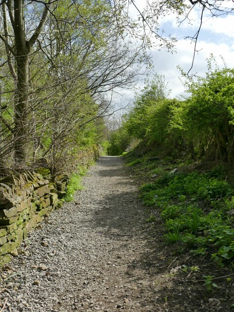
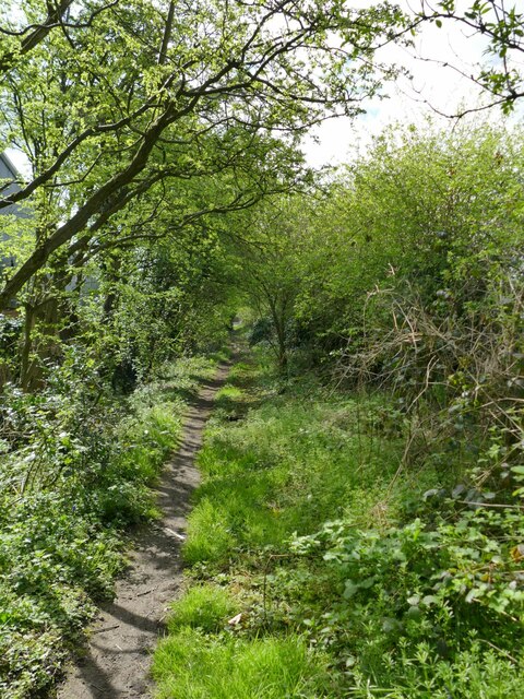
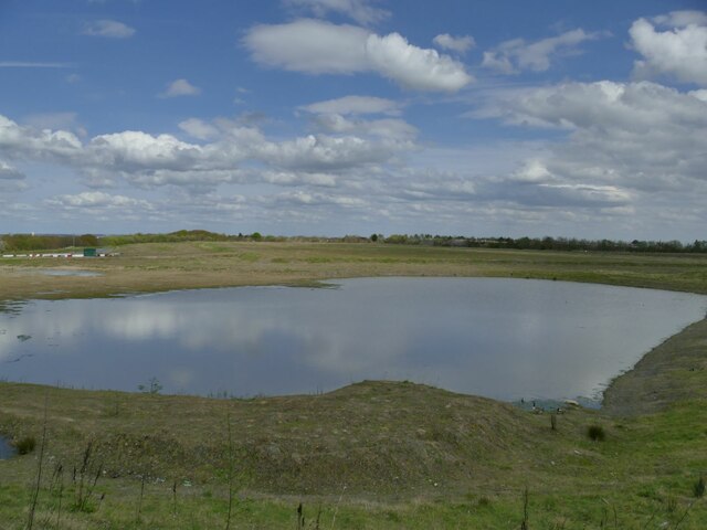
The village is characterized by its charming stone houses and traditional cottages, which are nestled along narrow lanes and surrounded by rolling green hills. The landscape surrounding Troy Hill is dominated by lush farmland, providing a scenic backdrop for leisurely walks and outdoor activities. The area is particularly popular with hikers and nature enthusiasts who seek to explore the nearby forests and meandering country trails.

Troy Hill boasts a rich history, with the village center showcasing a range of historical buildings and landmarks. The local church, St. Mary’s, is a notable example of early English architecture and is believed to date back to the 12th century. The village also has a small primary school, serving the educational needs of the local children.

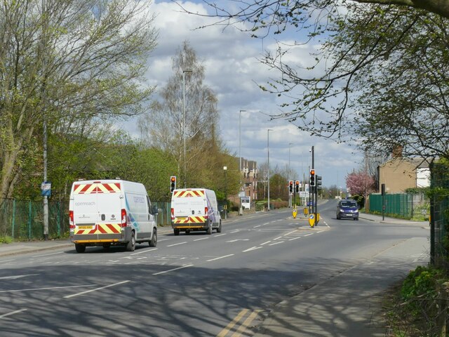
Despite its rural setting, Troy Hill offers convenient access to nearby towns and cities. The bustling market town of York is just a short drive away, offering a range of amenities including shopping centers, restaurants, and cultural attractions. The village is also well-connected via road and public transport links, making it a desirable location for those seeking a peaceful escape from city life without sacrificing convenience.

If you have any feedback on the listing, please let us know in the comments section below.
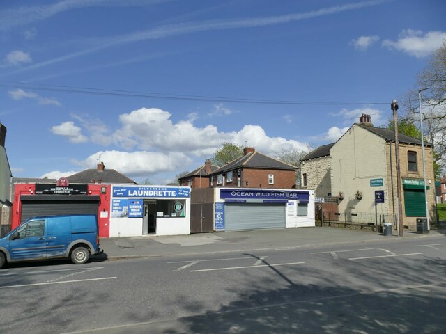
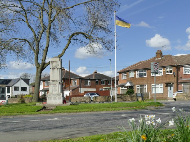
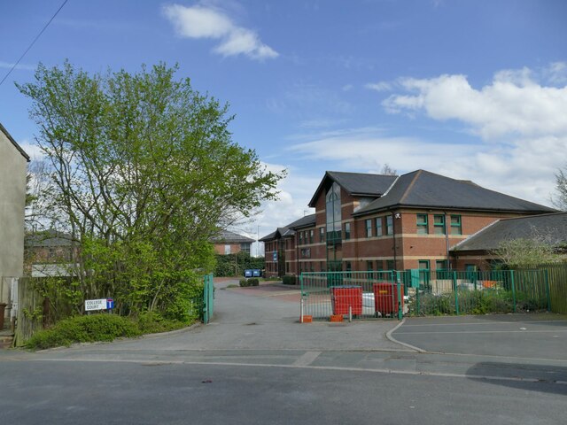
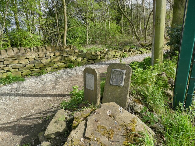
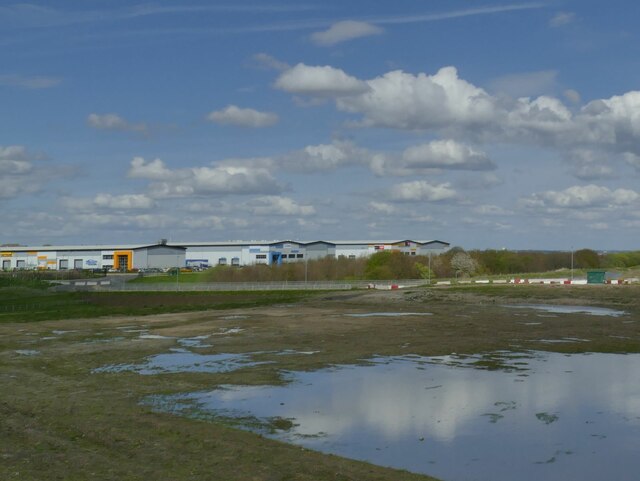
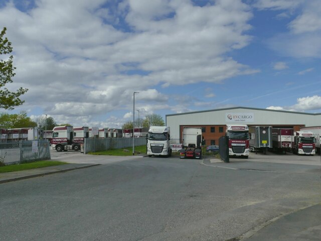
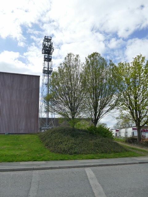
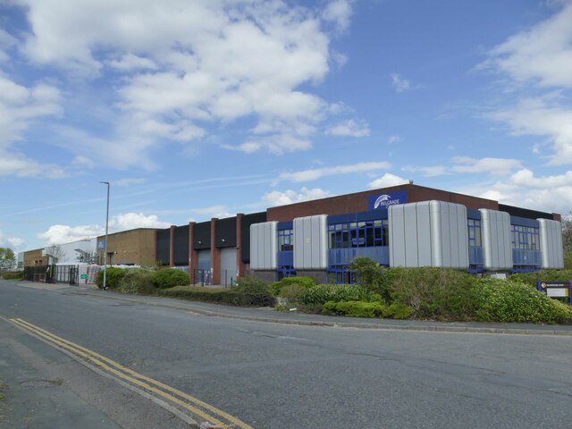
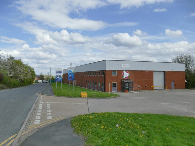
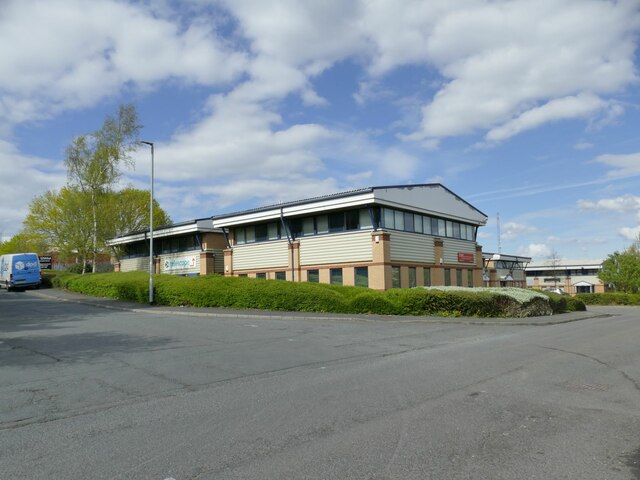
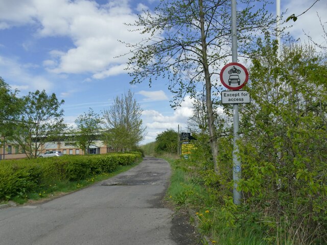
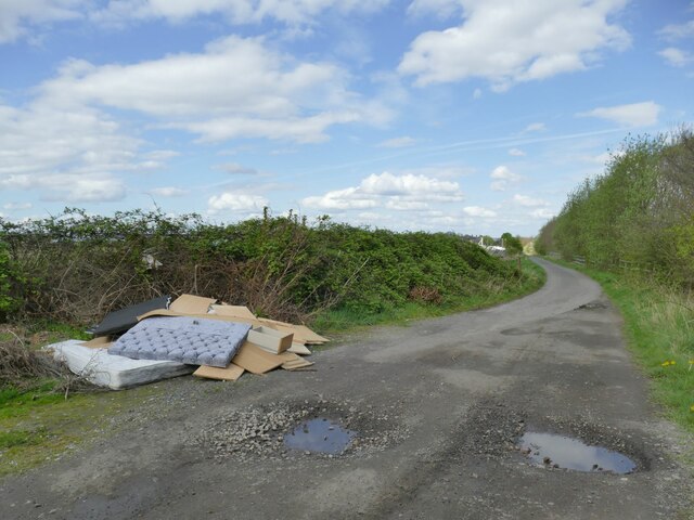
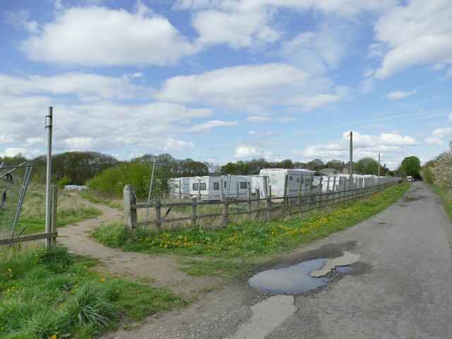
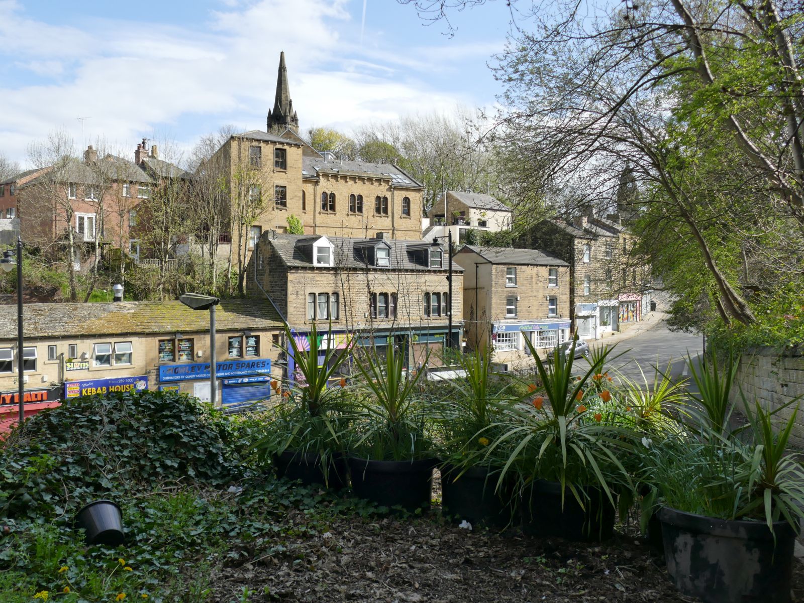
Troy Hill Images

Images are sourced within 2km of 53.752284/-1.599594 or Grid Reference SE2628. Thanks to Geograph Open Source API. All images are credited.

Shops on Town Street, Gildersome Currently comprising a pizza takeaway, laundrette, fish-and-chip shop and sandwich shop.
Shops on Town Street, Gildersome
Currently comprising a pizza takeaway, laundrette, fish-and-chip shop and sandwich shop.
Ukrainian flag, Town Street, Gildersome The flagpole by the war memorial seems to be used for marking particular occasions, as the last time I passed it was flying the NHS flag during the Covid-19 pandemic <a href="https://www.geograph.org.uk/photo/6786905">SE2429 : Gildersome village cenotaph</a>. This time it was marking the war in Ukraine, although the Union flag has also been seen <a href="https://www.geograph.org.uk/photo/6393017">SE2429 : War Memorial, Gildersome</a>.
Ukrainian flag, Town Street, Gildersome
The flagpole by the war memorial seems to be used for marking particular occasions, as the last time I passed it was flying the NHS flag during the Covid-19 pandemic SE2429 : Gildersome village cenotaph. This time it was marking the war in Ukraine, although the Union flag has also been seen SE2429 : War Memorial, Gildersome.
College Court, Gildersome A modern small business park, though Mill Court may have been a better name as it's built on the site of the former Allied Woollens mill.
College Court, Gildersome
A modern small business park, though Mill Court may have been a better name as it's built on the site of the former Allied Woollens mill.
Water valve markers, Gelderd Road, Gildersome Two metal plates indicating valves on a six-inch main belonging to Morley Corporation Water Works.  The MCWW sourced its water from reservoirs in upper Calderdale
Water valve markers, Gelderd Road, Gildersome
Two metal plates indicating valves on a six-inch main belonging to Morley Corporation Water Works. The MCWW sourced its water from reservoirs in upper Calderdale
Stone Pits Lane, off Gelderd Road, Gildersome Part of a public footpath from Gildersome to Bruntcliffe (now cut off by the M621 motorway).
Stone Pits Lane, off Gelderd Road, Gildersome
Part of a public footpath from Gildersome to Bruntcliffe (now cut off by the M621 motorway).
Windmill Lane, Gildersome The windmill itself was in the opposite direction and is long vanished (the site now being part of an industrial estate).
Windmill Lane, Gildersome
The windmill itself was in the opposite direction and is long vanished (the site now being part of an industrial estate).
New junction on Gelderd Road Only the latest maps show this junction, which has been equipped with traffic lights in anticipation of traffic into and out of a new industrial estate (to the right) that's still being developed.
New junction on Gelderd Road
Only the latest maps show this junction, which has been equipped with traffic lights in anticipation of traffic into and out of a new industrial estate (to the right) that's still being developed.
Flooded opencast workings near Gildersome This site is currently being developed as an industrial estate. According to the 2014 planning application available online, "The site has previously been part of a larger site used for opencast coal mining in the 1980s, and has been restored to grassland with some tree planting to the boundary". So what we see here is probably a filled quarry and the water may not actually be very deep.
Flooded opencast workings near Gildersome
This site is currently being developed as an industrial estate. According to the 2014 planning application available online, "The site has previously been part of a larger site used for opencast coal mining in the 1980s, and has been restored to grassland with some tree planting to the boundary". So what we see here is probably a filled quarry and the water may not actually be very deep.
New industrial estate near Gildersome This site is currently being developed as an industrial estate. According to the 2014 planning application available online, "The site has previously been part of a larger site used for opencast coal mining in the 1980s, and has been restored to grassland with some tree planting to the boundary". 

The photo is taken looking roughly along the alignment of a disused railway tunnel running beneath the site: the 2.1km long Gildersome Tunnel on the LNWR's Heaton Lodge and Wortley line (Leeds New Line) built in 1900 and abandoned in 1967, although passenger services ceased in 1953. According to contributor Phill D, When the M62 and M621 were built over it, a section extending from the southern portal was infilled with 30,000 cubic yards of colliery waste for reinforcement, so there is no chance of it being reopened as a cycle route, for example. See <a href="https://www.geograph.org.uk/photo/706925">SE2529 : Gildersome railway tunnel.</a> for one of Phill's photos of the tunnel interior.
New industrial estate near Gildersome
This site is currently being developed as an industrial estate. According to the 2014 planning application available online, "The site has previously been part of a larger site used for opencast coal mining in the 1980s, and has been restored to grassland with some tree planting to the boundary". The photo is taken looking roughly along the alignment of a disused railway tunnel running beneath the site: the 2.1km long Gildersome Tunnel on the LNWR's Heaton Lodge and Wortley line (Leeds New Line) built in 1900 and abandoned in 1967, although passenger services ceased in 1953. According to contributor Phill D, When the M62 and M621 were built over it, a section extending from the southern portal was infilled with 30,000 cubic yards of colliery waste for reinforcement, so there is no chance of it being reopened as a cycle route, for example. See SE2529 : Gildersome railway tunnel. for one of Phill's photos of the tunnel interior.
C M Downton's haulage depot, Stone Pits Lane Built on the site of a former iron foundry.
C M Downton's haulage depot, Stone Pits Lane
Built on the site of a former iron foundry.
Communication mast off Stone Pits Lane The mast is in the heart of an industrial estate but may not be related to any particular business. Rather, the location seems to be strategically chosen as it is on high ground, and within a 1km radius covers the whole of the complex Gildersome Interchange (M62/M621/A62/A650) and a good length of the M621.
Communication mast off Stone Pits Lane
The mast is in the heart of an industrial estate but may not be related to any particular business. Rather, the location seems to be strategically chosen as it is on high ground, and within a 1km radius covers the whole of the complex Gildersome Interchange (M62/M621/A62/A650) and a good length of the M621.
Belgrade Insulation, Stone Pits Lane Part of the Nepshaw Lane industrial estate.
Belgrade Insulation, Stone Pits Lane
Part of the Nepshaw Lane industrial estate.
Pinnacle Group, Nepshaw Lane A facilities management company, located on the Nepshaw Lane industrial estate.
Pinnacle Group, Nepshaw Lane
A facilities management company, located on the Nepshaw Lane industrial estate.
Telescope, Nepshaw Lane South Web and print designers, based on an industrial estate near Morley.
Telescope, Nepshaw Lane South
Web and print designers, based on an industrial estate near Morley.
End of public access, Nepshaw Lane South Vehicle access is restricted from this point northwards for about 550 metres, the lane having public byway status.
End of public access, Nepshaw Lane South
Vehicle access is restricted from this point northwards for about 550 metres, the lane having public byway status.
Flytipping, Nepshaw Lane South Restrictions on vehicle access haven't prevented tipping of old mattresses and furniture.
Flytipping, Nepshaw Lane South
Restrictions on vehicle access haven't prevented tipping of old mattresses and furniture.
Hoarding, Nepshaw Lane South The large developer's hoarding on the edge of the site for a new industrial estate   is probably intended to be seen by drivers on the M621 rather than walkers on the byway immediately adjacent.
Hoarding, Nepshaw Lane South
The large developer's hoarding on the edge of the site for a new industrial estate is probably intended to be seen by drivers on the M621 rather than walkers on the byway immediately adjacent.
Diverted footpath, Nepshaw Lane North The public right of way across what is currently being developed as an industrial estate has been diverted around the perimeter. The path gives access to Dean Wood. To the right is a caravan storage site.
Diverted footpath, Nepshaw Lane North
The public right of way across what is currently being developed as an industrial estate has been diverted around the perimeter. The path gives access to Dean Wood. To the right is a caravan storage site.
Show me another place!

Troy Hill is located at Grid Ref: SE2628 (Lat: 53.752284, Lng: -1.599594)

Division: West Riding

Unitary Authority: Leeds

Police Authority: West Yorkshire

What 3 Words

///festivity.hill.wiping. Near Morley, West Yorkshire

Nearby Locations

Troy Hill Morley Hole

Related Wikis

Morley, West Yorkshire

Morley is a market town and a civil parish within the City of Leeds metropolitan borough, in West Yorkshire, England. Morley is the largest town in the...

Morley and Rothwell (UK Parliament constituency)

Morley and Rothwell was a parliamentary constituency represented in the House of Commons of the Parliament of the United Kingdom. It elected one Member...

Morley and Outwood (UK Parliament constituency)

Morley and Outwood is a constituency in West Yorkshire represented in the House of Commons of the UK Parliament since 2015 by Andrea Jenkyns of the Conservative...

St Mary's in the Wood Church, Morley

St Mary's in the Wood Church is a redundant and former United Reform Church place of worship in Morley, West Yorkshire, England. It was built in 1876...

Nearby Amenities

Located within 500m of 53.752284,-1.599594
Mini Roundabout
Direction: clockwise
Lat/Long: 53.7523523/-1.6002343
Traffic Signals
Morley Bottoms
Source: local knowledge
Lat/Long: 53.7491582/-1.6022523
Turning Circle
Lat/Long: 53.7549329/-1.5986543
Turning Circle
Lat/Long: 53.7539929/-1.6015913
Turning Circle
Lat/Long: 53.7548186/-1.6018095
Turning Circle
Lat/Long: 53.7560391/-1.6029439
Nisa Local
Addr City: Leeds
Addr Postcode: LS27 9NU
Addr Street: Victoria Road
Addr Suburb: Morley
Atm: yes
Fhrs Id: 801129
Shop: convenience
Lat/Long: 53.7522329/-1.6014409
Turning Circle
Lat/Long: 53.7552426/-1.6048068
Fast Food
Nelson Fisheries
Addr City: Leeds
Addr Housenumber: 82
Addr Postcode: LS27 8LU
Addr Street: Church Street
Addr Suburb: Morley
Fhrs Id: 1075879
Lat/Long: 53.7523397/-1.6000237
Pub
Nelson Arms
Addr City: Leeds
Addr Postcode: LS27 8LS
Addr Street: Victoria Road
Addr Suburb: Morley
Fhrs Id: 320743
Lat/Long: 53.7524414/-1.5998202
Telephone
Booth: KX100
Covered: booth
Lat/Long: 53.7525196/-1.6001459
Turning Circle
Source: Bing
Lat/Long: 53.7546698/-1.5970576
Turning Circle
Lat/Long: 53.7523031/-1.5989962
Post Box
Operator: Royal Mail
Post Box Type: pillar
Ref: LS27 987
Lat/Long: 53.7518413/-1.595386
Turning Circle
Lat/Long: 53.7484773/-1.5967713
Turning Circle
Lat/Long: 53.7489292/-1.595804
Post Box
Operator: Royal Mail
Operator Wikidata: Q638098
Post Box Type: lamp
Ref: LS27 441
Royal Cypher: EIIR
Royal Cypher Wikidata: Q33102113
Lat/Long: 53.756408/-1.5988842
Turning Circle
Lat/Long: 53.7562392/-1.5966259
Bus Stop
Elland Road Winterbourne Avenue
Bus: yes
Local Ref: 45010330
Naptan AtcoCode: 450010330
Naptan Bearing: NE
Naptan CommonName: Elland Road Winterbourne Avenue
Naptan Crossing: Winterbourne Avenue
Naptan Indicator: Stop 45010330
Naptan Landmark: Residential Home
Naptan PlusbusZoneRef: LEEDS
Naptan ShortCommonName: Winterbourne Avenue
Naptan Street: Elland Road
Naptan Verified: no
Public Transport: platform
Source: naptan_import
Lat/Long: 53.7559583/-1.5963707
Bus Stop
Victoria Road Church Street
Bus: yes
Local Ref: 45010331
Naptan AtcoCode: 450010331
Naptan Bearing: NE
Naptan CommonName: Victoria Road Church Street
Naptan Crossing: Church Street
Naptan Indicator: Stop 45010331
Naptan Landmark: Nelson Arms PH
Naptan PlusbusZoneRef: LEEDS
Naptan ShortCommonName: Church Street
Naptan Street: Victoria Road
Naptan Verified: yes
Public Transport: platform
Shelter: yes
Source: naptan_import
Timetable: yes
Lat/Long: 53.7527394/-1.5998623
Bus Stop
Church Street Croft House Road
Local Ref: 45010333
Naptan AtcoCode: 450010333
Naptan Bearing: NW
Naptan CommonName: Church Street Croft House Road
Naptan Crossing: Croft House Road
Naptan Indicator: Stop 45010333
Naptan Landmark: Garage
Naptan PlusbusZoneRef: LEEDS
Naptan ShortCommonName: Croft House Road
Naptan Street: Church Street
Naptan Verified: yes
Shelter: yes
Source: naptan_import
Timetable: yes
Towards: Holbeck, Leeds, Middleton, Moor Allerton
Lat/Long: 53.750952/-1.6002584
Bus Stop
Queen Street Dawson Hill
Local Ref: 45010334
Naptan AtcoCode: 450010334
Naptan Bearing: N
Naptan CommonName: Queen Street Dawson Hill
Naptan Crossing: Dawson Hill
Naptan Indicator: Stop 45010334
Naptan PlusbusZoneRef: LEEDS
Naptan ShortCommonName: Dawson Hill
Naptan Street: Queen Street
Naptan Verified: yes
Shelter: yes
Source: naptan_import
Timetable: yes
Lat/Long: 53.7484883/-1.6026929
Bus Stop
Victoria Road King George Street
Bus: yes
Local Ref: 45011357
Naptan AtcoCode: 450011357
Naptan Bearing: SW
Naptan CommonName: Victoria Road King George Street
Naptan Crossing: King George Street
Naptan Indicator: Stop 45011357
Naptan PlusbusZoneRef: LEEDS
Naptan ShortCommonName: King George Street
Naptan Street: Victoria Road
Naptan Verified: no
Public Transport: platform
Source: naptan_import
Lat/Long: 53.7544582/-1.5977681
Bus Stop
Victoria Road Church Street
Bus: yes
Local Ref: 45011358
Naptan AtcoCode: 450011358
Naptan Bearing: SW
Naptan CommonName: Victoria Road Church Street
Naptan Crossing: Church Street
Naptan Indicator: Stop 45011358
Naptan Landmark: Nelson Arms PH
Naptan PlusbusZoneRef: LEEDS
Naptan ShortCommonName: Church Street
Naptan Street: Victoria Road
Naptan Verified: yes
Public Transport: platform
Source: naptan_import
Timetable: yes
Lat/Long: 53.7526669/-1.599681
Bus Stop
Victoria Road Ingle Avenue
Local Ref: 45011359
Naptan AtcoCode: 450011359
Naptan Bearing: NE
Naptan CommonName: Victoria Road Ingle Avenue
Naptan Crossing: Ingle Avenue
Naptan Indicator: Stop 45011359
Naptan PlusbusZoneRef: LEEDS
Naptan ShortCommonName: Ingle Avenue
Naptan Street: Victoria Road
Naptan Verified: no
Shelter: no
Source: naptan_import
Lat/Long: 53.7510811/-1.6039423
Bus Stop
Victoria Road Ingle Avenue
Local Ref: 45011360
Naptan AtcoCode: 450011360
Naptan Bearing: SW
Naptan CommonName: Victoria Road Ingle Avenue
Naptan Crossing: Ingle Avenue
Naptan Indicator: Stop 45011360
Naptan Notes: New TF shelter and 3P tt case fitted
Naptan PlusbusZoneRef: LEEDS
Naptan ShortCommonName: Ingle Avenue
Naptan Street: Victoria Road
Naptan Verified: no
Shelter: yes
Source: naptan_import
Lat/Long: 53.7513186/-1.6031193
Bus Stop
Victoria Road Bank Street
Local Ref: 45011361
Naptan AtcoCode: 450011361
Naptan Bearing: W
Naptan CommonName: Victoria Road Bank Street
Naptan Crossing: Bank Street
Naptan Indicator: Stop 45011361
Naptan PlusbusZoneRef: LEEDS
Naptan ShortCommonName: Bank Street
Naptan Street: Victoria Road
Naptan Verified: no
Source: naptan_import
Lat/Long: 53.7500452/-1.6059842
Bus Stop
Victoria Road Bank Street
Local Ref: 45011362
Naptan AtcoCode: 450011362
Naptan Bearing: E
Naptan CommonName: Victoria Road Bank Street
Naptan Crossing: Bank Street
Naptan Indicator: Stop 45011362
Naptan PlusbusZoneRef: LEEDS
Naptan ShortCommonName: Bank Street
Naptan Street: Victoria Road
Naptan Verified: no
Source: naptan_import
Lat/Long: 53.7500998/-1.6061808
Bus Stop
Queen Street Dawson Hill
Local Ref: 45011084
Naptan AtcoCode: 450011084
Naptan Bearing: S
Naptan CommonName: Queen Street Dawson Hill
Naptan Crossing: Dawson Hill
Naptan Indicator: Stop 45011084
Naptan PlusbusZoneRef: LEEDS
Naptan ShortCommonName: Dawson Hill
Naptan Street: Queen Street
Naptan Verified: yes
Source: naptan_import
Timetable: yes
Lat/Long: 53.7485594/-1.6024496
Bus Stop
Church Street New Bank Street
Local Ref: 45011085
Naptan AtcoCode: 450011085
Naptan Bearing: S
Naptan CommonName: Church Street New Bank Street
Naptan Crossing: New Bank Street
Naptan Indicator: Stop 45011085
Naptan Notes: L/C-A9
Naptan PlusbusZoneRef: LEEDS
Naptan ShortCommonName: New Bank Street
Naptan Street: Church Street
Shelter: no
Source: naptan_import
Timetable: yes
Towards: Morley
Lat/Long: 53.7501318/-1.5995534
Bus Stop
Brunswick Street Bank Street
Local Ref: 45011087
Naptan AtcoCode: 450011087
Naptan Bearing: W
Naptan CommonName: Brunswick Street Bank Street
Naptan Crossing: Bank Street
Naptan Indicator: Stop 45011087
Naptan PlusbusZoneRef: LEEDS
Naptan ShortCommonName: Bank Street
Naptan Street: Brunswick Street
Naptan Verified: yes
Source: naptan_import
Timetable: yes
Lat/Long: 53.7494622/-1.6036391
Bus Stop
Brunswick Street Bank Street
Local Ref: 45011088
Naptan AtcoCode: 450011088
Naptan Bearing: SW
Naptan CommonName: Brunswick Street Bank Street
Naptan Crossing: Bank Street
Naptan Indicator: Stop 45011088
Naptan PlusbusZoneRef: LEEDS
Naptan ShortCommonName: Bank Street
Naptan Street: Brunswick Street
Naptan Verified: yes
Source: naptan_import
Timetable: yes
Lat/Long: 53.7492655/-1.6039594
Bus Stop
New Bank Street Croft House Lane
Local Ref: 45024435
Naptan AtcoCode: 450024435
Naptan Bearing: SW
Naptan CommonName: New Bank Street Croft House Lane
Naptan Crossing: Croft House Lane
Naptan Indicator: Stop 45024435
Naptan Landmark: Industrial Estate
Naptan Notes: Stop moved location - 22/05/07
Naptan PlusbusZoneRef: LEEDS
Naptan ShortCommonName: Croft House Lane
Naptan Street: New Bank Street
Shelter: no
Source: naptan_import
Timetable: yes
Towards: Batley, Dewsbury
Lat/Long: 53.7504526/-1.5934085
Bus Stop
New Bank Street Croft House Grove
Local Ref: 45024436
Naptan AtcoCode: 450024436
Naptan Bearing: W
Naptan CommonName: New Bank Street Croft House Grove
Naptan Crossing: Croft House Grove
Naptan Indicator: Stop 45024436
Naptan PlusbusZoneRef: LEEDS
Naptan ShortCommonName: Croft House Grove
Naptan Street: New Bank Street
Naptan Verified: no
Source: naptan_import
Lat/Long: 53.7499083/-1.5972353
Bus Stop
King George Avenue Victoria Road
Bus: yes
Local Ref: 45024716
Naptan AtcoCode: 450024716
Naptan Bearing: SE
Naptan CommonName: King George Avenue Victoria Road
Naptan Crossing: Victoria Road
Naptan Indicator: Stop 45024716
Naptan Notes: At House No1
Naptan PlusbusZoneRef: LEEDS
Naptan ShortCommonName: Victoria Road
Naptan Street: King George Avenue
Naptan Verified: no
Public Transport: platform
Source: naptan_import
Lat/Long: 53.7544749/-1.5973888
Bus Stop
King George Avenue Croft House Mount
Bus: yes
Local Ref: 45025218
Naptan AtcoCode: 450025218
Naptan Bearing: SE
Naptan CommonName: King George Avenue Croft House Mount
Naptan Crossing: Croft House Mount
Naptan Indicator: Stop 45025218
Naptan PlusbusZoneRef: LEEDS
Naptan ShortCommonName: Croft House Mount
Naptan Street: King George Avenue
Naptan Verified: no
Public Transport: platform
Source: naptan_import
Lat/Long: 53.7537038/-1.5953032
Bus Stop
King George Avenue Croft House Mews
Local Ref: 45025219
Naptan AtcoCode: 450025219
Naptan Bearing: NW
Naptan CommonName: King George Avenue Croft House Mews
Naptan Crossing: Croft House Mews
Naptan Indicator: Stop 45025219
Naptan Notes: L/C-15
Naptan PlusbusZoneRef: LEEDS
Naptan ShortCommonName: Croft House Mews
Naptan Street: King George Avenue
Naptan Verified: no
Source: naptan_import
Lat/Long: 53.751861/-1.5925759
Bus Stop
Ingle Avenue Victoria Road
Local Ref: 45012208
Naptan AtcoCode: 450012208
Naptan Bearing: SE
Naptan CommonName: Ingle Avenue Victoria Road
Naptan Crossing: Victoria Road
Naptan Indicator: Stop 45012208
Naptan Notes: LC-1
Naptan PlusbusZoneRef: LEEDS
Naptan ShortCommonName: Victoria Road
Naptan Street: Ingle Avenue
Naptan Verified: no
Source: naptan_import
Lat/Long: 53.7511189/-1.6044879
Bus Stop
Ingle Avenue Victoria Road
Local Ref: 45050055
Naptan AtcoCode: 450050055
Naptan Bearing: NW
Naptan BusStopType: CUS
Naptan CommonName: Ingle Avenue Victoria Road
Naptan Indicator: Stop 45050055
Naptan PlusbusZoneRef: LEEDS
Naptan ShortCommonName: Victoria Road
Naptan Street: Ingle Avenue
Naptan Verified: no
Source: naptan_import
Lat/Long: 53.7510204/-1.6046102
Pub
Cross Church Street Working Mens Club
Addr City: Leeds
Addr Postcode: LS27 9DX
Addr Street: Victoria Avenue
Fhrs Id: 467316
Lat/Long: 53.7510155/-1.6019534
Noexit: yes
Lat/Long: 53.751292/-1.600492
Noexit: yes
Lat/Long: 53.7513552/-1.6011988
Traffic Signals
Access: yes
Bicycle: yes
Bus: yes
Colour: silver
Foot: yes
Horse: yes
Motor Vehicle: yes
Psv: yes
Traffic Signals: signal
Lat/Long: 53.7489356/-1.6023916
Crossing
Crossing: uncontrolled
Crossing Ref: zebra
Lat/Long: 53.7518696/-1.6017953
Fuel
Brookfields
Addr City: Leeds
Addr Postcode: LS27 9NU
Addr Suburb: Morley
Brand: Shell
Brand Wikidata: Q110716465
Fuel Diesel: yes
Opening Hours: 24/7
Phone: +44 113 238 2500
Ref Navads: NVDS353_12271741
Website: https://find.shell.com/gb/fuel/12271741-morley-service-station
Lat/Long: 53.7521539/-1.6012626
Post Office
Victoria Road Post Office
Lat/Long: 53.7522601/-1.6013404
Crossing
Crossing: uncontrolled
Crossing Island: no
Crossing Ref: zebra
Tactile Paving: yes
Lat/Long: 53.7525793/-1.5999247
Note: e.g. 9 Victoria Court
Postal Code: LS27 9SE
Lat/Long: 53.7517036/-1.6009298
Religion Hair & Beauty
Shop: hairdresser
Lat/Long: 53.751729/-1.6016677
Optiview Eye Care
Shop: optician
Lat/Long: 53.7517591/-1.6015792
Post Box
Collection Times: Mo-Fr 17:00; Sa 12:00
Post Box Type: pillar
Ref: LS27 765
Royal Cypher: EIIR
Royal Cypher Wikidata: Q33102113
Lat/Long: 53.752181/-1.6014585
Parcel Locker
Brand: InPost
Brand Wikidata: Q3182097
Operator: InPost
Parcel Mail In: yes
Parcel Pickup: yes
Ref: UKMOR14987
Lat/Long: 53.7522127/-1.6017482
Post Box
Collection Times: Mo-Fr 09:00; Sa 07:00
Operator: Royal Mail
Post Box Type: pillar
Ref: LS27 217D
Royal Cypher: GVIR
Royal Cypher Wikidata: Q33102169
Lat/Long: 53.7487877/-1.6023557
Atm
Lat/Long: 53.7522417/-1.6012479
Cafe
The Full Monty
Addr City: Leeds
Addr Housenumber: 100
Addr Postcode: LS27 8LL
Addr Street: Victoria Road
Addr Suburb: Morley
Fhrs Id: 321240
Lat/Long: 53.7532467/-1.5988661
Munchkins
Addr City: Leeds
Addr Postcode: LS27 9JF
Addr Street: Bank Avenue
Addr Suburb: Morley
Fee: yes
Fhrs Id: 899507
Indoor: yes
Leisure: playground
Website: https://www.munchkinsplay.co.uk/
Lat/Long: 53.7507615/-1.6014129
Cafe
Sandwich Corner
Addr City: Leeds
Addr Housenumber: 20
Addr Postcode: LS27 8LU
Addr Street: Church Street
Addr Suburb: Morley
Fhrs Id: 893208
Lat/Long: 53.7511707/-1.6001174
Cafe
Shake, Latte And Roll
Addr City: Leeds
Addr Housenumber: 2a
Addr Postcode: LS27 8LY
Addr Street: Church Street
Addr Suburb: Morley
Fhrs Id: 1628513
Lat/Long: 53.7501018/-1.5994173
Pub
Morley Conservative Club
Addr City: Leeds
Addr Postcode: LS27 9JH
Addr Street: Chapel Hill
Addr Suburb: Morley
Fhrs Id: 467311
Lat/Long: 53.749342/-1.6016449
Fast Food
Full House
Addr City: Leeds
Addr Housenumber: 11
Addr Postcode: LS27 8EG
Addr Street: Queen Street
Addr Suburb: Morley
Cuisine: chinese
Fhrs Id: 916359
Takeaway: yes
Lat/Long: 53.7487504/-1.6022417
Bar
Resident
Addr City: Leeds
Addr Housenumber: 17
Addr Postcode: LS27 8EG
Addr Street: Queen Street
Addr Suburb: Morley
Cuisine: tapas
Fhrs Id: 1338411
Lat/Long: 53.7483809/-1.6024791
Fast Food
Tasty Balti
Addr City: Leeds
Addr Housenumber: 15
Addr Postcode: LS27 8EG
Addr Street: Queen Street
Addr Suburb: Morley
Cuisine: indian
Fhrs Id: 1399425
Takeaway: yes
Lat/Long: 53.7485395/-1.6023637
Fast Food
Morley Kebab House
Addr City: Leeds
Addr Housenumber: 17
Addr Postcode: LS27 8EG
Addr Street: Queen Street
Addr Suburb: Morley
Cuisine: kebab
Fhrs Id: 1036916
Takeaway: yes
Lat/Long: 53.7485117/-1.6023879
Board To Tiers
Addr City: Leeds
Addr Housenumber: 29
Addr Postcode: LS27 8EE
Addr Street: Queen Street
Addr Suburb: Morley
Fhrs Id: 321222
Shop: pastry
Lat/Long: 53.7482056/-1.6026092
T P Patel
Addr City: Leeds
Addr Housenumber: 2
Addr Postcode: LS27 8NA
Addr Street: New Bank Street
Addr Suburb: Morley
Shop: convenience
Lat/Long: 53.7497782/-1.5995555
Cafe
St Peters Luncheon Club
Addr City: Leeds
Addr Housename: St Peters Church
Addr Postcode: LS27 9PA
Addr Street: Rooms Lane
Addr Suburb: Morley
Fhrs Id: 321644
Lat/Long: 53.7529961/-1.6005854
Waste Basket
Ref UK Leedscc Bin: 4410
Lat/Long: 53.748068/-1.6015
Waste Basket
Ref UK Leedscc Bin: 4409
Lat/Long: 53.748941/-1.596787
Waste Basket
Ref UK Leedscc Bin: 606
Lat/Long: 53.749962/-1.599939
Waste Basket
Ref UK Leedscc Bin: 668
Lat/Long: 53.750837/-1.600239
Waste Basket
Ref UK Leedscc Bin: 1534
Lat/Long: 53.751134/-1.604857
Waste Basket
Ref UK Leedscc Bin: 3452
Lat/Long: 53.751436/-1.602824
Waste Basket
Ref UK Leedscc Bin: 3451
Lat/Long: 53.75185/-1.601677
Waste Basket
Ref UK Leedscc Bin: 1533
Lat/Long: 53.751938/-1.606133
Waste Basket
Ref UK Leedscc Bin: 3450
Lat/Long: 53.752924/-1.59977
Waste Basket
Ref UK Leedscc Bin: 3461
Lat/Long: 53.754373/-1.597675
Bar
Bottle & Tap
Lat/Long: 53.7492268/-1.6021892
Bar
Otto
Lat/Long: 53.7491357/-1.6026021
Bar
Seven Hills
Lat/Long: 53.7490756/-1.6025173
Bar
Oscars
Lat/Long: 53.7490401/-1.6024881
Generator Method: photovoltaic
Generator Output Electricity: yes
Generator Source: solar
Generator Type: solar_photovoltaic_panel
Location: roof
Power: generator
Lat/Long: 53.7489027/-1.5965769
Generator Method: photovoltaic
Generator Output Electricity: yes
Generator Source: solar
Generator Type: solar_photovoltaic_panel
Location: roof
Power: generator
Lat/Long: 53.7497957/-1.5967432
Generator Method: photovoltaic
Generator Output Electricity: yes
Generator Source: solar
Generator Type: solar_photovoltaic_panel
Location: roof
Power: generator
Lat/Long: 53.7509534/-1.5984142
Generator Method: photovoltaic
Generator Output Electricity: yes
Generator Source: solar
Generator Type: solar_photovoltaic_panel
Location: roof
Power: generator
Lat/Long: 53.7509439/-1.5967539
Generator Method: photovoltaic
Generator Output Electricity: yes
Generator Source: solar
Generator Type: solar_photovoltaic_panel
Location: roof
Power: generator
Lat/Long: 53.7512373/-1.5971106
Generator Method: photovoltaic
Generator Output Electricity: yes
Generator Source: solar
Generator Type: solar_photovoltaic_panel
Location: roof
Power: generator
Lat/Long: 53.7515434/-1.5969363
Generator Method: photovoltaic
Generator Output Electricity: yes
Generator Source: solar
Generator Type: solar_photovoltaic_panel
Location: roof
Power: generator
Lat/Long: 53.7513912/-1.5973091
Generator Method: photovoltaic
Generator Output Electricity: yes
Generator Source: solar
Generator Type: solar_photovoltaic_panel
Location: roof
Power: generator
Lat/Long: 53.7514451/-1.5973708
Generator Method: photovoltaic
Generator Output Electricity: yes
Generator Source: solar
Generator Type: solar_photovoltaic_panel
Location: roof
Power: generator
Lat/Long: 53.7518241/-1.5975371
Generator Method: photovoltaic
Generator Output Electricity: yes
Generator Source: solar
Generator Type: solar_photovoltaic_panel
Location: roof
Power: generator
Lat/Long: 53.7516338/-1.5981433
Generator Method: photovoltaic
Generator Output Electricity: yes
Generator Source: solar
Generator Type: solar_photovoltaic_panel
Location: roof
Power: generator
Lat/Long: 53.7514974/-1.5995166
Generator Method: photovoltaic
Generator Output Electricity: yes
Generator Source: solar
Generator Type: solar_photovoltaic_panel
Location: roof
Power: generator
Lat/Long: 53.7515783/-1.5993181
Generator Method: photovoltaic
Generator Output Electricity: yes
Generator Source: solar
Generator Type: solar_photovoltaic_panel
Location: roof
Power: generator
Lat/Long: 53.7516148/-1.5992215
Generator Method: photovoltaic
Generator Output Electricity: yes
Generator Source: solar
Generator Type: solar_photovoltaic_panel
Location: roof
Power: generator
Lat/Long: 53.7517226/-1.5989345
Generator Method: photovoltaic
Generator Output Electricity: yes
Generator Source: solar
Generator Type: solar_photovoltaic_panel
Location: roof
Power: generator
Lat/Long: 53.7524506/-1.5990499
Generator Method: photovoltaic
Generator Output Electricity: yes
Generator Source: solar
Generator Type: solar_photovoltaic_panel
Location: roof
Power: generator
Lat/Long: 53.7523919/-1.5963221
Generator Method: photovoltaic
Generator Output Electricity: yes
Generator Source: solar
Generator Type: solar_photovoltaic_panel
Location: roof
Power: generator
Lat/Long: 53.7520525/-1.5932751
Generator Method: photovoltaic
Generator Output Electricity: yes
Generator Source: solar
Generator Type: solar_photovoltaic_panel
Location: roof
Power: generator
Lat/Long: 53.752108/-1.5931302
Generator Method: photovoltaic
Generator Output Electricity: yes
Generator Source: solar
Generator Type: solar_photovoltaic_panel
Location: roof
Power: generator
Lat/Long: 53.7511358/-1.5947449
Generator Method: photovoltaic
Generator Output Electricity: yes
Generator Source: solar
Generator Type: solar_photovoltaic_panel
Location: roof
Power: generator
Lat/Long: 53.7516782/-1.594525
Generator Method: photovoltaic
Generator Output Electricity: yes
Generator Source: solar
Generator Type: solar_photovoltaic_panel
Location: roof
Power: generator
Lat/Long: 53.7516386/-1.5936774
Generator Method: photovoltaic
Generator Output Electricity: yes
Generator Source: solar
Generator Type: solar_photovoltaic_panel
Location: roof
Power: generator
Lat/Long: 53.7516513/-1.5935674
Generator Method: photovoltaic
Generator Output Electricity: yes
Generator Source: solar
Generator Type: solar_photovoltaic_panel
Location: roof
Power: generator
Lat/Long: 53.7506489/-1.5934548
Generator Method: photovoltaic
Generator Output Electricity: yes
Generator Source: solar
Generator Type: solar_photovoltaic_panel
Location: roof
Power: generator
Lat/Long: 53.7513927/-1.5924972
Generator Method: photovoltaic
Generator Output Electricity: yes
Generator Source: solar
Generator Type: solar_photovoltaic_panel
Location: roof
Power: generator
Lat/Long: 53.7512516/-1.592854
Generator Method: photovoltaic
Generator Output Electricity: yes
Generator Source: solar
Generator Type: solar_photovoltaic_panel
Location: roof
Power: generator
Lat/Long: 53.7510422/-1.5925643
Generator Method: photovoltaic
Generator Output Electricity: yes
Generator Source: solar
Generator Type: solar_photovoltaic_panel
Location: roof
Power: generator
Lat/Long: 53.7511517/-1.5923122
Generator Method: photovoltaic
Generator Output Electricity: yes
Generator Source: solar
Generator Type: solar_photovoltaic_panel
Location: roof
Power: generator
Lat/Long: 53.7527646/-1.5961504
Generator Method: photovoltaic
Generator Output Electricity: yes
Generator Source: solar
Generator Type: solar_photovoltaic_panel
Location: roof
Power: generator
Lat/Long: 53.7528122/-1.5953055
Generator Method: photovoltaic
Generator Output Electricity: yes
Generator Source: solar
Generator Type: solar_photovoltaic_panel
Location: roof
Power: generator
Lat/Long: 53.7525743/-1.5940744
Generator Method: photovoltaic
Generator Output Electricity: yes
Generator Source: solar
Generator Type: solar_photovoltaic_panel
Location: roof
Power: generator
Lat/Long: 53.7531167/-1.5937525
Generator Method: photovoltaic
Generator Output Electricity: yes
Generator Source: solar
Generator Type: solar_photovoltaic_panel
Location: roof
Power: generator
Lat/Long: 53.753077/-1.5951821
Generator Method: photovoltaic
Generator Output Electricity: yes
Generator Source: solar
Generator Type: solar_photovoltaic_panel
Location: roof
Power: generator
Lat/Long: 53.7531864/-1.5966681
Generator Method: photovoltaic
Generator Output Electricity: yes
Generator Source: solar
Generator Type: solar_photovoltaic_panel
Location: roof
Power: generator
Lat/Long: 53.7530389/-1.5968236
Generator Method: photovoltaic
Generator Output Electricity: yes
Generator Source: solar
Generator Type: solar_photovoltaic_panel
Location: roof
Power: generator
Lat/Long: 53.7530564/-1.5962872
Generator Method: photovoltaic
Generator Output Electricity: yes
Generator Source: solar
Generator Type: solar_photovoltaic_panel
Location: roof
Power: generator
Lat/Long: 53.7531325/-1.5960351
Generator Method: photovoltaic
Generator Output Electricity: yes
Generator Source: solar
Generator Type: solar_photovoltaic_panel
Location: roof
Power: generator
Lat/Long: 53.7530976/-1.5959385
Generator Method: photovoltaic
Generator Output Electricity: yes
Generator Source: solar
Generator Type: solar_photovoltaic_panel
Location: roof
Power: generator
Lat/Long: 53.75315/-1.5953377
Generator Method: photovoltaic
Generator Output Electricity: yes
Generator Source: solar
Generator Type: solar_photovoltaic_panel
Location: roof
Power: generator
Lat/Long: 53.7533704/-1.5950426
Generator Method: photovoltaic
Generator Output Electricity: yes
Generator Source: solar
Generator Type: solar_photovoltaic_panel
Location: roof
Power: generator
Lat/Long: 53.7532626/-1.5948147
Generator Method: photovoltaic
Generator Output Electricity: yes
Generator Source: solar
Generator Type: solar_photovoltaic_panel
Location: roof
Power: generator
Lat/Long: 53.7531975/-1.594643
Generator Method: photovoltaic
Generator Output Electricity: yes
Generator Source: solar
Generator Type: solar_photovoltaic_panel
Location: roof
Power: generator
Lat/Long: 53.7531484/-1.5945491
Generator Method: photovoltaic
Generator Output Electricity: yes
Generator Source: solar
Generator Type: solar_photovoltaic_panel
Location: roof
Power: generator
Lat/Long: 53.7534497/-1.5945062
Generator Method: photovoltaic
Generator Output Electricity: yes
Generator Source: solar
Generator Type: solar_photovoltaic_panel
Location: roof
Power: generator
Lat/Long: 53.7535211/-1.5946725
Generator Method: photovoltaic
Generator Output Electricity: yes
Generator Source: solar
Generator Type: solar_photovoltaic_panel
Location: roof
Power: generator
Lat/Long: 53.7535607/-1.5947583
Generator Method: photovoltaic
Generator Output Electricity: yes
Generator Source: solar
Generator Type: solar_photovoltaic_panel
Location: roof
Power: generator
Lat/Long: 53.7536289/-1.5949005
Generator Method: photovoltaic
Generator Output Electricity: yes
Generator Source: solar
Generator Type: solar_photovoltaic_panel
Location: roof
Power: generator
Lat/Long: 53.7538652/-1.5953994
Generator Method: photovoltaic
Generator Output Electricity: yes
Generator Source: solar
Generator Type: solar_photovoltaic_panel
Location: roof
Power: generator
Lat/Long: 53.7537463/-1.5968317
Generator Method: photovoltaic
Generator Output Electricity: yes
Generator Source: solar
Generator Type: solar_photovoltaic_panel
Location: roof
Power: generator
Lat/Long: 53.7534592/-1.5960431
Generator Method: photovoltaic
Generator Output Electricity: yes
Generator Source: solar
Generator Type: solar_photovoltaic_panel
Location: roof
Power: generator
Lat/Long: 53.7535036/-1.5961343
Generator Method: photovoltaic
Generator Output Electricity: yes
Generator Source: solar
Generator Type: solar_photovoltaic_panel
Location: roof
Power: generator
Lat/Long: 53.7535845/-1.5962845
Generator Method: photovoltaic
Generator Output Electricity: yes
Generator Source: solar
Generator Type: solar_photovoltaic_panel
Location: roof
Power: generator
Lat/Long: 53.7547009/-1.5994549
Generator Method: photovoltaic
Generator Output Electricity: yes
Generator Source: solar
Generator Type: solar_photovoltaic_panel
Location: roof
Power: generator
Lat/Long: 53.7544488/-1.5997231
The data included in this document is from www.openstreetmap.org. The data is made available under ODbL.

Have you been to Troy Hill?

Leave your review of Troy Hill below (or comments, questions and feedback).