Bournbrook

Settlement in Worcestershire

England

Bournbrook

Selly Oak This apparently sylvan setting on the Worcester & Birmingham Canal is actually in the heart of Selly Oak.  The main A38 crosses the bridge in the distance and the railway station is hidden by the trees on the right.
Selly Oak Credit: David Stowell

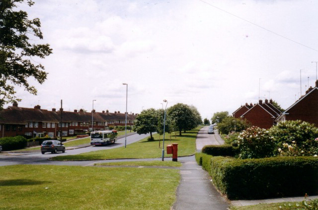
Bournbrook is a small suburban area located in the county of Worcestershire, England. It is situated approximately three miles southwest of Birmingham city center and falls under the jurisdiction of the city of Birmingham. Bournbrook is part of the Selly Oak ward and is primarily a residential area with a mixture of houses, apartments, and student accommodation.

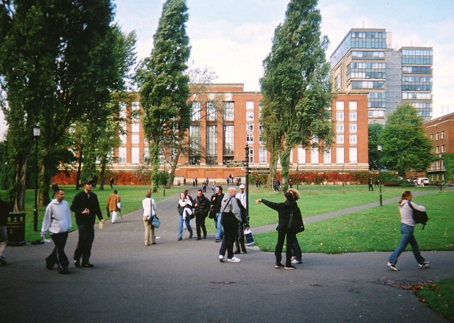
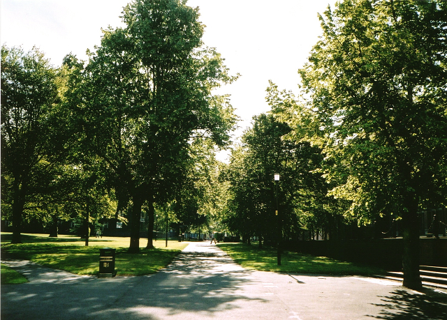
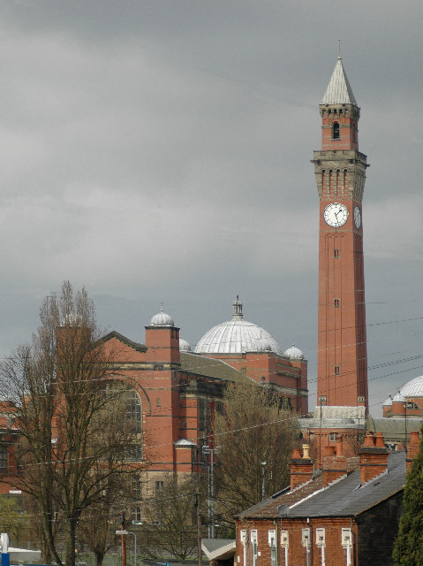
The area is notable for being home to the University of Birmingham, one of the leading educational institutions in the United Kingdom. The university campus is a significant feature of Bournbrook and provides a vibrant and diverse atmosphere to the area, especially during term-time. The campus includes various academic buildings, research facilities, student accommodations, sports facilities, and green spaces.

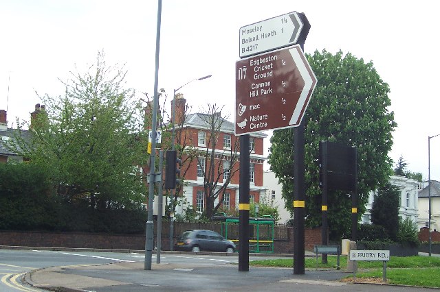
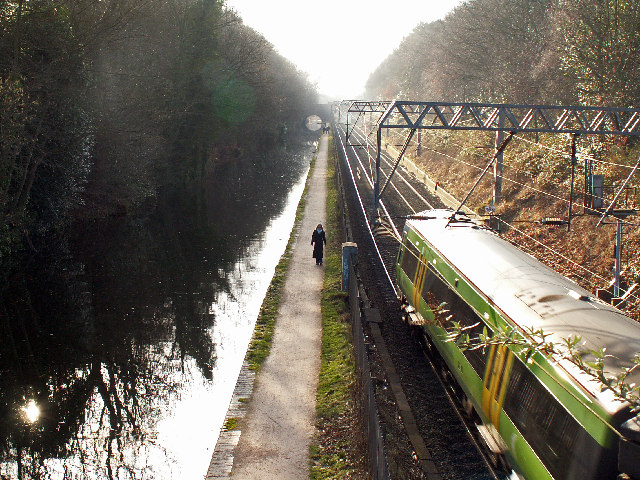
Bournbrook is well-connected to other areas, with regular bus and train services available. The nearby Selly Oak train station provides easy access to Birmingham city center and other destinations. The area is also served by several major roads, including the A38 Bristol Road and the A4040 Outer Ring Road, ensuring convenient transportation links to the wider region.

In addition to its educational institutions, Bournbrook boasts a range of amenities. There are local shops, supermarkets, restaurants, and cafes catering to the needs of residents and students. The area also benefits from proximity to the Queen Elizabeth Hospital, one of the largest hospitals in the region.

Overall, Bournbrook offers a mix of residential, educational, and healthcare facilities, making it an attractive place to live for students, professionals, and families alike.

If you have any feedback on the listing, please let us know in the comments section below.

Bournbrook Images

Images are sourced within 2km of 52.442303/-1.924643 or Grid Reference SP0582. Thanks to Geograph Open Source API. All images are credited.

Selly Oak This apparently sylvan setting on the Worcester & Birmingham Canal is actually in the heart of Selly Oak.  The main A38 crosses the bridge in the distance and the railway station is hidden by the trees on the right.
Selly Oak
This apparently sylvan setting on the Worcester & Birmingham Canal is actually in the heart of Selly Oak. The main A38 crosses the bridge in the distance and the railway station is hidden by the trees on the right.
Pershore Road, Selly Park, Birmingham Pershore Road is a long road running south from Birmingham city centre. Whilst the University of Birmingham itself is in nearby Edgbaston, much of the housing in this area is occupied by students.
Pershore Road, Selly Park, Birmingham
Pershore Road is a long road running south from Birmingham city centre. Whilst the University of Birmingham itself is in nearby Edgbaston, much of the housing in this area is occupied by students.
Cadbury World at Bournville Behind the visitor centre, there is the business end of the Cadbury factory at Bournville.
Cadbury World at Bournville
Behind the visitor centre, there is the business end of the Cadbury factory at Bournville.
A busy corner in Edgbaston Here the B4217 meets the A38 Bristol Road. Many of the opulent villas in the area have been converted to offices.
A busy corner in Edgbaston
Here the B4217 meets the A38 Bristol Road. Many of the opulent villas in the area have been converted to offices.
The Main Library, University of Birmingham The university campus in full swing at the beginning of the academic year. The large brick building is the main library and the (ugly?) tower block to the right is the Muirhead Tower.
The Main Library, University of Birmingham
The university campus in full swing at the beginning of the academic year. The large brick building is the main library and the (ugly?) tower block to the right is the Muirhead Tower.
View from Selly Oak railway station, Birmingham In the dark foreground are some of the buildings of Selly Oak, including the back of the community centre. The University buildings are brightly illuminated by the sunshine on the other side of the Bristol Road.
View from Selly Oak railway station, Birmingham
In the dark foreground are some of the buildings of Selly Oak, including the back of the community centre. The University buildings are brightly illuminated by the sunshine on the other side of the Bristol Road.
Quinton Road, Harborne Looking east along Quinton Road from Langford Grove. Quinton Road has unusually wide verges (a planning feature?) and doesn't actually go to Quinton because the golf course gets in the way.
Quinton Road, Harborne
Looking east along Quinton Road from Langford Grove. Quinton Road has unusually wide verges (a planning feature?) and doesn't actually go to Quinton because the golf course gets in the way.
University Square, Edgbaston campus, The University of Birmingham Trees in the central university square on a sunny summer's morning. The lack of students is not due to  the early hour, but to the fact that they are on their summer vacation. The grounds are always looking their best just before the week of summer graduation ceremonies.
University Square, Edgbaston campus, The University of Birmingham
Trees in the central university square on a sunny summer's morning. The lack of students is not due to the early hour, but to the fact that they are on their summer vacation. The grounds are always looking their best just before the week of summer graduation ceremonies.
Peacock at the Birmingham Nature Centre, Pershore Road The Nature Centre is situated 2 miles south of Birmingham City Centre, between Cannon Hill Park and the Pershore Road, and covers over six acres. This peacock freely roams the site.
Peacock at the Birmingham Nature Centre, Pershore Road
The Nature Centre is situated 2 miles south of Birmingham City Centre, between Cannon Hill Park and the Pershore Road, and covers over six acres. This peacock freely roams the site.
University of Birmingham The Great Hall and Clock Tower of the University
University of Birmingham
The Great Hall and Clock Tower of the University
Tally-Ho Seen from the Nature Centre car park.
Tally-Ho
Seen from the Nature Centre car park.
Cadbury factory, Bournville, from the Worcester and Birmingham canal towpath
St Francis Hall, University Chaplaincy St Francis Hall is the multifaith chaplaincy of the University of Birmingham, and is situated off Edgbaston Park Road, adjacent to the Guild of Students. Inside is a large versatile worship space, used regularly for Christian, Islamic and other faith meetings; a second, more 'Christian' worship space; a lounge and kitchen; a small prayer room; offices for various university chaplains and the chaplaincy assistant.
St Francis Hall, University Chaplaincy
St Francis Hall is the multifaith chaplaincy of the University of Birmingham, and is situated off Edgbaston Park Road, adjacent to the Guild of Students. Inside is a large versatile worship space, used regularly for Christian, Islamic and other faith meetings; a second, more 'Christian' worship space; a lounge and kitchen; a small prayer room; offices for various university chaplains and the chaplaincy assistant.
Vincent Drive, Harborne/Edgbaston Vincent Drive leads from the School of Medicine, downhill to the Junction of Harborne Lane and Harborne Park Road. The image shows a typical early evening rush hour scene
Vincent Drive, Harborne/Edgbaston
Vincent Drive leads from the School of Medicine, downhill to the Junction of Harborne Lane and Harborne Park Road. The image shows a typical early evening rush hour scene
Birmingham & Worcester Canal and railway line Looking southwest from Somerset Road. Pritchatts Road crosses the railway line and canal at the bridges in the distance. The Worcester and Birmingham Canal was built to link the River Severn to Birmingham & the Black Country. The railway line originally formed the former Midland Railway's West Suburban Railway, opened in 3rd April 1876. The line was electrified in the 1970s to form the Cross City Line, and is heavily used. The passing train is a longer distance central trains service.
Birmingham & Worcester Canal and railway line
Looking southwest from Somerset Road. Pritchatts Road crosses the railway line and canal at the bridges in the distance. The Worcester and Birmingham Canal was built to link the River Severn to Birmingham & the Black Country. The railway line originally formed the former Midland Railway's West Suburban Railway, opened in 3rd April 1876. The line was electrified in the 1970s to form the Cross City Line, and is heavily used. The passing train is a longer distance central trains service.
Stirchley Public Baths Stirchley Baths are situated at the junction of Bournville Lane and Hazelwell Street. This grade II listed building was built land provided by the Cadburys and officially opened on July 25th 1911 The swimming pool has been closed for 20 years or more and in very poor state. The state of the baths mirrors the general economic decline in the Stirchley area in the 1970s/80s. There are plans to regenerate the area and several applications being considered for various retail developments on adjacent sites. Proposals by the co-op, who have a very large superstore nearby, includes renovation of the baths.

Update - February 2012:  In 2011 Tesco announced an agreement with Birmingham City Council for purchase land required  for the construction of a new supermarket, occupied by Stirchley Community Centre and an indoor bowls centre. The money raised is to be used to restore Stirchley Baths for use as new community centre.
Stirchley Public Baths
Stirchley Baths are situated at the junction of Bournville Lane and Hazelwell Street. This grade II listed building was built land provided by the Cadburys and officially opened on July 25th 1911 The swimming pool has been closed for 20 years or more and in very poor state. The state of the baths mirrors the general economic decline in the Stirchley area in the 1970s/80s. There are plans to regenerate the area and several applications being considered for various retail developments on adjacent sites. Proposals by the co-op, who have a very large superstore nearby, includes renovation of the baths. Update - February 2012: In 2011 Tesco announced an agreement with Birmingham City Council for purchase land required for the construction of a new supermarket, occupied by Stirchley Community Centre and an indoor bowls centre. The money raised is to be used to restore Stirchley Baths for use as new community centre.
Bristol Road (A38) near Selly Park / Bournbrook Looking north east. The wide central grass strip of this dual carriageway formerly carried the tram lines. Just south west of this point the road narrows to a single carriageway through Bournbrook, which suffers from heavy congestion.
Bristol Road (A38) near Selly Park / Bournbrook
Looking north east. The wide central grass strip of this dual carriageway formerly carried the tram lines. Just south west of this point the road narrows to a single carriageway through Bournbrook, which suffers from heavy congestion.
Ornamental pond in King's Heath Park The building in the distance is King's Heath House. This was built in the 1830s. In the early 1900s the house and its 30 acre estate was transferred to Birmingham Corporation. In 1952 the house became a horticultural training college.
Ornamental pond in King's Heath Park
The building in the distance is King's Heath House. This was built in the 1830s. In the early 1900s the house and its 30 acre estate was transferred to Birmingham Corporation. In 1952 the house became a horticultural training college.
Show me another place!

Bournbrook is located at Grid Ref: SP0582 (Lat: 52.442303, Lng: -1.924643)

Unitary Authority: Birmingham

Police Authority: West Midlands

What 3 Words

///finishing.wipe.loving. Near Birmingham, West Midlands

Nearby Locations

Bournbrook Selly Park

Related Wikis

St Stephen's Church, Selly Park

St Stephen's Church, Selly Park is a Grade II listed parish church in the Church of England in Birmingham. == History == It was built between 1870 and...

Highfield, Birmingham

Highfield was a large house situated at 128 Selly Park Road in the Selly Park area of Birmingham, England. Built in the 1860s, it was bought in 1929 by...

St Edward's Church, Selly Park, Birmingham

The Catholic Church of St Edward, Selly Park, Birmingham is a Roman Catholic parish located in Selly Park in the Archdiocese of Birmingham. == History... ==

Selly Park

Selly Park is a residential suburban district in south-west Birmingham, England. The suburb of Selly Park is located between the Bristol Road (A38) and...

Encounter Church

Encounter Church formerly known as Selly Oak Elim Church and formerly St Wulstan's is a parish church of the Church of England in the Bournbrook district...

Bournbrook

Bournbrook is an industrial and residential district in southwest Birmingham, England, in the ward of Bournbrook and Selly Park and the parliamentary constituency...

Selly Oak railway station

Selly Oak railway station is a railway station in Selly Oak in Birmingham, England, on the Cross-City Line between Redditch, Birmingham and Lichfield....

Selly Park Girls' School

Selly Park Girls' School (formerly Selly Park Technology College for Girls) is a secondary school located in the Selly Park area of Birmingham, in the...

Nearby Amenities

Located within 500m of 52.442303,-1.924643
Mini Roundabout
Direction: clockwise
Lat/Long: 52.4430451/-1.922628
Area: yes
Lat/Long: 52.4394364/-1.9214376
Post Box
Ref: B29 258
Lat/Long: 52.4401313/-1.9217482
Bus Stop
Coronation Rd / Rookery Rd
Bench: no
Bin: no
Bus: yes
Lit: no
Naptan AtcoCode: 43000347301
Naptan Bearing: E
Naptan BusStopType: MKD
Naptan CommonName: Rookery Rd
Naptan Indicator: adj
Naptan NaptanCode: nwmatmgw
Naptan PlusbusZoneRef: BHAMNWS
Naptan Status: ACT
Naptan StopType: BCT
Naptan Street: CORONATION RD
Naptan Towards: Kings Heath
Public Transport: platform
Route Ref: 76
Shelter: no
Source: WMCA
Tactile Paving: no
Towards: Kings Heath
Lat/Long: 52.4423562/-1.9273968
Bus Stop
Bournbrook Rd / Elmdon Rd
Bus: yes
Naptan AtcoCode: 43000347501
Naptan Bearing: SE
Naptan BusStopType: MKD
Naptan CommonName: Elmdon Rd
Naptan Indicator: before
Naptan NaptanCode: nwmtwjmp
Naptan PlusbusZoneRef: BHAMNWS
Naptan Status: ACT
Naptan StopType: BCT
Naptan Street: BOURNBROOK RD
Naptan Towards: Kings Heath
Public Transport: platform
Route Ref: 76
Shelter: no
Source: WMCA
Towards: Kings Heath
Lat/Long: 52.4410672/-1.925966
Bus Stop
Dawlish Rd / Coronation Rd
Bus: yes
Naptan AtcoCode: 43000347101
Naptan Bearing: NW
Naptan BusStopType: MKD
Naptan CommonName: Coronation Rd
Naptan Indicator: opp
Naptan NaptanCode: nwmatmgm
Naptan PlusbusZoneRef: BHAMNWS
Naptan Status: ACT
Naptan StopType: BCT
Naptan Street: DAWLISH RD
Naptan Towards: Selly Oak
Public Transport: platform
Route Ref: 38
Shelter: no
Source: WMCA
Towards: Selly Oak
Lat/Long: 52.4418308/-1.9299959
Bus Stop
Dawlish Rd / Coronation Rd
Bus: yes
Naptan AtcoCode: 43000347102
Naptan Bearing: SE
Naptan BusStopType: MKD
Naptan CommonName: Coronation Rd
Naptan Indicator: adj
Naptan NaptanCode: nwmatmgp
Naptan PlusbusZoneRef: BHAMNWS
Naptan Status: ACT
Naptan StopType: BCT
Naptan Street: DAWLISH RD
Naptan Towards: Kings Heath
Public Transport: platform
Route Ref: 76
Shelter: no
Source: WMCA
Towards: Kings Heath
Lat/Long: 52.4421924/-1.9301835
Bus Stop
Raddlebarn Rd / St Mary'S Hospice
NaPTANAreaCode: 43000347203
Asset Ref: 608907
Bus: yes
Naptan AtcoCode: 43000347203
Naptan Bearing: NE
Naptan BusStopType: MKD
Naptan CommonName: St Mary's Hospice
Naptan Indicator: opp
Naptan NaptanCode: nwmatmgt
Naptan PlusbusZoneRef: BHAMNWS
Naptan Status: ACT
Naptan StopType: BCT
Naptan Street: RADDLEBARN RD
Naptan Towards: Selly Oak
Public Transport: platform
Route Ref: 38;76
Shelter: yes
Shelter Ref: 608907
Source: WMCA
Towards: Selly Oak
Lat/Long: 52.4387467/-1.9272503
Bus Stop
Raddlebarn Rd / St Mary'S Hospice
Bus: yes
Naptan AtcoCode: 43000347204
Naptan Bearing: SW
Naptan BusStopType: MKD
Naptan CommonName: St Mary's Hospice
Naptan Indicator: adj
Naptan NaptanCode: nwmtmptm
Naptan PlusbusZoneRef: BHAMNWS
Naptan Status: ACT
Naptan StopType: BCT
Naptan Street: RADDLEBARN RD
Naptan Towards: Kings Heath
Public Transport: platform
Route Ref: 76
Shelter: no
Source: WMCA
Towards: Kings Heath
Lat/Long: 52.4391269/-1.9266185
William Lygon and Son
Note: Building contractors
Lat/Long: 52.4420556/-1.9293469
Purple Frog
Note: Letting agents
Source: survey
Lat/Long: 52.4418987/-1.9297415
Post Box
Collection Times: Mo-Fr 17:30; Sa 12:00
Operator: Royal Mail
Operator Wikidata: Q638098
Post Box Type: pillar
Ref: B29 194
Royal Cypher: EVIIR
Royal Cypher Wikidata: Q33102324
Source: survey
Lat/Long: 52.4457809/-1.9275091
Serpentine Road Substation
Power: substation
Source: survey
Lat/Long: 52.4434652/-1.9244374
Crossing
Crossing: traffic_signals
Crossing Ref: pelican
Lat/Long: 52.4397842/-1.925962
Recycling
Recycling Clothes: yes
Recycling Glass: yes
Recycling Paper: yes
Source: survey
Lat/Long: 52.4387697/-1.9270263
Capricorn Car Parts Ltd
Addr City: Birmingham
Addr Housename: Tiverton House
Addr Housenumber: 254-256
Addr Street: Tiverton Road
Lat/Long: 52.4396549/-1.9296016
Indoor Controlled Environment Ltd
Addr City: Birmingham
Addr Housenumber: 250-252
Addr Street: Tiverton Road
Source: survey
Lat/Long: 52.43977/-1.9295722
Addr City: Birmingham
Addr Country: GB
Addr Housenumber: 201
Addr Street: Tiverton Road
Source: survey
Lat/Long: 52.4411176/-1.9305488
Telephone
Booth: KX100
Covered: booth
Operator: BT
Operator Wikidata: Q593786
Source: survey
Lat/Long: 52.4417651/-1.9315782
Selly Park
Is In: Birmingham,West Midlands,England,UK
Place: suburb
Wikidata: Q7448696
Wikipedia: en:Selly Park
Lat/Long: 52.4440464/-1.9204327
Bench
Backrest: yes
Source: survey
Lat/Long: 52.4431253/-1.9225578
Post Box
Collection Times: Mo-Fr 17:30; Sa 12:30
Operator: Royal Mail
Operator Wikidata: Q638098
Ref: B29 1106
Royal Cypher: EIIR
Royal Cypher Wikidata: Q33102113
Source: survey
Lat/Long: 52.4435266/-1.9225517
Post Box
Collection Times: Mo-Fr 09:00; Sa 07:00
Note: No reference number
Ref: B29 455
Royal Cypher: GR
Lat/Long: 52.4426778/-1.9271274
Crossing
Crossing Island: yes
Lat/Long: 52.4383146/-1.9274972
Power: substation
Ref Wpd: 724287
Source: wpd_opendata
Lat/Long: 52.4384128/-1.9277974
Crossing
Crossing Island: yes
Lat/Long: 52.4407134/-1.9255364
Grit Bin
Lat/Long: 52.44157/-1.9294914
Grit Bin
Lat/Long: 52.4457792/-1.9227434
Grit Bin
Lat/Long: 52.4403057/-1.922114
Grit Bin
Lat/Long: 52.4443725/-1.9274007
Source: bing
Traffic Calming: bump
Lat/Long: 52.4446238/-1.9215314
Grit Bin
Lat/Long: 52.4402606/-1.9217944
Addr City: Birmingham
Addr Housenumber: 12
Addr Postcode: B29 7QS
Addr Street: Woodside Road
Building: terrace
Lat/Long: 52.4381625/-1.9231708
Grit Bin
Lat/Long: 52.4457427/-1.9226341
Grit Bin
Lat/Long: 52.4441815/-1.9205312
Bench
Backrest: yes
Lat/Long: 52.4456249/-1.9271133
Source: bing
Traffic Calming: bump
Lat/Long: 52.4441396/-1.922288
Check Date: 2023-01-20
Source: bing
Traffic Calming: bump
Lat/Long: 52.4442691/-1.9226449
Check Date: 2023-01-20
Source: bing
Traffic Calming: bump
Lat/Long: 52.4432316/-1.9217923
Check Date: 2023-01-20
Source: bing
Traffic Calming: bump
Lat/Long: 52.4434344/-1.9209229
Give Way
Lat/Long: 52.4451512/-1.9293995
Give Way
Lat/Long: 52.4451799/-1.9292794
Give Way
Lat/Long: 52.4441818/-1.9288642
Give Way
Lat/Long: 52.4442049/-1.9287174
Recycling
Recycling Cans: yes
Recycling Glass: yes
Recycling Type: container
Lat/Long: 52.4417951/-1.931562
Addr City: Birmingham
Addr Postcode: B29 7QN
Addr Street: Greenland Gardens
Lat/Long: 52.4406267/-1.9178698
Generator Method: photovoltaic
Generator Output Electricity: yes
Generator Source: solar
Generator Type: solar_photovoltaic_panel
Location: roof
Power: generator
Lat/Long: 52.4429154/-1.9175354
Generator Method: photovoltaic
Generator Output Electricity: yes
Generator Source: solar
Generator Type: solar_photovoltaic_panel
Location: roof
Power: generator
Lat/Long: 52.4415805/-1.9301417
Generator Method: photovoltaic
Generator Output Electricity: yes
Generator Source: solar
Generator Type: solar_photovoltaic_panel
Location: roof
Power: generator
Lat/Long: 52.4415355/-1.9301002
Generator Method: photovoltaic
Generator Output Electricity: yes
Generator Source: solar
Generator Type: solar_photovoltaic_panel
Location: roof
Power: generator
Lat/Long: 52.4412976/-1.930009
Generator Method: photovoltaic
Generator Output Electricity: yes
Generator Source: solar
Generator Type: solar_photovoltaic_panel
Location: roof
Power: generator
Lat/Long: 52.4413197/-1.9299634
Generator Method: photovoltaic
Generator Output Electricity: yes
Generator Source: solar
Generator Type: solar_photovoltaic_panel
Location: roof
Power: generator
Lat/Long: 52.441332/-1.9299124
Give Way
Source: bing
Lat/Long: 52.4420023/-1.9301806
Give Way
Source: bing
Lat/Long: 52.4420285/-1.9300291
Give Way
Source: bing
Lat/Long: 52.4417372/-1.9313968
Give Way
Source: bing
Lat/Long: 52.4417863/-1.931442
Generator Method: photovoltaic
Generator Output Electricity: yes
Generator Source: solar
Generator Type: solar_photovoltaic_panel
Location: roof
Power: generator
Lat/Long: 52.4439651/-1.9308673
Generator Method: photovoltaic
Generator Output Electricity: yes
Generator Source: solar
Generator Type: solar_photovoltaic_panel
Location: roof
Power: generator
Lat/Long: 52.4439463/-1.9309223
Generator Method: photovoltaic
Generator Output Electricity: yes
Generator Source: solar
Generator Type: solar_photovoltaic_panel
Location: roof
Power: generator
Lat/Long: 52.4439299/-1.9309826
Generator Method: photovoltaic
Generator Output Electricity: yes
Generator Source: solar
Generator Type: solar_photovoltaic_panel
Location: roof
Power: generator
Lat/Long: 52.4439078/-1.9310349
Bicycle Rental
Warwards Lane / Selly Park
Capacity: 9
Email: support@beryl.cc
Fee: yes
Network: West Midlands Cycle Hire
Operator: Beryl
Operator Wikidata: Q106575369
Payment App: yes
Payment Cash: no
Payment Credit Cards: no
Payment Cryptocurrencies: no
Payment Debit Cards: no
Payment Electronic Purses: no
Phone: +44 20 3003 5044
Ref Gbfs: beryl_west_midlands:2948
Rental: city_bike;ebike
Website: https://beryl.cc/scheme/west-midlands
Lat/Long: 52.438357/-1.927388
Bicycle Rental
Oakfield Road
Bicycle Rental: docking_station
Capacity: 9
Email: support@beryl.cc
Fee: yes
Network: West Midlands Cycle Hire
Operator: Beryl
Operator Wikidata: Q106575369
Payment App: yes
Payment Cash: no
Payment Credit Cards: no
Payment Cryptocurrencies: no
Payment Debit Cards: no
Payment Electronic Purses: no
Phone: +44 20 3003 5044
Ref Gbfs: beryl_west_midlands:2949
Rental: city_bike;ebike
Website: https://beryl.cc/scheme/west-midlands
Lat/Long: 52.445861/-1.927303
Bicycle Parking
Bicycle Parking: stands
Capacity: 2
Lat/Long: 52.4406028/-1.9255543
Bicycle Parking
Bicycle Parking: stands
Capacity: 2
Lat/Long: 52.4395464/-1.9263489
Bicycle Parking
Bicycle Parking: hoop
Capacity: 1
Lat/Long: 52.438289/-1.9278769
Bicycle Parking
Bicycle Parking: hoop
Capacity: 2
Lat/Long: 52.4417118/-1.9315274
The data included in this document is from www.openstreetmap.org. The data is made available under ODbL.

Have you been to Bournbrook?

Leave your review of Bournbrook below (or comments, questions and feedback).