Boulder Clough

Settlement in Yorkshire

England

Boulder Clough

Nab End Quarry Abandoned quarry marked as Open Access on the map, but there are signs restricting this - due to public safety concerns.
Nab End Quarry Credit: Chris Heaton

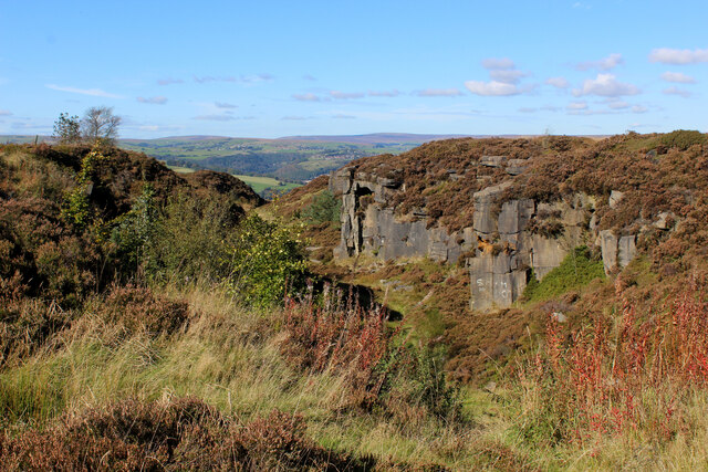
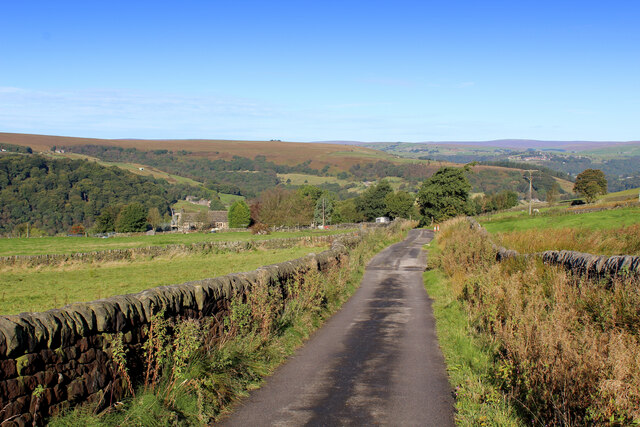
Boulder Clough is a quaint village nestled in the heart of Yorkshire, England. Located in the district of Calderdale, it lies within the South Pennines, offering picturesque views of rolling hills and lush green landscapes. Situated just a few miles away from the bustling town of Hebden Bridge, Boulder Clough provides a peaceful and idyllic retreat for residents and visitors alike.

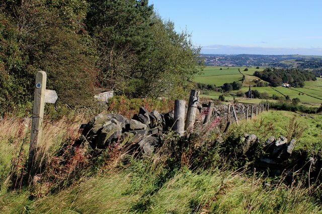
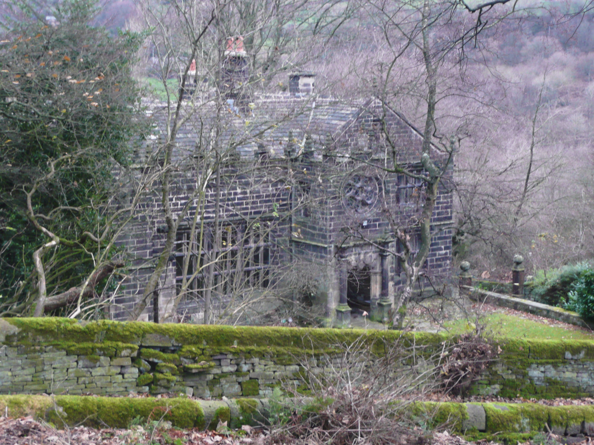
The village takes its name from the small river, Clough, which runs through its center. The river, surrounded by ancient woodland, adds to the natural beauty of the area, attracting nature enthusiasts and walkers who can explore the various trails and footpaths that wind alongside its banks.

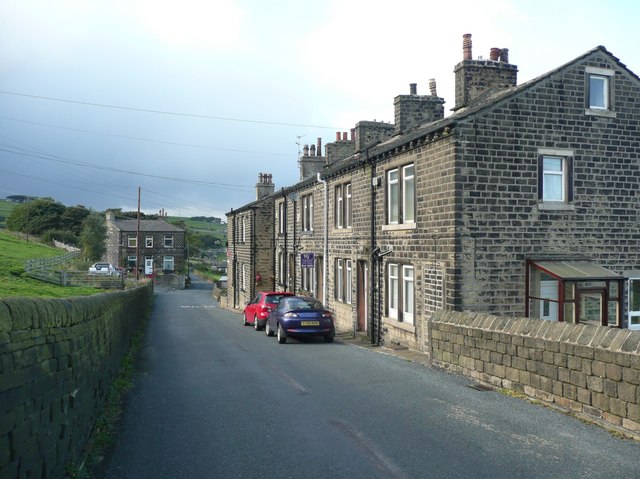
Boulder Clough is known for its traditional stone-built houses, which give the village a charming and timeless character. The community is tight-knit, with a friendly and welcoming atmosphere that makes it a desirable place to live. The village is home to a local pub, The Clough Inn, where residents can gather and socialize.

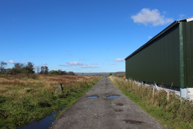
The surrounding area offers numerous outdoor activities, with opportunities for hiking, cycling, and horseback riding. Boulder Clough is also a popular spot for birdwatching, as its diverse flora and fauna attract a wide range of species. Additionally, the nearby Calderdale Way offers stunning views of the countryside and is a favorite among hikers.

Overall, Boulder Clough is a peaceful and picturesque village that offers a tranquil escape from the hectic pace of modern life. Its natural beauty, friendly community, and access to outdoor activities make it an appealing destination for those seeking a peaceful retreat in the heart of Yorkshire.

If you have any feedback on the listing, please let us know in the comments section below.

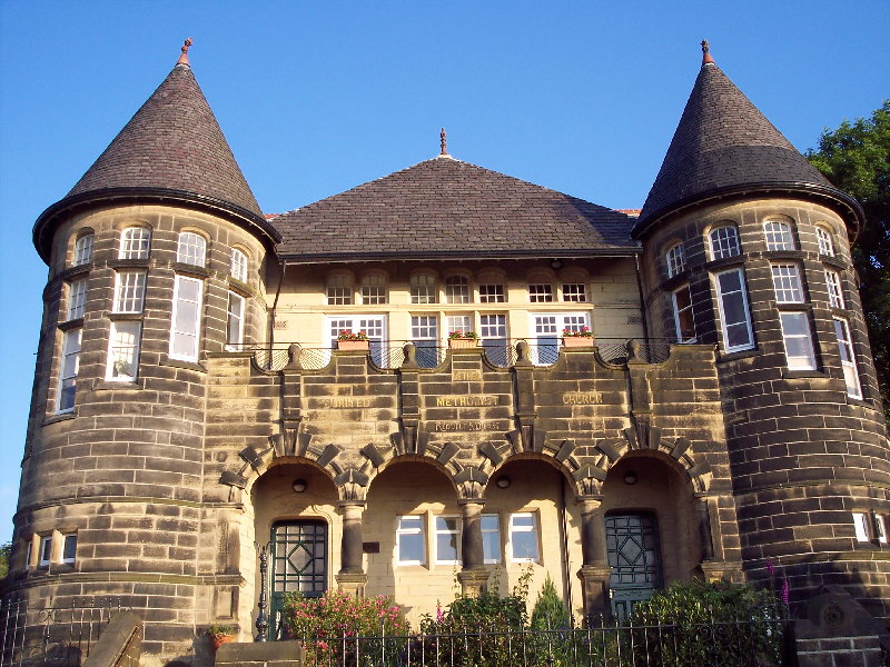
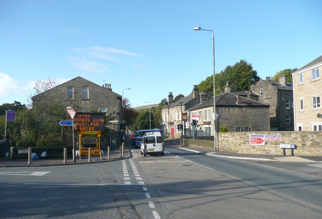
Boulder Clough Images

Images are sourced within 2km of 53.703424/-1.9560341 or Grid Reference SE0323. Thanks to Geograph Open Source API. All images are credited.

Nab End Quarry Abandoned quarry marked as Open Access on the map, but there are signs restricting this - due to public safety concerns.
Nab End Quarry
Abandoned quarry marked as Open Access on the map, but there are signs restricting this - due to public safety concerns.
Weather Hill Lane Gives access to Weather Hill and Wood Top, high above Cragg Vale
Weather Hill Lane
Gives access to Weather Hill and Wood Top, high above Cragg Vale
Clattering Stones Road Grassy track leading from Water Stalls Road to Catherine House, adopted by the Calderdale Way long distance footpath.
Say what you like about Calderdale - but you can always rely on this area when it comes to imaginative names.
Clattering Stones Road
Grassy track leading from Water Stalls Road to Catherine House, adopted by the Calderdale Way long distance footpath. Say what you like about Calderdale - but you can always rely on this area when it comes to imaginative names.
Trig Point on Crow Hill Triangulation Point at 1,257ft on the summit of Crow Hill, displaying a small amount of isolated moorland at the top.
Stoodley Pike can be seen on the skyline in the distance.
Trig Point on Crow Hill
Triangulation Point at 1,257ft on the summit of Crow Hill, displaying a small amount of isolated moorland at the top. Stoodley Pike can be seen on the skyline in the distance.
View from Crow Hill
View from Crow Hill
Crow Hill End Farm The farmyard is a little untidy, full of rusting machinery and discarded rubbish
Crow Hill End Farm
The farmyard is a little untidy, full of rusting machinery and discarded rubbish
Thornton Park Farm A bridleway and a public footpath leave Ash Hall Lane from the same spot - it is the footpath that heads for the farm across a pasture, although there is no physical evidence of one on the ground.
Thornton Park Farm
A bridleway and a public footpath leave Ash Hall Lane from the same spot - it is the footpath that heads for the farm across a pasture, although there is no physical evidence of one on the ground.
Bridleway heading down to Hall Green and Cotton Stones
Lower Crow Hill Farm Sitting at the base of Crow Hill, in front of a series of pastures.
Lower Crow Hill Farm
Sitting at the base of Crow Hill, in front of a series of pastures.
Stile on the Base of Crow Hill
Farm on High Stones Road
Straight Track crossing Blackwood Common to Nab End Quarry
Culpans Road Bridleway heading towards Moor Bottom Lane
Culpans Road
Bridleway heading towards Moor Bottom Lane
Colour Coded Bales on Blackwood Common
Bridleway on Blackwood Common Heading for the disused quarry at Nab End - passing a recently erected barn structure.
Bridleway on Blackwood Common
Heading for the disused quarry at Nab End - passing a recently erected barn structure.
Cooper House Bridge Over the Rochdale Canal on the approach to Luddenden Foot
Cooper House Bridge
Over the Rochdale Canal on the approach to Luddenden Foot
Stansfield Bridge Carries Stansfield Mill Lane across the River Ryburn
Stansfield Bridge
Carries Stansfield Mill Lane across the River Ryburn
River Calder Footbridge Behind the bridge is Tenterfields Business Park in Luddenden Foot
River Calder Footbridge
Behind the bridge is Tenterfields Business Park in Luddenden Foot
Show me another place!

Boulder Clough is located at Grid Ref: SE0323 (Lat: 53.703424, Lng: -1.9560341)

Division: West Riding

Unitary Authority: Calderdale

Police Authority: West Yorkshire

What 3 Words

///spillage.louder.outbound. Near Luddenden Foot, West Yorkshire

Related Wikis

Boulderclough

Boulderclough is a small village in the Borough of Calderdale in West Yorkshire, England. The village is situated between Sowerby at the south and Mytholmroyd...

Sowerby (UK Parliament constituency)

Sowerby () was a county constituency centred on the village of Sowerby in Calderdale, West Yorkshire. It returned one Member of Parliament (MP) to the...

Calder Valley (UK Parliament constituency)

Calder Valley is a constituency in West Yorkshire represented in the House of Commons of the UK Parliament since 2010 by Craig Whittaker, a Conservative...

Sowerby, West Yorkshire

Sowerby ( SOR-bi) is a village in the Metropolitan Borough of Calderdale, in West Yorkshire, England. It lies in the Pennines, contiguous with Sowerby...

Wood Lane Hall

Wood Lane Hall is a Grade I listed building near Sowerby, West Yorkshire, England. == History == The original hall had a timber frame, parts of which were...

Ryburn Valley High School

Ryburn Valley High School is a secondary school and sixth form located in the town of Sowerby Bridge, West Yorkshire, England. Originally built in the...

Triangle railway station

Triangle railway station was a railway station near Triangle on the Rishworth branch built by the Lancashire & Yorkshire Railway. When open, services ran...

Luddendenfoot

Luddendenfoot or Luddenden Foot is a village and former civil parish, lying north-west of Sowerby Bridge and west of Halifax, in Calderdale, West Yorkshire...

Nearby Amenities

Located within 500m of 53.703424,-1.9560341
Post Box
Post Box Type: wall
Royal Cypher: EVIIR
Lat/Long: 53.7037048/-1.9508745
Booth: K6
Removed Amenity: telephone
Lat/Long: 53.7035291/-1.9516634
Bus Stop
Hubberton Green Road
Local Ref: 45023020
Naptan AtcoCode: 450023020
Naptan Bearing: NW
Naptan CommonName: Hubberton Green Road
Naptan Crossing: Plain Lane
Naptan Indicator: Stop 45023020
Naptan Landmark: Washington House
Naptan Notes: L/C 2
Naptan PlusbusZoneRef: LEEDS
Naptan ShortCommonName: Plain Lane
Naptan Street: Hubberton Green Road
Naptan Verified: no
Source: naptan_import
Lat/Long: 53.7023251/-1.9498761
Bus Stop
Hubberton
Local Ref: 45023021
Naptan AtcoCode: 450023021
Naptan Bearing: SE
Naptan CommonName: Hubberton
Naptan Crossing: Wellhead Lane
Naptan Indicator: Stop 45023021
Naptan Landmark: Shepherds Rest PH
Naptan PlusbusZoneRef: LEEDS
Naptan ShortCommonName: New Barton
Naptan Street: Mirey Lane
Naptan Verified: no
Source: naptan_import
Lat/Long: 53.7037907/-1.950965
Hubberton Green Road
Naptan AtcoCode: 450028316
Naptan Bearing: S
Naptan BusStopType: CUS
Naptan CommonName: Hubberton Green Road
Naptan Crossing: Rooley Lane
Naptan Landmark: Unknown
Naptan PlusbusZoneRef: LEEDS
Naptan ShortCommonName: Hubberton Green Rd
Naptan Street: Hubberton Green Road
Naptan Verified: no
Source: naptan_import
Lat/Long: 53.702343/-1.9496034
Hubberton
Local Ref: 45051252
Naptan AtcoCode: 450051252
Naptan Bearing: NW
Naptan BusStopType: CUS
Naptan CommonName: Hubberton
Naptan Indicator: Stop 45051252
Naptan PlusbusZoneRef: LEEDS
Naptan ShortCommonName: Hubberton
Naptan Street: Mirey Lane
Naptan Verified: no
Source: naptan_import
Lat/Long: 53.7037368/-1.9511014
Power: pole
Lat/Long: 53.6991224/-1.9580312
Power: pole
Lat/Long: 53.6994676/-1.9579954
Power: pole
Lat/Long: 53.6998356/-1.9579656
Power: pole
Lat/Long: 53.7002083/-1.9579053
Power: pole
Lat/Long: 53.7003067/-1.9571709
Power: pole
Lat/Long: 53.7003522/-1.9568523
Power: pole
Lat/Long: 53.6993443/-1.9591008
Power: pole
Lat/Long: 53.6998064/-1.959874
Power: pole
Lat/Long: 53.7002941/-1.9606784
Power: pole
Lat/Long: 53.7008742/-1.961063
Power: pole
Lat/Long: 53.7014345/-1.960466
Power: pole
Lat/Long: 53.7020716/-1.9594694
Power: pole
Lat/Long: 53.7026439/-1.9585982
Power: pole
Lat/Long: 53.7032573/-1.9576411
Power: pole
Lat/Long: 53.7039239/-1.956659
Power: pole
Lat/Long: 53.7044807/-1.955789
Power: pole
Lat/Long: 53.7050153/-1.9549967
Power: pole
Lat/Long: 53.7054728/-1.9542792
Power: pole
Lat/Long: 53.7058/-1.9518856
Power: pole
Lat/Long: 53.705973/-1.9506708
Power: pole
Lat/Long: 53.7026513/-1.9574582
Power: pole
Lat/Long: 53.7058555/-1.9544761
Power: pole
Lat/Long: 53.706614/-1.954863
Power: pole
Lat/Long: 53.7072165/-1.9551546
Power: pole
Lat/Long: 53.7078257/-1.9554611
Give Way
Direction: backward
Lat/Long: 53.7036685/-1.9504631
The data included in this document is from www.openstreetmap.org. The data is made available under ODbL.

Have you been to Boulder Clough?

Leave your review of Boulder Clough below (or comments, questions and feedback).