Trethurgy

Settlement in Cornwall

England

Trethurgy

Eden Project - Rainforest Biome The Rainforest Biome <span class="nowrap"><a title="https://www.edenproject.com/visit/things-to-do/rainforest-biome" rel="nofollow ugc noopener" href="https://www.edenproject.com/visit/things-to-do/rainforest-biome">Link</a><img style="margin-left:2px;" alt="External link" title="External link - shift click to open in new window" src="https://s1.geograph.org.uk/img/external.png" width="10" height="10"/></span> at the Eden Project houses the largest rainforest in the world, with over 1,000 varieties of plants
Eden Project - Rainforest Biome Credit: Lauren

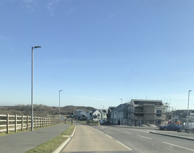
Trethurgy is a small village located in the county of Cornwall, England. Situated approximately 3 miles southeast of the popular town of St Austell, Trethurgy is nestled amidst the picturesque landscapes of the St Austell Downs. The village is predominantly rural, characterized by rolling hills, lush green fields, and a peaceful atmosphere.

With a population of around 400 residents, Trethurgy offers a close-knit community feel. The village is dotted with quaint cottages and traditional stone houses, giving it a charming and timeless appeal. The local economy is primarily reliant on agriculture, with many residents involved in farming and horticulture.

Trethurgy benefits from its proximity to the larger town of St Austell, which provides access to a wider range of amenities such as supermarkets, schools, and healthcare facilities. The village itself offers a few amenities including a local pub and a village hall, which serves as a hub for community events and gatherings.

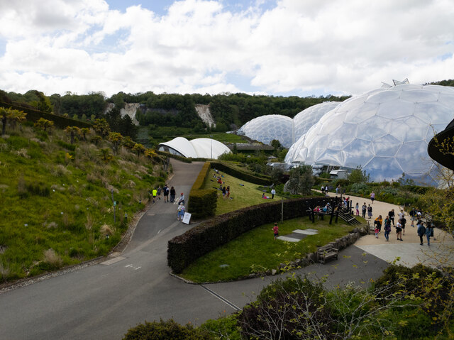
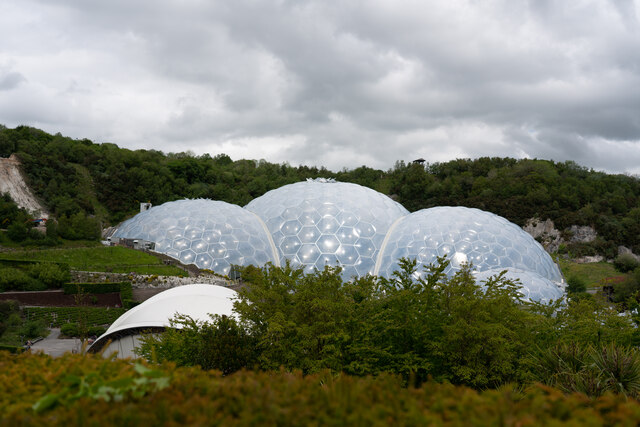
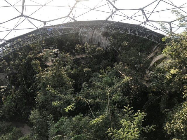
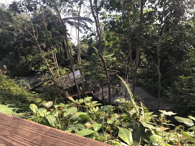
Nature enthusiasts are drawn to Trethurgy for its stunning landscapes and proximity to the South West Coast Path, providing ample opportunities for scenic walks and outdoor activities. The village is also within reach of popular attractions like the Eden Project and the Lost Gardens of Heligan, making it an ideal base for exploring Cornwall's natural and cultural wonders.

In summary, Trethurgy is a tranquil and idyllic village in Cornwall, offering a peaceful rural lifestyle coupled with easy access to nearby amenities and attractions.

If you have any feedback on the listing, please let us know in the comments section below.

Trethurgy Images

Images are sourced within 2km of 50.366406/-4.758544 or Grid Reference SX0355. Thanks to Geograph Open Source API. All images are credited.

Eden Project - Rainforest Biome The Rainforest Biome <span class="nowrap"><a title="https://www.edenproject.com/visit/things-to-do/rainforest-biome" rel="nofollow ugc noopener" href="https://www.edenproject.com/visit/things-to-do/rainforest-biome">Link</a><img style="margin-left:2px;" alt="External link" title="External link - shift click to open in new window" src="https://s1.geograph.org.uk/img/external.png" width="10" height="10"/></span> at the Eden Project houses the largest rainforest in the world, with over 1,000 varieties of plants
Eden Project - Rainforest Biome
The Rainforest Biome LinkExternal link at the Eden Project houses the largest rainforest in the world, with over 1,000 varieties of plants
Bridge over road at Carluddon With painted graffiti; the bridge carries a farm track
Bridge over road at Carluddon
With painted graffiti; the bridge carries a farm track
View across the Eden Project including the domes and garden from the east side of the park
Western domes at the Eden Project taken from the entrance to the park through the visitor centre
Rainforest Biome, Eden Project The Eden Project was conceived in the mid 1990s by local record producer Tim Smit as an educational facility, by showcasing plants used for food and medicinal purposes.  
Work on the site started in 1998 with the project officially opening to the public on 17 March 2001.

Utilising a recently decommissioned former china clay pit, the centrepiece consists of two large greenhouses, to create Biomes climatically controlled to provide conditions for Mediterranean and rainforest plants respectively.  These are entered by a connecting entrance area.  Also in the site is an educational centre and art gallery called The Core (opened in 2005), a stage (hosting an annual music festival among other events) and a large visitors’ centre.  The whole area is landscaped with further planting.  All soil both inside and outside the Biomes was made for the Project, that in the Biomes from composted bark and that in the landscaping from recycled domestic green waste.

It is one of the top visitor attractions in Cornwall, attracting around a million visitors each year.
Rainforest Biome, Eden Project
The Eden Project was conceived in the mid 1990s by local record producer Tim Smit as an educational facility, by showcasing plants used for food and medicinal purposes. Work on the site started in 1998 with the project officially opening to the public on 17 March 2001. Utilising a recently decommissioned former china clay pit, the centrepiece consists of two large greenhouses, to create Biomes climatically controlled to provide conditions for Mediterranean and rainforest plants respectively. These are entered by a connecting entrance area. Also in the site is an educational centre and art gallery called The Core (opened in 2005), a stage (hosting an annual music festival among other events) and a large visitors’ centre. The whole area is landscaped with further planting. All soil both inside and outside the Biomes was made for the Project, that in the Biomes from composted bark and that in the landscaping from recycled domestic green waste. It is one of the top visitor attractions in Cornwall, attracting around a million visitors each year.
Eden project domes and park
Inside one of the Eden Project domes
Former Wesleyan Chapel at Penwithick
Eden Project skywire
Eden Project
Eden Project
Eden Project
Eden Project
Eden Project
Eden Project
Eden Project
Eden Project
Eden Project car park
Eden Project: Green Build Hub
Road at Knightor Approaching the Trebal refinery.
Road at Knightor
Approaching the Trebal refinery.
New houses at Carluddon
Former Wesleyan Methodist Chapel
Show me another place!

Trethurgy is located at Grid Ref: SX0355 (Lat: 50.366406, Lng: -4.758544)

Unitary Authority: Cornwall

Police Authority: Devon and Cornwall

What 3 Words

///musically.divided.gratitude. Near St Austell, Cornwall

Nearby Locations

Trethurgy

Related Wikis

Trethurgy

Trethurgy is a village in the parish of Treverbyn, Cornwall, England, United Kingdom. It is about two miles northeast of St Austell. Carne Farm, Trethurgy...

St Jude's Church, Plymouth

St Jude's Church is a Church of England church in Plymouth, Devon, England. It was designed by the Plymouth architect James Hine and constructed in 1875...

Knightor

Knightor is a hamlet in the parish of Treverbyn, Cornwall, England. == References ==

Garker

Garker is a hamlet situated 3 miles (4.8 km) north-east of St Austell in Cornwall, England. Garker lies close to the western edge of the Eden Project...

Related Videos

Cornwall Holiday Vacation - The Eden Project - Staycation

Join me on a family break in Newquay, Cornwall. Weather pretty dire so we booked an inside trip to The Eden Project. Been years ...

Tropical Rainforest in Cornwall! Exploring the incredible Eden Project!

The Eden Project is an absolute must for anyone visiting Cornwall or Devon! Whether you're here on vacation or calling in to one ...

BA(Hons) Sustainable Tourism Management

Find out what it's like to study BA(Hons) Sustainable Tourism Management at Falmouth. See more about the course on the ...

CORNWALL HOLIDAY VLOG PT 2 🌊 ST. MICHAELS MOUNT & EDEN PROJECT 🌴🌿🌱

saintmichaelsmount #edenproject #cornwall2021 Hey Guys Here's part two of our little Cornish vlog! we had two days of ...

Nearby Amenities

Located within 500m of 50.366406,-4.758544
Trethurgy
Is In: Cornwall, England, UK
Name Kw: Tredhevergi
Place: village
Wikidata: Q7838873
Lat/Long: 50.3667745/-4.7608375
Telephone
Booth: K6
Covered: booth
Man Made: telephone_box
Lat/Long: 50.3674673/-4.7611857
Barrier: yes
Lat/Long: 50.3657375/-4.7621849
Power: pole
Lat/Long: 50.3706641/-4.7566657
Power: pole
Lat/Long: 50.3697685/-4.755684
Power: pole
Lat/Long: 50.3694126/-4.7552736
Power: pole
Lat/Long: 50.3685367/-4.7557242
Power: pole
Lat/Long: 50.3673014/-4.7563787
Power: pole
Lat/Long: 50.3663716/-4.7568628
Power: pole
Lat/Long: 50.3643663/-4.7565678
Power: pole
Lat/Long: 50.3647633/-4.7580242
Power: pole
Lat/Long: 50.3651722/-4.7595786
Power: pole
Lat/Long: 50.3652817/-4.7616117
Power: pole
Lat/Long: 50.3655597/-4.7572987
Power: pole
Lat/Long: 50.3643424/-4.7579344
Power: pole
Lat/Long: 50.3633072/-4.7584909
Power: pole
Lat/Long: 50.3639377/-4.7549477
Noexit: yes
Lat/Long: 50.369965/-4.7615275
Defibrillator
Access: yes
Defibrillator Location: outside Trethurgy Social Hall
Emergency: defibrillator
Indoor: no
Lat/Long: 50.3647957/-4.7623288
Information: guidepost
Tourism: information
Lat/Long: 50.3649097/-4.762398
Give Way
Direction: backward
Lat/Long: 50.3648533/-4.7624992
Give Way
Direction: forward
Lat/Long: 50.364879/-4.7621913
Give Way
Direction: backward
Lat/Long: 50.3650398/-4.762415
The data included in this document is from www.openstreetmap.org. The data is made available under ODbL.

Have you been to Trethurgy?

Leave your review of Trethurgy below (or comments, questions and feedback).