Trallwng, Y

Settlement in Brecknockshire

Wales

Trallwng, Y

Comin uwchben Trallwng / Common above Trallong Llwybr ar tir comin yn mynd i lawr y waered i gyfeiriad pentre Trallwng.

A path on common land descends the hill towards Trallong village (trans. muddy area).
Comin uwchben Trallwng / Common above Trallong Credit: Alan Richards

Trallwng, also known as Y, is a small village located in the county of Brecknockshire, Wales. Situated in the heart of the Brecon Beacons National Park, Trallwng is renowned for its stunning natural beauty and picturesque surroundings. The village is nestled within a valley, surrounded by rolling hills and lush greenery, offering residents and visitors a peaceful and idyllic setting.

Trallwng is home to a close-knit community, with a population of approximately 500 residents. The village retains its traditional charm, with many of its buildings dating back to the 18th and 19th centuries. The architecture reflects the local heritage, featuring stone cottages and farmhouses that add to the village's character.

Despite its small size, Trallwng offers a range of amenities to cater to the needs of its residents. These include a primary school, community center, and a pub, which serves as a hub for social gatherings and events. The village also benefits from its proximity to larger towns in the region, providing access to additional services and facilities.

Trallwng is a haven for outdoor enthusiasts, with an abundance of walking trails and hiking routes in the surrounding countryside. The nearby Brecon Beacons offer breathtaking views and opportunities for activities such as cycling, horse riding, and fishing. The village is also within close reach of popular tourist attractions, including the stunning waterfalls at Ystradfellte and the historic ruins of Tretower Court.

Overall, Trallwng is a charming village that offers a tranquil and scenic escape for both residents and visitors, with its natural beauty and strong sense of community.

If you have any feedback on the listing, please let us know in the comments section below.
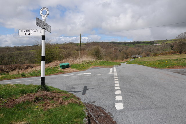
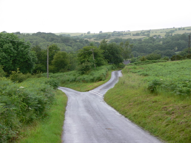
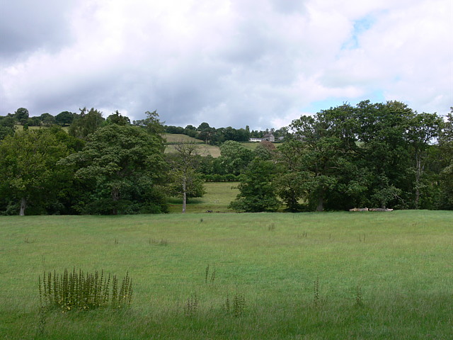
Trallwng, Y Images

Images are sourced within 2km of 51.949738/-3.5146309 or Grid Reference SN9629. Thanks to Geograph Open Source API. All images are credited.

Comin uwchben Trallwng / Common above Trallong Llwybr ar tir comin yn mynd i lawr y waered i gyfeiriad pentre Trallwng.

A path on common land descends the hill towards Trallong village (trans. muddy area).
Comin uwchben Trallwng / Common above Trallong
Llwybr ar tir comin yn mynd i lawr y waered i gyfeiriad pentre Trallwng. A path on common land descends the hill towards Trallong village (trans. muddy area).
Trac i Drallwng / Track to Trallong Hen heol, sy bellach yn llwybr cyhoeddus, yn mynd i lawr y waered i gyfeiriad pentre Trallwng.

An old road, downgraded to a path,  descends towards the village of Trallong (trans. muddy area).
Trac i Drallwng / Track to Trallong
Hen heol, sy bellach yn llwybr cyhoeddus, yn mynd i lawr y waered i gyfeiriad pentre Trallwng. An old road, downgraded to a path, descends towards the village of Trallong (trans. muddy area).
Traditional road sign, Brecon County I love these old road signs such as this one on a road junction to the west of Trallong in the Usk valley.
Traditional road sign, Brecon County
I love these old road signs such as this one on a road junction to the west of Trallong in the Usk valley.
Road junction on Trallong Common I love these old road signs such as this one on a road junction on Trallong Common to the west of Trallong in the Usk valley.
Road junction on Trallong Common
I love these old road signs such as this one on a road junction on Trallong Common to the west of Trallong in the Usk valley.
Road to the A40 Country road to the A40 near Trallong Common, The Black Mountain, part of the Brecon Beacons National Park forms the backdrop.
Road to the A40
Country road to the A40 near Trallong Common, The Black Mountain, part of the Brecon Beacons National Park forms the backdrop.
Road across Trallong Common Country road crossing Trallong Common.
Road across Trallong Common
Country road crossing Trallong Common.
Road to Bryn y Fedwen Farm Road to Bryn y Fedwen Farm, as can be seen from the sign the farm offers Bed and Breakfast.
Road to Bryn y Fedwen Farm
Road to Bryn y Fedwen Farm, as can be seen from the sign the farm offers Bed and Breakfast.
Road junction on Trallong Common
Minor road across Trallong Common
From Brecon to Trecastle The old road from Brecon to Trecastell on the north side of the River Usk.

Note the old, cast-iron road sign, sadly damaged since <a href="https://www.geograph.org.uk/photo/3459539">SN9530 : Road junction on Trallong Common</a>. The left turning leads over the Usk to the A40.
From Brecon to Trecastle
The old road from Brecon to Trecastell on the north side of the River Usk. Note the old, cast-iron road sign, sadly damaged since SN9530 : Road junction on Trallong Common. The left turning leads over the Usk to the A40.
The fork for Wernfigin on the road to Pentre'r-felin The wood in the background is Coed Mawr.
The fork for Wernfigin on the road to Pentre'r-felin
The wood in the background is Coed Mawr.
Road junction on Trallong Common Early post-war (WW2) cast iron direction sign
Road junction on Trallong Common
Early post-war (WW2) cast iron direction sign
Twyn y gaer A view across the fields towards the summit of Twyn-y-gaer
Twyn y gaer
A view across the fields towards the summit of Twyn-y-gaer
The track to Penbryn The single track road from Trallong to the farmstead at Penbryn
The track to Penbryn
The single track road from Trallong to the farmstead at Penbryn
Near Trallong Common
Cwm Camlais
Cwm Camlais
Nant-y-Gwreiddyn Row of cottages in the unenviable location of being adjacent the A40.
Nant-y-Gwreiddyn
Row of cottages in the unenviable location of being adjacent the A40.
Show me another place!

Trallwng, Y is located at Grid Ref: SN9629 (Lat: 51.949738, Lng: -3.5146309)

Unitary Authority: Powys

Police Authority: Dyfed Powys

Also known as: Trallwng

What 3 Words

///bribing.satellite.lamenting. Near Brecon, Powys

Related Wikis

Abercamlais railway station

Abercamlais railway station was a private platform serving the Abercamlais estate in the traditional county of Brecknockshire, Wales. == History == Opened...

Abercamlais

Abercamlais is a Grade I listed country house in the Usk valley between Brecon and Sennybridge in Powys, Wales. Possibly dating back to the Middle Ages...

Trallong

Trallong (Welsh: Y Trallwng) is a village and community in Powys, Wales, in the historic county of Brecknockshire. == Description == The community of Trallong...

Penpont Manor House

Penpont is a seventeenth-century Grade I listed manor house in the Usk valley between Brecon and Sennybridge in Powys, Wales. It was built by Daniel Williams...

Nearby Amenities

Located within 500m of 51.949738,-3.5146309
Abercamlais
Historic Railway: station
Railway: site
Wikidata: Q4666794
Wikipedia: en:Abercamlais railway station
Lat/Long: 51.9520407/-3.5088697
Direction: S
Generator Method: photovoltaic
Generator Output Electricity: yes
Generator Solar Modules: 15
Generator Source: solar
Generator Type: solar_photovoltaic_panel
Location: roof
Power: generator
Lat/Long: 51.949921/-3.5075153
The data included in this document is from www.openstreetmap.org. The data is made available under ODbL.

Have you been to Trallwng, Y?

Leave your review of Trallwng, Y below (or comments, questions and feedback).